Central
Coast
Local Planning Panel Meeting
Business
Paper
22
July 2021
The Local Planning Panel Meeting
of Central Coast
will be held Remotely
- Online,
Thursday 22 July 2021 at 2.00 pm,
for the transaction
of the business listed below:
1 Procedural Items
1.1 Disclosures
of Interest.............................................................................................................................. 3
2 Confirmation
of Minutes of Previous Meetings
2.1 Confirmation
of Minutes of Previous Meeting................................................................................. 4
3 Planning
Reports
3.1 DA/60262/2020
- 2 Scenic Highway, Terrigal - Ex-HMAS Adelaide Mast at the Terrigal Haven on
to a plinth footing with landscaping and provision for a flagpole.......................................... 11
3.2 Section
8.2 Review of Determination - DA/57698/2019 - Staged Caravan Park (165 sites)
at 255, 255A, 255B Avoca Drive, Kincumber and 19 Picketts Valley Road, Picketts
Valley.......... 141
4 Planning
Reports - Outside of Public Meeting
4.1 DA/58327/2020/2
- 15 Lynnette Crescent, East Gosford - Alterations & Additions to the
Existing Dwelling, Carport, Cabana, Inground Swimming Pool & Retaining
Structures................ 299
4.2 DA/58543/2020
- 60 Terrigal Esplanade, Terrigal - Alterations & Additions to Shop Top
Housing ..................................................................................................................................................................... 337
Donna
Rygate
Chairperson
|
Item No: 1.1
|
|
|
Title: Disclosures of Interest
|

|
|
Department: Governance
|
|
|
22 July 2021 Local Planning Panel
Meeting
|
|
Reference: F2020/02502
- D14205789
|
The NSW
Local Planning Panel Code of Conduct states that all panel members must sign
a declaration of interest in relation to each matter on the agenda before or
at the beginning of each meeting.
|
Recommendation
That Panel
Members now confirm that they have signed a declaration of interest in relation
to each matter on the agenda for this meeting and will take any management
measures identified.
|
Item No: 2.1
|
|
|
Title: Confirmation of Minutes
of Previous Meeting
|
|
|
Department: Corporate
Affairs
|
|
|
22 July 2021 Local Planning Panel
Meeting
|
|
Reference: F2020/02502
- D14741781
Author: Rachel
Callachor, Meeting Support Officer
|
Summary
The
Minutes of the following Meetings of the Local Planning Panel, which have
been endorsed by the Chair of that meeting, are submitted for noting:
· Local Planning Panel Meeting held
on 24 June 2021
· Electronic Determination regarding DA51538/2017
dated 28 June 2021
|
Recommendation
That the
minutes of the previous Local Planning Panel Meeting held on 24 June 2021 and
the Electronic Determination regarding DA51538/2017 dated 28 June 2021, which
had been endorsed by the Chair of those meetings, are submitted for noting.
Attachments
|
1⇩
|
MINUTES -
Local Planning Panel - 24 June 2021
|
|
D14695334
|
|
2⇩
|
MINUTES -
Local Planning Panel - Supplementary Meeting - 28 June 2021
|
|
D14714326
|
|
2.1
|
Confirmation
of Minutes of Previous Meeting
|
|
Attachment 1
|
MINUTES
- Local Planning Panel - 24 June 2021
|
Local Planning Panel
Minutes of the
Local
Planning Panel Meeting
Held remotely -
online
on 24 June 2021
Panel
Members
|
Chairperson
|
Donna
Rygate
|
|
Panel
Experts
|
Grant
Christmas
Linda McClure
|
|
Community
Representative/s
|
David
Kitson
|
Central
Coast Council Staff Attendance
Andrew Roach Unit
Manager Development Assessment
Emily
Goodworth Section Manager
Development Assessment North
Ailsa
Prendergast Section
Manager Development Assessment South
Mark Dowdell Principal
Development Assessment Engineer
Robert Eyre Principal
Development Planner Development Assessment South
Janice
Wheeler Senior
Development Planner Development Assessment North
Sarah
Georgiou Section
Manger Civic Support
Rachel
Callachor Meeting
Support Officer Civic Support
The Chairperson,
Donna Rygate, declared the meeting open at 2:04pm and advised in accordance
with the Code of Meeting Practice that the meeting was being recorded.
The Chair read
an acknowledgement of country statement.
Apologies
The
Panel noted that no apologies had been received.
1.1 Disclosures
of Interest
|
|
The Panel noted that no disclosures had been
identified and forms had been
submitted
by members.
Unanimous
|
2.1 Confirmation
of Minutes of Previous Meeting
|
|
The
Minutes of the following Meeting of the Local Planning Panel, which had been
endorsed by the Chair of that meeting, were submitted for noting:
· Local Planning Panel Meeting held
on 10 June 2021.
Moved: Linda McClure
Unanimous
|
|
|
|
The following people addressed the Panel:
Agenda item 3.1
1 Michael Leavey - on behalf of D
& P Nicolas Investments Pty Ltd & S & L Nicolas Investments Pty
Ltd – for the recommendation
2 Doug Sneddon - Doug Sneddon
Planning, on behalf of the applicant - against the recommendation
3 David Sutton - Slater Architects,
on behalf of the applicant – against the recommendation
Agenda item 4.1
1 Chris and Wendy Lewis - against the
recommendation.
2 Claudio Minns, Development Manager,
Blueview and Bill Ryder Director, Blueview - against the
recommendation.
3 Adam Crampton - Planning Manager,
ADW Johnson and Ben Myles, Civil Engineer, ADW Johnson – answered
questions on behalf of the applicant
|
The Local
Planning Panel public meeting closed at 3:12pm. The Panel moved into
deliberation from 3:24pm, which concluded at 4:10pm.
3.1 DA/52083/2017/4
- 5-7 Church Street, Terrigal - Modification of approved commercial premises
and shop top housing
|
|
Site Inspected
|
Yes
|
|
Relevant Considerations
|
As
per Council assessment report
|
|
Material Considered
|
· Documentation with application
· Council assessment report
· Submissions
|
|
Council Recommendation
|
Refusal
|
|
Panel
Decision
|
1 That
the Local Planning Panel refuse the application to modify DA52083/2017 Part
4 for commercial/shop top housing development on Lots 19 and 20 DP7861 No 5
and 7 Church Street, Terrigal, for the reasons below and having regard to
the matters for consideration detailed in Sections 4.15 and 4.55(2) of the
Environmental Planning and Assessment Act 1979.
i. The
proposed modification significantly increases the height and floor space of
the approved development and exceeds the development standards of Clause
4.3 and 4.4 of the Gosford Local Environmental Plan 2014.
ii. The
proposed modification does not comply with the objectives and development
standards of the B2 zone State Environmental Planning Policy 65, Gosford
Local Environmental Plan 2014, or Gosford Development Control Plan 2013.
iii. The
proposed modification would have additional impacts on adjoining sites
resulting in additional view loss and amenity impacts.
iv. Approval is not in the public
interest.
2 That
Council advise those who made written submissions of the Panel’s
decision.
|
|
Reasons
|
1 The proposal is not satisfactory
having regard to the relevant environmental planning instruments, plans and
policies.
2 The proposal represents an
unacceptable departure from the development standards under the Gosford
Local Environmental Plan 2014 and Gosford Development Control Plan 2013.
3 Approval of the proposal would set
a precedent and compromise the achievement of the
strategic planning objectives for the Centre.
4 There are significant issues or
impacts identified with the proposal
under s.4.15 of the Environmental
Planning and Assessment Act 1979.
|
|
Votes
|
The decision was
unanimous
|
|
4.1 DA/530/2019
- 2 and 11 Bryant Drive, Tuggerah - Mixed Use Development comprising
Specialised Retail Premises, Signage and Food and Drink Premises
|
|
|
Site Inspected
|
Yes
|
|
Relevant Considerations
|
As
per Council assessment report
|
|
Material Considered
|
· Documentation with application
· Council assessment report
· Submissions
|
|
Council Recommendation
|
Approval
|
|
Panel
Decision
|
1 That the Local Planning Panel defer a
decision regarding DA/530/2019 – 2 & 11 Bryant Drive - Mixed Use
Development comprising Specialised Retail Premises, Signage and Food and
Drink Premises and request the Council to notify all adjoining owners who
have not previously been notified and provide them the opportunity to make
a submission on the proposal within 14 days of the notification.
2 The matter is to be reported back
to the Panel for determination within 28 days of the closing date for
submissions in accordance in 1. above.
3 This report should include
information detailing the basis on which contributions are being levied,
including the net developable area for contributions that have been paid
and contributions that are proposed.
|
|
Reasons
|
1 The Panel considered that it was
arguable that the proposed development may be a change of use triggering a
requirement to notify all adjoining owners.
2 Clarification is required as
regards contributions.
|
|
Votes
|
The decision was unanimous
|
|
|
2.1
|
Confirmation
of Minutes of Previous Meeting
|
|
Attachment 2
|
MINUTES
- Local Planning Panel - Supplementary Meeting - 28 June 2021
|
Local Planning Panel
Minutes of the
Local
Planning Panel
Held remotely - online
on 28 June 2021
Panel
Members
|
Chairperson
|
Donna
Rygate
|
|
Panel
Experts
|
Grant
Christmas
Greg Flynn
|
|
Community
Representative/s
|
Mark
Elsley
|
A
Supplementary Report was provided to the Local Planning Panel on 22 June 2021,
as per request at the Panel meeting of 26 November 2020 where the matter was
deferred.
The Local
Planning Panel members considered the supplementary report and supporting
documents for DA/51538/2017 - 1 Bowtells Drive, Avoca Beach - Integrated
Development - Caravan park comprising 56 long term dwelling sites, 5 short term
caravan sites and office/amenities building (as amended) via electronic
determination.
Supplementary
Report - DA/51538/2017 - 1 Bowtells Drive, Avoca Beach - Integrated
Development - Caravan park comprising 56 long term dwelling sites, 6 short
term caravan sites and office/amenities building (as amended)
|
|
|
Relevant
Considerations
|
As per
Council assessment report and Supplementary report
|
|
Material
Considered
|
· Documentation with application
· Council assessment report, 26
November 2020
· Submissions
· Supplementary Report, 22 June
2021
|
|
Council
Recommendation
|
Approval
subject to conditions
|
Panel
Decision
1 That the Local Planning Panel grant
consent to DA/51538/2017 at 1 Bowtells Drive, Avoca Beach for the Integrated
Caravan park comprising 56 long-term dwelling sites, five short term caravan
sites, an office/amenities building and associated demolition works, subject
to the conditions detailed in the schedule attached to the Supplementary
report and having regard to the matters for consideration detailed in Section
4.15 of the Environmental Planning and Assessment Act 1979.
2 That Council advise those who made
written submissions of the Panel’s decision.
3 That the Council advise relevant
external authorities of the Panel’s decision.
Reasons
1 The Panel notes that the legal
advice on permissibility referred to 56 long term sites and 6 short term
sites, that “caravans” means “more than one”, and
that the current proposal is for 56 long term sites and 5 short term sites.
2 The issues raised by the Panel in
its earlier consideration of the application have been addressed.
3 The proposal is satisfactory having
regard to the relevant environmental planning instruments, plans and
policies.
4 The proposal has been considered
against the provisions of the Gosford
Local Environmental Plan 2014 and
has been found to be satisfactory.
5 There are no significant issues or
impacts identified with the proposal under s.4.15 of the Environmental Planning and
Assessment Act 1979 that
can not be addressed by way of conditions of consent.
Votes The
decision was unanimous
Date: 28
June 2021
|
|
Item No: 3.1
|
|
|
Title: DA/60262/2020 - 2 Scenic
Highway, Terrigal - Ex-HMAS Adelaide Mast at the Terrigal Haven on to a
plinth footing with landscaping and provision for a flagpole
|

|
|
Department: Environment
and Planning
|
|
|
22
July 2021 Local
Planning Panel Meeting
|
|
Reference: 011.2020.00060262.001
- D14610115
Author: Daniel
McNamara, Daniel McNamara Planning Services
|
Given
the potential for perceived conflict of interest, the assessment of the
application, including drafting of this report, were undertaken by an
independent planning consultant rather than Council officers.
Summary:
An
application has been received for installation of the Ex-HMAS Adelaide mast
at Terrigal Haven. The mast is proposed to be situated on a sandstone block
plinth footing, surrounded by a sandstone retaining wall, garden bed and an
access pathway linked to the existing car park. The development application
is required to be reported to the Central Coast Local Planning Panel (CCLP)
for determination as, Central Coast Council (CCC) is the applicant.
The
application has been examined having regard to the matters for consideration
detailed in section 4.15 of the Environmental Planning and Assessment Act
and other statutory requirements with the issues requiring attention and
consideration being addressed in the report.
The
development application was notified from 12 February 2021 until 22 March
2021. A total of six submissions were received.
The application is recommended for Refusal.
Applicant Central Coast Council
Owner Crown Land managed and
operated by Central Coast Council
Application
No DA 60262/2020
Description
of Land 2 Scenic Highway,
Terrigal
Proposed
Development Community
Facility-Installation of Mast
Site
Area 50.7 sqm (8.450 metres x 6 metres)
Zoning RE1 Public Recreation
Existing
Use Public Recreation
Employment
Generation No
Estimated
Value $50,000.00
|
Recommendation
1 That
the Local Planning Panel refuse the application subject to the reasons for
refusal detailed in the schedule attached to the report and having regard to
the matters for consideration detailed in Section 4.15 of the Environmental
Planning and Assessment Act.
2 That
Council advise those who made written submissions of its decision.
3 That
Council advise relevant external authorities of the Panel’s decision.
Key
Issues
· Visual Impact
· Bulk and Scale
· Access
· Traffic
· Character
· Safety and Vandalism
· Inconsistent with the
Terrigal Haven Plan of Management 2009
· Insufficient information
Precis:
|
Proposed Development
|
Installation
of the Ex-HMAS Adelaide mast onto a sandstone block plinth footing,
surrounded by a sandstone retaining wall, garden bed and an access pathway
linked to the existing car park.
|
|
Permissibility and
Zoning
|
RE1
Public Recreation under the Gosford Local Environmental Plan 2014.
The
proposed development is considered a community facility and
permissible with consent.
A
community
facility means
a building or place:
(a) owned or controlled by a public authority or
non-profit community organisation, and
(b) used for the physical, social, cultural or
intellectual development or welfare of the community, but does not include an
educational establishment, hospital, retail premises, place of public worship
or residential accommodation.
|
|
Relevant Legislation
|
Environmental
Planning & Assessment Act 1979 – Section 4.15
Local Government Act 1993 - Section 89
Environmental
Planning Policy (Infrastructure) 2007 State Environmental Planning Policy
State Environmental Planning Policy (Coastal Management) 2018
Gosford Local
Environmental Plan 2014
Gosford Development Control Plan 2013
Draft Central Coast
Local Environmental Plan 2018
|
|
Current Use
|
Public Recreation
|
|
Integrated Development
|
No
|
|
Submissions
|
Six (6)
|
The Site
The site
known as No. 2 Scenic Highway, Terrigal is located within Terrigal Haven (the
Haven), which is rocky headland east of the Terrigal central business district.
The Haven
is Crown land managed by Council. It is noted that the Terrigal Haven Plan of
Management 2009 (adopted 2010) permits the installation of the Ex-HMAS Adelaide
mast but does not identify a specific site for the development.
The Haven
is a distinctive landform in the shape of a bowl with four saddles that form
the edges of the bowl. Saddles are depressions at the edges which provide view
corridors to the ocean.
The four
saddles include Terrigal Beach, the northern base of the Skillion (which is an
iconic landform that rises towards the south and is a popular vantage lookout
point), the southern base of the Skillion, and, Broken Head, which is a small
protected bay, sandy beach and rock platforms.
The
Broken Head saddle is the proposed site location of this development
application (Site 1). The site is accessed from a number of existing paths from
the north eastern and south eastern car park. Currently, a trail road
allows vehicular access and limited wheelchair access from the slip rail
located on the northern side of the Skillion car parking bays. There is also a
footpath encompassing the whole Haven area which allows foot traffic to the
site.
The
landscape comprises rolling grass slopes with clustering of dense native
vegetation and a large number of pine trees along the beach front and across
the site.
The Haven
is popular for picnics, sporting events, informal recreation, day and evening
dining, and water- based activities such including scuba diving.
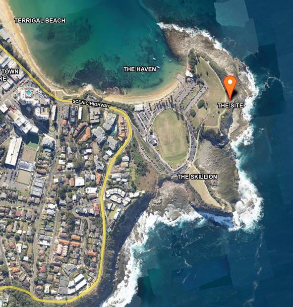
Figure 1 –
Site Plan
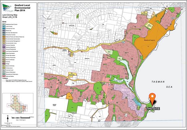
Figure 2
– Zoning Plan showing the site and locality
Surrounding
Development
The site
is located within the Terrigal Haven (the Haven) which is a zoned RE1 Public
Recreation which provides a diverse range of public assets such as the newly
upgraded boat ramp, a sporting field, a dog exercising area, whale watching
platforms, with their associated activities as well as rock fishing and diving.
The area
character is typical of a Hawksbury Sandstone Coastal Landscape, and heavily
influenced by coastal processes. The site is surrounded by remnant vegetation
and planted native species from the Coastal Headland Low Forest, Coastal
Headland Grassland and Coastal Headland Shrubland plant communities.
To the
west of the site is the seaside suburb of Terrigal and north west is Terrigal
Beach with residential dwellings, apartment complexes, and, The Crown Hotel
fronting the beach. The beach has a commercial main strip comprising of a
variety of restaurant, café, retail and office uses.
Immediately
south west of the site is the Terrigal Haven rugby field and clubhouse. This
area forms a natural amphitheater landscape with plenty of parking and picnic
areas, access to the ocean with from a boat ramp, fish cleaning table,
restaurants, and a sports field oval.
The
visual catchment of the site extends north along the established walking track
to the various viewing platforms on Broken Head, west to the sporting oval,
Reef Restaurant, The Haven Beach, residential areas and the viewing platform
between Terrigal and The Haven beaches and south to the Skillion.
There
is a new boardwalk recently constructed linking Terrigal Beach to the Haven. Upgrades to the existing rockpool
and boardwalk should be completed by April 2021, delivering many social, heath
and economic benefits for our community.
These projects are jointly funded by Central
Coast Council and the NSW Government’s Restart NSW Regional Growth
Environment and Tourism Fund, and, Crown Reserves Improvement Fund. The
delivery of these projects has been planned to minimise inconvenience, ensure
safety and reduce the construction impact on residents, local businesses and
tourists.
The boardwalk significantly improves pedestrian access between
Terrigal Beach promenade and The Haven, providing a safe and more accessible
route around the headland and new attraction for the Central Coast community
and visitors to enjoy.
The 277-metre-long boardwalk has been designed to complement the
natural environment and will be composed of materials that can withstand the
elements to ensure longevity and ease of maintenance. The design includes a
viewing platform, integrated seating, lighting and access to the rock platforms
and smooth integration with the existing walkways either end, which creates a
continuous link to the town centre.
Restoration works to the rockpool include the replacement of the
rockpool foundations and walls, construction of an access ramp to replace the
existing stairs and linking this area with the new boardwalk and existing
pathways.
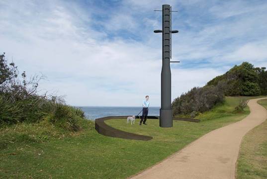
The Proposed Development
A
development application has been lodged by Central Coast Council (CCC) on
behalf of a community group and, as per Council’s resolution, will
project manage the installation if required.
The
proposal seeks installation of the Ex-HMAS Adelaide mast onto a sandstone block
plinth footing, surrounded by a sandstone retaining wall, garden bed and an
access pathway linked to the existing car park.
The total
height of the memorial will be will approximately 9.5 metres including the
Ex–HMAS Adelaide mast which is 7.4 metres in length and 450 mm in
diameter and new 2 metre footings.
The
project is a memorial dedicated to the crew of Ex-HMAS Adelaide which was
sunk/scuttled off the coast in April 2011 to provide an artificial reef and
dive site. The memorial will create a formal lookout area which will replicate
a ship’s bow. The dive site is an important tourist attraction for the
Central Coast. Prior to the scuttling of the Ex-HMAS Adelaide in 2011, the mast
from the Ex-HMAS Adelaide was gifted to the former Gosford City Council by the
NSW State Government.
The site
which has been chosen for the memorial known as Site 1 is a small saddle
between two elevated rock outcrops on Broken Head and forms a notable
depression in the skyline, void of large trees and vegetation.
The
rolling grass slope gives way to an eroding scree slope that then steps down
suddenly in blocky sandstone terraces to the flat rock platform below. The
grassed area provides one of the only natural viewing areas out to the ocean
that has yet to be formalised with a viewing platform or path. Areas of dense
vegetation have been established along the initial section of the proposed
alignment that then gives way to open grass areas with groups of small trees.
The
existing access path to the site begins at the car park overlooking the bolder
field between the Skillion and Broken Head, heading in a north east direction
towards the memorial site. The mast will have the ability to raise a flag on
commemorative days and events. It is noted that after a military vessel or
piece of infrastructure is decommissioned flags, illumination and the like
are not permitted without consent from maritime forces or RSL, other than on
commemoration days such as Anzac Day and between sunrise and sunset only.
The
project is funded by the NSW Stronger Communities Fund, NSW Government
Minister’s Discretionary Fund, the community, in kind contributions from
Thales and associates and CCC. Initial funding grants have now expired and
require further grant applications to be endorsed.
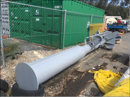
Figure 3
– The Ex-HMAS Mast from the HMAS Adelaide,
Source: CCC
Figure 4
– Photomontage of proposed development prepared by Leslie Howard
Associates, dated 6 November 2020
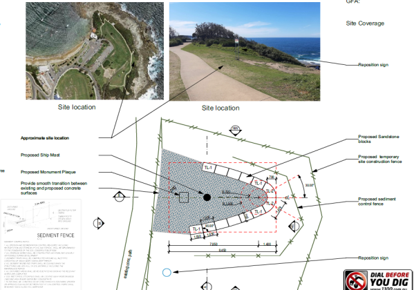
Figure 5
– Site Plan prepared by Leslie Howard Associates, dated 6 November 2020
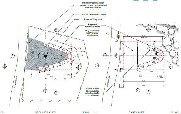
Figure 6
– Base and Ground Plan prepared by Leslie Howard Associates, dated 6
November 2020
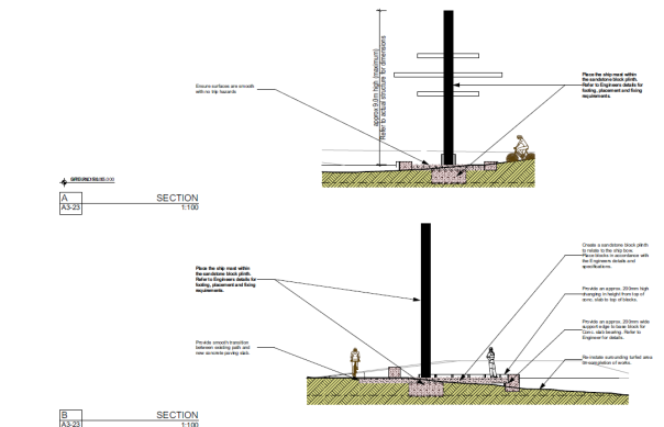
Figure 7
– Sections prepared by Leslie Howard Associates, dated 6 November 2020
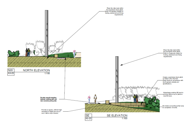
Figure 8
– North West and South East Elevations prepared by Leslie Howard
Associates, dated 6 November 2020
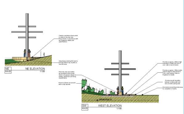
Figure 9
– North East and Western Elevations prepared by Leslie Howard Associates,
dated 6 November 2020
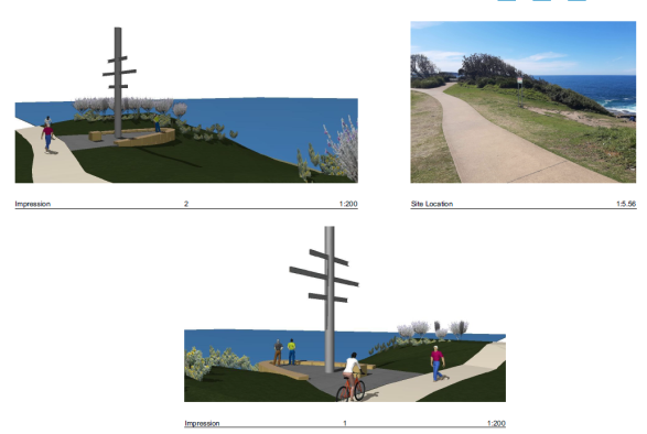
Figure 10
– External Views and Impression prepared by Leslie Howard Associates,
dated 6 November 2020
History
of the HMAS Adelaide
In
November 1980, the HMAS Adelaide was commissioned and built in the United
States of America as one of the first of six Adelaide-class guided missile
frigates delivered to the Royal Australian Navy. The naval vessel participated
in the Gulf War between 1990 - 1991 Gulf War, peacekeeping operations in East
Timor in 1999 and 2006, and, was deployed to the Arabian Gulf in 2001 and 2004.
In
2008, the vessel was decommissioned and HMAS Adelaide was demilitarised by the
Department of Defence before being handed over to the NSW Government in 2009. A mast from the Ex-HMAS Adelaide
was gifted to the former Gosford City Council by the NSW State Government and
Council undertook formal consultation regarding a suitable pathway for its use
as part of the Terrigal Haven Plan of Management 2009 (adopted 2010). The mast has been in Council storage since
2011.
On
13 April 2011, the Ex-HMAS Adelaide was scuttled to the ocean floor 1.8km off
the coast between Terrigal Beach and Avoca Beach to establish an artificial
reef and dive site, which has since attracted military historians and
recreational divers to the area. The sunken wreck joined four other former
naval vessels that have been transformed into dive sites in waters off Western
Australia, South Australia, Queensland and Victoria since 1997.
Community
interest in establishing a use for the mast as a memorial commenced in 2016.
The mast was assessed by the Navy and deemed to be in poor condition. The Navy
recommended specialist treatment, including a sandblast and painting to ensure
the mast was structurally sound. The mast is now intended to be used as part of a memorial
monument in honour of the many who have sailed on the HMAS Adelaide, in
recognition of the Royal Australian Navy and as a visual marker for the
ship’s position on the ocean floor.
Development Application History
In 2012 Gosford Council resolved that:
a. Council
consider the allocation of funding in future capital works programs for
engineering investigations and the required assessments into a Memorial for the
ex-HMAS Adelaide within the Terrigal Haven reserve.
b. Subsequent
to the confirmation of an appropriate site, Council Officers source grant
opportunities and funding for the construction of a memorial for the ex-HMAS
Adelaide.
Council again undertook consultation to
determine community sentiment on this project and will be responsible for
project management and ongoing maintenance.
In 2015, the former
Gosford Council agreed to project manage the installation of the mast on behalf
of a community group led by Matthew Wales which identified a site and submitted
a Development Application (DA) which received nine (9) submissions. A key issue
raised related to the identification of an alternate site to that proposed.
A visual impact
assessment and access assessment accompanying this DA did not support the
application and considered the development inconsistent with the Terrigal Haven
Plan of Management 2009. The DA was subsequently withdrawn. However, various community groups continued
to lobby for the development and raised $4796.00. A request was made to Council
to manage the project including installation of the mast, which was agreed to
by the former Gosford Council.
On 14 May 2018, Council considered a report
prepared by the Assets, Infrastructure and Business Department (Item 3.3) to
determine a potential preference for a site within The Haven at Terrigal for
placement of the mast. The report details site options for a bipartisan project
with the community raising money for the restoration and support from the
Australian Royal Navy, Returned Services League, and the State Government.
This project had support from the Returned
Services League (RSL) Sub-Branches, the retired Navy services and the
Australian Royal Navy and Crown Lands provided advice and consent for the
project. Further private consultation was undertaken before Council was engaged
to manage the construction of the development. Information provided to Council
states that consultation was with the following groups:
• Local community groups;
• Terrigal Wamberal RSL Sub-Branch;
• Australian Royal Navy;
• Crown Lands;
• Council staff in relation to the
impact of placement in the areas identified in Figure 10 below; and
• A letter of support was provided
by Adam Crouch MP, Member for Terrigal.
Council
had estimated the cost of installation of the mast to be $35,000.00. Grant
funding from the NSW State Government has been provided in the sum of $3,000.00
and community funds totalled $4,796.00. Substantial in-kind support was
provided. The community group intended to raise the balance of funds required
to complete the project through grants.
Council
nominated a location for the proposed known as Site 1, the community proposed
an alternative location known as Site 2 (see Council Item 3.3 - Attachment 1 at
Figure 10 below).
Visual
impact and risk management remained major issues associated with the
development, such as the risk of a person climbing the mast and falling. In
response to this issue, stepping points up to 4 metres previously proposed been
deleted from the design.
Council Minutes state:
Mayor Smith declared a significant non-pecuniary interest in the
matter due to her involvement with the Marine Discovery Centre and a number of
the dive clubs that have been involved in the matter. Mayor Smith advised that
she would leave the Chamber during consideration of this item and not
participate in discussion and voting. This item was resolved by the exception
method.
Councillor Greenaway left the Chamber at 10.52pm, did not return
and was absent for the vote.
Moved: Councillor Gale Collins
Seconded: Councillor Sundstrom
At
this meeting Council resolved:
“That Council request the Acting Chief Executive Officer
install the mast from the HMAS Adelaide II at Site 1 identified in the attached
photograph.”
(See
Figures 10 and 11 below).
For: Unanimous
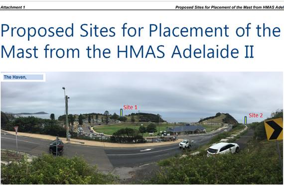
Figure 10 –
Council Meeting dated 14 May 2008 – Item 3.3 Attachment 1 - Proposed
Sites for Placement of the Mast from HMAS Adelaide II
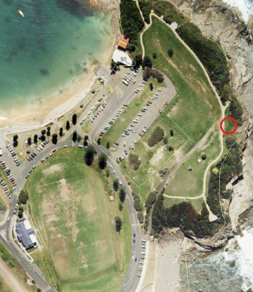
Figure 11
– Aerial view of Site 1 shown circled in red
History (Current Development Application)
This Development
Application DA 60262/2020 has been lodged by Central Coast Council (CCC) on
behalf of a community group.
The
development application is presented to the Central Coast Local Planning Panel.
Prior to lodgement formal community engagement was
held between 9 November 2020 and 7 December 2020 through Council’s web
page. Hyperlink to community engagement: https://www.yourvoiceourcoast.com/HMASadelaide
Community Engagement Summary
Consultation was undertaken to determine
community sentiment on the monument and its location to inform the application.
Positive and negative feedback
received:
• Support for this longstanding
promise moving forward;
• Importance of leaving the headland
in its natural state
• Concern about ongoing cost and
Council’s financial position;
• Concern about the identified
location for the monument limiting access for people with impaired mobility;
• Concern about the obstruction of
view and the need to keep the natural environment in mind when implementing
anything at The Haven; and
• Ex-HMAS Adelaide Monument was the
preferred name of the location should the installation of the Ex-HMAS Adelaide
Monument move forward.
The development
application was exhibited between 12 February 2021 and 26 February 2021. Six
(6) submissions were received including a letter from the Terrigal Area
Residents Association Inc. (TARA)
On 17 February 2021,
a request for further information was made to the applicant which has not been
satisfied. It was recommended that either the development application be
withdrawn to prepare the additional information, or alternatively, a
recommendation will be made for refusal.
The requested
additional information was required in order to undertake a more comprehensive
assessment addressing the relevant provisions of the Environmental Planning
and Assessment 1979.
Assessment:
Having
regard for the matters for consideration detailed in Section 4.15 of the Environmental
Planning and Assessment Act 1979 and other statutory requirements,
Council’s policies and Section 10.7 Certificate details, the assessment
has identified the following key issues, which are elaborated upon for the Panel’s information. Any tables relating
to plans or policies are provided as an attachment.
Provisions
of Relevant Instruments/Plans/Policies:
Gosford Local Environmental Plan 2014
Draft Environmental Planning Instruments
The site is subject to the draft Central
Coast Local Environmental Plan 2018.
1.2 Aims of Plan
(1) This Plan aims to make
local environmental planning provisions for land in the Central Coast local
government area in accordance with the relevant standard environmental planning
instrument under section 33A of the Act.
(2) The particular aims of this Plan are as
follows:
(a) to foster
economic, environmental and social wellbeing so that the Central Coast
continues to develop as a sustainable and prosperous place to live, work and
visit,
(b) to encourage a
range of housing, employment, recreation and services to meet the needs of
existing and future residents of the Central Coast,
(c) to promote the
efficient and equitable provision of public services, infrastructure and
amenities,
(d) to provide for a
range of local and regional community facilities for recreation, culture,
health and education purposes,
(e) to conserve,
protect and enhance the natural environment of the Central Coast, incorporating
ecologically sustainable development,
(f) to conserve,
protect and enhance the environmental and cultural heritage of the Central
Coast,
(g) to minimise risk
to the community in areas subject to environmental hazards, including flooding,
climate change and bush fires,
(h) to promote a high
standard of urban design that responds appropriately to the existing or desired
future character of areas,
(i) to promote design
principles in all development to improve the safety, accessibility, health and
wellbeing of residents and visitors,
(j) to concentrate
intensive land uses and trip-generating activities in locations that are most
accessible to transport and centres,
(k) to encourage the
development of sustainable tourism that is compatible with the surrounding
environment.
The
proposal is inconsistent with the draft 2.1 (2) (c), (e), (f), (g), (h), (i)
and (j) aims of the CCLEP 2018.
Zoning and Permissibility
The draft plan retains the RE1 Public
Recreation zoning of the land.
Zone Objectives
• To enable land to be used for public open space or
recreational purposes.
• To provide a range of recreational settings and activities
and compatible land uses.
• To protect and enhance the natural environment for
recreational purposes.
• To identify areas suitable for development for
recreational and cultural purposes.
• To provide space for integrated stormwater treatment
devices for flow and water quality management.
2 Permitted without consent
Environmental facilities; Environmental protection works
3 Permitted with consent Boat
launching ramps; Boat sheds; Building identification sign; Business
identification sign; Camping grounds; Car parks; Caravan parks; Charter and
tourism boating facilities; Centre based child care facilities; Community
facilities; Eco-tourist facilities; Emergency services facilities;
Entertainment facilities; Flood mitigation works; Food and drink premises;
Function centres; Information and education facilities; Jetty; Kiosks; Marina;
Market; Mooring pen; Mooring; Recreation areas; Recreation facility (indoor);
Recreation facility (major); Recreation facility (outdoor); Registered clubs;
Respite day care centres; Roads; Sewerage systems; Water recreation structures;
Water supply system 4 Prohibited Any development not specified in item 2 or 3
The
proposed development is considered a community facility and permissible
with consent.
In this
instance, it is considered the proposed development is inconsistent with the
stated draft objectives
of the RE1 Public Recreation Zone and incompatible with the desired future
character of the locality.
State Environmental Planning Policies (SEPP)
State Environmental Planning Policy
(Infrastructure) 2007
The State
Environmental Planning Policy (Infrastructure) 2007 (SEPPI) was gazetted on 21
December 2007, providing a consistent planning regime for infrastructure and
the provision of services across NSW, along with providing for consultation
with relevant public authorities during the assessment process.
Council
did not refer the application to Transport for NSW (TfNSW) under Clause 101.
State Environmental Planning Policy (Coastal
management) 2018
The provisions of State Environmental Planning Policy (Coastal
Management) 2018 require Council consider the aims and objectives of the SEPP
when determining an application within the Coastal Management Areas.
The Coastal Management Areas are areas defined on maps issued by
the NSW Department of Planning, Industry and Environment and the site falls
within the mapped coastal management areas.
Division 3 Coastal environment area
13 Development on land within the coastal
environment area
(1) Development consent must not be granted to development on land
that is within the coastal environment area unless the consent authority has
considered whether the proposed development is likely to cause an adverse
impact on the following:
(a) the integrity and resilience of the biophysical, hydrological
(surface and groundwater) and ecological environment,
(b) coastal environmental values and natural coastal processes,
(c) the water quality of the marine estate (within the
meaning of the Marine Estate Management Act 2014), in particular, the
cumulative impacts of the proposed development on any of the sensitive coastal
lakes identified in Schedule 1,
(d) marine vegetation, native vegetation and
fauna and their habitats, undeveloped headlands and rock platforms,
(e) existing public open space and safe
access to and along the foreshore, beach, headland or rock platform for members
of the public, including persons with a disability,
(f) Aboriginal cultural heritage, practices
and places,
(g) the use of the surf zone
(2) Development consent must not be granted to
development on land to which this clause applies unless the consent authority
is satisfied that:
(a) the development is designed, sited and will
be managed to avoid an adverse impact referred to in subclause (1), or
(b) if that impact cannot be reasonably
avoided—the development is designed, sited and will be managed to
minimise that impact, or
(c) if that impact cannot be minimised—the
development will be managed to mitigate that impact.
(3) This
clause does not apply to land within the Foreshores and Waterways Area within
the meaning of Sydney Regional Environmental Plan (Sydney Harbour Catchment)
2005.’.
The relevant matters have been considered in the assessment of this development
application.
Assessment: The application is inconsistent with the stated aims and
objectives of the SEPP (Coastal Management) 2018.
The proposed development will cause an adverse impact on the matters
required to be considered under Clause 13 (1) (a) – (g), Clause 13 (2)
(a) – (c) of SEPP (Coastal Management) 2018.
· Without
further specialist analysis, the proposed development may have adverse impact
on the integrity or resilience of the biophysical, hydrological or ecological
environment, coastal environmental values and natural coastal processes;
· It
is unknown as to whether the proposed development will have no adverse impact
on the water quality of the marine estate;
· Flora recorded at the
Haven includes Coastal Headland Shrubland (E51b). There are no anticipated
impacts on this vegetation as all construction works will be contained within
the exposed grassed area of the site. The proposed development may have an adverse impact on marine
vegetation; native vegetation/fauna and their habitats; undeveloped headlands;
or rock platforms;
· The proposed development has adverse impact
on the public amenity of the existing public open space and public access to
the coastal foreshore with regards to the chosen location and limitations
placed upon access;
· The
proposed development may have an adverse impact on any known Aboriginal
cultural heritage, practices or places;
· The
proposed development is far removed from the “surf zone‟ therefore
will not adversely impact its use by the public; and
· Drainage,
nutrient and erosion control measures would be required to be installed to
protect the any reserve and water way.
14 Development on land
within the coastal use area
(1) Development
consent must not be granted to development on land that is within the coastal
use area unless the consent authority—
(a) has considered whether
the proposed development is likely to cause an adverse impact on the
following—
(i) existing, safe access
to and along the foreshore, beach, headland or rock platform for members of the
public, including persons with a disability,
(ii) overshadowing, wind
funneling and the loss of views from public places to foreshores,
(iii) the visual amenity and
scenic qualities of the coast, including coastal headlands,
(iv) Aboriginal cultural
heritage, practices and places,
(v) cultural and built
environment heritage, and
(b) is satisfied
that—
(i) the development is
designed, sited and will be managed to avoid an adverse impact referred to in
paragraph (a),
(ii) or if that impact
cannot be reasonably avoided—the development is designed, sited and will
be managed to
(iii) minimise that impact,
or if that impact cannot be minimised—the development will be managed to
mitigate that impact, and
(c) has taken into
account the surrounding coastal and built environment, and the bulk, scale and
size of the proposed development.
(2) This clause does not apply to
land within the Foreshores and Waterways Area within the meaning of Sydney
Regional Environmental Plan (Sydney Harbour Catchment) 2005.’
Assessment: The application is inconsistent with the stated aims and
objectives of the SEPP (Coastal Management) 2018. The proposed development will
cause an adverse impact on the matters required to be considered under Clause
14 (1) (a) – (b) and Clause 2 of SEPP (Coastal Management) 2018.
• The proposed development will
cause an adverse impact to access along the foreshore and public reserve;
• The proposed development will
cause overshadowing, wind funnelling or loss of view from a public place as it
will not have adverse impacts on the visual amenity and scenic qualities of the
coast and headlands;
• The proposal has not been designed
and located to minimize visual amenity and scenic qualities to the most maximum
extent possible; and
• The proposal may cause an adverse
impact to and known Aboriginal cultural heritage or cultural and built
environment heritage.
(ii) Division 5
– General.
The following provisions of Division 5 of SEPP
(Coastal Management) 2018 apply to the consent authority’s consideration
of a development application on the subject land:
15 Development in coastal zone generally -
development not to increase risk of coastal hazards
Development consent must not be
granted to development on land within the coastal zone unless the consent
authority is satisfied that the proposed development is not likely to cause
increased risk of coastal hazards on that land or other land.
16 Development in
coastal zone generally - coastal management programs to be considered
Development consent must not be
granted to development on land within the coastal zone unless the consent
authority has taken into consideration the relevant provisions of any certified
coastal management program that applies to the land.’
Assessment: Due to its location and proximity
to the coastal foreshore, the subject land may be considered subject to
increased risk of coastal hazards.
The
Terrigal Haven Plan of Management 2009 has not addressed the proposed location
for any likely impacts in terms of any certified coastal management program and
will require revision to incorporate any future project location, construction,
management and maintenance.
The
proposed development could cause increased risk of coastal erosion.
Suitable
long term safety has not been adequately addressed in the design i.e.. No
fencing is proposed along the lookout to the Pacific Ocean, and, the geotechnical investigation /
dilapidation report prepared by Douglas Partners, dated July 2010 states
"the scope for work for this investigation/report did not include the
assessment of surface or sub-surface materials, or ground water for
contaminants within or adjacent to the site" is outdated.
The
relevant matters have been considered in the assessment of this application.
The application is considered inconsistent with the stated aims and objectives.
Gosford
Local Environmental Plan 2014
The site
is subject to the Gosford Local Environmental Plan 2014 (GLEP 2014).
Clause 1.2 Aims of Plan
(1) This Plan aims to make local environmental
planning provisions for land in that part of the Central Coast local government
area to which this Plan applies (in this Plan referred to as Gosford) in
accordance with the relevant standard environmental planning instrument under
section 3.20 of the Act.
(2) The particular aims of this Plan are
as follows—
(aa) to protect and promote the use and development of land for
arts and cultural activity, including music and other performance arts,
(a) to encourage a range of housing,
employment, recreation and services to meet the needs of existing and future
residents of Gosford,
(b) to foster economic, environmental and
social well being so that Gosford continues to develop as a sustainable and
prosperous place to live, work and visit,
(c) to provide community and recreation
facilities, maintain suitable amenities and offer a variety of quality
lifestyle opportunities to a diverse population,
(d) (Repealed)
(e) to concentrate intensive land uses
and trip-generating activities in locations that are most accessible to
transport and centres,
(f) to promote the efficient and
equitable provision of public services, infrastructure and amenities,
(g) to conserve, protect and enhance the
environmental and cultural heritage of Gosford,
(h) to protect and enhance the natural
environment in Gosford, incorporating ecologically sustainable development,
(i) to minimise risk to the community in
areas subject to environmental hazards, particularly flooding and bush fires,
(j) to promote a high standard of urban
design that responds appropriately to the existing or desired future character
of areas,
(k) to promote design principles in all
development to improve the safety, accessibility, health and well being of
residents and visitors,
(l) to encourage the development of
sustainable tourism that is compatible with the surrounding environment.
The
current development application proposal is inconsistent with
the Clause 2.1 (2)(c), (f), (g), (h), (i), (j) and (k) aims of the GLEP 2014.
Zoning
and Permissibility
The site
is zoned RE1 Public Recreation Zone.
Zone Objectives
• To enable land to be used for public open space
or recreational purposes.
• To provide a range of recreational settings and
activities and compatible land uses.
• To protect and enhance the natural environment
for recreational purposes.
• To identify areas suitable for development for
recreation, leisure and cultural purposes.
• To ensure that development is compatible with
the desired future character of the zone.
2 Permitted without consent
Environmental
facilities; Environmental protection works
3 Permitted with consent
Aquaculture; Camping
grounds; Car parks; Caravan parks; Centre-based child care facilities;
Community facilities; Kiosks; Recreation areas; Recreation facilities (indoor);
Recreation facilities (major); Recreation facilities (outdoor); Respite day
care centres; Restaurants or cafes; Roads; Water recreation structures
4 Prohibited
Any development not
specified in item 2 or 3
The proposed development is considered a community
facility and permissible with consent.
A community facility means a building or place:
(a) owned
or controlled by a public authority or non-profit community organisation, and
(b) used
for the physical, social, cultural or intellectual development or welfare of
the community, but does not include an educational establishment, hospital,
retail premises, place of public worship or residential accommodation.
In this
instance, it is considered the proposed development is inconsistent with the
stated objectives of the RE1 Zone being incompatible with the desired future character of the
locality.
Clause
7.1 Acid Sulfate Soils
Acid Sulphate Soils are not
present within the construction footprint. The site comprises of very stiff
grading to hard residual clay soils. An updated Geotechnical Investigation is recommended as
the report provided as part of the development application is dated July 2010.
Environmental conditions can change as discussed within this report.
The
matters contained in Clause 7.1 of Gosford Local Environmental Plan 2014 have
been considered.
Clause 7.4 Flood Planning
This land has not been classified as being
under a "flood planning level".
Gosford Development Control Plan 2013
This plan
is known as the Gosford Development Control Plan 2013 and supports the
objectives identified by the Gosford Local Environmental Plan 2014, the
Gosford Planning Scheme Ordinance or Interim Development Order No 122.
Part 2 Scenic Quality and
Character
The proposal does not acknowledge the desire to
maintain the Coastal Open Space System (COSS). Although the COSS does not cover
all visually significant ridge lands and upper slopes such as the Haven, the
broad controls relate to the proposed development which should have regard to
the character of the area both built and natural nature of the landscape
characteristics of it’s surroundings.
The structure is deemed unsuitable for Site 1,
reconsideration of an alternative location with consideration of the issues
addressed in this report would be preferable in order to respect the scenic
character of an area.
Any
Planning Agreement
There are
no planning agreements applicable to the application.
Relevant
Regulations
There are
no specific matters under the Regulation that require further discussion.
Likely
Impacts of the Development (built environment, natural environment, economic
and social impacts)
A
thorough assessment of the aspects of the proposed development on the built, natural
environments and social and economic impacts has been undertaken in terms of
the relevant planning controls.
Built Environment
The
subject site is zoned RE1 Public Recreation under GLEP 2014 and is surrounded
by public park and sports and recreation facilities with ocean front views.
The
proposed development is considered to have adverse impact upon the amenity of
adjoining public land, and private development by way of view obstruction, and
inequitable accessibility.
A
thorough assessment of the impacts of the proposed development on the built
environment has been undertaken. The potential impacts are considered
unreasonable.
Built
Form – Height, Bulk and Scale
The
development of the Ex-HMAS mast and surrounding sandstone structure is
articulated by virtues of it’s maritime design and is proposed to be made
of a subtle material which may appear as an unsuitable bulk and scale when
viewed from a distance.
The development
application did not include a survey, and amendments requested to architectural
drawing package to show correct dimensions of the structure and surrounding
area has not been provided. It is further noted that the Statement of
Environmental Effects (SEE) states the structure is 7.4 metres, and that the
base of the mast will be 2 metres above ground level.
The architectural
drawings show the mast height at approximately 9 metres and the Independent
Review of the Green Light Visual Impact Assessment states the proposal will be
approximately 9.5 metres. Therefore, proper comprehension of the scale of the
development is unable to be achieved,
From inspection of
the site and surrounds, it is apparent there is no existing fencing along this
part of the cliff coastline and none proposed. Given there may be interest in
groups gathering at the memorial on commemorative days such as Anzac Day and
Remembrance Day, Council should take into consideration establishing future
safety fencing similar to the transparent lightweight fencing along the cliff line gap
at the Skillion.
The architectural
drawings show landscaping immediately to the north and east of the proposed
development which does not appear to be consistent with that in situ.
Inadequate information has been submitted regarding the protection of, or
proposed removal and rectification of existing landscaping.
The
character of the area is typical of a Hawkesbury Sandstone Coastal Landscape,
heavily influenced by coastal processes. The site chosen is a small saddle
between two elevated rock outcrops on Broken Head and forms a notable
depression in the skyline, void of large trees and vegetation.
The
rolling grass slope gives way to an eroding scree slope that then steps down
suddenly in blocky sandstone terraces to the flat rock platform below. The
grass area provides one of the only natural viewing areas out to the Pacific
Ocean that has yet to be formalised with a viewing platform or path.
The
aesthetics are generally acceptable as the structure is articulated by virtues of it’s
maritime design and is made of a subtle material, however from a distance its
purpose may not be discernible and the structure may be confused for a pole
with no meaning and therefore will appear as an inappropriate and bulky
structure within the landscaped setting impacting upon views.
The
proposal is not compatible with, and will adversely impact on, the character
and amenity of the locality, public recreation area and streetscape. This is
predominantly as a result of the visual impact applicable to the height of the
development that would result in an outcome that is uncharacteristic and
unplanned in this location. As a result, the proposed development is
unsatisfactory in terms of impacts on the built environment.
A
thorough assessment of the proposed development’s impact on the built
environment has been undertaken having regard for SEPP Coastal Management along
with the provisions of GLEP 2014 and GDCP 2013 and it is considered the
potential built environment impacts are unreasonable.
Visual
Impact
Visual
impacts are considered unreasonable. The development will cause adverse visual
impact upon view corridors from private and public places. The Visual Impact
Assessment (VIA) Independent Review prepared by The Design Partnership supports
the recommendations identified in the Visual Impact Assessment prepared by
Green Light Design Group dated 1 October 2019. In particular:
“...
it will have significant impact upon Terrigal Haven and neighbouring
residential dwellings. We are also of the opinion that the memorial will have a
greater impact on Terrigal CBD than identified in the Visual Impact Assessment
report. This is due to the possibility it to be perceived as a functional
element such as a ventilation shaft.”
The visual impact
assessments do not support the project and consider the development
inconsistent with the Terrigal Haven Plan of Management 2009.
Concern is raised
regarding obstruction of views and the need to keep the natural environment in
mind when implementing anything at The Haven. Height poles would have assisted
with understanding the accuracy of view loss.
The study area for
the visual impact assessment has been selected to cover the main geographic
extent of potential visual impacts of the development. The Design Partnership
assessed the proposed development from the same view corridors as Green
Light.
The
independent review concludes that the development is unacceptable in terms of
the impact of the proposed works when assessed against the scenic values
identified in the Terrigal Haven Plan of Management 2009, in particular to
determine if the changes in the landscape are consistent with the desired
character of the reserve.
The
following scenic values extract from the Terrigal Haven Plan of Management 2009
have formed the basis of Ms Ryan’s (The Design Partnership) independent
assessment:
• Retain natural landscape quality;
• Preservation of Views to the
Pacific Ocean;
• Embellish Natural Vantage Points;
and
• Effective maintenance.
The review found
that the proposal will have a moderate to high visual impact overall in its
proposed location, noting the natural setting and that the mast would introduce
a built element in a prominent location which is visible from key locations.
Several key viewpoints were selected for further analysis
representative only of the spread and type of receivers that may be affected by
the proposed works, they are not exhaustive, nor do they reflect the exact view
shared by all receivers in a similar area.
The impact rating for any given viewpoint within the study area
was based on an evaluation of the sensitivity and magnitude, the methodology of
the proposed change:
• Sensitivity: Each
viewpoint has an inherent sensitivity to change in the visual scene of the
landscape based on the context of the viewer. This will have a direct influence
on the perceived visual impact experienced by the receiver; and
• Magnitude: A series of
factors are taken into account when assessing the magnitude of visual effect
from any one viewpoint. These factors include the distance from the proposed
works, extent of view, the amount of time the works are within view, and the scale
of change to the landscape setting.
Photo 1 – Photo 4 below shows a sample
of the key viewpoint locations and the potential visual impact. The proposed development is shown in red:
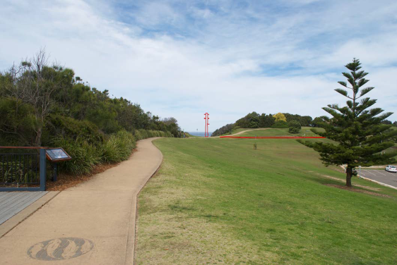
Photo 1: View south in the
Haven of the proposed development
Source: Green Light VIA
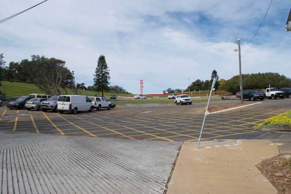
Photo 2: View from the west
in the public car park
Source: Green Light VIA
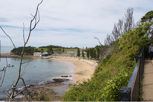
Photo 3: View south east
from the Scenic Highway
Source: Green Light VIA
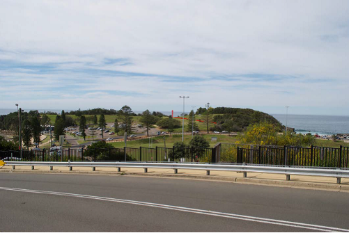
Photo 4: View east from the
Scenic Highway
Source: Green Light VIA
In summary, both
Visual Impact Assessments accompany this development application do not support
the project in the location chosen (Site 1).
Views that pedestrians will have when approaching the memorial
site along the concrete pathway on Broken Head will be affected. The existing
view takes in the vegetated headlands and outlook over the rock platform and
Pacific Ocean. The existing viewscape is scenic and dominated by soft landscape
elements, in particular a rolling grass slope that drops down to the sandstone
cliff edge. This viewpoint is considered of high sensitivity.
The proposed memorial will dominate the overall view and become
the focal point of the natural depression in the landform. Access to the grass
slope would also be impacted. The new structure would change the overall
appearance of the landscape and change the way the space is used leading to a
high magnitude of change.
The assessment
states that for private residences on the high side of the Scenic Highway, the
proposal will change the overall appearance of the skyline slightly as the
existing trees and light poles from the sports oval already extend above this
line. Subsequently,
the development will impact upon the existing privacy and amenity of the Public
Recreation area in terms of view loss, cause obstruction of views for local residences and visual impact is not considered negligible.
It is noted that the
installation of temporary height poles to identify the exact location and
height of the proposed development and structure was not undertaken in order to
further understand the extent of visual impact.
The
following extract from the Green Light assessment summarises the overall visual impact:
The visual impact of
the proposed works would be greatest for those viewers in close proximity to
the site. Viewpoints 1, 2 and 3 are representative of the catchment of viewers
who will perceive a high impact to the visual amenity of the reserve. In
general, the memorial structure will change the overall appearance of the
skyline and would become the dominant hard landscape element in the reserve.
Viewers that will see the change from a greater distance will likely perceive a
reduced visual impact from the proposed works however the change to the skyline
may still impact the views to the Pacific Ocean.
Assessment: The proposed site for the memorial has been considered from the
same view corridors, and, with consideration of the above exert from the Green
Light assessment.
The proposal is considered unacceptable in terms of the impact of
the proposed works as assessed against the scenic values identified in the
Terrigal Haven Plan of Management 2009 to determine if the changes in the
landscape are consistent with the desired character of the reserve.
The following scenic values (extract from the Terrigal Haven Plan
of Management) were used to form the basis of this assessment and reiterated
within the VIA:
Retain natural landscape quality
Large sections of Broken Head and
the Skillion are covered with native vegetation remnant of the plant
communities that inhabited the headlands over a long period. These sections of
vegetation contribute significantly to the natural landscape qualities that the
community value.
The proposed memorial will not
complement this part of the public recreation area and does not provide a
visually interesting cultural, scenic and heritage element into an otherwise
harsh windswept environment.
An improved landscape setting
could be achieved by integrating a memorial garden with native species of flora
to attract local fauna and soften the appearance of the gap at the focal point
in the skyline between the vegetated headlands on Broken Head. The design of
the proposed memorial will not provide an improvement to the natural landscape
qualities of the area as viewed from a number of important viewpoints.
The proposed access pathway will
require the removal of a section of native vegetation which will have an impact
on the natural landscape qualities. Replacement landscaping has not been
proposed.
Preservation of Views to the
Pacific Ocean
The proposed memorial will impact
on views to the ocean from a number of key viewpoints and it is expected that a
number of residents in private dwellings as well as users of The Haven will be
affected. The extent of the impact varies depending on the distance the viewer
is from the proposed memorial. Typically the closer the viewer is located to
the memorial the greater the magnitude of impact to their view of the ocean.
Embellish Natural Vantage Points
The proposed memorial is a new
hard structure that will be placed in an otherwise informal grass slope
overlooking the rock platform and ocean. The proposed development in its
current form are not considered a visually interesting addition to the
landscape and will not embellish an existing important historical naval viewing
platform.
Effective maintenance
The
review of the Green Light Visual Impact Assessment has found that the proposal
will have a moderate to high visual impact overall in its proposed location,
noting the natural setting and that the mast would introduce a built element in
a prominent location which is visible from several key locations. The proposed
development has not been included in the Terrigal Haven Plan of Management 2009
in terms of maintenance.
In summary, the
project has the ability to provide enormous cultural, social, educational, and
community benefits that will result from the memorial however not at the
expense of impacting upon scenic view corridors from private and public land. A
key concern raised has been that the purpose of the structure will not be
identifiable and from a distance will appear as a ventilation shaft.
Consideration should be given to ameliorating this issue by raising and flying
the appropriate flags with consent.
The
proposal is not reasonable in this circumstance and inconsistent with the
planning principle established in Tenacity Consulting Pty Limited v Warringah Council [2004] NSWLEC 140. The
development does not respect the principle of view sharing.
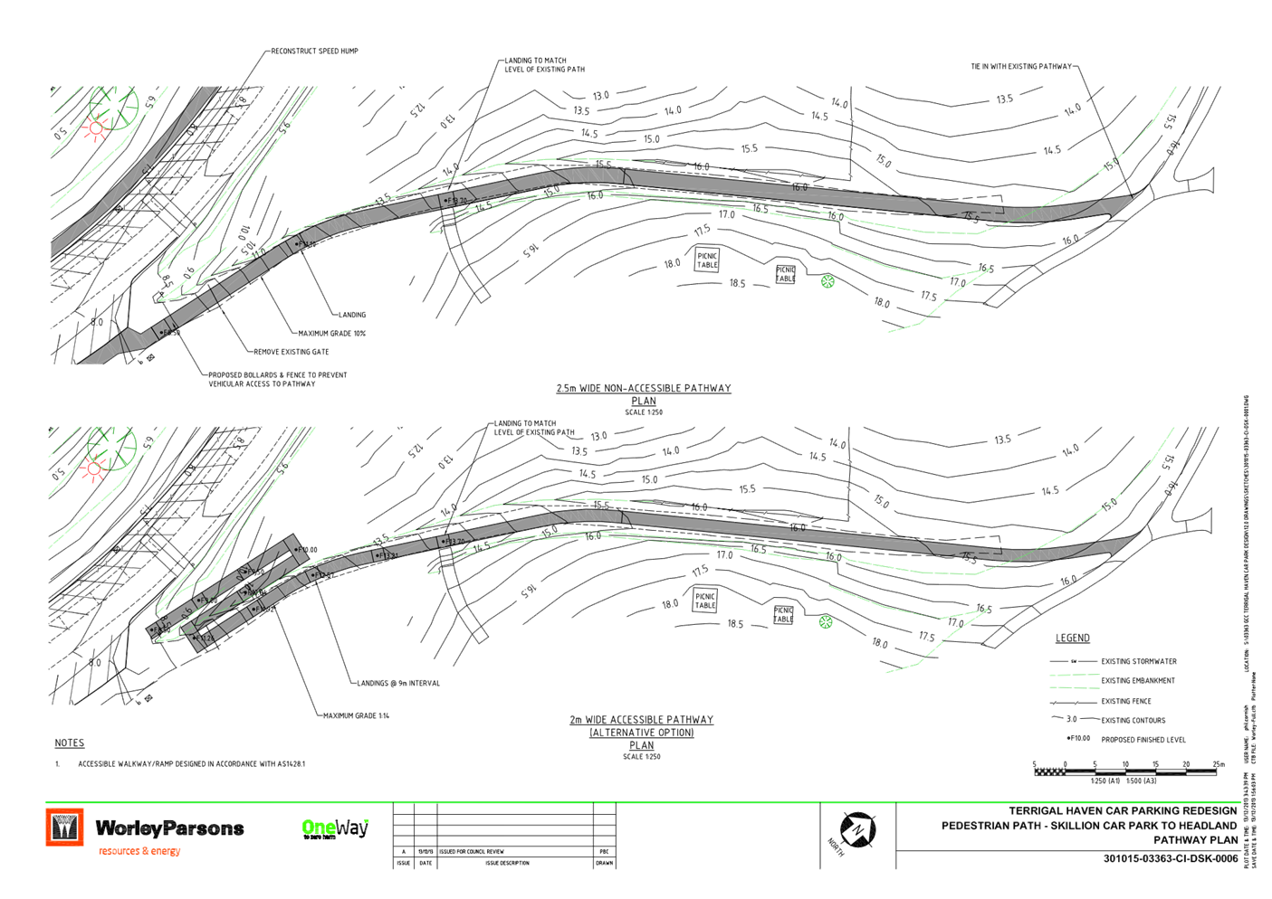
Access
and Transport
Equitable
access is not addressed which may limit access to the memorial site for people
with impaired mobility. Given the site is proposed as a commemorative place
this is of paramount importance on national days of significance such as ANZAC
Day and Remembrance Day.
The
proposed access does not comply with AS 1428.1, 1428.4.1, NCC (BCA 2016 Volume
1), Disability (Access to Premises – Buildings) Standards, and Central
Coast Council Disability Inclusion Plan.
The identified
location for the monument limits access for people with impaired mobility.
Presently, the site
is accessed from a number of existing paths from the north eastern and south
eastern car park. Currently, a trail road allows vehicular access and
limited wheelchair access from the slip rail located on the northern side of
the Skillion car parking bays. There is also a footpath encompassing the whole
Haven area which allows foot traffic to the site.
A new accessible
pathway should provide compliant access for all abilities.
Recommendations made
in an access report prepared by Access Solutions Consultants dated 7 March 2019
should be updated to assess the proposed situation and how the accessible
pathway will be resolved and installed by Council to meet access requirements.
Access Solutions do not support Site 1 due to cost, accessibility, lack of
access to sanitary facilities and the steep slope.
It is
further recommended that any future development application associated with a
memorial include a resting place or bench type structure given the site
location is atop a steep climb of The Haven.
A Traffic Impact
Assessment is also recommended for any future application to address the
potential impact management of traffic and parking overflow on national days of
recognition and commemoration such as ANZAC Day and Remembrance Day.
Overall
built environment impacts
The proposal is not
compatible with, and will adversely impact on, the character and amenity of the
locality, public recreation area and streetscape. This is predominantly as a
result of the visual impact applicable to the height of the development that
would result in an outcome that is uncharacteristic and unplanned in this
location. As a result, the proposed development is unsatisfactory in terms of impacts
on the built environment.
A
thorough assessment of the proposed development’s impact on the built
environment has been undertaken having regard for SEPP Coastal Management along
with the provisions of GLEP 2014 and GDCP 2013 and it is considered the
potential built environment impacts are unreasonable.
Natural Environment
There
will be significant impact upon the natural environment as a result of the
proposal. Although, the development of the site would result in a public
structure and memorial consistent with the existing use of the Haven as a place
of public recognition of the sunken Adelaide, insufficient information has been
provided addressing the impact upon the existing landscaping and vegetation
surrounding the site with regard to removal or protection.
Context
and Setting
The site
is located on the Haven. The memorial is proposed to be located within a gap
(saddle) of the vegetation line which is situated within a landscaped setting
and fronts the ocean.
The
vegetation in this area is classified as Coastal Headland Shrubland (E51b) with
species identified consistent with those found in surrounding coastal
environments (e.g. She-oak, Coastal Banksia and Coastal Tea-tree). This site
was selected as it has direct view of the buoys over the site of the Ex-HMAS
Adelaide, is close to the Marine Rescue Centre, and is clear of vegetation.
The
structure is 450mm in diameter and up to 9m in height. It is considered that
the development will obstruct significant or iconic views or vistas from public
and private land.
In this
circumstance, the location chosen at Site 1 is not considered suitable given
that the application was accompanied by insufficient information.
The
intention of the development is to establish a mast above the sunken naval
vessel to form part of a memorial at The Haven. Whilst this application is not
considered acceptable, the project to establish a memorial does have value. The
Haven is part of the RE1 Public Recreation area and an important area of
significant scenic quality and a special place for both locals and tourists. It
is considered that a future memorial could enhance this experience.
The
Terrigal Haven Plan of Management 2009 which was adopted by the former Gosford
City Council in 2010 has not been updated to include the subject development
application and ‘Lifecycle Plan’ has not been prepared.
In this
circumstance, the development is considered unacceptable in terms of the impact
of the proposed works as assessed against the scenic values identified in the
Terrigal Haven Plan of Management 2009 to determine if the changes in the
landscape are consistent with the desired character of the reserve.
Heritage
interpretation has not addressed the actions of the Terrigal Haven Plan of
Management. The concept plan must be consistent with appropriate management of
any culturally significant sites within the vicinity.
Geotechnical
The proposed structure is on a small saddle between two elevated
rock outcrops, on stable, slightly sloped land which is currently prone to
erosion from storms and associated coastal processes. The site however is well
protected from the south where severe storms can cause wider-spread erosion and
damage.
Douglas Partners
Pty Ltd (DP) carried out a geotechnical investigation. The work was carried out
for Wales & Associates Pty Ltd. The geotechnical investigation was carried
out to assess the subsurface conditions in order to provide geotechnical design
parameters for a footing to support the mast.
The
investigation comprised the drilling of a single borehole at the location of
the proposed monument. The borehole was drilled using a 4WD-mounted push tube
rig with 60 millimetre diameter sampling tubes and was taken to a depth of 3.2
metres.
Conditions
encountered in the borehole broadly comprised very stiff grading to hard
residual clay soils, with drilling terminating at 3.2 metre depth due to
refusal on weathered sandstone. No free groundwater was observed in the
borehole which was backfilled shortly after drilling for health and safety
reasons.
It is noted that
groundwater levels are affected by factors including rainfall and will
therefore vary over time.
The report dated July 2010 investigations
found that:
· Based on the
conditions encountered in the borehole, it is considered that the mast could be
supported either by a pad footing or by concrete bored pier(s), depending on
the applied loads.
· Pad footings
being at least 0.5 m below ground level on at least very stiff residual clay
could be proportioned for a maximum allowable bearing pressure of 200 kPa.
· Concrete bored
piers could be designed based on a maximum allowable end bearing pressure of
600 kPa and maximum allowable shaft adhesion 50 kPa within the weathered rock
profile. Shaft adhesion could also be included for the section of the piles within
the residual clay and a maximum allowable adhesion of 15 kPa would be
appropriate. Lateral loads (e.g, wind loading) could be resisted by the portion
of the bored pile embedded into the ground and could be based on an ultimate
passive earth pressure of 150 kPa within at least very stiff clay and 300 kPa
within the weathered sandstone. The upper 1 m should be ignored in this loading
case.
· Settlements
associated with footings designed based on the aforementioned parameters would
be expected to be less than about 1% of the footing width.
· Footing
excavations or pier holes should be free of water and loose debris prior to
pouring concrete. It is also recommended that all footing excavations be
inspected by a geotechnical engineer to check that the founding conditions are
consistent with the design requirements.
It
is recommended that any future development application provide an updated
geotechnical investigation / dilapidation report as the report dated July 2010 states that the
"the scope for work for this investigation/report did not include the
assessment of surface or sub-surface materials, or ground water for
contaminants within or adjacent to the site".
There has been
reported cliff dilapidation in 2020. Structural stability remains an issue for
investigation.
Flora and Fauna
Flora recorded at the Haven includes Coastal Headland Shrubland
(E51b). There are no anticipated impacts on this vegetation as all construction
works would be required to be contained within the exposed grassed area of the
site.
Bushfire
The site is not bushfire affected.
Flooding
The site is not flood affected.
Acid
Sulfate Soils
The site does not affect acid sulfate soils.
Economic Impacts
An
Economic Impact Assessment has not been submitted with this development
application. The proposed development could have beneficial economic impacts
bringing tourism to the memorial and local economy. It is noted that the
proposal is not considered that the proposal is inconsistent with the aims of
the Central Coast Structure Plan 2036 (CCSP 2036).
Social Impacts
A Social
Impact Assessment has not been submitted with the development application
outlining the net community benefits.
The
proposed development could have beneficial social, cultural, historical and
educational impacts as it will provide a memorial in the Terrigal Haven (as
approved within the Terrigal Haven Plan of Management 2009) to the sunken naval
vessel to which it relates and sits sunken and decommissioned off the coast
providing a diving reef adjacent north of this part of the coastal headland.
The
proposal for a memorial in principle is reasonable, however the built form will
be incongruous within the location within The Haven (Site 1) and will adversely
impact on the planned character and amenity of the locality.
Safety and
Vandalism
Memorials and public
artwork on the Central Coast have not been consistently maintained. The
construction of this memorial would require a maintenance program, maintenance
funding and a ‘Lifecycle Plan’. A Lifecycle Plan determines the
lifespan of the memorial, and determines ongoing maintenance costs and a
program for inspection and maintenance.
The
memorial is likely to experience vandalism, which will require removal as soon
as possible as tags left in place become a reward to the vandal. Vandalised memorials
also become more prominent in the landscape and send a signal that encourages
anti social behaviour. How climbable the memorial should also be considered. Vandalised memorials also become more
prominent in the landscape and send a signal that encourages anti social
behaviour.
Safety
measures have not been sufficiently addressed. Safety, vandalism and
maintenance regarding the construction and maintenance of the memorial requires
a maintenance program, maintenance funding and a ‘Lifecycle Plan’
determining the lifespan of the memorial, ongoing maintenance costs and a
program for inspections, and, how this part of the cliff coastline will be
ensured for public safety with fencing and the like.
Suitable
safety measures such as way fining signage have not been provided to ensure
mourners and visitors to the site are aware of the structures close proximity
to the cliff drop off. It is
recommended future consideration be given to providing low lying safety fencing
along the cliff line gap similar to that at the Skillion.
Where relevant The
Terrigal Haven Plan of Management 2009 which was adopted by the former Gosford
City Council in 2010 should be updated to include the development, safety and
maintenance program.
Heritage
Interpretation – European and Aboriginal
There is significant
Aboriginal heritage known to be within the surrounding area specifically along
the northern foreshore and adjacent to the Skillion on the eastern side.
Indigenous and non-indigenous heritage Indigenous heritage sites have been
identified within the Terrigal Haven area however due to the sensitive nature
of the information, specific details cannot be provided.
It is recognised
that the actions in this Terrigal Haven Plan of Management and the concept plan
must be consistent with appropriate management of these culturally significant
sites.
Any
future application should include a heritage interpretation strategy and plaque
will provide public awareness of the mast ex-naval history and importance of
service, identifying and respecting the memorial as it comprises the original
mast from the Ex-HMAS Adelaide which will be placed within a sandstone block
plinth.
Suitability of the Site for the
Development
The site is considered to be
unsuitable for the proposed development as follows:
• The site is zoned RE1
Public Recreation under GLEP 2014. The proposal is a permissible use under the
RE1 Public Recreation zone, however the scale of the proposed development by
virtue of it’s chosen location is inconsistent with the objectives of the
zone.
• There may be
environmental hazards which would prevent development of the site.
• Utility services may
be required which may not be available at the site.
• The site is not
located on and near public transport facilities however, is located within a
public recreation space providing community facilities.
• The development
application is in not accordance with desired character/scenic quality for the
area.
• There is no character
statement for this precinct that specifically addresses the land, however it is
conserved in this circumstance the aesthetics are generally unacceptable and
given the environmental impact, the application is not supported.
• The HMAS Adelaide
monument could in future present as a visually interesting historical monument
structure if it were of a suitable bulk and scale and sited within an equitable
location.
Any
Submission made in Accordance with this Act or Regulations
The
development application was notified between 12 February 2021 to 22 March 2021 in accordance with DCP 2013
– Chapter 1.2 Notification of Development Proposals with 6 submissions
received. The general issues raised in relation to the proposal are included
below:
• Concern about ongoing cost and
Council’s financial position.
Comment: Funding is already established
(although may require renewal) for the development. The NSW Government has
committed funding of the installation with a $66,000 grant from the Stronger
Communities Fund (round 2), with an additional $3,000 provided by the
Minister’s Discretionary fund (FY2015-16). Council is submitting
the development application and will be responsible for project management and
ongoing maintenance. Council will seek funding for the installation of the
access path as part of future project work.
• Concern about the identified
location for the monument limiting access for people with impaired mobility.
Comment: An Access Report prepared by Accessible Solutions
dated 7 March 2019 accompanies this development application which does not
support Site 1 due to cost, accessibility, lack of access to sanitary
facilities and the steep slope. Equitable accessibility should be resolved and
remains an ongoing issue at the Haven.
• Concern about the obstruction of
view and the need to keep the natural environment in mind when implementing
anything at The Haven.
Comment: Two Visual Impact Assessment (VIA)
reports accompany this DA including a June 2020 Independent Review by The
Design Partnership (TDP) of the Visual Impact Assessment (VIA) by the Green
Light Design Group (GLDG). Neither VIA support the DA, however it is considered
that the issues raised could be mitigated in order to achieve a more negligible
outcome particularly given the enormous cultural, social, educational, and
community benefits that will result from the Ex-HMAS Adelaide memorial.
• Access
Comment: Equitable access is not addressed which may
limit access to the memorial site for people with impaired mobility. Given the
site is proposed as a commemorative place this is of paramount importance on
national days of significance such as ANZAC Day and Remembrance Day.
The proposed access does not comply with AS
1428.1, 1428.4.1, NCC (BCA 2016 Volume 1), Disability (Access to Premises
– Buildings) Standards, and Central Coast Council Disability Inclusion
Plan.
Access Solutions do
not support Site 1 identified by Council for the development due to cost,
accessibility, lack of access to sanitary facilities and the steep slope.
It is
recommended that any future development application associated with a memorial
include a resting place or bench type structure given the site location is atop
a steep climb of the Haven.
A Traffic Impact
Assessment is also recommended for any future application to address the
potential impact management of traffic and parking overflow on national days of
recognition and commemoration such as ANZAC Day and Remembrance Day.
• Consultation
Comment: Prior to
lodgement fformal
community engagement was held between 9 November 2020 and 7 December 2020
through Council’s web page. Hyperlink to community engagement: https://www.yourvoiceourcoast.com/HMASadelaide
Consultation was undertaken to determine
community sentiment on the monument and its location to inform the application.
The development
application has been formerly exhibited between 12 February 2021 and 26
February 2021. Six (6) submissions were received including a letter from the
Terrigal Area Residents Association Inc. (TARA). The issues raised have been
considered in the assessment.
• Would Staff and Councillors
consider a Site inspection at which time two marker poles could be erected?
Comments: Although recommended in
correspondence to the applicant dated 17 February 2021, height poles were not
placed on the site to determine the height and visual impact.
• Maintenance
Comment: The installation of the mast was
included in the Terrigal Haven Plan of Management 2009 which states
‘Investigate appropriate location for a memorial in honour of the ex-HMAS
Adelaide II and her crew. Construct environmentally sensitive viewing platform
incorporating interpretive / educational signage and relevant relics from the
vessel.’
Any
future application will require the plan to be updated to include a maintenance
program, maintenance funding and a ‘Lifecycle Plan’. A Lifecycle
Plan determines the lifespan of the memorial and determines ongoing maintenance
costs and a program for inspection and maintenance.
• The ‘cluttering up’ of
one of nature’s quiet, simple and open landscapes would be a disaster
when viewed close up or from a distance.
Comment: The proposed structure is not
considered suitable for this location in this circumstance. Visual impact has
been thoroughly considered in this assessment.
• Support - In view of the long
period of gestation, corresponding increases in cost over 9 years the option
for site 2 proposal is strongly supported based on the current documentation
supporting this Development Application. The caveat being that Central Coast
Council rate payers are not requested to financially support this proposal
particularly given the cost overrun of the Terrigal Boardwalk.
Comment: Noted.
Submissions from Public Authorities
Roads
and Maritime Services (TfNSW)
Council
did not refer the development application to TfNSW for comments.
Internal
Consultation
The
application has been referred to and reviewed by the following experts in
council:
|
Building Surveyor
|
Supported subject to conditions.
|
|
Development Engineer
|
Supported subject to conditions. Refer
comments below.
|
|
Environmental Health
|
Supported without conditions.
|
|
Ecology
|
Supported without conditions.
|
|
Urban Design
|
See comments below
|
Development
Engineer
Accessible
footpath
The
development will require the construction of accessible footpath from the
Skillion car park to the perimeter footpath adjoining the proposed location of
the memorial structure. The design and construction of this is to be in
accordance with the Building Code of Australia and Council’s Civil Works
Specification.
Fencing
Planner
to consider whether the provision of safety fencing between the memorial
structure and the cliff is warranted.
Urban
Design Comments
In
terms of Urban Design, the proposed location appears to be satisfactory but the
dimensions of the monument are problematic and some of the issues still need to
be worked through.
A Landscape
Plan from a suitably qualified professional is required to provide revised drawings with a
more generous allocation to allow for circulation, and confirmation that the
appearance of the mast does not include the 3 horizontal projections that are
up to 4 metres long.
There
is also opportunity to modify the design to remove trip hazards in both the
walls and the plaque and incorporate interpretative signage in more appropriate
locations.
The
application is unable to be supported for the reasons outlined in the
recommended reasons for Refusal.
The Public Interest
The development will have an adverse impact
on the public amenity of the existing public open space and does not provide
equitable access. Visual impact must be resolved in order to mitigate
environmental impact by way of view obstruction from neighbouring properties
and surrounding public land.
Ecologically
Sustainable Principles
The
proposal has been assessed having regard to ecologically sustainable
development principles and is considered to be not inconsistent with the
principles.
Further
analysis is required to determine whether the proposed development is
considered satisfactory in terms of stormwater, drainage and erosion control. A
detailed landscape plan and arborist report has not been submitted outlining
the protection, retention and replacement of vegetation where possible.
Suitable
information has not been submitted with the application demonstrating that the
development is unlikely to have any significant adverse impacts on the
environment which could in turn decrease environmental quality for future
generations.
Flora
recorded at the Haven includes Coastal Headland Shrubland (E51b). There are no
anticipated impacts on this vegetation as all construction works will be
contained within the exposed grassed area of the site.
Climate Change
The
potential impacts of climate change on the proposed development have been
considered by Council as part of its assessment of the development application.
This assessment has included consideration of such matters as potential rise in
sea level; potential for more intense and/or frequent extreme weather
conditions including storm events, bushfires, drought, flood and coastal
erosion; as well as how the proposed development may cope, combat, withstand
these potential impacts.
Other Matters for Consideration
The Terrigal Haven Plan of Management 2009
The
installation of the mast was included in the Terrigal Haven Plan of Management
2009 adopted by the former Gosford City Council in 2010 which states
‘Investigate appropriate location for a memorial in honour of the ex-HMAS
Adelaide II and her crew. Construct environmentally sensitive viewing platform
incorporating interpretive/educational signage and relevant relics from the
vessel.’
Clauses
5.1 to 5.4 of the plan are relevant to the proposed development and were
addressed in the Visual Impact Assessment prepared by Greenlight as
independently reviewed by The Design Partnership.
Any
future application will require the plan to be updated to include a maintenance
program, maintenance funding and a ‘Lifecycle Plan’. A Lifecycle
Plan determines the lifespan of the memorial and determines ongoing maintenance
costs and a program for inspection and maintenance.
Illumination
No
illumination of the development of surrounding public land is proposed. This is not permissible without consent
of Australian Navy or RSL.
Waste Management
A Waste Management Plan (WMP) has been prepared in line with the
requirements of the Gosford Development Control Plan.
Construction
Management Plan/Project Delivery
The proposal would most likely not produce excessive dust or noise
during the construction affecting neighbours as there are no nearby sensitive
noise receivers such as residential dwellings, schools or hospitals. However,
the use of the public recreation area would be restricted during construction.
The
delivery of this project has been planned to minimise inconvenience, ensure
safety and reduce the construction impact on residents, local businesses and
tourists.
The proposed works are anticipated to last for approximately 2
weeks with the initial installation of the mast the priority. A plinth footing
is required to a depth of a minimum 4.4 metres deep by a 750 millimetres width
to ensure enough strength is obtained to secure the mast.
The base of the mast itself is 2 metres above ground and held by a
pre- welded stainless steel cage that is concreted into the plinth and
tightened with GR316 stainless steel bolts.
During
the construction period, access to the area around the footprint of the
structure and upgrade to access pathways would be restricted, plus a small
section of the Terrigal Haven carpark may be closed to cater to construction
vehicles etc.
Users of
the Haven, Main Oval and Skillion as well as foreshore areas and car park areas
are advised to adhere to onsite signage and not to enter the construction area.
However, a Construction Management Plan (CMP) was not submitted.
Planning Agreements
The
proposed development is not subject to a planning agreement / draft planning
agreement.
Development
Contributions
Development
Contribution Plan under Section 7.12 may be applicable if the proposal was
supported.
Water and Sewer Contributions
There are no water and sewer contributions applicable to the
proposed development.
Conclusion
This
application has been assessed against the heads of consideration of Section
4.15 of the Environmental Planning & Assessment Act 1979 and all relevant
instruments and policies. The potential constraints of the site have been
assessed and it is considered that the site is unsuitable for the proposed
development.
The
proposed development is expected to have an adverse impact on the built and
natural environment as well as visual impacts.
It is
considered that the proposed development will not complement the locality and
meet the desired future character of the area. Accordingly, the application is
recommended for Refusal
pursuant to
Section 4.16 of the Environmental Planning and Assessment Act.
The
development application is not supported, for the reasons below.
Reasons
for the Decision
The reasons for the decision
as recommended under the assessment of this application
are as follows:
1 The proposal is unsatisfactory
having regard for the relevant environmental planning instruments, plans and
policies.
2 The proposal has been considered
against the provisions of State Environmental Planning Policy (Coastal
Management), Gosford Local Environmental Plan 2014 and Gosford Development
Control Plan 2013 and has been found to be unsatisfactory.
3 There are significant issues or
impacts identified with the proposal under s.4.15 of the Environmental Planning
and Assessment Act 1979.
4 Additional information requested
in order to undertake a more comprehensive assessment addressing the relevant
provisions of the Environmental Planning and Assessment 1979 has not been
provided:
a A survey has not been provided
clearly identifying the location of the proposed structure and proximity of
vegetation that may be affected.
b Amendments are required on the
architectural drawings to show correct dimensions of the structure and
surrounding area. It is noted that the SEE states the structure is 7.4m, and
that the base of the mast will be 2m above ground level. The architectural
drawings show the mast height at approximately 9m and the Independent Review of
the Greenlight VIA states the proposal will be approximately 9.5m.
5 The application is inconsistent
with the stated aims and objectives of the SEPP (Coastal Management) 2018. The
proposed development will cause an adverse impact on the matters required to be
considered under Clause 13 (1) (a) – (g), Clause 13 (2) (a) – (c),
Clause 14 (1) (a) – (b) and Clause 2 of SEPP (Coastal Management) 2018.
6 Equitable access will not be
achieved, and does not comply with AS 1428.1, 1428.4.1, NCC (BCA 2016 Volume
1), Disability (Access to Premises – Buildings) Standards, and Central
Coast Council Disability Inclusion Plan.
7 The development will cause adverse
visual impact upon view corridors from private and public places.
8 The development is considered
unacceptable in terms of the impact of the proposed works as assessed against
the scenic values identified in The Terrigal Haven Plan of Management 2009 to
determine if the changes in the landscape are consistent with the desired
character of the reserve.
9 Safety measures have not been
sufficiently addressed.
10 A traffic impact assessment (TIA) has
not assessed the additional traffic overflow may be managed on commemorative
days of the year.
11 An ecology, biodiversity and
landscape or arborist assessment has not been submitted to assess the impact of
the development on the natural environment, fauna and flora.
12 A social impact assessment and
economic impact assessment has not been submitted to assess the net community
and economic benefits of the development.
13 The geotechnical investigation /
dilapidation report dated July 2010 prepared by Douglas Partners is considered
outdated and does not specifically address the proposed location of the mast
and plinth footing.
14 A Construction
Management Plan (CMP) has not been submitted.
15 The development is not presently
considered in the public interest. The development will have an adverse impact
on the public amenity of the existing public open space and does not provide
equitable access. Visual impact must be resolved in order to mitigate
environmental impact by way of view obstruction from neighbouring properties
and surrounding public land.
Attachments
|
1⇩
|
Architectural
Plans 2 Scenic Highway TERRIGAL DA60262 Part 1
|
|
D14327718
|
|
2⇩
|
Statement
of Environmental Effects Revised Nov 2020 2 Scenic Highway TERRIGAL DA60262
Part 1
|
|
D14468432
|
|
3⇩
|
Engineering
Plan & Carpark & Pathway Plan 2 Scenic Highway TERRIGAL DA60262 Part
1
|
|
D14327723
|
|
4⇩
|
Access
Report 2 Scenic Highway TERRIGAL DA60262 Part 1
|
|
D14327733
|
|
5⇩
|
Geotechnical
Report 2 Scenic Highway TERRIGAL DA60262 Part 1
|
|
D14327735
|
|
6⇩
|
Visual
Impact Assessment 2 Scenic Highway TERRIGAL DA60262 Part 1
|
|
D14327729
|
|
7⇩
|
Independent
Review 2 Scenic Highway TERRIGAL DA60262 Part 1
|
|
D14327736
|
|
3.1
|
DA/60262/2020
- 2 Scenic Highway, Terrigal - Ex-HMAS Adelaide Mast at the Terrigal Haven on
to a plinth footing with landscaping and provision for a flagpole
|
|
Attachment 1
|
Architectural
Plans 2 Scenic Highway TERRIGAL DA60262 Part 1
|
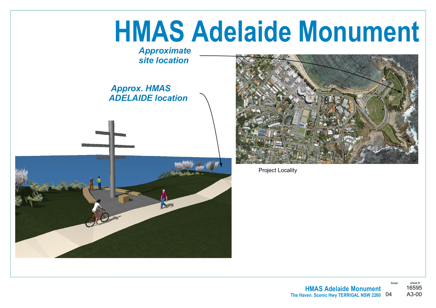
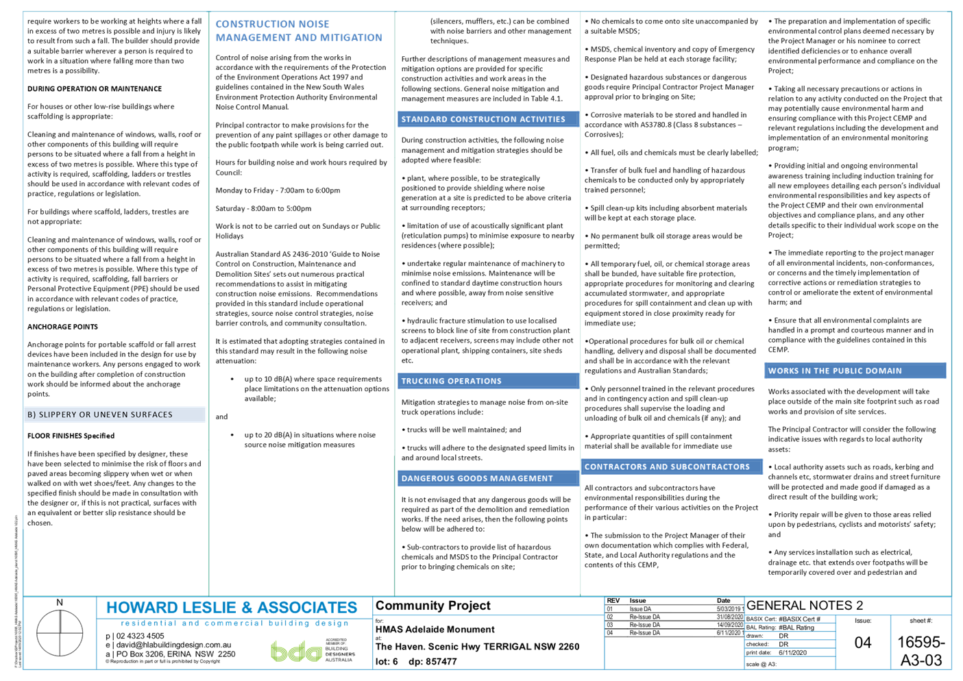
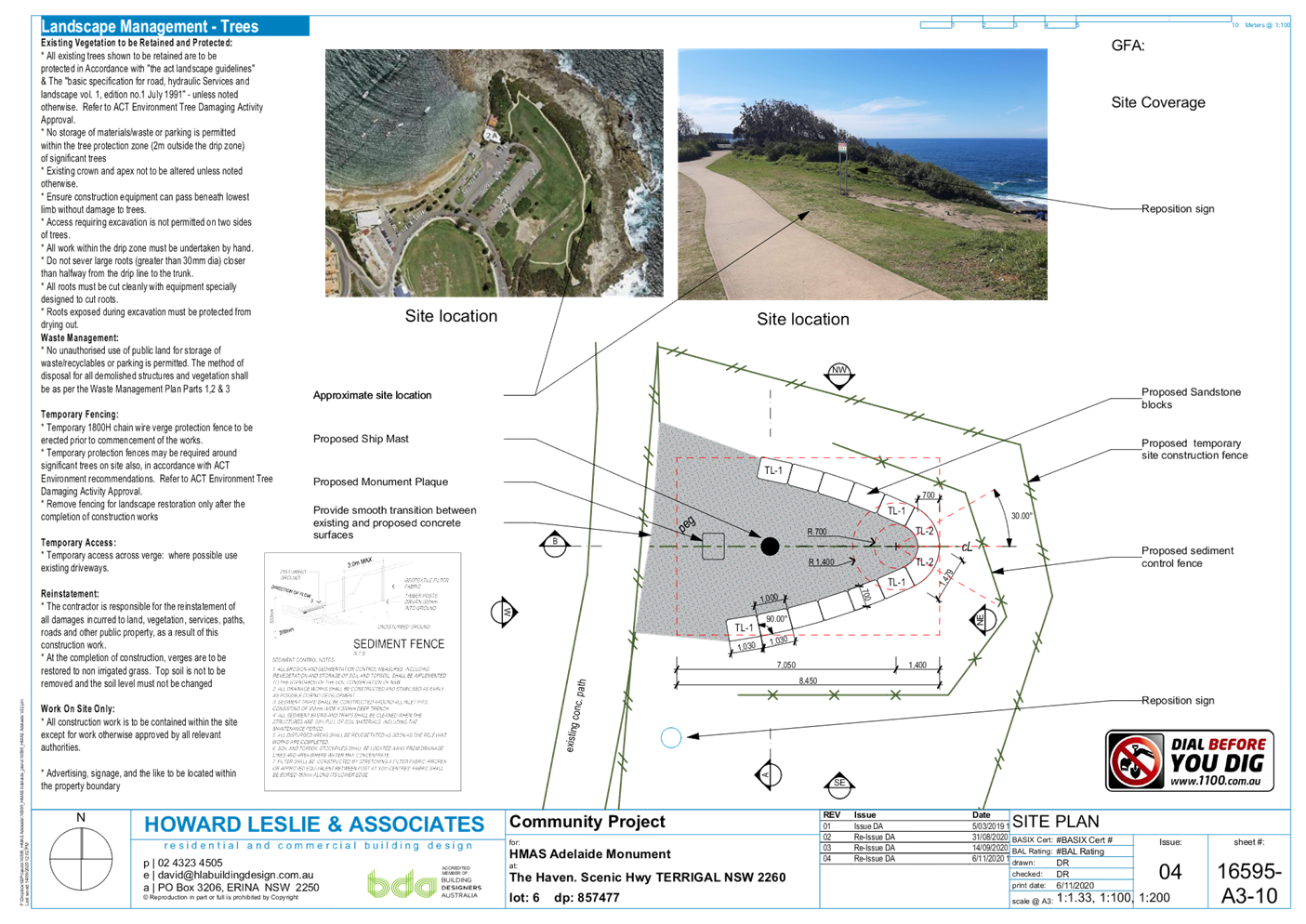
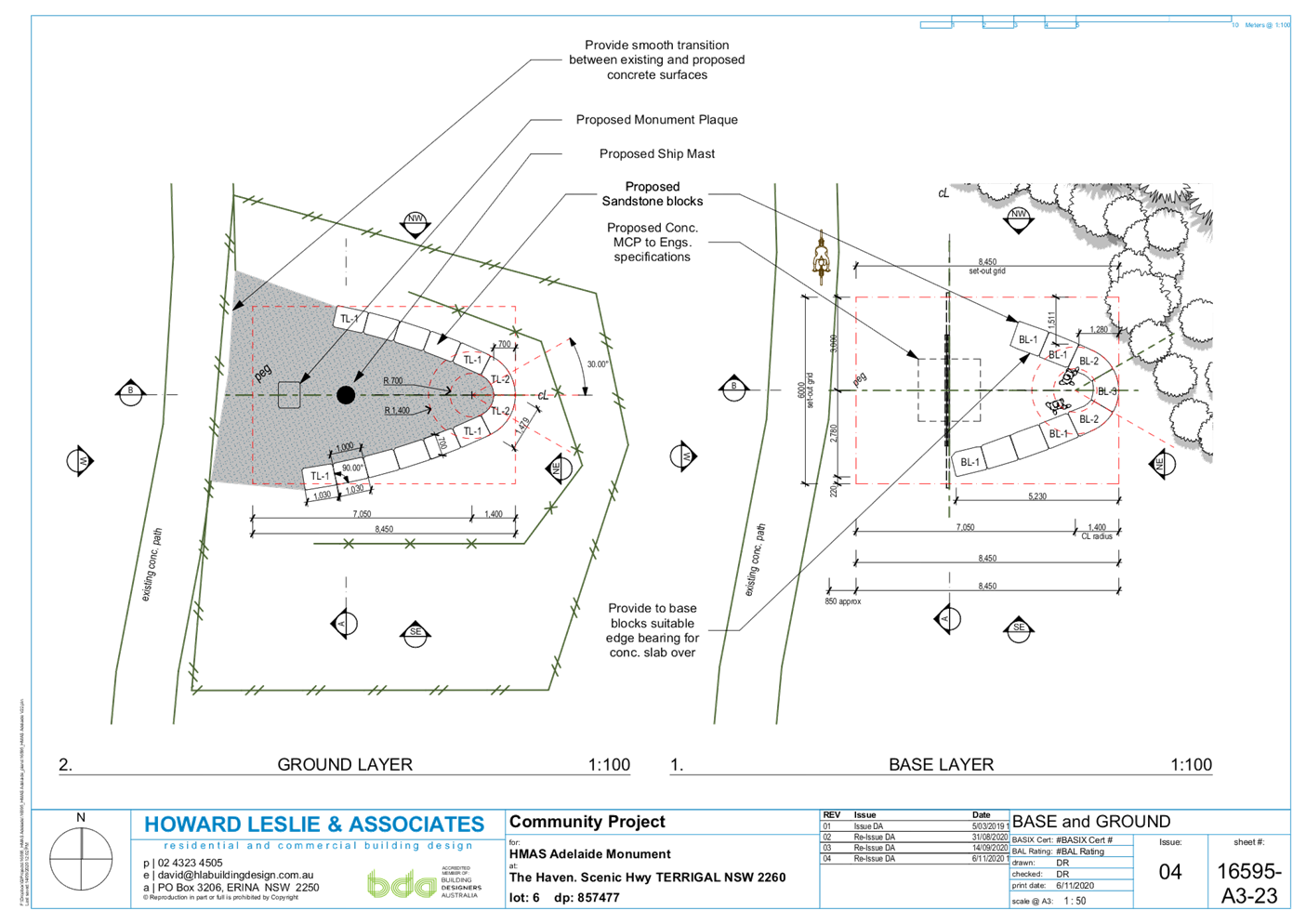
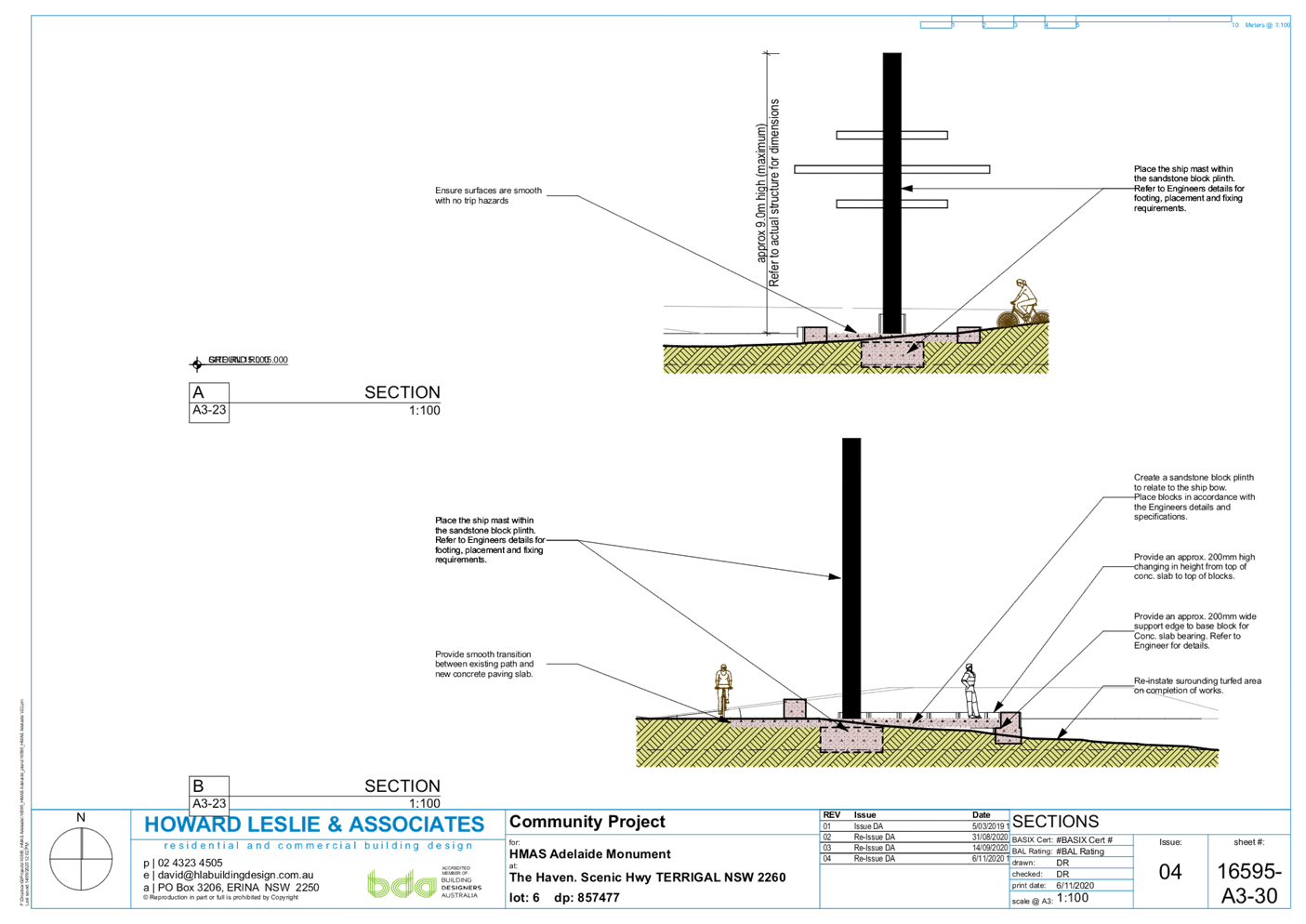
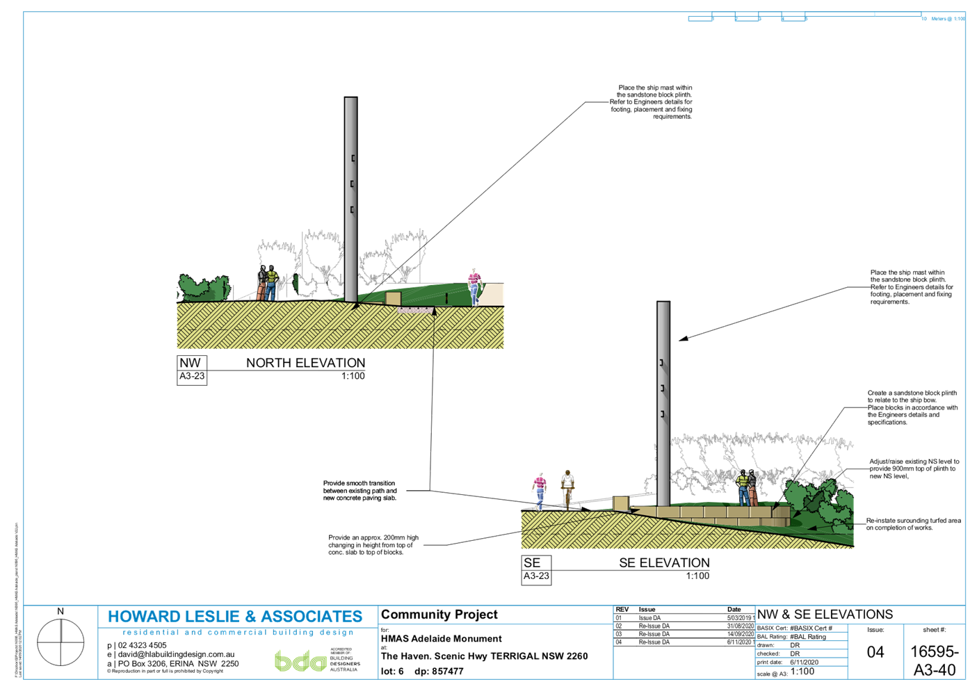
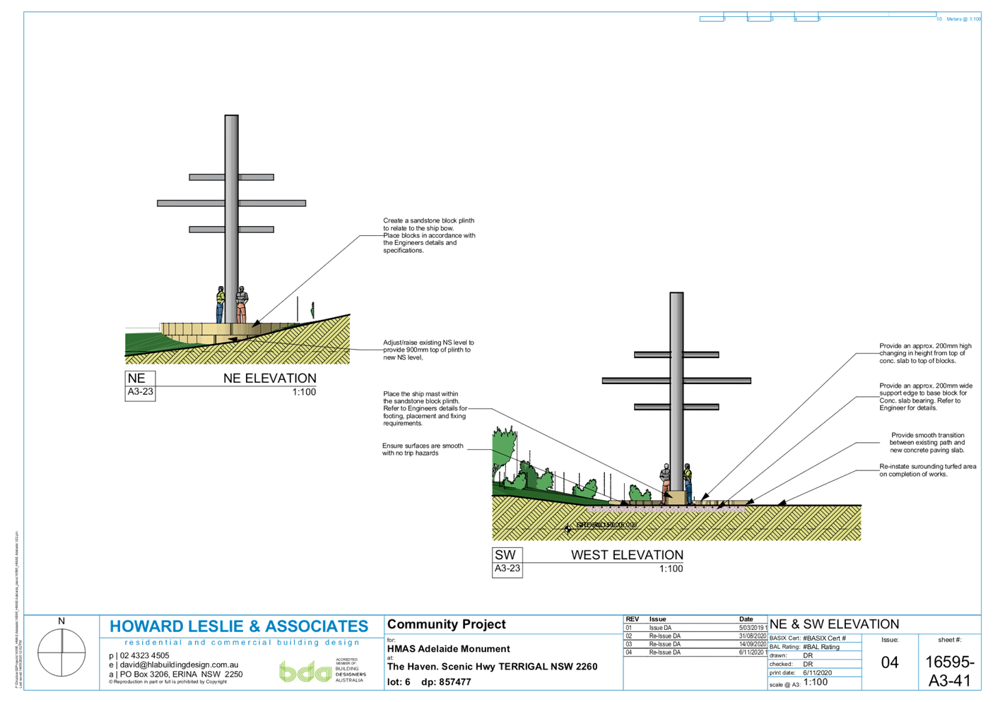
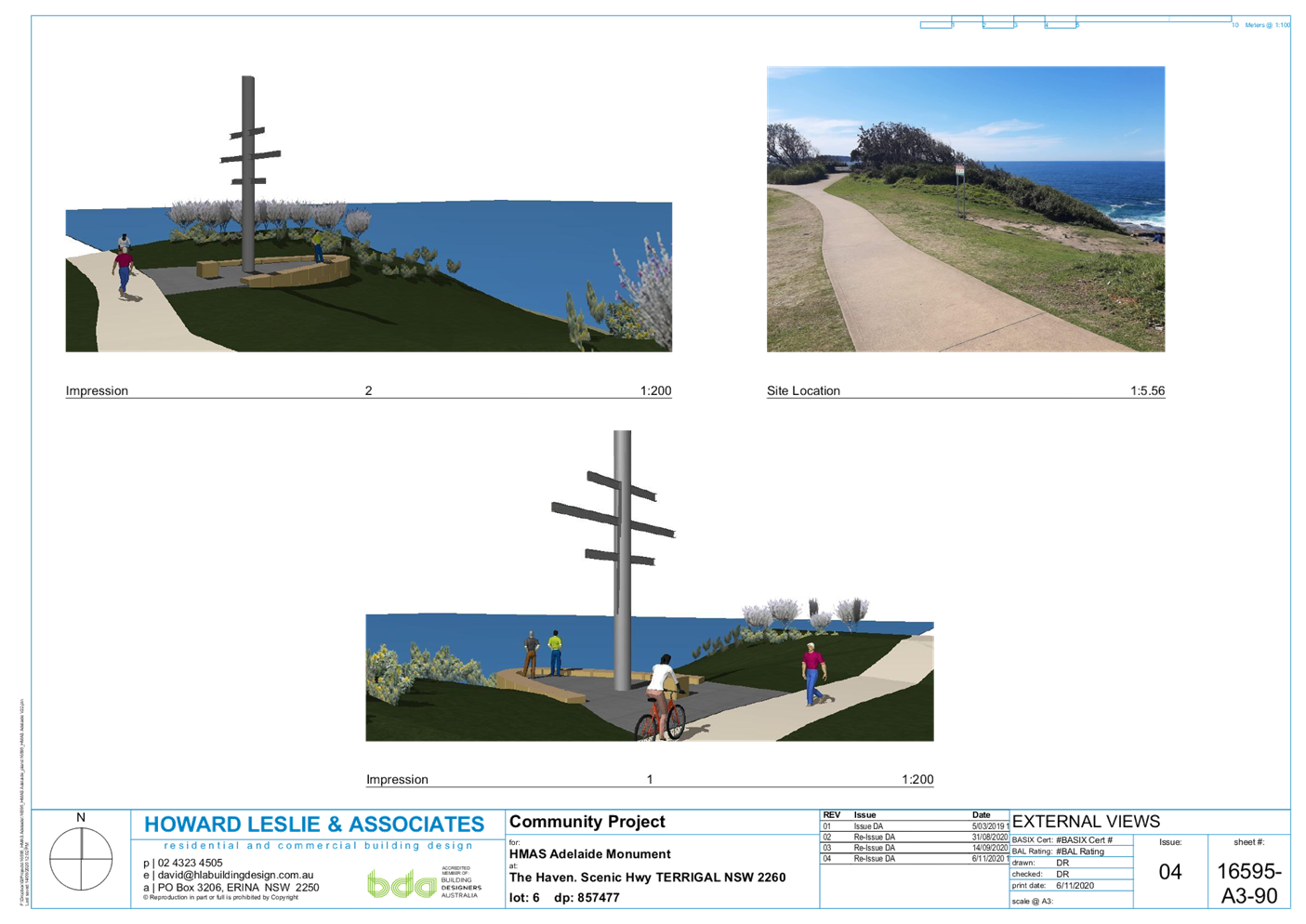
|
3.1
|
DA/60262/2020
- 2 Scenic Highway, Terrigal - Ex-HMAS Adelaide Mast at the Terrigal Haven on
to a plinth footing with landscaping and provision for a flagpole
|
|
Attachment 2
|
Statement
of Environmental Effects Revised Nov 2020 2 Scenic Highway TERRIGAL DA60262
Part 1
|
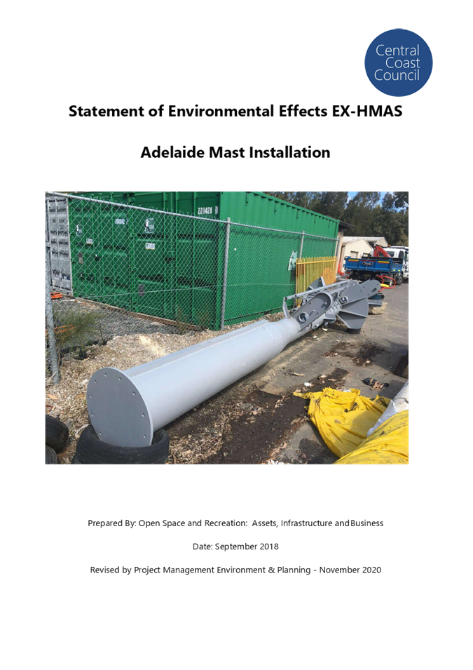
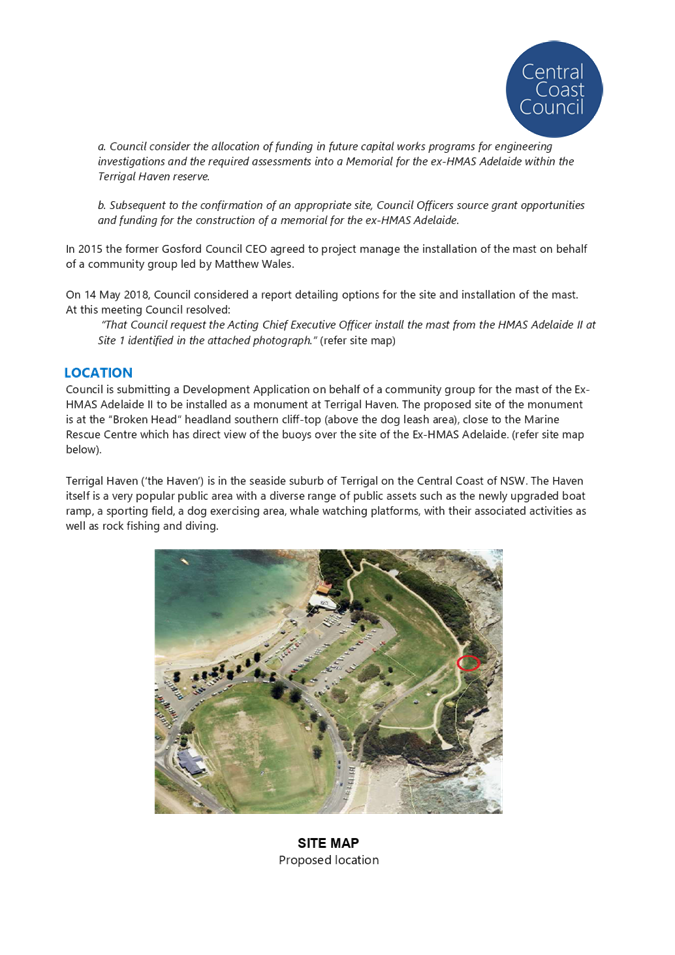


|
3.1
|
DA/60262/2020
- 2 Scenic Highway, Terrigal - Ex-HMAS Adelaide Mast at the Terrigal Haven on
to a plinth footing with landscaping and provision for a flagpole
|
|
Attachment 3
|
Engineering
Plan & Carpark & Pathway Plan 2 Scenic Highway TERRIGAL DA60262 Part
1
|
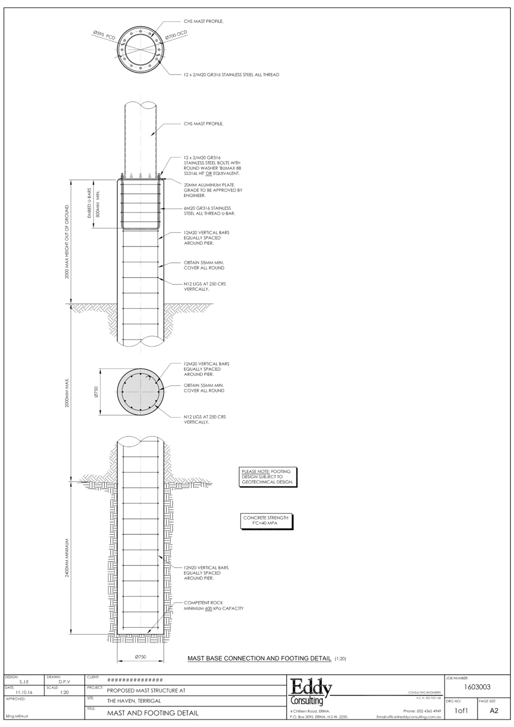
|
3.1
|
DA/60262/2020
- 2 Scenic Highway, Terrigal - Ex-HMAS Adelaide Mast at the Terrigal Haven on
to a plinth footing with landscaping and provision for a flagpole
|
|
Attachment 4
|
Access
Report 2 Scenic Highway TERRIGAL DA60262 Part 1
|
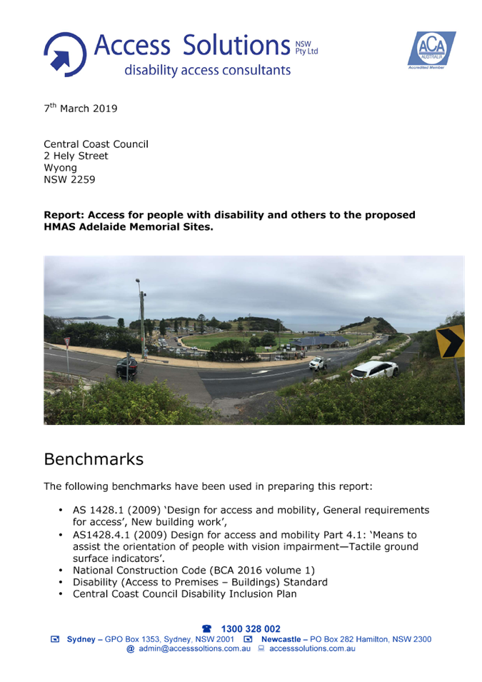
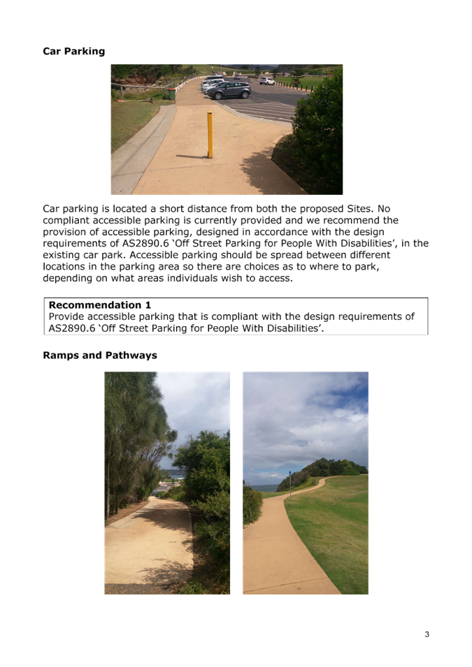
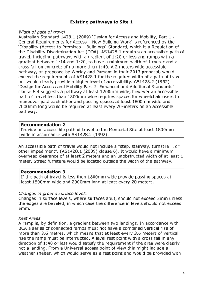
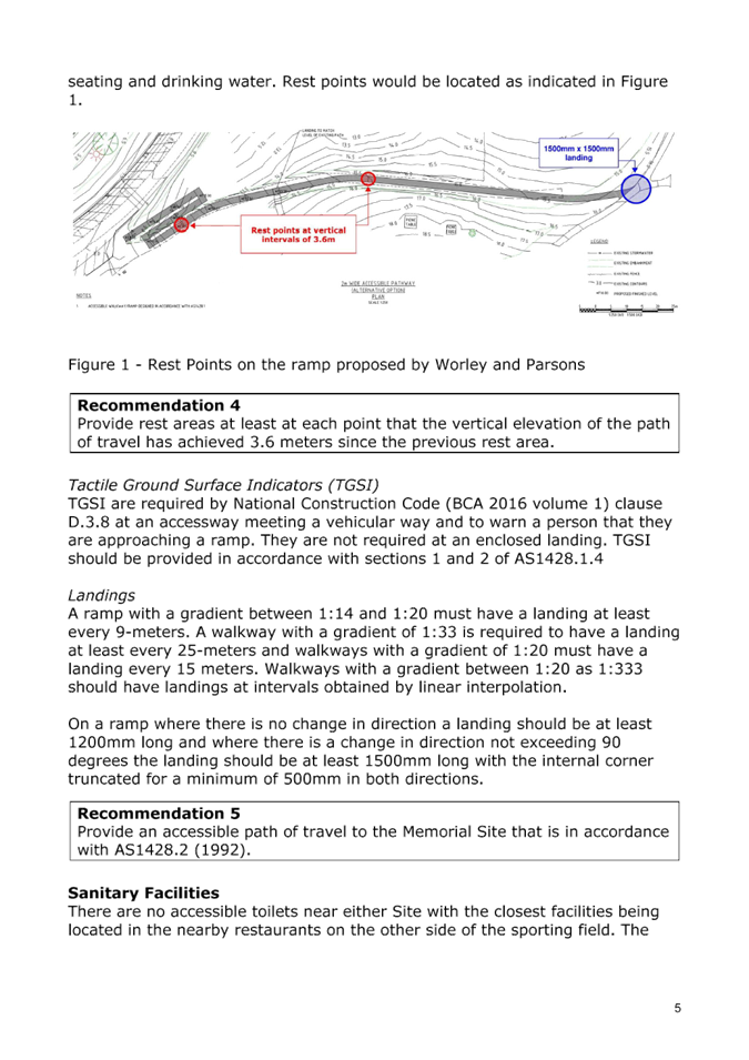
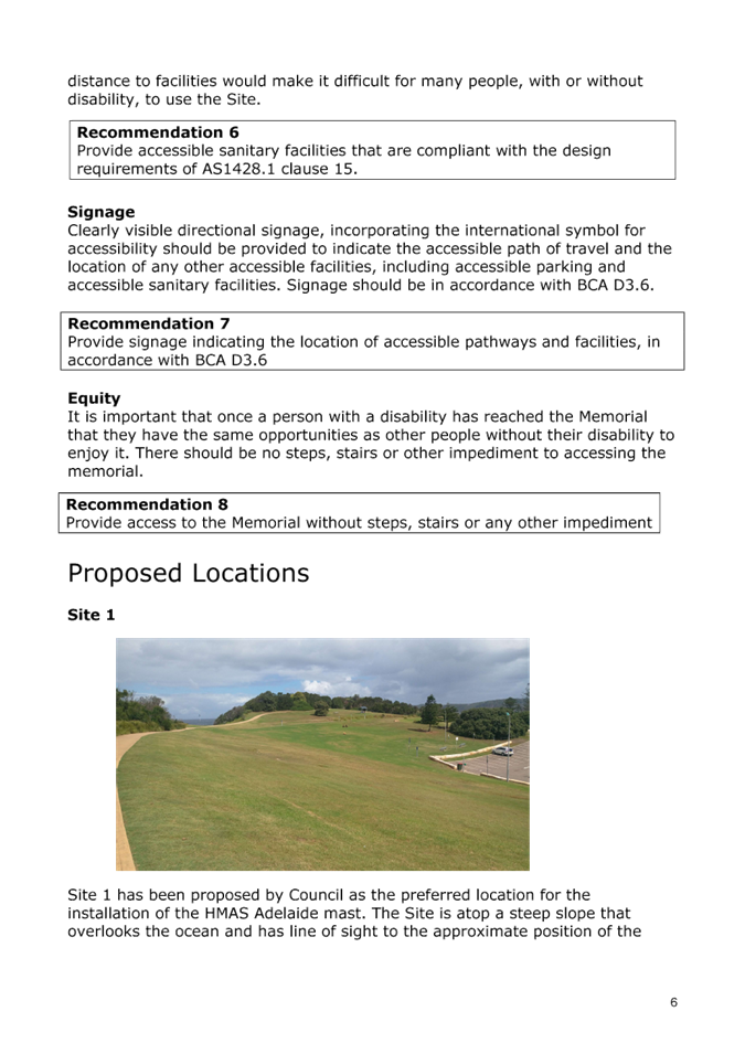
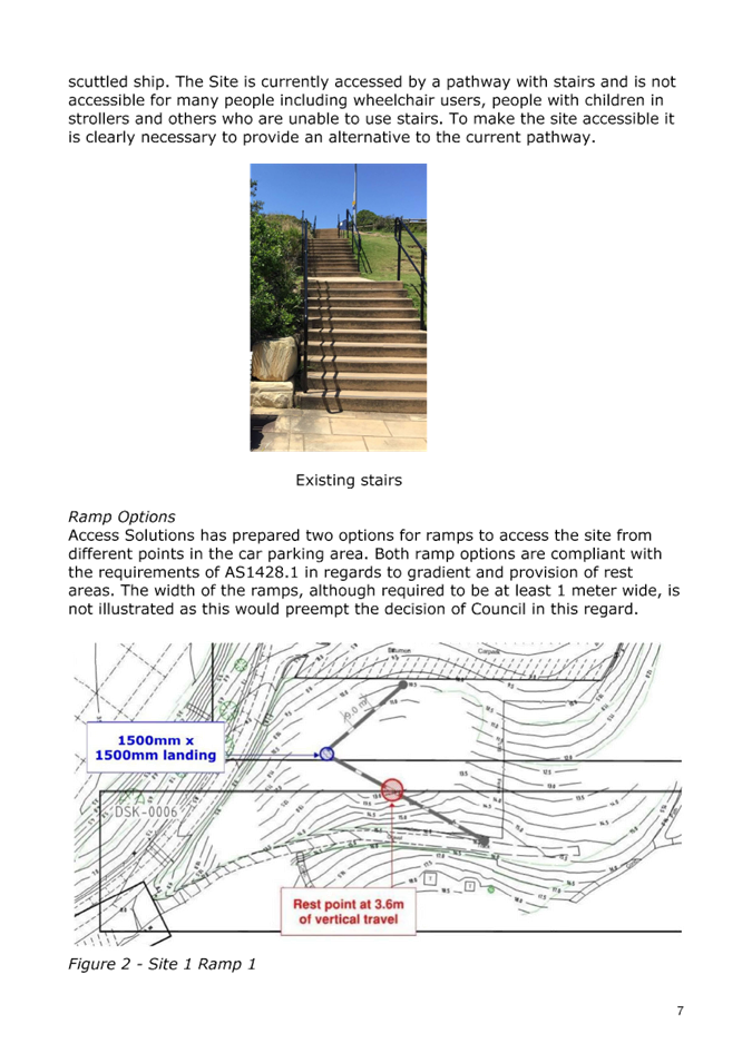
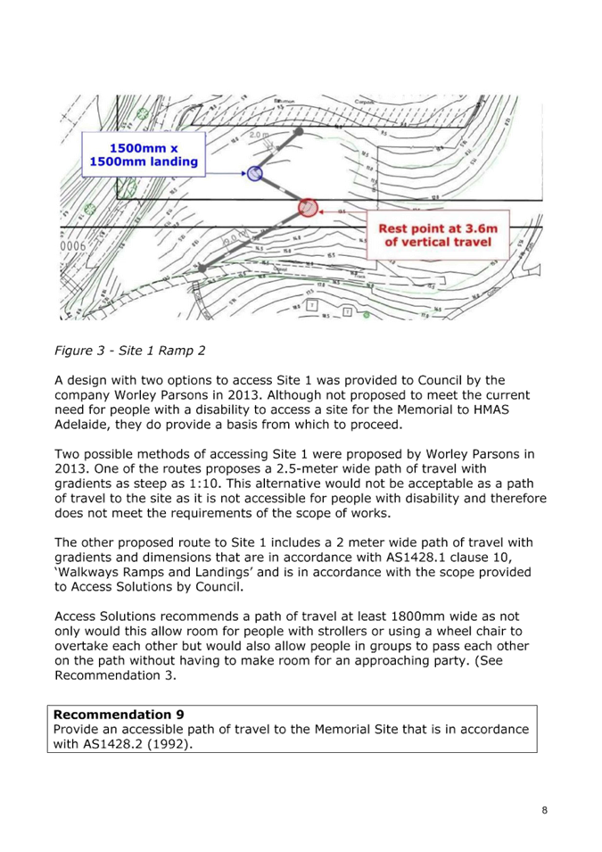
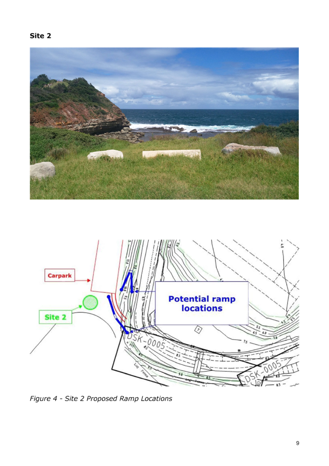

|
3.1
|
DA/60262/2020
- 2 Scenic Highway, Terrigal - Ex-HMAS Adelaide Mast at the Terrigal Haven on
to a plinth footing with landscaping and provision for a flagpole
|
|
Attachment 5
|
Geotechnical
Report 2 Scenic Highway TERRIGAL DA60262 Part 1
|
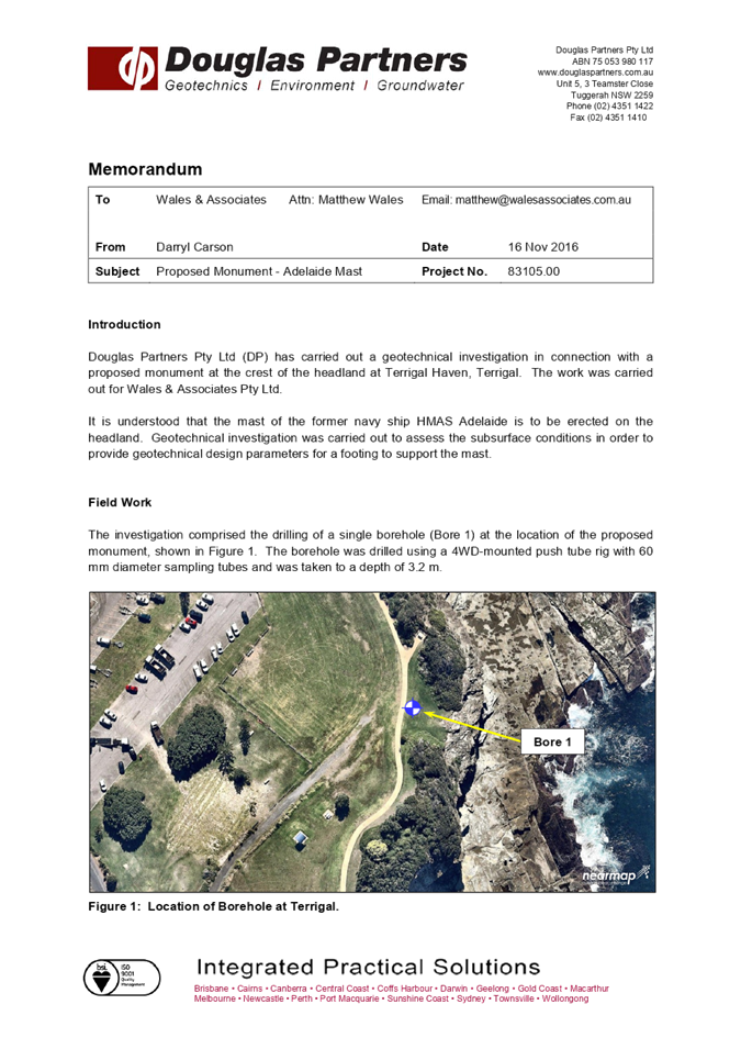


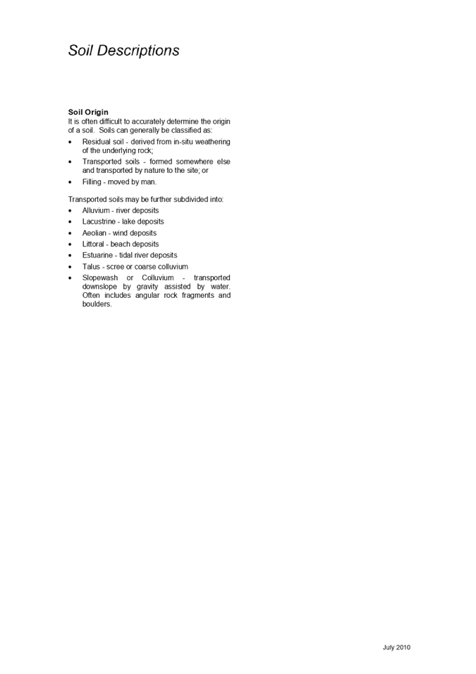
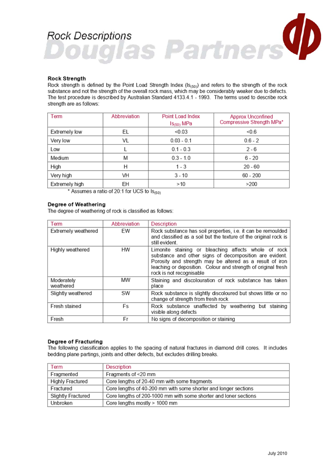
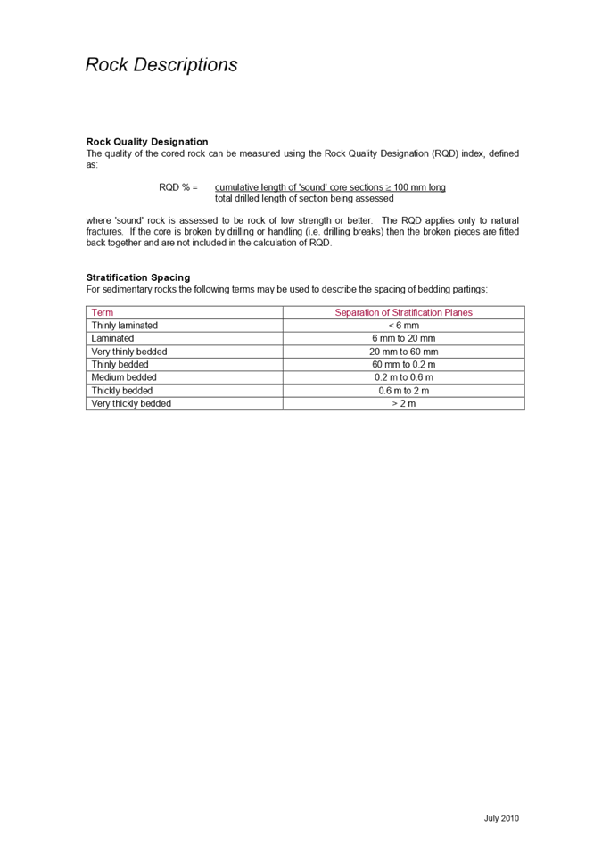

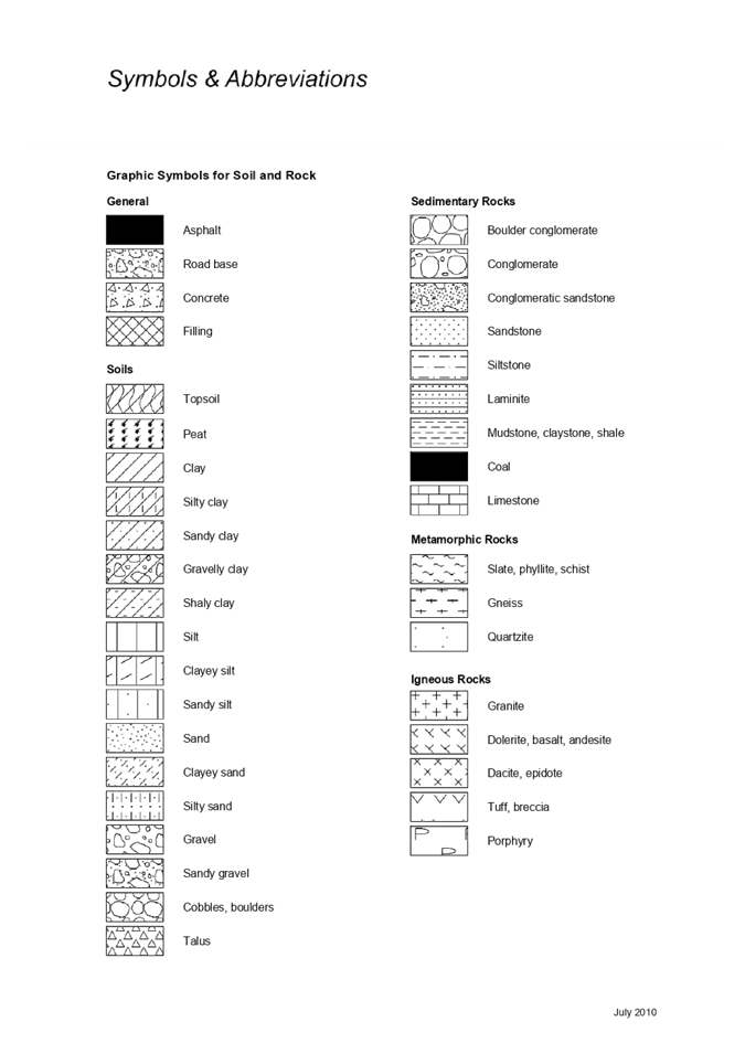
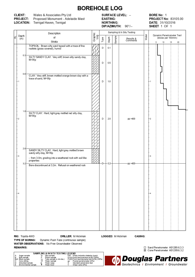
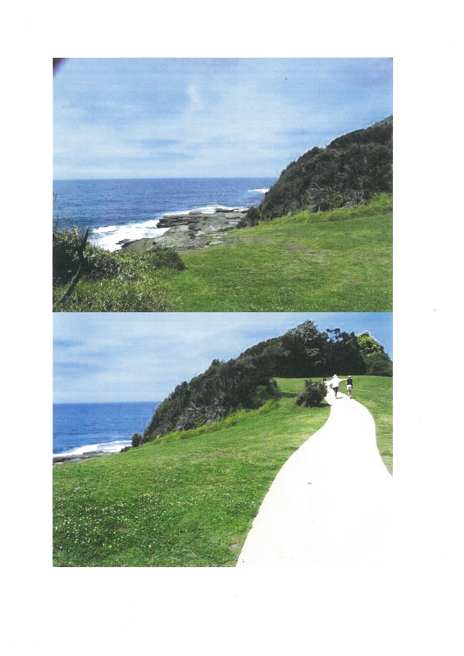
|
3.1
|
DA/60262/2020
- 2 Scenic Highway, Terrigal - Ex-HMAS Adelaide Mast at the Terrigal Haven on
to a plinth footing with landscaping and provision for a flagpole
|
|
Attachment 6
|
Visual
Impact Assessment 2 Scenic Highway TERRIGAL DA60262 Part 1
|
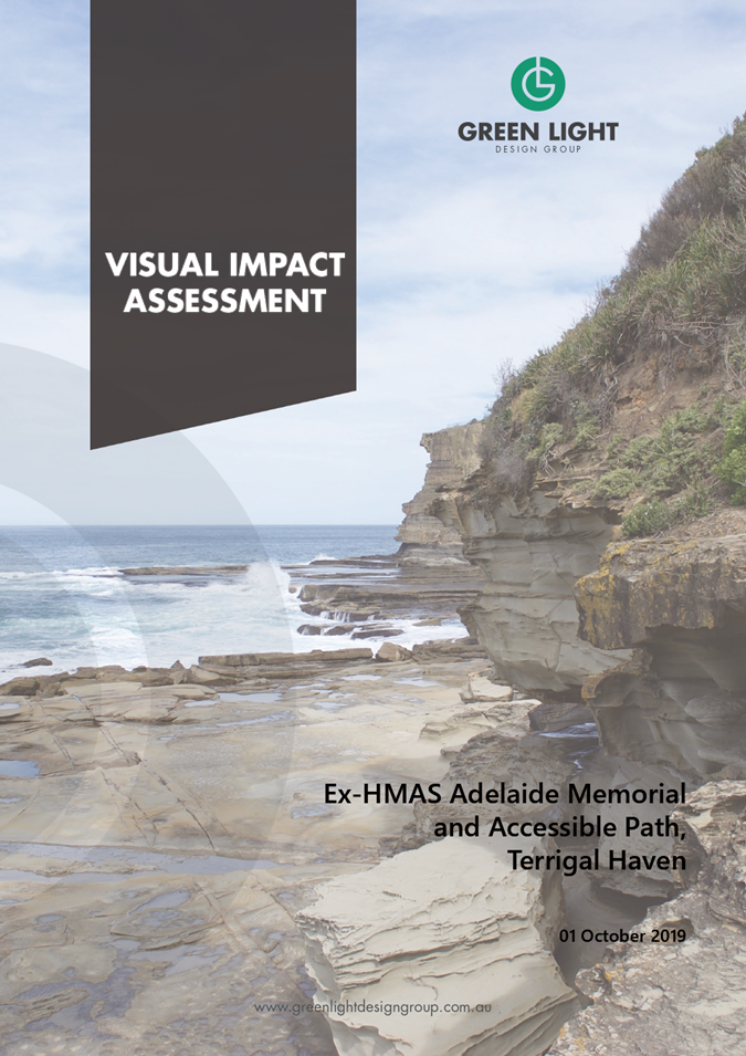
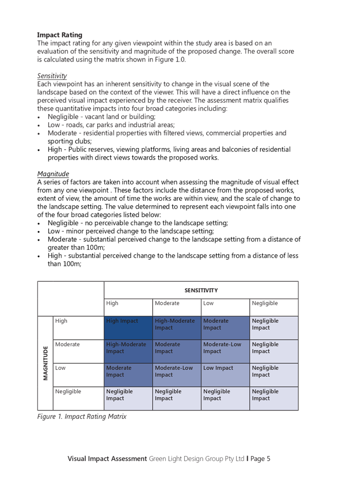
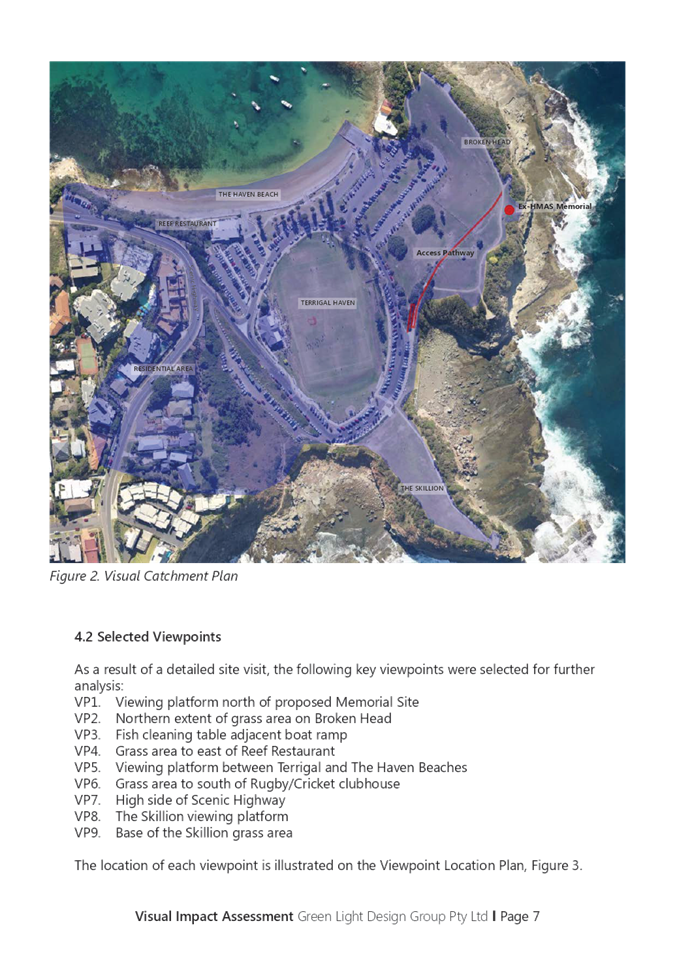
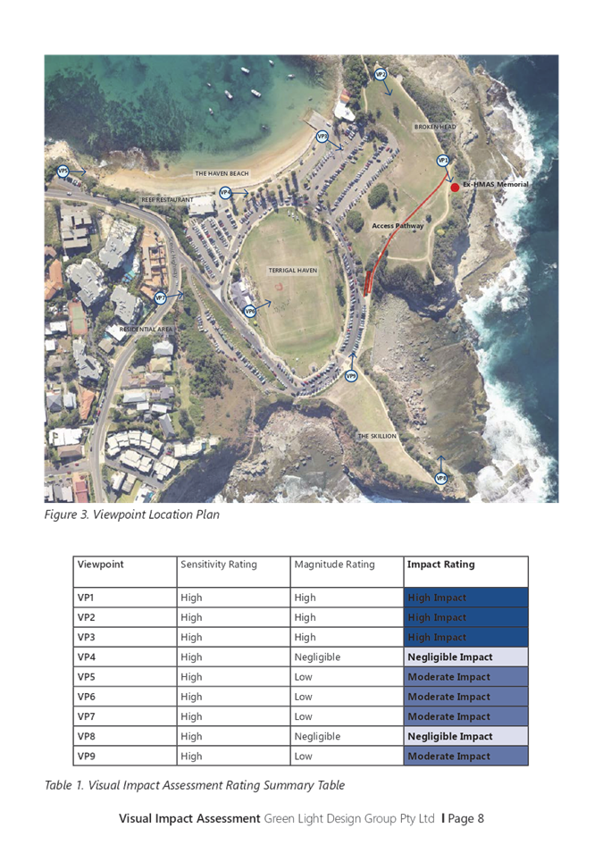
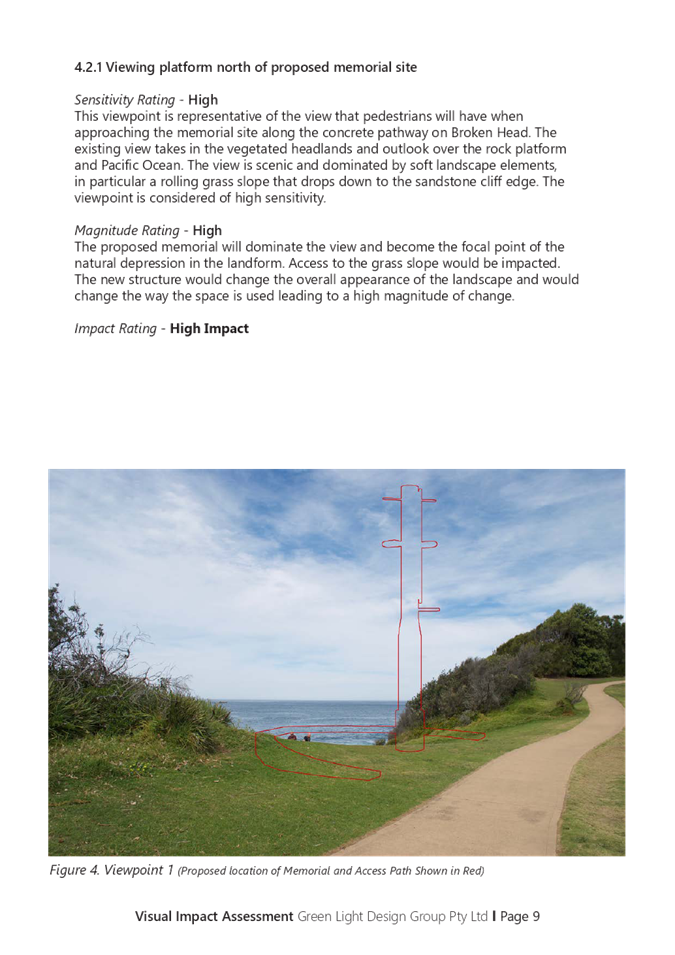
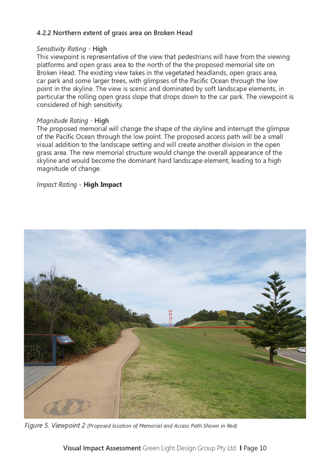
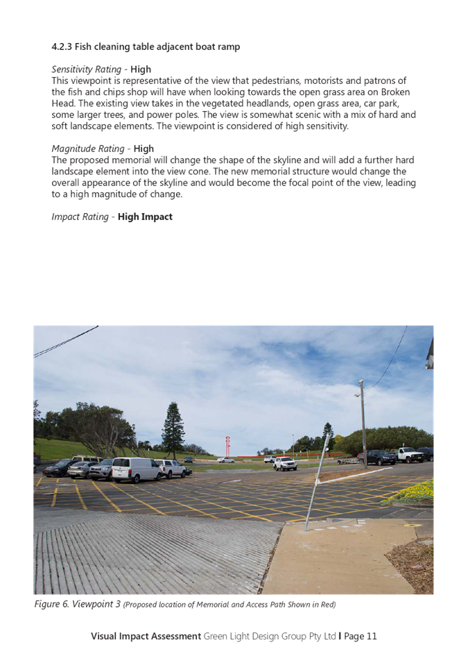
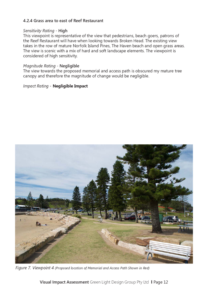
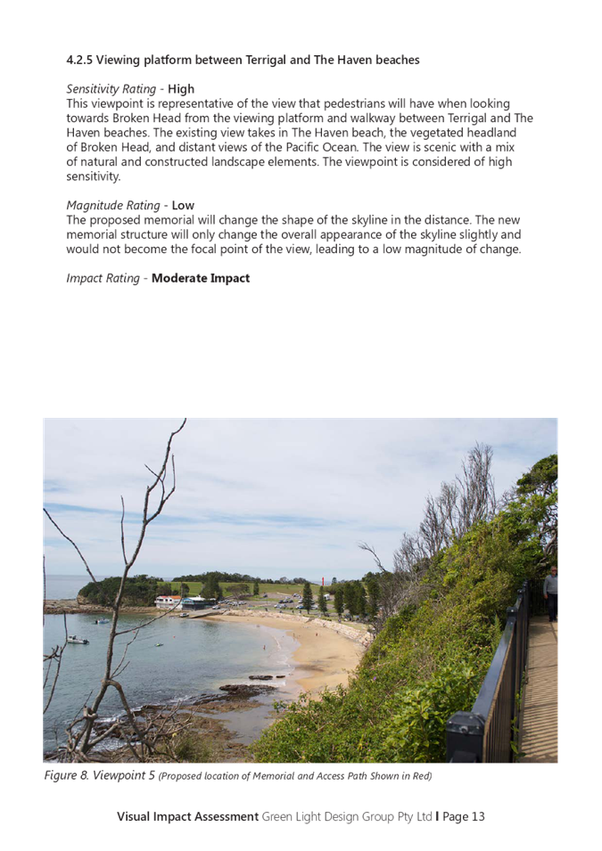
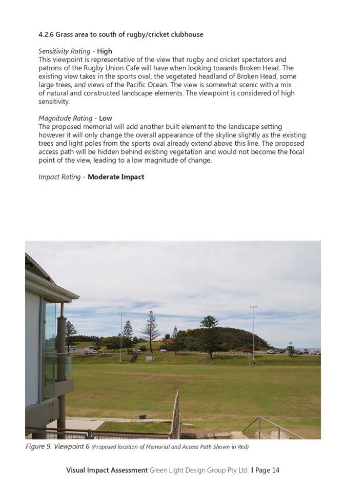
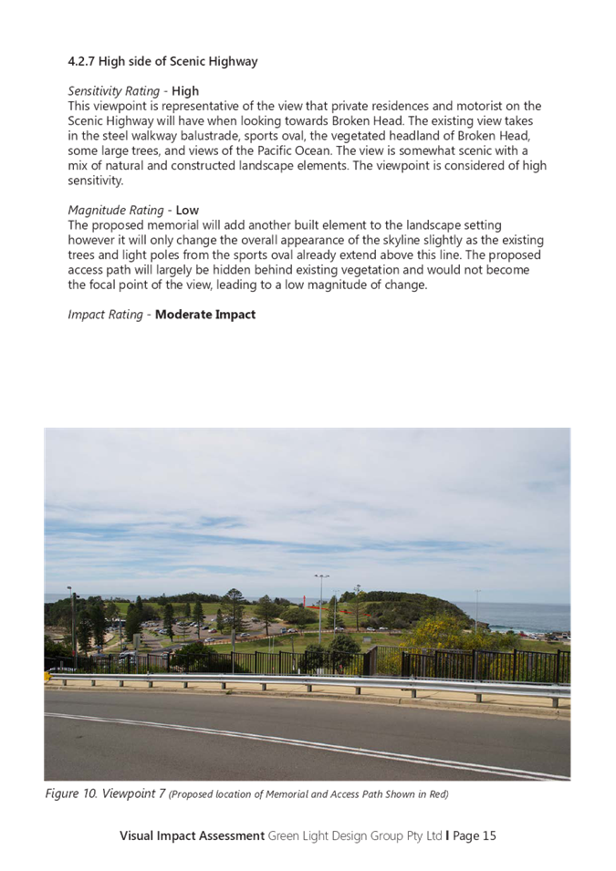
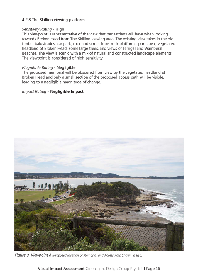
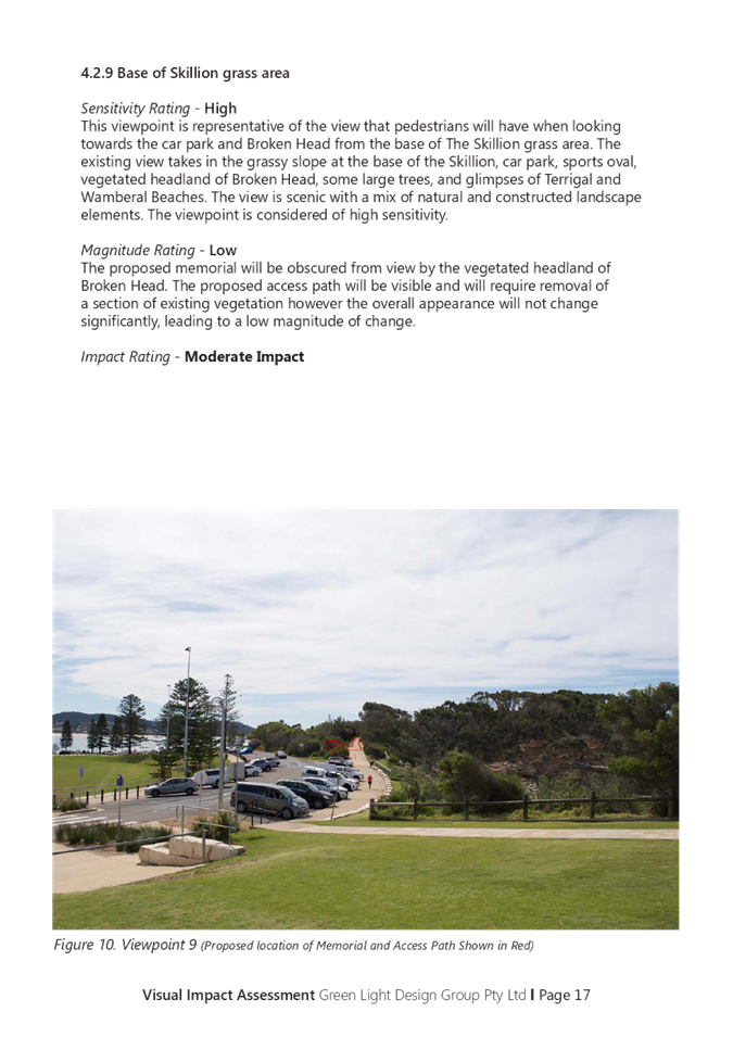

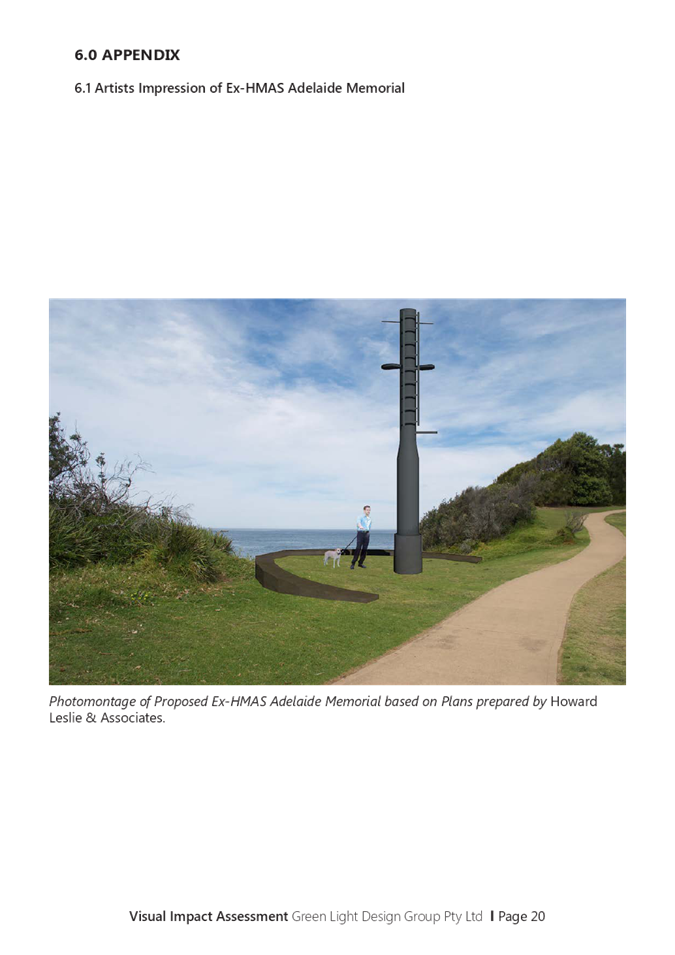

|
3.1
|
DA/60262/2020
- 2 Scenic Highway, Terrigal - Ex-HMAS Adelaide Mast at the Terrigal Haven on
to a plinth footing with landscaping and provision for a flagpole
|
|
Attachment 7
|
Independent
Review 2 Scenic Highway TERRIGAL DA60262 Part 1
|
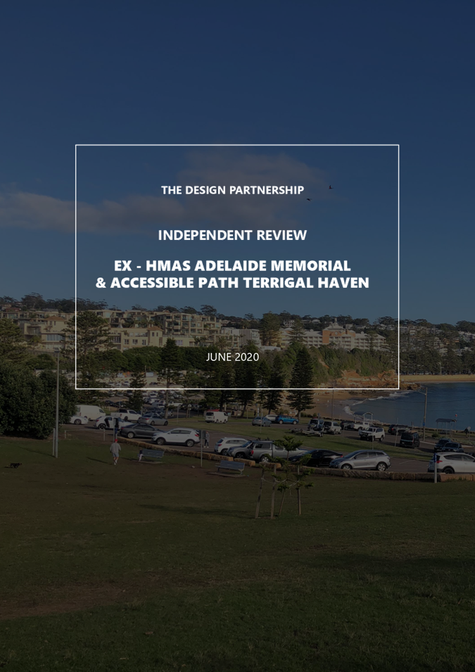

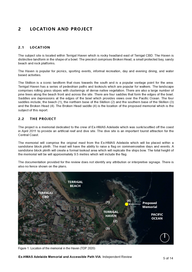
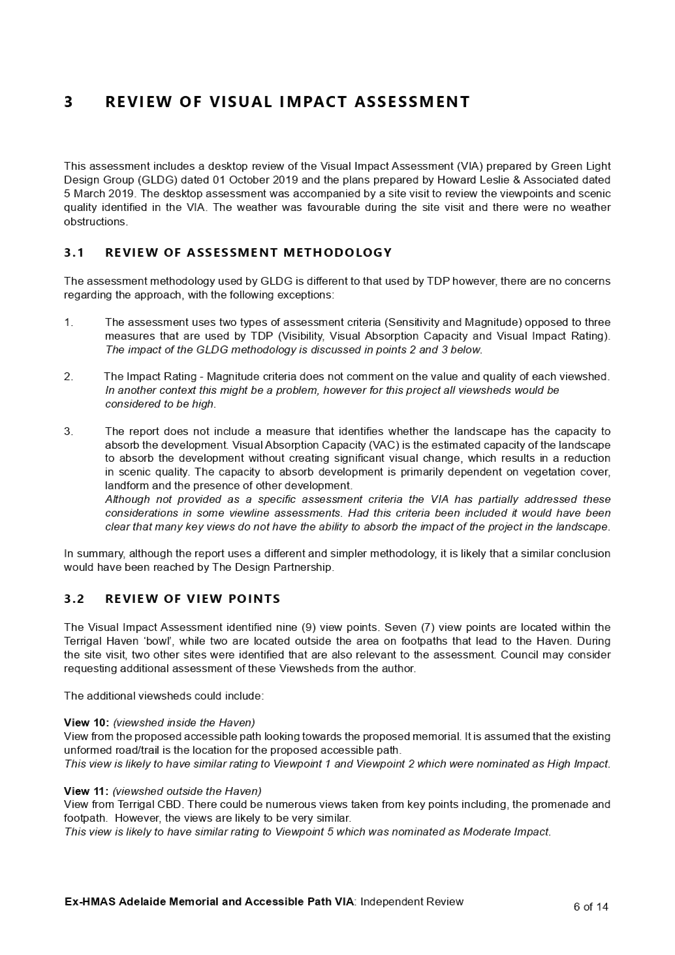
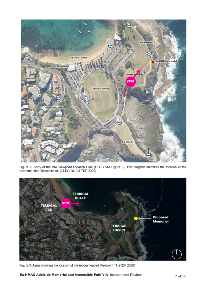


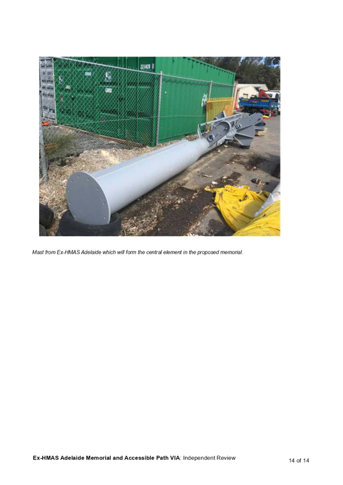
|
Item No: 3.2
|
|
|
Title: Section 8.2 Review of
Determination - DA/57698/2019 - Staged Caravan Park (165 sites) at 255, 255A,
255B Avoca Drive, Kincumber and 19 Picketts Valley Road, Picketts Valley
|

|
|
Department: Environment
and Planning
|
|
|
22
July 2021 Local
Planning Panel Meeting
|
|
Reference: 021.2019.00057698.002
- D14549569
Author: Erin
Murphy, Senior Development Planner
Manager: Emily
Goodworth, Section Manager, Development Assessment
Approver: Andrew
Roach, Unit Manager, Development Assessment
|
Summary
An
application has been received under Section 8.2 of the Environmental Planning
and Assessment Act, 1979 (the Act) for the consent authority to
review its decision on the refusal of Development Application DA/57698/2019
for a staged ‘Residential Land Lease Community’ (Caravan Park)
comprising 202 sites, community facilities, roads and infrastructure,
landscaping, and demolition of existing structures at 255, 255A, 255B Avoca
Drive, Kincumber and 19 Picketts Valley Road, Picketts Valley.
This report
re-examines the issues associated with Development Application DA/57698/2019
with particular regard to supporting documentation and amended plans
submitted with the Section 8.2 Review.
The application was refused by the
Local Planning Panel at its meeting of 6 August 2020. In accordance with the provisions of
Clause 8.3(5) of the Environmental Planning and Assessment Act 1979,
the Review of Determination must also be determined by the Local Planning
Panel. In addition, the Local Planning Panels Operational Direction
(endorsed by the Minister on 30 June 2020) states that: ‘the
determination of a review application from a panel decision shall be
determined by different members of the panel to those who made the original
determination.’ (Section 2.1).
The reasons for refusal are
summarised below:
· The proposed development
is not consistent with the objectives of the E4 Environmental Living zone.
· The proposed development
would result in additional stormwater run-off and increased downstream
flooding.
· The proposed development
would result in significant cut and fill, earthworks and removal of
vegetation on the site which would impact the ecological values, visual and
scenic quality of the area.
· The site is not suitable
for the proposed development due to its landscape, scenic and ecological qualities
which should be preserved.
· Insufficient information
has been provided on potential contamination, road works within the site,
ecology impacts, heritage impacts, waste impacts, soil and water management,
emergency and construction access, bush fire hazard, and tree retention.
· The proposal is an
overdevelopment of the site and is inconsistent with the current and future
desired character of the locality. Approval is not in the public interest.
· Pursuant to Draft
Central Coast LEP (2018), the proposed development is prohibited within E4
Environmental Living zone.
The
application has been examined having regard for the matters for consideration
detailed in Section 4.15 and Section 8.3 of the Environmental Planning
& Assessment Act 1979 and other statutory requirements, with the
issues requiring attention and consideration being addressed in the report.
The
application proposes the following amendments to the development originally
considered by the consent authority:
· A reduction in sites from
202 to 165 sites
· Minor relocation of
internal Road 1 in the south west corner
· Minor alterations to
internal Road 6
· Reduction of tree
removal from 491 to 327 trees
· Retention of existing
farmhouse and incorporated into future community facilities
· Removal of Welcome
Centre
The
proposal, as amended, fails to provide adequate justification or additional
information to address the reasons for refusal.
Applicant Choice Living Avoca
Development Pty Ltd c/ADW Johnson
Owner Choice
Living Avoca Development Pty Ltd
Application
No DA/57698/2019
Description
of Land Lot A DP449600, Lots 2,
3 and 9 DP976799, Nos 255,
255A, 255B Avoca Drive Kincumber, and 19 Picketts Valley
Road
Picketts Valley.
Proposed
Development Staged Caravan Park comprising
165 sites, community facilities, retained farmhouse, demolition of
structures, removal of dams, roads and infrastructure and landscaping
Site
Area 24.12ha
Zoning E4
Environmental Living
Existing
Use Dwelling houses,
agriculture
Employment
Generation No
Estimated
Value $19,739,800
|
Recommendation
1 That
the Local Planning Panel refuse the application Section 8.2(a) review of
determination of Development Application Ref DA/57698/2019 for the integrated and
Staged ‘Residential Land Lease Community’ (Caravan Park) comprising
165 sites, community facilities, retained farmhouse, demolition of structures,
removal of dams, roads and infrastructure and landscaping at Nos 255, 255A,
255B Avoca Drive Kincumber, and 19 Picketts Valley Road Picketts Valley,
subject to the reasons for refusal detailed in the schedule attached to the
report and having regard to the matters for consideration detailed in Section
4.15 of the Environmental Planning and Assessment Act.
2 That
Council advise those who made written submissions of the Panel’s
decision.
3 That
Council advise relevant external authorities of the Panel’s decision.
Key
Issues
· Permissibility and
characterisation of use as a caravan park
· Inconsistency
with the objectives of the E4 Environmental Living zone
· Ecological
impacts
· Insufficient
information has been provided on stormwater run-off and increased downstream
flooding impacts, ecology impacts, waste impacts, soil and water management,
emergency and construction access and tree retention.
· Overdevelopment
and inconsistency with the current and future desired character of the locality
· Inconsistency with Draft
Central Coast LEP (2018)
· Ability to comply with the
Local Government (Manufactured Home Estates, Caravan Parks, Camping Grounds
and Moveable Dwellings) Regulation 2005
Precis:
|
Proposed Development
|
Staged
‘Residential Land Lease Community’ (Caravan Park) comprising 165
sites, community facilities, retained farmhouse, demolition of structures,
removal of dams, roads and infrastructure and landscaping.
|
|
Permissibility and
Zoning
|
E4 Environmental Living
(Gosford Local Environmental Plan 2014)
Caravan parks are
permissible within the E4 Environmental Living. The characterisation of the
site as a caravan park is detailed further below.
|
|
Relevant Legislation
|
· Environmental
Planning & Assessment Act 1979 –
· Section 4.15
· Local Government
Act 1993 – Section 68 and 89
· Fisheries Management Act
1994
· Heritage Act 1977
· Protection of the
Environment Operations Act 1997
· Roads Act 1997
· Rural Fires Act 1997
· Water Management Act
2000
· State Environmental
Planning Policy (Coastal Management) 2018
· Gosford Local
Environmental Plan 2014
· Gosford Development
Control Plan 2013
· State Environmental
Planning Policy (Infrastructure) 2007
· State Environmental
Planning Policy (State and Regional Development) 2011
· State Environmental
Planning Policy No 21-Caravan Parks
· State Environmental
Planning Policy No 36- Manufactured Home Estates.
· State Environmental Planning Policy
No55- Remediation of Land
· Draft
Central Coast Local Environmental Plan 2018 (CCLEP)
· Local Government
(Manufactured Home Estates, Caravan Parks, Camping Grounds and Moveable
Dwellings) Regulation 2005.
|
|
Current Use
|
Dwelling
houses and agriculture
|
|
Integrated Development
|
· Natural
Resources Access Regulator (NRAR)
· NSW Primary Industries
(NSW Fisheries)
· NSW Rural Fire Service
(NSW RFS)
|
|
Submissions
|
137 submissions
|
The Site and Surrounds
The
site is an irregular shape and consists of four (4) existing allotments, 255,
255A & 255B Avoca Drive Kincumber, and 19 Picketts Valley Road Picketts
Valley, legally identified as:
· Lot A DP449600
· Lots 2, 3 and 9 DP976799
The
site is located on the northern side of Avoca Drive between Picketts Valley
Road and
Melville
Street, Kincumber, having a 154m frontage to Avoca Drive, and an 82m
frontage
to Picketts Valley Road.
The
land is undulating with varying slopes to 20% and is dissected by two
watercourses
which
traverse the property in a generally east-west direction. There is also
existing
dam/water
storage on site. The levels vary from about RL 40m at the southern side
boundary
with
Avoca Drive, falling away to the north to about RL 6m at the first watercourse.
The elevation rises again to about RL 40m near the centre of the site then
falls away (to about RL 6m) at the second watercourse, rising again to (about
RL 30m) at the northern side/ rear of the site.
Past
use of the land has been generally agricultural with dwelling houses. The site
contains 3
existing
dwelling houses, sheds, stables, and an access driveway from Avoca Drive. One
dwelling house and the dam are located at the southern end of the site, with
the remaining dwelling houses, sheds, and stables located approximately in the
centre of the site between the two watercourses.
The
rear of the site and frontage to Picketts Valley Road is heavily vegetated,
with the
remainder
of the site having scattered stands of vegetation.
The
site is identified as "bushfire prone
land". A Bushfire Assessment Report prepared by
Peterson Bushfire (Reference 17033 dated 11 March 2021) was submitted with the
application
recommending the proposal comply with varying BAL levels with the highest
being
BAL-19 for 7% of the dwelling sites.
The
site is located about 2.5km east of the Kincumber shopping centre and about
3.8km west
of
Avoca Beach.
Adjoining
development to the north, east and west comprises small rural holdings,
associated
dwelling
houses and agricultural uses. Land to the south and south-west (opposite side
of
Avoca
Drive) includes residential areas of Kincumber incorporating senior living
developments.
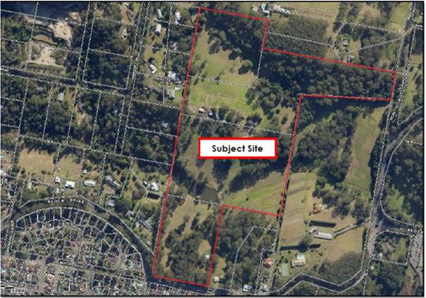
Figure 1-Locality Plan
Background
Development
application DA/57698/2019 was considered by the Local Planning Panel at its
meeting of 6 August 2020. This application was for a Staged ‘Residential
Land Lease Community’ (Caravan Park) comprising 202 long term sites, 2
short term ‘caravan’ sites, community facilities, roads and
infrastructure, landscaping, and demolition of existing structures.
DA/57698/2019 was refused development consent by the Local Planning Panel.
The
reasons for refusal at that meeting are summarised below:
· The proposed development
is not consistent with the objectives of the E4 Environmental Living zone
· The proposed development
would result in additional stormwater run-off and increased downstream
flooding.
· The proposed development
would result in significant cut and fill, earthworks and removal of vegetation
on the site which would impact the ecological values, visual and scenic quality
of the area.
· The site is not suitable
for the proposed development due to its landscape, scenic and ecological qualities
which should be preserved.
· Insufficient information
has been provided on potential contamination, road works within the site,
ecology impacts, waste impacts, soil and water management, emergency and
construction access, bush fire hazard, and tree retention.
· The proposal is an
overdevelopment of the site, inconsistent with the current and future desired
character of the locality and approval is not in the public interest.
· Pursuant to Draft Central
Coast LEP (2018) the proposed development is prohibited within E4 Environmental
Living zone.
The
reasons for refusal and applicant’s response to these reasons are
included under the ‘Applicant’s Response to Reasons for
Refusal’ heading below.
The Proposed Development
The s8.2 application includes amended engineering and landscape
plans. It is noted there have been no revised design plans submitted. The
amended proposal maintains the overall design approach and general
configuration of the originally considered development with the following
amendments made as part of the review of determination:
· A reduction in sites from
202 sites to 165 sites
· Minor relocation of
internal Road 1 in south west corner
· Minor alterations to
internal Road 6
· Reduction of tree removal from
491 to 327 trees
· Retention of existing
farmhouse and incorporation into future community facilities
· Removal of Welcome Centre
at the southern end of the site near the entrance
It
is considered that both qualitatively and quantitatively, the amended proposal
remains substantially the same as the original proposal as per the provisions
of Clause 8.3(3) of the Environmental Planning & Assessment Act, 1979.
The Section
8.2 application proposes the following:
· Demolition of existing structures
on the site
· Retention of existing
farmhouse
· De-watering and filling in
of the existing farm dam
· De-watering and reshaping
of dam on southern watercourse to revert to a watercourse
· Bulk earthworks.
Preliminary plans submitted indicate cut up to 6.2m and fill up to 5.5m. The
applicant has estimated the total cut volume of 92,970m3, fill of 98,692m3, and
a shortfall of 5,722m3 to be imported into the site
· Construction of three water
quality basins
· 165 long term dwelling
sites
· 2 short term
‘caravan’ sites (15m x 6m)
· Construction of community
facilities including a club house (including caretakers’ residence),
indoor swimming pool, tennis court, bowling green, putting green, village
green, community garden and yoga deck
· Construction of
intersection of access driveway with Avoca drive and internal driveways
· Realignment of southern
existing watercourse crossing and upgrade of road and culvert
· Services, including the
provision of sewer
· Removal of 327 trees
· Landscaping
The
development is proposed to be staged, with the three stages shown in Figure 2.
The
165 long-term dwelling sites are proposed to contain
future manufactured homes. The application shows an indicative mix of 1 and 2
storey, 3-bedroom homes.
The
applicant also advises the application for the operation of the caravan park
and moveable dwellings will be lodged separately under Section 68 of the Local
Government Act 1993.
When
requested to provide updated design plans, the applicant provided the original
design plans as lodged with the original submission and stated that: Certain
parts of this document have been amended by the additional information
submitted in December 2020 as part of the Review of Determination
request. In particular, the original site layout showing 202 sites and
been reduced to 165 sites as documented in the specific reports accompanying
the request for Review.
A
note “SUPERSEDED LAYOUT - Refer to amended 165 site layout and
supporting information lodged with Council December 2020 as part of the Request
for Review of determination” was on the Context Plan, Site Plan, Site
Sections, Shadow Diagrams, Staging Plan and Entry Recreational and Sales
Facilities plan (which has been deleted as part of the amended scheme).
Accordingly, assessment staff have relied upon the amended landscape and
engineering plans to undertake the review (refer figures 2, 3 and 4).
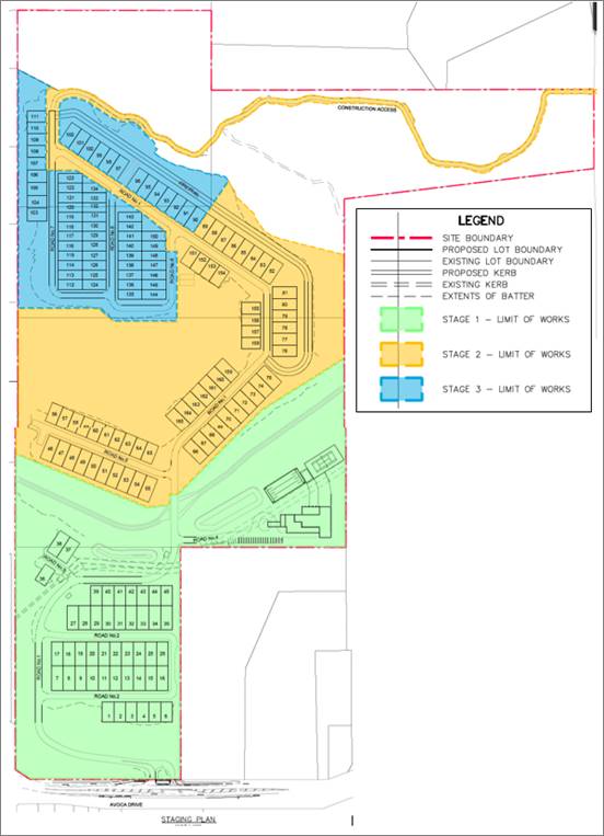
Figure 2- Engineering Site
Layout and Staging Plan
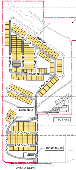
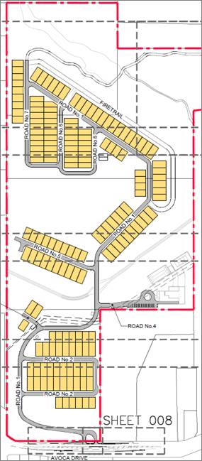
Figure 3- Original Site
Plan (left) and Section 8.2 review Site Plan (right)
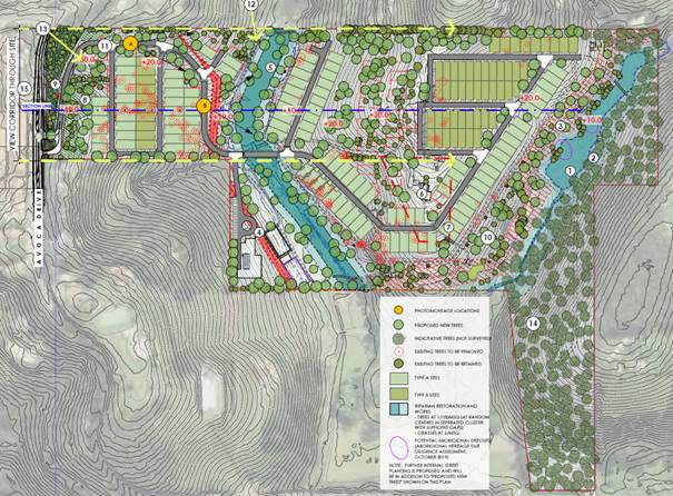
Figure
4- Current landscape plan submitted with Section 8.2 application
Planning
History
Council’s
records show that the following applications were previously lodged on this
site.
DA16548/1992 - 6 lot community title
subdivision was approved on 9 November 1993; this consent has lapsed.
Two Pre-DA meetings 2018 & 2019
On
10 May 2018 a pre-DA meeting was held with Council for a senior living
development on the site. The meeting identified that a retirement
village/senior living development was a prohibited use under the Gosford Local Environmental
Plan 2014 and State Environmental Planning
Policy (Senior Living).
A
further pre-DA meeting was held on 5 September 2019 for a caravan park on the
site
consisting
of about 210 sites in the form of manufactured homes with community facilities
and
associated infrastructure. The applicant was advised at that time that;
The proposed caravan park is a
prohibited use under the draft Central Coast Local
Environmental Plan 2018. It is
likely that Council will not support the proposal due to the draft plan being
imminent, the density proposed, impact on scenic values of the site, and
inconsistency with the objectives of the E4 zone. A caravan park should not be
a quasi-retirement village, particularly due to the site constraints of this
site. The proposal will also have to comply with the definition of
’caravan park.
DA60468/2020 –
an application for a Caravan Park (31 Long Term Sites and 39 Short Term Sites)
was lodged on 14 December 2020 and is still under assessment. The proposed site
layout is shown in Figure 4. This application has been made by the same
applicant and given the number of submissions will also be required to be
determined by the Local Planning Panel.

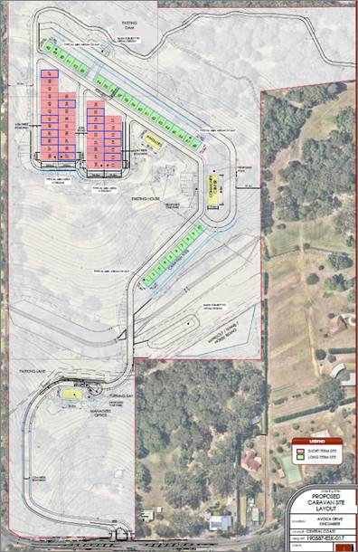
Figure 5- Site layout plan
for DA60468/2020
Applicant’s
Response to Reasons for Refusal
The
applicant has provided a response to each of the reasons for refusal which have
been summarised below, with Council’s comment, as follows:
Reason for Refusal
a) The
proposed development is not consistent with the objectives of the E4 Environmental
Living zone under the provisions of the Gosford Local Environmental Plan 2014.
Applicant’s Response
The objectives
of the E4
Environmental Living zone are:
· To provide for low-impact
residential development in areas with special ecological, scientific or
aesthetic values.
· To ensure that residential
development does not have an adverse effect on those values.
· To promote ecologically,
socially and economically sustainable development and the need for, and value
of, biodiversity in Gosford.
· To provide land for
low-impact tourist-related development that is of a scale that is compatible
with the special ecological, scientific or aesthetic values of the area.
· To ensure that development
is compatible with the desired future character of the zone.
Section 4.1.2, Table 2 of the original Statement of
Environmental Effects provided initial
responses as to how the development was consistent with
the objectives of the zones. The comments in this submission should be read in
conjunction with and supplementary to those earlier comments.
It should be noted that zone E4 Objectives provide for
low-impact residential development.
The term “low impact” should be
differentiated with the terminology used in, for example,
objectives for zone R2 which reference low density
residential environment.
This submission highlights how the submitted proposal
can occur with low impact to the
local setting and landscape in which it sits.
Objective 1 - Key attributes of land zoned E4
The following comments are provided in respect to the
three key attributes - being special ecological, scientific or aesthetic
values.
Special ecological
It is noted that the whole of the site is zoned E4. The
site does not contain any land zoned
E2 Environmental Conservation, which is typically
applied to areas of high ecological,
scientific, cultural or aesthetic values. It is noted
that the site retains its current E4 zoning in
Council’s draft consolidated LEP, with no E2 zoned
land proposed.
Council’s online mapping provides a layer for
known Endangered Ecological Communities,
and distinguishes between Critically Endangered
Ecological Communities, Endangered
Ecological Communities and Regionally Significant
Vegetation. Figure 1 below is extract
from Councils website.

The subject land does not have any mapped Endangered
Ecological Communities but does contain some Regionally Significant Vegetation (marked as yellow hatching on the above map).
‘The amended application not only avoids any
clearing of the Regionally Significant Vegetation, but will also enhance this
vegetation through proposed landscaping works. Extract from the Development
Landscape Plans is provided in Figure 2.
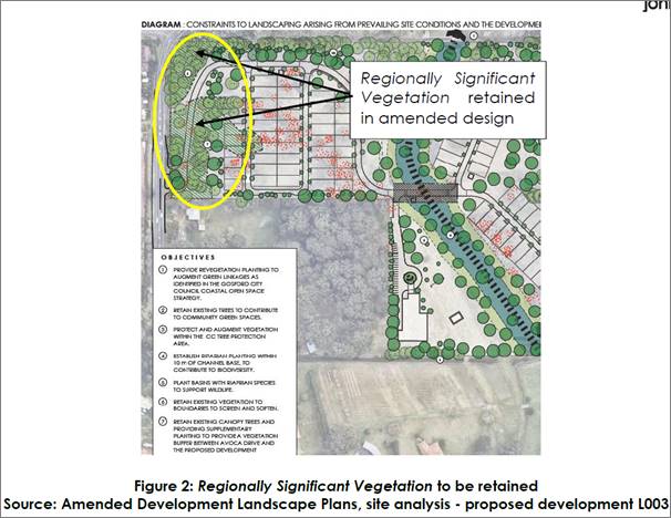
It should be noted that local biodiversity is further
improved by the retention and rehabilitation of approximately 5.5ha of
vegetation at the northern end of the site where the tree count is estimated at
more than 1,200 trees, retention of over 605 trees in the works area and works
to the historic farm dam and drainage channel to be reconstructed and
rehabilitated to mimic a natural riparian corridor. When complete, the local
landscape will benefit by at least 208 additional trees.
Further, an amended Biodiversity Development Assessment
Report (BDAR) accompanies this application. Prepared by a specialist and
accredited Ecologist, this report further assesses local biodiversity and
within the BDAR addresses avoid and minimise principles, provides further
recommendations on minimising and mitigating impacts and identifies ecocredit
obligations of approximately $790,000 to be retired if this development
proceeds.
New buildings and associated infrastructure have been
sited to take advantage of a landscape previously cleared for agriculture and
timber getting operations.
Figure 3 following is
from a 1971 aerial photo.
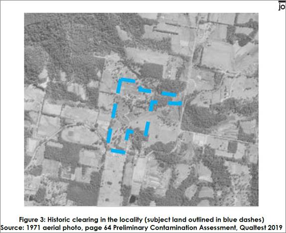
Scientific
There are no scientific values recorded against the
site, with no listings in any Local, State or other register for European
heritage value. A search of records for any registered Aboriginal sites
resulted in nil findings.
Notwithstanding the absence of any search results,
specific site investigations were undertaken as part of this development
application process for both European and Aboriginal heritage values.
The Aboriginal Cultural Heritage Assessment, submitted
with the original proposal, has revealed a potential archaeological deposit
(PAD) adjacent to the southern bank of the northern dam. This area has been
marked on plans and is retained within riparian setbacks. No works are intended
within close proximity. In accordance with standard protocols should nearby
excavations reveal any matters of significance, appropriate procedures will be
implemented.
In Council’ assessment report dated 6 August 2020,
Council’s Heritage Officer has raised a
number of comments to the submitted European heritage
assessment and site, particularly
in respect to existing structures upon the land and
potentially the holding itself.
The amended application proposes to retain the original
farm cottage and will be repurposed as a community facility within the
development. There is opportunity within community infrastructure and buildings
within the development to capture key elements of the sites history.
Aesthetic
The site has a relatively short frontage to Avoca Drive,
with the site falling away from the road to the first of two watercourses, the
second which is hidden behind a low central ridge. Other than the Avoca Drive
frontage there are a few public vantage points from where the site is visible.
Buildings are set back from front and side boundaries
and are at levels below adjacent land
to reduce visual prominence. Areas between buildings and
front side setbacks will be landscaped to defuse form.
Trees within the riparian corridor will be retained and
supplemented, providing canopy
screening to future houses.
The project team has considered those comments raised by
Council Offices in their report dated 6 August 2020, with the amended proposal
modified and reduced accordingly.
Key changes to maintain the aesthetics’ of the
locality include;
· Retention and enhancement
of the Regionally Significant Vegetation adjacent to the southern Boundary;
· Relocation of the primary
lead-in road approximately 5m further in from the western Boundary to allow for
greater retention of and minimise impacts to trees along the western boundary;
· Removal of sites and
retention of trees along the central ridge line.
· Works to the historic farm
dam and drainage channel to be reconstructed and rehabilitated to mimic a
natural riparian corridor.
· Retention and
rehabilitation of approximately 5.5ha of vegetation at the northern end of the
site, where the tree count is estimated at more than 1,200 trees
· The net increase trees on
site by at least 208
as
outlined in Table 1.
The above measures provide for enhanced screening and
are appropriate and significant measures to minimise the impacts on aesthetics,
as demonstrated in the following figures.
Annexure 3 provides a response from the Team’s
consulting Landscape Architect/ Arborist,
with a photomontage showing the proposed development
when viewed from Avoca Dr
(south western corner) as Annexure 4.
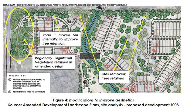
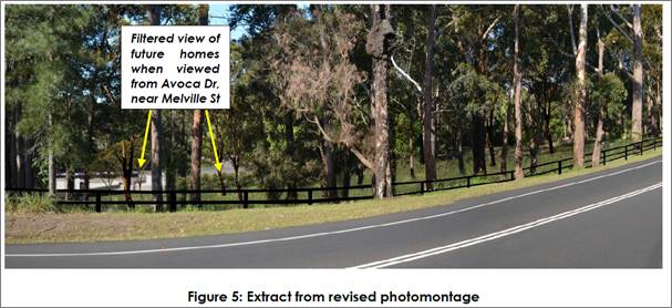
Objective 2 – no adverse impact on values
The above responses to [zone] Objective 1 demonstrate
that key values have been considered
and appropriately responded to in the amended and
reduced proposal so that no adverse
impacts occur on those values.
Objective 3 - To promote ecologically, socially and
economically sustainable development
and the need for, and value of, biodiversity in Gosford
Approval of this residential land lease community is
likely to be the greatest opportunity to achieve ecologically, socially and
economically sustainable development which respects and values the biodiversity
of the region. Once developed, it will remove any opportunity for further
development as the Region continues to experience a continued growth in
population for the years ahead.
The submitted Biodiversity Development Assessment Report
(BDAR) has considered local biodiversity conditions and has provided measures
to mitigate any impacts of the development. The development is largely proposed
upon land previously cleared for agricultural pursuits – making good of
previous clearing works so as to minimise impacts on the natural environment.
The community once constructed will provide a sense of
place and security for a section of the ageing population sharing similar
values. The growth in popularity of such communities, occupancy rates and
waiting list is testament to their desirability for a lifestyle living choice. This
is expanded on in the Social Impact Assessment report submitted with the
application,
with additional comments in response to the Local
Planning Panel report now provided as
Annexure 5.
The development once complete will be the management
responsibility of one single entity. All internal roads community facilities,
landscaped gardens and retain bushland will be maintained by the operator, at
no cost to Council. Buildings and community facilities within the community
will be maintained to documented standards, to ensure values are preserved.
Landscaping, including rehabilitated riparian corridors and retained
conservation land to the north will be maintained for the life of the
development.
A fenced dog exercise park has been provided where
residents can meet where dogs can be safely off leash with minimal impact to
local fauna.
The retention of over 5.5 ha of native forests and
further lands in the riparian corridor (Approximate 8ha in total) – land
not currently Identified in Councils Coastal Open Space
Strategy, will be preserved and maintain for the life of
the development, in keeping with
COSS principles.
Objective 4 - To provide land for low-impact
tourist-related development.
Comments stated in the original proposal remain relevant
for the amended proposal;
The proposal does not specifically
target the tourist market, but provides for 2 sites for caravan/motorhomes. It
is expected that future residents of the community may wish to entertain family
and friends, who might be travelling on extended holidays around this Nation.
The selected sites will not impact on the surrounding natural or built
environment.
Objective 5 To ensure that development is compatible
with the desired future character of the zone
Comments stated in the original proposal remain relevant
for the amended proposal;
The proposal is based on a systematic
assessment of the site and allowing natural features to give shape to a
development and integrate with its surrounds. The emphasis has been on
conserving and enhancing the site’s features such as open watercourses,
retaining trees and avoiding large-scale levelling.
The amended proposal has taken into account comments
raised by Council Officers in their report dated 6 August 2020, with the
amended proposal modified and reduced accordingly. Amendments include;
· A reduction in the
area of site works;
· Reduction in site
yield, allowing for greater retention of existing vegetation;
· Removal of
“Welcome Centre” and community facility near Avoca Dr;
· Relocation of
internal infrastructure (roads) away from side boundaries to assist with vegetation retention
and screening opportunities from neighbouring properties;
· Retention of mapped
Regionally Significant Vegetation adjacent to southern boundary and side
boundaries;
· Retention of trees
on the central ridgeline;
· Retention of approx.
5.5ha of vegetation land as set-aside conservation land consistent with COSS
principles;
· Reduction in trees
to be remove and increase in trees to be planted, resulting in a net increase in
trees onsite
These above amendments, and other design changes as
detailed in the comprehensive plan sets and specialist reports annexed to this
submission demonstrate how the reduction in scale of this project seeks to
differentiate development of this site to urban development (including a
recently approved 3 storey aged care facility) upon the adjacent R2 Low Density
residential zoning.
Comment
In relation
to the zone objectives, the “special ecological values” of
the land include:
· The wetland provided for by the large
dams and waterway, including the largest dam which meets the definition of a
locally important wetland (BDAR p8);
· The wildlife corridor, which benefits
a range of threatened species including the Yellow Bellied Glider;
· Potential Green and Golden Bell Frog
habitat, including a vegetated link to Avoca Lagoon where there is a known
population of the species;
· The BDAR details that the presence of
35 threatened “ecosystem” credit species has been assumed. This
indicates that habitat for these species is either present or assumed to be
present based on surveys undertaken;
· The BDAR details that purchase of
species credits for six threatened species would be required to offset the
residual impacts of the development. This indicates that important habitat for these
species, including breeding habitat, is either present or assumed to be
present;
· Presence of the Critically Endangered
plant species Rhodamnia rubescens;
· Presence of mapped Regionally
Significant Vegetation Narrabeen Coastal Blackbutt Forest (Bell), which is
equivalent to Plant Community Type (PCT) Smooth-barked Apple - Turpentine -
Blackbutt open forest on ranges of the Central Coast in the BDAR.
Vegetation
and Habitat Removal
The BDAR (20
November 2020) for the revised proposal subject to the 8.2 review states that
“A large portion of the native vegetation in the subject land requires
complete clearing (4.93 ha, or approximately 72.1%).” (pp51).
The BDAR (Table 6.1) gives the total area of clearing as covering 6.92 ha. This
comprises 3.02ha of total clearing, 3.56ha of APZ (including areas of total and
incomplete clearing) and 0.34ha of clearing along the access from
Pickett’s Valley Rd.
Figure 1.2
in the BDAR shows the areas assumed to require complete clearing and those
areas assumed to be IPA and Outer Protection Area (OPA). Site disturbance,
including bulk earthworks, is still stated as covering over 50% of the site
(SEE, pg 4). This will modify the existing landform and involve total removal
of trees and vegetation in these areas.
The
vegetation to be retained still only includes 11 of the 46 hollow bearing trees
identified in the subject land, approximately 24% (pg 51 of BDAR).
The
development will result in the reduction of an existing wildlife corridor that
benefits the Yellow-bellied Glider, amongst other threatened species.
The
development will result in the reduction of aquatic habitat due to the
modifications to the waterways, including dewatering of the larger dam which is
recognised in the BDAR as a local wetland and assumed habitat for the
Endangered Green and Golden Bell Frog.
Statements
are made in the SEE about the proposal providing a net increase in numbers of
trees on the site. However, this would involve removing well established mature
trees in favour of tree planting. A proportion of replanted plants are usually
anticipated to fail to reach maturity, and those remaining would take many
years to reach maturity. Of significance are the 35 hollow bearing trees
proposed to be removed.
The proposed
tree removal has not been sufficiently minimised and is still excessive with
regards to the environmental and planning constraints of the site.
The
reduction of impacts to visually prominent trees adjacent to the southern
boundary that are mapped as Regionally Significant appears to have occurred but
could be much better. Councils Tree Assessment Officer noted the following:
· Civil works for the
battering of the road and catchment drains along the road and western boundary
will still have an unaddressed impact on the trees they think they are
avoiding.
· The secondary access track
to Pickets Valley Drive will likely need to be wider and require more cut and
fill. This is likely to have a greater unquantified impact on native trees.
· Such bushfire requirements
may further fragment the existing tree canopy and inhibit the success or
suitability of re-planted trees, resulting in even greater tree removal than
presented by the applicant.
· The proposal still does
not go far enough to better utilise existing cleared area, conserve mature
trees that provide scenically prominent backdrops visible from roads and nearby
properties and does not prevent further fragmentation of the tree canopy. The
concept hasn’t adequately minimised impacts on mature native trees, nor
concentrated enough new buildings and pavements in existing clearings.
Given the above factors, the
development proposal as outlined in the 82A review could still not be
reasonably described as “low impact”. The proposal is not
compatible with the special ecological values of the site. The proposal has not
made sufficient use of existing cleared areas and avoided important habitats.
European Heritage
Councils
Strategic Planner and qualified Architect has reviewed the amended plans and
information and concludes that heritage impacts have not been adequately
addressed, noting the following:
· The site is occupied by an
original farmhouse. The applicant sought to have the building listed as an item
of heritage significance though it is not currently on the list of heritage
items in Schedule 5 of the Gosford Local Environmental Plan 2014 , it is
considered an item of local significance and worthy of listing.
· The existing curtilage
makes an important contribution to the original
farmhouse. The curtilage allows views of the original farmhouse from all sides
and provides a relatively open treed backdrop to the farmhouse.
· The application proposes
locating dwelling sites to the north and east approximately 8m from the
original farmhouse which will obscure view to the farmhouse and result in a
cluttered visual background to the item when viewing it from the south and west
· The total number of sites
and their impact on the curtilage of the item results in detrimental impacts.
The impact on the
original
farmhouse is considered to be unacceptable.
· It is considered an
unobstructed curtilage of 60m on all sides of the item is the minimum necessary
to maintain the significance of the item and allow the retention of existing
trees and landscaping that also contribute to the significance
However,
as the site is not currently a heritage listed property or subject to a draft
listing, it is noted that weight of the heritage significance of the farmhouse
is limited.
The
farmhouse does contribute to the aesthetic values of the site, as such further
consideration could be given to the preservation of the farmhouse and its
setting and curtilage. Irrespective of this, the proposal remains inconsistent
with the zone objectives for the E4 zone for the other reasons detailed in this
report.
Coastal Open Space System (COSS) Land
The
site does not adjoin land identified or owned by Council for the Coastal Open
Space
System
(COSS). The northern part of the site north of the second creek is proposed to
be
excluded
from the proposed development to retain existing vegetation and a link between
Kincumber
Mountain to the west and Avoca Lagoon to the east. The preservation of the
northern
part of the site is supported but will be impacted by the proposed construction
access and fire trail. To provide such a link between Kincumber Mountain and
Avoca Lagoon would require additional private land to be added to the COSS.
Summary
The
proposed development as amended remains non complaint with the objectives of
the E2 zone. The
proposal as amended is not a low impact residential
development. It still involves:
· Significant cut and fill,
up to 6.2m and 5.5m respectively
· Significant land
disturbance of 131,165m2, which is over half of the site
· Significant tree removal,
with 327 trees proposed to be removed (noting proposed 535 tree plantings)
The
proposal impacts the unreasonably impacts the trees and ecological and
biodiversity values of the site and locality. The proposal is not compatible
with the desired future character of the zone and area due to the urban nature
of the development and impacts on the natural and built environment.
Reason for Refusal
b) The proposed development would result
in additional stormwater run-off and increased downstream flooding.
Applicant’s Response
Response: Stormwater
A Water Cycle Management Plan was included as Appendix
13 of the SEE submitted with the original DA. It is noted that during
Council’s assessment time no contact was made by relevant Council staff
in relation to stormwater matters, nor was this matter addressed in Council
Offices LPP report dated 6 August 2020, yet appears as a reason for refusal
(1f).
An updated Water Cycle Management Plan has been prepared
for the revised 165 site proposal and is provided as Annexure 6. This report
concludes;
The proposed stormwater system has
been designed to safely convey the minor and
major flows from within the development
to the receiving waters without adversely
impacting downstream properties and
infrastructure.
The stormwater detention provided by
the proposed basins will allow the limiting of
the post development critical peak
discharges leaving the site to less than that of
pre-development for all storm events
up to the 1% AEP, thereby not increasing the
risk of flood inundation to existing
downstream development and not increasing the
demand on the downstream stormwater
infrastructure.
A treatment train process of
rainwater tanks, GPTs and biofiltration basins have been
designed to effectively reduce the
nutrients and gross pollutants from stormwater
runoff from the proposed development.
MUSIC modelling has demonstrated that
the treatment train for runoff from the
proposed development complies with
the performance target objectives of CCC
prior to discharge into the
downstream waterways.
Total water management has been
considered during the design and modelling of
the proposed development so as to incorporate
water retention or reuse measures
to reduce the demand on potable
water.
An erosion and sedimentation control
plan will be implemented to minimise the risk
of erosion to disturbed areas and
limit the transport of sediments from the
development site to the receiving
waters during construction.
Response: Flooding
A Flood Impact Assessment was included as Appendix 14 of
the SEE submitted with the
original DA.
It is noted that during Council’s assessment time
no contact was made by relevant Council staff in relation to flooding matters,
yet Council Officers LPP report dated 6 August 2020, included four (4)
recommendations the original report should have addressed. The subsequent lack
of additional information then appears as a reason for refusal.
An updated Flood Impact Assessment has been prepared for
the revised 165 site proposal
and is provided as Annexure 7. This report addresses
earlier criticisms and now concludes;
Two flow paths, Saltwater Creek and
an unnamed tributary, flow through the Site into
Avoca Lagoon. The ‘Coastal
Lagoon Catchments, Overland Flood Study’ (the Flood
Study) TUFLOW hydraulic model was
used as the basis of this assessment. The Council
TUFLOW model was modified to
incorporate pertinent aspects of the development.
Post Development conditions were
assessed in the flood model for the 1% AEP and
PMF events with the results presented
as flood depths, levels and hazard. The results
indicate that all proposed lots are
above the level of the PMF and the FPL, and that
the creek crossing is above the level
of the 1% AEP event. Hazardous flows overtopping
the crossing are noted during extreme events and warning signage should be
implemented to manage the risk to motorists.
A flood impact assessment indicates
that the development does not result in off-site
flood impacts and consideration of
the potential cumulative impacts indicates that
multiple similar developments would
not result in increased flood impacts as per the
Floodplain Development Manual (FDM,
2005) requirements. Local drainage design
will manage site runoff and ensure
that it does not affected neighbouring properties.
Comment
The applicant’s repeated
assertions that there were no requests for information to address certain
issues are noted. It should be noted that there is no legislative requirement
for council to issue a request for information.
The
application was refused on a number of matters, including fundamental
inconsistencies with the zone objectives, as such, it would not have been
prudent to ask the applicant to undertake further detailed technical studies at
that time, as it would not have addressed the fundamental issues with the
nature of proposed development.
This reason for refusal is still valid for the following reasons:
· There is no
way to assess the appropriateness of any of the input parameters as very few
are presented. The following information has not been provided:
o Intensity–Frequency–Duration
(IFD) data used in Analysis
o Probable
Maximum Flood (PMF) Parameters and rainfall determination used in analysis
o Pre and Post
Developed WBNM files (with all parameters and ARR HUB & IFD files used)
o TUFLOW run
files
· It is proposed
to create new blocks of land that will contain residential dwellings and incur
a level of hazard of H3 (without the inclusion of the impact of structures
(Dwellings) in a PMF event, which if accounted for, would likely raise the
hazard level further.
· The construction access
requires a creek crossing approximately 15m from Picketts Valley Road. The
culvert and associated fill have not been accounted for in the flood modelling.
There is insufficient information to ascertain if this will increase flood
levels upstream of the creek crossing.
· The construction access
passes by an existing dam. It is unclear whether any parts of this access are
located below the 1% AEP flood.
· The use of the TrueGrid
permeable paving system has not been demonstrated as being adequate for the
expected construction traffic loadings.
· A concept stormwater plan
for the proposed intersection and upgrade of Avoca Drive have not been
provided.
The
proposed development as amended has not adequately addressed flooding and
stormwater impacts.
Reason for Refusal
c) The proposed development would result
in significant cut and fill, earthworks and removal of vegetation on the site
which would impact the ecological values, visual and scenic quality of the
area.
Applicants Response
The extent of cut and fill across the site has been
reduced for the amended design as a result of a reduction in overall yield and
relocation and redesign of internal roads. This has resulted in reduction in
cut by 36%, reduction in fill by 40%, with an overall total balance improvement
by 68% as summaries in Table 1. This is likely improve further through detailed
design plans to be submitted at the Construction Certificate stage, with the
objective to achieve a nil cut/fill balance.
The area disturbed has been reduced by approximately
15%.
Once a site (any site) is disturbed by cut and fill and
other site or building works, the level of cut/ fill and disturbance, to some
degree, becomes a constant in terms of impacts on ecological values –
that is, vegetation is either removed or it’s not. The depth of cut/fill,
to some degree, becomes immaterial.
In this instance, the level of cut and fill within the
development footprint has the effect of lowering overall development, by
filling natural depressions, and designing internal roads and access for
improved manoeuvrability for residents throughout. The lowering of site levels,
reduction in the number of sites, increased side setbacks, greater retention of
mature trees providing increased vegetation screening, and proposed plantings
which results in a net increase of trees by not less than 208, will not result
in the deterioration of visual and scenic quality of the area to the extent
that warrants refusal of the proposal.
The impacts of site disturbance on local ecological
values has been addressed in the revised BDAR Assessment, which concludes that
the development can be approved subject to appropriate mitigation measures,
ongoing management plans and the retirement of eco-credits. This
is detailed in full at Annexure 8.
The extent of cut and fill results in development upon
the subject land being lower than the surrounding landscape, including Avoca Dr
to the south and adjacent rural- residential development to the west.
The siting of future development, together with the
retention and enhancement of Regionally Significant Vegetation adjacent to the
southern boundary, increased setbacks and vegetated buffer opportunity
along the western boundary, the loss of sites and retention of mature trees central to the site,
significantly reduces any impacts the visual and scenic quality of the area to
the extent that it justifies refusal on this reason.
The extent of design changes is detailed in the amended
concept engineering plans, landscape development application and photomontage
as annexed to this submission. A separate Tree Impact Assessment for the
upgraded construction access track is provided as
Annexure 9.
Comment
The
proposed development still results in significant cut and fill, earthworks and
removal of vegetation on the site which would impact the ecological values,
visual and scenic quality of the area.
While
the applicant notes a reduction in cut by 36% and a reduction
in fill by 40%, the argument that is made is that “Once a site (any
site) is disturbed by cut and fill and other site or building works, the level
of cut/ fill and disturbance, to some degree, becomes a constant in terms of
impacts on ecological values – that is, vegetation is either removed or
it’s not. The depth of cut/fill, to some degree, becomes
immaterial.”
While the area to be area disturbed
has been reduced by approximately 15%, significant land disturbance of 131,165m2
remains, which is over half of the site (54%).
The
significant cut and fill, up to 6.2m and 5.5m respectively, will completely
change the nature of the landscape, from natural undulating hills to retaining
walls and flat pads, to support the proposed 165 one and two storey manufactured
home sites.
While
the significant tree planting of 535 trees is noted, 327 trees are still
proposed to be removed. Whilst tree removal is acknowledged as being required
to enable development to occur on land, the extent of tree removal proposed in
this location within the E4 zone, which seeks to retain the ecological values
and visual and scenic quality of the area, is not considered appropriate or
warranted in this instance.
Accordingly,
the proposed development is still considered to be unacceptable with regard to
cut and fill, earthworks and removal of vegetation and is considered to result
in a development that is not in harmony with the objectives of the E4 zone and
one which will negatively impact on the ecological values, and visual and
scenic quality of the area.
Reason for Refusal
d) The site is not suitable for the
proposed development due to its landscape, scenic and ecological qualities
which should be preserved.
Applicant’s Response
The proposal has been carefully designed to ensure that
it sits within the local landscape, sympathetic to surrounding development.
Landscape design principles are provided on page L101 of the Landscape
Development Assessment, provided as Annexure 2.
The amended design, both layout and home designs,
continue to take into account natural topography, with internal roads, the
location of sites, and future home designs taking advantage of slopes by
accommodating retaining walls between sites, with a mix of 2 storey designs to
suit. Importantly, sites have been removed from key locations to increase
landscape buffers between the development footprint and adjacent land, and to
retain mature trees that not only preserve ecological values but also provide
additional vegetation screening across the site, particularly when viewed from
Avoca Dr.
The siting of future development, together with the
retention and enhancement of Regionally Significant Vegetation adjacent to the
southern boundary, increased setbacks and vegetated buffer opportunity along the
western boundary, the loss of sites and retention of mature trees central to
the site, significantly reduces any impacts the visual and scenic quality of
the area to the extent that it justifies refusal on this reason.
The Biodiversity Development Assessment Report has
assessed impacts of site disturbance on local ecological values. This report
concludes that the development can be approved subject to appropriate
mitigation measures, ongoing management plans and the retirement of
eco-credits. This is detailed in full at Annexure 8, with a response letter
from the consulting ecologist provided as Annexure 10.
The retention of over 5.5 ha of native forests and
further lands in the riparian corridor
(Approximate 8ha in total) – land not currently
Identified in Councils Coastal Open Space Strategy, will be preserved and
maintain for the life of the development, in keeping with COSS principles.
The locality and immediate landscape is under continual
‘transition’ as the Region experiences sustained and forecast
population grow. Two immediate examples of nearby growth are summarised in the
following table;
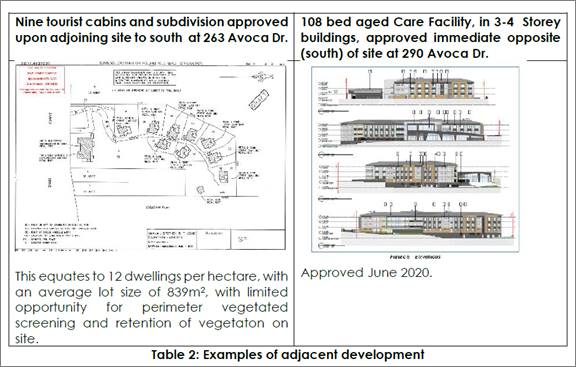
It is put that the proposed development, which has been
designed to site development generally upon land previously cleared for
agriculture and forestry, maximise perimeter vegetated buffers, retain
significant canopy trees, retained conservation land, re-establish riparian
corridors etc will provide for at least equal, if not superior outcomes, in
respect to landscape, scenic and ecological qualities than is otherwise
provided by existing development further along Picketts Valley Rd. An aerial
image of nearby development (also zoned E4) is provided below in figure 6.
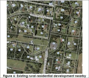
Comment
The
site is not considered suitable for the proposed development due to the urban
nature of the development, extent of earthworks required, tree clearing and
impacts on ecology.
The
applicant states that the development has been “carefully designed to
ensure that it sits within the local landscape”, but this is not the
case as the proposal involves large-scale site regrading, to provide for what
are akin to benched lots for future one and two storey dwellings. The site
regrade plan at Figure 5 demonstrates this. The design has not sought to
utilise existing roads or cleared areas within the site.

Figure 5- Site regrade
plans extract
The scale and nature of the proposed
‘caravan park’, with the intention of 165 dwelling sites that will
cater for substantially sized one and two storey manufactured homes, is
essentially an urban development. The land is zoned for low-impact residential and tourist-related
development that will not have an adverse impact on the ecological or aesthetic
values and is of a scale that is compatible with those values of the area.
In
regard to the applicant’s reference to the consent at 263 Avoca Drive,
deferred commencement development consent was granted for 9 x 2 bedroom Tourist
Units and Shed, car parking and provision of sewer to the site under DA/40779/2011
on 13 July 2012.
This
development was approved almost 10 years ago, under different planning
controls, being the Gosford
Interim Development Order No 122. However, it is noted there were similar issues and
controls at that time. The assessment report for DA/40779/2011 included
the following comments:
“The proposed development
consists of nine (9) low-impact single storey units and minimal cut/fill.
The proposal will minimise environmental and tree management issues in relation
to the subject land. However, the provision of sewer to the subject land
includes a proposal to connect to the Gosford Coastal Carrier System
Augmentation Stage 2 works through private land to the west of the site. The
proposed sewer line as shown on the Plan titled: “Concept Pressure Main and
Gravity Sewers within Lot 3 DP 421607 and Lot A DP 449600 Avoca Drive
Kincumber”, prepared by Treers Rose & Associates, is located within
an established tree line which runs along the front and western boundaries of
this property.
Removal or further
fragmentation of the tree canopy along the property boundary of Lot A DP 449600
to accommodate connection to Council’s Sewer system has potential to
impact on natural scenic qualities and amenity of surrounding properties in the
locality and detract from the character of the locality. Accordingly, a
deferred commencement condition has been imposed requiring the sewer line to be
positioned to minimise impact on established trees.”
It
is noted that a Section 96(1A) amendment to Deferred Development Consent
DA/40779/2011 involved the deletion of the deferred commencement conditions,
and allowed for the issue of an operative consent, but also added 3 stages, and
included the requirements of the deferred commencement conditions within Stage
2, with the stages constructed as follows:
· Stage 1 shall comprise
construction of a shed. The shed shall not be used for habitable
purposes. Stage 1 works shall not include tree removal as indicated in
red on the consent plans.
· Stage 2 shall comprise provision
and connection of reticulated sewer to the site, submission of Arboricultural
Impact Assessment and Nest-box Replacement Strategy
· Stage 3 shall comprise the
following works:
· Construction
of Nine (9) x two (2) bedroom tourist units; including required car parking - 9
spaces.
· Redesign
of the existing parking arrangements and provision of a total of fifty-seven
(57) car parking spaces for use by the existing restaurant/art gallery; and
· Reconstruction
of access and construction of an access road through the site to provide access
to the proposed units and shed.
· Provision
of sewer to the development.
· Tree
removal.
Council
records show that only Stage 1 (the shed) of this development consent has been
progressed. The required Arboricultural Impact Assessment, which is required to
be submitted to and approved by Council, has not been undertaken.
Given
this approval has not progressed, this does not represent an ‘example of
nearby growth’ as stated by the applicant.
The
108-bed aged care facility referenced by the applicant at 88 Scaysbrook Drive
(formerly 290 Avoca Drive), was approved by the Regional Planning Panel on 16
June 2020 under DA/56271/2019. It is noted that all works on this site
are confined to within the R2 Low Density Residential zone. It is also noted
that the R2 portion of the site is already developed and cleared and forms part
of the larger aged care facility known as 'Brentwood Village retirement
precinct'.
Again,
given this approval relates to residentially zoned land, and previously
developed land, this does not reasonably justify a similar form of growth or
development on the subject site which is zoned E4 Environmental Living.
The
existing rural residential land to the north along Picketts Valley Road and
Country View Road as refenced by the applicant, is zoned 7(c2) Conservation and
Scenic Protection (Scenic Protection - Rural Small Holdings) under the Gosford
Interim Development Order No.122, and is not Zoned E4 as stated by the
applicant. The relevance of this subdivision arrangement, which from records
appears to be from the 80’s and 90’s, 30-40 years ago, is not
apparent.
The
applicant has not provided adequate justification to demonstrate that the site
is suitable for proposed development.
Reason for Refusal
f) Insufficient information has been
provided on potential contamination, road works within the site, ecology
impacts, heritage impacts, waste impacts, soil and water management, emergency
and construction access, bush fire hazard, and tree retention.
Applicants Response
It is noted that during Council’s assessment time
of the original development application no contact was made by relevant Council
staff in relation to a number of matters raised in this reason for refusal.
Contamination
A Phase 1 Site Contamination Assessment and Phase 2
Detailed Assessment were submitted during assessment of the original
application. These initial reports recommended further actions to improve site
conditions but concluded that this site can be made suitable for the proposed
development provided the stated recommendations are implemented.
It is noted that no further requests for information
were made by Council.
In Council Officers Assessment report to LPP dated 6
August 2020, identified further concerns and the need for additional reporting
requirements, including a;
|
Required
|
Response
|
|
1. Stage 3 Remediation Action Plan (RAP) –
|
Now provided as Annexure 11
|
|
2. Hazardous Substances Audit (HSA)
|
Now provided Annexure 12
|
|
3. Dewatering Management Plan
|
Now provided as Annexure 13
|
|
4. Soil and Water Management Plan
|
Now provided as Annexure 14
|
A Contaminated Land Management Plan has also been
prepared and provided as Annexure 15.
Council had also requested remediation and validation
prior to DA approval, however, the
Project’s Senior Environmental Scientist has
advised that such a request is highly unusual and
onerous at this stage of the project. Further comments
in reply are provided as Annexure
16.
Road works
A complete set of Concept Civil Engineering Drawings
reflecting the revised 165 site layout
are provided as Annexure 1. This set includes staging
plans, site constraints and demolition,
dewatering, Avoca Drive intersection plan, various
detail plans, road section plans including fire trail and construction access,
concept stormwater layout, site regrading, pad regrading,
erosion and sediment controls, concept water and sewer
layout.
Ecology impacts
As noted earlier in the submission a revised
Biodiversity Development Assessment Report has
been prepared in support of the revised 165 site
proposal. This report, like the original,
considers avoid and minimise measures, other measures to
minimise and mitigate any
impacts, and the quantum of environmental credits
required to be retired in order for the
development to proceed.
The revised BDAR Is provided as Annexure 8.
Heritage
This revised proposal has considered the comments from
Councils Heritage Officer provided
in the LPP report dated 6 August 2020.
A significant change in this amended application is the
retention of the original dwelling
which will be adaptively used and incorporated into the
proposed community buildings as
recommended by Council’s Heritage Officer.
Page L302 of the Landscape Development Plans provides an
overview of the “village
green” which will contain the existing dwelling
and curtilage. Further examples of
landscaping treatments and materials, such as the use of
timber post and rail fencing, use
of oversized and weathered timber in constructed
landscape structures (pergolas etc) and
other landscaping features will be incorporated
throughout the development as measures
to reflect the site’s cultural history as agricultural
land.
It is noted that the site does not contain any
registered items of Aboriginal cultural or
European heritage significance. A Potential
Archaeological Deposit was previously
recorded in the submitted Cultural Heritage Assessment
as part of the original
documentation package. This PAD area is contained within
the riparian buffer of the
northern watercourse and is not impacted by the proposed
development.
Waste
A revised Waste Management Plan, reflecting the amended
165 site layout, consistent with
Council’s DCP Chapter 7.2 is provided as Annexure
17.
Soil and water management
A Soil and Water Management Plan, reflecting the amended
165 site layout is provided as
Annexure 14.
It is noted that the civil contractor will be required
to produce their own Soil and Water Management Plan prior to construction.
Emergency and construction access
The amended proposal seeks to retain the emergency and
construction access, leading from the northern part of the development area,
connecting through to Pickett’s Valley Rd.
Details of the upgraded access track are provided in the
Concept Civil Drawings, provided as Annexure 1.
A separate Tree Assessment for the construction access
has been prepared and provided as Annexure 9. This report identifies 5 trees
along the existing access track to be removed, with a further 4 trees at risk
due to minor upgrade and maintenance works.
Prior to design work, further ecological investigation
were undertaken in this location
targeting Rhodamnia rubescens, with 12 Additional plants
located. The alignment of the
access track has been adjusted slightly, where required,
to avoid any impacts upon the threatened plants. This is further commented on
in the BDAR (Annexure 8).
Bush fire hazard
The NSW Rural Fire Service issued its General Terms of
Approval (GTA’s) to the original proposal. A number of conditions appear
to have been applied in error, or as oversight, as they do not reflect current
conditions or comments made in the original Bushfire Assessment and Design
Plans.
A key issue was that the issued GTA is required the
entire property to be treated as an “inner protection zone” (IPA).
This condition is in conflict with intention to preserve existing bushland at
the northern end of the site.
The inconsistencies have been discussed with NSW RFS and
a summary of those discussions and specific request to revise relevant
conditions is provided in the letter prepared by Peterson Bushfire, provided as
Annexure 18.
Tree retention.
As outlined in Table 1 and as discussed elsewhere in the
submission, the revised proposal for 165 sites has resulted in a significant
reduction in the amount of trees required to be removed, and in fact with
proposed plantings, results in a net increase in trees by approximately 208.
The amended design also retains the mapped Regionally
Significant Vegetation, located
along the Avoca Drive frontage.
The amended design continues to retain approximately
5.5ha of existing bushland, which will be preserved and maintained consistent
with COSS principles.
Comment
Contamination
The
preliminary and detailed contamination assessment identify lead and asbestos
contamination in surface soils around the vicinity of the residential dwelling,
microbial contamination associated with the septic tank and buried asbestos
pipework.
The
Remediation Action Plan (‘RAP’) has been prepared generally in
accordance with the NSW EPAs Guidelines. The demolition plan indicates that one
dwelling is to be retained with all other buildings to be demolished. The
Hazardous Substances Audit, which forms part of the RAP indicates that
asbestos, synthetic mineral fibre and lead paint is present in several
structures.
The
RAP identifies the preferred methods of remediation, which include offsite
disposal of lead and asbestos impacted soils, asbestos pipes and asbestos from
the buildings to a licensed waste facility. Excavation and exposure to UV
radiation of the microbial contamination is the preferred option, with offsite
disposal to a licensed waste facility as a contingency plan, however this could
be conditioned should consent be granted. An asbestos removal plan,
environmental management plan and unexpected finds protocol forms part of the
RAP. A construction environmental management plan for the remediation and
validation works has also been provided.
A
Stage 4 Validation that all site contamination has been removed and the site is
suitable for the proposed land uses would be required to be provided to Council
following demolition and remediation works, should consent be granted.
The
application as amened has now adequately addressed contamination.
Road works
As
previously discussed under the comment for reason for refusal b), outstanding
engineering information relating to road works remains which does not allow the
consent authority to be satisfied of the impacts in relation to the following:
· The construction access
requires a creek crossing approximately 15m from Picketts Valley Road. The
culvert and associated fill have not been accounted for in the flood modelling.
There is insufficient information to ascertain if this will increase flood
levels upstream of the creek crossing.
· The construction access
passes by an existing dam. It is unclear whether and parts of this access are
located below the 1% AEP flood.
· Additional information
from a geotechnical engineer certifying the use the TrueGrid permeable paving
system will be adequate for the expected construction traffic loadings has not
been provided.
· Concept stormwater plan
for the proposed intersection and upgrade of Avoca Drive has not been provided.
Ecology impacts
There
is still insufficient information submitted in relation to ecological impacts
associated with the development. Having regard for the updated Biodiversity
Development Assessment Report (BDAR), the amended plans and report submitted
with the Section 8.2 Review of Determination the following matters have been
identified.
Vegetation
and Habitat Removal
The SEE
incorrectly states that any clearing of the Regionally Significant Vegetation
(Narrabeen Coastal Blackbutt Forest) will be avoided. There is in fact clearing
of this community within the extent mapped by Bell for the access of Avoca
Drive and as shown in Figure 1 of the SEE. The BDAR also outlines that 5.54 ha
of Plant Community Type (PCT) Smooth-barked Apple - Turpentine - Blackbutt open
forest would be cleared. This PCT is equivalent to the regionally significant
vegetation community mapped by Bell and referred to in the SEE.
The proposed
bushfire Asset Protection Zone (IPA) appears to still encroach into the
required 20m Vegetated Riparian Zone of the southern bank of the northern
watercourse at certain locations, see Figure 1.2 and Figure 2.1
in the BDAR and Figure 4 in the Bushfire Assessment (March 2021).
Tree
Removal and Retention
Tree removal
is stated in the SEE to be 327 trees, reduced from 491 (previous proposals).
There is no tree plan or Arborist report that details the size, species, health
or significance of those trees to be removed compared to those being retained. Statements are made in the SEE about the proposal providing
a net increase in numbers of trees on the site. However, this would involve
removing well established mature trees in favour of tree planting. A proportion
of replanted plants are usually anticipated to fail to reach maturity, and
those remaining would take many years to reach maturity. Of significance are
the 35 hollow bearing trees proposed to be removed.
The impact
on existing trees is underestimated, particularly with reference to the extent
of earthworks required for the accesses. There is a lack of detail that allows
full assessment including tree plans, schedules and tagging to trees to allow
cross referencing. The proposed tree removal has not been sufficiently minimised
and is still considered excessive with regards to the environmental and
planning constraints of the site.
Access
from Picketts Valley Road
There
remains a lack of clarity and conflicting information in relation to the
upgrade of the secondary access from Pickets Valley Rd, including the scale of
tree and vegetation removal required in this area. The BDAR states that a
“A temporary construction access route will enter the northern portion
of the subject land off Picketts Lane and will use a partially pre-existing
track” and that “The temporary construction access track
would not require widening or the removal of any canopy species”. The
BDAR, including the credit calculations, have assumed no canopy removal along
the access track. This not consistent with the Tree Assessment Report for the
access track and engineering plans which show that tree removal would in fact
be required along the access. The credit calculations in the BDAR are incorrect
if there is going to be an upgrade of this access, as outlined in the Arborist
report and as required by the RFS GTAs.
BDAR information
A
number of technical
issues have been identified with the amended Biodiversity Development
Assessment Report (BDAR):
· The BDAR needs to state which version
of the BAM has been used, BAM 2017 or BAM 2020. It is assumed BAM 2017 has been
used.
· The “BAM Biodiversity Credit
Report (Like for like)” needs to be provided. Only the “payment
summary report” has been provided with the BDAR, which does not show the
full set of required credit information.
· Council’s Ecologists again
detected additional Rhodamnia rubescens plants along the access from
Pickets Valley Rd that are likely to be impacted and not covered by the revised
BDAR.
· One of the BAM plots was located
along an access track (Figure 3.6 in BDAR). This is not compliant with the
acceptable methods to locate plots outlined in Section 4.3.4 of the BAM.
· Tree removal along the access road
have not been included in the calculations but is required based on the Tree
Assessment Report and RFS requirements.
· Any proposed species polygon assigned
to the GGBF is to be consistent with the ‘NSW Guide to Surveying
Threatened Frogs’ (September 2020).
· Additional on-site mitigation
measures would be required for removal of Green and Golden Bell Frog habitat.
· The BDAR would need to be updated to
include all the RFS requirements for clearing.
· Overall, the BDAR contains
insufficient measures to avoid and minimise the biodiversity impacts of the
proposal.
Heritage
As
the site is not currently a heritage listed property or subject to a draft
listing, it is noted that weight of the heritage significance of the farmhouse
is limited.
The
farmhouse does contribute to the aesthetic values of the site, as such further
consideration could be given to the preservation of the farmhouse and its
setting and curtilage. However, given he above, the application does not
require further information in regard to heritage.
Waste
Councils
Waste Management Assessment Officer has reviewed the Waste Management Plan and
Traffic Report submitted with the review of determination application and notes
the following outstanding issues:
· The submitted document
provides limited, overly brief demolition advice. Construction waste disposal
advice refers to mixes of waste types where separation of all waste types for
each waste stream is required.
· Commentary regarding
travel paths for resident transfer of mixed and recyclables waste bins to the
common waste servicing locations is required. As indicated in Table C.2:
Bin-carting design standards of the Better practice guide for resource recovery
in residential developments dated April 2019 by NSW EPA, a maximum surface
gradient of 1 :14 over a maximum 30m distance is required.
· Swept turning path details
to AS 2890.2 are required to demonstrate waste vehicle movements over the
internal road network. The Traffic Report by McLaren provides comment only that
the road design will generally be able to accommodate a 12.5m Heavy Rigid
Vehicle, subject to detailed design with no swept turning paths for waste
vehicle use detailed.
· A detailed Waste
Management Strategy as referred to in the submitted Waste Management Plan to
support sustainable ongoing operation of the proposed development has not been
provided.
Soil
and water management
Councils
Senior Environmental Health Officer notes that works will require approximately
131,165m2 of soil disturbance, therefore a Soil and Water Management
Plan should be approved prior to consent being granted as per Section 6.3 of
the Gosford DCP.
The
site contains two watercourses, tributaries of Saltwater Creek and Avoca
Lagoon. Avoca Lagoon is a regionally significant water body, with high
recreational, ecological and aesthetic values.
Works
involve dewatering and filling a small farm dam, reshaping the southern dam
into a flowing watercourse with riparian vegetation and keeping the northern watercourse
in its current state (with additional riparian planting). Three permanent
detention/biofiltration basins (to be used as sediment basins during
construction works) are proposed upstream of the existing watercourses to allow
for treatment prior to dewatering. A further three sediment basins will be
constructed to capture and treat sediment laden water during construction
works.
Works
are required on ‘waterfront land’, therefore a soil loss class 6
applies automatically and works are identified as a high erosion hazard,
therefore timing constraints apply to when excavation and construction works
can be undertaken.
The
submitted Soil and Water Management Plans are not satisfactory for the
following reasons:
· Construction drawings and
notes for wet sediment basins have not been provided.
· Water quality parameters
set for dewatering sediment basins and dewatering existing dams have not been
provided.
· Hay bales are not
supported in watercourses due to the risk of weeds spreading downstream. Also,
construction notes and detail for hay bales have not been provided.
· Special sediment and
erosion control measures have not been listed and identified.
· Sediment basins have been
sized on 50% settling zone capacity however as soil loss is identified as Class
6, they must be sized on 2-month soil loss.
· Mulch mounds are not
depicted on Area 1 and Area 4 catchments and are used to make up storage zones
for sediment basins, however no technical construction details or notes are
provided, nor is this method endorsed by the ‘Blue book’.
Soil and water management has not
been adequately addressed.
Emergency and construction access
Councils
Tree Assessment Officer notes that the secondary emergency and construction
access track to Pickets Valley Drive essentially follows the alignment of an
existing track. The Tree Assessment Report - Access Track (Dec 20) proposes
removal of five (5) trees, however a site inspection has revealed that the
track will likely need to be wider and require cut and fill. This is likely to
have a greater unquantified impact on native trees. T
No
tagging of trees has been undertaken nor has any corresponding tree plan been
prepared.
It
is noted that the applicant offered via mail dated 16 March 2021 the
following:
As we review public submissions, one
clear issue is the proposed temporary construction access to/from Picketts
Valley Rd.
In response to this public concern
(traffic volumes, safety, environmental impacts etc), we can amend the
construction process so that all construction will occur via the main entrance
from Avoca Dr. Amended concept engineering plans, including staging plans
etc and an amended CMP are currently being prepared and will be ready by early
next week, and will be submitted via the Portal.
This
issue was raised in the original assessment report and submissions and the
information submitted for the Review of Determination still proposed access
from Picketts Valley Road. The above offer to move amend the construction
process has been received more than two months post lodgement of the review of
determination application.
Having
regard for the fact that the application would require renotification and
another referral to both internal and external officers, and there were other
concerns in relation to the proposed development, the applicant was requested
not to submit further amended plans.
It
is also noted that the applicant made an offer to tag trees, however this offer
came in after the application was lodged and Council Officers (including
Planning, Engineering, Ecology, and Tree Officers) had already visited the
site. This should have been carried out prior to lodgement of the Review of
Determination application and an updated Arborist report prepared.
Bush fire hazard and tree retention
The
applicant has submitted a bushfire assessment which has been reviewed by the
NSW Rural Fire Service (RFS). The RFS has issued a bushfire safety authority
which includes a condition requiring the whole site to be managed as an inner
protection zone, with the exception of the native
vegetation located in the northern part of the site, the riparian corridor that
is proposed to be retained and conserved, and the existing stand of managed
trees located along Avoca Drive.
The
Inner Protection Area requires a tree canopy less than 15%, canopies separated
by 2 to 5m and large gaps in vegetation. Such bushfire requirements may further
fragment the existing tree canopy and inhibit the success or suitability of
re-planted trees.
Tree
removal along the access road shown has not been included in the BDAR
calculations but is required based on the Tree Assessment Report for the Access
Track. The BDAR would need to be updated to
include all required clearing.
Reason for Refusal
g) The proposal is an overdevelopment of
the site, inconsistent with the current and future desired character of the
locality and approval is not in the public interest.
Applicant’s Response
Overdevelopment of the site
In forming an opinion as to whether the proposal is an
overdeveloped of the site consideration should be given to whether the proposal
is consistent with zone objectives. In this instance, the first design
objective states;
To provide for low-impact residential
development in areas with special ecological,
scientific or aesthetic values.
It should be noted that zone E4 Objective provide for
low-impact residential development.
The term “low impact” should be
differentiated with the terminology used in, for example,
objectives for zone R2 which reference low density
residential environment.
Earlier in this submission, comment has been provided as
to how the amended proposal
can occur with low impact to the local setting and
landscape in which it sits. It is stressed
that low density and low impact are not the same.
As noted earlier in this submission, the project team
has worked hard to ensure the proposal
has low impact upon the site and surrounds. The lowering
of site levels, reduction in the
number of sites, increased side setbacks, greater
retention of mature trees providing
increased vegetation screening, and proposed plantings
which results in a net increase of
trees by not less than 208 and reestablishment and
enhancement of riparian zones.
An updated Traffic Impact Assessment is provided as
Annexure 19.
The assertion that the proposal is an overdevelopment of
the site is not supported by the
Biodiversity Development Assessment Report, or expert
reports addressing Traffic, Flooding,
or Stormwater Management.
The original proposal was supported by;
· Council’s Water
& Sewer Section – subject to conditions;
· Council’s Social
Planner – subject to conditions;
· NSW Rural Fire Service
– subject to conditions;
· TfNSW (formerly RMS)
– subject to conditions;
· Natural Resources Access
Regulator – subject to conditions;
· NSW Department of Primary
Industries (Fisheries) - subject to conditions;
It is anticipated that the amended and reduced proposal
will again be supported by the above Departments.
Inconsistent with the current and future desired
character of the locality
Section 4.12 of the original Statement, stated the
following in respect to desired future
character;
The proposal is based on a systematic
assessment of the site and allowing natural
features to give shape to a
development and integrate with its surrounds. The
emphasis has been on conserving and
enhancing the site’s features such as open
watercourses, retaining trees and
avoiding large-scale levelling.
Further comments were provided under Cl 4.7.1, in
respect to Council’s DCP Ch. 2.1
Character, and stated the following;
The site has a relatively short
frontage to Avoca Drive, with the site falling away from
the road to the first of two
watercourses, the second which is hidden behind a low
central ridge. Other than the Avoca
Drive frontage there are a few public vantage
points from where the site is
visible.
Buildings are set back from front and
side boundaries and are at levels below
adjacent land to reduce visual
prominence. Areas between buildings and front side
setbacks will be landscaped to defuse
form.
Trees within the riparian corridor
will be retained and supplemented, providing
canopy screening to future houses.
A detailed landscaping master plan
provided as Appendix 1c and provides full detail
on the landscaping measures including
tree planning schedule to minimise visual
impacts and to complement the
surrounding landscape.
Not only do these comments remain relevant for the
amened proposal, but the changes made to the amended proposal (including the
lowering of site levels, reduction in the number of sites, increased side
setbacks, greater retention of mature trees providing increased vegetation
screening, and proposed plantings which results in a net increase of trees by
not less than 208 and reestablishment and enhancement of riparian zones)
further demonstrate the proponents willingness wot work with both Council &
the community to ensure the modified development is consistent with the current
and future desired character of the locality.
It should be noted that the current Gosford LEP 2014,
allows for a variety of uses upon land
zoned E4 Environmental Living including: -
Animal boarding or training
establishments; Camping grounds; Caravan parks; Dwelling
houses; Eco-tourist facilities;
Environmental protection works; Extensive agriculture; Homebased child care;
Home industries; Oyster aquaculture; Pond-based aquaculture; Pubs;
Recreation facilities (indoor); Recreation facilities (outdoor); Registered
clubs; Restaurants or cafes; Roads; Secondary dwellings; Signage;
Tank-based aquaculture; Tourist and visitor accommodation; Veterinary hospitals;
Water storage facilities
The highlighted uses above represent some examples where
potential impacts could equal
or exceed those impacts anticipated by this current
amended proposal.
It should also be noted that the Gosford LEP
2014 currently permits strata subdivision of the
land which allows creation of allotments
having a lot size less than the prescribed minimum
by virtue of Cl. 4.1A of Gosford LEP 2014.
This Clause states;
4.1A Minimum subdivision
lot size for strata plan schemes in certain rural, residential, recreation and
environment protection zones
(1) The objective of this
clause is to ensure that land to which this clause applies is not
fragmented by
subdivisions that would create additional dwelling entitlements.
(2) This clause applies
to land in the following zones that is used, or proposed to be
used, for residential
accommodation or tourist and visitor accommodation—
(a) Zone RU1 Primary
Production,
(b) Zone RU2 Rural
Landscape,
(c) Zone RU5 Rural
Village,
(d) Zone R2 Low Density
Residential,
(e) Zone RE1 Public
Recreation,
(f) Zone E2 Environmental
Conservation,
(g) Zone E3 Environmental
Management.
(h) (Repealed)
(3) The size of any lot
resulting from a subdivision of land to which this clause applies
for a strata plan scheme
(other than any lot comprising common property within the
meaning of the Strata Schemes
(Freehold Development) Act 1973 or Strata Schemes
(Leasehold Development)
Act 1986) is not to be less than the minimum size shown on
the Lot Size Map in relation to that land.
The important exception to this Clause is
that Zone E4 Environmental Living was repealed
when an amendment was gazetted on 27 March
2015. The consequence of this repeal is
that no minimum lot sizes applies for an
approved development e.g. tourist accommodation, under the Gosford LEP 2014.
There are a number of examples of where this
has occurred, with one example adjacent to the site at 263 Avoca Dr Kincumber,
where a 9 lot strata subdivision has been approved, created lots with an
average size of 840m2 (equates to 12 dwellings/Ha – comparable to low
density residential development) upon land zoned E4. We are aware of other
similar examples within 2km of the site upon land also zoned E4. This provides
an indication that Council is flexible on its own views on the current and
future desired character of the locality.
It should be noted that the original and
amended proposal do not propose subdivision, with the development intended to
be managed by a single entity, with individual sites subject to a lease
arrangement.
Consistent with recognised Planning
Principles, the visual dominance of the amended
development is reduced by;
· The retention
and enhancement of the Regionally Significant Vegetation adjacent to the
southern boundary;
· Increased
setbacks from both southern and western boundaries;
· Retention of trees along
the western boundary providing for improved vegetation screening;
· Revised cut/fill and
benching work which has the effect of reducing the overall levels of future
housing and also taking advantage of level changes and designing houses
accordingly;
· Ensuring a maximum height
of any building will be two story, consistent with surrounding existing
development (with the exception of the recent approval for 3-4 storey Aged care
facility opposite upon 290 Avoca Dr).
It should also be noted and as previously mentioned
earlier in this submission, the locality and immediate landscape is also under
continual ‘transition’ as the Region experiences sustained and
forecast population grow.
Having regard for the above matters, the design
responses and detail provided in the specialist reports annexed, it is our
considered view that the amended proposal is not inconsistent with the current
and future desired character of the locality.
Public interest
Section 5.4 of the original submission put forward
reasons why approval of the original application was in the public interest.
These reasons remain relevant to the amended 165
site proposal.
The amended proposal has gone to great lengths to reduce
potential localised impacts by reducing site yield, realigning roads to
increase separation distances to adjacent developments and to improve vegetation
screening opportunities between developments, retaining mature trees central to
the site to enhance vegetated screening, retaining mapped Regionally
Significant Vegetation, retention of the original dwelling to be repurposed
into future community facilities, identifying and avoiding a listed threatened
plant, and other measures.
The original proposal was supported by;
· Council’s Water
& Sewer Section – subject to conditions;
· Council’s Social
Planner – subject to conditions;
· NSW Rural Fire Service
– subject to conditions;
· TfNSW (formerly RMS)
– subject to conditions;
· Natural Resources Access
Regulator – subject to conditions;
· NSW Department of Primary
Industries (Fisheries) - subject to conditions;
It is anticipated that the amended and reduced proposal
will again be supported by the above Departments.
Comment
The
proposal as amended is still considered to be an overdevelopment of the site.
As discussed above the significant site regrading, cut and fill and site
disturbance of over half of the site cannot reasonably be considered ‘low
impact’. There are significant impacts on trees, ecology, flooding, soil
and water quality, and the visual and aesthetic values of the site.
The
applicant’s comments on the difference between low impacts and low
density are noted. Setting aside density, the nature and character of the
development is that of an urban development, which is not in line with the
current and future desired character of the locality or environmental living
zone which applies to the site now, and is intended to apply to the site upon
the commencement of the Central Coast Local Environmental Plan.
The
other permitted uses within the zone are noted. The statement that the uses
“represent some examples where potential impacts could equal or exceed
those impacts anticipated by this current amended proposal” is a
general assumption as any future development would have regard for the merits
of a proposal and its potential impacts.
The
relevance of the strata subdivision controls as cited by the applicant are not
clear. Strata subdivision allows for different ownership arrangements but still
may be considered “low impact” in the context of the assessment and
may result in little physical or environmental impacts on land in
isolation.
The
applicant notes the strata subdivision of the nine tourist cabins at the
adjacent 263 Avoca Drive, Kincumber (approved under DA 47581/2015 on 18
March 2016), and includes the resultant density “lots with an average
size of 840m2 (equates to 12 dwellings/Ha – comparable to low density
residential development) upon land zoned E4.”. However, it is not the
density, but the impacts that are of relevance. It is noted that the Assessment
Report for the strata subdivision states that “The proposal is a Strata
Subdivision of an approved tourist development and has no additional impact on
the site or the locality. The
proposal will not detract from the character or scenic qualities of the area or
have unreasonable impacts on the environment.”
For
the above reasons and those discussed further in this report the proposal is
not in the public interest.
Reason for Refusal
h) Pursuant to Draft Central Coast LEP
(2018) the proposed development is prohibited within E4 Environmental Living
zone.
Applicant’s Response
Council’s attention is drawn to Cl.1.8A of the
exhibited draft consolidating LEP 2018, which
states;
1.8A Savings provision relating to
development applications
If a development application has been
made before the commencement of this Plan in relation to land to which this
Plan applies and the application has not been finally determined before that
commencement, the application must be determined as if this Plan had not
commenced.
The original development application was lodged on 14
January 2020. The Draft Central
Coast LEP (2018) was in draft form at the time of
lodgement (and still remains in draft form).
It is the proponents considered view that Cl.1.8A
preserves the provisions of the Gosford LEP
2014, and that the proposed land use is Permitted with
Consent.
The relevance of Draft LEP’s, including the weight
to be applied, has been examined many
times before the Courts. In general, the weight to be
given to a draft LEP depends on
whether the draft LEP is “certain and
imminent”. Certainty refers to the content of the LEP.
If the terms of the draft LEP are still being debated
then the draft LEP is not certain. If the
terms have been finalised then the draft LEP is certain.
Being imminent refers to how close
the LEP is to be made, that is signed off by the
Minister.
A brief history on the Draft Central Coast LEP (2018) is
provided below;
· In November 2016 Council
resolved to refer the draft Planning Proposal to the Dept of Planning seeking
Gateway Determination;
· The Dept of Planning
issued Gateway Determination on 26 October 2017. Dot Point 1, sub point 6 of
the Gateway states;
·
Provide
justification for reducing the potential areas where caravan parks are
permissible
·
The Gateway Determination
was extended on 29th November 2018;
·
The
draft consolidated LEP was exhibited 6 December 2018 to 28 February 2019;
·
Amongst
the exhibition material included the Planning Proposal, dated December 2018;
·
Assessment
of Sec 117 Directions, in particular 3.2 Caravan Parks & MHE’s,
wherein Council acknowledges inconsistency with the Direction, but considered
to be of minor significance.
·
It
is unclear whether Council has provided sufficient justification in response to
Gateway Point 1, sub-point 6
· On 9 March 2020, a report
was put to Council seeking that the Draft LEP be adopted and that the Planning
Proposal be referred to the Department of Planning, Industry & Environment
to be finalised. However, on the night, Councillors resolved to make not less
than 17 amendments to tabled report. Questions were raised as to whether the
extent of changes warranted re-exhibition. this issue remains unresolved.
Council also resolved on the 9 March 2020;
That Council
a) defer finalisation of the draft
Consolidated LEP and Consolidated DCP until after the LSPS has been finalised
b) consider a further report to Council
that aligns the draft Consolidated LEP / DCP with the adopted Local Strategic
Planning Statement including;
i) any proposed changes to the CCLEP /
CCDCP
ii) any further work necessary, if
applicable
iii) outlining how the draft CCLEP / DCP
aligns with each Action in Council’s Community Strategic Plan
The Draft Central Coast LEP (2018) has not been reported
back to Council since 9 March
2020, and is therefore put not to be certain or
imminent.
It is noted that there has been a gradual erosion of
landowner entitlements as each version
of the principle planning document (IDO or LEP) has been
introduced – from zone
7(c3) under the former IDO, to the proposed E4 under the
Draft LEP as it applies to the subject land. This is despite each conversion
LEP promoted as generally a “like for like” zone
conversion intending to carry over similar permissible
used from one document to another.
It is accepted that it is not always possible to
transiting exact entitlements, but the point is
made that the landowner has suffered a downgrade of
entitlements on each conversion,
which are not minor or insignificant (to the landowner) as
Council has previously stated in
the relevant Planning Proposal(s). It is put that such
significant changes to the landowner’s
entitlements should occur as part of the future
comprehensive review of the LEP, and
supported by the various studies including rural lands,
housing, the yet to be complete
urban edge review etc, rather than incremental
“downzoning” as has currently occurred.
A summary of the loss of entitlements is highlighted in
the Table? below;
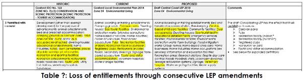
Comment
The
Draft Central Coast Local Environmental Plan (Draft CCLEP) is a matter
for consideration under Section 4.15 of the Environmental Planning &
Assessment Act 1979.
Under the provisions of the Draft
CCLEP, the land is
proposed to retain the E4 Environmental Living zoning, however
‘caravan parks’ are not permissible in the E4 zone under the
provisions of the Draft CCLEP.
The
Planning Proposal exhibited in support of the draft LEP included a section
titled “CCLEP Part 2 – Permitted or Prohibited Development”,
which compared the provisions of Wyong LEP 2013 and Gosford LEP 2014 and
contained the following relevant information:
In some circumstances, Principle 5
– Permissibility Retention has not been able to be applied. This is
because, in some instances, the application of zones between the two former
LGAs has been different. For example, the E4 Environmental Living zone in the
former Wyong LGA was generally applied for the purposes of larger lot
residential development in environmentally sensitive locations. While in the
former Gosford LGA, the E4 Environmental Living zone was applied to enable
tourist development in environmentally sensitive locations. Therefore, some
land uses have been found to not always align, and may be inappropriate for
application over the entire Central Coast LGA
The
Draft CCLEP includes a savings provisions that provide for an application
lodged before the making of the draft Plan, that the application must be
determined as if the draft Plan had not been made.
The
Draft CCLEP is a matter for consideration under s4.15(1) of the Environmental
Planning and Assessment Act 1979. How much weight should be given to a
draft LEP depends on whether the draft Plan is imminent, and the public
interest in approving a development which is proposed to be prohibited. In this
regard the following points should be considered:
· The weight to be given to
each head of consideration in s4.15(1) of the EPA Act is a matter for the
consent authority.
· The case law is to the
effect that the weight to be given to a draft instrument will be greater, the
more ‘certain and imminent’ it’s making (Terrace
Tower Holdings v Sutherland Shire Council [2003] NSWCA 289 (Terrace
Towers)).
· A draft instrument is
generally considered to be ‘imminent and certain’ where it has been
approved by the planning authority and sent to the Minister to be made.
· By contrast, a draft
instrument which has not been the subject of public consultation will generally
be given less weight than one that has been the subject of public consultation.
The
Draft CCLEP has been publicly exhibited and adopted by Council
on 14 December 2020, however, has not yet been sent to the
Minister to be made. The Draft CCLEP is considered both reasonably imminent and
certain and can be afforded significant weight.
The
following site-specific circumstances are considered in terms of the public
interest being served in approving the development:
· The objectives of the E4
zone under the Draft CCLEP are:
o To provide for low-impact
residential development in areas with special ecological, scientific or
aesthetic values.
o To ensure that residential
development does not have an adverse effect on those values.
o to allow additional land
uses that will not have an adverse impact on those values.
· As discussed throughout
this report the proposed development is not consistent with these objectives as
the proposal cannot be considered to be ‘low impact’ and results in
adverse impacts on the ecological and aesthetic values of the site.
· There is no historic or
future expectation for this nature of development on the site. The site is
located within the Kincumber Character Area 13: Scenic Buffer under the GDCP
2013. The desired character for this area includes “very-low density
residential developments” and requires the retention of natural
slopes, prevention of further fragmentation of tree canopy, low impact
construction methods and avoidance of retaining walls. The proposed development
is in direct conflict with desired character future for the area.
In
Terrace Tower holdings Pty Limited v Sutherland Shire Council [2003]
NSWCA 289, the Court
held
that:
‘…The purpose of a
draft instrument is entitled to be given significant weight in deciding whether
to reject an application brought under a pre-existing planning instrument that
would undermine the draft instrument’s purpose in a substantial
way.’
The
draft CCLEP will prohibit caravan parks on E4 zoned land. The applicant was
aware of this during the exhibition of the draft plan and prior to the lodgement
of the application and Section 8.2 Review. No public submissions were received
objecting to the proposed E4 zoning of the land and or that caravan parks
should be retained as a permissible use with consent in the zone during the
exhibition of the Draft CCLEP.
It
is not in the public interest to approve a development which is inconsistent
with both the current and draft zone objectives. This would prejudice the
making of the draft Plan and future planning objectives for the area. It is
considered the draft plan must be given significant weight and remains a
recommended reason for refusal insofar as it is inconsistent with the zone
objectives is therefore does not result in the public interest being served.
Assessment:
Having
regard for Sections 8.2 and 8.3 and the matters for consideration detailed in
Section 4.15 of the Environmental Planning and Assessment Act 1979 and
other statutory requirements, Council’s policies and Section 10.7
Certificate details, the assessment has identified the following key issues,
which are elaborated upon for the Local Planning Panel’s
information. Any tables relating to plans or policies are provided as an
attachment.
Sections
8.2 and 8.3 of the Environmental Planning and
Assessment Act 1979
Section 8.2 (1) (a) of the EP&A Act 1979 allows for
the determination of an application by a local planning panel to be subject to
a review under this Division.
Section
8.3 (3) allows for the applicant to amend the proposed development and the
“consent authority may review the matter having regard to the amended
development, but only if it is satisfied that it is substantially the same
development”. The amended plans retain the general configuration of
the original proposal and it is considered that the proposal remains
substantially the same as that for which was refused on 6 August 2020.
Section
8.3(5) states that “the review of a determination or decision made by
a local planning panel is also to be conducted by the panel”
Moreover,
the Local Planning Panel best practice notes recommend the local planning panel
reviewing the decision is comprised of different Panel members to those who
made the original decision. This panel is to be called the “Decision
Review Panel of the Central Coast Council local planning panel."
Section
4.6 of
the Environmental Planning and Assessment Act 1979 -Integrated Development
Water
Management Act 2000
The
proposed development includes the carrying of work within 40m of waterfront
land and is classified as Integrated Development. In accordance with section 91
of the Water Management Act 2000 a controlled activity approval from the
Natural Resource Access Regulator (NRAR) is required.
The
Section 8.2 Review of Determination application was referred to NRAR. In an
email dated 28 April 2021, NRAR advised that the General terms of Approval
issued for the original application would remain the same and no further
information was required.
Rural
Fires Act 1997 & Planning for Bushfire Protection
The
subject site is located within a designated bushfire prone area and the
proposed development is nominated as a Special Fire Protection Purpose under
Section 100B of the Rural Fires Act 1997. General terms of approval were
sought from the NSW RFS in accordance with Section 4.47 of the Environmental
Planning and Assessment Act 1979.
On
23 February 2021 the RFS requested that:
· An updated Bush Fire assessment
report should be provided, prepared by a Bushfire Consultant and reflect the
current revised scheme, illustrating its compliance with Appendix 2 of Planning
for Bush Fire Protection (PBP) 2019.
· It should illustrate the
extent to which the proposed development conforms with, or deviates from, the
specifications set out in PBP 2019, and address all requirements in clause 44
of the Rural Fires Regulation 2013; and,
· Include any of the
discussions undertaken with the NSW RFS, as well as the issues and compliance
with PBP 2019, as outlined in their request for a review dated 24 November
2020.
An
updated Bushfire Report was provided by the applicant on 15 March 2021.
Pursuant
to Section 100B of the Rural Fires Act 1997 NSW RFS issued a Bushfire
Safety Authority on 4 May 2020.
It
is noted that the Bushfire Safety Authority included the requirement for the
entire property to be managed as an IPA (refer extract below) which is
considered problematic with regard to tree retention and in maintaining the
ecological and aesthetic values of the area.
That the entire property must be
managed as an inner protection area (IPA) in accordance with the requirements
of Appendix 4 of Planning for Bush Fire Protection 2019 with the exception of
the native vegetation located in the northern part of the site, the riparian
corridor that is proposed to be retained and conserved and the existing
stand of managed trees located along Avoca Drive.
Fisheries
Management Act 1994
The
proposed development includes
dewatering
and filling a small farm dam and reshaping the southern dam into a flowing
watercourse. These works involve dredging or reclamation work, and therefore
require a s201 permit under the Fisheries Management Act 1994.
The
Review of Determination application was referred to Department of Primary Industries
(Fisheries) and on 2 February 2021 a letter from the Department of Primary
Industries (Fisheries) advised the following:
The proposal constitutes a controlled
activity under the Water Management Act 2000. As such, an Integrated
Development Application should be submitted to NRAR for assessment and
determination. If NRAR determines that the works do not require a Controlled
Activity Approval, then the integrated development must be referred to DPI
Fisheries and will require a s201 permit for dredging and reclamation under the
Fisheries Management Act in order to proceed.
The proponent has indicated that NRAR
have been consulted and a Controlled Activity Approval is being sought.
DPI Fisheries recommends that some
deeper pools be provided along the realigned creek (perhaps in the location of
the existing farm dam) to provide refuge points for fish during drought periods.
NRAR
have confirmed a controlled activity approval is required therefore no further
action was required in relation to referral to Fisheries.
Gosford Local Environmental Plan 2014
(GLEP 2014)
Zoning
and Permissibility
The
subject site is zoned E4
Environmental Living under
Gosford Local Environmental
Plan 2014. A caravan
park is permissible in the zone with development consent.
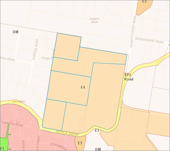
Figure 6 – Zoning
Map extract
Caravan park means land (including a
camping ground) on which caravans (or caravans and other moveable dwellings)
are, or are to be, installed or placed.
A caravan park is a
permissible use in the E4 zone. The proposed development involves the provision
of 165 long-term and two short-term dwelling sites and an associated community
building and facilities.
The
definition of ‘caravan park’ requires that caravans are to
be installed or placed on the land; ‘other moveable dwellings’
may be placed or installed on the land in conjunction with caravans, but are
not required in order for the development to meet the definition of a ‘caravan
park’.
The definition of “moveable
dwellings” includes manufactured homes under the GELP2014:
“moveable
dwelling means:
(a) any tent,
or any caravan or other van or other portable device (whether on wheels or
not), used for human habitation, or
(b) a
manufactured home, or …”
The parentheses “(or caravans
and other moveable dwelling)” contained in the definition of
“caravan park” states that manufactured homes in conjunction with
caravan sites qualifies, and forms part of the definition for, a caravan park.
The
definition of ‘caravan park’ does not specify a minimum
number or proportion of caravan sites beyond requiring that there must be
‘caravans’ (i.e. more than one). The application proposes two
short-term sites for caravans. The location of the two short-term sites are
shown in Figure 7.
Legal advice received by Council for
a caravan park at 1 Bowtells Drive, Avoca Beach (DA 51538/2017) recently
confirmed that there is no minimum number or proportion of caravan sites
and that there is no authority from the Land and Environment Court which
requires that a certain proportion or percentage of sites within a caravan park
(as that term is defined by the standard template) are required to contain
caravans.
However,
the inclusion
of two short-term dwelling sites for caravans, in conjunction with 165
long-term dwelling sites must be proposed for a proper purpose to satisfy the
requirements of the definition for a caravan park, having particular regard for
the decision made in TMT
Devco Pty Limited v Cessnock City Council [2016] NSWLEC 1161 (‘TMT Devco’).
In
TMT Devco Pty Limited v Cessnock City Council [2016] NSWLEC 1161
(‘TMT Devco’), the Court determined that development for
manufactured homes with associated “caravan parking and RV
storage” did not qualify as a “caravan park” as it was
considered ancillary to the use of the site as a manufactured home
estate.
For
this application, the applicant states that “only 2 short term sites
are provided, essentially to provide suitable parking
for visitors of residents”.
In addition to this, the sites are not provided with
servicing as required by the
Local
Government (Manufactured Home Estates, Caravan Parks, Camping Grounds and
Moveable Dwellings) Regulation 2005, such as appropriately located shower, toilet and laundry
facilities (discussed further under the Local Government (Manufactured
Home Estates, Caravan Parks, Camping Grounds and Moveable Dwellings) Regulation
2005 heading below). The applicant states that the two short term sites are provided for “guests of
residents of the long-term sites and will therefore utilise their facilities
when visiting”.
The
facts and proposed uses in the TMT Devco case are not fundamentally
different to those proposed by this application. The
applicant states that that two short term sites are ‘essentially parking
spaces’ for visitors of the long-term dwelling sites. As such the two
short-term sites appear to be ancillary to the long-term sites in a similar way
to that of TMT Devco.
The characterisation of the site as a caravan park is considered
to be erroneous as the short-term caravan sites are ancillary to the use of the
long-term manufactured home sites and it is evident that they will not be
utilised for the placement of caravans. Accordingly, the consent authority
cannot be satisfied the proposed development complies with the definition.
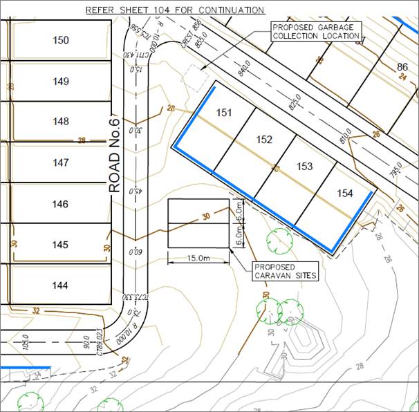
Figure 7 –
Engineering Plans extract - location of two short term caravan sites
Caravan Park Use and Approval to Operate a
Caravan Park
Despite
the discussion regarding permissibility and definition of a caravan park above,
it is important to note that this application is for the use of the site for a
caravan park, as well as the required infrastructure works and construction of
the community building and facilities. A separate approval from Council under
s.68 of the Local Government Act 1993 (LG Act) is required to operate a
caravan park and is subject to the provisions of Subdivisions 1-8 of Division 3
of the Local
Government (Manufactured Homes Estates, Caravan Parks, Camping Grounds and
Moveable Dwellings) Regulation 2005.
An
applicant can make a development application, in which they apply for both
development consent under the EP&A Act and approval under the LG Act to
operate a caravan park, or they can make two separate applications. This
application relates to the use and infrastructure works and building work only
and does not included the Section 68 application for the operation of
the caravan park.
Objectives of the zone
The objectives of the E4 Environmental Living zone are:
· To provide for
low-impact residential development in areas with special ecological, scientific
or aesthetic values.
· To ensure that
residential development does not have an adverse effect on those values.
· To promote
ecologically, socially and economically sustainable development and the need
for, and value of, biodiversity in Gosford.
· To provide
land for low-impact tourist-related development that is of a scale that is
compatible with the special ecological, scientific or aesthetic values of the
area.
· To ensure that
development is compatible with the desired future character of the zone.
The
proposed development does not comply with the objectives of the zone for the
following
reasons:
· The proposal
is not a low-impact residential or tourist related development and is of an
urban nature.
· The proposal
is not low impact given it proposes:
o significant
cut and fill, up to 6.2m and 5.5m respectively;
o significant
land disturbance of 131,165m2, which is over half of the site; and
o significant
tree removal, with 327 trees proposed to be removed (noting proposed 535 tree
plantings)
· The proposal
impacts the ecological and biodiversity values of the site and locality.
· The proposal
is not compatible with the desired future character of the zone and area due to
the urban nature of the development and impacts on the environment.
Clause 7.1 - Acid Sulfate Soils
The
site contains Class 5 Acid Sulfate Soils and the site is not located within
500m of class 1-4
land. In this
instance, the proposed works are not considered to impact on Acid Sulfate
Soils.
Clause 7.2 - Flood Planning
The
land has been classified as being under a “flood planning level”
and subject to the
imposition
of a minimum floor level.
Two
watercourses flow through the site and into Avoca Lagoon, being Saltwater Creek
and an unnamed watercourse. The applicant has submitted a Flood Impact Assessment and the conclusions of this assessment are not
accepted for the following reasons:
· There is no
way to assess the appropriateness of any of the input parameters as very few
are presented. The following information has not been provided:
o Intensity–Frequency–Duration
(IFD) data used in Analysis
o Probable
Maximum Flood (PMF) Parameters and rainfall determination used in analysis
o Pre and Post
Developed WBNM files (with all parameters and ARR HUB & IFD files used)
o TUFLOW run
files
· It is proposed
to create new blocks of residential land that incur a level of hazard of H3 (without
the inclusion of the impact of structures (Dwellings) in a PMF event), which if
accounted for, would likely raise the hazard level further
7.3
Floodplain risk management
The
objectives of this clause are:
· In relation to development
with particular evacuation or emergency response issues, to enable evacuation
of land subject to flooding in events exceeding the flood planning level,
· To protect the operational
capacity of emergency response facilities and critical infrastructure during
extreme flood events.
Clause
7.3(3) states that development consent must not be granted for caravan parks
unless the consent authority is satisfied that the development will not, in
flood events exceeding the flood planning level, affect the safe occupation of,
and evacuation from, the land.
Insufficient
information has been provided to satisfy assessment staff that the above
objectives regarding floodplain risk management can be achieved. Accordingly,
it is considered the consent authority is unable to grant development consent
without the above information.
State Environmental Planning Policy No
21-Caravan Parks
The proposal has been assessed having
regard for the provisions of State Environmental Planning Policy 21 -
Caravan Parks which state:
(1) The
aim of this Policy is to encourage—
(a) the
orderly and economic use and development of land used or intended to be used as
a caravan park catering exclusively or predominantly for short-term residents
(such as tourists) or for long-term residents, or catering for both, and
(b) the
proper management and development of land so used, for the purpose of promoting
the social and economic welfare of the community, and
(c) the
provision of community facilities for land so used, and
(d) the
protection of the environment of, and in the vicinity of, land so used.
(2)
The strategies by which that aim is to be achieved are—
…
(b) by
requiring that development consent be obtained from the local Council for
development for the purposes of caravan parks, and
(c) by
providing that development consent may be granted that will authorise the use
of sites for short-term stays (whether or not by tourists) or for long-term
residential purposes, or for both, and
(d) by
requiring that development consent be obtained from the local Council for the
subdivision of land for lease purposes under section 289K of the Local
Government Act 1919.
The proposed development is not
considered to result in the orderly and economic use of the land as the
development is of a nature and scale that is not appropriate for the character
of the area and will result in unacceptable environmental impacts.
Clause 8 requires consideration of
the number of sites suitable for long and short-term sites and requires any development consent to include a
condition specifying the maximum number of sites (if any) within that land that
may be used for long-term residence.
The
definition of long-term and short-term sites, from the Local
Government (Manufactured Home Estates, Caravan Parks, Camping Grounds and
Moveable Dwellings) Regulation 2005 are:
long-term site means a dwelling site that is
specified in the approval for a caravan park as being a long-term site.
short-term site means a dwelling site on which a moveable
dwelling that is ordinarily used for holiday purposes may be installed and that
is specified in the approval for a caravan park as being a short-term site.
Development consent is being sought
for 165 long -term sites and 2 short-term dwelling
sites. The 165 long-term dwelling sites are not considered suitable for
long-term residences as discussed elsewhere in this report.
Clause
10 of this SEPP includes the matters to be considered by the consent authority
including:
(a) whether,
because of its location or character, the land concerned is particularly
suitable for use as a caravan park for tourists or for long-term residence,
(b) whether
there is adequate provision for tourist accommodation in the locality of that
land, and whether existing or potential tourist accommodation will be displaced
by the use of sites for long-term residence,
(c) whether
there is adequate low-cost housing, or land available for low-cost housing, in
that locality,
(d) whether
necessary community facilities and services are available within the caravan
park to which the development application relates or in the locality (or both),
and whether those facilities and services are reasonably accessible to the
occupants of the caravan park,
(e) any
relevant guidelines issued by the Director, and
(f) the
provisions of the Local Government (Caravan Parks and Camping Grounds)
Transitional Regulation 1993.
The topography of the site is steep
with two watercourses traversing the site and covered in a large number of
trees. The site is not considered suitable for the type of development that is
proposed as evident by the significant site regrading required, extent of cut
and fill required and resultant impacts on trees, ecology, soil and water and
visual qualities.
The proposal will neither provide,
nor displace any tourist or low-cost accommodation. The proposal is a “residential
land lease community for over 50s, in the form of manufactured homes” (as per the
applicants original Statement of Environmental Effects).
The proposed development includes
on-site facilities and is located approximately 3km from shopping and services
at Kincumber.
An assessment against the Local
Government (Manufactured Home Estates, Caravan Parks, Camping Grounds and
Movable Dwellings) Regulation 2005 is included further below.
It is considered that the site is not
suitable for the long-term and shot-term sites proposed. The proposal will have
unacceptable environmental impacts and is not of a scale or nature that is
consistent with the existing or desired future character of the surrounding
locality. The application is inconsistent with the stated aims and objectives
of State Environmental
Planning Policy 21 - Caravan Parks.
State Environmental
Planning Policy No 55-Remediation of Land
Clause 7 of SEPP 55 requires the
consent authority to consider whether the land is contaminated when determining
a development application. The
proposed development involves significant disturbance through site regrading
and the provision of infrastructure on the site.
As
previously noted, the applicant has provided the following information in
relation to contamination:
· Preliminary Stage 1
Contamination Assessment
· Detailed Stage 2
Contamination Assessment
· Contamination Assessment
Report
· Stage 3 Remediation Action
Plan
· Construction Contamination
Management Plan
· Dam Dewatering Management
Plan
The
submission of the above information is considered to satisfy the provisions of
clause 7(1)(c) as it is considered that the land will be suitable for the
purposes of a caravan park upon remediation of the land prior to its use.
Draft
Central Coast Local Environmental Plan 2018
As
discussed under Reason for Refusal (h) above, the land is proposed to retain
the E4 Environmental Living zoning, however ‘caravan parks’ are not
permissible in the E4 zone under the provisions of the Draft CCLEP.
The
Draft CCLEP is a matter for consideration under Section 4.15 of the Environmental
Planning & Assessment Act 1979 and has been considered in detail under
the Reason for Refusal (h) above.
The objectives of the E4 zone under
the Draft CCLEP are similar to the current objectives, being:
o To provide for low-impact residential
development in areas with special ecological, scientific or aesthetic values.
o To ensure that residential
development does not have an adverse effect on those values.
o to allow additional land uses that
will not have an adverse impact on those values.
As discussed throughout this report
the proposed development is not consistent with these objectives as the
proposal cannot be considered to be ‘low impact’ and results in
adverse impacts on the ecological and aesthetic values of the site. Even if
caravan parks remained a permissible use, the proposal remains inconsistent
with the draft zone objectives and could not be supported in its current form.
Gosford
Development Control Plan 2013 (GDCP 2013)
Chapter 2.1 Character
The
site is identified as being located within Unit 13-Scenic Buffer of the Kincumber Precinct. The desired character for this area,
as set out in the DCP is (with emphasis added):
‘These should remain rural-residential
buffers where the scenically-distinctive semirural
and natural qualities of
prominent backdrops to Gosford City’s major roads and tourist routes are
preserved by appropriate very-low density residential developments associated
with low-impact rural activities, and by small-scale businesses or community
and educational facilities that have a modest impact.
Retain natural slopes and
prevent further fragmentation of the tree canopy in order to maintain habitat
values and informal scenic characters of hillside or valley
properties, plus meandering
roads with unformed verges. Along creeks, ridges, slopes or road frontages,
conserve all mature bushland remnants that provide scenically-prominent
backdrops visible from any road or nearby property. Limit intrusion of
structures upon their landscape setting by concentrating new buildings and
pavements in existing clearings. Use low-impact construction such as
suspended floors and decks rather than extensive cut-and-fill, particularly on
elevated slopes or near bushland.
In areas that are defined as
bushfire prone, hazard must not be increased by inappropriate new plantings or
structures. Minimise the extent of cleared asset protection zones by
fire-resistant siting, design and construction for all new structures plus
effective management of gardens. The ideal compromise between desired scenic
quality and hazard-reduction would limit clearing to the understorey plus
thinning of the canopy to establish breaks between existing trees.
Maintain the informal character
of existing semi-rural hillsides by avoiding tall retaining walls, extensive
terraces or broad driveways that would be visible from any road or nearby
property, and provide boundary fences that are see-through such as traditional
post-and-rail designs. Surround all buildings with extensive garden setbacks,
planted with new trees and shrubs that are predominantly indigenous to
complement the established canopy. Noxious or environmental weeds must not be
planted, and existing infestations should be controlled.
The
proposed development remains inconsistent with the desired character for this
area due to the extent of clearing, earthworks, and urban nature of
development. The proposed development does not maintain a rural-residential
buffer and is essentially an urban residential development situated within a
semi-rural/urban buffer location.
Chapter
2.2- Scenic Quality
The
site is located within Kincumber
land unit of the East
Brisbane Water
Geographic Unit. The development
objectives are:
1 Maintain broad
patterns of land use within area to ensure protection of landscape diversity
and in particular Environmental/Conservation and Scenic Protection zoned areas.
2 Retain current
subdivision standards in Environmental/Conservation and Scenic Protection zoned
areas to ensure continuing dominance of landscape features over built
environment.
3 Opportunities for
increases in densities and scale are available in urban areas, not subject to
visibility constraints or other physical constraints. Visually constrained land
includes land viewed from main roads, waterfront areas and land on higher
slopes.
4 Uses of a retail and
commercial nature and associated signage permitted in scenic protection zoned
areas to be, where achievable, of a style and scale which reflects the rural
nature of the area in which it is located.
5 Restrict zoning
density of development to current levels on higher visible slopes in urban
areas, particularly in steep land zoned areas.
6 Continue to attempt
to secure lands identified for inclusion in the Coastal Open Space System as
part of the visual landscape.
7 Proposals for
residential and retail/commercial rezonings be preferred where the result will
be the consolidation of existing residential and retail/commercial areas rather
than the extension of these areas as ribbon development or as incremental
extensions into adjoining areas.
8 Recognise importance
of privately owned Environmental/Conservation zoned land in providing a
complimentary land system to and a buffer area for COSS lands.
The
proposed development is by nature and character an urban, seniors living,
residential development, with over half of the site being disturbed by cut and
fill and with 165 tightly packed dwelling sites proposed. This pattern of land
use is commensurate with a more typical urban residential development and
similar to the residential and seniors housing development located to the
south, which is on residential zoned land. This pattern of land use is not
appropriate on environmental conservation land and does not ensure protection of landscape diversity or ensure the
continuing dominance of landscape features over built environment.
The
built forms will be visible from adjoining properties and from public spaces
(including
Avoca
Drive) and will impact the scenic quality of this area due to the extent of
clearing, earthworks, and the nature of development.
Chapter 3.10-Environmental Controls
for Development in Zone E4.
The
objectives of this clause are:
· to provide further detail to guide
assessment relating to tourist-related development to that provided in
Council’s planning instrument.
· to encourage tourist-related
development which is sympathetic with the ecological characteristics of the
land on which it is located and in the catchment of the land.
· to encourage tourist-related
development where the layout of the development ensures that the natural/rural
characteristics are the dominant feature of the land.
· to encourage tourist-related
development where the design of buildings blends with the natural/rural
setting.
The
specific requirements of this section of the GDCP 2013 are to:
· Restrict the
amount of development on land on slopes greater than 20% - Where this is not
possible, due to the extensive areas of the land having slopes over 20%,
development can occur on the steeper land as long as building methods are
adopted which rely on minimal disturbance to the land surface such as pole or
similar type construction.
· Maximise
retention of existing native vegetation - All development including all
building works, access, bushfire asset protection zones should be confined to
existing cleared areas
· Restrict the
amount of cut and fill - The extent of cut and fill for buildings is to be limited
to a maximum of 1m and in other cases is to be minimised.
· Ensure
provision of utility services protects ecological and landscape values of land
and catchment.
· Encourage a
design of tourist development which is compatible with the natural/rural character
of Environmental land in the City.
The
site has some areas with slopes in excess of 20% which results in extensive cut
and fill across the site for the provision of roads and benching of sites.
Building methods, such as pole foundations, have not been proposed to minimise
impacts.
While
the reduction in tree removal from the originally proposed 491 to 327 trees is
noted, it remains a significant number, and the works are not confined to the
existing cleared areas on site. It is considered that the type of development
proposed, including the number of dwelling sites, is not conducive to the
retention of existing native vegetation and for minimising the extent of cut
and fill on the site where site disturbance equates to approximately 131,165m2,
which is over half of the site (54%).
While
utility services can be provided to the site with underground connections, this
will form part of the overall excessive disturbance of the site.
The
proposal is not a tourist development and is not compatible with the
natural/rural character of environmental land and is inconsistent with this
section of GDCP 2013.
Chapter 6.1- Acid Sulfate Soils.
The
site is identified as containing acid sulfate soils Class 5 and is not located
within 500m of sites containing acid sulfate soils Classes 1-4. An acid sulfate
soil management plan therefore is not required.
Chapter 6.3-Erosion and Sedimentation
Control
The
proposed development results in extensive cut/fill and earthworks to create
roads and
building
sites. The slope of the land along with the extent of earthworks proposed, in
proximity to the watercourses, have the potential for erosion to impact on the
watercourses and downstream properties. The submitted Soil and Water Management
Plans are not satisfactory as discussed elsewhere in this report.
Chapter 6.6-Tree and Vegetation
Management.
327
trees are proposed to be removed. While
proposed tree plantings are noted, there remains a significant removal of trees on E4
zoned land which is a result of the intensification of development proposed on
the land that is not in harmony with the objectives of the zone. Development of
E4 land is required to consist of low-impact development that does not affect
the ecological and aesthetic values of the land and will result in sustainable
development of the site. The caravan park in its current form does not achieve
these objectives.
Council’s
Tree Assessment Officer and Ecologist have also raised concerns in relation to
the extent of tree removal on site.
Chapter 7.1 - Car Parking
The
dwelling sites can accommodate a manufactured home that can provide the
required number of car parking spaces for each dwelling along with visitor
parking spaces.
Chapter 7.2 - Waste Management
An
amended waste management plan was submitted with the application.
Council’s Waste Assessment Officer advises the plan is not satisfactory
as it fails to adequately address waste generated during construction and
operational waste collection and servicing.
Any
planning agreement
There
are no planning agreements applicable to the application.
Relevant Regulations
Local
Government (Manufactured Home Estates, Caravan Parks, Camping Grounds and
Moveable Dwellings) Regulation 2005
The
proposal has been assessed in accordance with the Local
Government (Manufactured Home Estates, Caravan Parks, Camping Grounds and
Moveable Dwellings) Regulation 2005 (LG Regulation 2005).
Part
3 ‘Caravan parks, camping grounds and moveable dwellings’ applies
to the operation of caravan parks and camping grounds, and to the installation
of moveable dwellings (including manufactured homes) in caravan parks and
camping grounds.
Clause
71 requires that council must not grant an approval to operate a caravan
park or camping ground unless it is satisfied that it will be designed,
constructed, maintained and operated
in accordance with the
relevant requirements of Subdivisions 1–8 of Division 3. Table 1
below includes an assessment of the requirements of Subdivisions 1-8. Where
text in the comment column is bold, this indicates an identified non-compliance
or lack of information to demonstrate compliance.
|
Part 3, Division 3 – Caravan
Parks and Camping Grounds
|
|
Requirement
|
Comment
|
|
Subdivision
1 Land and site requirements
|
|
83 Minimum size of
caravan park or camping ground – 1 ha
|
Complies - the site has an area of
approximately 24 hectares.
|
|
84 Community amenities
– 10% of land area for recreation or other communal activities
|
Over 10% of the site can be used
for recreational purposes including the proposed community centre building
and swimming pool, bowling green, tennis court, putting green, dog park,
walking tracks and passive outdoor recreation.
|
|
85 Size of dwelling sites and camp sites – 80sqm
site size for long term sites
65sqm
for short term sites
|
Complies – 204m2
minimum for long term and 90m2 minimum for short term sites.
|
|
86 Site identification
|
Capable of compliance.
|
|
Subdivision
2 Setbacks
|
|
87 Dwelling sites to have road frontage
|
All dwelling sites will have
vehicular access to internal access road.
|
|
88 Setbacks of community buildings
– 10m to property boundary and the boundary of a dwelling site. This
can be reduced to 3m and 5m respectively in accordance with cl 88(3).
|
Complies - The community building
is setback more than 10m from site boundaries and other dwelling sites.
|
|
89 Setbacks of dwelling sites and
camp sites from road frontages – 10m from a public road and 3m from any
other boundary.
|
All dwelling sites are setback
greater than 10m form any public road or property boundary.
|
|
90 Use of buffer zones –
setback area can be used for amenities, roads, parking and landscaping
|
N/A
|
|
91 Separation distances - 3m
required between moveable dwellings on long- term sites, with the exception
of semi- detached
|
The applicant states that this is
“To be addressed when future manufactured homes (moveable dwellings)
are installed.” However, the indicative plans show the dwellings
with separation of less than 3m and concern is raised with the future ability
or intention to comply with this control.
|
|
Subdivision
3 Roads
|
|
92 Entrance and exit roads –
7m
5m width of sealed portion if
divided
|
The Engineering plans show a
divided entrance road, with a road width of 4m and 5m, the 4m section is not
compliant. The remainder of Road 1, where not divided has a carriageway of
6.5m, which is not complaint.
|
|
93 Forecourt – 4m by 20m, to
accommodate incoming vehicles
|
The applicant states that this
control is not applicable, stating that “This is not considered
relevant given that the majority of the site is proposed for long term sites
for manufactured homes. With this in mind, the caravan park will not have
constant incoming/outgoing campervans and caravans. A s82 objection will be
lodged with s68 application to operate following approval of the proposed
DA.”
|
|
94 Width of roads – 6m for 2
way roads
|
Complies – roads are 6m wide
|
|
95 Speed limits – 15km per
hour and must be sign posted
|
Capable of compliance.
|
|
96 Resident parking - one resident
parking space for each dwelling site or camp site.
|
Complies - The sites provide ample
space for the parking of a caravan and a car.
Each manufactured home will have a
car parking space.
|
|
97 Visitor parking - one visitor
parking space for each 10 long-term sites, one visitor parking space for each
20 short-term sites
|
Complies - 18 visitor spaces are
required; 21 spaces are provided
|
|
98 Visitor parking for people with
disabilities - at least one for every 100 sites
|
Complies – 2 spaces are
provided
|
|
99 Road surfaces – all
weather sealed, with adequate drainage
|
The internal driveways are proposed
and capable of being all weather sealed, however the proposal has not
adequately addressed the stormwater drainage and flooding impacts as a whole.
|
|
100 Lighting - All access roads
must be adequately lit between sunset and sunrise.
|
Capable of compliance providing
there is minimal impact on fauna.
|
|
Subdivision
4 Utility services
|
|
|
101 Water supply
|
Complies - the site is capable of
being connected to mains water supply
|
|
102 Sewerage
A long-term site must be provided
with a connection to the sewage disposal system
Any short-term sites must be
provided with at least one common soil waste dump point for the disposal
of closet waste from caravan holding tanks and the like.
|
The long-term sites and the
community building is capable of being connected to sewer.
No common soil waste dump point is
provided for the short-term sites. It is noted that the applicant states
“only 2 short term sites are provided, essentially to provide
suitable parking for visitors of residents. Appropriate connect points to
reticulated sewer will be provided.”
|
|
103 Drainage
|
The proposal has not adequately
addressed the stormwater drainage and flooding impacts as a whole.
|
|
104 Electricity supply
|
Dwelling sites are capable of
having an electricity supply
|
|
105 Common trenches – may be
used for services
|
Noted
|
|
Subdivision
5 Shower and toilet facilities
|
|
106 Modification of calculations
under this Subdivision - dwelling sites reserved for use by self-contained
moveable dwellings, and dwelling sites provided with ensuite facilities, are
to be disregarded.
|
Noted - Each of the 165 long-term
sites will have self-contained bathroom facilities and are disregarded from
the calculations.
The applicant states that this
section is “not applicable as all long-term sites will be self-
contained.” However, does not address the requirements for the two
short-term caravan sites (which are required and integral to the site
characterisation as a permissible use, being a caravan park).
|
|
107 Number of showers and toilets
to be provided – 4 showers, 4 toilets + urinal and 5 basins required
|
A compliant number of toilets are provided
within the community/leisure centre building.
|
|
Clause 108 Facilities
for people with disabilities – one of each facility for each sex
|
Two accessible toilets/shower rooms
are provided
|
|
109 Other facilities – hot
and cold water, mirrors, sanitary napkin disposal
|
Capable of compliance
|
|
110 Construction of shower blocks
and toilet blocks – materials and finishes
|
Capable of compliance with required
materials
|
|
111 Proximity of dwelling sites to
shower blocks and toilet blocks – short term site must be located
within 100m
|
Does not comply, the two short-term
sites are located over 250m from the community building.
It is noted that the applicant says
this clause is not applicable, but servicing of the two short- term sites is
required and the two-short term sites are required for compliance with the
definition of a caravan park and to satisfy permissibility.
|
|
Subdivision 6 Laundry facilities
|
|
112 Modification of
calculations under this Subdivision - camp sites are taken as equivalent of
one short-term site
|
NA
|
|
113 Washing machines – 2
washing machines required
|
Does not comply – none
provided. The applicant states that “Only 2 short term sites are
proposed, whom will be guests of residents of the long-term sites and will
therefore utilise their facilities when visiting. A Section 82 Objection
to this requirement accompanies this documentation.”
It is noted that no Section 82
Objection has been provided.
|
|
114 Laundry tubs – 1 laundry
tub required
|
Does not comply – none
provided
|
|
115 Clothes dryers – 1
clothes dryer is required
|
Does not comply – none
provided
|
|
Clause
116 Drying areas – 50m required
|
Does not comply – none
provided
|
|
117 Water supply – hot and
cold water required
|
Does not comply – none
provided
|
|
118 Ironing facilities – 1
ironing board and iron with electricity supply required
|
Does not comply – none
provided
|
|
119 Construction of laundry blocks
-materials and finishes
|
Does not comply – none
provided
|
|
120 Maintenance
|
Does not comply – none
provided
|
|
Subdivision
7 Management
|
|
121 Maximum number of persons per
dwelling site or camp site – maximum of 12 people
|
Capable of compliance
|
|
122 Register of occupiers
|
Capable of compliance
|
|
123 Information to be given to
prospective occupiers
|
Capable of compliance
|
|
124 Use of caravan parks and
camping grounds – caravan park must not be used for commercial
purposes, for the manufacture, construction or reconstruction of movable
dwellings
|
The applicant states that the site
will not be used for the manufacture, construction or reconstruction of
moveable dwellings, however the applicant also notes that the manufactured
homes will be constructed on site.
|
|
125 Community map
|
Capable of compliance
|
|
126 Access to approval and
community map
|
Capable of compliance
|
|
127 Garbage removal –
arrangements specified must be instituted and maintained
|
Capable of compliance
|
|
128 Fire hydrants - No site
situated more than 90m from a fire hydrant.
|
Capable of compliance
|
|
129 Fire hose reels
|
Capable of compliance
|
|
130 Car washing bay
|
Capable of compliance
|
|
131 Buildings – require
approval
|
Noted. Consent is sought for the
community building.
|
Table 1 - Local
Government (Manufactured Home Estates, Caravan Parks, Camping Grounds and
Moveable Dwellings) Regulation 2005 Assessment
As
indicated in the bold text in Table 1 above, there are several non-compliances
with the Local
Government (Manufactured Home Estates, Caravan Parks, Camping Grounds and
Moveable Dwellings) Regulation 2005, including:
· Clause 91 –
separation distance between movable dwellings; indicative plans show
consistently less than the 3m requirement between the manufactured homes.
· Clause 92 – entrance
and exit road are less than the required 5m width required.
· Clause 93 – the
requirement for a caravan forecourt is disregarded as irrelevant by the
applicant and not indicated on the plans.
· Clause 111 – there
is no separate showers and toilet blocks, while there are adequate shower and
bathroom facilities provided with the community building, this clause requires
these facilities to be within 100m of the short-term sites, with the distance
being well over 250m.
· Clauses 113-119 –
relate to laundry facilities – none are provided, with the applicant
stating that the short-term sites will only be used by guests of the long-term
sites and will rely upon the facilities within the manufactured homes.
· Clause 124 states that the
caravan park must not be used for the construction of movable dwellings –
the applicant advises that the manufactured homes will be constructed on site.
A number of these non-compliances
demonstrate that inadequate services will be provided to the short-term caravan
sites. The justification provided by the applicant suggest that these short-term
sites are ancillary to the long-term sites only, with statements such as the
two short-terms sites are “essentially to provide suitable parking for visitors of
residents”
and are provided for “guests of residents of the long term sites, and will
therefore utilise their facilities when visiting”. This raises the question of
the nature and characterisation of the use of the site as a caravan park, which
has been discussed previously in the report.
Clause 75 relates to the installation of moveable dwellings on
flood liable land and requires Council to have regard to the principles
contained in the Floodplain Development Manual. In this regard, consideration
needs to be given to the location of the long-term dwelling sites and whether
any future erection of a manufactured home/moveable dwelling will be in an
appropriate location having regard for flooding impacts. Insufficient
information has been received to determine if the dwelling sites, access etc.
are in an appropriate location having regard for flooding.
Any
variations would require an objection from the applicant in accordance with
Section 82(1) and 82(2) of the Local
Government Act 1993
that compliance with the above provisions are unreasonable or unnecessary in
the particular circumstances of the case and specify the ground of the
objection. A subsequent concurrence from the Departmental Chief Executive would
be required in accordance with Section 82(3) of the Local Government Act 1993.
The
applicant has indicated that a Section 82 objection will be lodged with the
Section 68 application to operate the caravan park in the event approval is
granted for the proposed development.
It
is noted that this application is for the use of the land as a caravan park and
associated infrastructure works, as well as the construction of the community
building. Even though the s.82 objection is deferred until consideration of the
s.68 application to operate the caravan park, concern is raised in relation to
the proposal’s future ability to comply with the Local
Government (Manufactured Home Estates, Caravan Parks, Camping Grounds and
Moveable Dwellings) Regulation 2005.
The
applicant’s justification for the variations, that being that the two
short terms sites are “essentially
to provide suitable parking for visitors of residents” and are provided for “guests of residents of the long term
sites, and will therefore utilise their facilities when visiting” are not considered acceptable or well
founded as they dismiss the
ability of the
short-term sites to be used as genuine short-term caravan sites and the issue
of permissibility remains an issue.
Clause
135(1) of the Local Government (Manufactured Home Estates, Caravan Parks,
Camping Grounds and Moveable Dwellings) Regulation 2005 states that “A relocatable home must not be installed on a dwelling site unless each
major section of the home has been constructed and assembled at, and transported
to the caravan park from, a place of manufacture outside the caravan park.The
applicant has advised that the moveable dwellings will be constructed in major
sections, however, has advised that the moveable dwellings will be constructed
on site. The legislation clearly refers to the “installation” of a
relocatable dwelling that has been constructed and assembled outside the
caravan park. This is not supported.
It
is also unclear whether consent is being sought under this application for the
construction of the manufactured homes on site. Insufficient information has
been provided in this regard.
Likely
Impacts of the Development (built environment, natural environment, economic
and
social impacts)
Built
Environment
The
site is located within the E4 Environmental Living zone, which permits caravan
parks. However, as discussed elsewhere in the report, it is considered the
proposal cannot be properly characterised as a caravan park and is more akin to
a seniors housing development and a manufactured home estate, both of which are
prohibited in the E4 Environmental Living zone.
The
site is located within the Kincumber Character Area 13: Scenic Buffer under the
GDCP 2013. The desired character for this area includes “very-low
density residential developments” and requires the retention of
natural slopes, prevention of further fragmentation of tree canopy, low impact
construction methods and avoidance of retaining walls.
The
proposed removal of vegetation, cut and fill and benching, does not retain the
natural slope of the land and the extent of development proposed on the land
(165 dwelling sites) will not result in a low impact, very low density
residential development that is consistent with the desired character of the
area.
The
proposal is not considered acceptable in the context of the site and surrounds.
Natural Environment
The
proposed development includes the removal of over 300 trees. However, it there
is likely to be more trees to be removed in several areas, including around the
main entrance road and the around the fire access road through the rear of the
site to Pickets Valley Road. This tree removal will have unacceptable visual
and ecological impacts, despite any proposed replanting/landscaping.
The
site contains two watercourses which are tributaries of Saltwater Creek and
Avoca Lagoon. Avoca Lagoon is a regionally significant water body, with high
recreational, ecological and aesthetic values. Works will require a significant
degree of soil disturbance (approximately 131,165m2). The applicant
has been unable to demonstrate how the requirements of Section 6.3 of the
Gosford DCP have been met or how soil and water will be managed appropriately
on site.
The
proposal has significant and unacceptable ecological impacts, as discussed in
this report.
The proposal has not adequately addressed the stormwater and
flooding impacts, as discussed throughout this report.
There
will be a significant and unacceptable impact on the natural environment as a
result of the proposed development.
Trees
A
Tree Impact Assessment relating to the upgraded construction access track was
provided, however no revised Arborist Report or acceptable plans showing the
reduction in tree removal relating to the rest of the site has been
provided. Council’s Tree Assessment Officer has provided the following
comments:
· The reduction of impacts
to visually prominent trees adjacent to the southern boundary that are mapped
as Regionally Significant appears to have occurred but could be much better.
Instead of running mostly through the mapped area, greater reductions of
impacts could be achieved by redesigning the entry access and then setting back
the east-west running portion beyond 40m of the southern boundary (Avoca
Drive). This could reduce tree removal from approximately 60 trees down to less
than 20 trees.
· The primary lead road has
been moved 5m further in from the western boundary, however civil works for the
battering of the road and catchment drains along the road and western boundary
will still have an unaddressed impact on the trees that are nominated as being
avoided. Consideration could be given to modifying the existing central access
track, so that its location impacts mostly on smaller natives or undesirable
exotic species (Camphor laurel).
· Retention of native trees
along the central ridge to improve the vegetated buffer has been somewhat
achieved, with many of the mature native trees in this area now being retained.
Although the proposed tree removal in this area has been reduced, a mixture of
planted ornamentals and groups of natives set within the managed grounds of the
existing dwelling and stables will still be removed.
· An area that appears to
have been overlooked and would reduce impacts on existing trees is the grove
along the watercourse on the eastern side of the access. Retention of trees by
redesigning to utilise the mostly cleared area upslope could greatly contribute
to screening from adjoining properties.
· The secondary access track
to Pickets Valley Drive essentially follows the alignment of an existing track.
The Tree Assessment Report - Access Track (Dec 20) proposes removal of just
five trees, however a site inspection found that the track will likely need to
be wider and subject to further cut and fill. This is likely to have a greater
unquantified impact on native trees.
· The RFS response states
that the entire property must be managed as an Inner Protection Area (IPA)
(with the exception of the native vegetation located in the northern part of
the site, the riparian corridor that is proposed to be retained and conserved
and the existing stand of managed trees located along Avoca Drive). The IPA
requires a tree canopy less than 15%, canopies separated by 2 -5m and large
gaps in vegetation. Such bushfire requirements may further fragment the
existing tree canopy and inhibit the success or suitability of re-planted
trees, resulting in even greater tree removal than presented by the applicant.
· The proposal doesn’t
satisfy an expectation to better utilise the existing cleared area nor
demonstrates minimising impacts on native trees by greater tree retention.
· The proposal still does
not go far enough to better utilise existing cleared area, conserve mature
trees that provide scenically prominent backdrops visible from roads and nearby
properties and does not prevent further fragmentation of the tree canopy. The
concept hasn’t adequately minimised impacts on mature native trees, nor
concentrated enough new buildings and pavements in existing clearings.
Ecology
Councils
Senior Ecologist reviewed the updated Biodiversity Development Assessment
Report (BDAR) as well as the amended plans and report submitted with the Section
8.2 Review of Determination and has raised concern in relation to the proposed
development.
As
discussed previously in the report, the information contained in the revised
BDAR does not adequately address the extent of tree removal and vegetation across
the site, particularly having regard for APZ requirements. There has been a
limited number of hollow bearing trees retained on site (11 of 46) and the development will result in the
reduction of an existing wildlife corridor that benefits the Yellow-bellied
Glider, and other threatened species and a reduction of aquatic habitat due to
the modifications to the waterways, including dewatering of the larger dam
which is recognised in the BDAR as a local wetland and assumed habitat for the
Endangered Green and Golden Bell Frog. The proposed tree removal has not been
sufficiently minimised and is still considered excessive.
It is considered the proposed
development cannot be reasonably described as “low impact”. The
proposal is not compatible with the special ecological values of the site and
has not made enough use of existing cleared areas and avoided important
habitats.
Economic & Social Impacts
The
proposed development would create employment during construction and additional
population
to support local services.
The
proposal has not been lodged as a seniors housing development and is therefore
not subject to the Senior Living SEPP but is effectively will operate as
one as the target market for residents of the caravan park is 55 and over. As
the proposal is not permitted under the Senior Living SEPP and does not
rely on the Senior Living SEPP, the appropriateness of the sites in
terms of accessibility, slope, flooding, bushfire and availability and impacts
on medical and other services has not been addressed.
It
is recognized that there is a need to cater for increasing ageing of the
population and to provide for affordable housing, however, this site is not
appropriate for this type of development and would not provide affordable
housing as it is presented as an ‘upmarket’ seniors housing estate.
Suitability
of the Site for the Development:
The
site is zoned E4
Environmental Living under
Gosford LEP
2014. Caravan parks
are a
permissible
use with consent under the current E4 zone.
Caravan
parks are a prohibited use on E4 zoned land under the draft CCLEP 2018.
The
site is considered not suitable for the proposed development due to extent of
earthworks
required, tree clearing, impact on ecology, and the fact that in its current
form, the proposal is not compatible with the desired character of the area.
The
proposed development does not fit in the locality and is essentially an urban
development on land that is nominated for low-impact residential and
tourist-related development and as an area of special ecological and aesthetic
values where sustainable development is to be promoted.
Any Submission made in
Accordance with this Act or Regulations
The
application was publicly exhibited for the following periods:
· 22 January 2021 to 1 March
2021
· 26 March 2021 to 4 May
2021
It
is noted that the application was renotified as additional information was
received from the applicant, however this information did not propose any
further changes but provided further detail of the proposed development. The
additional information included:
· Modified Design Principle
Plans, marked-up accordingly as relevant for the reduced layout of 165 sites.
· Additional landscape
plans, which includes additional section detail and photomontages.
· Updated Bushfire report.
A total of 137 submission were received. The submissions
are summarised in the table below:
|
Summary of Submissions
|
Response
|
|
Amended
plans represent only minor reduction from refused plans - It does not address
the overall issues
|
Agreed. These
concerns are shared and discussed in detail in this assessment repot.
|
|
Contrary
to E4 zone objectives is not ‘low impact’, is not compatible with
the semi-rural character of the area, tree, ecology, water and scenic
impacts, excessive regrading
|
Agreed. These
concerns are shared and discussed in detail in this assessment repot.
|
|
Traffic
and safety concerns, traffic report is inadequate
|
Avoca Drive is a
main road which carries a high volume of local and through traffic. The
traffic generated by the proposed development can be catered for by the
existing road system. Both Council’s traffic engineer and TfNSW require
construction of an intersection onto Avoca Drive for the proposed
development. It should also be noted that TfNSW propose to carry out future
upgrading roads along Avoca Drive in this locality in the future. The traffic
study has been reviewed by TfNSW and Council’s traffic engineer who
consider the study adequately addresses the impact on the road system
and have
recommended works if approved.
|
|
Significant
tree removal
|
The removal of
trees will impact the visual quality, scenic value and character of the area,
as well as impact on the biodiversity values of the site.
|
|
Site
is not suitable for elderly residents who will be socially isolated,
particularly those with mobility problems.
|
These concerns are
noted.
|
|
Flooding
impacts
|
The impact of
flooding from the watercourses through the site will determine the minimum
floor level for dwellings erected on the site. The proposed development will
result in a significant increase in impervious and paved areas which will
increase stormwater runoff. The impact of this must not increase flooding impacts on other sites in the catchment
area. The flood report submitted does not satisfactorily address flooding.
|
|
Caravan
parks are prohibited in the E4 zone under the draft CCLEP 2018 which has been
exhibited.
|
This is correct.
The issue of permissibility is discussed in the report.
|
|
Oversupply
of retirement living in the Kincumber area.
|
The proposal has
been lodged as a caravan park not housing for seniors or people with a disability
and is being assessed accordingly.
|
|
Impacts
the water quality of the lagoon.
|
Insufficient
information has been provided to demonstrate impacts on water quality and
that appropriate stormwater controls will be implemented on site.
|
|
Bushfire
prone, safety issue with new residents
|
The applicant has
submitted a bushfire assessment which has been reviewed by the RFS. The RFS
has issued a bushfire safety authority approval.
|
|
Impact
on local infrastructure and the environment during construction.
|
Construction
impacts can be mitigated by the preparation of a construction management
plan.
|
|
The
site is an aboriginal transit site with endangered and protected species.
|
The Aboriginal
Cultural Heritage Assessment, submitted with the original proposal, has
revealed a potential archaeological deposit (PAD) adjacent to the southern
bank of the northern dam. This area has been marked on plans and is retained
within riparian setbacks. No work are intended within close proximity. In
accordance with standard protocols should nearby excavations reveal any
matters of significance, appropriate procedures will be implemented. As the
application is recommended for refusal, no further action has been undertaken
on this matter.
|
|
The
existing power line to the site is an agreement between owners and power
would not be able to be provided to the site.
|
The developer
would be required to provide power and services to the development in accordance
with the various service authority requirements.
|
|
Kincumber
shopping centre is at capacity and will be overloaded by this development.
|
There are a number
of other shopping centres that could cater for the increase in population
created by this development, including Erina Fair. The increase in population
is minor in the wider context of the Central Coast and this is not a reason
to refusal.
|
|
It
is a blatant misuse of the definition of a caravan park
|
The issue of the
definition as a caravan park has been discussed in the report.
|
|
Concern
with close proximity of proposed houses to existing houses on adjoining
sites.
|
Sufficient
setbacks from site boundaries are provided in terms of amenity for
neighboring residents. However the visual impacts from the proposed site
regrading, tree removal and proposed dwelling sites are not acceptable
|
|
Local
hospitals are under immense pressure due to our aging population
|
This concern is
noted however this issue is to be dealt with at a state level and is not a
reason to refuse the application
|
|
Picketts
Valley Road should not be used as an entry and exit to the site for
construction purposes. The intersection of Picketts Valley Road and Avoca
Drive is steep and hazardous.
|
The proposed
access to Picketts Valley from the rear is for construction access as well as
for emergency access in the event of bushfire, and if approved would be
constructed to meet these heavy vehicle requirements.
|
|
Manufactured
homes are not permitted on E4 zoned land. The proposal is inconsistent with
SEPP 21 Caravan Parks as the site has many environmental constraints.
|
Manufactured homes
are permitted in the E4 zone as part of a caravan park development, however
for the reasons outlined in this assessment report the proposal is not
considered to be properly characterized as a caravan park and the site is not
considered suitable for the proposed development.
|
|
Subdivision
of the site into large lots would be more appropriate.
|
The minimum lot
size in subdivision is 4 ha. The site would have the potential to subdivide
from 4 lots into 6 lots. Council officers must assess the development
application before them, which is not for subdivision in this case.
|
|
Impact
on property values
|
Individual
property values are not a valid reason to refuse the proposal and no evidence
has been submitted to substantiate changes in land values which are affected
by several criteria and variables.
|
|
No
security fencing around the perimeter of the site
|
Security fencing
is not a requirement and there is existing fencing between properties.
|
|
Water
restrictions
|
This is not a
reason to refuse the application. The increase in population is minor and
water supply has been planned for the increase across the region.
|
|
Since
Living Choice have owned the property there has been no maintenance carried
out such as to fencing, removing fallen tree branches which land on
adjoining
land.
|
This is not a
relevant matter in determination of the application. It is a matter to be
resolved between neighbours.
|
|
There
are koalas in the area and this will further destroy their habitat.
|
The site or area
has not been identified as containing koalas or koala habitat.
|
|
The
developer has stated in public meetings that the housing is permanent
dwellings and houses will never be moved. The mobile housing classification
is to avoid stamp duty on transactions and planning restrictions.
|
The proposed
development will involve a lease arrangement of the land. The definition
allows for the provision of long-term dwellings.
|
Submissions
from Public Authorities
The application has been referred to NSW
Rural Fire Service, the Natural Resource Access Regulator (NRAR) and the
Department of Primary Industries (Fisheries) as detailed under the Integrated
Development heading of this report.
General Terms of Approval have been provided by NSW Rural Fire Service,
the Natural Resource Access Regulator (NRAR) and were not required by
Department of Primary Industries (Fisheries).
The application was also referred to Transport for New South Wales
(TfNSW), who made no further comments on the proposal, to those comments made
in relation to the original development application.
Internal
Consultation
The
Section 8.2 Review of determination was referred to and reviewed by the
following assessment staff:
· Environmental Health
– not supported
· Environment - Ecology
– not supported
· Tree Assessment –
not supported
· Engineering – not
supported
· Engineering - Flooding
/Hydrology – not supported
· Waste Services – not
supported
· Engineering - Traffic and
Transport – no objection, however, notes a deficiency in the traffic
report as no SIDRA analysis of the increase in U-turns at Avoca Drive / Scenic Highway
roundabout has been undertaken
Any
comments provided by the officers have been considered in the assessment of the
application and discussed within this report.
Ecologically
Sustainable Principles:
The
proposal has been assessed having regard to ecologically sustainable
development
principles
and is considered to be inconsistent with the principles.
The
proposed development is not considered to incorporate satisfactory stormwater, drainage
and erosion control and the retention of vegetation where possible and is
likely to have significant adverse impacts on the environment and will decrease
environmental quality for future generations. The proposal does result in the
disturbance of any endangered flora or fauna habitats and is likely to significantly
affect fluvial environments.
Climate Change
The
potential impacts on climate change of the proposed development have been considered
by Council as part of its assessment of the application.
The
assessment has included consideration of such matters as potential sea level
rise; potential for more intense and/or frequent weather conditions including
storm events, bushfires, drought, flood and coastal erosion; as well as how the
proposed development may cope, combat, withstand these potential impacts.
The
proposed development is not considered to be compatible with the likely
increases in flooding and risk of bushfires particularly having regard to the
likely age of occupants, and intensity of development.
Other
Matters for Consideration:
Development Contribution Plan
The
site is not subject to the provisions of any section 7.11 development
contribution plan.
The
site is subject to the provisions of the Central Coast Regional Section 7.12
Development Contribution Plan 2019. A contribution levy of 1% of the proposed cost of works would be applicable.
Water
and Sewer Contributions
Water and
sewer contributions are applicable to the development and Section 306
requirements would be issued under the Water Management Act 2000 if the
proposal was supported.
Central Coast Regional Plan 2036
The
plan identifies the need for an increase in population and housing by the year
2036, including the need for aged housing. The Central Coast has a higher proportion
of aged people over 55 than the state average. There is also a need for
affordable housing such as that provided in caravan parks or other residential
accommodation. The proposed development would provide additional housing in the
local government area however, this site is not considered appropriate for the
type of development proposed.
The Public Interest
For the reasons identified
in the assessment and contained within Council’s reasons for refusal, the
proposal is not considered to be in the public interest.
Conclusion
This
application has been assessed having regard for the matters for consideration
under Sections 8.3 and 4.15 of the Environmental Planning and Assessment Act
1979 and all relevant instruments, plans and policies.
It is
considered that the development is not properly characterised as a caravan
park. Based on the applicant’s own assertions, the short-term caravan
park sites are ‘essentially parking spaces’ for visitors of the
long-term dwelling sites and are therefore ancillary to the long-term sites.
As
previously discussed, the
definition of "caravan park" is conjunctive, such that it
requires the installation or placement of both caravans and moveable
dwellings on the site, despite the fact there are no set requirements for the
proportion or mix of caravans and moveable dwellings in order to satisfy the
definition of a caravan park. There is no evidence that caravans will be placed
on the short-term sites and therefore the consent authority cannot be satisfied
that the proposed development meets the definition of a caravan park.
The
Draft CCLEP was adopted by Council on 14 December 2020. The CCLEP will come into
force when notified on the NSW Legislation website and is now considered
both imminent and certain. Under
the provisions of the Draft CCLEP, the land is proposed to retain the E4
Environmental Living zoning, however ‘caravan parks’ are not
permissible in the E4 zone. It
is considered the draft plan must be given significant weight. The proposal is
not consistent with the Draft CCLEP, and in particular does not meet the draft
objectives of the E4 zone.
Irrespective
of the characterisation of use and permissibility, the constraints of the site
and impacts of the development have been assessed and it is considered that the
site remains unsuitable for the proposed development. The proposal fails to
meet the E4 zones objectives (both current and draft) and cannot be ‘low
impact’ given the significant site disturbance, tree removal and the
impact on ecological, environmental and visual impacts. The proposal remains
inconsistent with the current and future desired character of the area.
The proposal
also fails to demonstrate how compliance with the Local Government
(Manufactured Home Estates, Caravan Parks, Camping Grounds and Moveable
Dwellings) Regulation 2005 will be achieved.
Given the
above the
proposal is not in the public interest.
Accordingly,
it is recommended the previous decision of the Panel be reaffirmed and the
application be refused pursuant to section 4.16 of the Environmental
Planning and Assessment Act 1979.
Attachments
|
1⇩
|
Reasons
for Refusal
|
|
D14622499
|
|
2⇩
|
Section
8.2A Concept Engineering Plans
|
|
D14398832
|
|
3⇩
|
Section
8.2A Landscape Plan
|
|
D14398882
|
|
4⇩
|
Original
Development Assessment Report
|
Provided
Under Separate Cover
|
D14622508
|
|
3.2
|
Section
8.2 Review of Determination - DA/57698/2019 - Staged Caravan Park (165 sites)
at 255, 255A, 255B Avoca Drive, Kincumber and 19 Picketts Valley Road,
Picketts Valley
|
|
Attachment 1
|
Reasons
for Refusal
|
Reasons for Refusal
a) The
proposed development is not properly characterised as a ‘caravan
park’ as the two short-term dwelling sites must be proposed for a proper
use to satisfy the requirements of the definition for a caravan park. The two
short-term dwelling sites have been nominated for parking for visitors of
residents.
b) The
proposed development is not consistent with the objectives of the E4
Environmental Living zone under the provisions of the Gosford Local
Environmental Plan 2014.
c) The proposed development would result in significant
cut and fill, earthworks and removal of vegetation on the site which would
impact the ecological values, visual and scenic quality of the area.
d) The
site is not suitable for the proposed development due to its landscape, scenic
and ecological qualities which should be preserved.
e) Insufficient
information has been provided in relation to stormwater run-off and downstream
flooding impacts, ecology, waste, soil and water management, emergency and
construction access and tree retention.
f) The
proposal is an overdevelopment of the site, inconsistent with the current and
future desired character of the locality and approval is not in the public
interest.
g) The
proposed development does not have adequate regard to achieving compliance with
the Local Government (Manufactured Home Estates, Caravan Parks, Camping
Grounds and Moveable Dwellings) Regulation 2005
|
3.2
|
Section
8.2 Review of Determination - DA/57698/2019 - Staged Caravan Park (165 sites)
at 255, 255A, 255B Avoca Drive, Kincumber and 19 Picketts Valley Road,
Picketts Valley
|
|
Attachment 2
|
Section
8.2A Concept Engineering Plans
|
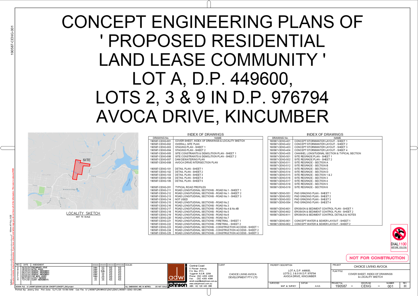
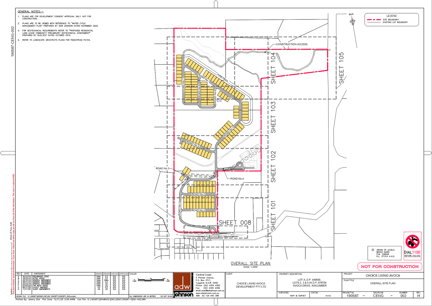
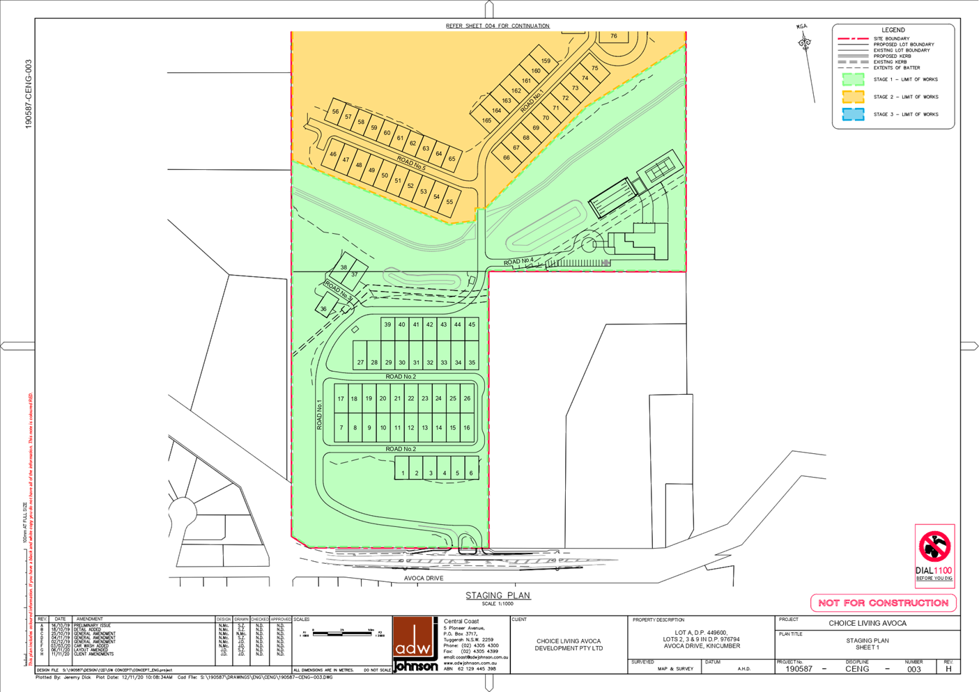
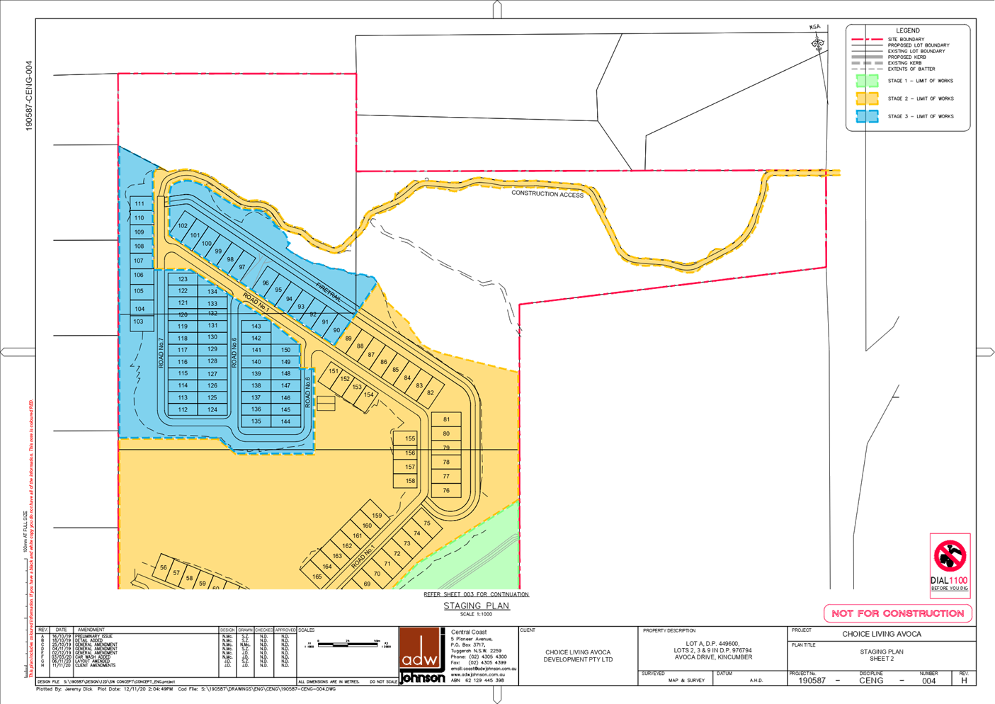
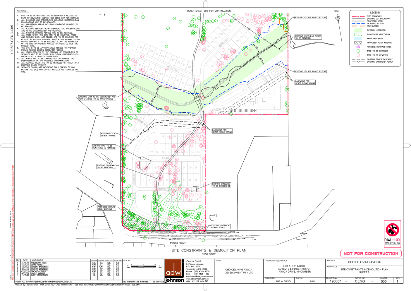
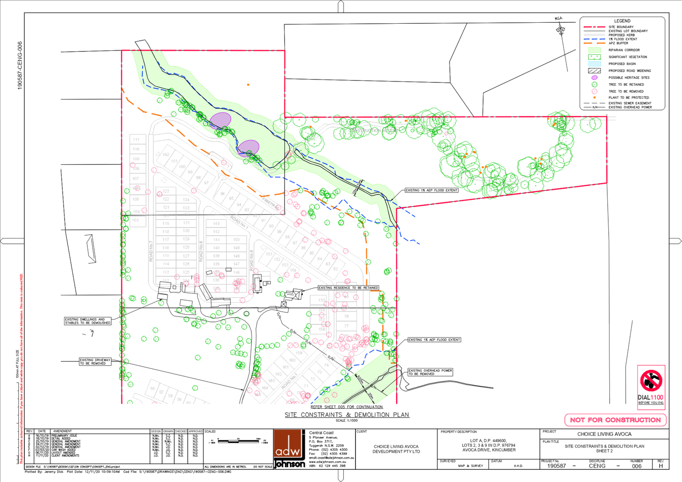
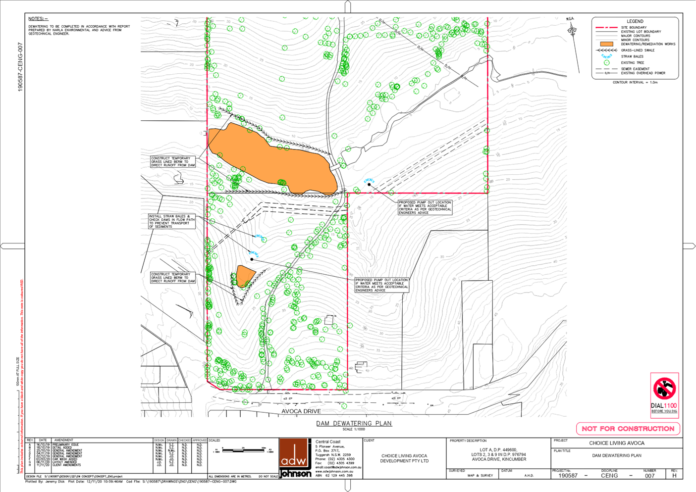
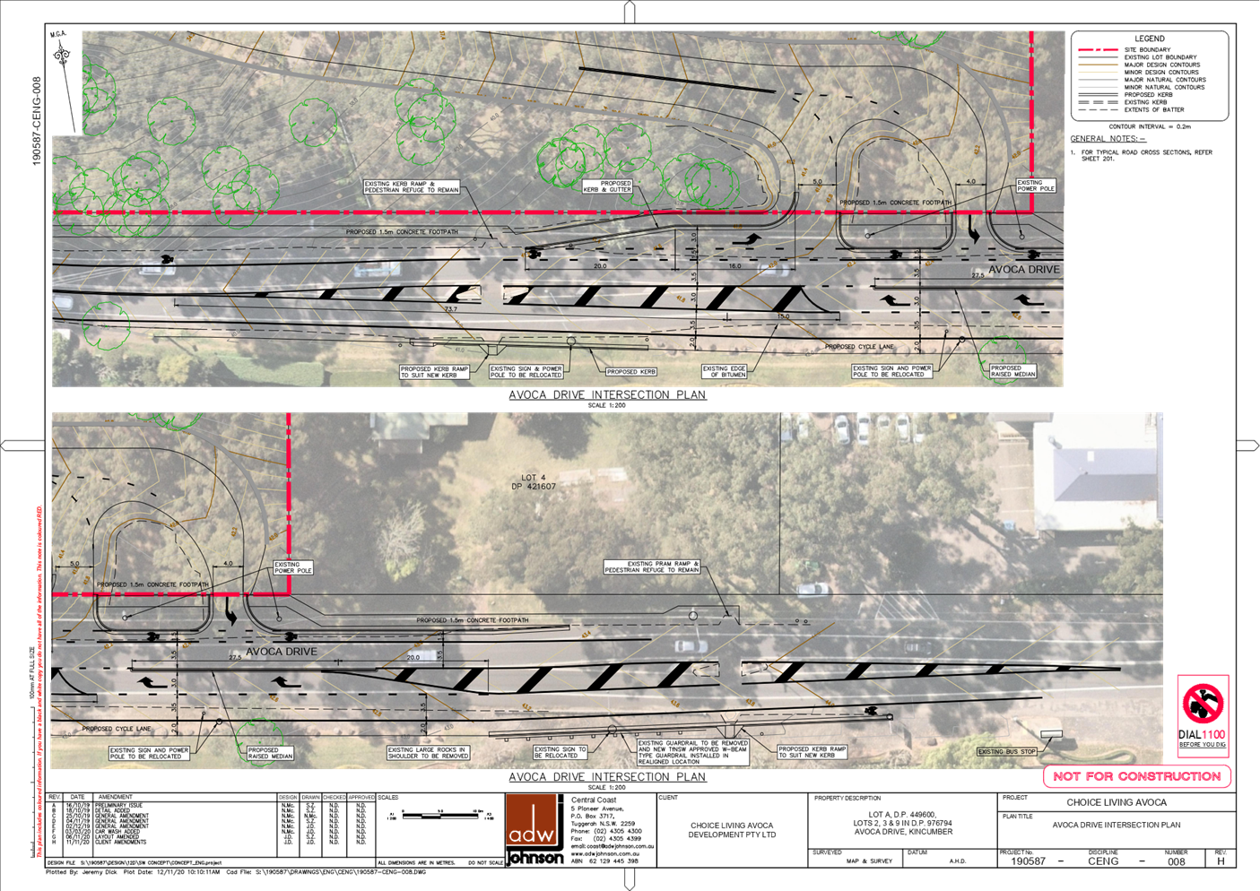
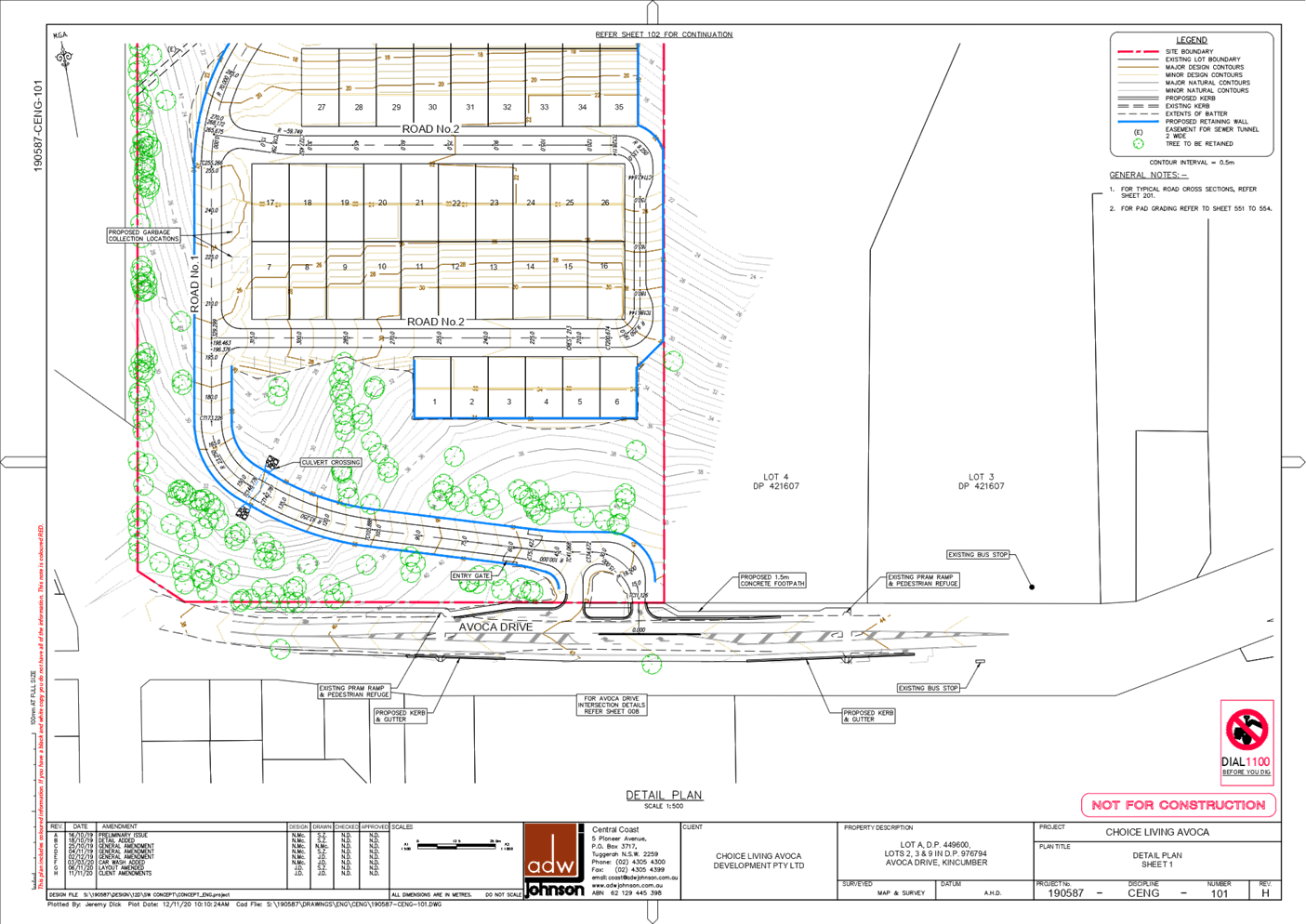
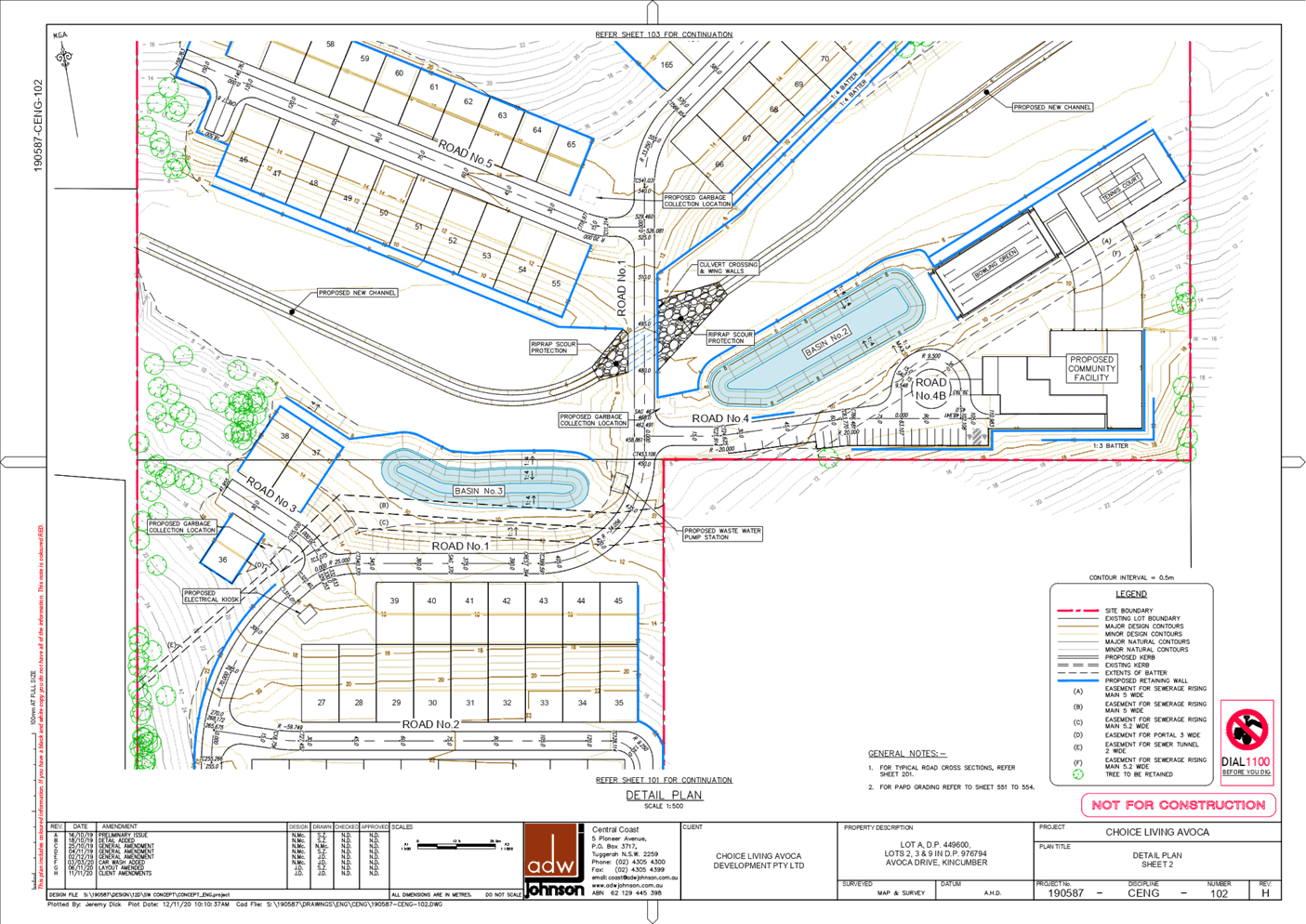
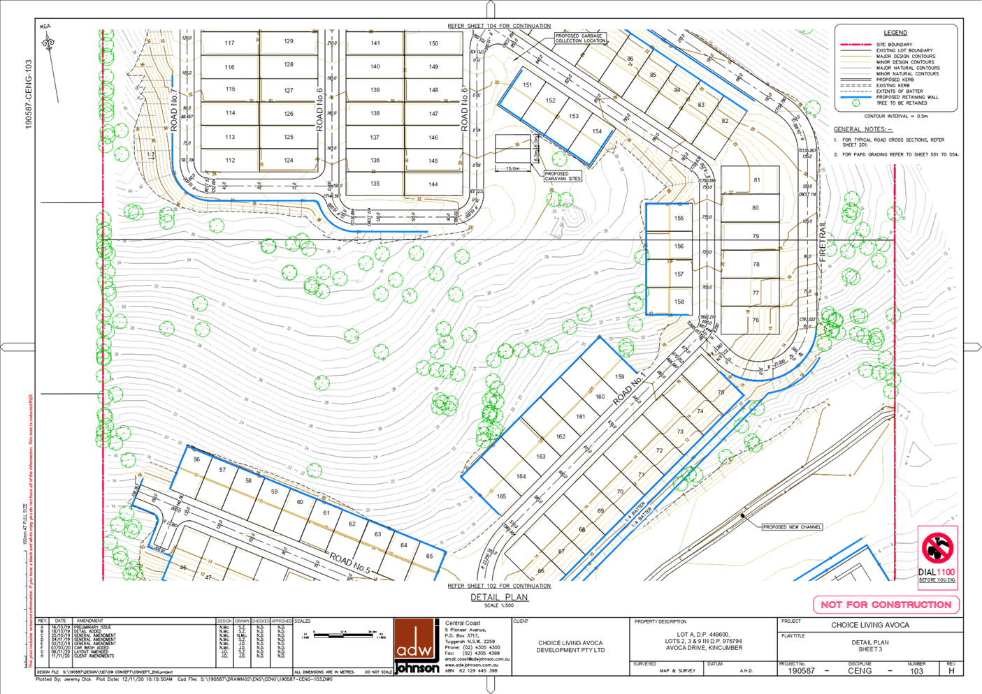
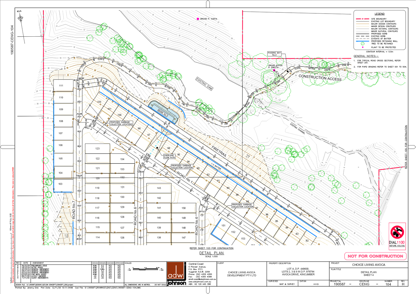
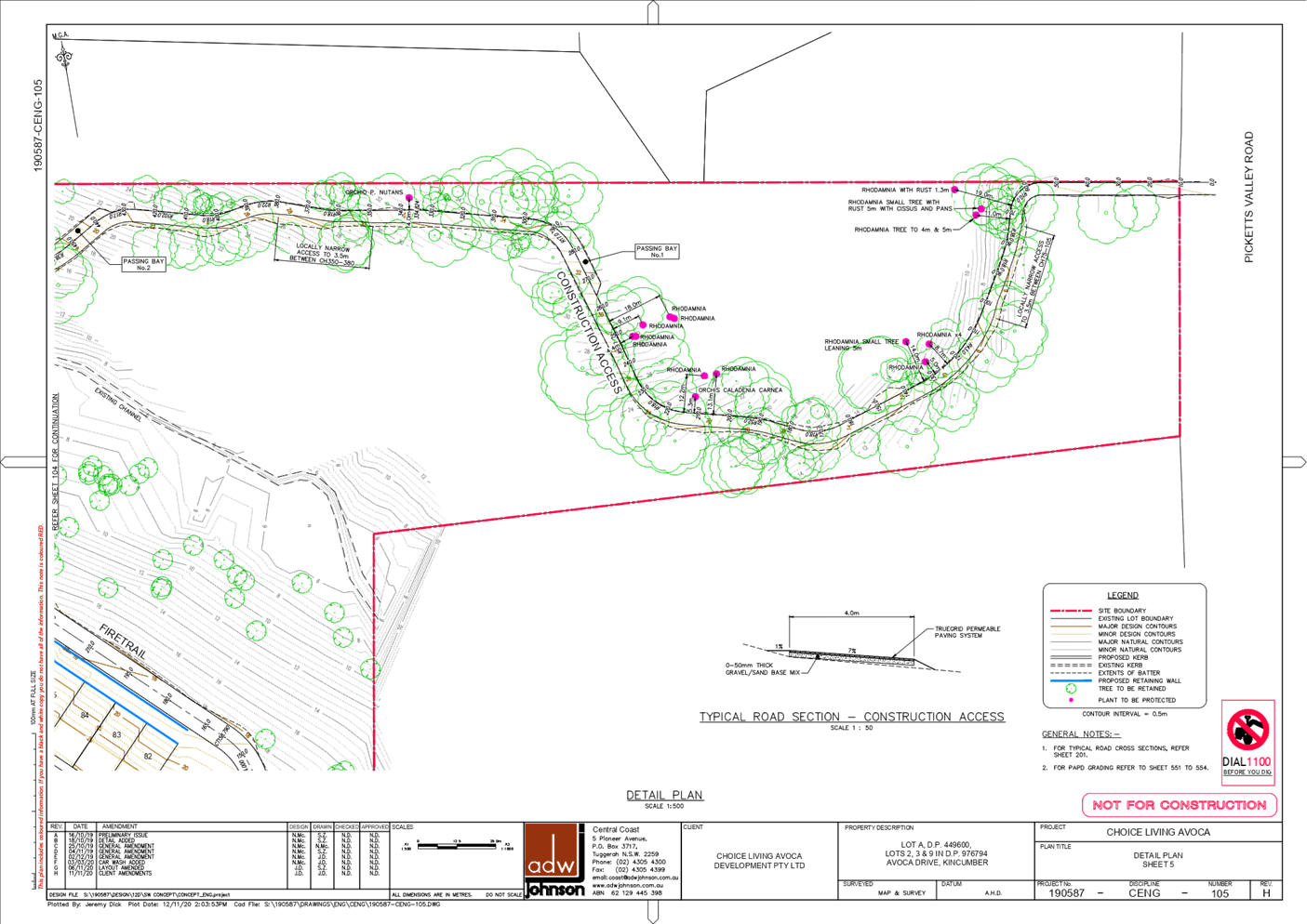
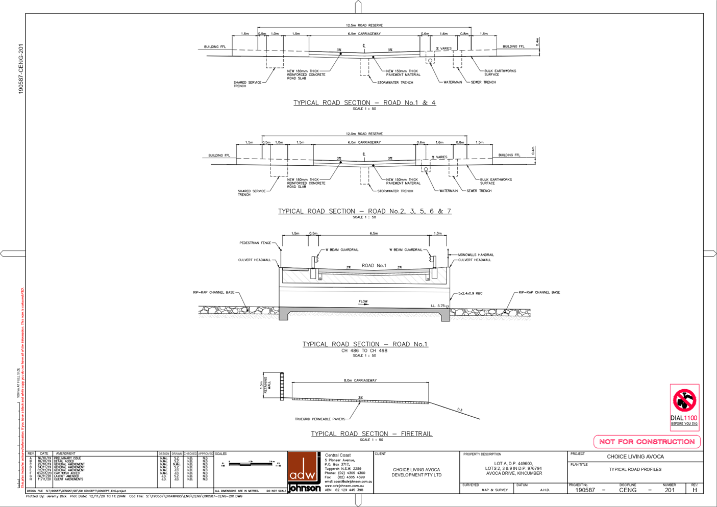
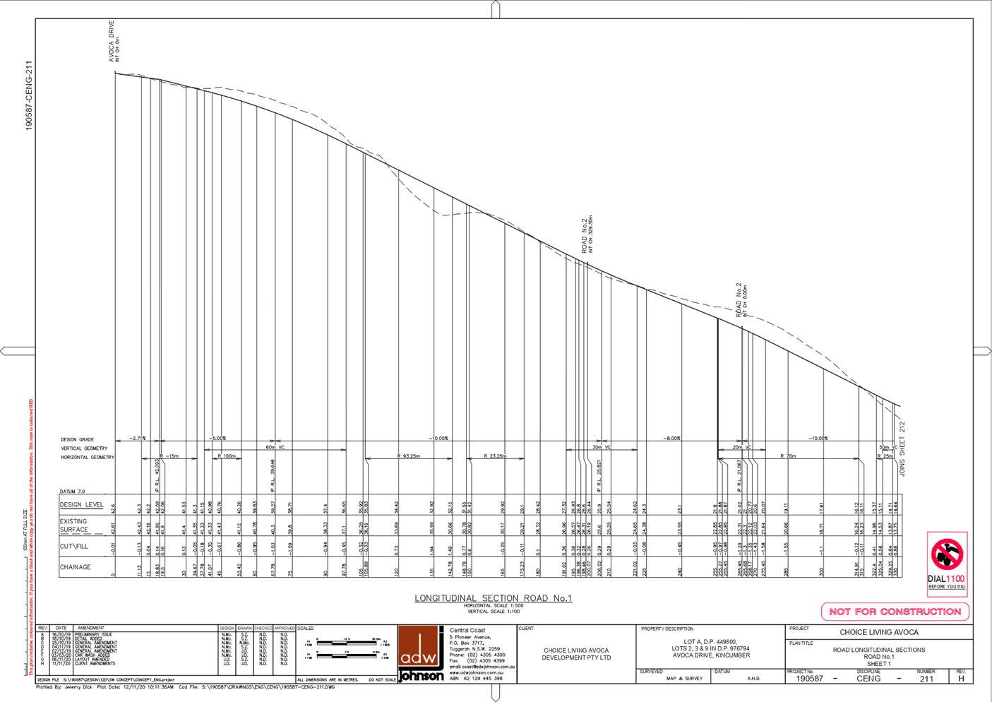
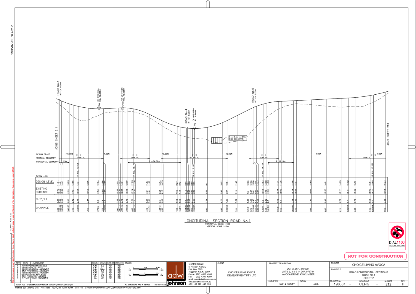
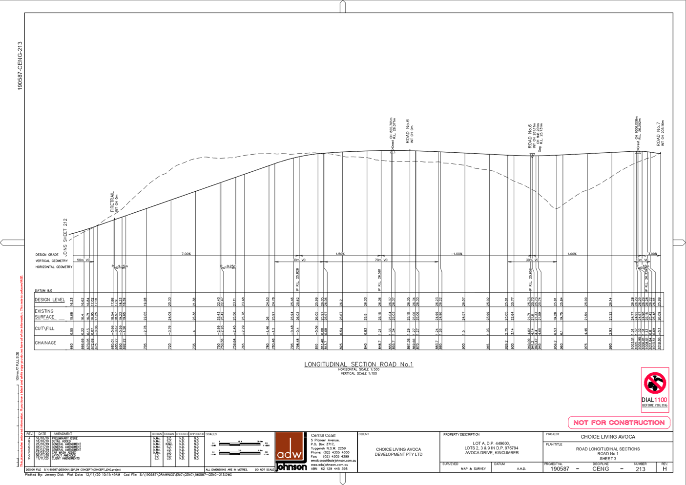
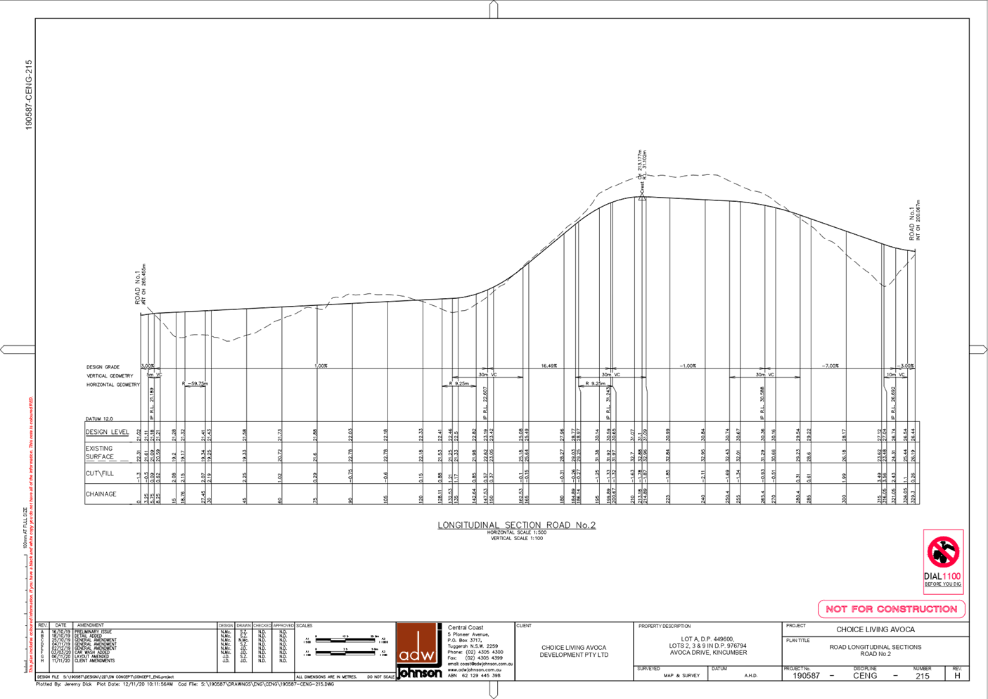
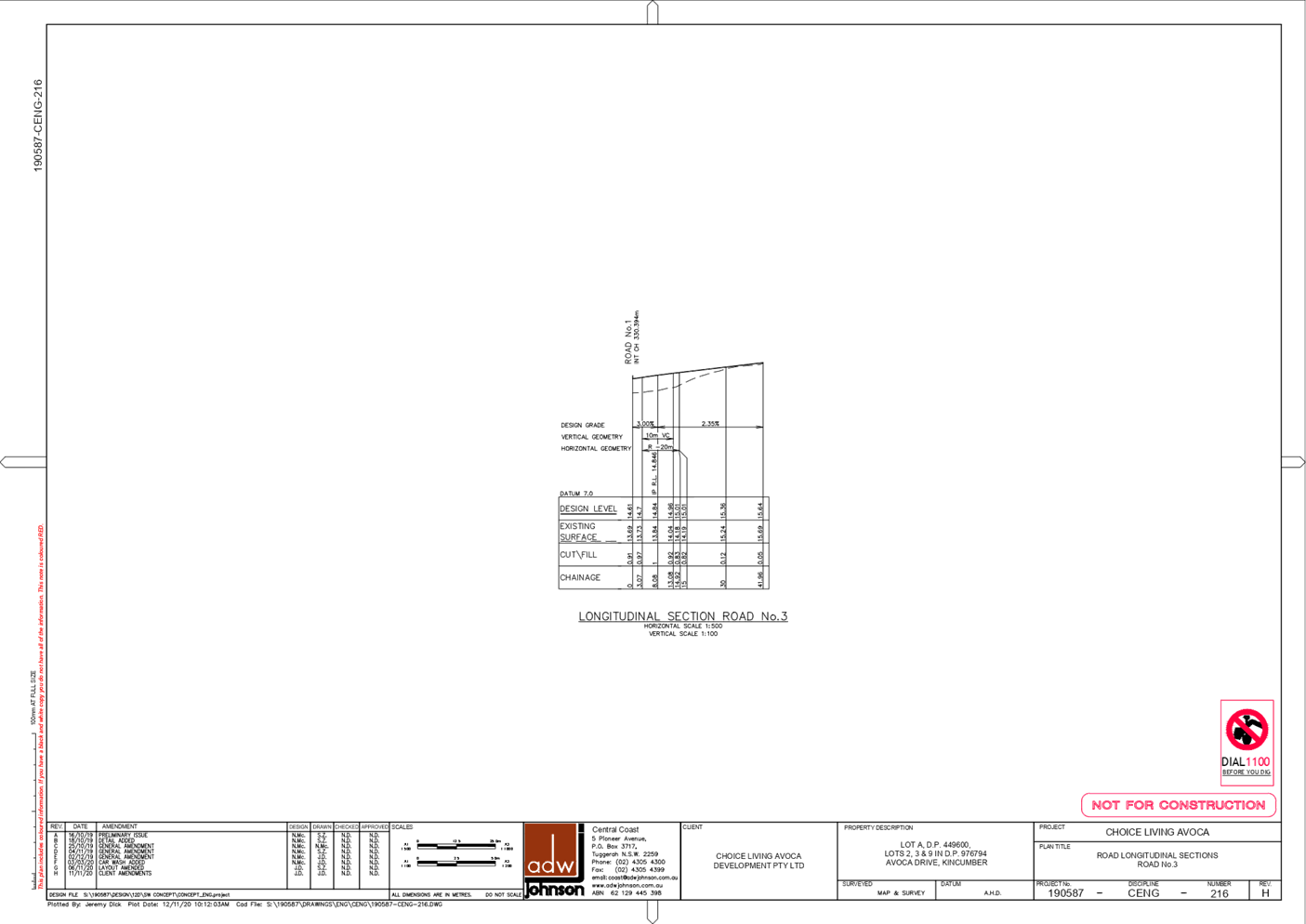
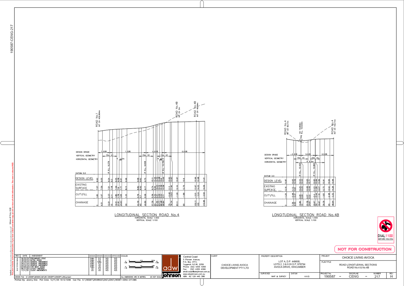
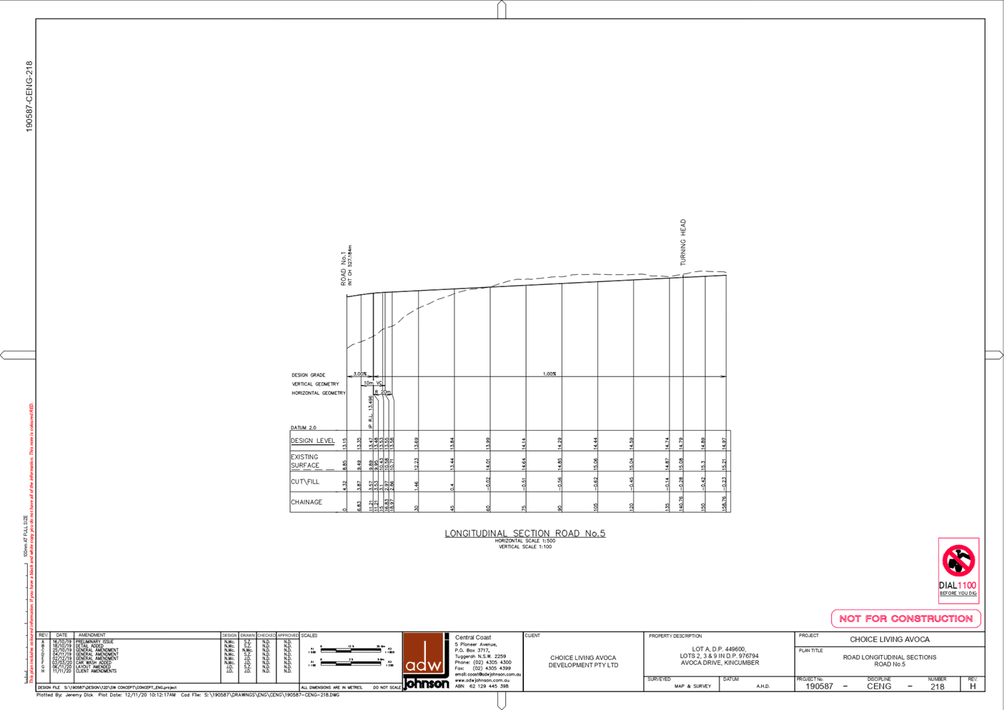
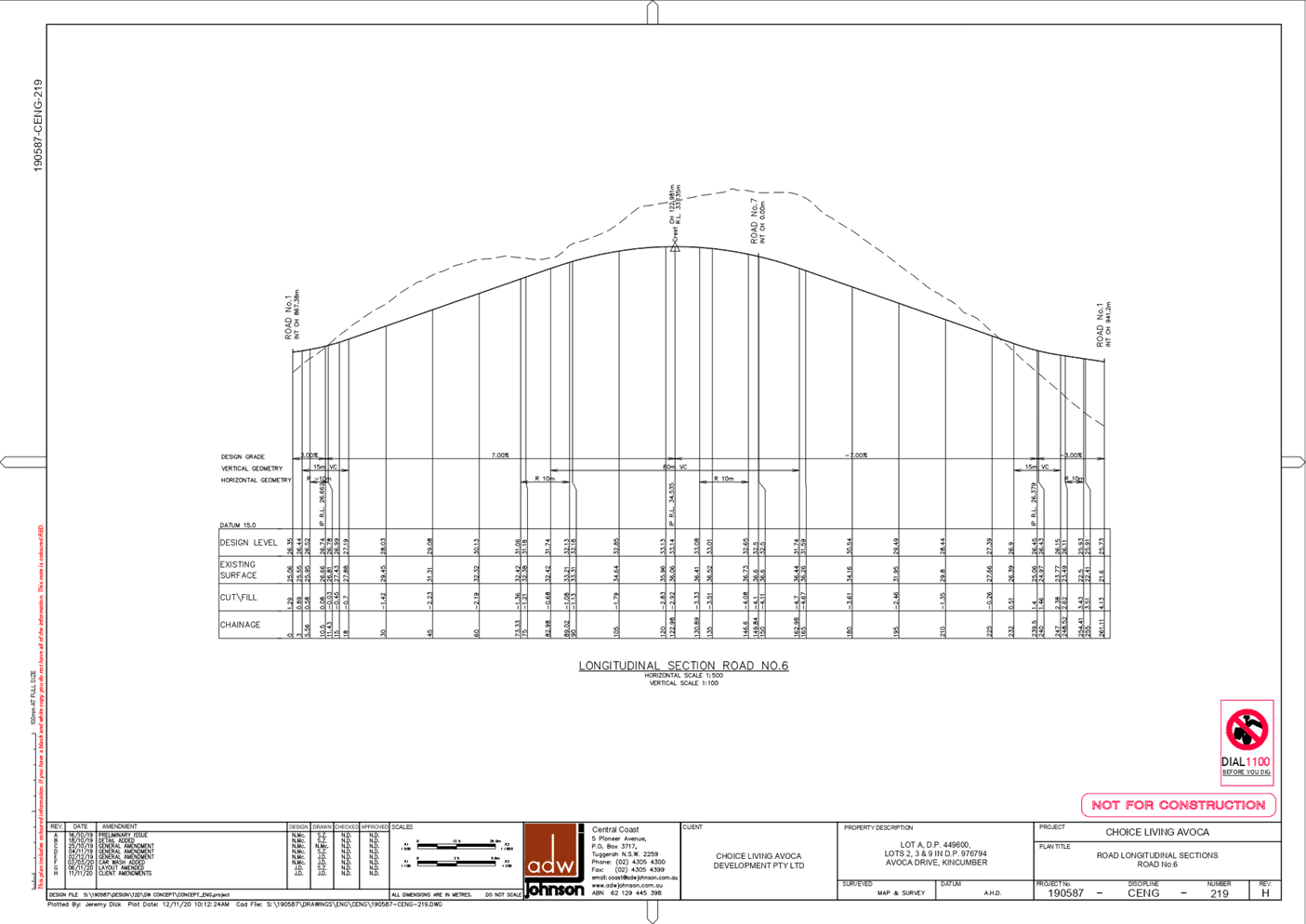
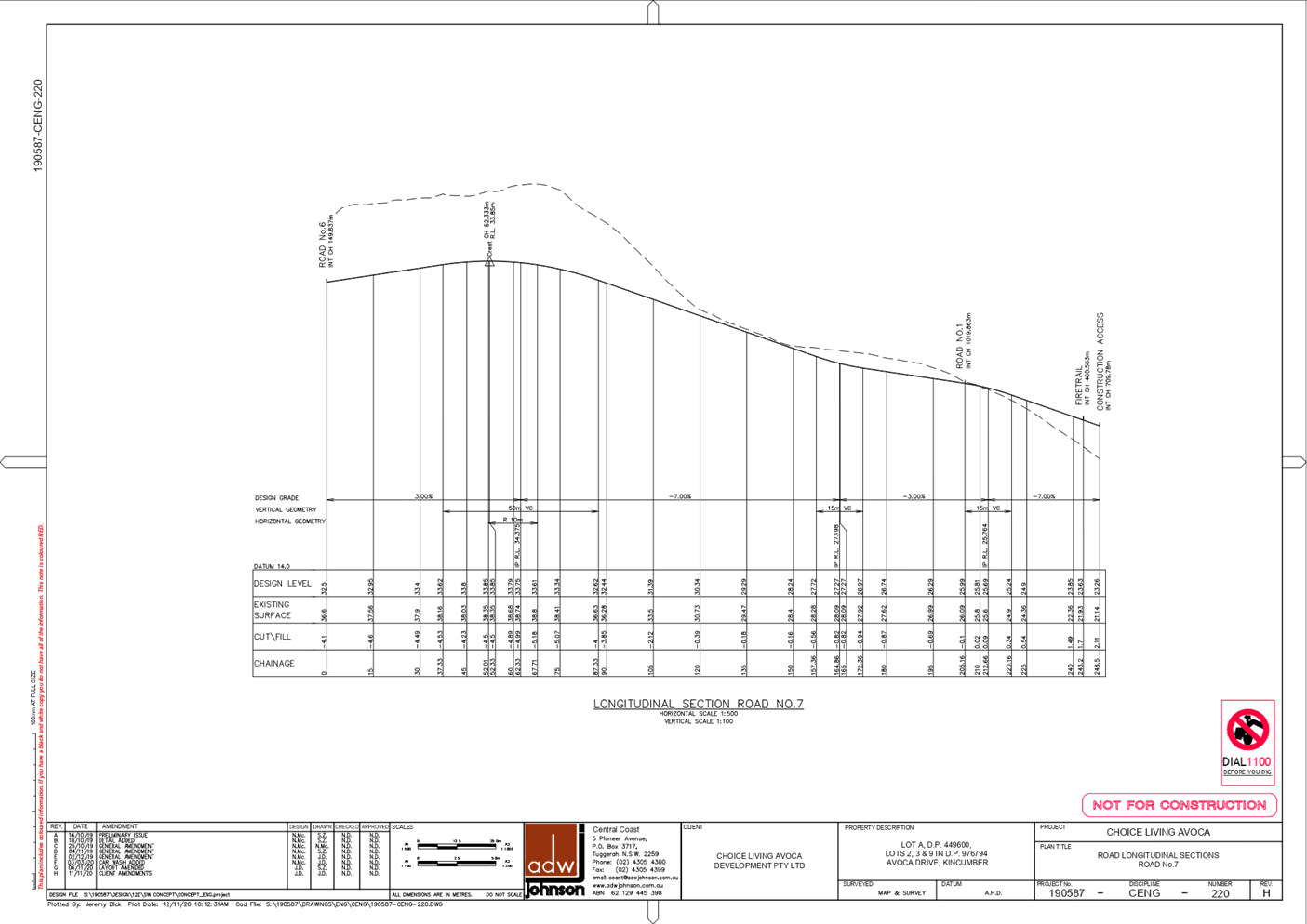
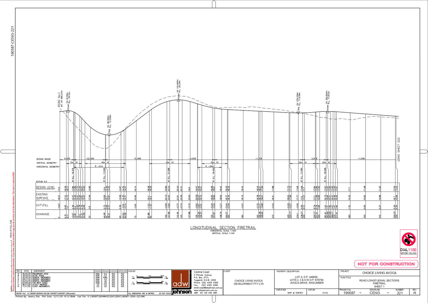
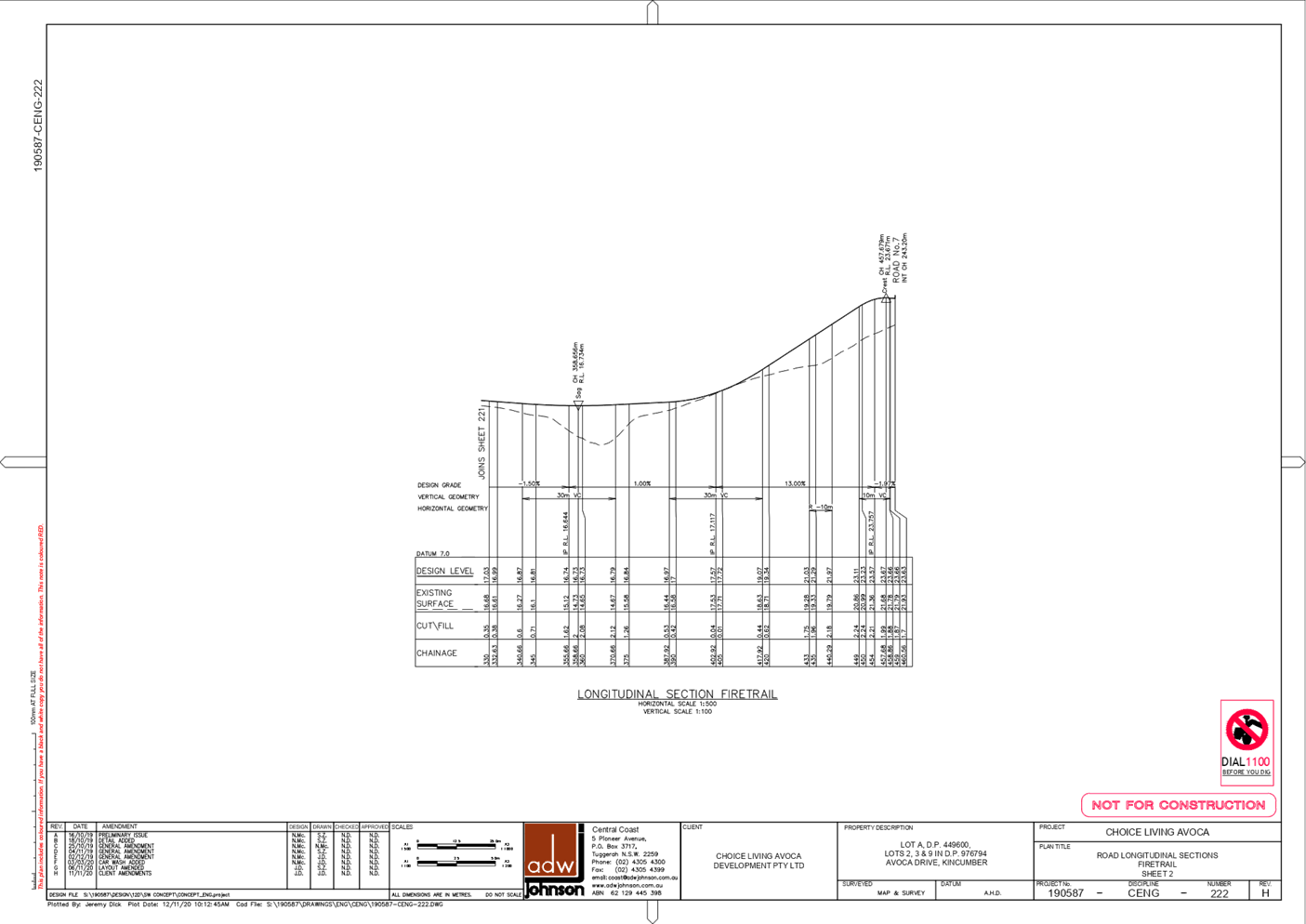
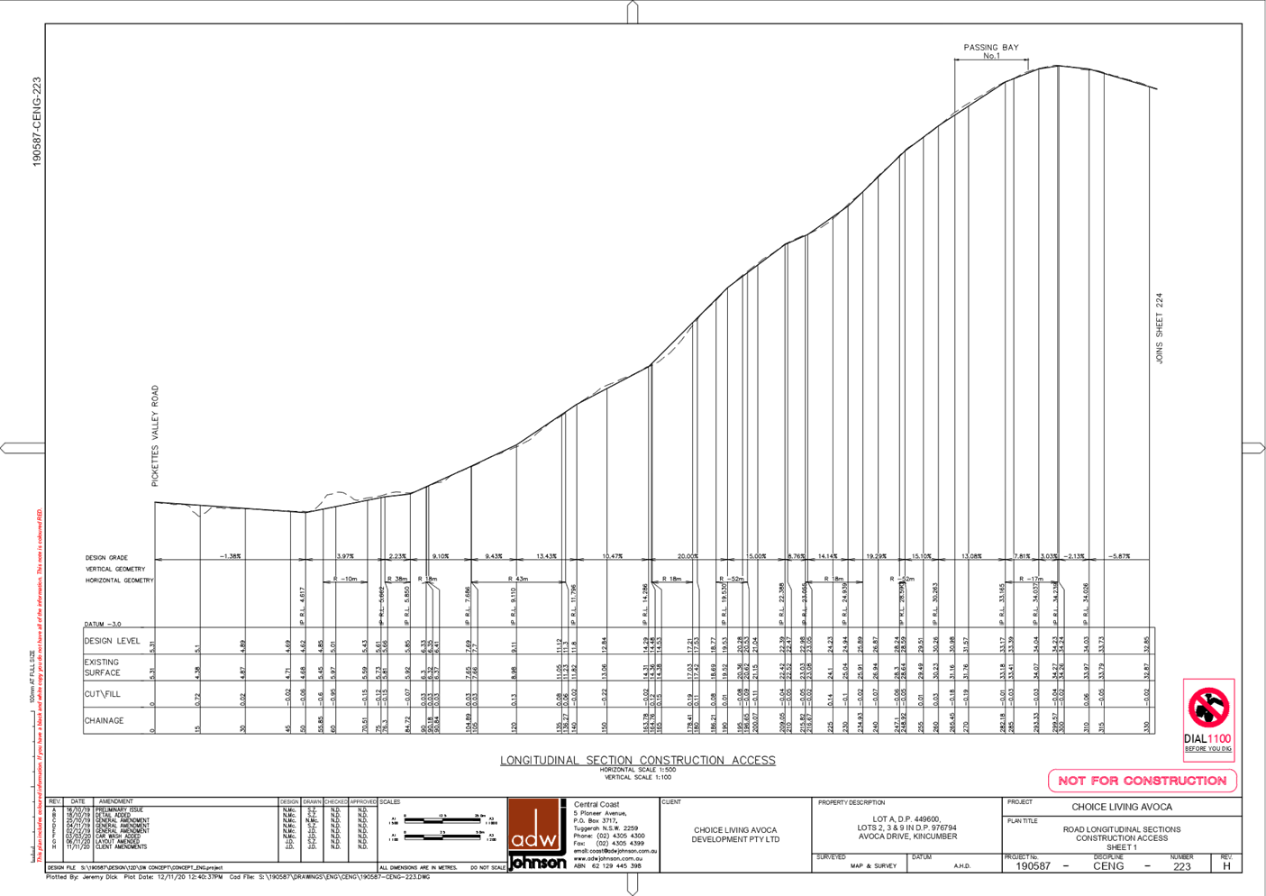
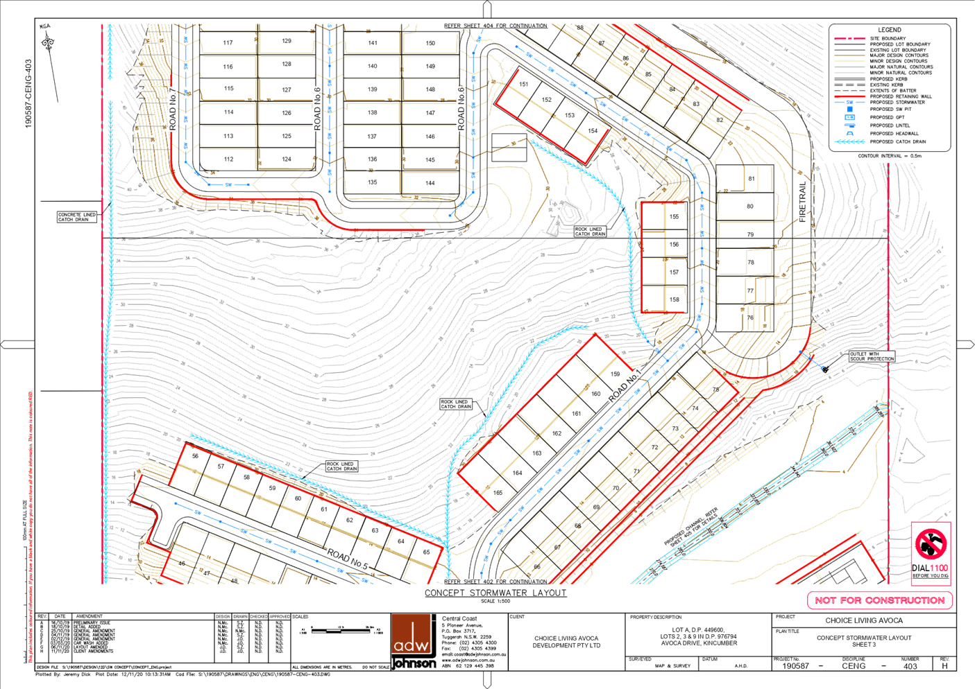
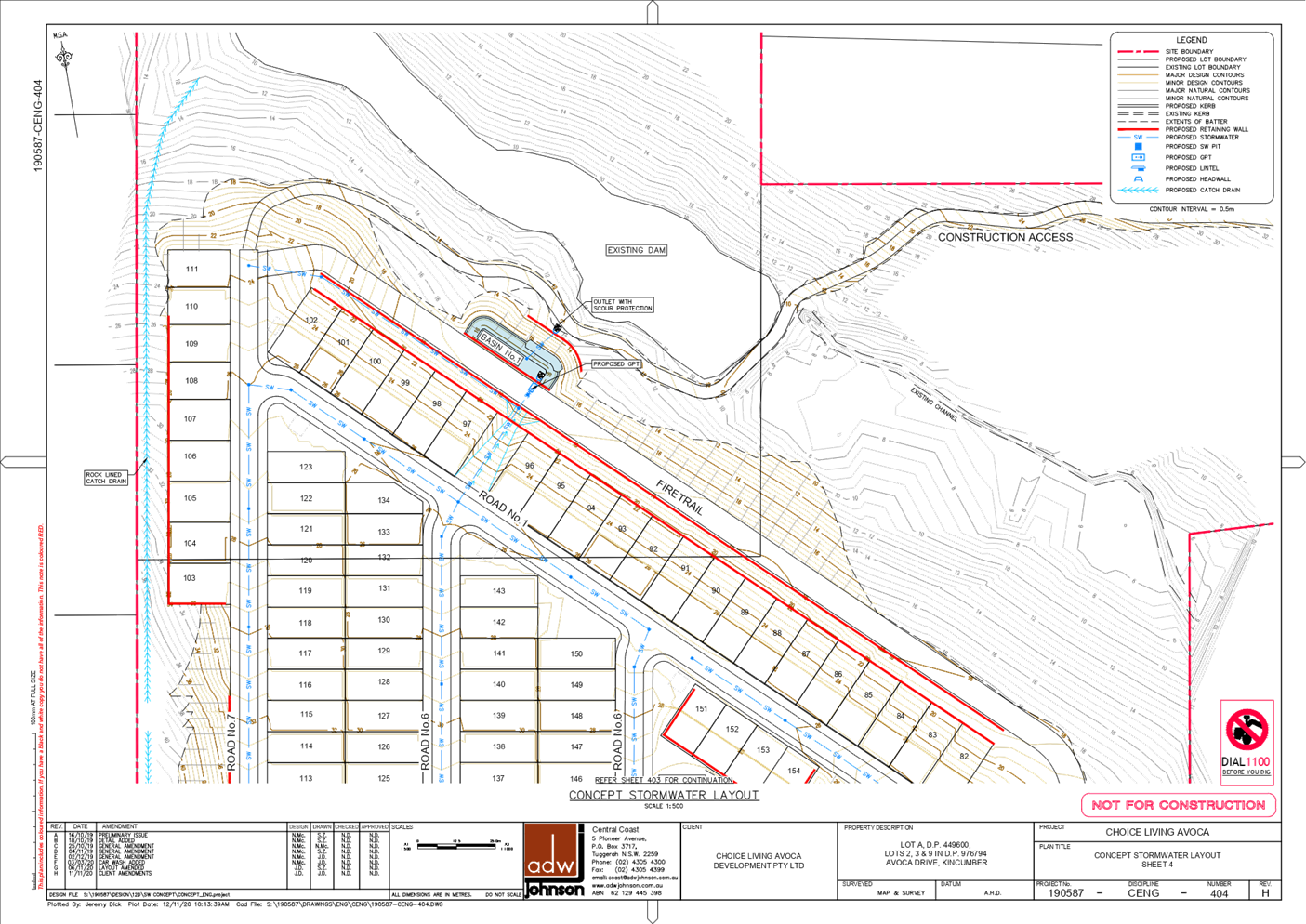
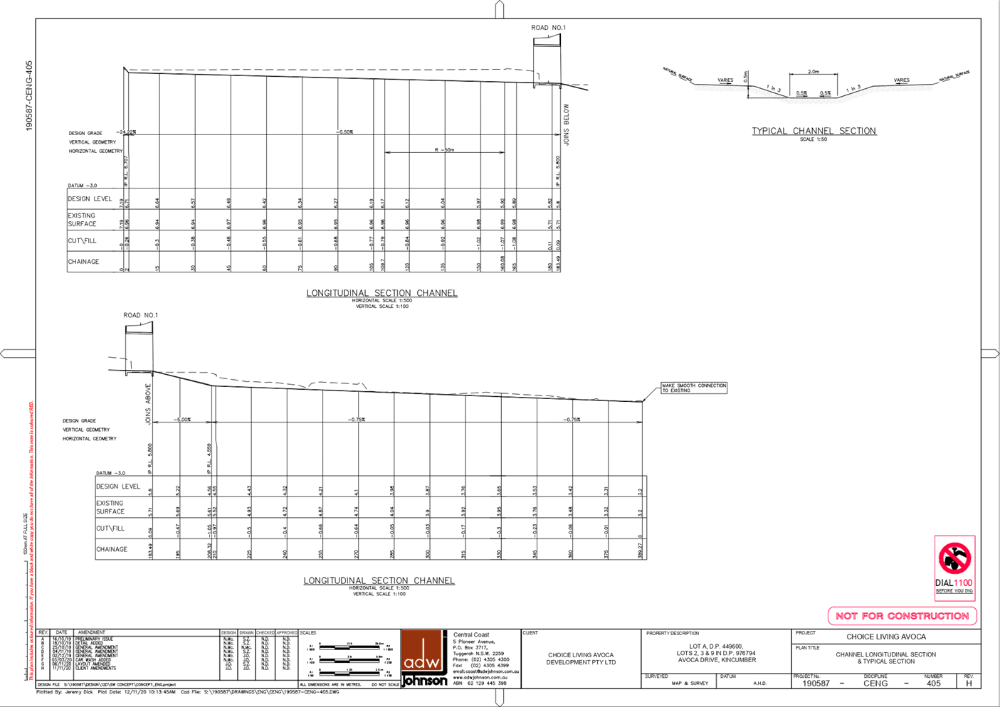
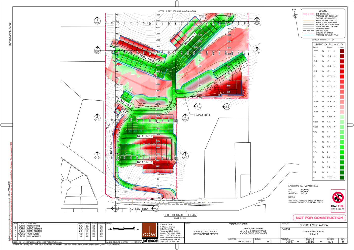
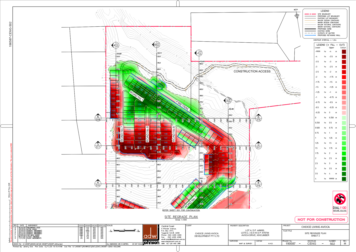
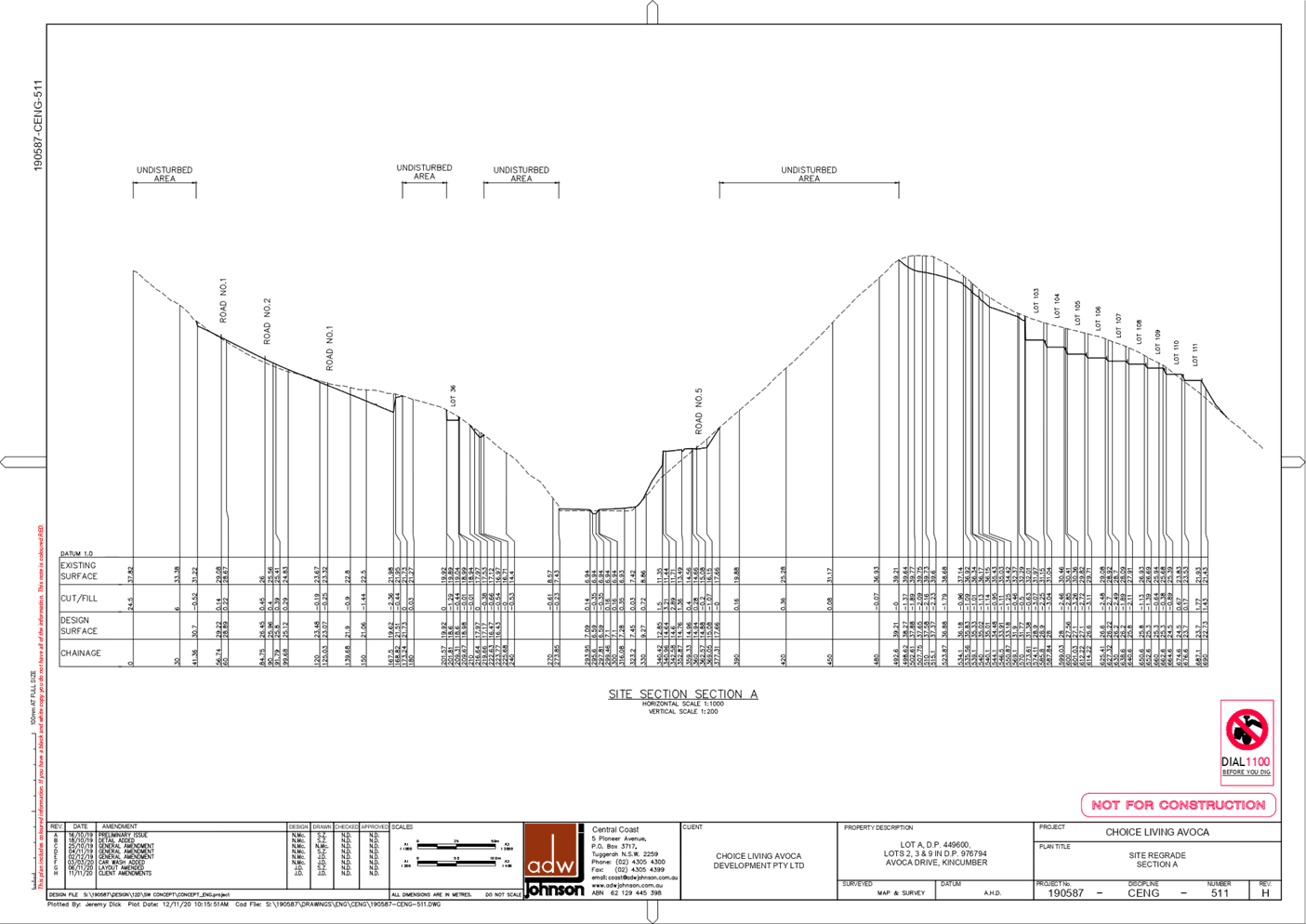
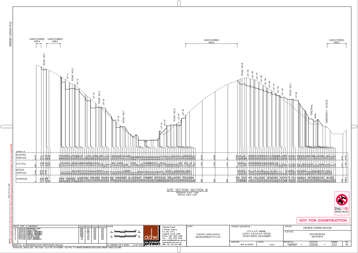
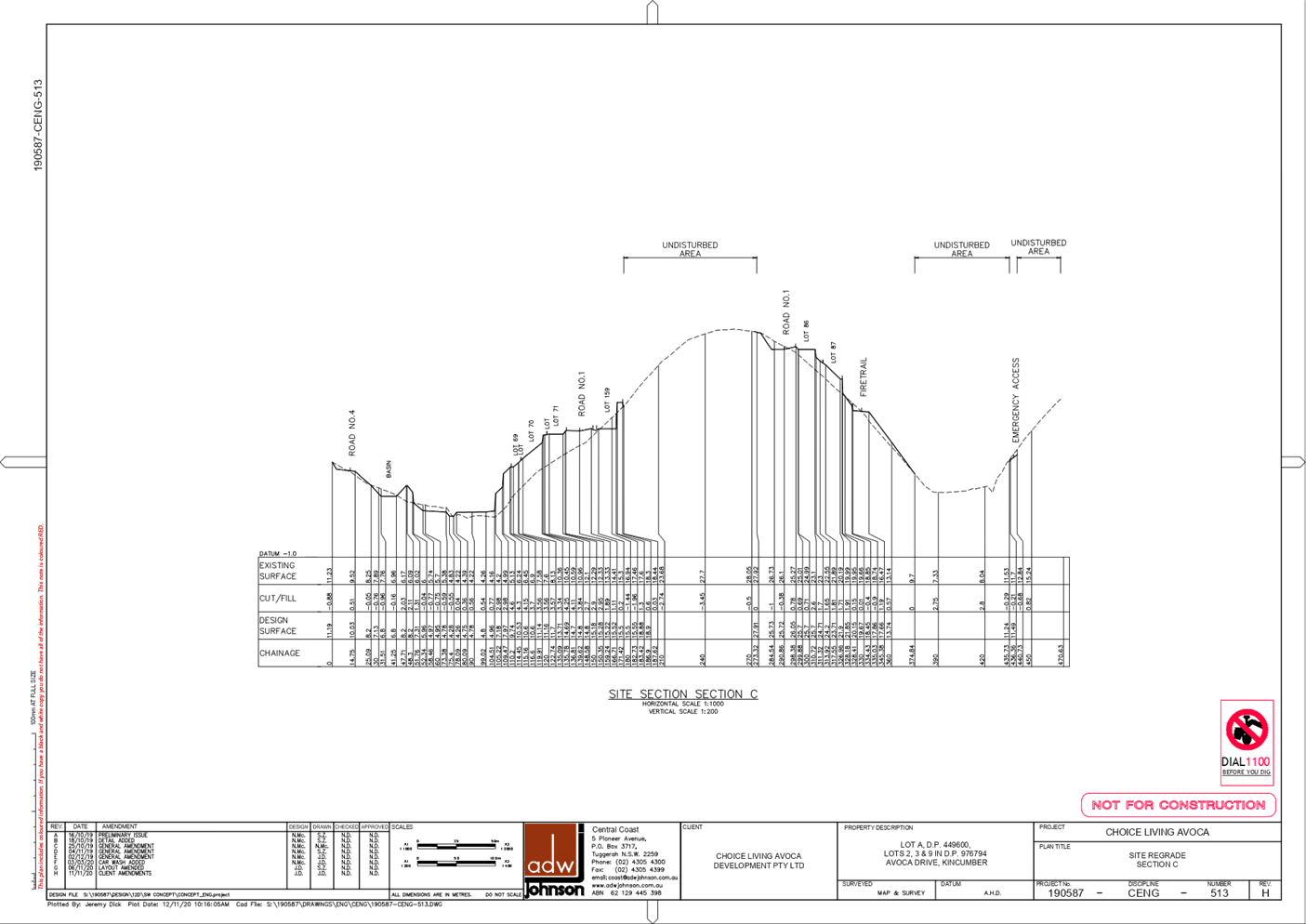
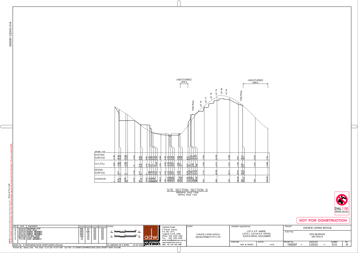
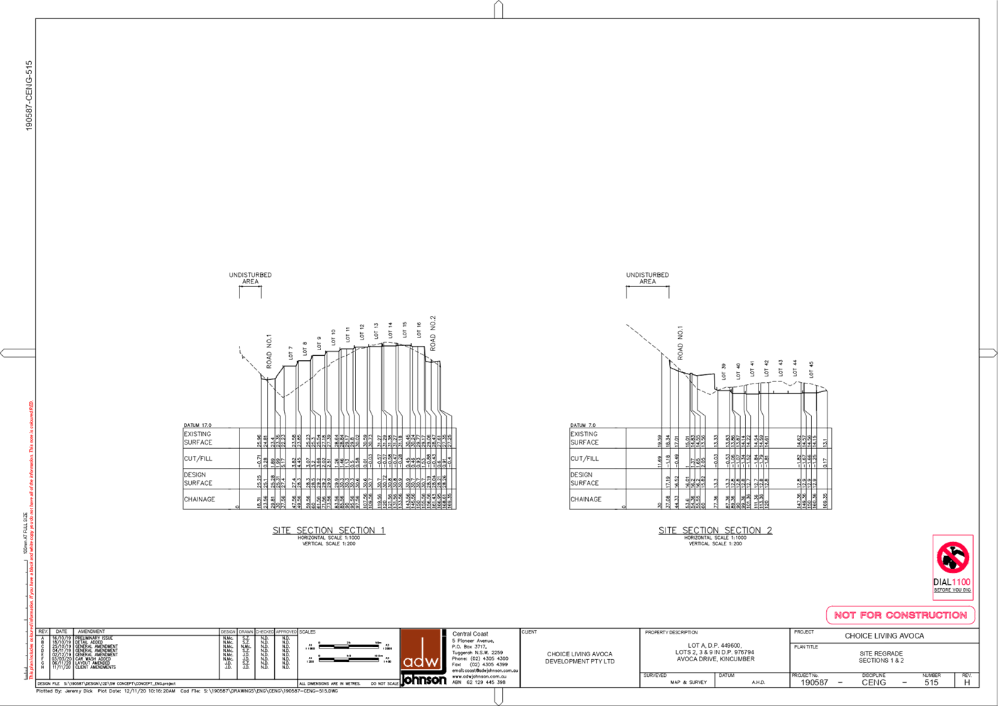
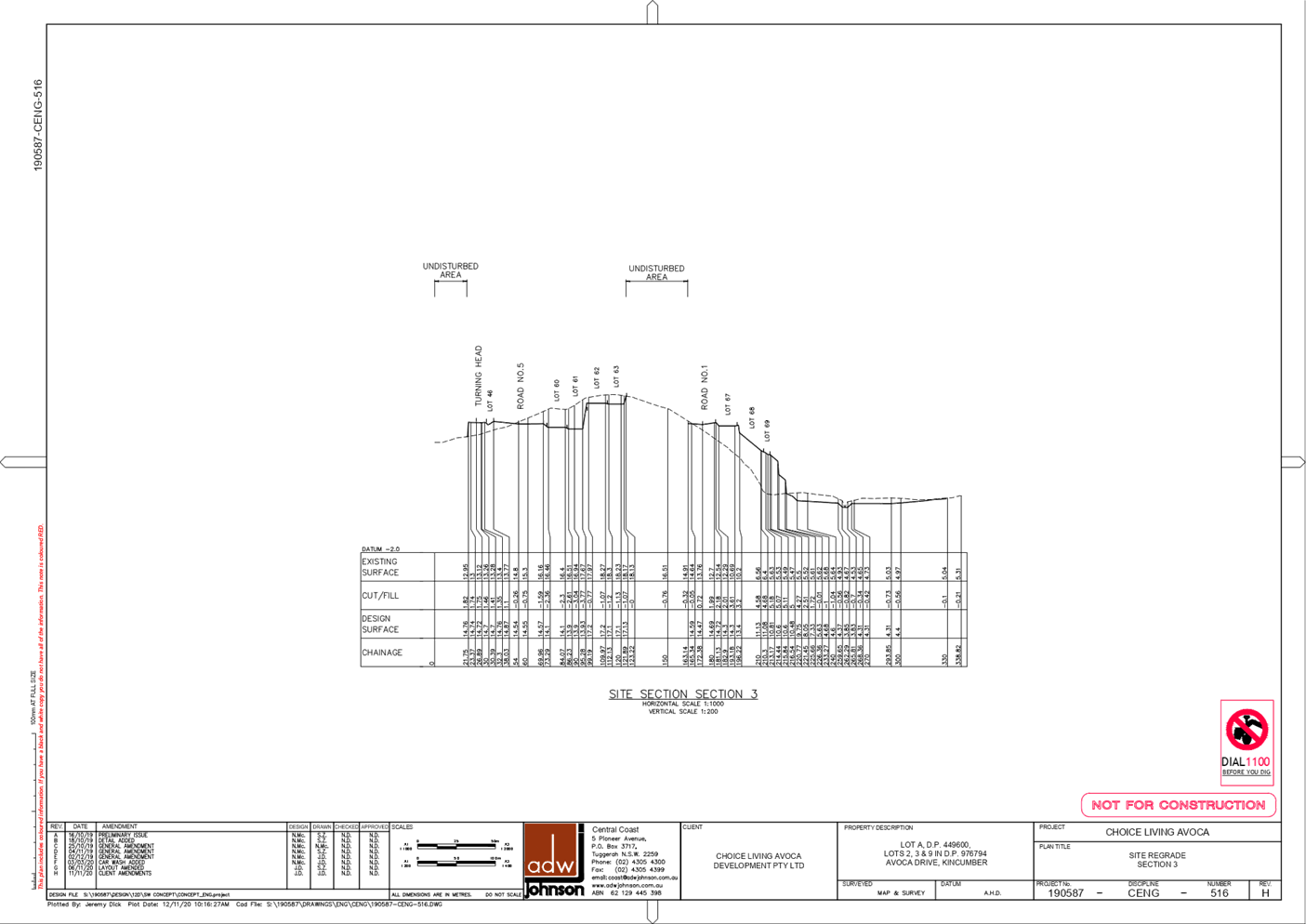
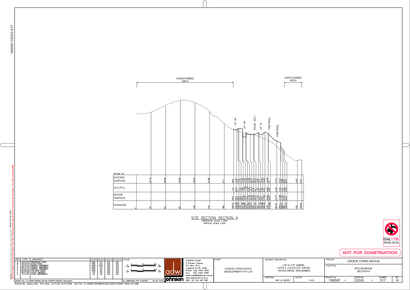
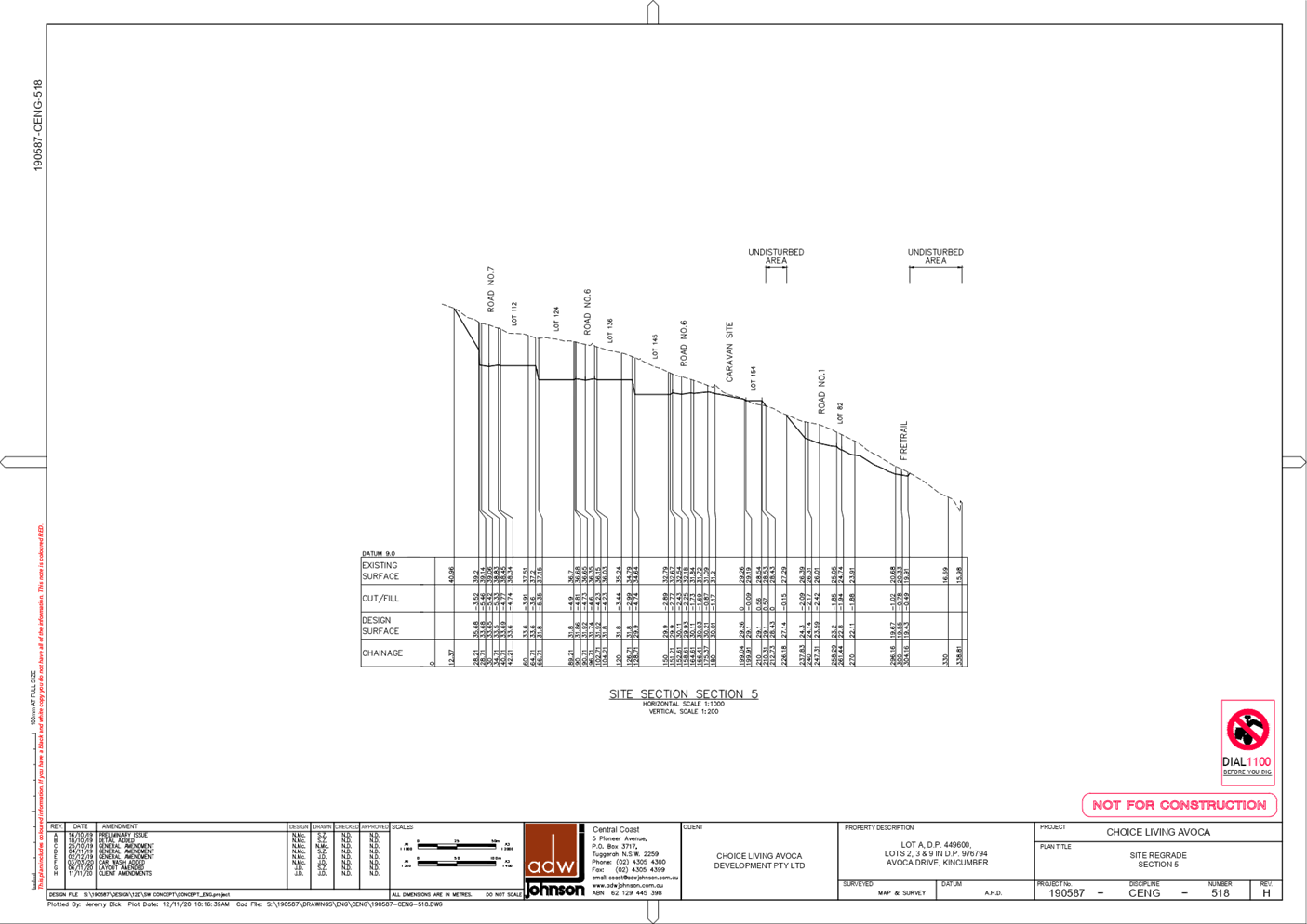
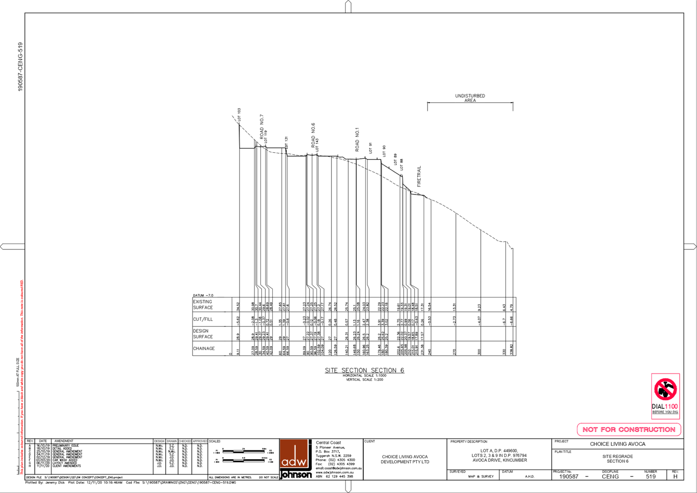
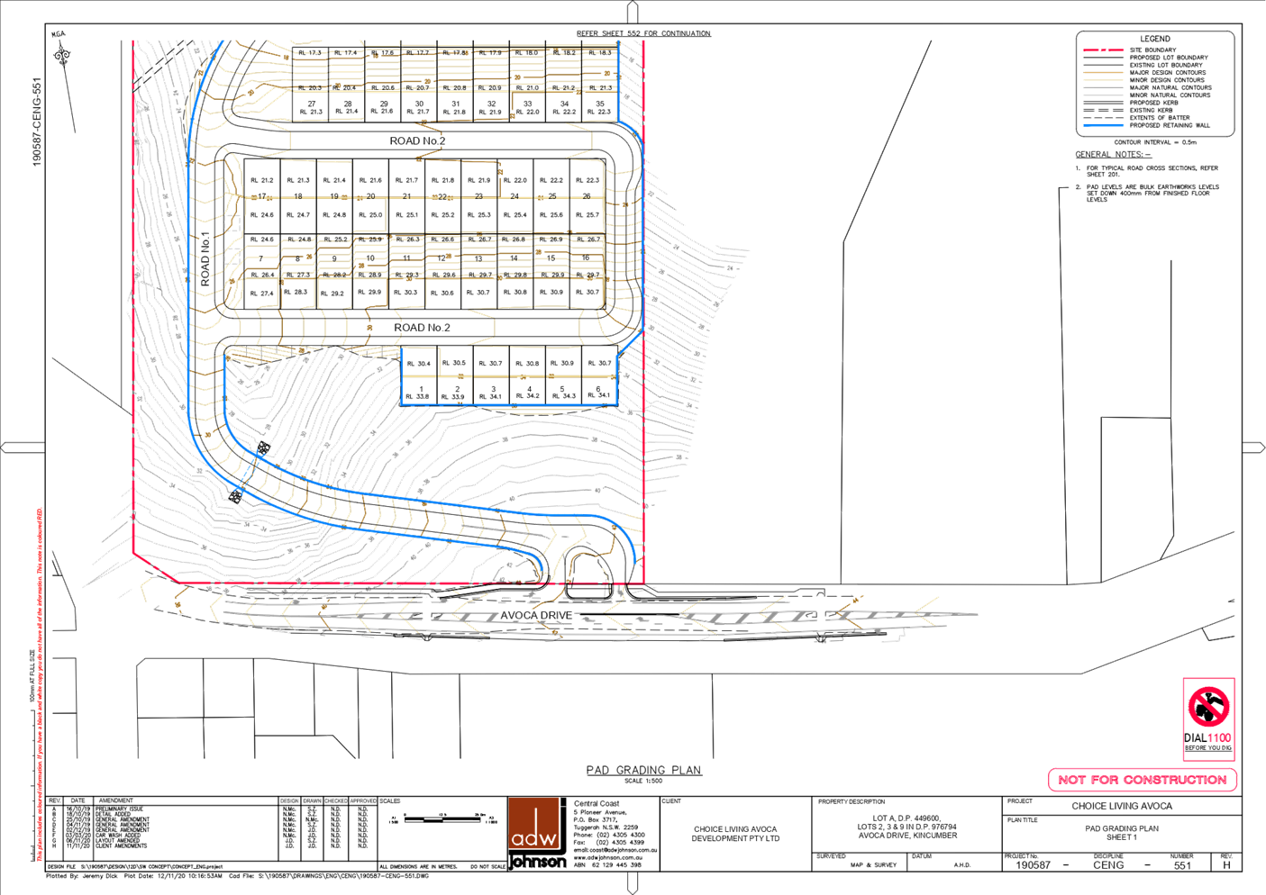
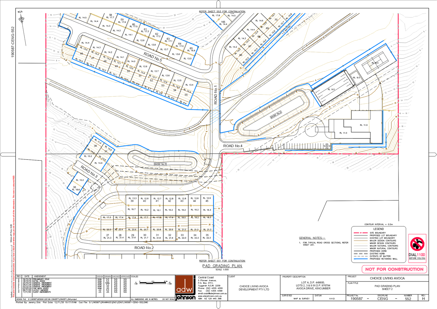
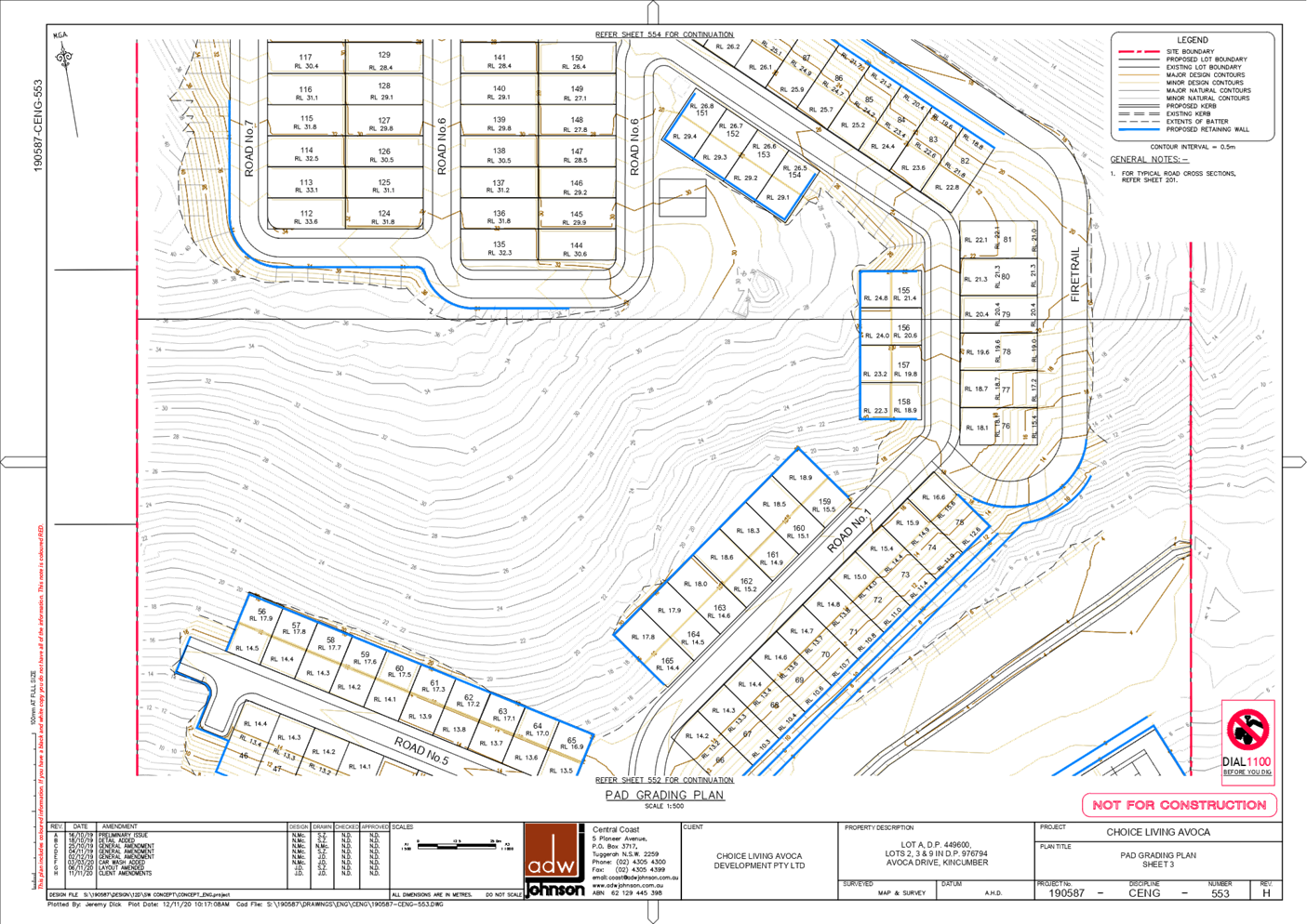
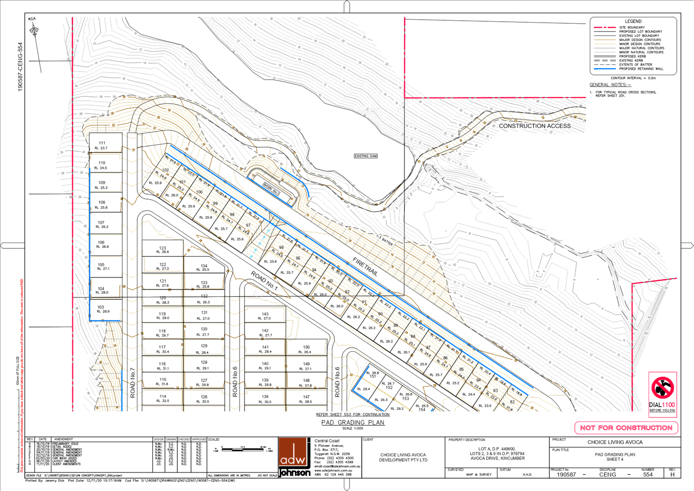
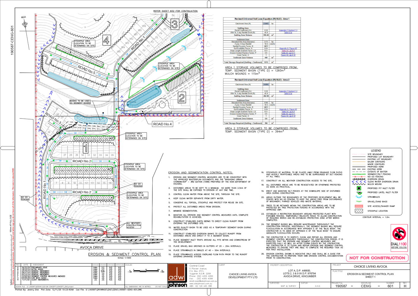
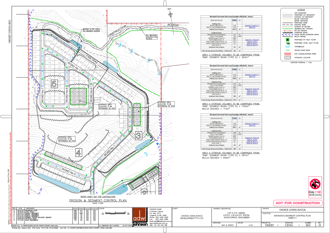
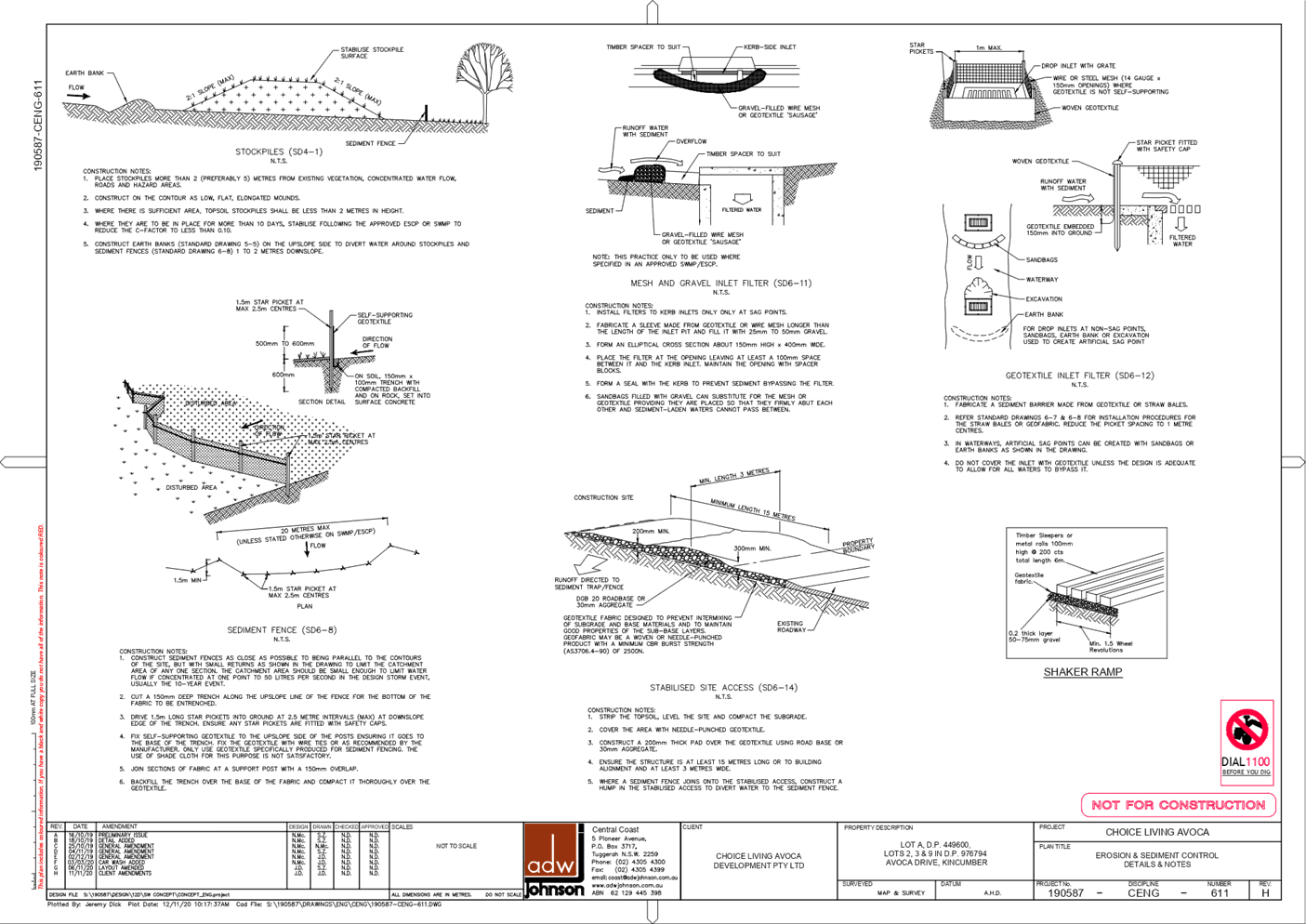
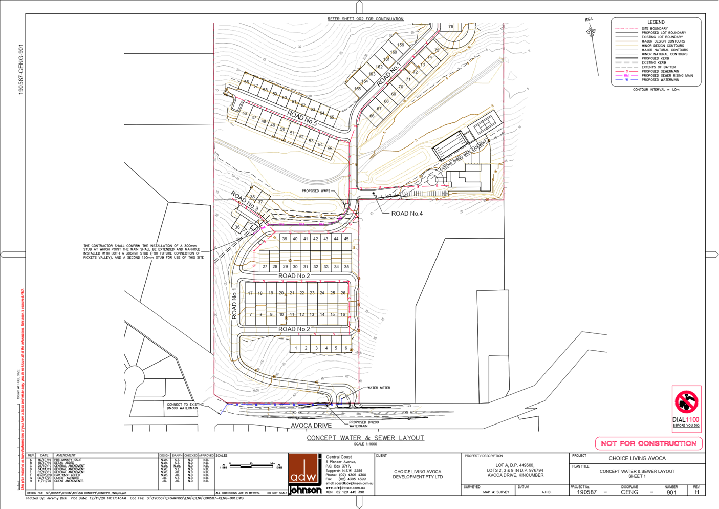
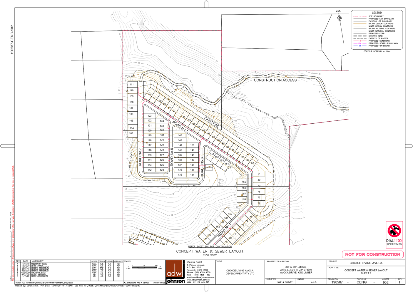
|
3.2
|
Section
8.2 Review of Determination - DA/57698/2019 - Staged Caravan Park (165 sites)
at 255, 255A, 255B Avoca Drive, Kincumber and 19 Picketts Valley Road,
Picketts Valley
|
|
Attachment 3
|
Section
8.2A Landscape Plan
|
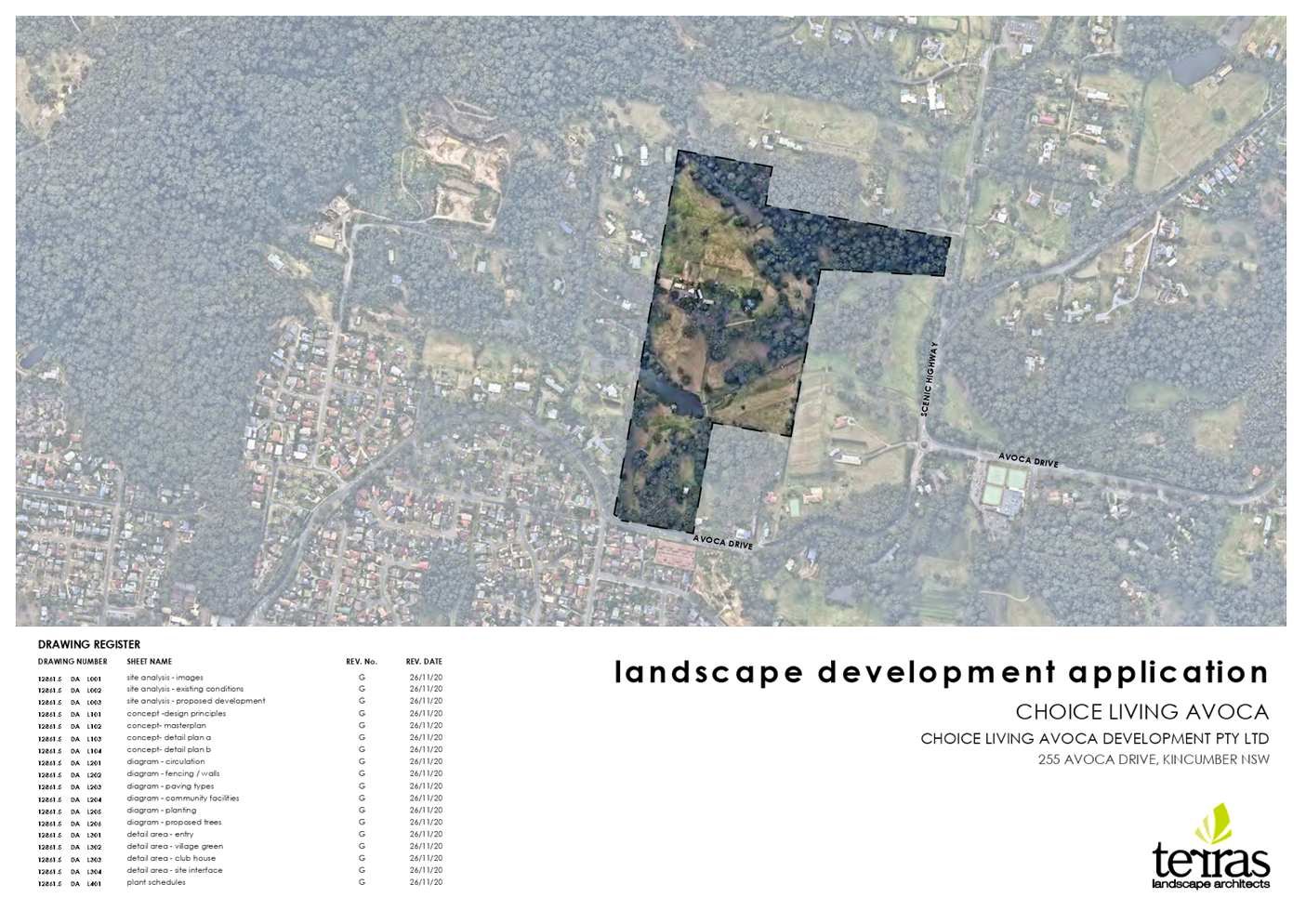
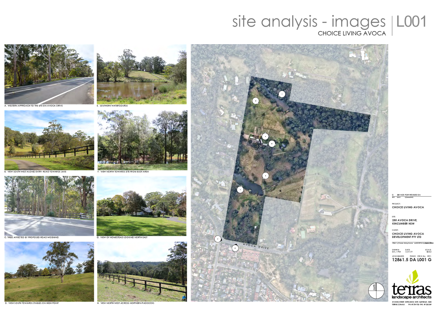
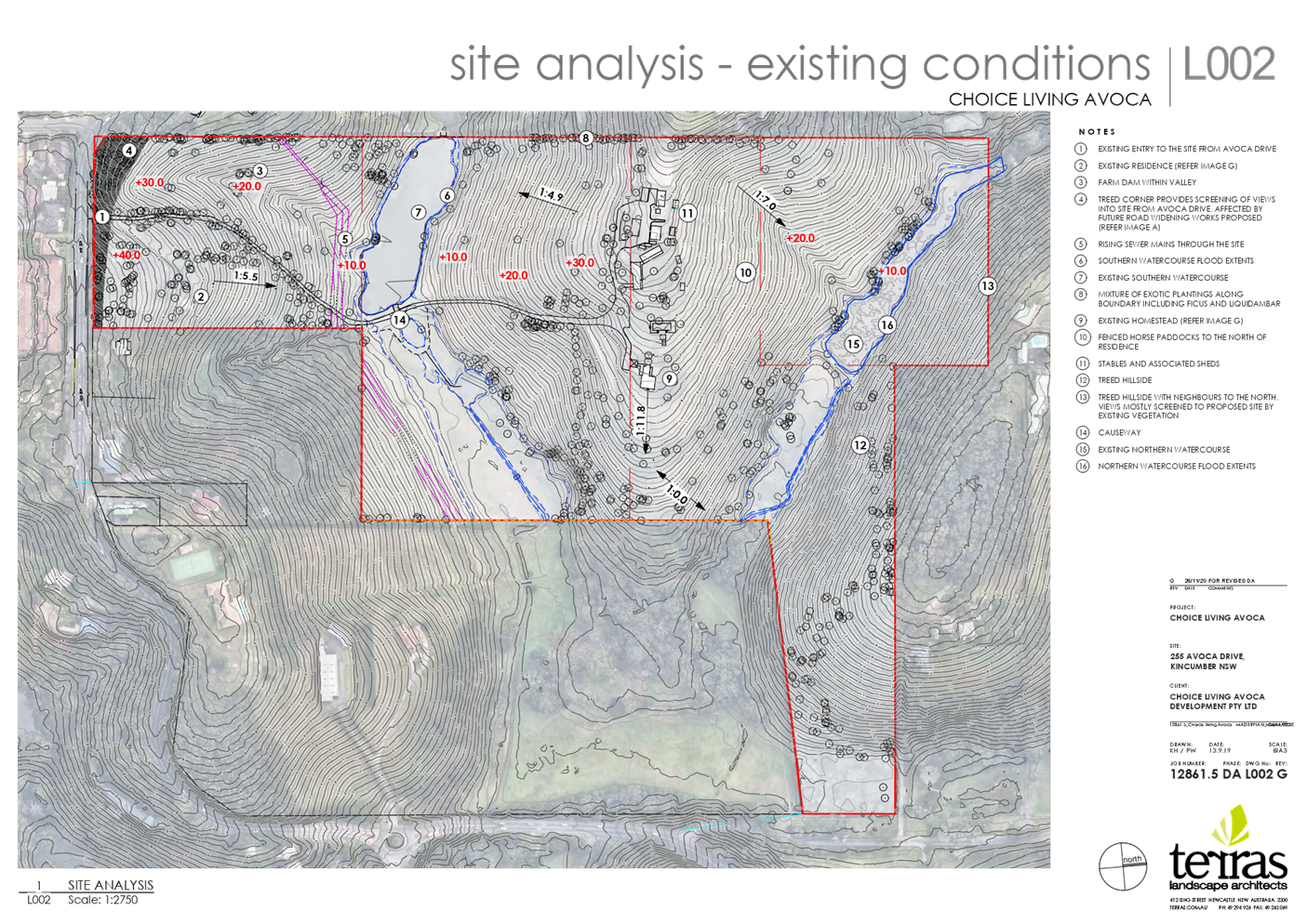
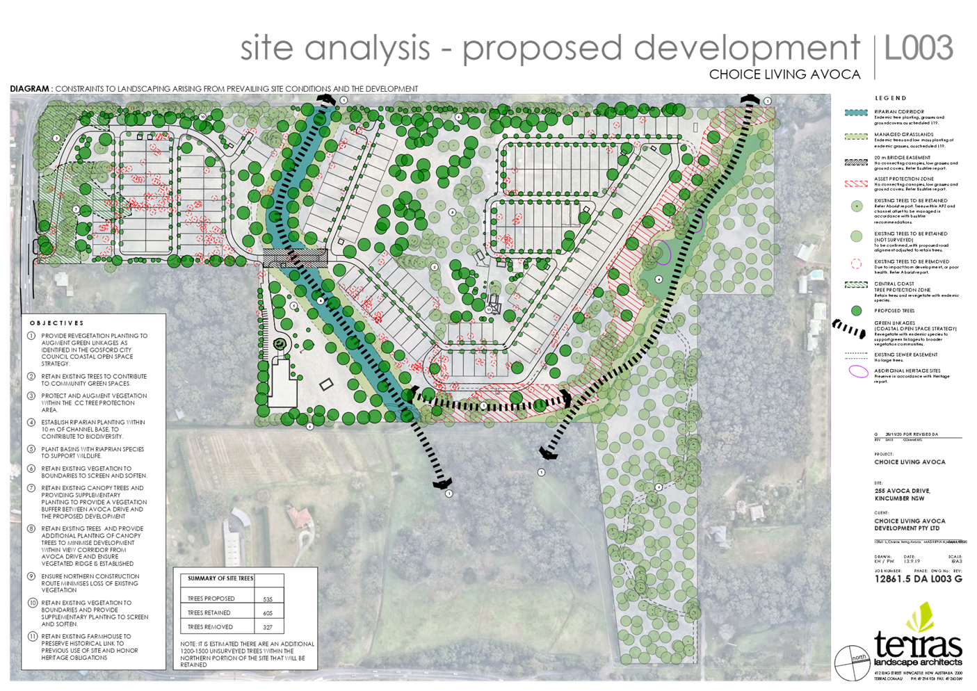
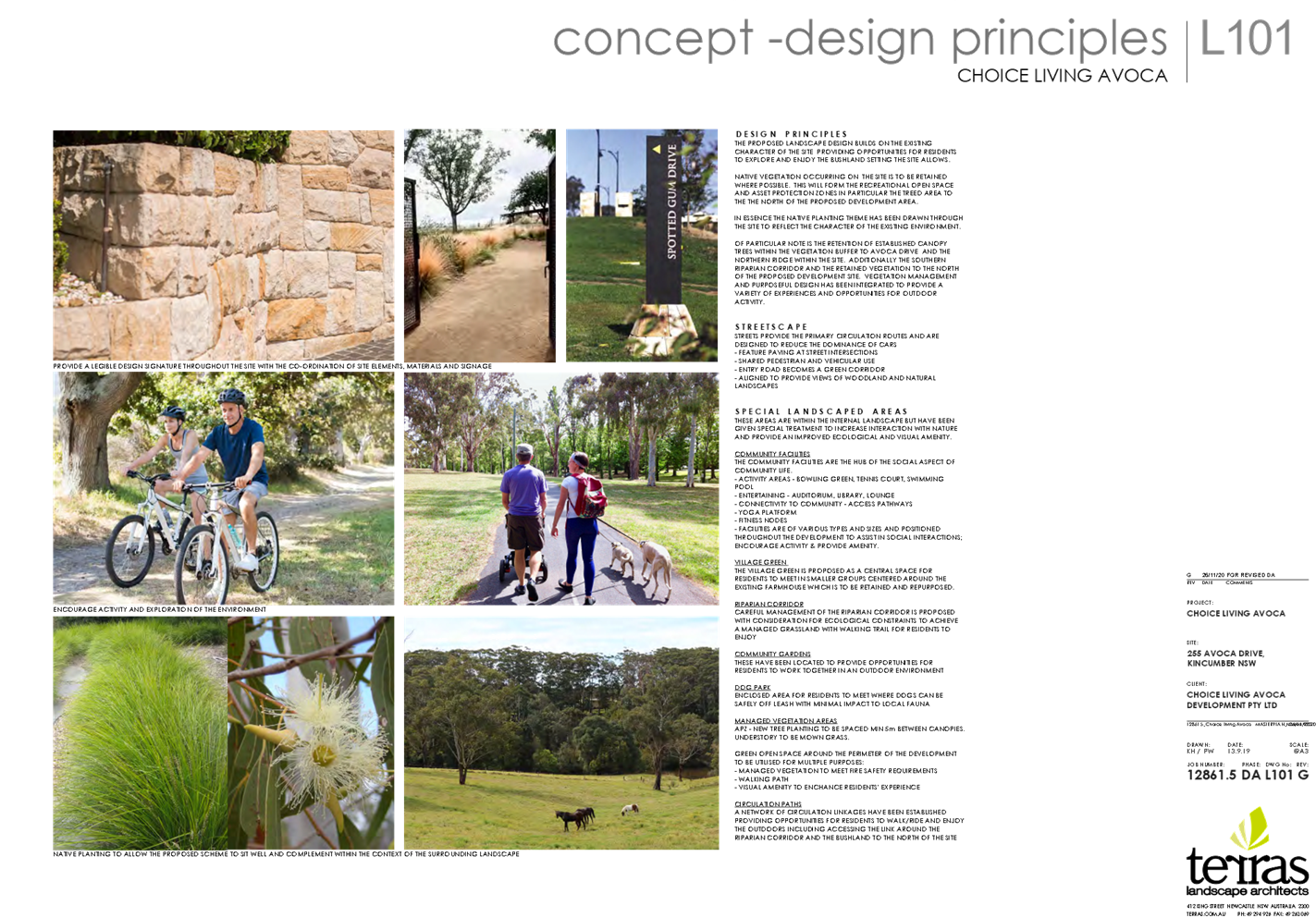
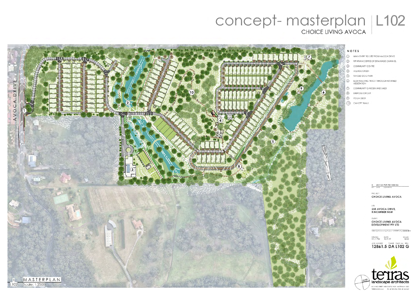
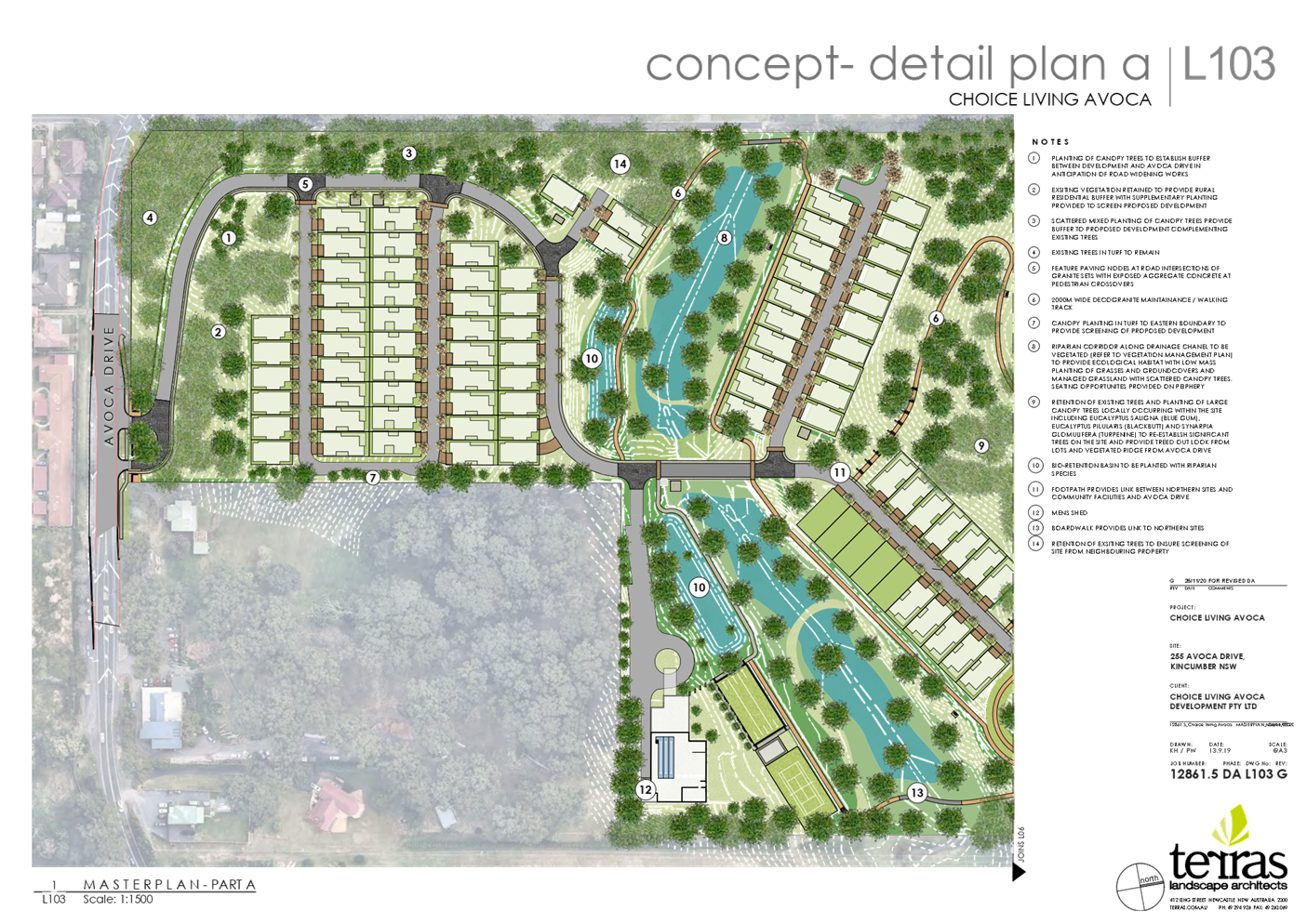
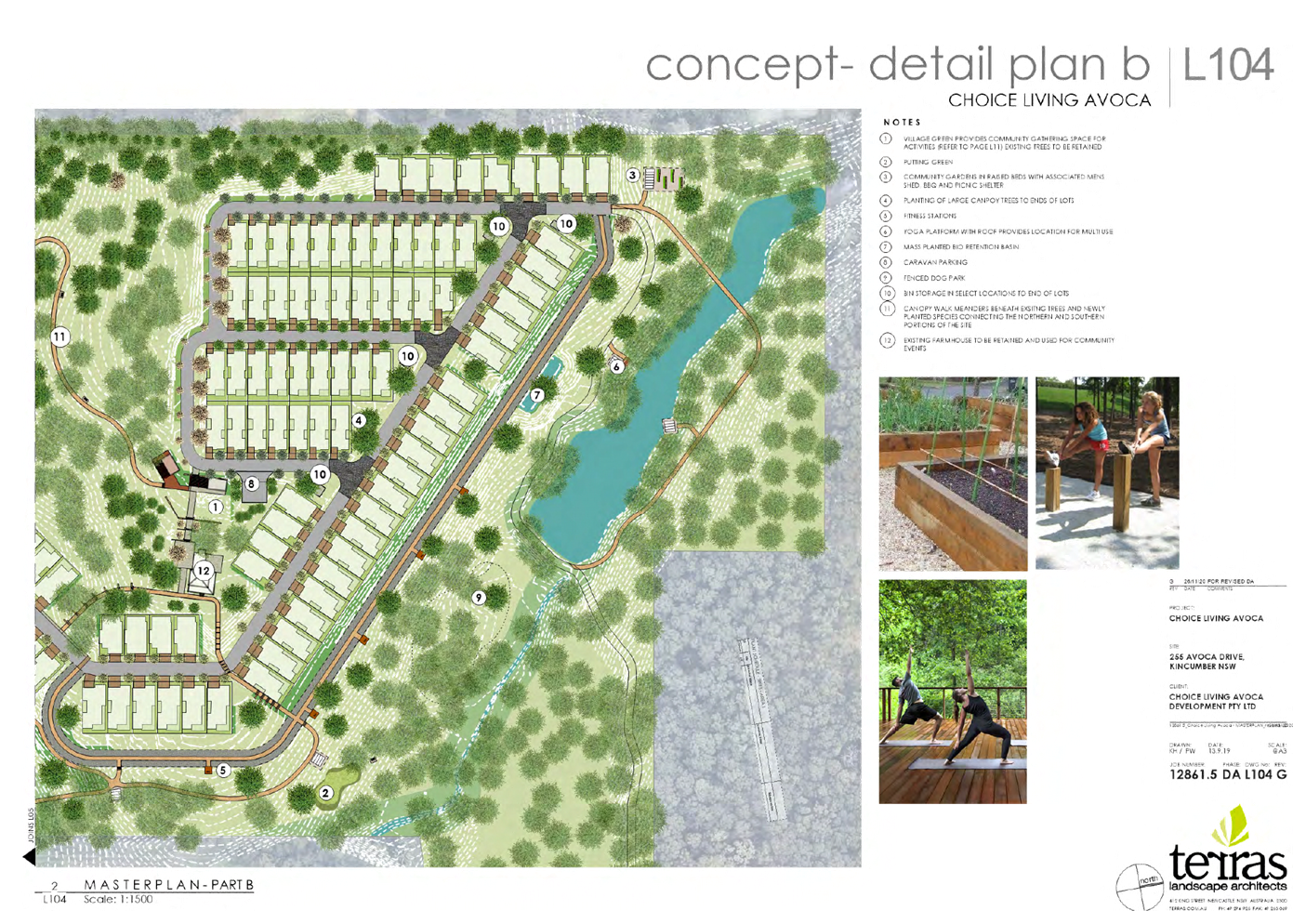
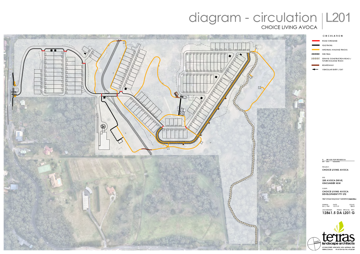
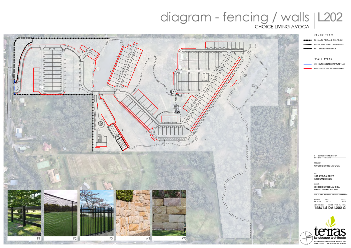
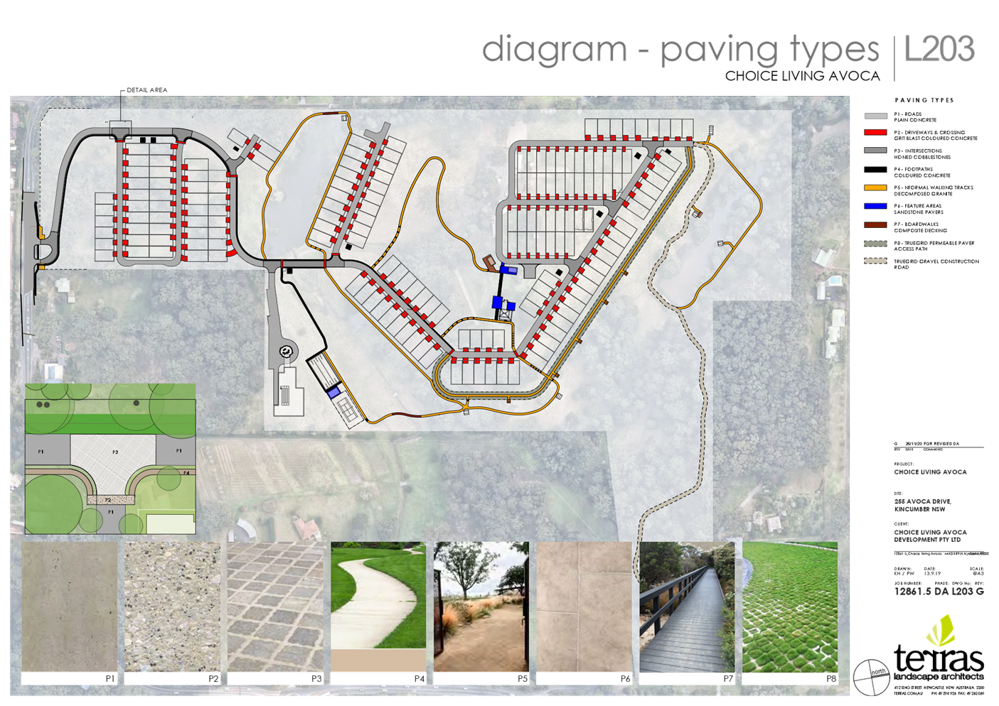
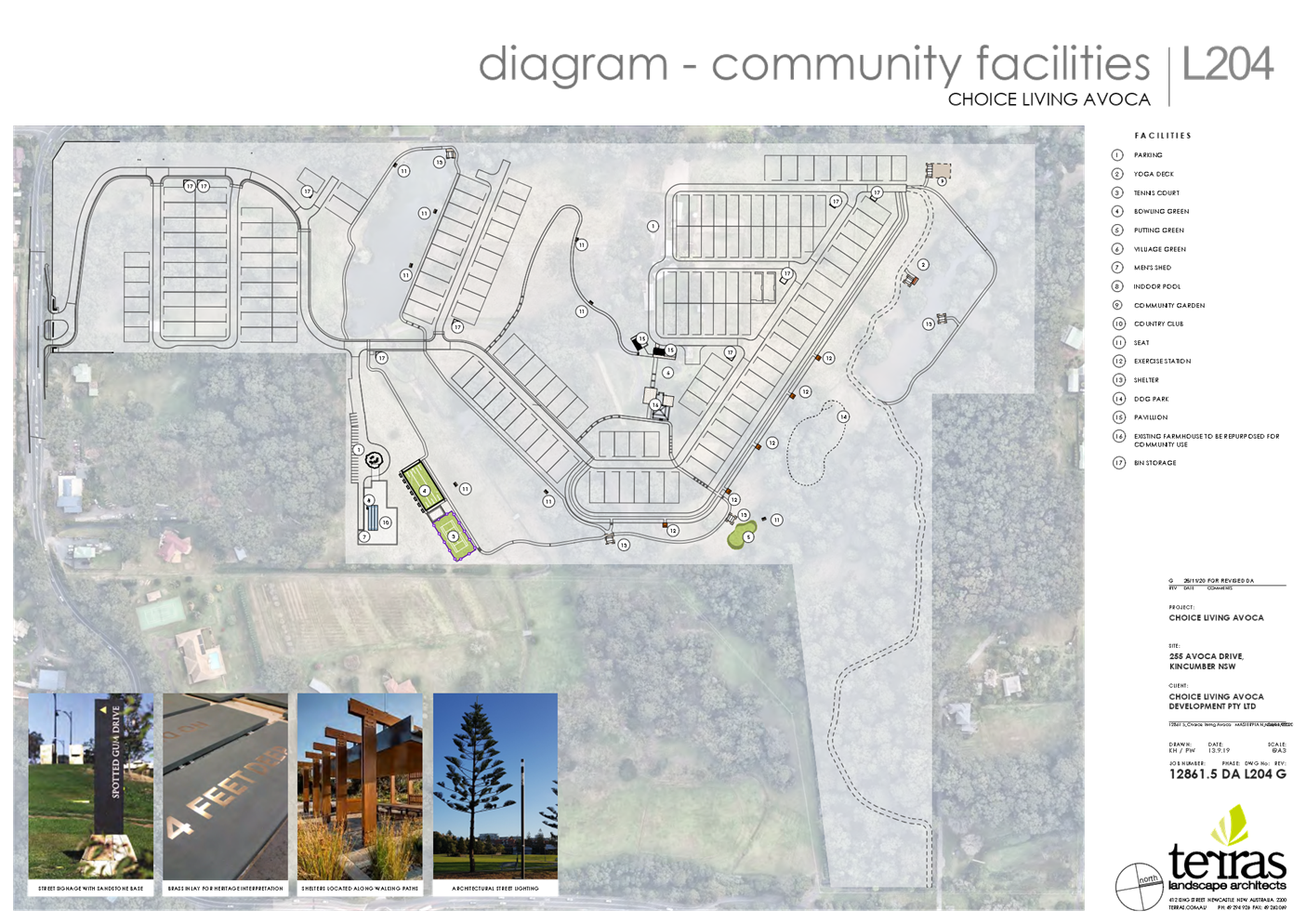
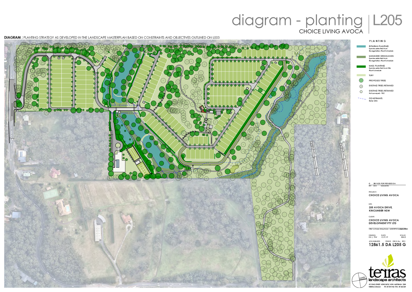
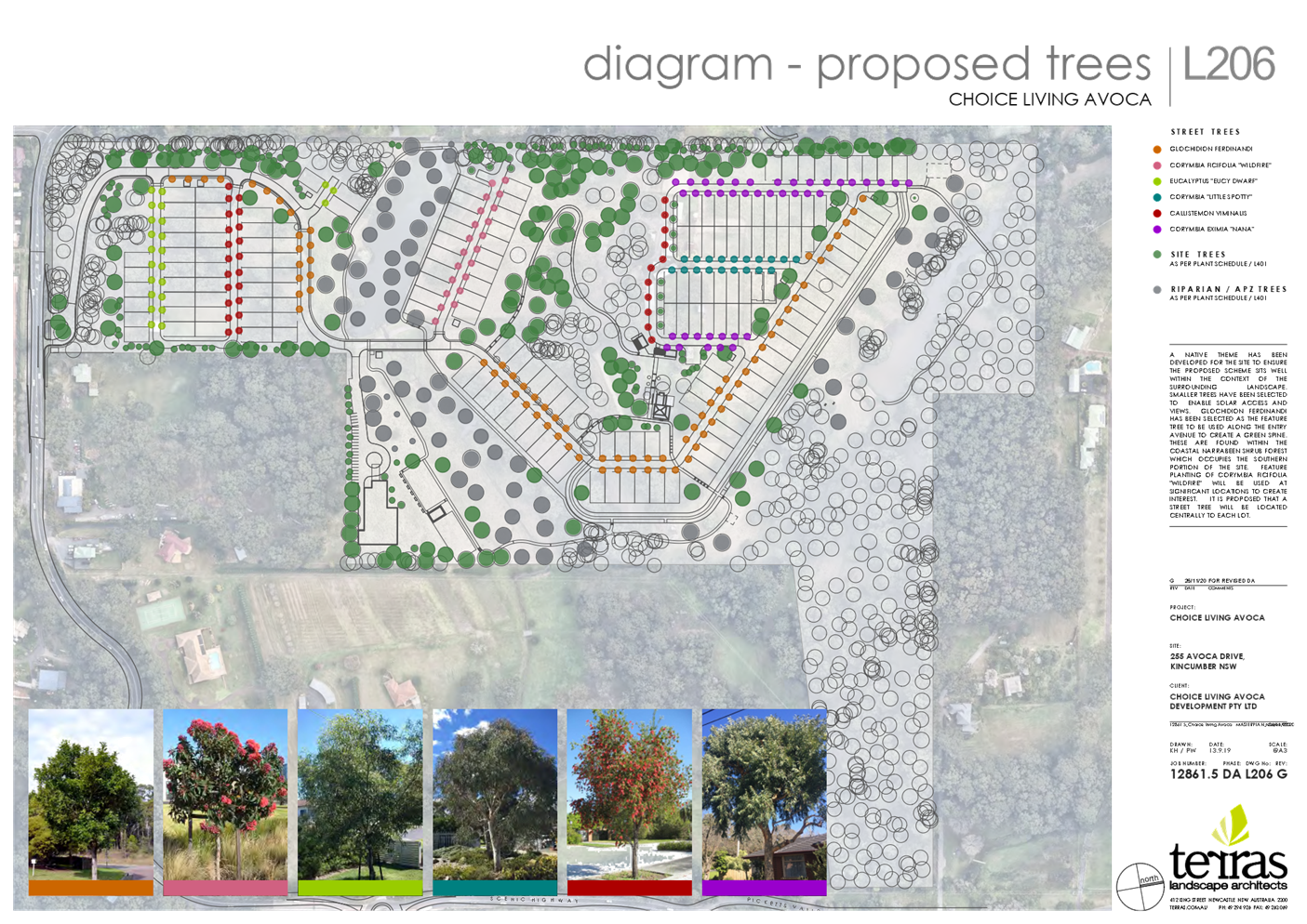
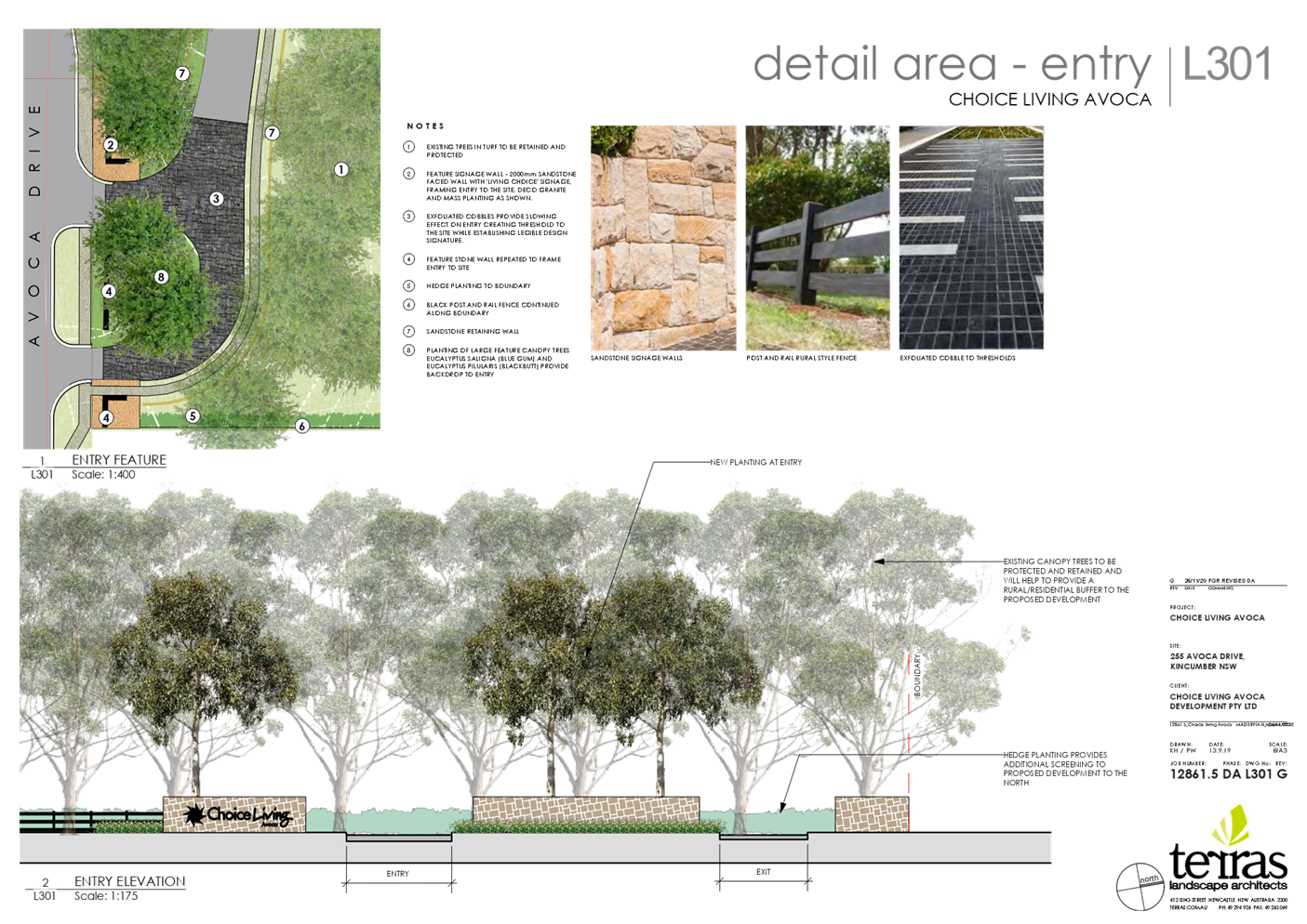
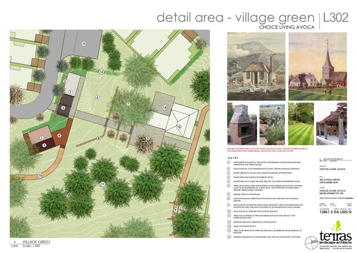
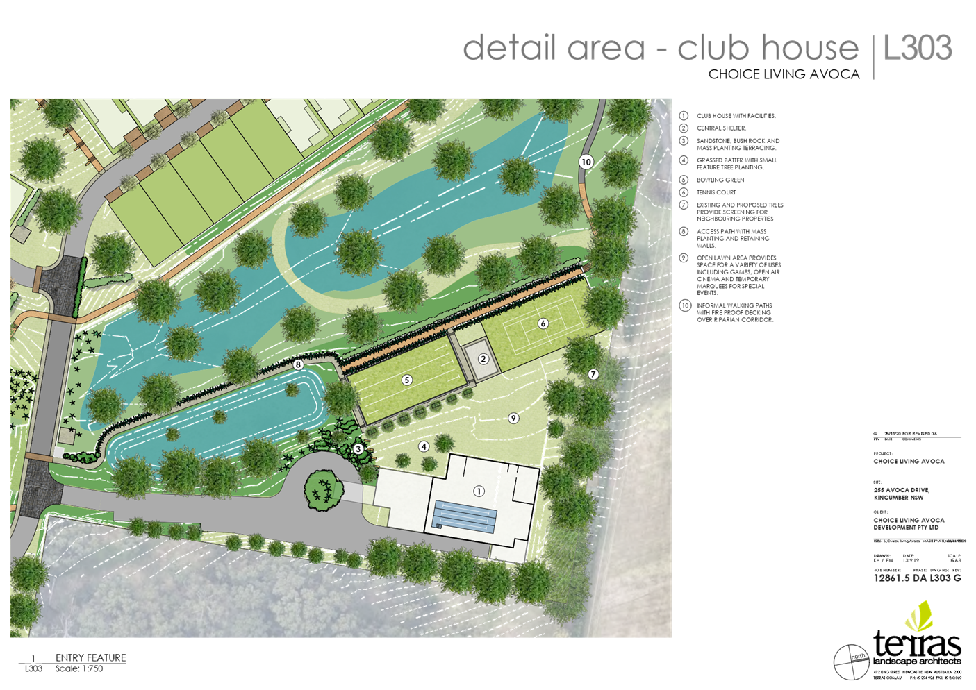
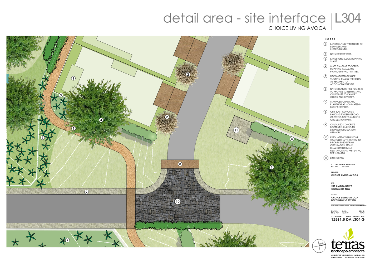
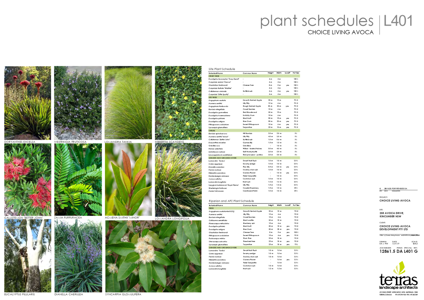
|
Item No: 4.1
|
|
|
Title: DA/58327/2020/2 - 15
Lynnette Crescent, East Gosford - Alterations & Additions to the Existing
Dwelling, Carport, Cabana, Inground Swimming Pool & Retaining Structures
|
|
|
Department: Environment
and Planning
|
|
|
22
July 2021 Local
Planning Panel Meeting
|
|
Reference: 011.2020.00058327.002
- D14691546
Author: Paul
Davies, Senior Health and Building Surveyor
Manager: Wayne
Herd, Section Manager, Building Assessment and Certification
Approver: Andrew
Roach, Unit Manager, Development Assessment
Recommendation
1 That
the Local Planning Panel grant consent to DA/58327/2020/2 - 15 Lynnette
Crescent, East Gosford - Alterations & Additions to the Existing Dwelling,
Carport, Cabana, Inground Swimming Pool & Retaining Structures, subject to
the conditions detailed in the report and having regard to the matters for
consideration detailed in Section 4.15 of the Environmental Planning and
Assessment Act 1979.
|
Summary
Approval
of development application 58327/2020 was previously granted by the Local
Planning Panel on the 15 November 2020 for alterations and additions to the
existing dwelling, carport, cabana, inground swimming pool and retaining
structures
A
Section 4.55 application has been received to amend the previously granted
approval with changes to the garage design extending further forward,
altering the cut and fill of the rear yard, addition of laundry windows and
minor façade changes. The application has been examined having
regard to the matters for consideration detailed in section 4.15 of the
Environmental Planning and Assessment Act 1979 and other statutory
requirements with the issues requiring attention and consideration being
addressed in the report.
The
application is referred to the Local Planning Panel due to a potential
conflict of interest - a joint owner of the property and is a Specified
Council employee who is principally engaged in exercising functions under the
Environmental Planning and Assessment Act 1979.
Applicant Mrs TL Votano
Owner Mr CJ and Mrs TL Votano
Application
No 58327/2020
Description
of Land Lot 20 DP 29159 -15
Lynnette Crescent, EAST GOSFORD
Proposed
Development Alterations and additions to the
existing dwelling, carport, cabana, inground swimming pool and retaining
structures
Site
Area 701.9 m2
Zoning R2
Low Density Residential
Existing
Use Dwelling house
Employment
Generation N/A
Estimated
Value $270,000
|
Key
Issues
· The owner of the
development site is a delegated staff member within Council’s Environment
and Planning Directorate. Accordingly, the development application is required
to be referred to the Local Planning Panel for determination;
· The proposal seeks a
further variation to the required primary road setback to permit the
development. The variation is considered consistent with the adjoining
development, not out of character of the streetscape and compliant with
relevant setback objectives of Chapter 3.1 “Dwelling Houses, Secondary
Dwellings and Ancillary Development”;
· The proposal modifies
earthworks within the rear yard area of the allotment. The proposed earthworks
and subsequent retaining, have been reduced via a more balanced level of cut
and fill, thereby achieving an improved design outcome;
· Objection to the
development has not been received from adjoining landowners. While some
telephone discussions on the changes have occurred, no objection was offered to
the changes, verbally or in writing.
Precis:
|
Proposed Development
Subject of the Sec 4.55 application
|
Alterations and
additions to the existing dwelling, carport, cabana, inground swimming pool
and retaining structures.
a. Garage
extended 1 m further forward
b. Retaining wall in middle of rear yard has been
removed with the cut and fill modified by lowering pool area level by 70 mm
and increasing grassed area fill 880mm. The retaining wall on the boundary
remains and identified as max 600mm.
c. Deletion
of skylight
d. Reduction
in some window sizes
e. Errors
in description and wording of consent
f. Laundry
window added
g. Minor
internal layout changes
h. Changes
to driveway width (not supported)
|
|
Permissibility and Zoning
|
The subject site is
zoned R2 - Low Density Residential under the provisions of Gosford
Local Environmental Plan 2014 (Gosford LEP 2014).
The proposed
development is defined as a ‘dwelling house’ which is defined
under the Gosford LEP 2014 as;
‘dwelling
house’ means –
a
building containing only one dwelling.
The use is permissible
with consent of Council within the zone.
|
|
Relevant Legislation
|
The following planning
policies and control documents are relevant to the development and were
considered as part of the assessment.
· Environment Planning
and Assessment Act 1979 - section 4.15 (EP&A Act)
· Gosford Local
Environmental Plan 2014 (GLEP 2014)
· Draft Central Coast
Local Environmental Plan 2018 (Draft CCLEP 2018)
· Gosford
Development Control Plan 2013 Chapter 2.1 Character
· Gosford
Development Control Plan 2013 Chapter 3.1 Dwelling Houses, Secondary
Dwellings and Ancillary Development (Gosford DCP 2013)
· Gosford
Development Control Plan 2013 Chapter 7.1 Carparking (Gosford DCP 2013)
|
|
Current Use
|
Dwelling house
|
|
Integrated Development
|
No
|
|
Submissions
|
The development
application was notified in accordance with the provisions of the Gosford
Development Control Plan 2013 Chapter 7.3 - Notification of
Development Proposals from 24 February 2021 until 17 March 2021. No
submission was received.
|
Variations to Policies
Variation 1
|
Clause
|
Clause 3.1.3.1a
|
|
Standard
|
The proposed Garage is
required to be located a minimum of 1.0m behind the average primary road
setback displayed by the nearest two dwelling houses located within 40m of
the site.
|
|
LEP/DCP
|
Chapter 3.1
“Dwelling Houses, Secondary Dwellings and Ancillary Development”
|
|
Departure
basis
|
The development seeks a
reduced primary road setback of 4.5 m for the proposed garage in lieu of the
required average primary road setback of approximately 9.2m (being 1.0 m
behind the required average setback of 8.2m). This represents a variation of
4.6 m or 51%.
|
The Site
The
site is a single lot identified as Lot 20 DP 29159 No. 15 Lynnette
Crescent, East Gosford. The site is located on the western side of Lynnette
Avenue having a total area of 701.9 m2. The site contains a
two-storey residential dwelling with existing driveway access to Lynnette Ave
(Figure 1).
The subject site is zoned R2 - Low
Density Residential under the provisions of Gosford Local Environmental
Plan 2014 (Gosford LEP 2014) (Figure 2).
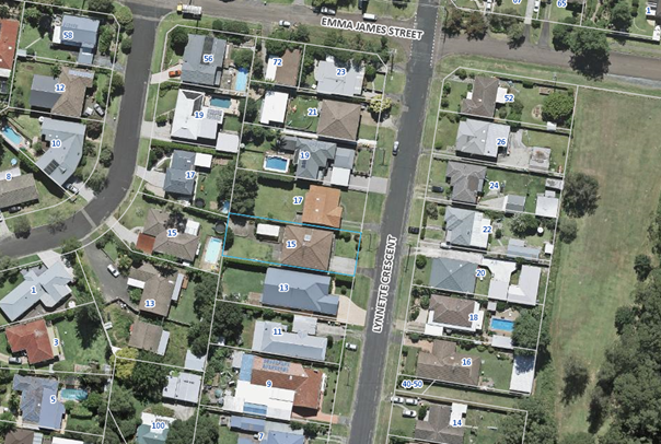
Figure 1: Aerial photograph of subject site with the
site etched in blue.
Figure 2: Extract of Gosford Local Environmental Plan
2014 zoning map with the site etched in blue.
Surrounding
Development
The
subject site is surrounded on all sides by existing R2 – low density
zoned residential allotments, generally containing a mixture of older style
single storey dwellings interspersed with newer dwellings of single and two
storey design and associated ancillary development. Of varying distances to the
east, west and south are RE2 Recreation zoned lands comprising sporting fields
and bushland remnants. The East Gosford commercial precinct lies approximately
1.0 km to the south west of the allotment.
The
Proposed Development
The
Section 4.55 application submitted to Council, proposes the following
amendments to the consent issued on 15 November 2020;
· Garage
extended 1 m further forward
· Retaining wall
in middle of the rear yard has been removed with the cut and fill modified by
lowering pool area level by 70 mm and increasing grassed area fill 880mm. The
retaining walls remain 1 metre inside the boundary and are identified as max
770mm cut below, and 600mm fill above, natural ground levels.
· Deletion of
skylight
· Reduction in
some window sizes
· Errors in
description and wording of consent
· Laundry window
added
· Minor internal
layout changes
· Changes to
driveway width (not supported)
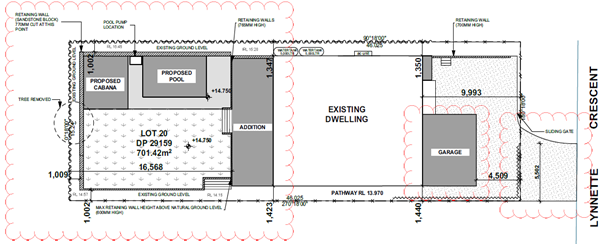
Figure 3: The proposed site plan
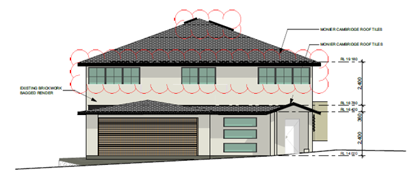
Figure 4:
The proposed eastern (street) elevation
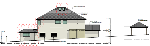
Figure 5: The proposed northern elevation
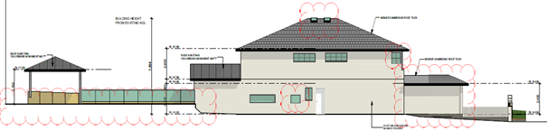
Figure 6: The proposed southern elevation
History
DA58327/2020 (011.2020.00058327.001)
Development Application - Alterations & Additions
Lodged: 08/05/2020 ( Approved by Local Planning Panel :
15/11/2020 )
Address: 15 Lynnette Crescent EAST GOSFORD NSW 2250
Builder: To Be Advised
Principal Certifying Authority: To Be Advised
Applicant: T L Votano
Assessment:
Having
regard for the matters for consideration detailed in Section 4.15 of the
Environmental Planning and Assessment Act 1979 and other statutory
requirements, Council’s policies and Section 10.7 Certificate details,
the assessment has identified no issues that would prevent the approval
Provisions
of Relevant Instruments/Plans/Policies:
State Environmental Planning Policy
(Building sustainability Index) BASIX 2004
A compliant BASIX
certificate achieving the State Governments Energy Efficiency targets has been
provided in support of the application.
Gosford
Local Environmental Plan 2014
Permissibility
The subject site is zoned R2 - Low Density Residential under
the provisions of Gosford Local Environmental Plan 2014 (Gosford LEP 2014). The development proposal
is permissible in the zone with consent however, it is inconsistent with the
objectives of the zone which are as follows:
Zone
R2 Low Density Residential - Objectives of zone
· To provide for the
housing needs of the community within a low density residential environment.
· To enable other land uses
that provide facilities or services to meet the day to day needs of residents.
· To ensure that
development is compatible with the desired future character of the zone.
· To encourage best
practice in the design of low-density residential development.
· To promote ecologically,
socially and economically sustainable development and the need for, and value
of, biodiversity in Gosford.
· To ensure that
non-residential land uses do not adversely affect residential amenity or place
demands on services beyond the level reasonably required for low-density
housing.
The
garage setback variation will result in a development which is generally consistent
with the adjoining developments and will have only a minor visual impact upon
the existing streetscape in Lynnette Crescent.
The
extent of the cut and fill in the rear yard remains consistent with planning
controls for permissible levels and required setbacks. Minor visual and privacy
amenity impacts exist from the level changes, however this not out of character
of typical infill development on sloping allotments. As is typical, they are
proposed to be addressed via landscaping with the use of screen planting.
Accordingly,
the proposal is considered to be consistent with the R2 residential zone.
Draft Central Coast Local
Environmental Plan 2018 (Draft CCLEP 2018)
A
review of the Draft Central Coast Local Environmental Plan 2018 (Draft CCLEP 2018)
which was exhibited until 27 February 2018, indicates that the subject site
retains its low density R2 residential zoning, with dwelling houses remaining
permissible with the consent of Council.
Height
of Buildings
The
subject allotment is mapped as having a maximum building height of 8.5m with
the proposed development having a lesser building height of 7.6m therefore
being compliant.
The proposed amendments do not increase the building
height.
Floor
Space Ratio
Clause
4.4(2) applies
to the maximum floor space ratio for a building on any land. The proposed
building is not to exceed the floor space ratio shown for the land on the Floor
Space Ratio Map in order to achieve the following objectives:
· to ensure that the
density, bulk and scale of development is appropriate for a site,
· to ensure that the
density, bulk and scale of development integrates with the streetscape and
character of the area in which the development is located,
· to facilitate development
in certain areas that contributes to economic growth.
The
subject allotment is mapped as having a maximum floor space ratio of 0.5:1 with
the proposed development proposing a lesser floor space ratio of 0.39:1
therefore being compliant.
The
proposed amendments do not increase the FSR.
Acid Sulphate Soils
Clause
7.1 applies to development that has the potential to disturb, expose or drain
acid sulfate soils. In this regard, the allotment is mapped as being
potentially affected by Class 5 acid sulfate soils. Class 5 acid sulfate soils
are affected as follows: -
|
Class of land
|
Works
|
|
5
|
Works within 500m
of adjacent Class 1, 2, 3 or 4 land that is below 5m Australian Height Datum
and by which the water table is likely to be lowered below 1m Australian
Height Datum on adjacent Class 1, 2, 3 or 4 land.
|
In this case, the subject site is located
within 500m of an adjacent land that is impacted by potential class 2 acid
sulfate soils, with this area being located below R.L 5m Australian Height Datum.
The proposal, however, given the relative minor nature of the works, is not
considered to impact the water table and accordingly, no further consideration
of this issue is warranted.
Gosford
Development Control Plan 2013
Chapter
2.1 – Character
Chapter 2.1 - Character applies to the development application.
The chapter sets out the ‘existing’ and ‘desired’
character for each precinct and requires that character be considered in the
assessment of any development application.
The subject site is located within the East Gosford Open Parklands
character precinct. The existing East Gosford Open Parkland Hillsides character
statement includes:
· Residential
neighbourhoods that are situated on gentle to moderate slopes cleared of their
original vegetation, planted with shrubs and small trees creating a leafy but
open parkland character.
· A variety of medium sized
allotments face streets with narrow pavements that are flanked by wide turfed
edges extending across gardens without fences.
· Newer brick and tile
buildings of single or double storey construction, which are sited close to the
neighbours and have broad street facades that are often dominated by wide
garages.
The desired future East Gosford Open Parklands character statement
includes the following relevant points:
· Retain existing ground
levels along all boundaries.
· Avoid the appearance of a
continuous wall of development along any street.
· Locate new buildings
behind front setbacks that are similar to their surrounding properties.
· Emphasise a leafy garden
character by gardens and street verges planted with taller trees, avoiding wide
driveways and tall fences.
· All dwellings should
display a traditional street address with verandahs or decks and living rooms
or front doors that are visible from the roadway.
· Avoid wide garages that
would visually dominate any front façade or block views from the
dwelling to the street.
The
garage that extends forward to be within 4.5m of the front boundary and is a
single storey structure. The proposed development and resulting variation does
not create a significant visual impact when viewed from the street frontage and
the adjoining dwelling to the south. See figures 7-9 below.
Figure 7: Detailing the existing
Lynnette Cr streetscape looking north
Figure 8: Detailing the existing
Lynnette Cr streetscape looking south
Figure 9: Imagining the existing
setback of adjoining development
Chapter 3.1 – Dwelling Houses, Secondary Dwellings
and Ancillary Development
|
Clause
|
Requirement
|
Proposed
|
Compliance
|
|
3.1.2.1 - Building height
|
8.5m by virtue of LEP mapping
Maximum 2 storeys
|
7.6m
Two storeys
|
Yes
Yes
|
|
3.1.2.2 – Site coverage
|
Maximum 50%
|
39%
|
Yes
|
|
3.1.3.1a – Front setback (carport)
|
1m behind Average setback of adjoining dwellings being –
9.2m
|
4.5m (51%
variation)
|
No
|
|
3.3.3.1b – Rear setback
|
0.9m
|
1.150m
|
Yes
|
|
3.1.3.1c – Side setback
|
1.075m given building height
|
1.340m minimum
|
Yes
|
|
3.1.3.3.2 – Garage door articulation
|
Maximum 60% of building width – 7.5m
|
5.5m
|
Yes
|
|
3.1.4.3 - Private open space areas
|
Minimum 24m2
Minimum dimension 3m
Maximum gradient 1:50
|
Well In excess of 24m2
Well in excess of 3m
Level
|
Yes
Yes
Yes
|
|
3.1.5 – Car parking and access
|
2 spaces if 4 or more bedrooms
Parking to be located behind the primary road setback
Maximum driveway width 4m at the street crossover
|
3 included
5.5m
|
Yes
Yes
No *See internal referral comments below
|
|
3.1.6.1 - Earthworks
|
Maximum 1m fill
Maximum 3m Excavation >1m from boundary
No retaining wall for fill is to be less than 1m from boundary
Fill not associated with dwelling to be max 1m and
setback 1m from boundary
|
0.88m
Max excavation is 770mm and setback >1m from boundary
1m from boundary
Max fill is 880mm and is set back >1m from the boundary
|
Yes
Yes
Yes
Yes
|
|
3.1.6.2 – Retaining walls
|
To be designed by a structural engineer
|
Structural plans submitted
|
Yes
|
|
3.1.6.3 - Drainage
|
To be disposed of to street
|
To street
|
Yes
|
|
3.1.7.2 - Outbuildings
|
Maximum area of 75m2
|
23m2
|
Yes
|
|
3.1.7.4 – Swimming pools
|
Be located behind the primary road setback or rear yard
Comply with side and rear setbacks
Pump located to minimise noise
|
In rear yard area
In excess of 0.9m
Appropriately located
|
Yes
Yes
Yes
|
Note: The variations required by Clause 3.1.5 are considered within and in
conjunction with Variation 1 relating to the proposed primary road setback for
the garage structure.
Variation 1
The proposal seeks a variation to the required primary road setback
to permit the development. The proposed single storey garage structure seeks a
reduced setback of 4.5m in lieu of the required 9.2m (being 1m behind the
required average setback of the adjoining dwellings).
Consent was previously granted with a garage front setback of
5.549m, being a variation of 40%. The proposed development subject of the Sec
4.55 application proposes a front setback of 4.5m, being a variation of
51%.
In considering this
setback variation, assessment of the proposed development against the relevant
objectives of Chapter 3.1 is required. Chapter 3.1 objectives relating to
setbacks states:
· To ensure that setbacks
are compatible with adjacent development and complements the character,
streetscape, public reserve, or coastal foreshore;
· To ensure the visual
focus of a development is the dwelling, not the garage;
· To protect the views,
privacy and solar access of adjacent properties;
· To maintain view
corridors to coastal foreshores and other desirable outlooks;
· To maintain the scenic
and environmental qualities of natural waterbodies and their foreshores and
respond to site attributes such as topography;
· To provide deep soil
areas enough to conserve existing trees or accommodate new landscaping;
· To provide appropriate
articulation of facades and horizontal elements reduce the appearance of bulk
and provides visual interest to the building and subsequent streetscape where
they face a street frontage/s.
In reviewing the proposal
against these objectives, the following commentary is provided:
· The proposed garage is
consistent with the adjoining development to the south at No. 13 Lynnette Cres
and is considered to be consistent with the setback pattern displayed. The
garage being single storey, situated on the low side of the street allotment is
considered to have minimal impact on the streetscape character within Lynnette
Cres.
· The variation is
supported
Figure 10: Detailing the approximated
setbacks of adjoining development and proposed setback
Chapter 6.3 - Erosion Sedimentation Control
Appropriate
erosion/sedimentation control measures form a condition of consent
Chapter 6.4 - Geotechnical
Requirements for Development Applications
The
allotment is mapped as being subject to medium landslip risk. It is considered
that no further information from a geotechnical perspective is required to
support the development proposal at development application stage.
Chapter 6.6 - Preservation of Trees or Vegetation
The
proposal does not require the removal of any native vegetation.
Chapter 6.7 – Water Cycle Management
The
proposal includes the provision of water tanks for collection and re-use
totaling 10,000L capacity. The provisions of these tanks exceed the capacity
for on-site storage and re-use as required by the Water Cycle Management
Chapter.
Chapter
7.1 Carparking
Chapter 7.1 - Carparking applies to the development application.
The purpose of this chapter is to ensure that sufficient and well-designed
on-site provisions for carparking are achieved for developments.
The
minimum standard for carparking for this development is for two spaces, one of
which is to be setback a minimum of 6m from the frontage of the site. This
requirement is achieved by the garage associated with the dwelling.
Likely
Impacts of the Development:
Built
Environment
The
proposed development is considered consistent with the built environment.
Access
and Transport
The
site is well served by the existing roadway and is also well served by public
transport.
Context
and Setting
The
subject site lies within a traditional low density residential area, generally
comprising allotments containing single dwellings and associated ancillary
development. The existing streetscape within Lynnette Cres in proximity to the
site, displays development that maintains a generally consistent setback
pattern to the primary road boundary, providing an open streetscape vista.
The
design of the development proposal, which incorporates a minor setback
variation to the primary road boundary, is considered consistent with the areas
context and setting.
Natural Environment
The
subject site does not contain any threatened species or habitat with the
development not requiring the removal of any significant vegetation.
Accordingly, the proposal is considered satisfactory in relation to impacts on
the natural environment.
Suitability
of the Site for the Development:
A
review of Council’s records has identified that the site is impacted by
constraints including risk of landslip and potential acid sulphate soils. As
has been demonstrated, these constraints are not considered to render the site
unsuitable for the proposed development.
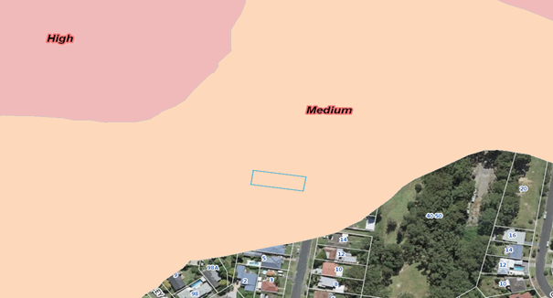
Figure 12:
Indicating landslip mapping with the site etched in blue
Whether the proposal fits in the
locality
The
subject area in proximity to the site, displays a traditional low density
residential environment. Given the variations required by the development, with
particular emphasis on the proposed carport, it is considered that the proposal
is out of character and inconsistent with the nature of the locality.
Any submission made in
accordance with this Act or Regulations
The Public Interest: (s4.15(1)(e)):
Submissions
The development application was notified to adjoining landowners
from the 24 February to 17 March 2021 in accordance with Gosford Development
Control Plan 2013 Chapter 7.3 - Notification of Development Proposals.
No submissions were received
Submissions
from Public Authorities
The
application was not required to be referred to any public authorities.
Internal
Consultation
The
application was previously referred internally in relation to the proposed
vehicle access crossing being 5.5m. This referral required a maximum vehicle
access crossing width of 5.0m permitted. The development was previously
approved with 5m vehicle access crossing.
The
amended plans now identify an increase of the Vehicle access crossing to 5.5m.
This change is not supported and is to be reduced prior to the issue of a
construction certificate via a condition of consent.
Ecologically
Sustainable Principles:
The
proposal has been assessed having regard to ecologically sustainable
development principles and is considered to be consistent with the principles.
The
proposed development is considered to incorporate satisfactory stormwater,
drainage and erosion control and is unlikely to have any significant adverse
impacts on the environment and will not decrease environmental quality for
future generations. The proposal does not result in the disturbance of any
endangered flora or fauna habitats and is unlikely to significantly affect
fluvial environments.
Climate
Change
The potential impacts of climate change on the proposed
development have been considered as part of the assessment of the application.
This assessment has included consideration of such matters as
potential for more intense and/or frequent extreme weather conditions
including storm events, bushfires, drought and flood as well as how the
proposed development may cope / combat / withstand these potential impacts.
The development proposal
is not considered to be impacted by potential climate change.
Other
Matters for Consideration:
Nil
matters.
Conclusion:
This
application has been assessed under the heads of consideration of section 4.15
of the Environmental Planning & Assessment Act 1979 and all relevant
instruments and polices. Upon completion of this assessment, given the minor
variations sought by the development, with these variations demonstrating
general compliance with both the stated objectives of Chapter 3.1 and the areas
desired future character statement, it is considered that the site is suitable
for the proposed development.
Accordingly,
approval of the development is recommended.
Attachments
|
1⇩
|
Draft
Conditions of Consent
|
|
D14692118
|
|
2
|
Development
Plans
|
Provided
Under Separate Cover
|
D14496870
|
|
3⇩
|
Redacted
Development Plans
|
|
D14740880
|
|
4.1
|
DA/58327/2020/2
- 15 Lynnette Crescent, East Gosford - Alterations & Additions to the
Existing Dwelling, Carport, Cabana, Inground Swimming Pool & Retaining
Structures
|
|
Attachment 1
|
Draft
Conditions of Consent
|
1... PARAMETERS OF THIS CONSENT
|
1.1. Approved
Plans and Supporting Documents
Implement
the development substantially in accordance with the plans and supporting
documents listed below as submitted by the applicant and to which is affixed a
Council stamp "Development Consent" unless modified by any
following condition.
Architectural Plans by: N.A. Hill
Building Designs
|
Drawing
|
Description
|
Sheets
|
Issue
|
Date
|
|
19054
|
Cover
Sheet
|
00
|
1
|
06/05/2020
|
|
19054
|
Site
and Site Analysis
|
1
|
1
|
06/05/2020
|
|
19054
|
Existing
Floor Plan
|
2
|
1
|
06/05/2020
|
|
19054
|
Proposed
Ground Floor Plan
|
3
|
1
|
06/05/2020
|
|
19054
|
Proposed
First Floor Plan
|
4
|
1
|
06/05/2020
|
|
19054
|
Roof
Plan
|
5
|
1
|
06/05/2020
|
|
19054
|
Window
Schedule
|
6
|
1
|
06/05/2020
|
|
19054
|
Elevation
Plan
|
7
|
1
|
06/05/2020
|
|
19054
|
Elevation
and Section Plan
|
8
|
1
|
06/05/2020
|
|
19054
|
Notes
|
9
|
1
|
06/05/2020
|
Supporting Documentation
Nil
1.1. Approved
Plans and Supporting Documents
Implement
the development substantially in accordance with the plans and supporting
documents listed below as submitted by the applicant and to which is affixed a
Council stamp "Development Consent" unless modified by any
following condition.
Architectural Plans by : N. A. Hill
Building Designs
|
Drawing
|
Description
|
Sheets
|
Issue
|
Date
|
|
19054
|
Cover
Sheet
|
01
|
02
|
23/11/2020
|
|
19054
|
Site and
Site Analysis Plan
|
02
|
02
|
23/11/2020
|
|
19054
|
Existing
Floor Plan
|
03
|
02
|
23/11/2020
|
|
19054
|
Proposed
Ground Floor Plan
|
04
|
02
|
23/11/2020
|
|
19054
|
Proposed
First Floor Plan
|
05
|
02
|
23/11/2020
|
|
19054
|
Roof Plan
|
06
|
02
|
23/11/2020
|
|
19054
|
Window
Schedule
|
07
|
02
|
23/11/2020
|
|
19054
|
Elevation
Plan
|
08
|
02
|
23/11/2020
|
|
19054
|
Elevation
and Section Plan
|
09
|
02
|
23/11/2020
|
|
19054
|
Notes
|
10
|
02
|
23/11/2020
|
Supporting Documentation
Nil
1.2. Carry out all building works in
accordance with the National Construction Code Series, Building Code of
Australia, Volume 1 and 2 as appropriate.
1.3. Comply
with all commitments listed in the BASIX Certificate for the development as
required under clause 97A of the Environmental Planning and Assessment
Regulation 2000.
2... PRIOR TO ISSUE OF ANY CONSTRUCTION CERTIFICATE
|
2.1. All conditions
under this section must be met prior to the issue of any Construction
Certificate.
2.2. No activity is to be carried out
on-site until the Construction Certificate has been issued, other than:
a) Site
investigation for the preparation of the construction, and / or
b) Implementation
of environmental protection measures, such as erosion control and the like that
are required by this consent
c) Demolition
2.3. Submit
amendments to the approved plans to the Accredited Certifier pursuant to Clause
139 of the Environmental Planning Regulation 2000 that must detail:
1. A maximum driveway width of 5.0
metres within the road reserve to the front of the allotment.
2.4. Submit an application to Council
under section 305 of the Water Management Act 2000 for a section 307
certificate of compliance. The Application form can be found on
Council’s website www.centralcoast.nsw.gov.au. Early application is
recommended.
The
Section 305 application will result in a section 306 letter of requirements
which must be obtained prior to the issue of any Construction
Certificate. The requirements letter will outline which requirements must
be met prior to each development milestone eg. Prior to construction certificate,
subdivision works certificate, occupation certificate and/or subdivision
certificate.
|
3... PRIOR TO COMMENCEMENT OF ANY WORKS
|
3.1. All conditions under this section
must be met prior to the commencement of any works.
3.2. Appoint a Principal Certifier for the
building work:
a) The
Principal Certifier (if not Council) is to notify Council of their appointment
and notify the person having the benefit of the development consent of any
critical stage inspections and other inspections that are to be carried out in
respect of the building work no later than two (2) days before the building
work commences.
b) Submit
to Council a Notice of Commencement of Building Works or Notice of Commencement
of Subdivision Works form giving at least two (2) days’ notice of the
intention to commence building or subdivision work. The forms can be found on
Council’s website: www.centralcoast.nsw.gov.au
3.3. Erect a sign in a prominent position
on any work site on which building, subdivision or demolition work is being
carried out. The sign must indicate:
a) The name, address and telephone
number of the Principal Certifier for the work; and
b) The name of the principal contractor
and a telephone number at which that person can be contacted outside of working
hours; and
c) That unauthorised entry to the work
site is prohibited.
d) Remove the sign when the work has
been completed.
3.4. Submit both a Plumbing and Drainage
Inspection Application, with the relevant fee, and a Plumbing and Drainage
Notice of Work in accordance with the Plumbing and Drainage Act 2011 (to
be provided by licensed plumber). These documents can be found on
Council’s website at: www.centralcoast.nsw.gov.au
Contact
Council prior to submitting these forms to confirm the relevant fees.
This condition only applies if
installation/alteration of plumbing and/or drainage works proposed
(excludes stormwater drainage). This condition does not apply to swimming
pool plumbing that does not physically connect/break into the sewer system.
3.5. Install
run-off and erosion
controls to prevent soil erosion, water pollution or the discharge of loose
sediment on the surrounding land by:
a. erecting a silt fence and providing
any other necessary sediment control measures that will prevent debris escaping
into drainage systems, waterways or adjoining properties, and
b. diverting uncontaminated run-off
around cleared or disturbed areas, and
c. preventing the tracking of sediment
by vehicles onto roads, and
d. stockpiling top soil, excavated
materials, construction and landscaping supplies and debris within the lot
3.6. Erect
a temporary hoarding or
temporary construction site fence between the work site and adjoining lands
before the works begin and must be kept in place until after the completion of
the works, if the works:
· could cause a danger, obstruction or inconvenience to
pedestrian or vehicular traffic, or
· could cause damage to adjoining lands by falling
objects, or
· involve the enclosure of a public place or part of a
public place
Note
1: A structure on
public land or on or over a public road requires the prior approval of the
relevant authority under the Local Government Act
1993 or the Roads Act 1993, respectively.
Note
2: The Work Health and Safety Act 2011 and Work Health and
Safety Regulation 2011 contain provisions
relating to scaffolds, hoardings and other temporary structures.
3.7. Provide
or make available toilet
facilities at the work site before works begin and maintain the facilities
until the works are completed at a ratio of one toilet plus one additional
toilet for every twenty (20) persons employed at the site.
Each
toilet must:
a. be a standard flushing toilet connected
to a public sewer, or
b. have an on-site effluent disposal system
approved under the Local
Government Act 1993, or
c. be a temporary chemical closet approved
under the Local
Government Act 1993
3.8. Submit
to Council as the Roads
Authority an application for a vehicle access crossing including payment of the
application fee.
4.1. All conditions
under this section must be met during works.
4.2. Carry out construction or demolition
works during the construction phase of the development only between the hours
as follows:
· 7.00am and 5.00pm Monday to Saturday
No
construction or demolition works associated with the development are permitted
to be carried out at any time on a Sunday or a public holiday.
4.3. During the construction phase of the
development, if any Aboriginal object (including evidence of habitation or
remains), is discovered during the course of the work:
a) All excavation or disturbance of the
area must stop immediately in that area, and
b) The Office of Environment and
Heritage must be advised of the discovery in accordance with section 89A of the
National Parks and Wildlife Act 1974.
Note: If an Aboriginal object is
discovered, an Aboriginal heritage impact permit may be required under the National
Parks and Wildlife Act 1974.
4.4. Implement and maintain all erosion
and sediment control measures at or above design capacity for the
duration of the construction works and until such time as all ground disturbed
by the works has been stabilised and rehabilitated so that it no longer acts as
a source of sediment.
4.5. Keep a copy of the stamped approved
plans on-site for the duration of site works and make the plans available upon
request to either the Principal Certifier or an officer of Council.
4.6. Notify Council when plumbing and
drainage work will be ready for inspection(s) and make the work accessible for
inspection in accordance with the Plumbing and Drainage Act 2011.
This
condition only applies if installation/alteration of plumbing and/or drainage
works are proposed (excludes stormwater drainage)
4.7. Place all
building materials, plant and equipment on the site of the development during
the construction phase of the development so as to ensure that pedestrian and
vehicular access within adjoining public roads, footpaths and reserve areas, is
not restricted and to prevent damage to public infrastructure. Further, no
construction work is permitted to be carried out within the road reserve unless
the works are associated with a separate approval issued under the provisions
of the Roads Act 1993.
4.8. Re-use, recycle or dispose of all building
materials in accordance with the Waste Management Plan submitted with the
subject application.
4.9. Erect or install prior to the swimming pool
being filled with water all the required swimming pool safety barriers and
gates in accordance with the approved plans and specifications and the
provisions of the Swimming Pools Act 1992, Swimming Pools Regulations 2018 and
Australian Standard AS 1926.1-2012 including the display of an approved sign
regarding pool safety and resuscitation techniques that contains all of the
following information:
· “YOUNG CHILDREN SHOULD BE SUPERVISED WHEN USING
THIS SWIMMING POOL”
· “POOL GATES MUST BE KEPT CLOSED AT ALL
TIMES”
· “KEEP ARTICLES, OBJECTS AND STRUCTURES AT LEAST
900mm CLEAR OF THE POOL FENCE AT ALL TIMES” and
· A simple flow sequence (which may be the flow sequence
depicted in the Cardiopulmonary Resuscitation Guideline) containing details of
resuscitation techniques (for infants, children and adults)
4.10. Dispose filter backwash and overflow to the
sewer. The sewer connection must be completed prior to the filling of the pool
with water and in a manner that will not cause a nuisance, or where sewer is
not available, the disposal of filter backwash must be discharged into a rubble
absorption trench to the satisfaction of the Principal Certifier.
4.11. No fill other than that
as indicated within the approved plans is permitted to be placed upon the site.
|
5... PRIOR TO ISSUE OF ANY OCCUPATION CERTIFICATE
|
5.1. All conditions
under this section must be met prior to the issue of any Occupation
Certificate.
5.2. Submit
a Certificate of
Compliance for all
plumbing and drainage work and a Sewer Service Diagram showing sanitary
drainage work (to be provided by licensed plumber) in accordance with the Plumbing
and Drainage Act 2011.
This condition only applies if
installation/alteration of plumbing and/or drainage works are proposed
(excludes stormwater drainage)
5.3. Prior
to the occupation or use
of the building/structure, an application for an Occupation Certificate for the
development must be submitted to and approved by the Principal Certifier. The
Occupation Certificate application is to satisfy all of the requirements of the
Environmental Planning and Assessment Regulation 2000.
5.4. Install
the required rainwater
tank in the location as detailed within the approved development plans with
suitable plumbing connections provided to collect rainwater from the roof area
as detailed within the BASIX Certificate applicable to the development. The
required rainwater tank is to be installed in accordance with the requirements
of the National Plumbing and Drainage Code Australian Standard AS 3500 and must
be provided with first flow diversion devices fixed to all inflows and a
functioning pressure pump plumbed to service all fixtures as detailed within
the BASIX Certificate applicable to the development. The required tank must be
controlled in order that supplemental flow from domestic mains does not take
place until the capacity of the tank has been reduced to 20%.
5.5. Drain
all stormwater from impervious surface areas, including pathways and driveways,
to the street.
5.6. Obtain
the Section 307 Certificate of Compliance under the Water Management Act 2000
for water and sewer requirements for the development from Central Coast Council
as the Water Supply Authority, prior to issue of the Subdivision Certificate.
All
water supply and sewer works for the development must be completed and all
other conditions of the Section 306 letter satisfied. Completion of works
includes the submission and acceptance by Council of all work as executed
drawings plus other construction compliance documentation and payment of a
maintenance / defects bond to Council in accordance with Council’s
adopted fees and charges.
5.7. Construct
the vehicle access crossing in accordance with the vehicle access crossing
Notice of Determination issued by Council.
5.8. Do
not change the location of the Vehicle Access Crossing without prior written
approval from Council.
6.1. Insulate
and / or isolate the
motor, filter, pump and all sound producing equipment or fitting associated
with or forming part of the pool filtering system so as not to create an
offensive noise to the occupants of the adjoining premises as defined in the
Protection of the Environment Operations Act 1997.
Failure to comply with this
development consent and any condition of this consent may be a criminal
offence. Failure to comply with other environmental laws may also
be a criminal offence.
Where there is any breach Council may
without any further warning:
· Issue Penalty Infringement
Notices (On-the-spot fines);
· Issue notices and orders;
· Prosecute any person
breaching this consent, and/or
· Seek injunctions/orders
before the courts to retain and remedy any breach.
Warnings as to Potential Maximum
Penalties
Maximum Penalties under NSW
Environmental Laws include fines up to $1.1 Million and/or custodial sentences
for serious offences.
· Discharge of sediment from a site may be determined to
be a pollution event under provisions of the Protection of the Environment
Operations Act 1997. Enforcement action may commence where sediment
movement produces a pollution event.
· The following public authorities may have separate
requirements in the following aspects:
a) Australia Post for the positioning
and dimensions of mail boxes in new commercial and residential developments
b) Jemena Asset Management for any
change or alteration to the gas line infrastructure
c) Ausgrid for any change or alteration
to electricity infrastructure or encroachment within transmission line
easements
d) Telstra, Optus or other
telecommunication carriers for access to their telecommunications
infrastructure
e) Central Coast Council in respect to
the location of water, sewerage and drainage services.
· Carry out all work under
this Consent in accordance with SafeWork NSW requirements including the Workplace
Health and Safety Act 2011 No 10 and subordinate regulations, codes of
practice and guidelines that control and regulate the development industry.
· Dial Before You Dig
Underground assets may exist in the
area that is subject to your application. In the interests of health and safety
and in order to protect damage to third party assets please contact Dial Before
You Dig at www.1100.com.au
or telephone on 1100 before excavating or erecting structures. (This is the law
in NSW). If alterations are required to the configuration, size, form or design
of the development upon contacting the Dial Before You Dig service, an
amendment to the development consent (or a new development application) may be
necessary. Individuals owe asset owners a duty of care that must be observed
when working in the vicinity of plant or assets. It is the individual's
responsibility to anticipate and request the nominal location of plant or
assets on the relevant property via contacting the Dial Before You Dig service
in advance of any construction or planning activities.
|
4.1
|
DA/58327/2020/2
- 15 Lynnette Crescent, East Gosford - Alterations & Additions to the
Existing Dwelling, Carport, Cabana, Inground Swimming Pool & Retaining
Structures
|
|
Attachment 3
|
Redacted
Development Plans
|
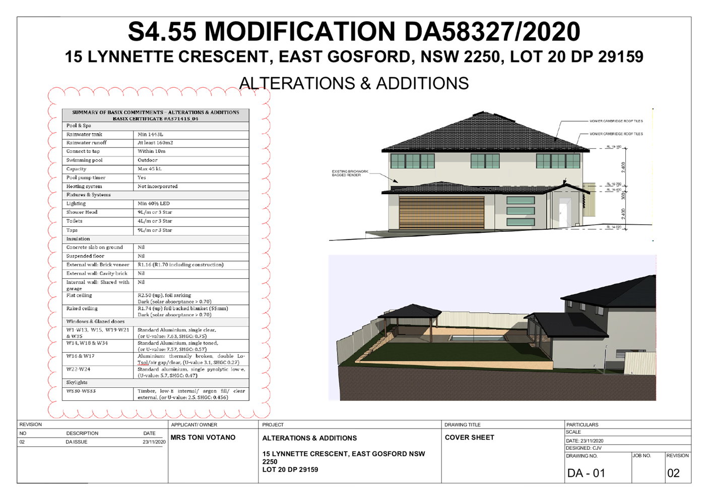
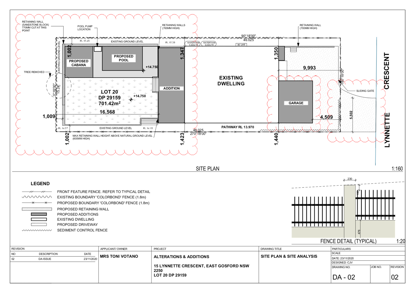
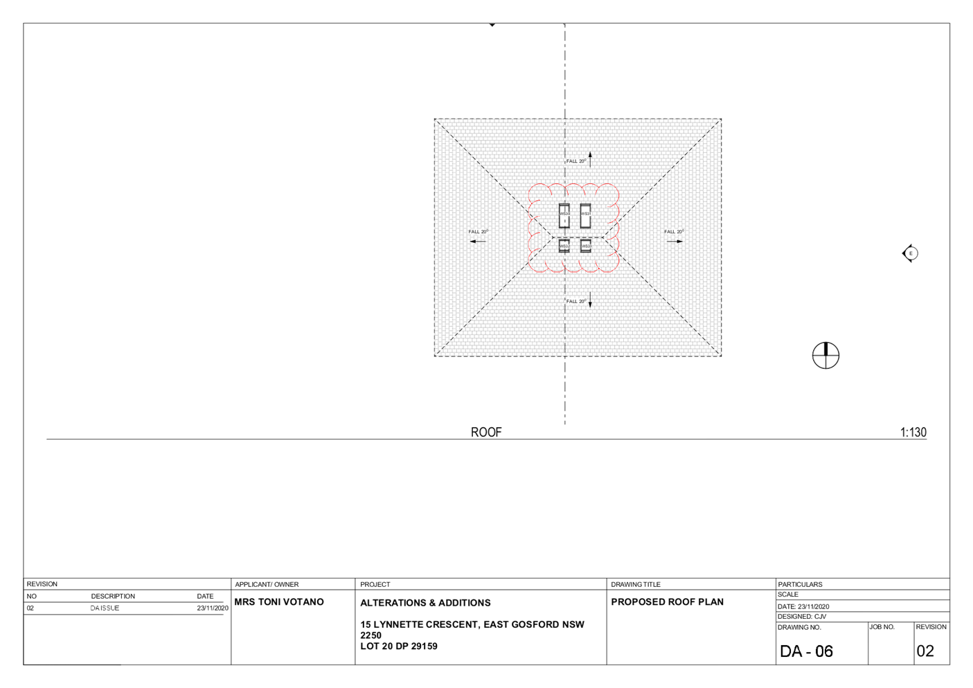
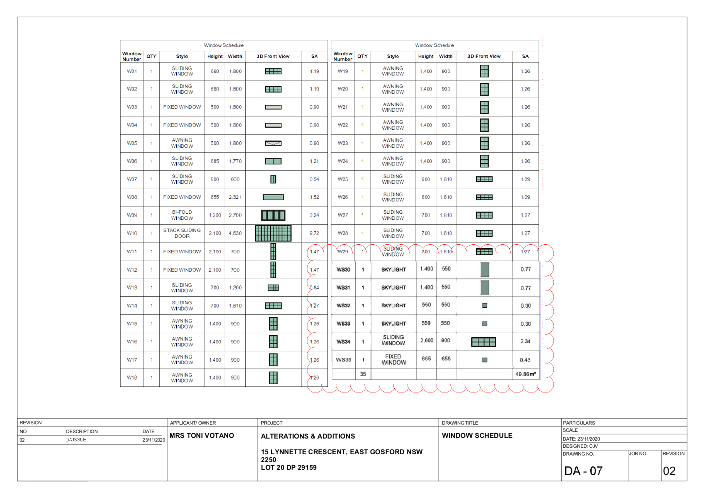
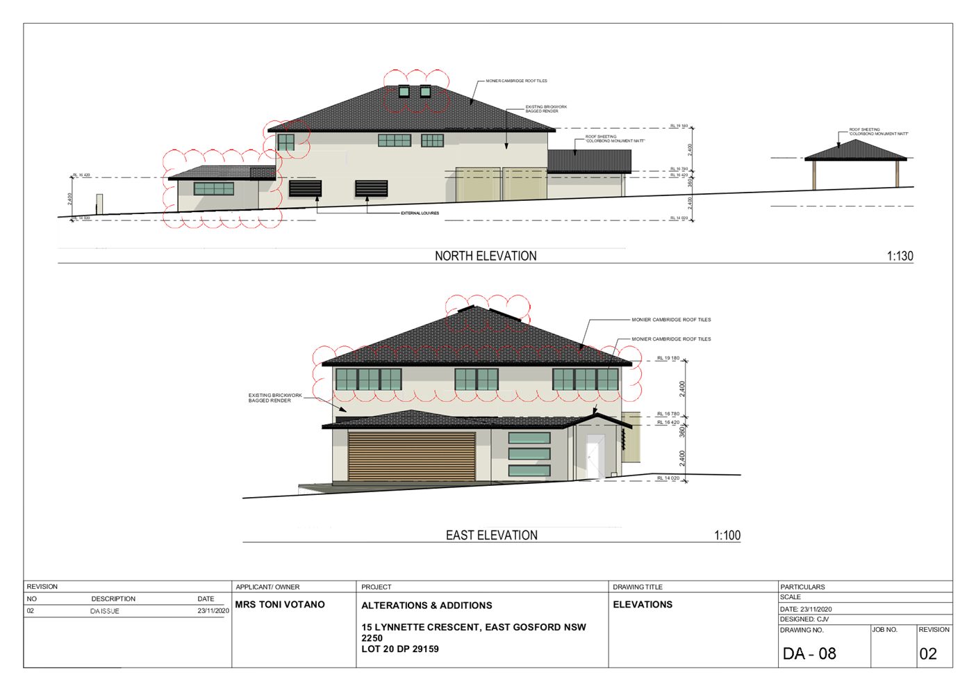
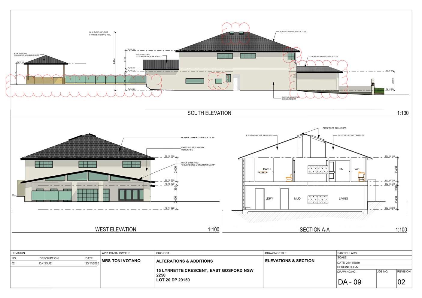
|
Item No: 4.2
|
|
|
Title: DA/58543/2020 - 60
Terrigal Esplanade, Terrigal - Alterations & Additions to Shop Top
Housing
|
|
|
Department: Environment
and Planning
|
|
|
22
July 2021 Local
Planning Panel Meeting
|
|
Reference: 011.2020.00058543.001
- D14737021
Author: Susana
Machuca, Senior Development Planner
Manager: Ailsa
Prendergast, Section Manager, Development Assessment South
Approver: Andrew
Roach, Unit Manager, Development Assessment
Recommendation
1 That the Local Planning
Panel assume the concurrence of the Secretary of the Department of Planning to
permit the non-compliance with the development standard under Clause 4.6 of the
Gosford Local Environmental Plan 2014, in accordance with the provisions of
Clause 64 of the Environmental Planning and Assessment Regulation 2000.
2 That
the Local Planning Panel grant consent to DA58543/2020 for a Shop Top Housing
development on Lot: 1 DP: 214139 and Lot: B in DP: 374520, No. 60 Terrigal
Esplanade, TERRIGAL, subject to the conditions detailed in the schedule
attached to the report and having regard to the matters for consideration
detailed in Section 4.15 of the Environmental Planning and Assessment Act 1979.
Key
Issues
· Floor Space Ratio of the
proposal
· Height Form –
Maximum External Wall height
Precis:
|
Proposed Development
|
Alterations and
Additions to Shop Top Housing development and partial demolition of existing
rear retail structure.
|
|
Permissibility and
Zoning
|
The land is zoned B2
Local Centre under the Gosford Local Environmental Plan 2014.
The development is
considered Shop Top Housing which is permissible in the zone with consent of
Council.
“shop top
housing” means:
one or more dwellings
located above ground floor retail premises or business premises.
Note. Shop top housing
is a type of residential accommodation.
|
|
Relevant Legislation
|
· Environmental
Planning & Assessment Act 1979 – Section 4.15
· Local
Government Act 1993 – Section 89
· State
Environmental Planning Policy (Coastal Management) 2018
· Draft
Central Coast Local Environmental Plan 2018
· Gosford
Local Environmental Plan 2014
Gosford Development
Control Plan 2013
|
|
Current Use
|
Shop Top Housing
|
|
Integrated Development
|
No – not integrated
development in accordance with Clause 4.46 of the Environmental Planning
& Assessment Act 1979.
|
|
Submissions
|
Nil
|
Variations to Policies
|
Clause
|
4.4 Floor Space Ratio
|
|
Standard
|
1.1:1
|
|
LEP/DCP
|
Gosford Local Environmental Plan 2014
|
|
Departure
basis
|
32.9% - (44.11m2)
|
|
|
|
|
Clause
|
4.3.6 Max. External
Wall height
|
|
Standard
|
10m
|
|
LEP/DCP
|
Gosford Development
Control 2013
|
|
Departure
basis
|
11.4% - (1.14m) along
18.3% of the total length of east and west side boundaries
|
The Site
The
subject site is legally identified as Lot: 1 DP: 214139 and Lot: B in DP:
374520, No. 60 Terrigal Esplanade, Terrigal, has a site area of approximately 121.9m2. The site is
located on the southern side of Terrigal Esplanade between Campbell Crescent and
Kurrawyba Avenue and has a frontage of 3.175m to Terrigal Esplanade, a rear
boundary of 3.17m to Hudson Lane and side boundaries of approximately 38.41m.
The site runs on an approximately east to west axis, is rectangular in shape
and falls to the rear of the site approximately 1.59m from Terrigal Esplanade
(RL4.29AHD) to Hudson Lane (RL2.70AHD). Refer to Figures 1 and 2.
The
site is currently occupied by an existing two (2) storey brick commercial
building where a café occupies the ground floor level and residence
above on the first-floor level (shop top housing) with a metal roof and with
off street parking access from Hudson Lane. The site does not contain any
vegetation. Refer to Figures 3 and 4.
The
subject site is not identified as being “Bushfire prone land” on
Council’s mapping system.
The
subject site is however, identified to be located within Council’s
Terrigal CBD Flood Study area and subject to flooding. Restrictions to
development on the land may apply, including adherence to a Flood Planning
Level for building improvements. Council's Engineer is supportive of the
application subject to conditions.
The
site is zoned B2
Local Centre under the provisions of Gosford Local Environmental Plan 2014
(GLEP 2014). The site is proposed to retain the same zoning under Draft
Central Coast Local Environmental Plan 2018 (CCLEP 2018).

Surrounding
Development
The site is located on Terrigal Esplanade facing Terrigal
beachfront. Surrounding development comprises a mixture of established one (1),
two (2) and three (3) level retail/commercial (most older style shop top
housing) allotments to the east, south and west. To the north is Terrigal Beach
and reserve including Terrigal Surf Life Saving Club and memorial. On the
eastern and western adjoining properties, No. 58 and 62 Terrigal Esplanade
comprise shop top housing developments with Ice cream Parlour and Chinese
Restaurant tenancies respectively. Refer to Figures 5 and 6.

The
Proposed Development
An
application has been received for the proposed partial demolition and proposed
alterations and additions to the existing shop top housing with on-grade
parking, an overall maximum height of RL 13.96 (HOB 11.136m)
and floor space ratio (FSR) of 1.46:1, an equivalent to a total Gross
Floor Area (GFA) of 178.2m2. Refer to Figures 7, 8 and 9.
Overall,
the proposal comprises:
1. Retail shop
(approximately 74.03m2 + 21.6m2 combined circulation space):
a) Partial
demolition at the rear of the existing retail premises (refer to demolition
plan drawing No. DA21 Rev. F);
b) Alterations
and additions to retail floor levels:
o Construction of new awning at
Terrigal Esplanade;
o construction new lift shaft, stairs
and circulation space;
o relocation of exhaust shaft to roof
level;
o construction new retail sanitary
facilities /balcony /storage and cool-room area; and
o construction of residential entry.
2. Residential two
(2) bedroom Unit - (approximately 83.37m2 level 1 + 20.8m2 level 2 + 17.9m2
POS):
c) Alterations
and additions to residential first floor levels:
o construction new Lift shaft, stairs
and circulation space;
o rearrangement of living /kitchen
/bedroom areas to existing front residential unit to accommodate new
living/dining /kitchen area and tv lounge /bathroom areas; and
o construction at rear of new bathroom,
bedroom and balcony;
d) Construction
of new second floor level to residential unit:
o construction new Lift shaft, stairs
and circulation space; and
o construction new toilet /wet bar
/dining and private open space (POS) areas.
3. Parking and Waste
storage facilities with direct access to Hudson Lane.
4. Hours of
Operation: The proposed residential component of the development will be
accessible 24 hours a day. The retail component currently Esplanade Café
is open 6:00am top 4:00 seven days a week.
The
application has been amended twice during the assessment process (amended
architectural plans, WMP and SoEE were submitted on 3 March 2021) in response
to issues raised through initial assessment by Council officers including but
not limited to building, engineering, planning and solid waste requirements.
Final amended architectural plans, WMP and SoEE submitted 26 April 2021, 17 May
2021 and 8 July 2021 respectively to include final updated information.
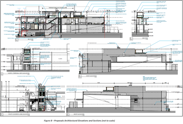

History
Council’s
records show that the following applications were previously lodged on this
site:
CC3622/1999
Construction Certificate - AWNING
Lodged: 11/05/1999 (MATRIX COMPLIANT APPROVAL: 29/06/1999)
BA4353/1997
Building Application: SHOP FITOUT
Lodged:21/04/1997(Approved :29/05/1997)
Address: 60 Terrigal Esplanade TERRIGAL NSW 2260
No
other applications of relevance are contained in Council records.
Assessment
Having
regard for the matters for consideration detailed in Section 4.15 of the
Environmental Planning and Assessment Act 1979 and other statutory
requirements, Council’s policies and Section 10.7 Certificate details,
the assessment has identified the following key issues, which are elaborated
upon for Council’s information. Any tables relating to plans or policies
are provided as an attachment.
State
Environmental Planning Policies (SEPP)
State
Environmental Planning Policy (Building Sustainability Index: BASIX) 2004
The
proposed shop top housing constitutes ‘Basix affected development’
as defined within the Environmental Planning and Assessment Regulation 2000. As
such, the application is supported by a BASIX certificate Number A344115_03
prepared by Howard Leslie & Associates dated 18 February 2020 which
confirms the proposal will meet the NSW government's requirements for
sustainability, if built in accordance with the commitments in the certificate.
Conditions
have been imposed on the consent to ensure that these requirements are adhered
to. (Refer to Conditions 1.1 and 1.3).
The
proposal is considered to be consistent with the requirements of State
Environmental Planning Policy (Building Sustainability Index: BASIX) 2004.
State Environmental Planning Policy (Coastal Management) 2018
The
provisions of SEPP Coastal Management require Council to consider the aims and
objectives of the SEPP when determining a development application within the
Coastal Management Areas. The Coastal Management Areas are areas defined on
maps issued by the NSW Department of Planning & Environment. The subject
property is mapped coastal environment area and a coastal use area under the
SEPP.
The
relevant matters have been considered in the assessment of this application.
The application is considered consistent with the stated aims and objectives.
The
development is located within the Terrigal Town Centre west of Terrigal
Esplanade. The proposed expansion (44.11m2) is considered to not result
in any impact on the coastal environment or coastal processes.
Council
has considered the proposed development and it is concluded the proposal is
consistent with cl. 14 of SEPP Coastal Management 2018 and no further objection
is made in this regard.
Gosford
Local Environmental Plan 2014
The
site is subject to the Gosford Local Environmental Plan 2014 (GLEP
2014).
Clause
1.2 Aims of Plan
(1) This Plan
aims to make local environmental planning provisions for land in that part of
the Central Coast local government area to which this Plan applies (in this
Plan referred to as Gosford) in accordance with the relevant standard
environmental planning instrument under section 3.20 of the Act.
(2) The particular aims of
this Plan are as follows—
(aa) to
protect and promote the use and development of land for arts and cultural
activity, including music and other performance arts,
(a) to
encourage a range of housing, employment, recreation and services to meet the
needs of existing and future residents of Gosford,
(b) to
foster economic, environmental and social well-being so
that Gosford continues to develop as a sustainable and prosperous place to live,
work and visit,
(c) to
provide community and recreation facilities, maintain suitable amenities and
offer a variety of quality lifestyle opportunities to a diverse population,
(d) (Repealed)
(e) to
concentrate intensive land uses and trip-generating activities in locations
that are most accessible to transport and centres,
(f) to
promote the efficient and equitable provision of public services,
infrastructure and amenities,
(g) to
conserve, protect and enhance the environmental and cultural heritage of
Gosford,
(h) to
protect and enhance the natural environment in Gosford, incorporating
ecologically sustainable development,
(i) to
minimise risk to the community in areas subject to environmental hazards,
particularly flooding and bush fires,
(j) to
promote a high standard of urban design that responds appropriately to the
existing or desired future character of areas,
(k) to
promote design principles in all development to improve the safety,
accessibility, health and well-being of residents and visitors,
(l) to
encourage the development of sustainable tourism that is compatible with the
surrounding environment.
The
development application
overall meets
the objectives of the zone by supporting the ongoing renewal of the centres in
fostering economic, environmental and social well-being as such, it is
considered to be consistent with Clause 1.2 (2)(a), (b), (c), (e), (h), (j) and
(k) aims of the GLEP 2014.
Zoning and Permissibility
The
site is zoned B2 Local Centre under the Gosford Local Environmental Plan
2014 (GLEP) 2014.
1 Objectives
of Zone:
· To provide a range of
retail, business, entertainment and community uses that serve the needs of
people who live in, work in and visit the local area.
· To encourage employment
opportunities in accessible locations.
· To maximise public
transport patronage and encourage walking and cycling.
· To provide for residential
uses, but only as part of a mixed-use development.
· To ensure that development
is compatible with the desired future character of the zone.
· To promote ecologically,
socially and economically sustainable development.
· To ensure that the town
centres of Erina and Woy Woy are recognised as providing a higher level, and
greater diversity, of services and facilities to serve a wide population
catchment from numerous localities and as key public transport nodes, secondary
to Gosford City Centre.
· To ensure that village
centres such as Avoca, East Gosford, Ettalong Beach, Kincumber, Lisarow,
Niagara Park, Terrigal, Umina Beach, West Gosford and Wyoming are recognised as
providing a broad range of services and facilities to serve the population of
the locality.
· To ensure that villages
are recognised as providing local level services and facilities and are
developed at a scale that reflects their population catchment and as a focus
for public transport routes.
· To ensure that the
different roles of villages are recognised with some villages being key tourist
destinations with boutique activities in addition to serving the needs of local
residents, while other villages are purpose-built centres to serve the needs of
the local population.
· To encourage the
residential population of villages and town centres to contribute to the
vitality of those locations.
The
proposed development would provide for small scale business use similar to
those currently located on the main street commercial strip and of which will
continue to service the needs of both residents and visitors to the area.
Additionally, the proposed residential unit will undergo a needed building
upgrade to be in line with current modern architectural design and amenity of
development in the proximate surrounding area. It is noted that the proposed
shop top housing development will continue to offer commercial premises that
would be ultimately be available to local businesses, and a diversified
residential offering that increases the housing supply in the area.
As
such, the proposed development is considered to be consistent with the desired
future character of the zone, insomuch the built form would maintain the bulk
and scale of Terrigal Esplanade as well as supporting the ongoing renewal of
the local centre by concentrating employment and housing opportunities in
accessible and well serviced centres.
2. Permitted without consent:
Recreation areas
3. Permitted
with consent
Boarding houses; Centre-based child
care facilities; Commercial premises; Community facilities; Educational
establishments; Entertainment facilities; Function centres; Information and
education facilities; Medical centres; Oyster aquaculture; Passenger transport
facilities; Recreation facilities (indoor); Registered clubs; Respite day care
centres; Restricted premises; Roads; Service stations; Shop top housing;
Tank-based aquaculture; Tourist and visitor accommodation; Any other
development not specified in item 2 or 4
4. Agriculture;
Air transport facilities; Animal boarding or training establishments; Biosolids
treatment facilities; Boat building and repair facilities; Boat sheds; Camping
grounds; Caravan parks; Cemeteries; Charter and tourism boating facilities;
Correctional centres; Crematoria; Depots; Eco-tourist facilities; Electricity
generating works; Environmental facilities; Environmental protection works;
Exhibition homes; Exhibition villages; Extractive industries; Farm buildings;
Flood mitigation works; Forestry; Freight transport facilities; Heavy
industrial storage establishments; Highway service centres; Home-based child
care; Home businesses; Home occupations (sex services); Industrial retail
outlets; Industries; Marinas; Mooring pens; Moorings; Mortuaries; Open cut
mining; Pond-based aquaculture Recreation facilities (major); Recreation
facilities (outdoor); Research stations; Residential accommodation; Resource
recovery facilities; Rural industries; Sewage treatment plants; Sex services
premises; Storage premises; Transport depots; Vehicle body repair workshops;
Vehicle repair stations; Warehouse or distribution centres; Waste disposal
facilities; Water recreation structures; Water recycling facilities; Water
supply systems; Wholesale supplies
The
proposed development is classified as Shop top housing and is permissible in
the zone with consent.
4.3 Height of Buildings
The
objectives of clause 4.3 are:
(a) to establish
maximum height limits for buildings,
(b) to permit building
heights that encourage high quality urban form,
(c) to ensure that
buildings and public areas continue to receive satisfactory exposure to sky and
sunlight,
(d) to nominate heights
that will provide an appropriate transition in built form and land use
intensity,
(e) to ensure that
taller buildings are located appropriately in relation to view corridors and
view impacts and in a manner that is complementary to the natural topography of
the area,
(f) to protect public
open space from excessive overshadowing and to allow views to identify natural
topographical features.
Clause
4.3(2) of the Gosford Local Environmental Plan 2014 states that the
height of a building on any land is not to exceed the maximum height indicated
on the Height of Buildings Map. Council’s LEP as per the Height of
Buildings Map prescribes a maximum
height
of 18.5m for the subject land. The proposed shop top housing has a maximum
height of building (HOB) of 11.136m which is approximately 7.36m less than the
requirement. As such, the proposed height of building satisfies the objectives
of this clause.
4.4 Floor Space Ratio
The
provisions of cl. 4.4.A(4) within the GLEP 2014 establishes the maximum Floor
Space Ratio (FSR) for buildings. The applicable FSR control is 1.1:1, which
permits a maximum gross floor area (GFA) of 134.09m2. The proposed development
would result in a GFA of 178.2m2, equating to a variation of 44.11m2, a FSR of
1.46:1 or 32.9%, non-compliant with the development standard.
This
variation has been assessed in accordance with cl 4.4 of GLEP 2014.
4.6 Exceptions
to Development Standards
Clause
4.6 (Exceptions to Development Standards) of GLEP 2014 provides the ability to
grant consent to a development application where the variation to a development
standard can be adequately justified and where the objectives of clause 4.6 are
satisfied, being:
(a) to
provide an appropriate degree of flexibility in applying certain development
standards to particular development,
(b) to
achieve better outcomes for and from development by allowing flexibility in
particular circumstances.
In accordance
with cl. 4.6(4) of GLEP 2014, development consent must not be granted for a
development that contravenes a development standard unless the consent
authority is satisfied that the applicant’s written request has
adequately addressed the matters required to be demonstrated in subclause (3).
Subclause 3 provides:
‘Development
consent must not be granted for development that contravenes a development
standard unless the consent authority has considered a written request from the
applicant that seeks to justify the contravention of the development standard
by demonstrating:
(a) that compliance with
the development standard is unreasonable or unnecessary in the circumstances of
the case, and
(b) that there are
sufficient environmental planning grounds to justify contravening the development
standard.’
A cl. 4.6 (Exceptions to Development
Standards) variation for the non-compliance associated with FSR (cl.
4.4A (4) of GLEP 2014) was provided. The cl. 4.6 of GLEP 2014 request submitted
by the applicant states how strict compliance with the development standards is
unreasonable or unnecessary (having regard to the decision in Wehbe v
Pittwater Council [2007] NSW 827) and how there are sufficient
environmental planning grounds to justify the contravention, is summarised
below:
· The
proposed development recognises the standards for the maximum development
density and intensity of land use in the precinct but anticipates the future
needs of the Terrigal town centre through high quality building design that
offsets and improves on the current built form;
· The proposal recognises the need to
control building density and bulk in relation to site area in order to achieve
the desired future character for different locations. The proposed building
design maintains a similar building envelope as seen at street level to that
which would be achieved by meeting the current standard whilst seeking to lift
the design standards of the main street and setting new standards for future
buildings;
· The proposed design minimises any
adverse environmental effects on the use or enjoyment of adjoining properties
and the public domain through good building design that meets the desired
character outcomes and setts the third level back from the street frontage to
minimise visual impact;
· The proposal provides an appropriate
correlation between the size of a site and the extent of any development on
that site through good urban design and building articulation; and
· The proposal facilitates design
excellence by ensuring the extent of the proposed floor space in the building
envelope leaves generous space for the articulation and modulation of design.
The cl.4.6 of
GLEP 2014 variation request submitted by the applicant also provides assessment
of the proposal against the relevant development standard and zone objectives,
and Council is satisfied that the applicant has demonstrated consistency with
these objectives such that the proposal is in the public interest.
In
order to demonstrate if the proposal has merit, consideration of the proposed floor space ratio - has been provided with
regard to the objectives of the control contained within cl. 4.4 of GLEP 2014:
a) to establish
standards for the maximum development density and intensity of land use;
In this instance, the proposal continues to provide a
range of retail and business uses on the ground floor (street level) that will
serve the needs of people who live in, work in and visit the Terrigal area. The
proposed development provides for residential uses as part of a mixed-use
development through the provision of improved and expanded residential
accommodation above the existing ground level retail space;
b) to
control building density and bulk in relation to site area in order to achieve
the desired future character for different locations;
The proposal does not result in
excessive building bulk and scale. The proposal maintains a similar building
envelope when seen at street level due to the third storey being setback from
The Terrigal Esplanade frontage. Whilst the proposal is seeking to upscale the
design standards of the main street and setting new standards for future shop
top buildings, it continues to ensure that the different roles of villages are
recognised with centres such as Terrigal being key tourist destinations with
boutique activities in addition to serving the needs of local residents;
c) to
minimise adverse environmental effects on the use or enjoyment of adjoining
properties and the public domain;
The proposal does not impact on
adjoining properties it does not affect overshadowing nor views from properties
facing the beach front views or from the rear lane;
d) to
maintain an appropriate visual relationship between new development and the
existing character of areas or locations that are not undergoing, and are not
likely to undergo, a substantial transformation;
The proposal is consistent with zone objectives as the
proposed building design maintains a similar building envelope when seen at
street level and encourages the residential population of villages and town
centres to continue to providing local level services and facilities and is
developed at a scale that reflects their population catchment; and
e) to provide an appropriate correlation
between the size of a site and the extent of any development on that site;
The maximum GFA permitted on the site is
134.09m2. The proposed development has a maximum GFA of 178.20m2, an exceedance
of 44.11m2 reflecting a FSR of 1.46:1 representing a 32.9% variation. The
proposed exceedance of the maximum permissible floor space area is associated
with the width and proportions of subject site. However, despite the variation
and proportionality of the site, the proposed building provides an appropriate
correlation between the size of the site and the extent of any development on that
site through good use of floor space in relation to site levels and building
articulation without causing unreasonable amenity impacts to adjoining
properties.
Based
on the consideration of this objective, Council is advised that compliance with
the development standard is unnecessary, as the proposed additional FSR does
not hinder the objective being realised.
f) to facilitate design
excellence by ensuring the extent of floor space in building envelopes leaves
generous space for the articulation and modulation of design;
The 3D renderings reviewed of the proposal demonstrates
that the scale and intensity of the shop top housing development would not
result in a development outcome that is inappropriate for the established
evolving character of the immediate area and raised no objection.
The
cl.4.6 of GLEP 2014 variation request submitted by the applicant also provides
assessment of the proposal against the relevant development standard and zone
objectives, and Council is satisfied that the applicant has demonstrated
consistency with these objectives such that the proposal is in the public
interest.
In
accordance with cl. 4.6(4)(b) of GLEP 2014 development consent must not be
granted for development that contravenes a development standard unless the
concurrence of the Secretary has been obtained.
Planning
Circular PS 18-003, issued 21 February 2018, states that a delegate of Council
may not assume the concurrence of the Secretary when considering exceptions to
development standards under cl.4.6 of GLEP 2014 if the development contravenes
a development standard by greater than 10%. In this instance, the proposed
variations exceed 10%, and the concurrence of the secretary cannot be assumed.
As such the application is required to be reported to the LPP for
determination.
This
assessment has been carried out having regard to the relevant principles
identified in the following case law:
1 Wehbe
v Pittwater Council [2007] NSWLEC 827
2 Four2Five
Pty Ltd v Ashfield Council [2015] NSWLEC 1009
3 Four2Five
Pty Ltd v Ashfield Council [2015] NSWLEC 90
4 Four2Five
Pty Ltd v Ashfield Council [2015] NSWCA 248
The
cl. 4.6 (Exceptions to Development Standards) of GLEP 2014 request submitted by
the applicant appropriately addresses the relevant principles and exhibits
consistency with the relevant objectives under GLEP 2014.
This assessment concludes that the
cl. 4.6 (Exceptions to Development Standards) of GLEP 2014 variation provided
having regard to cl.4.4 Floor Space Ratio development standard of GLEP 2014 is
appropriately founded and worthy of support.
7.1 Acid Sulfate Soils
This
land has been identified as being affected by the Acid Sulfate Soils Map and
the matters contained in clause 7.1 of Gosford Local Environmental Plan 2014
have been considered. The site contains Class 3 Acid Sulfate Soils. In this
instance, the proposed works are not considered to impact on Acid Sulfate
Soils. (Condition 4.14)
7.2
Flood Planning
The
subject site is located in an area subject to flooding as identified in
Councils Terrigal CBD Flood Study and subject to the imposition of a minimum
floor level. The 1 % AEP flood level adjacent the site within Hudson Lane is
3.3m AHD and the Flood Planning level applied to all habitable floor levels is
3.8m AHD. The proposed car parking space and bin storage floor level is graded
at 5 % above from the Hudson lane 2.8 m AHD pavement level. It is noted that
flood waters will potentially inundate the floor to a depth of 400mm. As such,
it is recommended that a Flood Protection Barrier is provided at the garage
shutter to ensure the flood protection to the parked vehicle and reduce any
safety risk to the occupants. Notwithstanding, Council’s Engineer is
supportive of the proposal subject to conditions (Conditions 1.1, 2.7, 2.8
and 5.20 and 6.11).
The
development is considered satisfactory in respect to Clause 7.2 of
GLEP.
s. 4.15(1)(a)(ii) of the
EP& A Act: Draft Environmental Planning Instruments:
Draft Central Coast Local Environmental Plan
The
application has been assessed under the provisions of the draft Central Coast Local
Environmental Plan (draft CCLEP) with respect to zoning,
development standards and special provisions.
Under the draft CCLEP the subject
land will remain to be zoned as B2 Local Centre. Permissibility for shop top
housing development within this zone is to remain as per the current
applicable Gosford Local Environmental Plan 2014 which permits the proposal with
consent of Council.
Gosford
Development Control Plan 2013
This
plan is known as the Gosford Development Control Plan 2013 (GDCP) and
supports the objectives identified by the Gosford Local Environmental Plan
2014.
Part
2 Scenic Quality and Character
The
proposal is subject to the provisions of Gosford Development Control Plan
(DCP) 2013 Chapter 2 Scenic Quality and Character as such, the subject site is
located within the Terrigal 8: Mainstreet Centre character area. The desired
character statement for this locality (summarized) recommends that:
· This should remain a
mixed-use centre that provides a range of services and accommodation for local
residents as well as visitors, where the scenic potential of a prominent
backdrop to Gosford City’s ocean beaches is enhanced by new developments
that encourage high levels of street activity and also achieve improved
standards of amenity plus urban-and-civic design quality.
· Protect and enhance
existing levels of “main-street” activity with building forms that
maintain both the pedestrian-friendly scale of existing one and two storey
shop-front developments, and also the current level of midday sunlight along
all footpaths and laneway frontages. Promote high levels of on-street
activity by maximising the number of retailers or businesses and the continuity
of shop-windows along all street and laneway frontages. Avoid indoor arcades
that would draw people away from the street. Incorporate awnings, colonnades or
balconies in all buildings to provide sheltered pedestrian settings that
encourage pavement dining. Contribute to high levels of visible activity along
all streets by surrounding upper storeys with balconies that accommodate
restaurant dining or residents’ outdoor recreation.
· Reflect the form of
development that is typical of traditional coastal centres where a wide variety
of retailers are accommodated by separate buildings upon narrow-fronted
allotments. Along any street or waterfront, avoid the appearance of a
continuous wall of development or uniform building heights. Vary the shape and
height of all visible facades. Top-most storeys should be setback behind wide
roof terraces, and roofs plus parapet heights should step from one building to
the next. Street corners should be emphasised by taller forms. Neighbouring
buildings should be separated by landscaped courtyards and alleyways that
provide view corridors, access to apartment lobbies, and daylight plus an
outlook for above-ground dwellings.
· Disguise the scale and
bulk of new buildings. All visible facades should employ extensive windows that
are shaded by lightly-framed balconies, verandahs or exterior sunshades, plus
painted finishes and some board or sheet cladding rather than expanses of plain
masonry. Roofs should be gently-pitched to minimise the height of ridges,
flanked by wide eaves that shade terraces and also disguise the scale of
exterior walls. Side and rear facades should match the design quality of the
street frontage.
· Conceal off-street parking
behind street-front shops or apartments, and provide unobtrusive vehicle
entrances from laneways or secondary streets to minimise disruption of
shopfronts and their associated pedestrian activity. Contribute to co-ordinated
street improvements that include dedicated pedestrian crossings, footpath
paving, landscaping and lighting to provide safe and secure settings for
informal social interaction. Building colour schemes and commercial signs
should be co-ordinated and limited in size and number to promote the identity
of this coastal centre, rather than emphasising corporate sponsorship.
· Overall, it is noted that
the proposed alterations and additions retains the mix-use character and
density of the existing shop top developments found within the immediate
surrounding area. The building design improves the standards of amenity and
contributes to the urban-and-civic design quality of the main street centre.
The height and form of the building preserves a bulk and scale that ensures to
maintain panoramic views and coastal views for surrounding development as well
as participation at street level of the prime ocean scenic backdrop for the
locals and visitors alike.
· The proposal ensures to
maintain ‘main street’ activity by upgrading building floor areas,
planimetric design, distribution and connectivity, facades, shop awning and
building materials that are to scale, modern, compatible and protective to
outdoor pedestrian-friendly settings and open space recreation areas of the
immediate surrounding neighbourhood.
· As such, the proposed
development meets the objectives of the zone by providing and supporting the
ongoing renewal of the Terrigal Town Centre with quality-built spaces that
contribute and concentrate social economic opportunities in accessible and well
serviced centres.
An
assessment of the proposed development against the relevant chapters of Gosford
Development Control Plan (GDCP) 2013 is provided in a Compliance Table
under
Attachment
3. The
proposed works are consistent with the relevant chapters of GDCP 2013.
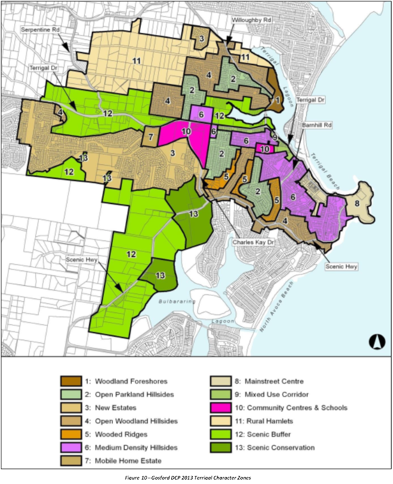
Likely
Impacts of the Development:
Built
Environment
The
subject site is zoned B2 Local Centre under GLEP 2014 and is surrounded by a
mix of one (1), two (2) and three storey commercial and retail development of
evolving contemporary design amongst original mid twentieth shop top housing.
The site is on a prominent stretch of Terrigal Esplanade facing Terrigal Beach
that is central to all the public activities of the village centre.
The
proposals-built form is considered acceptable in the context of the site. The
proposed works are consistent with the uses envisaged for the B2 local Centre
zone, and if approved the building would offer both an improved standard of
housing supply and commercial opportunities with urban design quality and
amenity within the Terrigal Village Centre. While the design is not reflective
of the original mid-twentieth century bungalows, it is consistent with the
emerging and desired character of the locality as single shop top housing
nearing the end of their economic life are being up-graded to development of
contemporary design and use of materials.
It
is noted that the proposal will not increase in density nor detract highly from
the original scale and bulk present in the immediate vicinity and
neighbourhood. Nor is not considered to have adverse amenity impacts to
adjoining development from overshadowing, privacy, noise generating activities
and views.
A
comprehensive assessment of the impacts of the proposed development on the
built environment has been undertaken in terms of the GDCP 2013 compliance. The
potential impacts are considered reasonable.
Natural
Environment
The
proposal is satisfactory in relation to impacts on the natural environment as
identified throughout this report. It is noted that the building envelope does
not exceed the HOB, there is no exiting vegetation and/or tree to be removed to
accommodate the proposed built form, and any existing view corridors will not
be affected.
As
such it is considered that there will be no significant impact upon the natural
environment as a result of the proposal.
Economic
Impacts
It
is anticipated that he proposed development will provide further urban design
quality and amenity for the Terrigal Town Centre where there is constant and
strong need for upgraded commercial /retail tenancy floor space as well as
apartment style residential accommodation.
The
proposed development will continue to contribute to the supply of services and
employment opportunities within the local area and introduce upgraded and
quality residential housing to Terrigal Town Centre which is in close proximity
to a wide variety of existing services, transport, hospitality and tourism
activities.
Social Impacts
It
is anticipated that proposed development will have beneficial social impacts in
that it will provide constant small scale but active employment and services
for the hospitality and tourism activities of Terrigal Beach and the town
centre which is of regional importance.
Suitability of the Site
for the Development
The site is considered to be suitable for the proposed development
as follows:
· The site is zoned B2
Local Centre zoning under GLEP 2014. The proposal is a permissible use under
the B2 Local Centre zone and the scale of the proposed development is
consistent with the objectives of the zone;
· There are no
environmental hazards which would prevent development of the site;
· Utility services are
available to the site; and
· The site is located on
and near public transport facilities as well as public services, recreation and
community facilities.
Any
Submission made in Accordance with this Act or Regulations
The development application was notified between 26 July
2020 to 24 July 2020 in accordance with Gosford
Development Control Plan (GDCP) 2013, Chapter 7.3 Notification of
Development Proposals. No submissions received.
Submissions from Public Authorities
There have been no submissions from any Public Authorities.
Internal Consultation
The
application has been referred to and reviewed by the following experts in
council:
|
Development
Engineer Officer
|
|
Supported
subject to conditions 1.1, 2.7, 2.8 and 5.20.
|
|
|
Building
Officer
|
|
Supported
subject to conditions 1.1, 2.6, 2.9, 3.7, 3.8, 3.9, 3.12, 3.13,
3.14, 3.16, and 6.24.
|
|
|
Food
Surveillance Officer
|
|
Supported
subject to conditions 1.1, 2.6, 2.10, 4.21, 5.16, 5.17, 5.18 and
6.23.
|
|
|
Liquid
Trade Officer
|
|
Supported
subject to conditions 1.1, 2.4, 5.13, 5.14, 5.15 and 6.22.
|
|
|
Solid
Waste Officer
|
|
Supported
subject to conditions 1.1, 4.20, 6.12, 6.14, 6.15, 6.16, 6.17, 6.18, 6.19,
6.20 and 6.21.
|
|
|
Water
and Sewer
|
|
Supported
subject to conditions 1.1, 2.4 and 2.5.
|
|
The Public Interest:
The
public interest is best served by the orderly and economic use of land for
which it is zoned. The proposed shop top housing development is permissible
with consent and complies in general with the provisions of the relevant
Council policies and controls. As such, the approval of the application is
considered to be in the public interest as follows:
· The development would
introduce and generate social and economic benefits for the community and urban
space by providing a high-level amenity housing choice to the area and offer
updated commercial tenancies that would enable local businesses to establish within
the neighbourhood centre;
· The proposal is consistent
with the relevant objectives of the applicable environmental planning
framework, including the GLEP 2014 and GDCP 2018; and
· The proposal does not
result in any unreasonable environmental impacts and will not unreasonably
impact the amenity of neighbouring properties.
Ecologically
Sustainable Principles:
The
proposal has been assessed having regard to ecologically sustainable
development principles and is considered to be consistent with the principles.
The
proposed development is considered to incorporate satisfactory stormwater,
drainage and erosion control and introduces landscaping and POS as a roof top
feature where possible and is unlikely to have any significant adverse impacts
on the environment and will not decrease environmental quality for future
generations. The proposal does not result in the disturbance of any endangered
flora or fauna habitats and is unlikely to significantly affect fluvial
environments.
Climate Change
The
potential impacts of climate change on the proposed development have been
considered by Council as part of the assessment of the application.
This
assessment has included consideration of such matters as potential rise in sea
level; potential for more intense and/or frequent extreme weather conditions
including storm events, bushfires, drought, flood and coastal erosion; as well
as how the proposed development may cope, combat, withstand these potential
impacts.
The
proposed development is considered satisfactory in relation to climate change.
Other
Matters for Consideration:
Any Planning Agreement
There are no planning agreements applicable to the application.
Relevant Regulations
There are no specific matters under
the Regulation that require further discussion.
Vehicle Access
The amended plans detail a single car
space located between the building masonry walls which are aligned along the
boundary of the site. It is noted that the proposed car space will comply with
the AS 2890.1:2004 for car parking dimensions however the required additional
300mm offset to the walls cannot be accommodated to each side. The property
width is basically 260mm to narrow to provide full compliance with AS
2890.1:2004.
To ensure egress from the car space
is undertaken with safety the maneuvering into the car space from Hudson Lane
should be in a reverse movement. This will ensure all egress vehicle movements
are in a forward direction reducing potential conflicts with traffic movements
with Hudson Lane and risks to pedestrian safety.
Council Development Engineer has
assessed the application and is supportive subject to conditions.
Waste Management
A
Waste Management Plan (WMP) was submitted with the application and found to be
deficient and not accordance with the Development Application Guide and Chapter
7.2 – Waste Management of Gosford DCP 2013 for all site preparation,
demolition, construction and use Ongoing Operation. Councils Waste Officer
noted that the demolition and construction waste estimates appear
underestimated and/or not provided. The applicant has reviewed and amended the
WMP twice in line with the requirements of the Gosford Development Control Plan
2013. Council Waste Officer’s final review still noted some deficiencies
but is supportive of the application subject to conditions. (Conditions 1.1, 4.20, 6.12, 6.14,
6.15, 6.16, 6.17, 6.18, 6.19, 6.20 and 6.21).
Section 94A Contributions
The
site is located within section 7.11 development contribution plan 47A Terrigal.
The applicable contribution amount was calculated and imposed as a standard
condition of consent requiring the contribution to be paid prior to the issue
of any Construction Certificate.
It
is noted that the overall GFA of the proposal has increased by 44.11m2 and as
such the above calculations reflect the difference between the proposed GFA of
178.2m2 minus existing GFA of 134.09m2. Refer to Development Contributions
Calculations Sheets on CM D14736314 and D1476314.
As such and Pursuant to Section 7.11 of the
Environmental Planning and Assessment Act 1979, pay to Council a total
contribution amount of $3,463.00, that may require
adjustment at the time of payment, in accordance with the relevant Council
Contribution Plans No. 47A - Terrigal. (Condition 2.2)
|
Open
Space -Embellishment
|
A
|
(Key No 804)
|
57.00
|
|
Footpaths
- Capital
|
A
|
(Key No 805)
|
147.00
|
|
Town
Centre / Foreshore Improvements
|
A
|
(Key No 835)
|
1,948.00
|
|
Stormwater
& Flood Mitigation
|
A
|
(Key No 836)
|
1,311.00
|
|
TOTAL
AMOUNT
|
$3,463.00
|
Water
and Sewer Contributions
There
are no water and sewer contributions applicable to the proposed development.
Conclusion:
This
application has been assessed under the heads of consideration of section 4.15
of the
Environmental Planning and Assessment Act 1979 and all relevant instruments and
policies and on balance, the proposed development is considered reasonable and
therefore is recommended that the Local Planning Panel grant development
consent approval to DA58543/2020 subject to conditions set out in Attachment 1.
Reasons for the Decision:
The
reasons for the decision as recommended under the assessment of this
application are as follows:
1 The
proposal is satisfactory having regard for the relevant environmental planning
instruments, plans and policies.
2 The
proposal has been considered against the provisions of Gosford Local
Environmental Plan 2014 and has been found to be satisfactory.
3 There are no significant
issues or impacts identified with the proposal under s.4.15 of the Environmental
Planning and Assessment Act 1979.
Attachments
|
1⇩
|
Draft
Conditions of Consent - 60 Terrigal Esplanade TERRIGAL
|
|
D14735942
|
|
2
|
Amended
Architectural Drawings Rev F - 60 Terrigal Esp. TERRIGAL
|
Provided
Under Separate Cover
|
D14633636
|
|
3⇩
|
GDCP
1 Table - 60 Terrigal Esplanade TERRIGAL
|
|
D14735943
|
|
4
|
Amended
Statement of Enviromental Effects - 60 Terrigal Esplanade TERRIGAL
|
Provided
Under Separate Cover
|
D14735940
|
|
5
|
Redacted
Amended Architectural Drawings Rev F - 60 Terrigal Esp. TERRIGAL
|
Provided
Under Separate Cover
|
D14739507
|
|
4.2
|
DA/58543/2020
- Alterations & Additions to Shop Top Housing - 60 Terrigal Esplanade,
Terrigal
|
|
Attachment 1
|
Draft
Conditions of Consent - 60 Terrigal Esplanade TERRIGAL
|
1. PARAMETERS OF THIS CONSENT
|
1.1. Approved
Plans and Supporting Documents
Implement
the development substantially in accordance with the plans and supporting
documents listed below as submitted by the applicant and to which is affixed a
Council stamp "Development Consent" unless modified by any
following condition.
Architectural Plans by Howard Leslie
& Associates
|
Drawing
|
Description
|
Sheets
|
Issue
|
Date
|
|
DA-00
|
DRAWING
LISTS & SYMBOLS
|
1
|
F
|
26/04/2021
|
|
DA-01
|
GENERAL
NOTES 1
|
1
|
F
|
26/04/2021
|
|
DA-10
|
SITE
ANALYSIS PLAN
|
1
|
F
|
26/04/2021
|
|
DA-11
|
SHADOW
DIAGRAMS
|
1
|
F
|
26/04/2021
|
|
DA-12
|
LANDSCAPE
PLAN
|
1
|
F
|
26/04/2021
|
|
DA-21
|
DEMOLTION
PLANS
|
1
|
F
|
26/04/2021
|
|
DA-22
|
PLANS
|
1
|
F
|
26/04/2021
|
|
DA-30
|
BUILDING
ELEVATIONS & SECTIONS
|
1
|
F
|
26/04/2021
|
|
DA-40
|
SCHEDULES
|
1
|
F
|
26/04/2021
|
|
DA-50
|
3D
VIEWS
|
1
|
F
|
26/04/2021
|
Supporting Documentation
|
Title
|
Document No.
|
Prepared by
|
Date
|
|
Amended
Statement of Environmental Effects (SoEE)
|
D14735940
|
Wales
& Associates
Pty Ltd
|
8 July 2021
|
|
Basix
Certificate
|
D14023875
|
Howard
Leslie & Associates
|
18 February 2020
|
|
Amended
Waste Management Plan
|
D14534525
|
Howard
Leslie & Associates
|
18 June 2021
|
1.2. Carry
out all building works in accordance with the National Construction Code
Series, Building Code of Australia, Volume 1 and 2 as appropriate.
1.3. Comply with
all commitments listed in the BASIX Certificate for the development as required
under clause 97A of the Environmental Planning and Assessment Regulation 2000.
2. PRIOR TO ISSUE OF ANY CONSTRUCTION
CERTIFICATE
|
2.1. All
conditions under this section must be met prior to the issue of any
Construction Certificate.
2.2. Pursuant to
Section 7.11 of the Environmental Planning and Assessment Act 1979, pay to
Council a total contribution amount of $3,463.00, that may require adjustment
at the time of payment, in accordance with the relevant Council Contribution
Plans No. 47A - Terrigal.
|
Open
Space -Embellishment
|
A
|
(Key No 804)
|
57.00
|
|
Footpaths
- Capital
|
A
|
(Key No 805)
|
147.00
|
|
Town
Centre / Foreshore Improvements
|
A
|
(Key No 835)
|
1,948.00
|
|
Stormwater
& Flood Mitigation
|
A
|
(Key No 836)
|
1,311.00
|
|
TOTAL
AMOUNT
|
$3,463.00
|
The
total amount must be indexed each quarter in accordance with the Consumer Price
Index (All Groups Index) for Sydney issued by the Australian Statistician as
outlined in the contributions plan.
Contact
Council’s Contributions Planner on Tel 1300 463 954 for an up-to-date
contribution payment amount.
Any
Construction Certificate must not be issued until the developer has provided
the Certifier with a copy of a receipt issued by Council that verifies that the
contributions have been paid. A copy of this receipt must accompany the
documents submitted by the Certifier to Council under Clause 104 of the Environmental
Planning and Assessment Regulation 2000.
A
copy of the Contribution Plan may be inspected at the office of Central Coast
Council, 49 Mann Street Gosford or on Council's website:
Development Contributions - former Gosford LGA
2.3. No
activity is to be carried out on site until any Construction Certificate has
been issued, other than:
a. Site
investigation for the preparation of the construction, and / or
b. Implementation
of environmental protection measures, such as erosion control etc that are required by this consent.
c. Demolition
2.4. Submit
a trade waste application for approval to Council as the Water and Sewer
Authority in order to discharge liquid trade waste into the sewerage system.
This form can be found on Council’s website: www.centralcoast.nsw.gov.au
2.5. Submit
an application to Council under section 305 of the Water Management Act 2000
to obtain a section 307 Certificate of Compliance. The Application for a 307
Certificate under section 305 Water Management Act 2000 form can be found
on Council's website www.centralcoast.nsw.gov. Early application is
recommended.
A
section 307 Certificate must be obtained prior to the issue of any Construction
Certificate
2.6. Submit details to the Principal
Certifier of any proposed mechanical ventilation systems. The design of the
mechanical ventilation is to comply with the relevant requirements of Clause
F4.12 of the National Construction Code Series, Building Code of Australia,
Volume 1 and 2 as appropriate, Australian Standard AS 1668.1:2015 The use of
ventilation and air conditioning in buildings – Fire and smoke
control in buildings and Australian Standard 1668.2:2012 The use of
ventilation and air conditioning in buildings – Mechanical ventilation in
buildings (including exhaust air quantities and discharge location points).
These details are to be included in the Construction Certificate.
2.7. Flooding
Design
Submit to the Accredited
Building Certifier an engineering design including specifications for the
installation of a Flood protection Barrier to be located within the property
fronting Hudson Lane. The Flood Barrier shall be designed to protect the garage
and internal floor level of the garage from flood water inundation during the 1
% AEP Flood Event. The top of the Flood Barrier shall extend to the Flood
Planning Level of 3.8metres AHD. Note: The Flood Barrier shall be installed and
certified by the designing engineer as being fully operational prior to the
occupation of the development.
2.8. Driveway
Design
The
engineering design of the driveway, car parking space and garage floor by a
practising Structural Engineer to accommodate the installation, operation and
on-going maintenance of the designed Flood Protection Barrier.
2.9. The
architectural details are to demonstrate access to and within the shop and
access from the shop level to the sanitary facilities on level 1 to fully
comply with Section D of the Building Code of Australia Volume 1 of the NCC
(version in force at the making of an application for a construction
certificate) and the Disability (Access to Premises - Buildings) Standards
2010.
2.10. The
existing commercial kitchen is to be upgraded to comply with the Food Act
2003, Food Regulation 2010, Australia New Zealand Food Standards Code,
Australian Standard AS 4674-2004: Design, Construction and Fit-out of Food
Premises and Clause G1.2 of the National Construction Code Series, Building
Code of Australia, Volume 1 and 2 as appropriate. Details of compliance are to
be included in the plans and specifications for the Construction Certificate.
|
3. PRIOR TO COMMENCEMENT OF ANY WORKS
|
3.1. All conditions under this section
must be met prior to the commencement of any works.
3.2. Appoint
a Principal Certifying Authority after the construction certificate for the
building work has been issued.
a. The
Principal Certifying Authority (if not Council) is to notify Council of their
appointment and notify the person having the benefit of the development consent
of any critical stage inspections and other inspections that are to be carried
out in respect of the building work no later than two (2) days before the
building work commences.
b. Submit
to Council a Notice of Commencement of Building Works form giving at
least two (2) days notice of the intention to commence building or subdivision
work. The forms can be found on Council’s website www.gosford.nsw.gov.au
3.3. Do
not commence site works until the sediment control measures have been installed
in accordance with the approved plans / Gosford DCP 2013 Chapter 6.3 - Erosion
Sedimentation and Control.
3.4. Erect
a sign in a prominent position on any work site on which building, subdivision
or demolition work is being carried out. The sign must indicate:
a. The
name, address and telephone number of the principal certifying authority for
the work; and
b. The
name of the principal contractor and a telephone number at which that person
may be contacted outside of working hours; and
c. That
unauthorised entry to the work site is prohibited;
d. Remove
the sign when the work has been completed.
3.5. Submit
both a Plumbing and Drainage Inspection Application, with the relevant fee, and
a Plumbing and Drainage Notice of Work in accordance with the Plumbing and
Drainage Act 2011 (to be provided by licensed plumber). These documents can be
found on Council’s website at: www.centralcoast.nsw.gov.au
Contact
Council prior to submitting these forms to confirm the relevant fees.
This condition only
applies if installation / alteration of plumbing and / or drainage works
proposed (excludes stormwater drainage). This condition does not apply to
swimming pool plumbing that does not physically connect / break into the sewer
system.
3.6.
Provide and
maintain a garbage receptacle at the work site until the works are completed.
The garbage receptacle must have a tight-fitting lid and be suitable for food
scraps and papers.
3.7 Install
run-off and erosion controls to prevent soil erosion, water pollution or the
discharge of loose sediment on the surrounding land by:
a. erecting
a silt fence and providing any other necessary sediment control measures that
will prevent debris escaping into drainage systems, waterways or adjoining
properties, and
b. diverting
uncontaminated run-off around cleared or disturbed areas, and
c. preventing
the tracking of sediment by vehicles onto roads, and
d. stockpiling
topsoil, excavated materials, construction and landscaping supplies and debris
within the lot.
3.8.
Notify the intention to commence works by giving written notice to
the owner of the adjoining property affected by the proposed excavation and/or
structural protective works. The required notice must be accompanied by details
of the proposed work at least seven (7) days prior to the commencement of
proposed excavation and/or structural protection works.
3.9. Submit
a dilapidation report to Council, the Registered Certifier and relevant
adjoining property owners. The report is to be prepared by a suitably qualified
person detailing the structural characteristics of all buildings located on
properties immediately adjoining the site boundaries and any council asset in
the vicinity of the development. The report must document and provide
photographs that clearly depict any existing damage to the improvements erected
upon allotments immediately adjoining the development site and to the road,
kerb, footpath, driveways, water supply and sewer infrastructure, street trees
and street signs or any other Council asset in the vicinity of the development.
In the event that access
to an adjoining property(s) for the purpose of undertaking the dilapidation
report is denied, submit evidence in writing demonstrating that all steps were
taken to obtain access to the adjoining property(s).
3.10. Prepare
a Construction Traffic and Pedestrian Management Plan (CTPMP) for all
activities related to works within the site. The plan must be prepared and
implemented only by persons with Roads and Maritime Service accreditation for
preparing and implementing traffic management plans at work sites.
The CTPMP must describe
the proposed construction works, the traffic impacts on the local area and how
these impacts will be addressed.
The CTPMP must address,
but not be limited to, the following matters:
• Ingress
and egress of construction related vehicles to the development site.
• Details
of the various vehicle lengths that will be used during construction and the
frequency of these movement.
• Use
of swept path diagrams to demonstrate how heavy vehicles enter, circulate and
exit the site or Works Zone in a forward direction.
• Deliveries
to the site, including loading / unloading materials and requirements for work
zones along the road frontage to the development site. A Plan is to be included
that shows where vehicles stand to load and unload, where construction plant
will stand, location of storage areas for equipment, materials and waste,
locations of Work Zones (if required) and location of cranes (if required).
• Works
Zones if heavy vehicles cannot enter or exit the site in a forward direction.
• Control
of pedestrian and vehicular traffic where pre-construction routes are affected.
• Temporary
Road Closures.
Where the plan identifies
that the travel paths of pedestrians and vehicular traffic are proposed to be
interrupted or diverted for any construction activity related to works inside
the development site an application must be made to Council for a Road
Occupancy Licence. Implementation of traffic management plans that address
interruption or diversion of pedestrian and/or vehicular traffic must only take
place following receipt of a Road Occupancy Licence from Council or the Roads
and Maritime Service where on a classified road.
Where a dedicated
delivery vehicle loading and unloading zone is required along the road frontage
of the development site a Works Zone Application must be lodged and approved by
Council. A minimum of 3 months is required to allow Traffic Committee endorsement
and Council approval.
The Construction Traffic
and Pedestrian Management Plan must be reviewed and updated during construction
of the development to address any changing site conditions.
A copy of the
Construction Traffic and Pedestrian Management Plan must be held on site at all
times and be made available to Council upon request.
3.11. Ensure
that all parties / trades working on the site are fully aware of their
responsibilities with respect to tree protection conditions.
3.12.
Disconnect, seal and make safe all existing site services prior to the
commencement of any demolition on the site. Sewer and water services must be
disconnected by a licensed plumber and drainer with a Start Work Docket
submitted to Council's Plumbing and Drainage Inspector as the Water and Sewer
Authority.
3.13.
Erect a temporary hoarding or temporary construction site fence between the
work site and adjoining lands before the works begin and must be kept in place
until after the completion of the works, if the works:
a. could
cause a danger, obstruction or inconvenience to pedestrian or vehicular
traffic, or
b. could
cause damage to adjoining lands by falling objects, or
c. involve
the enclosure of a public place or part of a public place
Note 1: A structure on public land or on or
over a public road requires the prior approval of the relevant authority under
the Local Government Act 1993
or the Roads Act 1993,
respectively.
Note 2: The Work Health and Safety
Act 2011 and Work Health and
Safety Regulation 2011
contain provisions relating to scaffolds, hoardings and other temporary
structures.
3.14. Undertake
any demolition involving asbestos in accordance with the Work Health and
Safety Act 2011.
The
person having the benefit of this consent must ensure that the removal of:
a. more
than 10m2 of non-friable asbestos or asbestos containing material is carried
out by a licensed non-friable (Class B) or a friable (Class A) asbestos
removalist, and
b. friable
asbestos of any quantity is removed by a licensed removalist with a friable
(Class A) asbestos removal licence
The
licensed asbestos removalist must give notice to the regulator before work
commences in accordance with Clause 466 of the Work Health and Safety
Regulation 2011.
3.15. Submit
a Hoarding Application to Council for approval under the Roads Act where it is
proposed to erect construction fencing, a hoarding, site sheds or utilise the
road reserve for any construction activity related to the development works
within the site.
Fees, in accordance with
Council’s Fees and Charges, will be invoiced to the applicant following
lodgement of the application and will be required to be paid prior to Council
releasing any approval.
3.16.
Provide or make available toilet facilities at the work site before works
begin and maintain the facilities until the works are completed at a ratio of
one toilet plus one additional toilet for every twenty (20) persons employed at
the site.
Each
toilet must:
a. be
a standard flushing toilet connected to a public sewer, or
b. have
an on-site effluent disposal system approved under the Local Government Act
1993, or
c. be
a temporary chemical closet approved under the Local Government Act 1993
4.1. All
conditions under this section must be met during works.
4.2. Carry
out construction or demolition works during the construction phase of the
development only between the hours as follows:
• 7.00am and 5.00pm
Monday to Saturday
No construction or demolition works
associated with the development are permitted to be carried out at any time on
a Sunday or a public holiday.
4.3. During
the construction phase of the development, if any Aboriginal object (including
evidence of habitation or remains), is discovered during the course of the
work:
a. All
excavation or disturbance of the area must stop immediately in that area, and
b. The
Office of Environment and Heritage must be advised of the discovery in
accordance with section 89A of the National Parks and Wildlife Act 1974.
Note: If an Aboriginal object is
discovered, an Aboriginal heritage impact permit may be required under the National
Parks and Wildlife Act 1974.
4.4. Implement
and maintain all erosion and sediment control measures at or above design
capacity for the duration of the construction works and until such time as all
ground disturbed by the works has been stabilised and rehabilitated so that it
no longer acts as a source of sediment. The controls must comply with Gosford
DCP 2013 Chapter 6.3 - Erosion
and Sedimentation Control.
4.5. Keep a copy of the stamped approved
plans on site for the duration of site works and make the plans available upon
request to either the Principal Certifying Authority or an officer of Council.
4.6. Notify Council when plumbing and
drainage work will be ready for inspection(s) and make the work accessible for
inspection in accordance with the Plumbing and Drainage Act 2011.
This
condition only applies if installation / alteration of plumbing and / or
drainage works proposed (excludes stormwater drainage).
4.7. Place
all building materials, plant and equipment on the site of the development
during the construction phase of the development so as to ensure that
pedestrian and vehicular access within adjoining public roads, footpaths and
reserve areas, is not restricted and to prevent damage to public
infrastructure. Further, no construction work is permitted to be carried out within
the road reserve unless the works are associated with a separate approval
issued under the provisions of the Roads Act 1993.
4.8. Submit
a report prepared by a registered Surveyor to the Principal Certifier at each
floor level of construction of the building (prior to the pouring of concrete)
indicating that the finished floor level is in accordance with the approved
plans. A compilation of these reports is to be provided to Council at
completion of the Occupation Certificate.
4.9. Cease
work immediately in that area if any relics are uncovered during excavation
on-site. Contact the Heritage Office in accordance with section 146 of the
NSW Heritage Act 1977.
Work
must not recommence until any necessary Excavation Permit has been obtained
from the Heritage Council under section 140 of the NSW Heritage Act, 1977.
4.10. Demolish
all buildings and / or building components in a safe and systematic manner in
accordance with Australian Standard AS 2601-2001: The demolition of
structures. Waste materials must be disposed of at a waste management
facility.4.11 Undertake the removal of trees as shown on the
approved Tree Retention Plan by Urbis 9/2/21 in a manner so as to prevent
damage to those trees that are to be retained.
4.12. Implement
erosion and sediment control measures and undertake works in accordance with
the ‘Blue Book’ (Managing Urban Stormwater: Soils and
Construction, Landcom, 2004).
4.13. Implement
dust suppression measures on-site during bulk earthworks to suppress dust generated
by vehicles and equipment. Dust must also be suppressed at all other stages of
construction in order to comply with the Protection of the Environment
Operations Act 1997.
4.14. Cease all
excavation works if acid sulfate soils are identified until such time as
details of mitigation and treatment measures are submitted to, and approved by,
the Principal Certifier.
4.15. Arrange
with the relevant service provider / Authority (eg. Ausgrid, Jemena, NBN or
other communications provider) for the supply of services concurrently with the
engineering works required by this consent. Arrangements must include, where
required, any relocation of existing mains and services, and dedication of
easements for mains and services.
4.16. Collect
stormwater in appropriate tanks or pits and direct overflows to Council’s
stormwater system.
4.17. Submit to
Council a Clearance Certificate issued by a suitably qualified independent
Occupational Hygienist or Licensed Asbestos Assessor certifying that the site
has been made free of asbestos material following completion of demolition
works.
4.18. Immediately
notify the Council of any new information which comes to light during
remediation, demolition or construction works which has the potential to alter
previous conclusions about site contamination and remediation.
4.19. Implement
dust suppression measures on-site during bulk earthworks to suppress dust
generated by vehicles and equipment. Dust must also be suppressed at all other
stages of construction in order to comply with the Protection of the
Environment Operations Act 1997.
4.20. Reuse,
recycle or dispose of all waste building materials capable of reuse or
recycling during the demolition and construction phase to a suitable, licensed
facility as broadly indicated in the Waste Management Plan dated 18 June 2021
signed by D. Rowe
4.21. A floor
waste drain is to be provided outside the new cool room door.
4.22. Classify
all excavated material removed from the site in accordance with NSW EPA
(November 2014) Waste Classification Guidelines and/or the Resource
Recovery Orders under Part 9, Clause 93 of the Protection of the Environment
Operations (Waste) Regulation 2014.
4.23. Removal of
greater than 10m2 of non-friable asbestos and the removal of all friable asbestos
must be undertaken by a licensed asbestos removal and in compliance with the NSW
Government Workcover How to Safely Remove Asbestos Code of Practice 2019.
2.24. Install
run-off and erosion controls to prevent soil erosion, water pollution or the
discharge of loose sediment on the surrounding land by:
(a) diverting uncontaminated run-off around cleared or disturbed areas,
and
(b) erecting a silt fence and providing any other necessary sediment
control
measures
that will prevent debris escaping into drainage systems,
waterways
or adjoining properties, and
(c) preventing
the tracking of sediment by vehicles onto roads, and
(d) stockpiling
top-soil, excavated materials, construction and
landscaping
supplies and debris within the lot.
2.25. Maintain
all erosion and sediment control measures within their operating capacity until
the completion of the works and stabilisation of the site, to prevent debris
escaping from the site into drainage systems, waterways, adjoining properties
and roads.
|
5. PRIOR TO ISSUE OF ANY OCCUPATION
CERTIFICATE
|
5.1. All
conditions under this section must be met prior to the issue of any Occupation
Certificate.
5.2. Submit
a Certificate of Compliance for all plumbing and drainage work and a Sewer
Service Diagram showing sanitary drainage work (to be provided by licensed
plumber) in accordance with the Plumbing and Drainage Act 2011.
This
condition only applies if installation / alteration of plumbing and / or
drainage works proposed (excludes stormwater drainage).
5.3. Prior to the occupation or
use of the building/structure, an application for an Occupation Certificate for
the development must be submitted to and approved by the Principal Certifier.
The Occupation Certificate application is to satisfy all of the requirements of
the Environmental Planning and Assessment Regulation 2000.
5.4. Complete
landscaping works in accordance with the approved landscape plan.
5.5. Revegetate and stabilise all areas
disturbed by construction activities associated with the development so as to
prevent erosion and dust nuisance occurring.
5.6. Provide the Principal Certifier with
written certification from a qualified landscape designer certifying that
landscaping has been implemented in accordance with the approved landscape plan
as amended by any conditions of this consent.
5.7.
Install lighting to car parking and back of house area in
accordance with the requirements of Australian Standard 1158: Lighting for
roads and public spaces and Australian Standard 2890.1.
5.8. Complete
the building in accordance with the relevant provisions and requirements of the
National Construction Code Series.
5.9. Implement
the following Crime Prevention through Environmental Design (CPTED) principles
and strategies to minimise the opportunity for crime:
a. provide
adequate lighting to common areas as required under Australian Standard AS
1158: Lighting for roads and public spaces
b. paint
the ceiling of the car park white
c. design
of landscaping, adjacent to mailboxes and footpaths, must not provide
concealment opportunities for criminal activity
d. design
the development to avoid foot holes or natural ladders so as to minimise
unlawful access to the premises
e. provide
signage within the development to identify all facilities, entry / exit
pointsand direct movement within the development
f. install
a system of Closed Circuit Television of a type and in locations on the site
that will record high-quality images of all public areas within the site.
5.10. Provide
fold-away clothes lines for clothes drying purposes that must not extend above
courtyard fencing.
5.11. Complete
the building in accordance with the relevant provisions and requirements of the
National Construction Code Series.
5.12. Repair
any damage to Council’s infrastructure and road reserve as agreed with
Council. Damage not shown in the dilapidation report submitted to Council
before the development works had commenced will be assumed to have been caused
by the development works unless the Developer can prove otherwise.
5.13. Install
floor waste bucket traps in food preparation and handling areas.
5.14. Install
in-sink strainers within the kitchen sink waste outlet(s).
5.15. Install
an approved commercial grease arrestor in association with the food premises,
suitably sized for influent flow rates (minimum capacity 1000 litres).
5.16. Provide
certification to the Principal Certifier to confirm the final fit-out of the
premises complies with the Food Act 2003, Food Regulation 2010, Australia
New Zealand Food Standards Code, Australian Standard AS 4674-2004: Design,
Construction and Fit-out of Food Premises and Clause G1.2 of the National
Construction Code Series, Building Code of Australia, Volume 1 and 2 as
appropriate.
5.17. No
food handling, as defined by the NSW Food Act 2003, is permitted in the
food premises prior to the issue of the Occupation Certificate.
5.18. Provide
certification from a mechanical engineer to the Principal Certifier that the
construction, installation and operation of the exhaust hood ventilation system
meet the requirements of:
• Australian
Standard AS 1668 Part 1-2015: The use of ventilation and air-conditioning in
buildings - Fire and smoke control in buildings
• Australian
Standard AS 1668 Part 2-2012: The use of ventilation and air-conditioning in
buildings - Mechanical ventilation in buildings
5.19. Structural
Engineers Certification of the Flood Protection Barrier by the designing
engineer as being fully operational prior to the occupation of the development.
5.20. The
preparation of a Management Plan for the Flood Protection Barrier to ensure the
on-going future operation and routine maintenance of the designed Flood
Protection Barrier.
6.1. Ensure
the garbage / recycling bins do not encroach on the car parking or vehicle
manoeuvring areas.
6.2. Maintain
the site landscaping for the life of the development.
6.3. Operate
and maintain all external lighting so as not to impact on any adjoining
property.
6.4. Maintain
all security fencing for the life of the development in the approved location.
6.5. Restrict
the hours of operation of the retail use to those times listed below:
• Weekdays 06:00am
to 04:00pm
• Saturdays 06:00am
to 04:00pm
• Sundays and
Public Holidays 06:00am to 04:00pm
Any variation to these
hours is subject to the prior consent of Council.
6.6. Do
not store materials, waste matter or products outside the building or the
approved storage area at any time.
6.7. Operate
and maintain all external lighting so as not to impact on any adjoining
property.
6.8. Maintain
the external finishes of the building(s), structures, walls and fences for the
life of the development and remove any graffiti within seven (7) days.
6.9. Do
not give to offensive noise as defined in the Protection of the Environment
Operations Act 1997.
6.10. Do not give
rise to offensive odour as defined in the Protection of the Environment
Operations Act 1997.
6.11. Ensure all
egress vehicle movements from the site are in a forward direction onto Hudson
Lane.
6.12. Store all waste generated
on the premises in a manner so that it does not pollute the environment.
6.13. Service
Waste Management in accordance with Gosford Development Control Plan 2013,
Part 7: Chapter 7.2 - Waste Management, Appendix H.
6.14. Transport
all waste generated on the premises to a facility which is licensed to receive
that material.
6.15. No obstructions
to the wheel out of the waste bins are permitted including grills, speed humps,
barrier kerbs, etc.
6.16. Comply with
all commitments as detailed in the Waste Management Plan signed by David Rowe,
dated 18 June 2021.
6.17. Locate the
approved waste storage enclosure / area as indicated on Project / Drawing
Number 18651-DA10, Revision F, dated 26 April 2021, prepared by Howard Leslie
& Associates.
6.18. Do not
place or store waste material, waste product or waste packaging outside the
approved waste storage enclosure.
6.19. Place the
residential mobile garbage/recycling/green waste containers at a suitable
location at the kerbside in Hudson Lane no earlier than the evening prior to
collection day and return to the approved, screened storage location as soon as
possible after service, no later than the evening on collection day. The waste
containers are not to encroach beyond side boundaries. The residents,
caretaker, owner etc are responsible for placement and return of the mobile
waste containers.
6.20. Mixed and
recyclables Commercial waste containers to be wheeled out on the arrival of the
commercial waste contractor and immediately returned to the approved, screened
commercial waste storage enclosure after servicing. Commercial waste servicing
to be undertaken at such times to minimise disruption to other
vehicles/pedestrians etc within Hudson Lane.
6.21. Residential
and Commercial mixed and recyclables waste containers to be stored within the
approved, screened waste storage enclosures at all times.
6.22. Lodge a new
Liquid Trade Waste application when there is a change of ownership / occupancy or
change to the activities licenced under this approval. As part of this process,
Council will re-assess the Liquid Trade Waste requirements for the site and
update the Liquid Trade Waste approval document as appropriate. This form can
be found on Council’s website: www.centralcoast.nsw.gov.au
6.23. This
approval does not extend to include any alterations or additions to those
buildings upon the adjoining properties. Any proposals for the adjoining properties
are to be subject of separate development applications submitted to Council.
(FO001)(FO002).
6.24. Insulate
and / or isolate the motor, filter, pump and all sound producing equipment so
as not to create an offensive noise to the occupants of the adjoining premises
as defined in the Protection of the Environment Operations Act 1997.
6.25. Do not let,
adapt or use the dwelling for separate occupation in two or more parts.
Failure to comply with
this development consent and any condition of this consent may be a criminal
offence. Failure to comply with other environmental laws may also
be a criminal offence.
Where there is any breach
Council may without any further warning:
· Issue Penalty Infringement
Notices (On-the-spot fines);
· Issue notices and orders;
· Prosecute any person
breaching this consent, and/or
· Seek injunctions/orders
before the courts to retain and remedy any breach.
Warnings as to Potential Maximum
Penalties
Maximum Penalties under
NSW Environmental Laws include fines up to $1.1 Million and/or custodial
sentences for serious offences.
• It
is an offence under the National Parks and Wildlife Act 1974 to disturb an
Aboriginal artefact without a Permit.
• Discharge
of sediment from a site may be determined to be a pollution event under
provisions of the Protection of the Environment Operations Act 1997.
Enforcement action may commence where sediment movement produces a pollution
event.
• The
following public authorities who may have separate requirements in the
following aspects:
a. Australia
Post for the positioning and dimensions of mailboxes in new commercial and
residential developments;
b. Jemena
Asset Management for any change or alteration to the gas line
infrastructure;
c. Ausgrid
for any change or alteration to electricity infrastructure or encroachment
within transmission line easements;
d. Telstra,
Optus or other telecommunication carriers for access to their
telecommunications infrastructure.
e. Central
Coast Council in respect to the location of water, sewerage and drainage
services.
• The Carry out all work
under this Consent in accordance with SafeWork NSW requirements including the Workplace
Health and Safety Act 2011 No 10 and subordinate regulations, codes of
practice and guidelines that control and regulate the development industry.
• Telecommunications
Act 1997 (Commonwealth)
Telstra (and its
authorised contractors) are the only companies that are permitted to conduct
works on Telstra's network and assets. Any person interfering with a facility
or installation owned by Telstra is committing an offence under the Criminal
Code Act 1995 (Cth) and is liable for prosecution. Furthermore, damage to
Telstra's infrastructure may result in interruption to the provision of
essential services and significant costs. If you are aware of any works or
proposed works which may affect or impact on Telstra's assets in any way, you
are required to contact: Telstra's Network Integrity Team on phone number 1800
810 443.
• Install and maintain backflow
prevention device(s) in accordance with Council’s WS4.0 Backflow
Prevention Containment Policy. This policy can be found on Council's website: www.centralcoast.nsw.gov.au
• Dial
Before You Dig
Underground
assets may exist in the area that is subject to your application. In the
interests of health and safety and in order to protect damage to third party
assets please contact Dial Before You Dig at www.1100.com.au or telephone on 1100 before
excavating or erecting structures. (This is the law in NSW). If alterations are
required to the configuration, size, form or design of the development upon contacting
the Dial Before You Dig service, an amendment to the development consent (or a
new development application) may be necessary. Individuals owe asset owners a
duty of care that must be observed when working in the vicinity of plant or
assets. It is the individual's responsibility to anticipate and request the
nominal location of plant or assets on the relevant property via contacting the
Dial Before You Dig service in advance of any construction or planning
activities.
• The operation of all mechanical plant
equipment and machinery must not give rise to offensive noise as defined in the
Protection of the Environment Operation Act 1997.
|
4.2
|
DA/58543/2020
- Alterations & Additions to Shop Top Housing - 60 Terrigal Esplanade,
Terrigal
|
|
Attachment 3
|
GDCP 1
Table - 60 Terrigal Esplanade TERRIGAL
|
DA58543/2020 - Alterations &
Additions to Shop Top Housing
Description
of Land - LOT: 1 DP: 214139, No. 60 Terrigal Esplanade, Terrigal
LOT:
B DP: 374520, No. 60 Terrigal Esplanade, Terrigal
Gosford
Development Control Plan 2013 (GDCP 2013)
Chapter
4.3 Terrigal Village Centre
Compliance
Table
|
Development Control
|
Required
|
Proposed
|
Compliance
|
|
4.3.4 Desired
Character and
Scenic Quality
|
The
desired character of Terrigal Village Centre
|
The
subject site is within the Terrigal Village Centre, wherein the specific
zoning recommendations and desired character for the area are quoted and
captured in part as follows:
· Establish
contemporary urban design-based controls and guidelines for mixed-use
development
- Having regard
for the scenic quality and environmental capability of the Terrigal Village
Centre; and
- Addressing the
character and amenity that are displayed by the surrounding neighbourhoods.
· Define fundamental
features of the desired design character and design quality for both public
places and buildings;
· Recognise the
importance of relationships between land use, the levels of pedestrian and
business activity, the size and the design of buildings;
· Encourage
modestly-scaled buildings that would not dominate the scenic qualities of a
foreshore setting; and
· Promote
architectural identity for this village centre that is regionally-distinctive
or high levels of residential amenity in surrounding residential areas as
well as within the Terrigal Village Centre, and
The
proposed development is consistent with the desired character of Terrigal
Village Centre for the following reasons:
· The proposed
development continues to promote efficient land use by encouraging mixed use
redevelopment of a higher architectural design quality that will benefit
local residents as well as visitors to the area and Gosford City;
· The overall bulk
and scale (which is below the maximum HOB requirements) of the building
ensures that the alterations and additions neither dominate the coastal
setting nor intrude unreasonably onto the coastal foreshore setting and ocean
views available from surrounding residential hillsides and immediate
adjoining neighbouring properties.
|
Yes
|
|
4.3.5 Street Frontage
|
Near
Continuous shopfronts and incorporate best-practice architectural design for
narrow frontages to accommodate efficient use between amenity /services
/access /parking etc.
|
· The proposed
development will continue to contribute and encourage intensive pedestrian
activity along Terrigal Esplanade and to some extent on Hudson Lane. It will
also provide higher amenity and quality housing stock with a clear formalised
and protected residential entry from the laneway in a well serviced
neighbourhood area. The site is in situated in and within walking distance to
all Terrigal Village amenities and attractions, commercial, financial,
tourism and hospitality, modern residential, local transport, galleries and
parklands/reserves and beaches of regional importance. It is noted that the
subject site is located within key public open spaces, with direct view lines
or vistas of Terrigal beach foreshore.
· In regard to
best-practice architectural design the proposal incorporates various elements
privy to wider frontages sites with bonus space such as, ramp access, lift
lobbies and stairs, concealed parking facilities and building services shaft
/waste cupboards etc. As such and given the inherent site width restrictions,
it is considered that the building form responds naturally to the desired
continuous shop front as a building “base” with a solid first
storey above facing the main street. To Hudson lane the building form
responds with a combination horizontal layering of setbacks and use of materials
emphasising in discreet form the upper level balconies of both the added
retail staff amenities and residential unit.
|
Yes
|
|
4.3.6 Height Form + Scale of building
|
LEP
Height Control
Clause
4.3A
Site
Frontage:
Less
than 20m
Site
Area: Less than 2000m2
Max. Height in Storeys: 3
Max.
External Wall height: 10m
Max.
Street Storeys/ Lane Wall Height: 2 / 8.75m
|
Max.
Height in Storeys: 3
Max.
External Wall height: 11.14m
(Variation
1.14m or 11.4%)
Max.
Street Storeys/ Lane Wall Height: 2 / 8.73m
· Overall, given the
site proportions and half level split contours to the rear of the site, it is
considered that the proposed development is generally consistent with the
height form and scale of building objectives for shop top housing developments
in Terrigal Village Centre. Although the building façade from Hudson
Lane could read as a 4 storey building (because of site contours and use of
split level floors), given the setback distances and position of the roof top
level towards the centre of the site it is anticipated this is a design
volume that will not be visible at street eye level. Refer to 3D renderings.
· The proposed
development building bulk and scale is modest and provides a building form
and building height which formalises and enhances the surrounding space and
site boundaries with a solid edge in line with current development trends
characteristic to Hudson Lane. The building form is articulated to create a
stepped /terraced architectural volume reminiscent of an “urban village”
style of development with modern use of materials.
· The planimetric
residential floor plan design responds to the Australian Coastal style way of
living by promoting varied types and use of open space living areas including
an outdoor entertainment on the third level to Terrigal Esplanade. The
retail/shop component incorporates a new awning in line with the specified
Terrigal Foreshore improvement amenities at street level and remains as the
primary retail frontage as a publicly accessible area.
|
Yes
No, however variations supported
Yes/Yes
Yes
|
|
4.3.7 Setbacks Sitting + Scale of Building
|
Street
Setbacks: None
Hudson
Lane Setback: 3m
|
Street
Setbacks: None
Hudson
Lane Setback: 3m
It
is considered that the proposed development is generally consistent with the
objectives for shop top housing developments for the following reasons:
· Provides an
improved amenity and urban design quality to both street and lane frontages
by providing an appropriate interface with building components and use versus
pedestrian activity and access.
· Maintains and
encourages mixed use variety of retail shops with improved housing choice in
line with current local market demand.
· Complements the
desired character of the neighbouring area and does not impact on the natural
scenic qualities.
|
Yes
|
|
4.3.10 Residential Amenity
|
Minimum
Floor to Floor Dimensions: 2.7m
|
The
proposal’s ceiling heights for habitable rooms have a minimum of
2.7m.
|
Yes
|
|
|
Views
|
Given
the inherent site proportions and building sitting and form, it is
anticipated the proposal will not have any unreasonable impacts on views.
|
Yes
|
|
|
Private
Open Space
|
The
residential units floor plans indicate that the first floor has a balcony
(6.8m2) to the main bedroom facing Hudson Lane and a top roof terrace with
pergola (20m2) on the second level facing Terrigal beach.
|
Yes
|
|
|
Outlook
+ Daylight
|
The
floor plans indicate that the level of the building have expansive windows
and bifold doors to provide an attractive outlook towards Hudson Lane and
Terrigal Esplanade activities and natural backdrops located beyond the site.
Additionally, the architectural roof design has incorporated a skylight in a
way to contribute additional sun light access to the middle section of the
building.
|
Yes
|
|
4.3.11Natural Hazards + Environmental Planning
|
Flood
prone properties
|
The
subject site is located within an area subject to flooding at the rear on
Hudson Lane. As such the proposed building design has incorporated a car
space and bin storage area floor level graded at 5% above Hudson Lane
pavement level. Additionally, Council’s development engineers have recommended
that a Flood Protection Barrier form part of the garage shutter to ensure
flood protection to the parked vehicle and reduce safety risks to future
occupants. Council Engineers are supportive of the application subject to
conditions of consent.
|
Yes
|
|
Energy
Efficiency
|
The
proposal is accompanied by a BASIX Certificate which confirms the proposal
will meet the NSW government's requirements for sustainability, if built in
accordance with the commitments in the certificate. Notwithstanding, the
proposals windows and bi-fold doors facing north are well set in with an
awning or pergola in-front as the case may be.
|
Yes
|
|
|
Stormwater
Management
|
The
proposal will continue to use exiting infrastructure where all roof water and
surface runoff is collected by gutters, pipelines and pits and discharged to
Council’s reticulated stormwater system located on Hudson Lane.
|
Yes
|
|
7.1
Car Parking
|
Shop
top Housing:
1
car space per dwelling
|
The
proposal provides one (1) on-site parking space, however it is noted that the
proposal does not result in an overall increase in required parking spaces
from the existing situation and is acceptable.
|
Yes
|