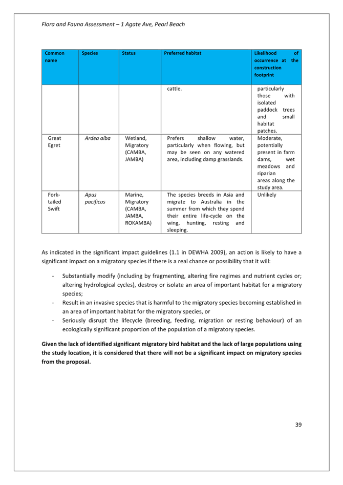
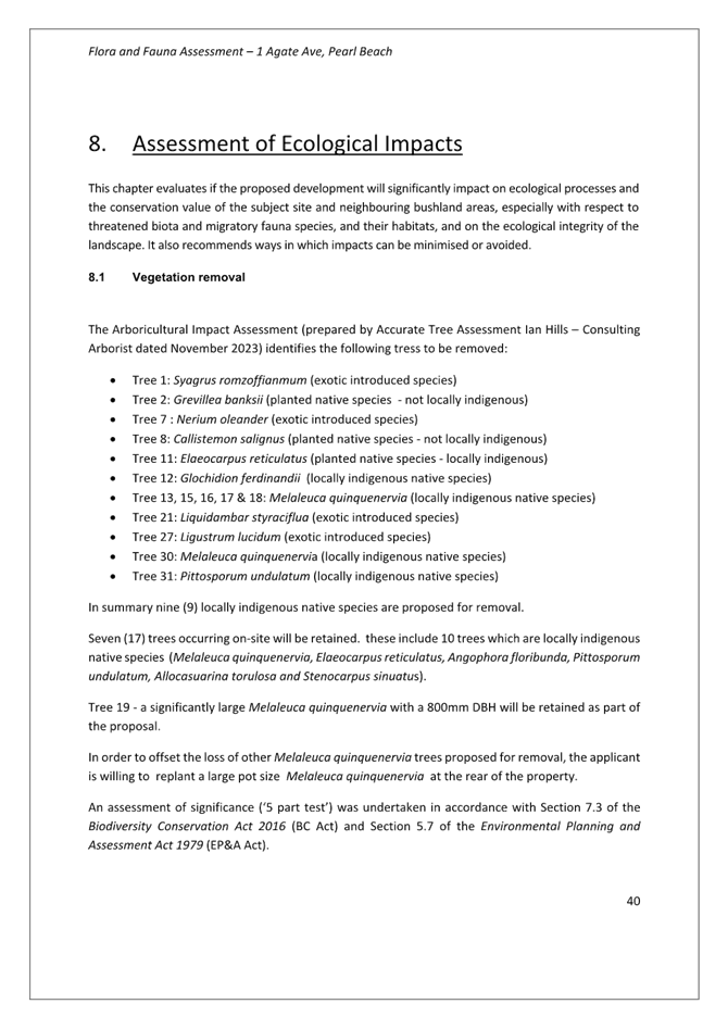
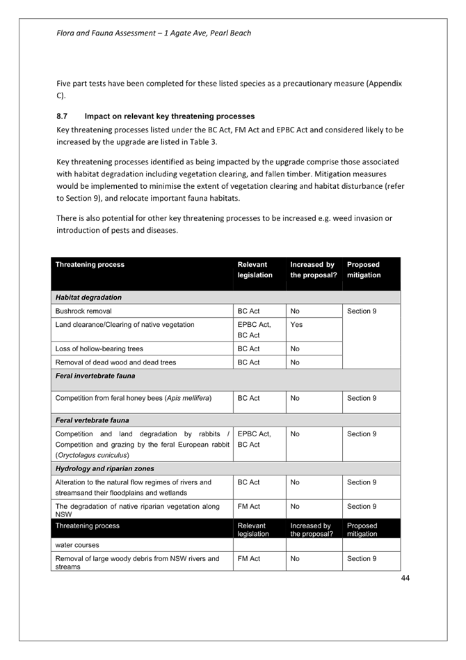
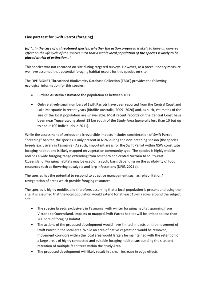
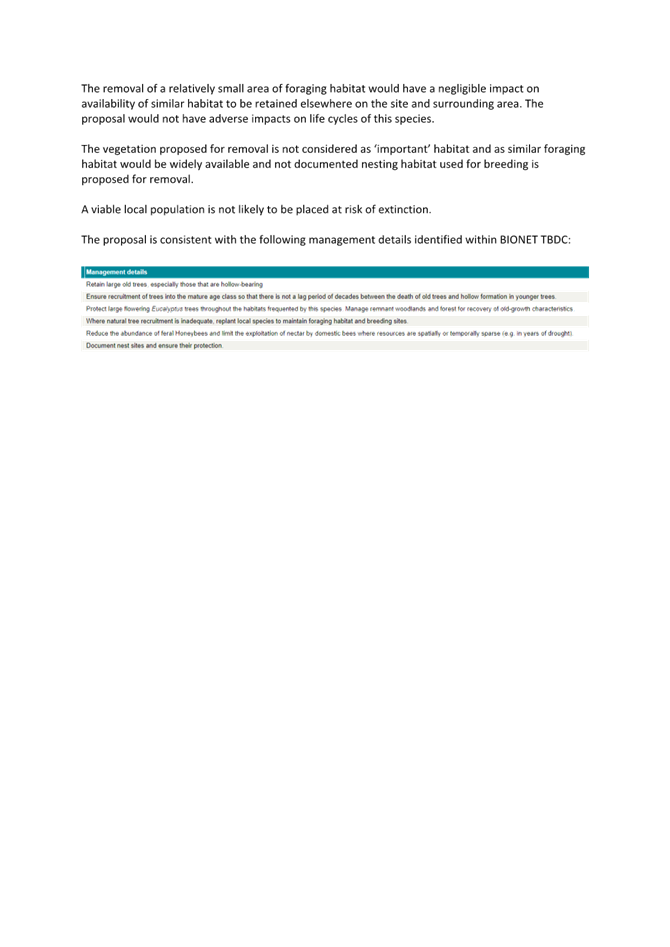
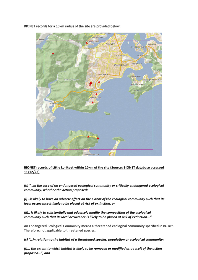
 |
Central Coast
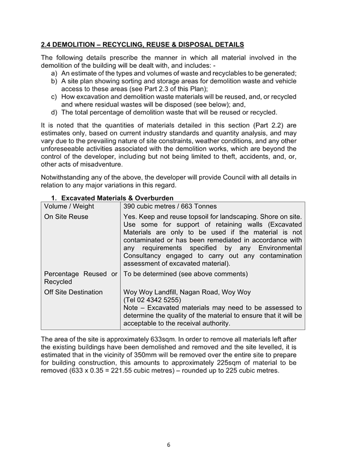
Local Planning Panel Meeting
Business Paper
17 October 2024
 |
|
Central Coast
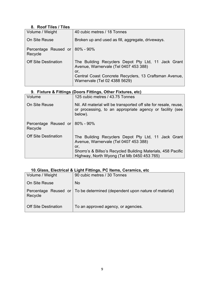
Local Planning Panel Meeting
Business Paper
17 October 2024
|
The Local Planning Panel Meeting
of Central Coast
will be held remotely - online,
Thursday 17 October 2024 at 2.00 pm,
for the transaction of the business listed below:
1 Procedural Items
1.1 Disclosures of Interest.............................................................................................................................. 3
2 Confirmation of Minutes of Previous Meetings
2.1 Confirmation of Minutes of Previous Meeting................................................................................. 4
3 Planning Reports
3.1 DA/2106/2023 - 120A Ocean Parade Blue Bay - Alterations & Additions to Existing Dwelling and Plunge Pool............................................................................................................................................... 10
3.2 DA/1955/2023 - New Dwelling House & Swimming Pool - 67 Ocean View Drive WAMBERAL NSW 2261............................................................................................................................................................. 78
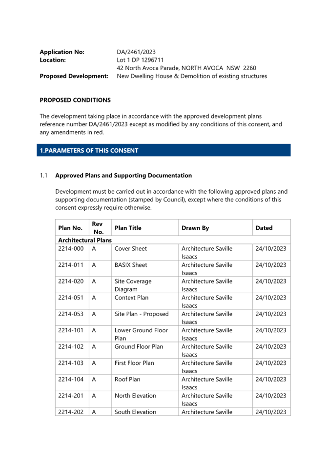
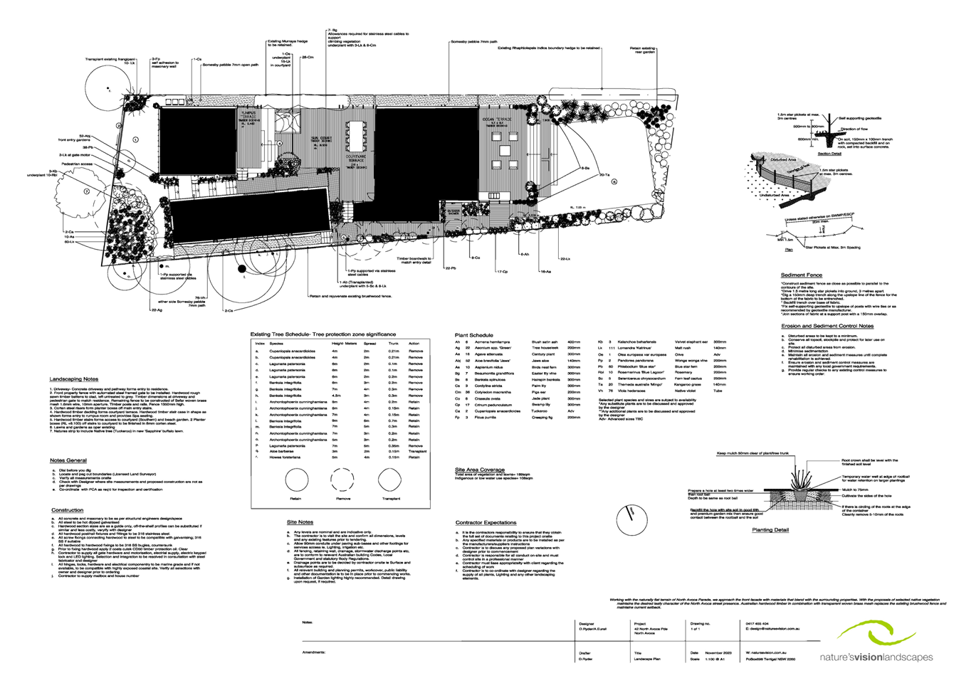
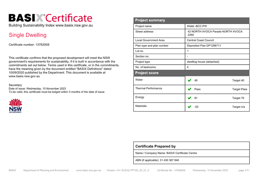
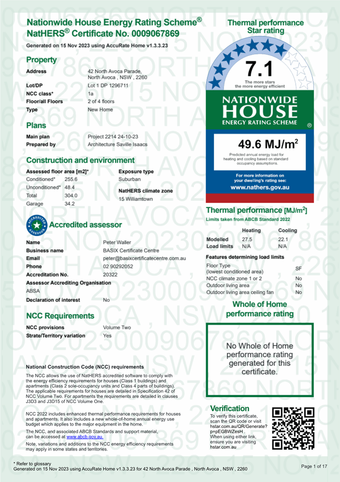
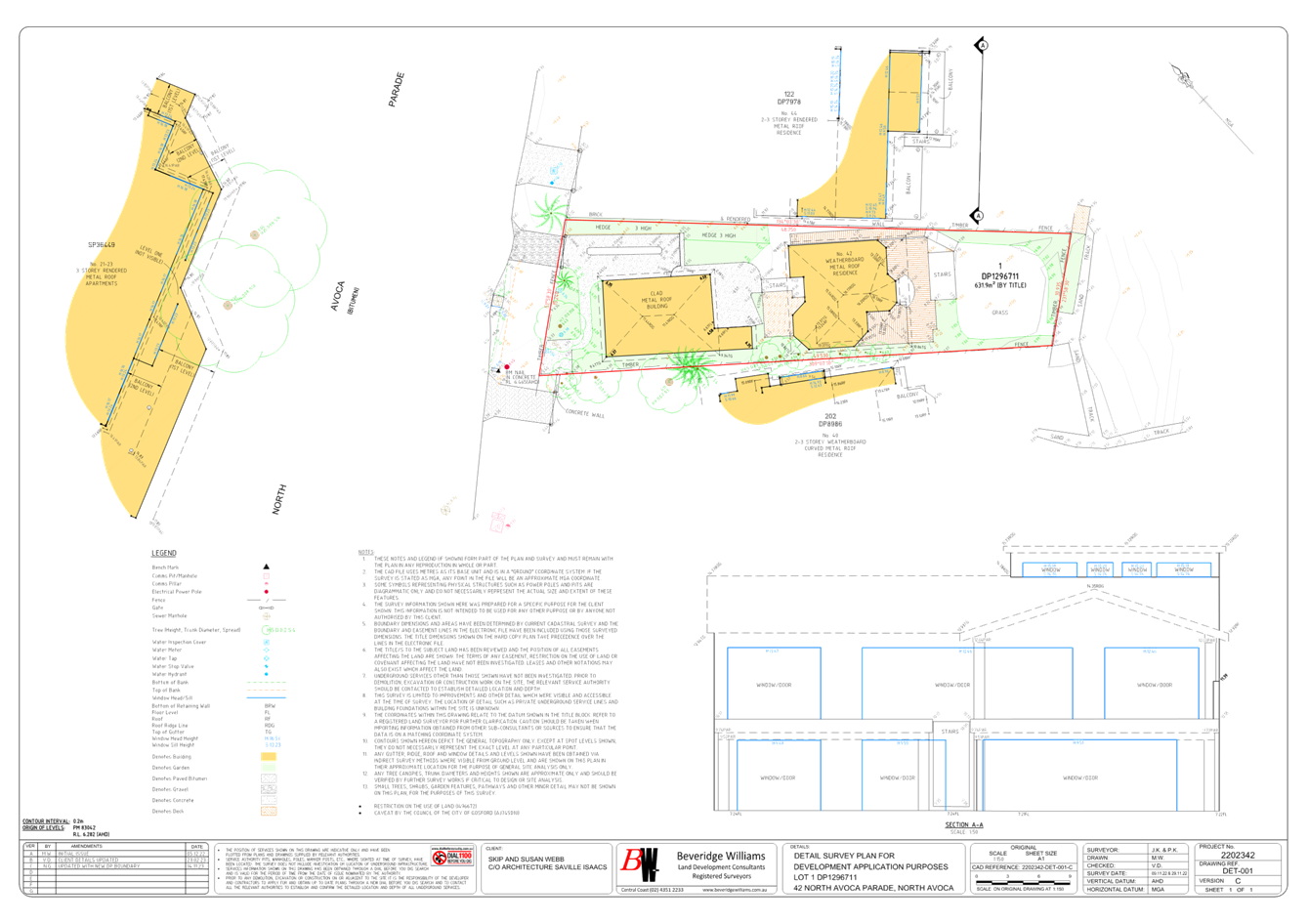
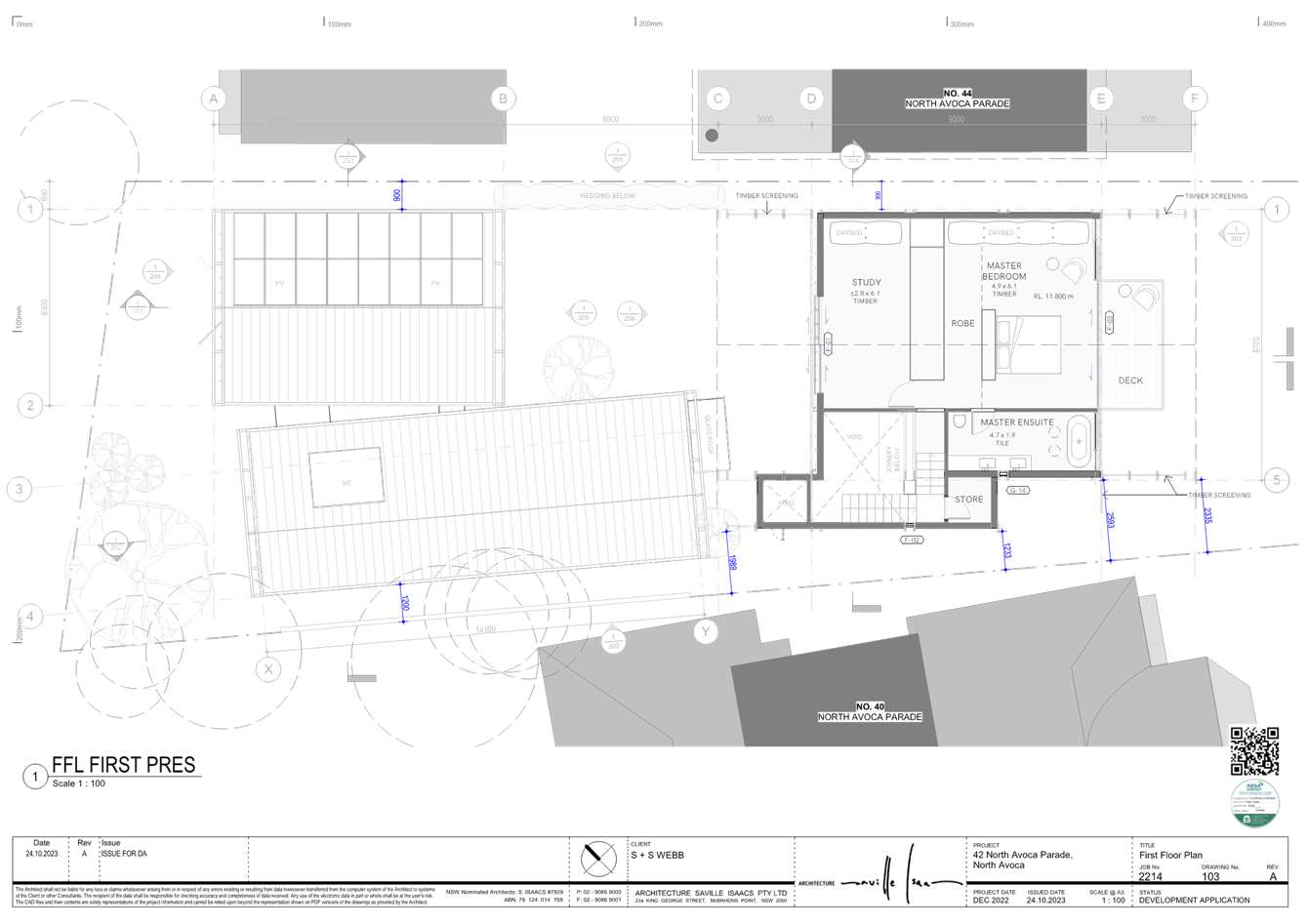
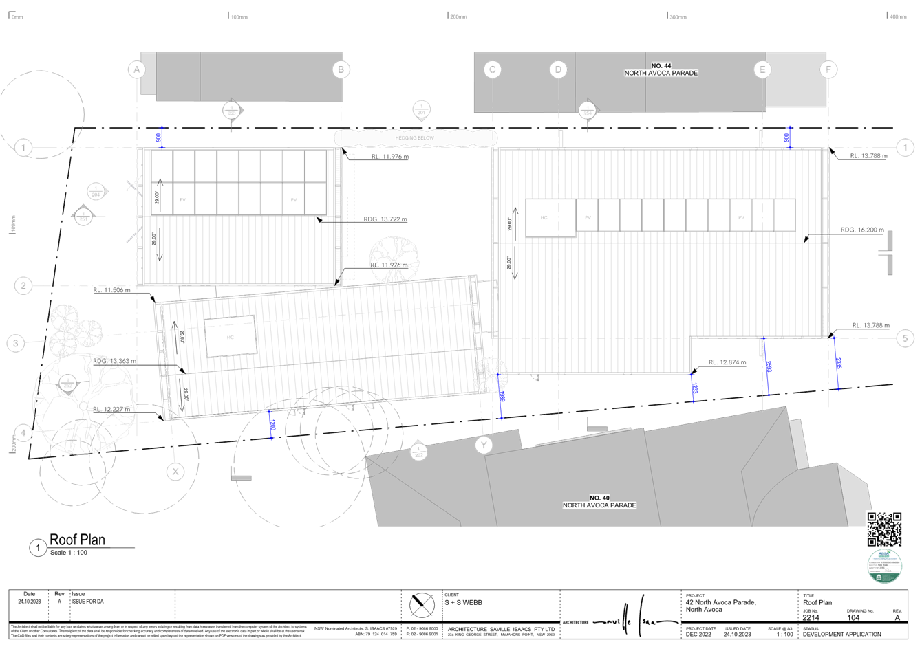
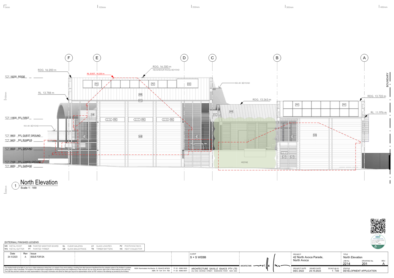
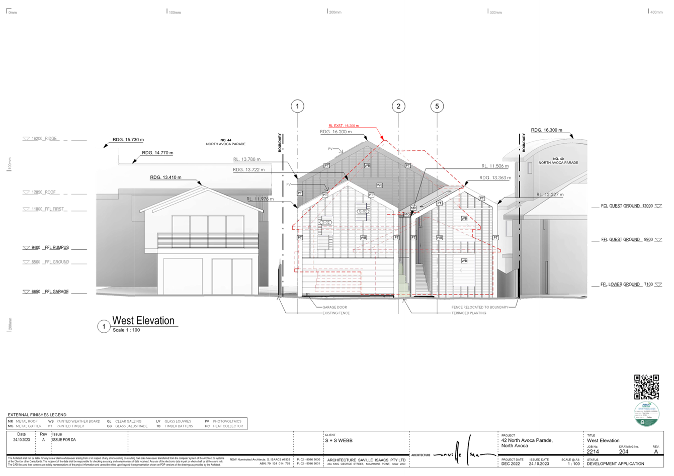
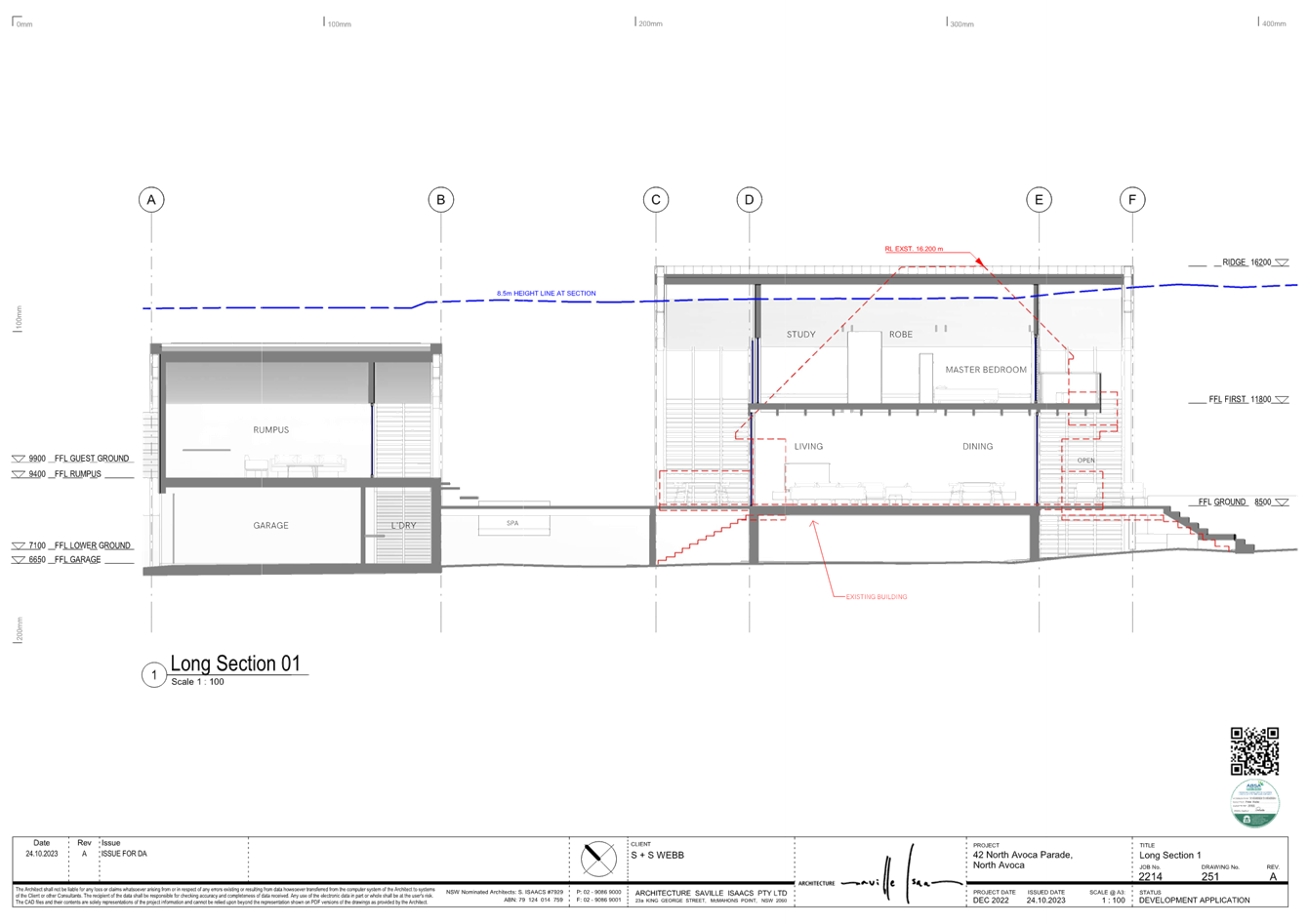
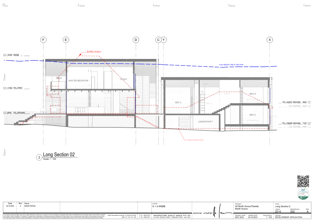
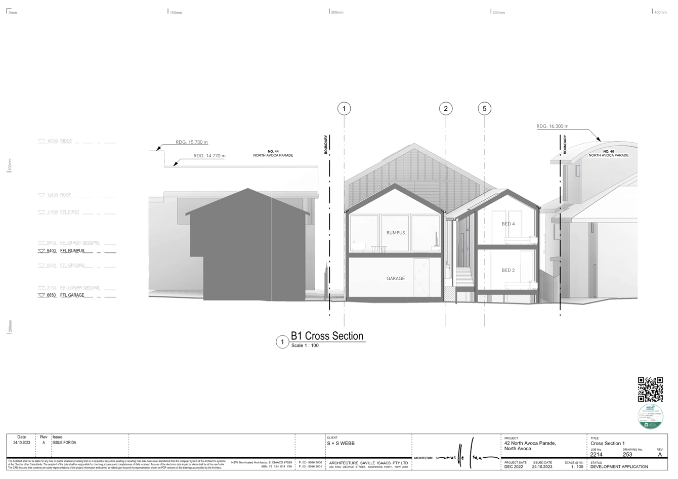
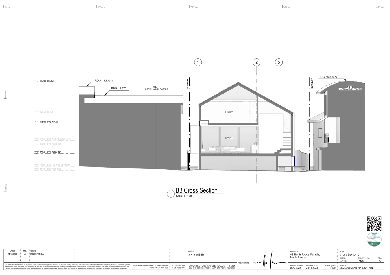
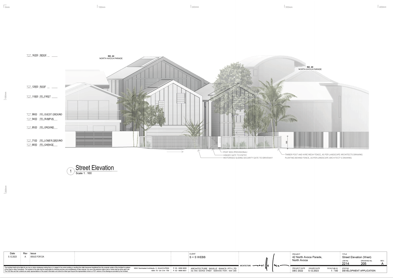
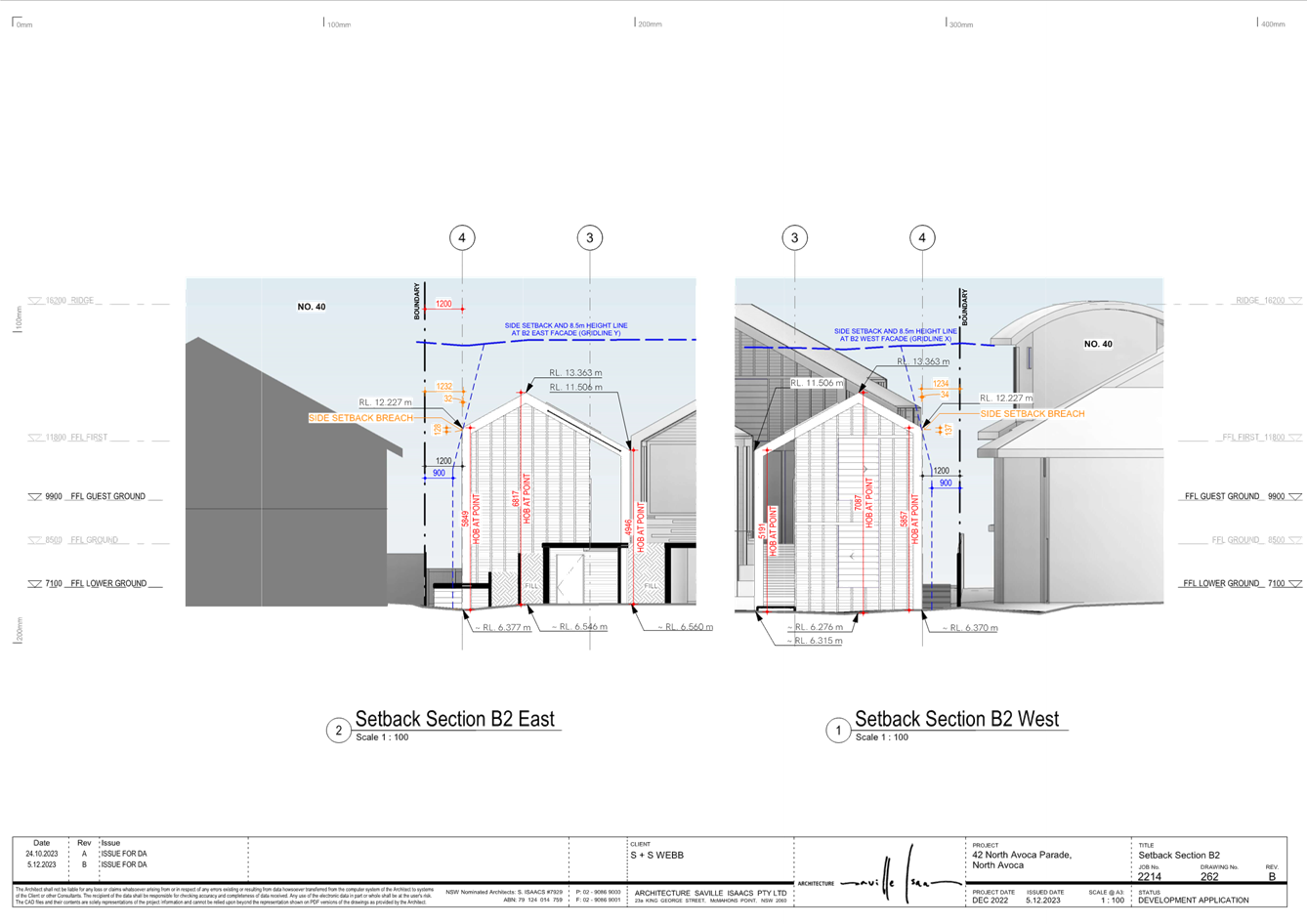
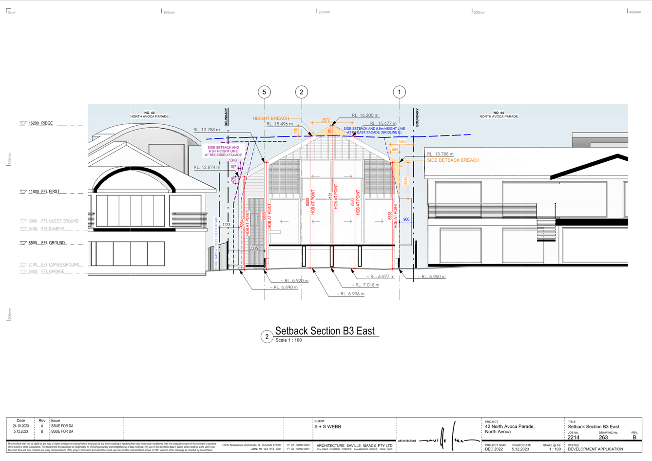
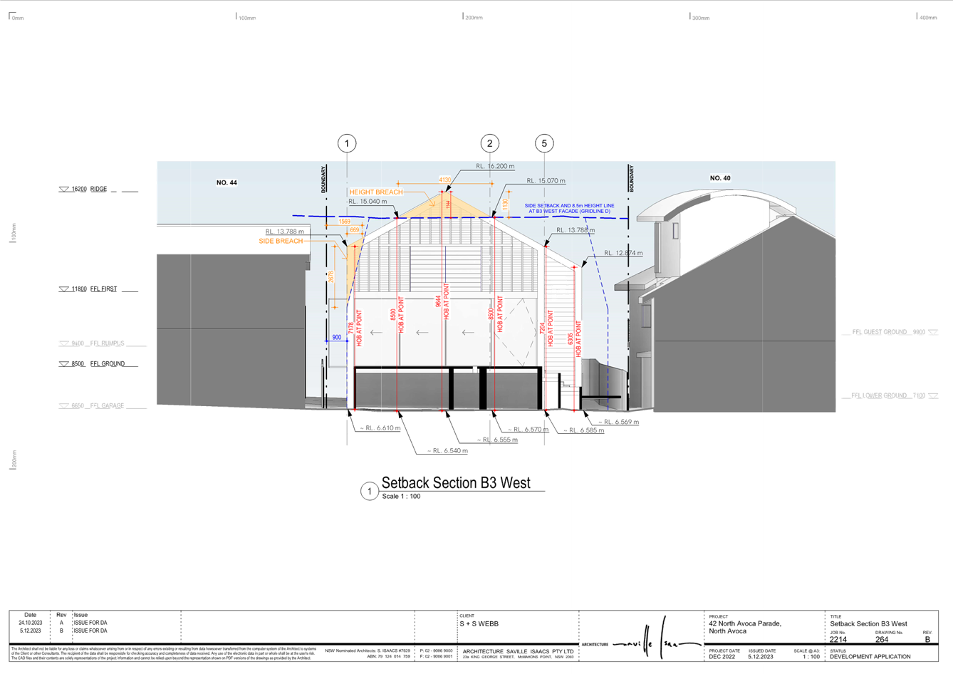
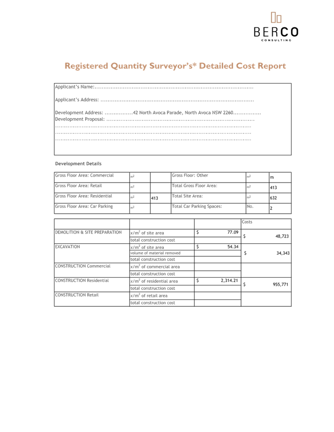
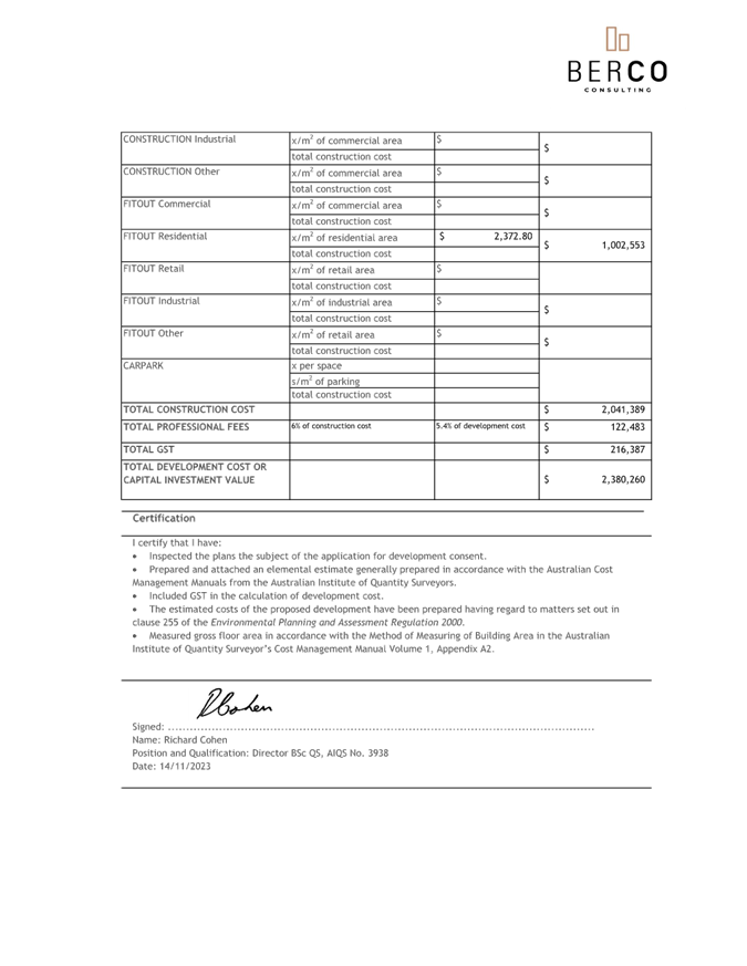
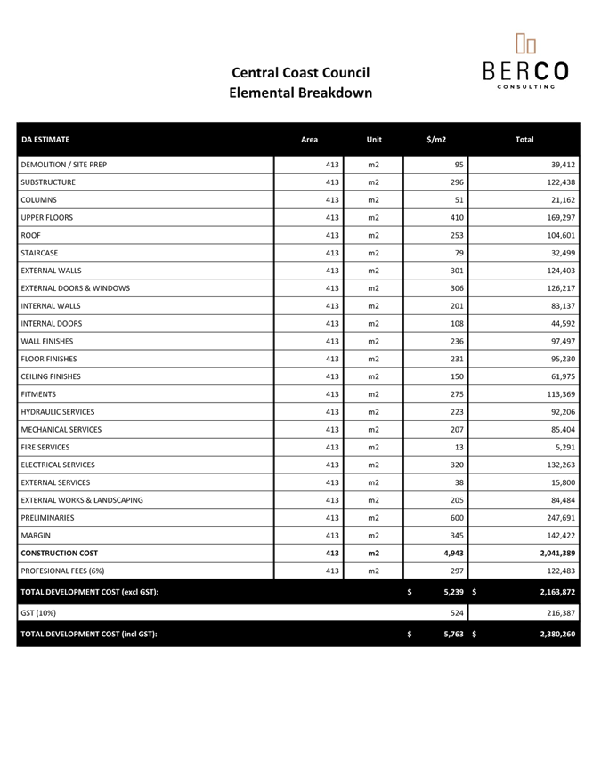
3.3 DA/2461/2023 - New Dwelling House & Demolition of Existing Structures - 42 North Avoca Parade North Avoca NSW 2250....................................................................................................... 398
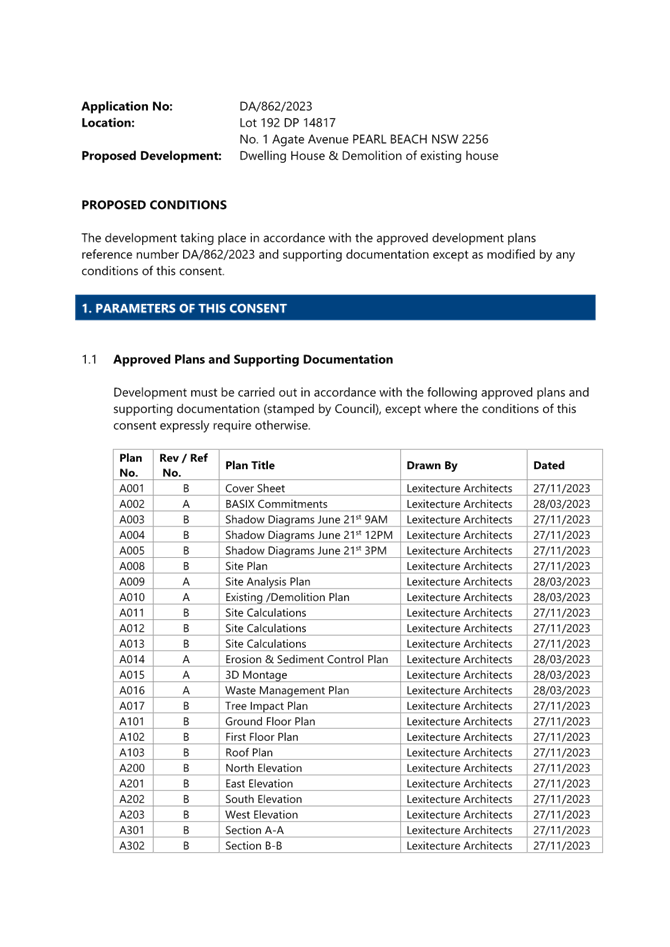
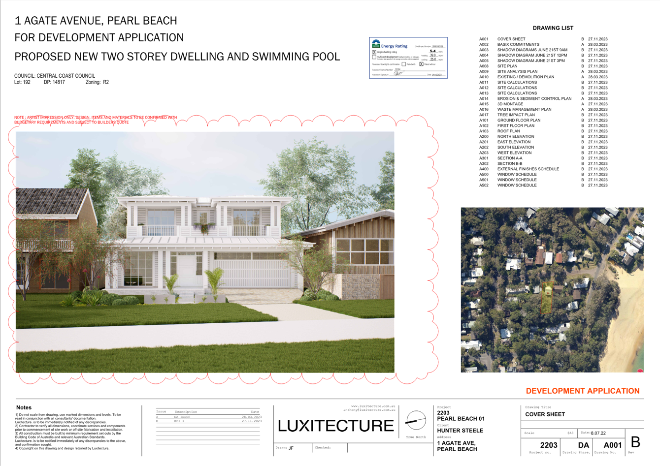
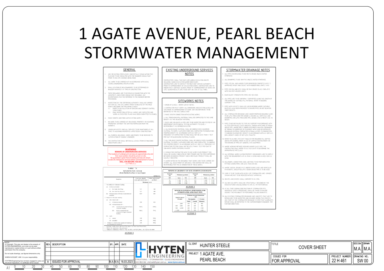
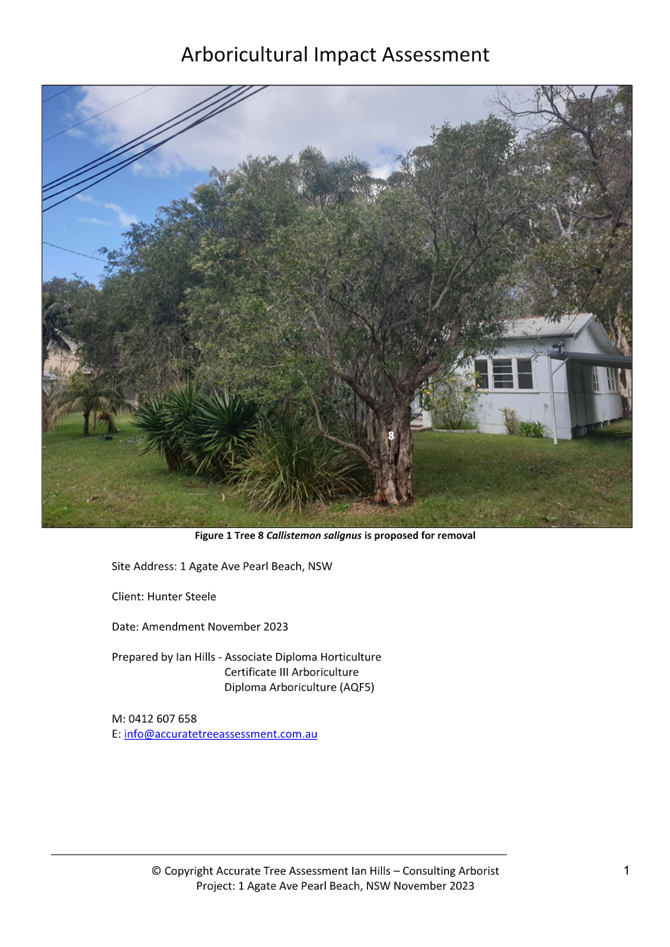
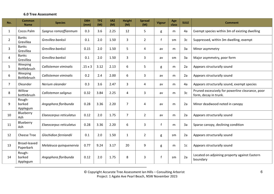
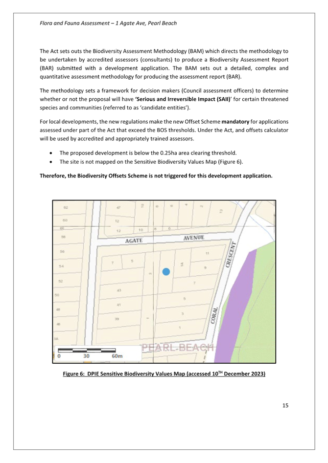
3.4 DA/862/2023 - 1 Agate Avenue PEARL BEACH - New Dwelling and Demolition of Existing Dwelling.................................................................................................................................................... 857
The Hon Terry Sheahan AO
Chairperson
|
Item No: 1.1 |
|
|
Title: Disclosures of Interest |
|
|
Department: Governance |
|
|
3 October 2024 Local Planning Panel Meeting |
|
Reference: F2020/02502 - D14205789
|
The NSW Local Planning Panel Code of Conduct states that all panel members must sign a declaration of interest in relation to each matter on the agenda before or at the beginning of each meeting.
|
That Panel Members now confirm that they have signed a declaration of interest in relation to each matter on the agenda for this meeting and will take any management measures identified.
|
Item No: 2.1 |
|
|
Title: Confirmation of Minutes of Previous Meeting |
|
|
Department: Corporate Services |
|
|
17 October 2024 Local Planning Panel Meeting |
|
Reference: F2020/02502 - D16454298
Author: Lisa Martin, Civic Support Officer Civic Support
|
Summary
The
Minutes of the following Meeting of the Local Planning Panel, which have been
endorsed by the Chair of that meeting, are submitted for noting: · Local Planning Panel Meeting held on 3 October 2024
|
That the minutes of the previous Local Planning Panel Meeting held on 3 October 2024, which were endorsed by the Chair of that meeting, are submitted for noting.
|
1⇩ |
MINUTES - Local Planning Panel - 3 October 2024 |
|
D16440998 |
|
2.1 |
Confirmation of Minutes of Previous Meeting |
|
Attachment 1 |
MINUTES - Local Planning Panel - 3 October 2024 |

|
Item No: 3.1 |
|
|
Title: DA/2106/2023 - 120A Ocean Parade Blue Bay - Alterations & Additions to Existing Dwelling and Plunge Pool |
|
|
Department: Environment and Planning |
|
|
17 October 2024 Local Planning Panel Meeting |
|
Reference: DA/2106/2023 - D16281623
Author: Gary Evans, Principal Health and Building Surveyor
Section Manager: Wayne Herd, Section Manager Building Assessment and Certification
Unit Manager: Andrew Roach, Unit Manager. Development Assessment
|
Summary
An application has been received for alterations and additions to the existing dwelling and pool at 120A Ocean Parade Blue Bay. The application has been examined having regard to the matters for consideration detailed in section 4.15 of the Environmental Planning and Assessment Act 1979 and other statutory requirements with the issues requiring attention and consideration being addressed in the report.
This development application is required to be reported to the Local Planning Panel due to the number of submissions received exceeding ten (10) submissions. A total of 16 submissions were received across 2 notification periods.
The application is recommended for approval, subject to conditions.
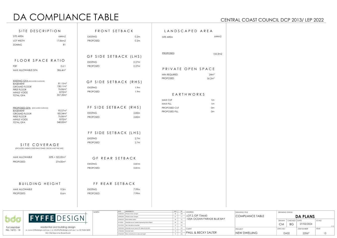
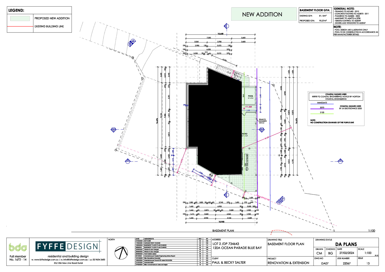
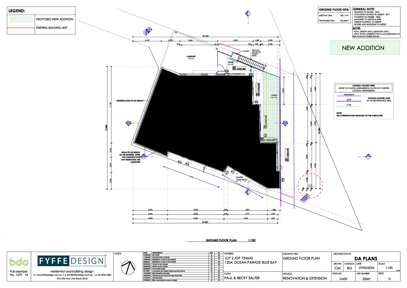
Applicant Mr Paul Salter Owner Ms RL Salter Application No 2106/2023 Description of Land Lot 2 DP734643 – 120A Ocean Parade Blue Bay Proposed Development Alterations and Additions to Existing Dwelling & Plunge Pool Site Area 644m2 Zoning R1 General Residential Existing Use Residential Employment Generation N/A Estimated Value $787,761.55 |
Recommendation
1 That the Local Planning Panel grant consent to DA/2106/2023 – 120A Ocean Parade Blue Bay – Alterations and Additions to Existing Dwelling and Pool subject to the conditions detailed in the schedule attached to the report and having regard to the matters for consideration detailed in Section 4.15 of the Environmental Planning and Assessment Act 1979.
2 That Council advise those who made written submissions of the Panel’s decision.
Key Issues
· The application is required to be reported to the Local Planning Panel for determination as in excess of ten (10) submissions have been received in relation to the development proposal.
· The development proposes variations to the rear and side boundary setback provisions as contained within Central Coast Development Control Plan 2022 (Chapter 2.1 “Dwelling Houses, Secondary Dwellings and Ancillary Structures), to permit the development.
· The application also proposes variation to the rear (coastal) setback as required by Central Coast Development Control Plan 2022 (Chapter 3.2 Coastal Hazard Management – Northern area), to permit the development.
Precis:
|
Proposed Development |
Alterations and Additions to Existing Dwelling and Plunge Pool |
|
Permissibility and Zoning |
The subject site is zoned R1 - General Residential under the provisions of Central Coast Local Environmental Plan 2022 (CCLEP 2022).
The land contains an existing ‘dwelling house’ which is defined under the Central Coast LEP 2022 as;
‘dwelling house’ means – a building containing only one dwelling.
The proposed development is best defined as alterations and additions to the existing dwelling and plunge pool and is permissible with consent in the current zone. |
|
Current Use |
Dwelling House |
|
Integrated Development |
No |
|
Submissions |
The development application was notified (in accordance with the provisions of the Central Coast Development Control Plan 2022 (CCDCP 2022)) on two separate occasions as follows:
• Originally proposed development - from 10 November 2023 until 24 November 2023.
During the first notification period, a total of seven (7) submissions were received in relation to the development proposal. Further, at the request of objectors, the date for the receipt of submissions was extended for a further seven (7) day period till 1 December 2023.
• Amended development proposal – from 1 March 2024 until 15 March 2024.
During the second notification period, a total of nine (9) submissions were received in relation to the amended development proposal. |
Variations to Policies
The development proposal seeks variations to Central Coast Development Control Plan 2022 (Chapter 2.1. Dwelling Houses, Secondary Dwellings and Ancillary Structures) as follows.
Variation 1
|
Clause |
2.1.3.1(c)(i) |
|
Standard |
The required Side boundary setback for lots greater than 12.5 metres at the building line is required to be a minimum 0.9 metres for any part of the building up to 4.5 metres height. |
|
Departure basis |
The proposal seeks a zero-side boundary setback in relation to the proposed northern access stairs from the mid-level balcony. This represents a 100% variation. |
Variation 2
|
Clause |
2.1.3.1(e) |
|
Standard |
The required rear boundary setback for dwellings, secondary dwellings, and ancillary development to land zoned public recreation which adjoins a waterway is to be: · 6.0 metres for the ground storey; and · 10.0 metres for any storey above the ground storey. |
|
Departure basis |
The proposal reduced setbacks to the rear land zoned public recreation which adjoins a waterway as follows:
· Minimum 2.471 metres to the swimming pool edge within the lower level; and · Minimum 2.471 metres to the upper-level balcony and roof covering.
These reduced setbacks represent variations as follows: -
· Maximum 3.529 metres or 59% to the lower storey; · Maximum 7.529 metres or 75% to the upper-level balcony and roof covering. |
The development proposal seeks variation Central Coast Development Control Plan 2022 (Chapter 3.2 Coastal Hazard Management – Northern Area)
|
Clause |
3.2.2.2.1(a) |
|
Standard |
Generally, no new freestanding or other development will be considered seaward of the existing dwelling within the Immediate Risk Coastal Planning Zone (red line). |
|
Departure basis |
The proposal seeks the erection of dwelling additions and a plunge pool forward of the existing dwelling which are wholly forward of the Immediate (red) 2011 adopted coastal hazard line. This effectively represents a 100% variation. |
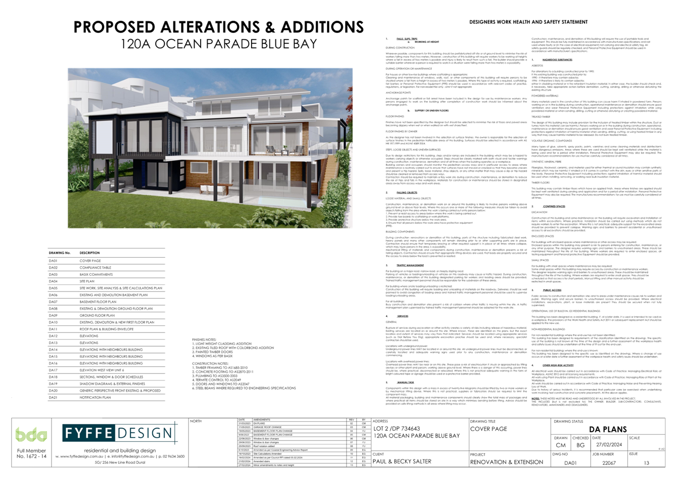
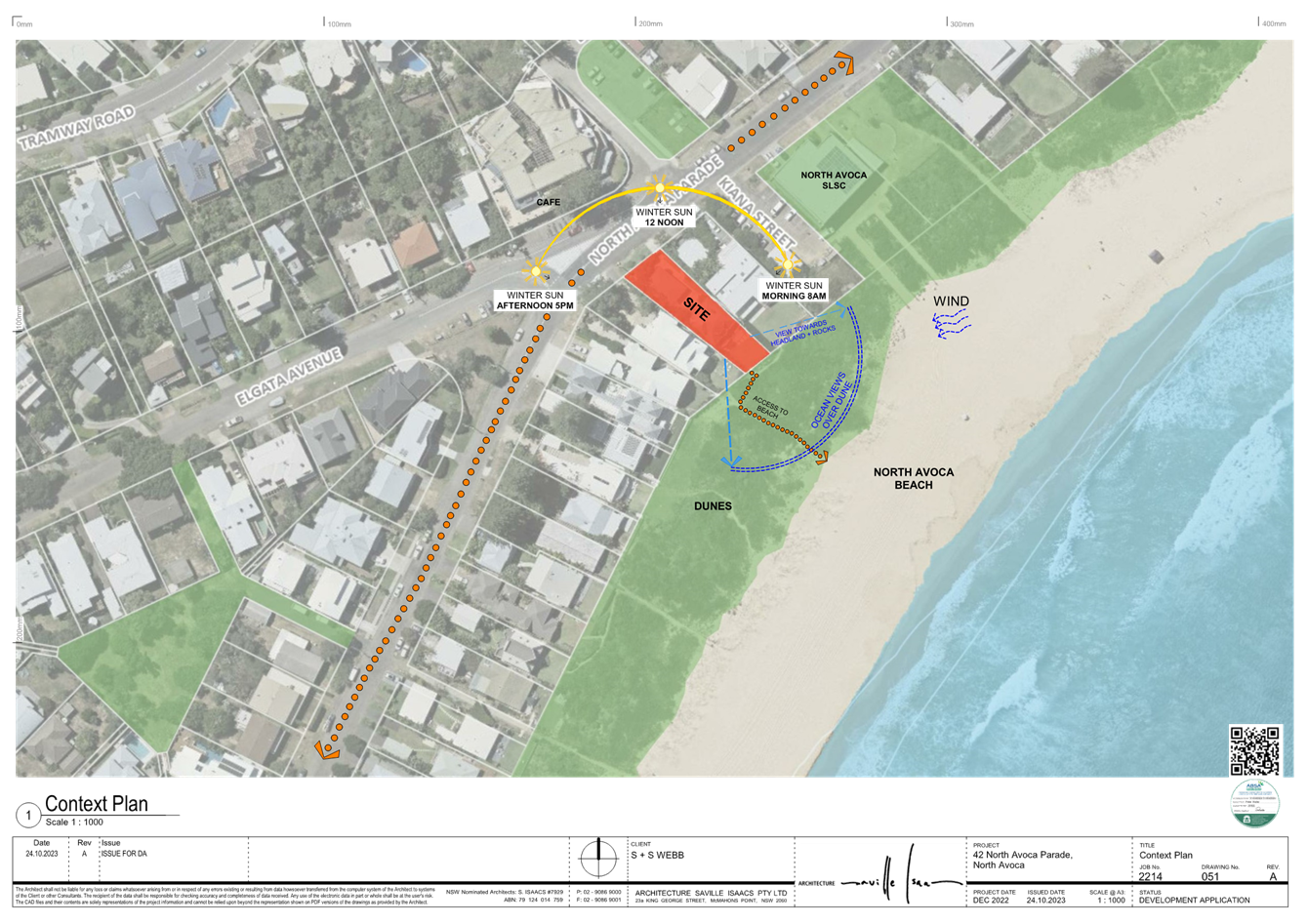
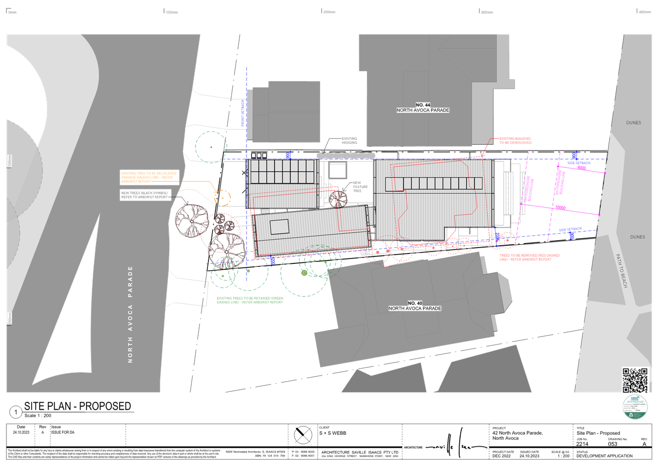
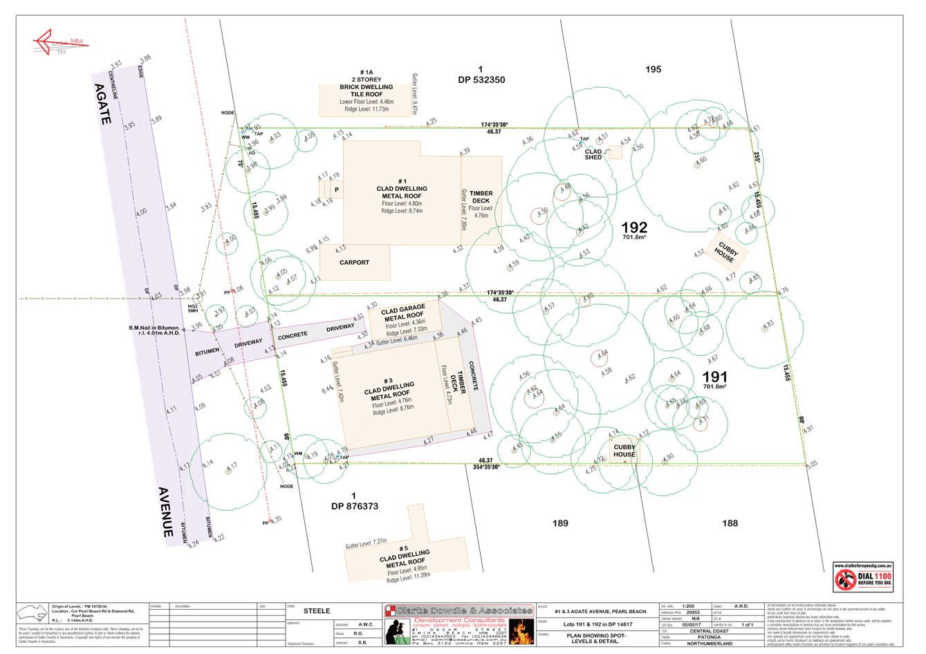
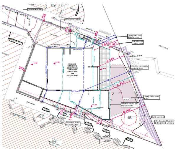
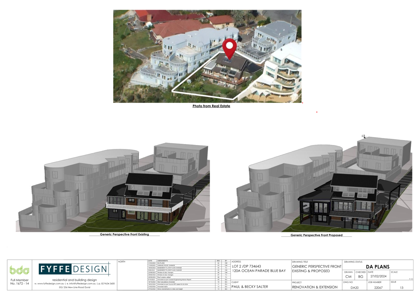
The Site
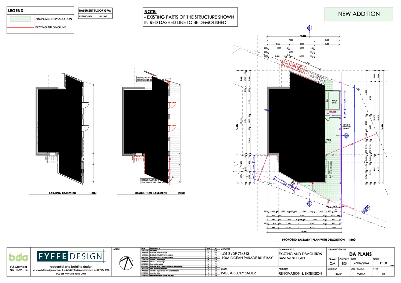
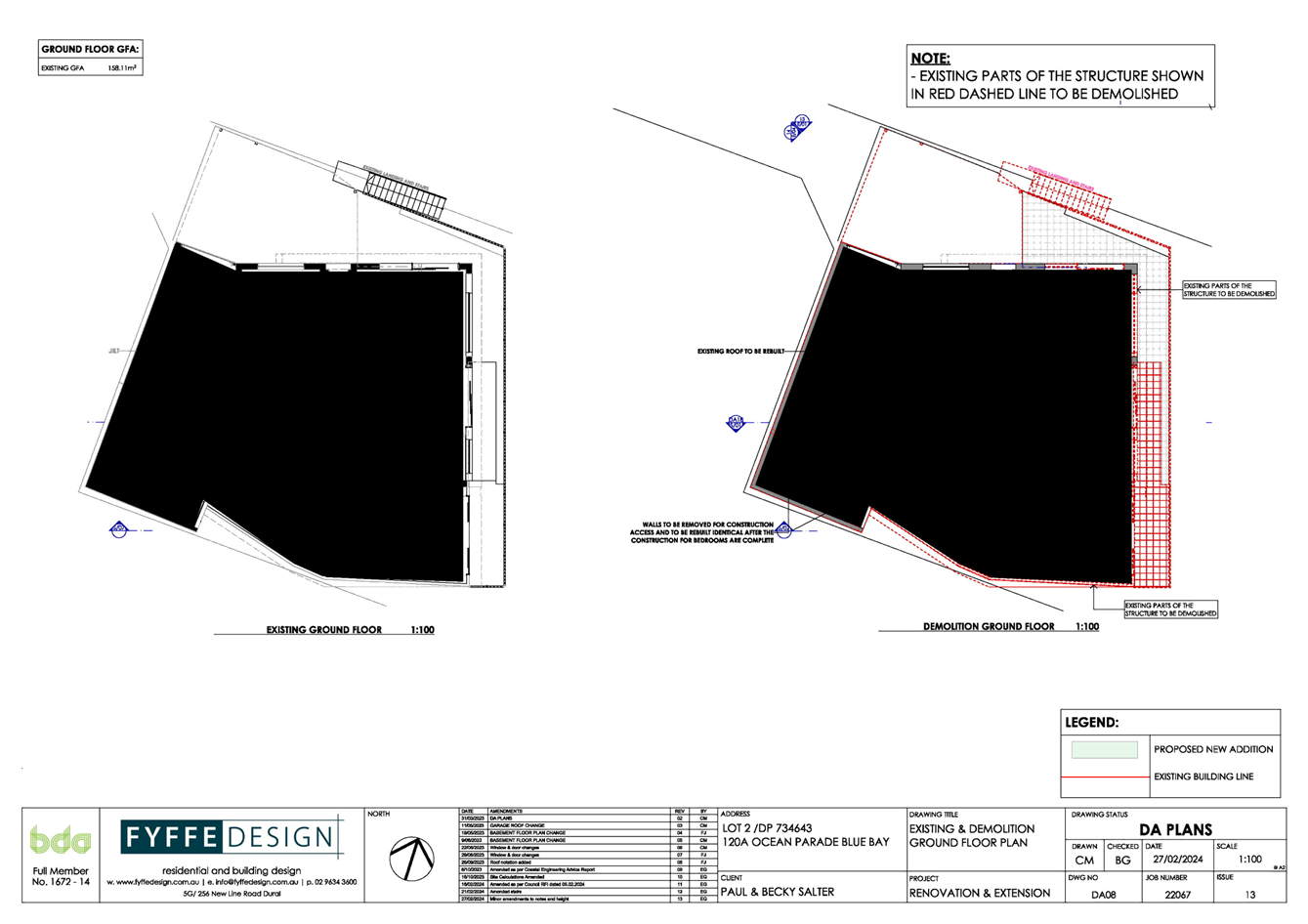
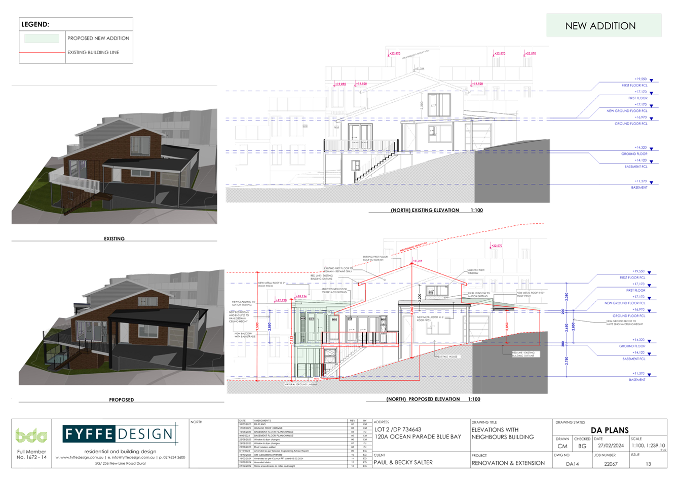
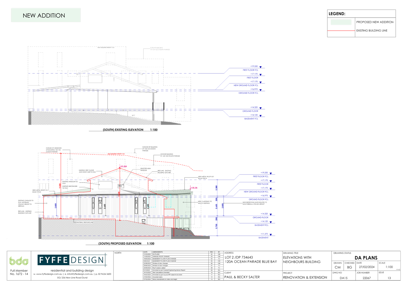
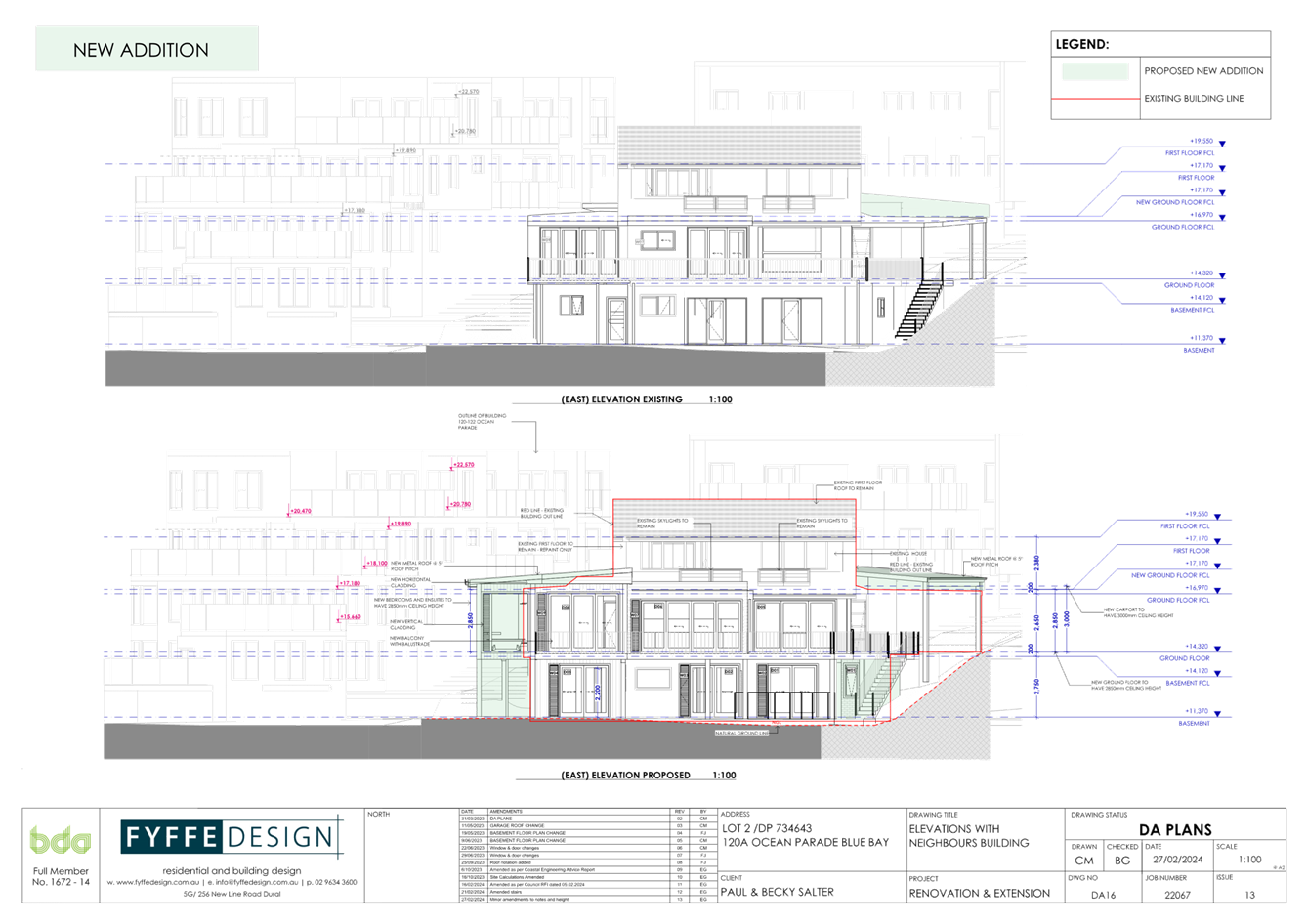
The site (Figures 1-6) is a single lot identified as Lot 2 DP 734643 (120A Ocean Pde Blue Bay). The site is a battle-axe shaped allotment located on the eastern side of Ocean Parade with the site having direct waterfront access to the ocean foreshore to the rear of the allotment. The site displays minimal slope within the battle-axe handle within which the site access driveway is located. The site then slopes sharply across the existing building envelope before levelling in the area where the rear additions and plunge pool are proposed.
The site has a total area of 644m2 and contains an older multi-level dwelling with some areas of the existing dwelling located with minimal setback to the site boundaries. The site also has a history of use as a medical facility (consulting rooms).
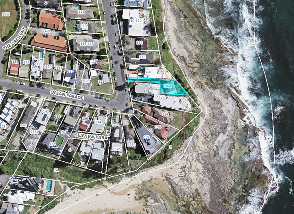
Figure 1: Detailing the aerial view of the locality with the site etched in blue.
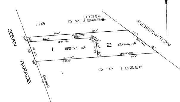
Figure 2: Deposited Plan extract detailing Lot 2.
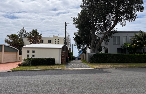
Figure 3: Detailing the Site Entry as viewed from Ocean Parade noting the adjoining residential flat buildings.
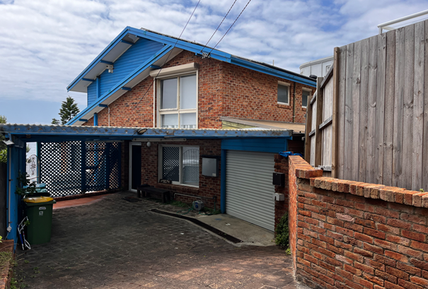
Figure 4: Detailing the existing dwelling as viewed from the sites battle-axe handle.
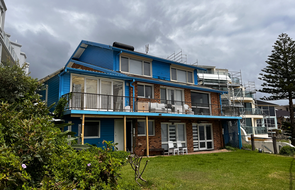
Figure 5: Detailing the existing dwelling as viewed from the rear foreshore area.
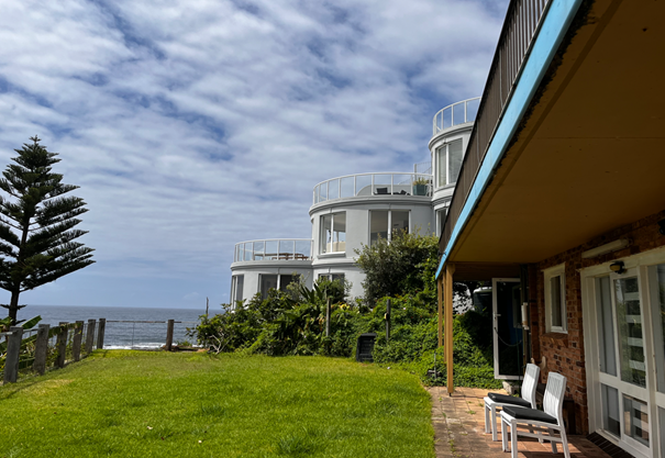
Figure 6: Detailing the area of the site where additions are proposed looking south.
Surrounding Development
The subject site is surrounded by residential lots also retaining an R1 General Residential zoning, containing a mixture of older style single storey cottages interspersed with newer substantial ocean facing dwellings and higher density residential flat buildings of predominantly three to four storey construction.
The Proposed Development
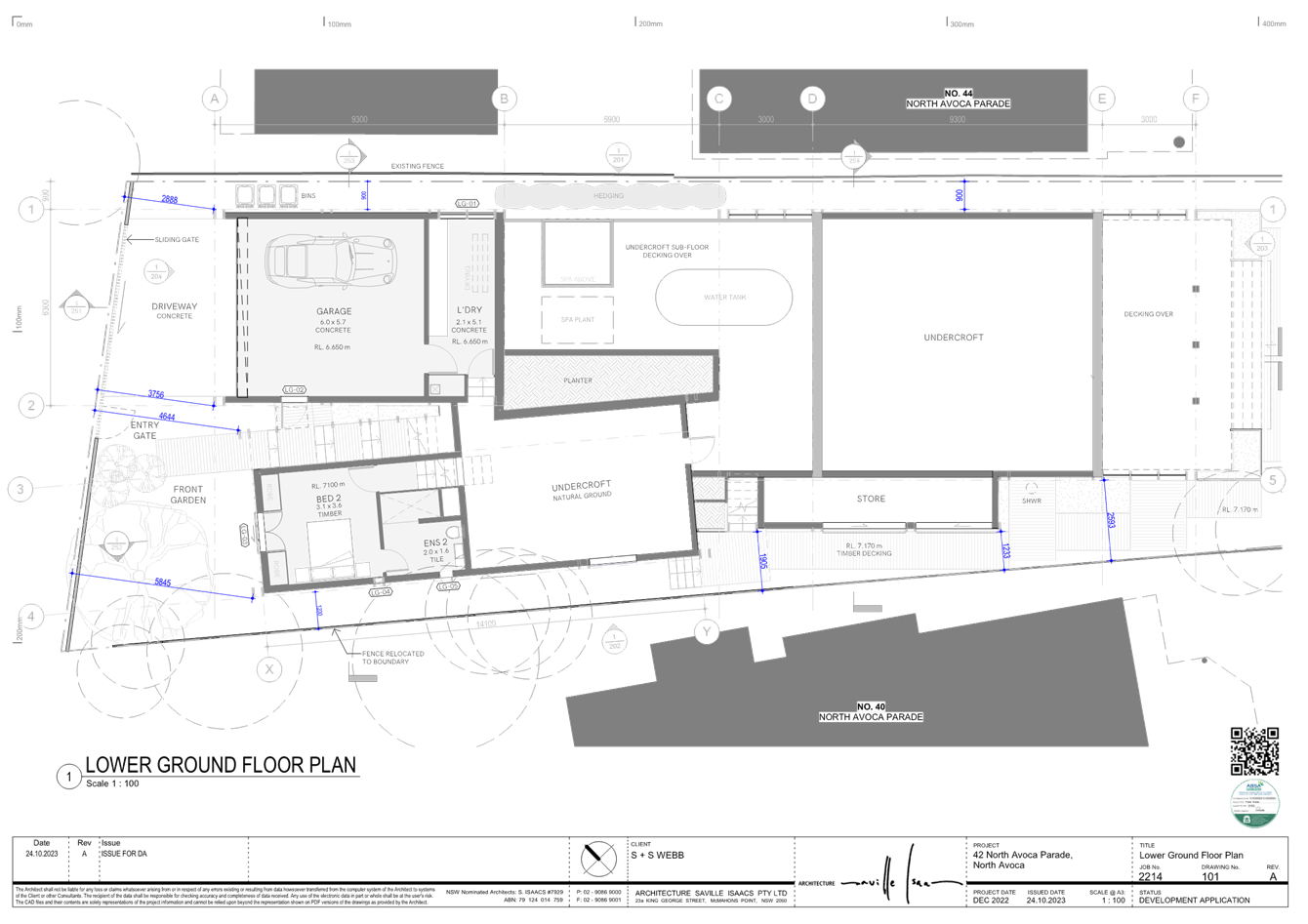
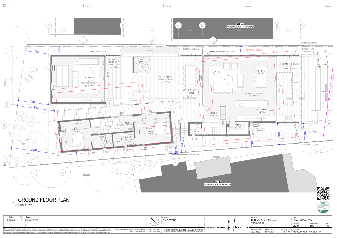
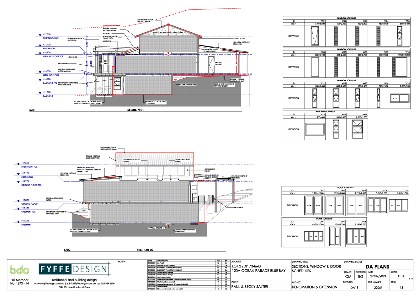
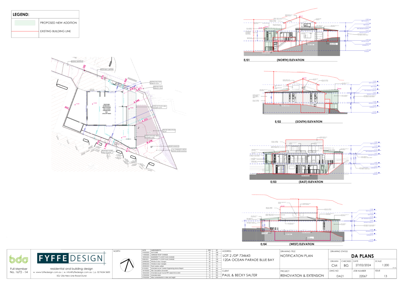
The development application seeks consent for alterations and additions to the existing dwelling and a plunge pool as depicted within Figures 7-11 below.
 Figure
7: Detailing the proposed site plan.
Figure
7: Detailing the proposed site plan.
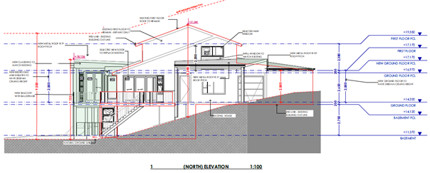
Figure 8: Detailing the proposed northern elevation.
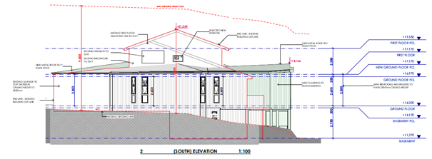
Figure 9: Detailing the proposed southern elevation.
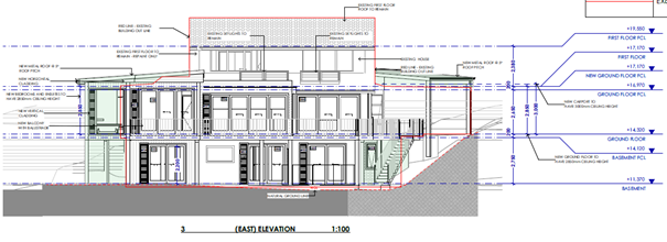
Figure 10: Detailing the proposed eastern elevation.
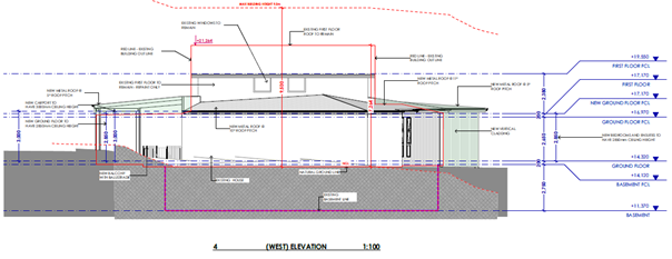
Figure 11: Detailing the proposed western elevation.
History
· DA/487/1999 – Storeroom Addition/Alteration – Approved under Delegation 13 May 1999.
Further to the above development approval, there appears to be some historic use of the site as a medical facility (consulting rooms). No evidence of a formal approval for this use can be found within historic records.
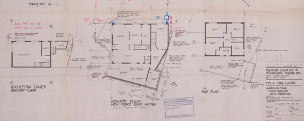
Figure 12: Detailing the approved development plan relating to the above approval, noting the reduced boundary setbacks for the approved storeroom addition.
ASSESSMENT:
Having regard for the matters for consideration detailed in Section 4.15 of the Environmental Planning and Assessment Act 1979 and other statutory requirements, Council’s policies and Section 10.7 Certificate details, the assessment has identified the following key issues, which are elaborated upon for Council’s information. Any tables relating to plans or policies are provided as an attachment.
Environmental Planning and Assessment Regulation 2021 (Demolition)
With regard to demolition of works as part of a Development Application, clause 61 of the
Environmental Planning and Assessment Regulation 2021 provides additional matters that the
consent authority must consider:
(1) In determining a development application for the demolition of a building, the consent authority must consider the Australian Standard AS 2601—2001: The Demolition of Structures.
Comment: The works will be covered by the Australian Standard As 2601-2001 and is
conditioned for compliance as per draft condition 5.7.
A waste management plan has been submitted and accepted. Council is satisfied the
necessary demolition works required to facilitate dwelling alterations and additions and the plunge pool construction will occur in accordance with AS2601-2001.
State Environmental Planning Policy (Resilience and Hazards) 2021
The relevant provisions of the SEPP are addressed as follows:
Chapter 2 Coastal Management
The aims of Chapter 2 are to be considered when determining an application within the
Coastal Management Areas. The Coastal Management Areas are defined on maps issued by
the NSW Department of Planning and Environment.
The site is located within the Coastal Environment Area as identified on these maps and
subject to the provisions of Section 2.10 of the SEPP.
The development is not likely to have an adverse impact on the matters referred to in clause 2.10. The development is not considered likely to cause increased risk of coastal hazards on the site or other land and the site is not subject to the coastal management program for the purposes of Division.5. A summary of considerations is included below.
Section 2.10 - Development on land within the coastal environment area
In accordance with clause 2.10(1) development consent must not be granted unless the
consent authority has considered whether the proposed development is likely to cause an
adverse impact (see table on following page for considerations).
|
Matters for Consideration |
Compliance |
|
(a) the integrity and resilience of the biophysical, hydrological (surface and groundwater) and ecological environment |
The proposal is not likely to cause adverse impacts on the biophysical, hydrological, or ecological environment. |
|
(b) coastal environmental values and natural coastal processes |
The proposal will not impact on the geological and geomorphological coastal processes. |
|
(c) the water quality of the marine estate (within the meaning of the Marine Estate Management Act 2014, in particular, the cumulative impacts of the proposed development on any of the sensitive coastal lakes identified in Schedule 1 |
The proposal will not result in an adverse impact on the water quality of the marine estate and does not drain to a sensitive lake contained in Schedule 1. |
|
(d) marine vegetation, native vegetation and fauna and their habitats, undeveloped headlands and rock platforms |
The proposal will not result in an adverse impact on native vegetation or fauna, undeveloped headlands, and rock platforms. |
|
(e) existing public open space and safe access to and along the foreshore, beach, headland or rock platform for members of the public, including persons with a disability, |
The proposal has frontage to a foreshore. The development will not impede safe access to the foreshore area for members of the public including persons with a disability. |
|
(f) Aboriginal cultural heritage, practices and places |
There are no identified aboriginal cultural heritage items on the site. |
|
(g) the use of the surf zone. |
The proposal is not considered to impact upon any beach/surf zone. |
There have been no adverse impacts identified in the consideration of Section 2.10(1) that would engage the further considerations under Section 2.10(2).
Chapter 4 – Remediation of Land
The provisions of SEPP (Resilience & Hazards), Chapter 4 (Remediation of Land) have been considered in the assessment of the development application.
Section 4.6 of the SEPP requires consent authorities to consider whether the land is contaminated, and if the land is contaminated, it is satisfied that the land is suitable in its
contaminated state (or will be suitable, after remediation) for the purpose for which the
development is proposed to be carried out.
A review of the land use history, aerial photographs and an inspection of the site has not
revealed any evidence of potentially contaminating land uses being carried out on the site.
The development and the land is not otherwise mentioned in Subsection 4.6(4) and accordingly the provisions of Subsection 4.6(2) are not engaged by the proposal and consent may be granted.
The proposal is considered consistent with the provisions of Chapter 4 of the SEPP. The Panel can be satisfied that proposed development under DA/2106/2023 complies with the provisions of Chapter 2 Coastal Management and Chapter 4 Remediation of Land of the State Environmental Planning Policy (Resilience and Hazards) 2021.
Central Coast Local Environmental Plan 2022 (CCLEP 2022) – Permissibility
The subject site is zoned R1 General Residential under the provisions of CCLEP 2022.
The proposed development is best defined as a ‘dwelling house’ which is defined under CCLEP 2022 as:
‘dwelling house’ means – a building containing only one dwelling.
The proposed development, inclusive of the proposed ancillary plunge pool, is permissible in the zone, with development consent.
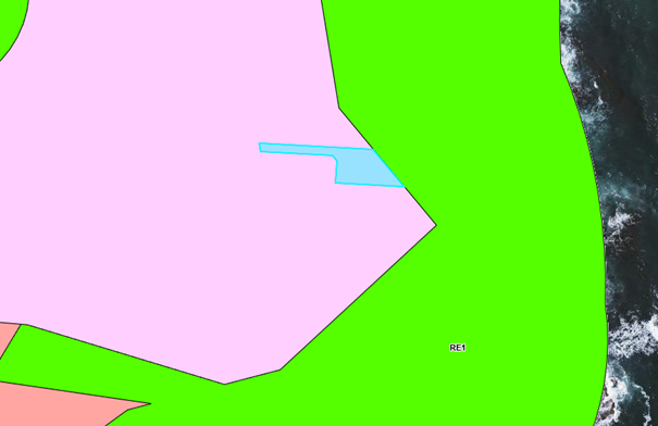
Figure 13: Detailing the area zone map with the site etched in blue.
Central Coast Local Environmental Plan 2022 (CCLEP 2022) - Objectives of Zone
The objectives of the R1 General Residential zone are:
· To provide for the housing needs of the community.
· To provide for a variety of housing types and densities.
· To enable other land uses that provide facilities or services to meet the day to day needs of residents.
· To promote best practice in the design of multi dwelling housing and other similar types of development.
· To ensure that non-residential uses do not adversely affect residential amenity or place unreasonable demands on services.
Following a detailed assessment of the development proposal it is considered that the
proposal is consistent with the stated objectives of the zone, providing housing consistent with the emerging character of the area, with the proposal not having adverse impacts on the
locality.
Central Coast Local Environmental Plan 2022 (CCLEP 2022) - Principal Development
Standards
It is to be noted that the site is mapped for both building height and Floor Space Ratio
under the provisions of Central Coast Local Environmental Plan 2022.
Building Height
The site is subject to a maximum 9.5 metre height limit with the existing dwelling on the site being below the mapped building height limit. Further, all proposed additions are located well below the mapped 9.5 metre building height limit.
Floor Space Ratio
The site is subject to a maximum Floor Space Ratio (FSR) of 0.6:1. In this regard, the proposal seeks a maximum FSR of 0.54:1 noting that the sites battle-axe handle is not excluded from site area. Accordingly, the proposal is compliant with the sites mapped FSR limit.
Central Coast Local Environmental Plan 2022 – Clause 7.6 Essential Services
Development consent must not be granted to development unless the consent authority is satisfied that all of the following services that are essential for the development are available,
or that adequate arrangements have been made to make them available when required:
a) the supply of water
b) the supply of electricity
c) the disposal and management of sewage
d) stormwater drainage or on-site conservation
e) suitable vehicular access
f) the collection and management of waste
The Panel can be satisfied that the proposed development complies with the provisions of
clause 7.6 and adequate servicing arrangements have been made for the proposed development.
Central Coast Development Control Plan 2022
Chapter 2.1 – Dwelling Houses, Secondary Dwellings and Ancillary Development
|
Description |
Required |
Proposed |
Compliance with Control |
Compliance with Objective |
|
|||||
|
2.1.2.1 |
Building Height |
Maximum 9.5 metres by virtue of LEP mapping |
8.6 metres (existing to be maintained) |
Yes |
Yes |
|
||||
|
2.1.2.1(c) |
Building Height |
2 storeys/3 storey maximum where site is steeply sloping |
3 Storeys (existing to be maintained |
Yes |
Yes |
|
||||
|
2.1.2.2 |
Site Coverage |
450m2 – 900m2 0.5:1 |
<0.5:1 |
Yes |
Yes |
|
||||
|
2.1.2.3 |
Floor space ratio |
Maximum 0.6:1 |
<0.6:1 |
Yes |
Yes |
|
||||
|
2.1.3.1 SETBACKS |
|
|||||||||
|
2.1.3.1(c) |
Side setback greater than 12.5m |
Minimum 0.9 metres up to 4.5 metres height |
Minimum 917mm |
Yes for southern addition
No for northern access stair |
Yes – See comments below |
|
||||
|
2.1.3.1(e)(a) and (b) |
Rear setback to an area zoned recreation facing a water body |
6.0 metres lower storey
10.0 metres upper storey
|
Minimum 2.471 metres |
No – See comments below |
Yes – See comments below |
|
||||
|
2.1.4.4 RESIDENTIAL AMENITY |
|
|||||||||
|
2.1.4.1 |
Views |
The proposal is considered with the objectives of the clause and established view loss principles – refer to view loss analysis within the body of the report below. |
Yes |
Yes |
|
|||||
|
2.1.4.2 |
Visual privacy |
Minimal impact on privacy considering the location, size and setbacks of the proposed habitable spaces and windows from allotment boundaries. |
Yes |
Yes |
|
|||||
|
2.1.4.3 |
Private Open Space Areas |
Lots greater than 10m wide: 24m2 of open space |
>24m2 |
Yes |
Yes |
|
||||
|
Minimum dimension of 3m. |
>3m |
Yes |
Yes |
|
||||||
|
the principal private open space area should be sited behind the front building line |
Behind the front building line |
Yes |
Yes |
|
||||||
|
should be generally level and may be in the form of a deck, terrace or paved area. |
Generally level/ 1:50 |
Yes |
Yes |
|
||||||
|
2.1.4.4 |
Sunlight Access |
Principal open space of dwelling to receive 3.0 hours of sunlight
Principal Open space of adjoining dwellings to 3.0 hours of sunlight |
>3.0 hours
>3.0 hours |
Yes |
Yes |
|
||||
|
2.1.5 |
Car Parking and Access |
Minimum 2.0 spaces for a dwelling containing 4 bedrooms |
2 spaces |
Yes |
Yes |
|
||||
|
2.1.6 EARTHWORKS, STRUCTURAL SUPPORT AND DRAINAGE |
|
|||||||||
|
2.1.6.1 |
Earthworks |
Excavation must not be greater than 1.0 metre depth where within 1.0 metre of the allotment boundary |
1.0 metre maximum |
Yes |
Yes |
|
||||
|
2.1.6.2 |
Retaining Walls |
To be designed by a structural where engineer where in excess of 600mm in height |
1.0 metre maximum |
To be conditioned for compliance – refer draft condition 2.3 |
Yes |
|
||||
|
2.1.6.3 |
Drainage |
To be directed to street system or an appropriate on side disposal system |
To be directed to the street via existing disposal system noting minimal additional roof area |
Yes |
Yes |
|
||||
|
2..1.7 ANCILLARY DEVELOPMENT |
|
|||||||||
|
2.1.7.3 |
Swimming Pools |
Located behind building setback
Comply with required rear and side boundary setbacks
Filter equipment to be sound insulated |
No |
Yes – refer to variation discussion in terms of rear boundary setback variation |
||||||
Variations
DCP Chapter 2.1 Clause 2.1.3.1(e) - Rear Boundary Setback; and
DCP Chapter 2.1 Clause 2.1.3.1(c)(i) – Side Boundary Setback
In reviewing the development proposal in its entirety, it is considered necessary to consider the required boundary setbacks in unison.
In assessing these variations therefore, consideration of the objectives of Chapter 2.1 is
required. Relevant objectives of Chapter 2.1 relating to setbacks are as follows:
▪ To ensure that setbacks are compatible with adjacent development and complements
the character, streetscape, public reserve, or coastal foreshore.
▪ To ensure the visual focus of a development is the dwelling, not the garage.
▪ To protect the views, privacy, and solar access of adjacent properties; To maintain the scenic and environmental qualities of natural waterbodies and their foreshores and respond to site attributes such as topography.
▪ To provide deep soil areas sufficient to conserve existing trees or accommodate new
Landscaping.
▪ To provide appropriate articulation of facades and horizontal elements reduce the
appearance of bulk and provides visual interest to the building and subsequent
streetscape where they face a street frontage/s.
· To maintain view corridors to coastal foreshores and other desirable outlooks.
In reviewing the proposal against these objectives, the following commentary is provided in
support of the development proposal:
· The adjoining substantial residential flat buildings to the immediate north and south of the site, are aligned in close proximity to the rear foreshore reserve boundary. Further, the proposed additions will be located significantly behind the rear setback displayed by the adjoining buildings.
· Whilst an impact upon some view corridors afforded to various units within the residential flat building located at No. 122 Ocean Parade occurs, the assessed view loss is considered acceptable when considering established view loss principles and the overall views obtained from the impacted units.
· The proposal is not considered to cause adverse privacy or overshadowing impact to individual units within the adjoining residential flat building being No. 122 Ocean Parade.
· The reduced side boundary setback in terms of the northern access stair is considered reasonable as the proposed stair replaces an existing dilapidated access stair in the same location. Further the location of this stair will not cause amenity impact to the adjoining building to the north, with the reduced National Construction Code setback clearance to be the subject of an alternate performance based solution.
· The reduced rear boundary setback is considered consistent with the relevant objectives of the Coast Hazard Chapter, noting the discussion around this issue within the body of the report below.
· The proposed additions are reasonably designed, with the completed building significantly improving the appearance of the existing aged dwelling on the site.
Accordingly, in the circumstance, the required rear foreshore reserve and side boundary setbacks are considered acceptable in the location and therefore supported in this instance.
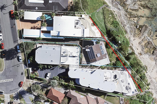
Figure 14: Detailing the average rear boundary setback line noting the proposed additions will be sited significantly behind the rear boundary setback of the adjoining buildings.
DCP Chapter 2.1 Clause 2.1.4.1 – Views
Clause 2.1.4.1 of requires the design of new buildings to have regard to existing views enjoyed by surrounding properties. Existing views should not be substantially affected where it is possible to design for the sharing of views. The primary view lines of adjacent properties
should be maintained where possible. Notwithstanding this, view sharing should be encouraged whilst not restricting the reasonable development of the site.
Various neighbours at 122 Ocean Pde, being a residential flat building, have lodged objection relating to potential view loss. The loss of view occurs from various locations within individual units within the building.
For the purpose of this assessment, the planning principles established by the Land and
Environment Court have been utilised. In Tenacity Consulting v Warringah [2004] NSWLEC
140, the Court adopted a four-step assessment process for determining potential impacts on
existing views and is detailed as follows:
Step 1: Determining the type of view to be affected.
The first step is to consider the type of view to be affected. Water views are valued more highly than land views. Whole views are valued more highly than partial views, eg. a water
view in which the interface between land and water is visible is more valuable than one in
which it is obscured.
The proposal will result in the partial loss of views to individual units within the residential flat building located at No. 122 Ocean Parade as indicated below:
Unit 3
· Partial loss of existing rock platform, water interface and distant beach views in a north/north easterly aspect.
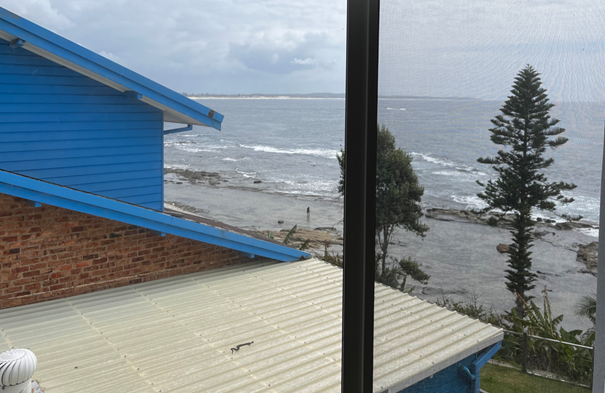
Figure 15: Detailing the existing view corridor to the northeast from unit 3 Dining area (standing).
Figure 16: Detailing the existing view corridor to the east from the side (secondary) balcony of unit 3 (standing).
Unit 4
· Partial loss of existing rock platform and water interface views in a north/north easterly aspect.
Figure 17: Detailing the existing view corridor to the north from the dining area of unit 4 (standing).
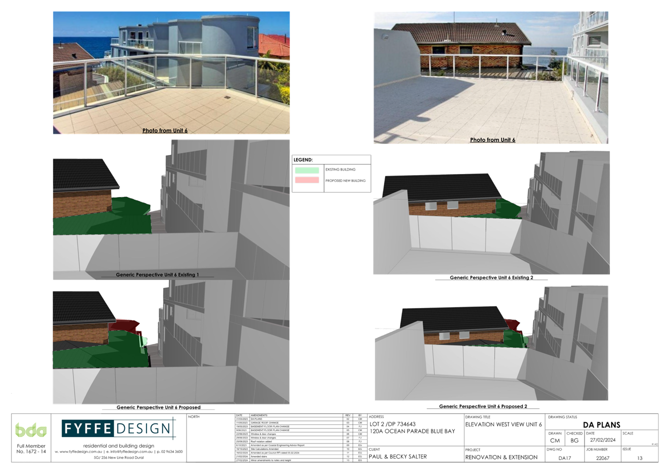
Unit 6
· Partial loss of ocean views in an easterly and north easterly aspect.
Figure 18: Detailing the Existing view corridor afforded in an easterly direct from Unit 6 external Terrace.
Figure 19: Detailing the Existing view corridor afforded to the northeast from Unit 6 external Terrace
The views afforded to each of the above units are considered as scenic (no iconic views available).
Step 2: Determining the position of where views are obtained.
The second step is to consider from what part of the property the views are obtained. In
addition, whether the view is enjoyed from a standing or sitting position may also be relevant.
Unit 3
· The views in a northward direction are currently obtained from sitting and standing positions within the units dining area; and
· The views in an easterly direction are obtained from sitting and standing positions upon a secondary side balcony area and internally from a side bedroom.
Unit 4
· The views in a northward direction are currently obtained from sitting and standing positions within the unit’s kitchen and dining areas.
Unit 6
· The views in an easterly and north easterly direction are obtained from sitting and standing positions from the main bedroom and external terrace area.
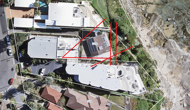
Figure 20: Detailing areas where view loss occurs from impacted units within No. 122 Ocean Pde.
Step 3: Assessing the extent of impact.
The third step is to assess the extent of the impact. This should be done for the whole of the
property, not just for the view that is affected. The impact on views from living areas is more significant than from bedrooms or service areas. It is usually more useful to assess the view loss qualitatively as negligible, minor, moderate, severe or devastating.
In reviewing the view impacts to the affected units within 122 Ocean Parade, it is considered that the impact upon existing view corridors would be considered as being minor. Particularly when considering the extent of available view corridors afforded to other areas within units 3 and 4, which are largely directly east facing. Further it is noted that the views obtained from these units are across the northern allotment boundary being a side boundary.
Step 4: Assessing whether the extent of impact is reasonable.
The fourth step is to assess the reasonableness of the proposal that is causing the impact. A
development that complies with all planning controls would be considered more reasonable than one that breaches them. Where an impact on views arises as a result of noncompliance
with one or more planning controls, even a moderate impact may be considered unreasonable.
With a complying proposal, the question should be asked whether a more skilful design could provide the applicant with the same development potential and amenity and reduce the impact on the views of neighbours. If the answer to that question is no, then the view
impact of a complying development would probably be considered acceptable and the view sharing reasonable.
While most of the view loss can be categorised as minor, Roseth S.C. argues that where an
impact on views arises as a result of non-compliance with one or more planning controls, even a moderate impact may be considered unreasonable.
Views across side boundaries are more difficult to protect than views from front and rear boundaries, and the expectation to retain side views is often unrealistic. As shown above (Figure 20), the objector's property is located south of the subject allotment and principal view impacts (from units 3 and 4) occur to the north (across a side boundary).
In considering the view impacts it is noted that the proposed development has been designed with a parallel rear foreshore reserve setback immediately adjoining the building at No. 118 Ocean Pde, of 8.698 metres to the proposed addition. Whilst this is acknowledged as being non-compliant with required rear foreshore boundary setback controls, as indicated within the body of this report, the provision of a compliant 10.0 metre setback would do little to provide improved view sharing opportunities.
Additionally, the proposal has been the subject of some re-design by the applicant to provide for some lessening of the impact of the proposal in terms of the limited views affected. Namely via the provision of a compliant southern side boundary setback and additionally, the lowering of the roof pitch of the southern side addition by some 0.508 metres.
Given this, the building design is considered to have addressed the principals of view sharing. Accordingly, the proposal is considered to have minor impact upon existing views, particularly when considering the overall views obtained from the impacted units. As such, the proposal is considered consistent with established view loss principals and is therefore supported in this instance.
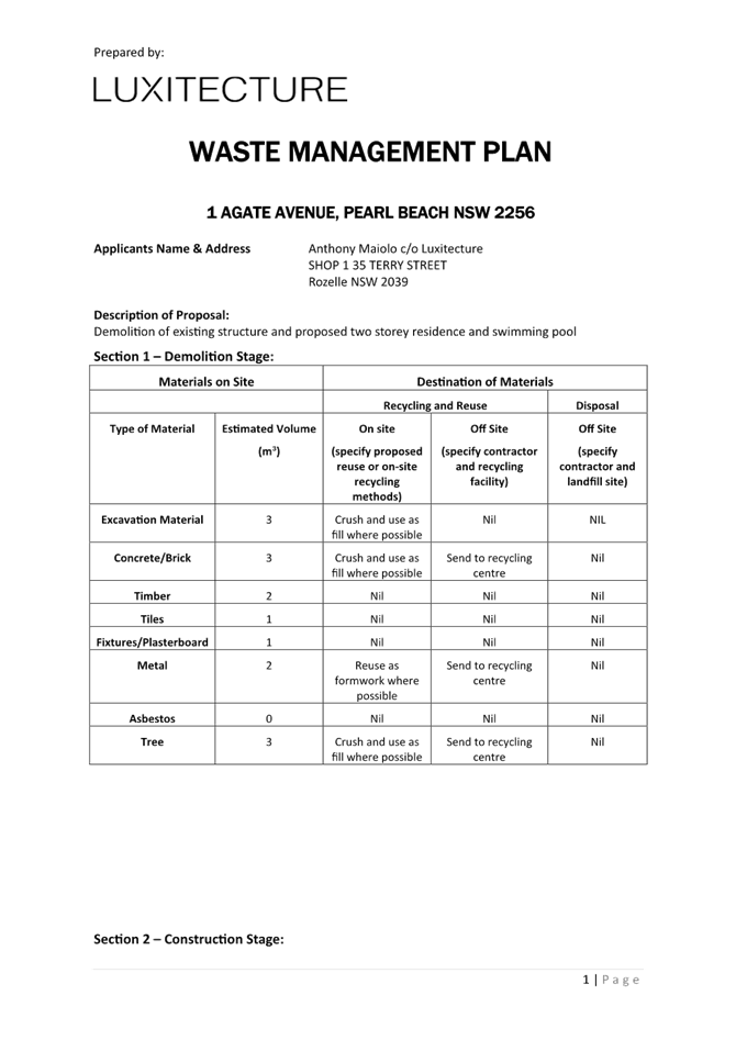
DCP Chapter 2.14 Waste Management
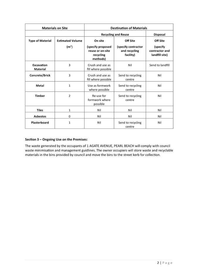
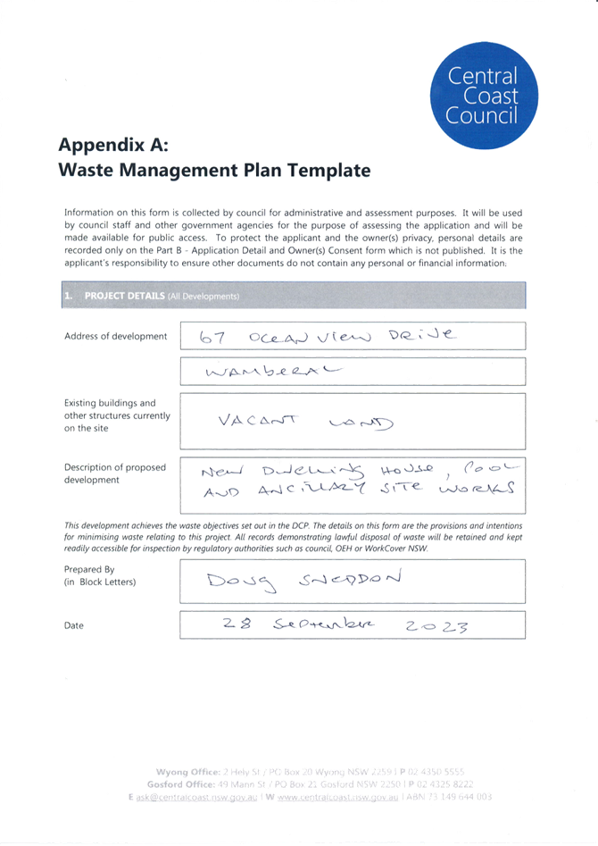
A Waste Management Plan has been submitted in support of the proposed development.
The proposal has demonstrated compliance with this chapter of the CCDCP 2022 and
associated Waste Control Guidelines. An appropriate condition is included in the development consent requiring compliance with the submitted waste management plan (condition 5.4).
DCP Chapter 2.17 – Character and Scenic Quality
The site is subject to character provisions of Chapter 2.17. In this regard, the development
proposal is considered consistent with the development pattern evident within the
Blue Bay suburb. In this regard, there are numerous examples of similarly designed dwellings of a two and three storey appearance, located upon allotments having direct ocean front access in proximity to the allotment. Additionally, adjoining oceanfront allotments in proximity to and adjoining the site contain significant residential flat buildings.
Given the relative minor alterations and additions sought by the proposal, it is considered therefore that the completed development will be consistent with character provisions of Chapter 2.17, with the proposal therefore considered appropriate in the location.
DCP Chapter 3.2 Coastal Hazard Management – Northern Area
The proposal has been assessed in accordance with the relevant provisions of CCDCP 2022 Chapter 3.2 Coastal Hazard Management - Northern Area (Former Wyong LGA).
The adopted Coastal Hazards Mapping (2011) as identified in Figure 21 below, indicate the following:
· Immediate Risk Coastal Hazard Planning Line - red line.
· High Risk Coastal Hazard Planning Line – amber line.
· Low Risk Coastal Hazard Planning Line – yellow line.
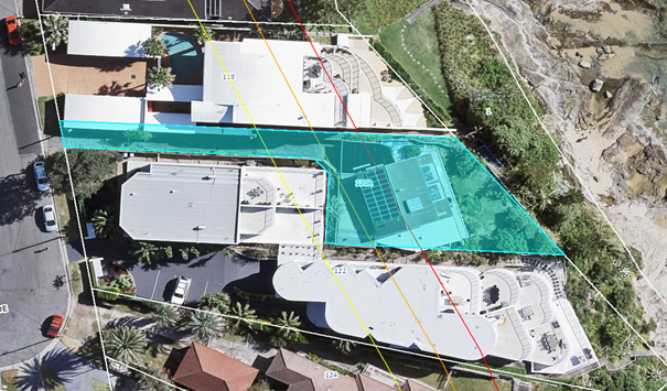
Figure 21: Detailing the Coastal Hazard lines impacting the site.
There is some discrepancy between the alignment of the aerial photography and the plan in relation to the property boundary. The hazard lines are rectified against the aerial photography. Regardless, when aligned with the property boundary, the outline of the proposed addition is located wholly forward of the adopted 2011 Immediate Coastal Hazard Area (seaward of the red line).
Given the sites coastal erosion constraint, application has been referred internally to Council’s Coastal Planning Officer. Initial referral advice indicated that the proposal could not be supported from a coastal erosion perspective, as the development did not comply with the prescriptive requirements of Clause 3.2.2.2 Table 1 “Additions and alterations within or landward of the pre-existing dwelling footprint” of Chapter 3.2.
Additionally, the internal comments indicated that the proposal was not suitable to process within the confines of Chapter 3.2 given other planning considerations, namely being the reduced setback sought by the development, to the rear foreshore area.
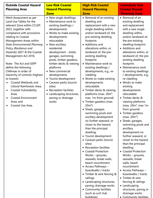
Figure 22: Detailing Table 1 of Chapter 3.2 indicating “non exhaustive” development types which may be considered forward of the immediate (red) coastal hazard line.
Subsequent to the initial internal comments provided by Council’s Coastal Planning Officer, the applicant, in response to both the coastal erosion concerns and other issues relevant to the proposal as raised by the assessing officer, provided amended development plans.
These plans included the removal and relocation of a proposed access stair increasing the rear foreshore boundary setback and additionally, the provision of a plunge type swimming pool. Additionally, an addendum to the originally submitted coastal engineering report was provided.
Upon receipt of the additional information, the amended development proposal was again referred internally to Council’s Coastal Planning Officer. Further comments were received with respect to this additional information indicating the proposal was again not supported as Council’s current coastal assessments are undertaken against the adopted 2011 coastal hazard lines, not the so called “potential extent of coastal recession lines” as offered by the submitted geotechnical report and referred to within the submitted coastal engineering report. Accordingly, the amended proposal remained non-compliant with the prescriptive requirements of Table 1 of Chapter 3.2.
In an attempt to better understand the concerns with the development as raised by internal coastal referral comments outside of strict compliance with Table 1 of Chapter 3.2, a request was made that further commentary be provided giving indication as to why the development proposal did not meet the relevant objectives of Chapter 3.2.
In response, further internal coastal comments were provided indicating the originally submitted geotechnical report did not meet the standard as required by Clause 3.2.2.3 of Chapter 3.2 and was considered inadequate. This being based upon comments that bore hole logs within the submitted report were not located within the building addition footprint, did not provide an adequate description of site sub-strata and further, did not adequately identify present geological formations and bedrock location. It is to be noted that despite the proposal being referred to the Coastal Planning Officer on two prior occasions, the provision of this advice relating to the submitted geotechnical report, had never been indicated previously.
Accordingly, based upon these further internal referral comments, the applicant was provided with further opportunity to provide additional commentary with respect to the originally submitted geotechnical report. In response, a further updated geotechnical report was provided by the applicant within which additional borehole logs were undertaken with the updated report considered to address the deficiencies as raised by the internal referral comments.
Upon its submission, the updated geotechnical report was again referred internally to the Coastal Planning Officer. In response, further comments were provided indicating again that the proposal did not comply with the prescriptive requirements of Table 1 of Chapter 3.2. Further, advice was provided that despite the site specific geotechnical and coastal engineering reports, based upon an objective that development be restricted within the coastal hazard zone, applying precautionary principles, there was no basis to consider ignoring the adopted 2.11 coastal hazard lines. This being despite the relative minor nature of the proposed additions relative to the rear boundary (foreshore) setback displayed by the substantial adjoining residential flat buildings.
In reviewing Clause 3.2.2.2 of Chapter 3.2 it is noted that the Clause gives indication that development forward of the immediate hazard line (red line) is unsuitable. However, the clause, also indicates the development types to be “non-exhaustive” and allows for some structures, as indicated within Table 1 (figure 22 above), to be permitted, if supported by appropriate coastal and geotechnical assessment reports, relevant to the scale of the development proposal.
Further, the coastal hazard lines used for assessment purposes and as indicated as applying to the site, are based on an historic assessment undertaken and adopted by Council in 2011. Subsequent to this, an updated coastal assessment undertaken in 2016 has been undertaken, with the recommendations of this assessment never having been adopted by Council. In this regard, if the draft 2016 coastal hazard lines were used to define permitted development on the site, the proposed additions would be located wholly landward of the immediate (red) coastal hazard line.
In considering the submitted coastal engineering report, it indicates that within the adopted 2011 Coastal Management Plan, the subject site and adjoining area was designated as a geotechnical area of advice. That is, geotechnical hazards were considered to govern over traditional sandy beach coastline hazards as the site is underlain by bedrock, with a traditional beach subject to coastal hazards, underlain by sand.
Additionally, the coastal engineering report gives an estimation of wave run-up levels. At present, maximum wave run-up levels are at about 6.5m AHD. Allowing for a 1.0m sea level rise (considered as conservative by the coastal engineer), a design wave run-up level of 7.5m AHD can be adopted. The lowest floor level at the site is 11.37m AHD, well above the design wave run-up and potential inundation level.
Further to the above information it is relevant to consider the proposal in terms of the stated objectives of Chapter 3.2. Objectives of Chapter 3.2 are as follows:
· To complement and reinforce the objectives and requirements of the Coastal Management Act 2016;
· To reduce the impact of coastal hazards on individual owners and occupiers of land within the Coastal Vulnerability Area;
· To manage development along the coastline through a risk-based, adaptive management approach;
· To protect beach amenity and public safety;
· To avoid impacts on adjoining land, resources or assets; and
· To consider practical opportunities for minor ancillary development.
In considering the proposal against these objectives, it is worthwhile considering the following relevant points;
· The proposal, as indicated within the body of this report, is considered to address the provisions of the State Environmental Planning Policy (Resilience and Hazards) 2021;
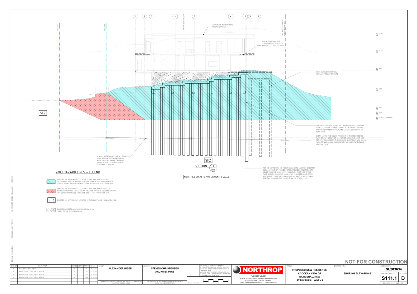
· The site is located upon a coastal bluff well above wave run-up and potential inundation levels. Further, the proposed additions and plunge pool are to be located upon foundations socketed into bedrock, noting the rear of the existing dwelling and side additions (to be demolished) are supported by single timber posts supported on conventional shallow footings;
· The development proposal is supported by a compliant site-specific geotechnical investigation reporting that the adopted 2011 coastal hazard lines are considered conservative for the site, with the proposal also supported by an appropriate coastal engineer’s assessment report prepared by a Land and Environment Court acknowledged expert. It is considered therefore that the proposal achieves the objective of the Chapter related to the adoption of a risk-based approach;
· The proposal in the context of the site and adjoining development, is considered a minor addition to the existing dwelling a maximum 2.220m further seaward than the existing dwelling on the allotment; and
· The proposal has been assessed as being satisfactory in terms of impacts on adjoining lands, with particular emphasis on view loss, with adequate separation provided to existing sewer infrastructure located within the rear portion of the site.
Accordingly, in the circumstance it is considered that in applying precautionary principles to the development proposal, strict compliance with Chapter 3.2 provisions is unwarranted in the location, with the proposal therefore supported in relation to the site’s coastal erosion constraint.
Further, upon final review of the full suite of information, Council’s Coastal Planning Officer agrees with the merit based assessment of the development proposal.
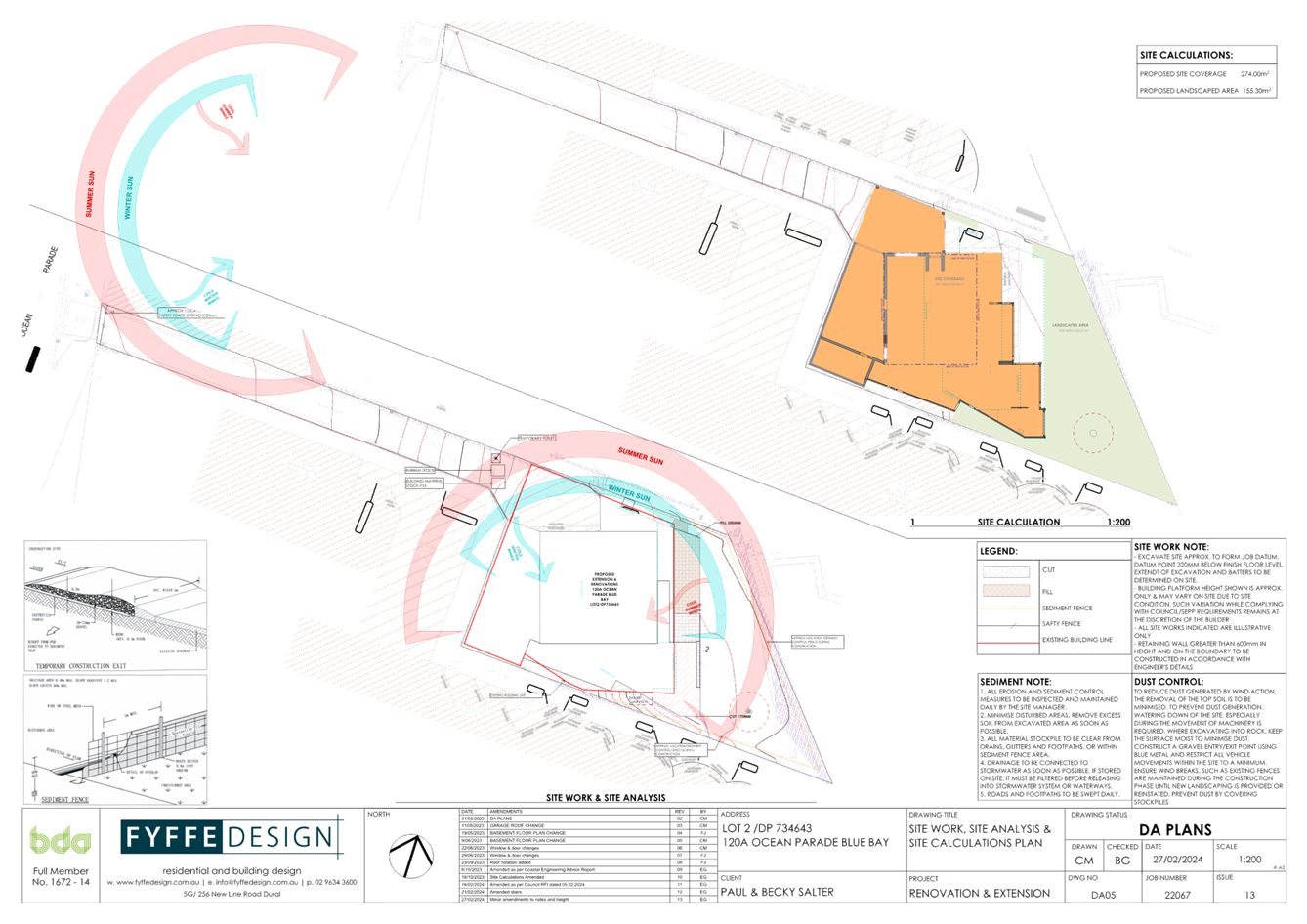
DCP Chapter 6.3 Erosion Sedimentation Control
The implementation of appropriate siltation controls will be conditioned within the issued development consent.
Likely Impacts of the Development:
Built Environment
A thorough assessment of the proposed development’s impact on the built environment has
been undertaken in terms of the CCLEP 2022 and CCDCP 2022 compliance. It is considered on balance that the potential impacts are considered reasonable.
Natural Environment
The proposal involves some minor site excavation for dwelling and swimming pool construction. Whilst there is some impact upon the natural environment, with particular reference to coastal erosion hazard, this is considered reasonable given the sites General Residential zoning and the extent of the proposal in relation to adjoining development. Accordingly, the proposal is considered satisfactory in relation to impacts on the natural environment.
Context and Setting
The proposal is located within the R1 General Residential zone under CCLEP 2022 and subject to character provisions of Chapter 2.17 of the CCDCP 2022. The proposal provides an improved dwelling outcome, noting the aged and dilapidated nature of the existing site improvements, within the residential zone, with the proposal considered consistent with the objectives of the R1 land use. In addition, the proposal is considered consistent with the emerging character of the area.
Economic and Social Impacts
The proposal will provide minor economic benefit through the provision of temporary employment during demolition and construction works. Socially, the proposal does not give rise to any adverse environmental impacts in respect to overshadowing or view impacts within either the public or private domain.
Suitability of the Site for the Development:
Coastal Erosion Considerations
As indicated, the proposed additions are wholly located forward of the current adopted 2011 immediate coastal hazard line. As indicated within the body of the report above however, assessment of the proposal against the relevant objectives of the Coastal Erosion Chapter indicates that the proposal is satisfactory in terms of the coastal erosion.
The Panel can therefore be satisfied that the development proposal is satisfactory in terms of
the sites coastal erosion constraint.
Submissions
As indicated, the development application was notified in accordance with the provisions of
Chapter 1.2 “Notification of Development Proposals” of Central Coast Development Control
Plan 2022 on two separate occasions as follows: -
• First round of notification - from 10 November 2023 until 24 November 2023.
During this period, a total of seven (7) submissions were received.
As a result of concerns with the proposed development raised by the assessing officer, the
applicant in response provided amended development plans. These amended development
plans significantly altered the proposed development and included the following amendments:
• Increase to the southern side boundary setback for the proposed addition, to comply with Chapter 2.1 and NCC provisions:
• Reduction in roof pitch and overall height by 0.508 metres to the proposed side addition to address view loss/sharing concerns;
• Provision of the proposed lower level plunge pool;
• Removal of the rear access stairs forward of the proposed balcony addition;
• Increase in setback to the balcony to the northern allotment boundary; and
• Other minor changes to window and boundary setbacks.
Upon receipt of the amended development plans, re-notification of the development was undertaken during the following period:
• Second round of notification – 1 March 2024 until 15 March 2024.
Upon completion of this re-notification, a total of nine (9) submissions were received.
A summary of submission items with respect to the amended development proposal is as
follows:
• Concerns regarding view loss.
Comment: As indicated within the view loss analysis within the body of the report above, view loss impacts to various locations within individual apartments within the adjoining residential flat building, are considered acceptable and in line with established view loss principles. Further, the proposal has been amended via the reduction in roof pitch and overall lowering of the southern side addition to provide for further view sharing.
• Concerns regarding unauthorised nature of prior development on the site.
Comment: Reduced southern side boundary setbacks displayed by the existing dwelling on the site, have been authorised via a prior development approval being DA/487/1999 – refer to Figure 12 within the body of the report above.
• Concerns regarding reduced southern side boundary setback for the proposed addition
Comment: Amended development plans have been received indicating a compliant minimum 900mm southern side boundary setback for the proposed addition.
• Concerns regarding adequate clearance/identification of sewer infrastructure.
Comment: Sewer infrastructure within the site has been identified via survey, with the proposed addition clear of the sewer existing manhole. Further, the development is supported by water and sewer staff subject to conditions.
· Concerns that the proposal has not been supported by a Coastal engineering assessment report.
Comment: The proposal has been supported by a coastal erosion hazard assessment report and additionally an addendum to this report. Further, the application has been supported by a geotechnical assessment and additionally, a further detailed geotechnical report as requested by Council’s Coastal Officer.
· Concerns regarding roofing material colour and potential for glare and reflectivity.
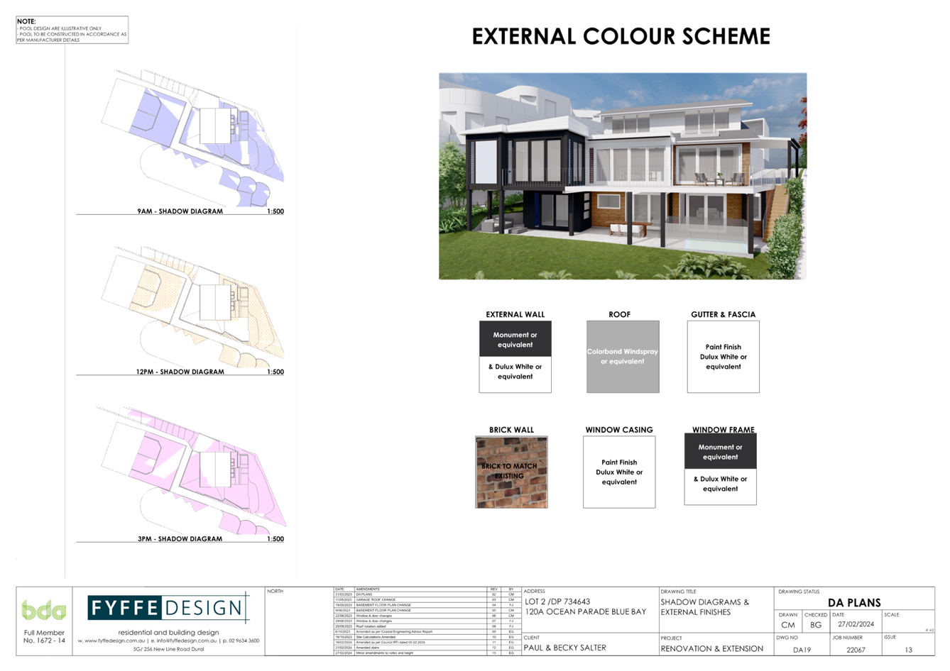
Comment: The submitted BASIX certificate and external finishes schedule indicate the use of a darker “Colorbond Windspray” roof tone. This is considered acceptable in terms of potential glare and reflectivity impacts.
· Concerns regarding privacy impacts
Comment: The additional windows proposed within the southern addition are located within infrequently occupied areas of the dwelling and bathrooms. The provision of these windows is therefore considered to create minimal if any additional privacy impacts.
· Concerns completed development is to be used for separate occupancy.
Comment: Internal stair access is provided between all levels of the completed dwelling. Further, review of the internal floor plans, indicates the completed development to be a single dwelling only.
· Concerns regarding extent of demolition works not being evident.
Comment: Demolition works are largely confined within the existing dwelling and the existing southern side addition. Further, appropriate conditions are to be applied with respect to demolition works complying with AS2601-2001.
· Concerns regarding vehicle traffic movements.
Comment: The existing site condition is not altered in terms of the sites existing garage and site vehicular access.
· Concerns Regarding site coverage.
Comment: As indicated within the body of the report above, permitted site coverage and Floor Space Ratio development controls have been complied with. In this regard, it is to be noted that the sites battle-axe handle is not excluded from either site coverage or Floor Space Ratio calculations. Further, unenclosed balcony and deck areas and additionally eaves, are also excluded from site coverage calculations.
Submissions from Public Authorities
The development proposal was not required to be referred to any external authority.
Internal Consultation
|
Coastal Engineering |
Supported. See commentary previously in report |
||
|
Water and Sewer |
Supported subject to conditions 2.2 and 6.2. |
Ecologically Sustainable Principles:
The proposal has been assessed having regard to ecologically sustainable development principles and is considered consistent with the principles.
The proposed development is considered to incorporate satisfactory stormwater, drainage and erosion control and the retention of vegetation where possible and is unlikely to have any significant adverse impacts on the environment and will not decrease environmental quality for future generations. The proposal does not result in the disturbance of any endangered flora or fauna habitats and is unlikely to significantly affect fluvial environments.
Climate Change
The potential impacts of climate change on the proposal have been considered by Council as
part of the assessment of the application.
The assessment has included consideration of such matters as potential rise in sea level,
potential for more intense and / or frequent extreme weather conditions including storm events, bushfires, drought, flood and coastal erosion; as well as how the proposed development may cope, combat and withstand any resultant impacts. The proposed
development is considered satisfactory in relation to climate change.
The Public Interest
The proposed development is seen to be in the public interest by providing assurance that the subject land can be developed in proportion to its site characteristics.
Conclusion
The development application has been assessed having regard for the matters for
consideration under Section 4.15 of the Environmental Planning and Assessment Act 1979 and
all relevant instruments, plans and policies. Following a thorough assessment of the relevant
planning controls and the key issues identified in this report it is considered that the
application can be supported because:
1. The Panel can be satisfied that the proposed development is considered satisfactory having regard to the matters for consideration provided in Section 4.15 of the Environmental Planning and Assessment Act 1979.
2. The application has been assessed against the requirements of clause 61 of the Environmental Planning and Assessment Regulation 2021 in respect of demolition.
3. The Panel can be satisfied that the provisions of State Environmental Planning Policy (Resilience and Hazards) 2021, Chapter 2 Coastal Management, sections 2.10, 2.11 and 2.15 have been considered and satisfied.
4. The Panel can be satisfied that the proposed development is consistent with the zone objectives as set out in the Central Coast Local Environmental Plan 2022.
5. The Panel can be satisfied that the relevant provisions of the environmental planning instruments, plans and policies that apply to the development have been considered in the assessment of the application.
6. Subject to the imposition of appropriate conditions, the proposed development is not expected to have any adverse environmental, social, or economic impact.
The application is therefore recommended for approval subject to the conditions included in Attachment 1.
|
1⇩ |
Draft conditions/reasons - 120A Ocean Parade, BLUE BAY NSW 2261 - DA/2106/2023 - Central Coast Council |
|
D16304948 |
|
2⇩ |
Revised Plans - 120A Ocean Pde Blue Bay - DA/2106/2023 |
Provided Under Separate Cover |
D16089002 |
|
Redacted - Revised Plans - 120A Ocean Pde Blue Bay - DA/2106/2023 |
|
D16451168 |
|
3.1 |
DA/2106/2023 - 120A Ocean Parade Blue Bay - Alterations & Additions to Existing Dwelling and Plunge Pool |
|
Attachment 1 |
Draft conditions/reasons - 120A Ocean Parade, BLUE BAY NSW 2261 - DA/2106/2023 - Central Coast Council |
|
DA/2106/2023 - 120A Ocean Parade Blue Bay - Alterations & Additions to Existing Dwelling and Plunge Pool |
|
|
Attachment 2 |
Redacted - Revised Plans - 120A Ocean Pde Blue Bay - DA/2106/2023 |
|
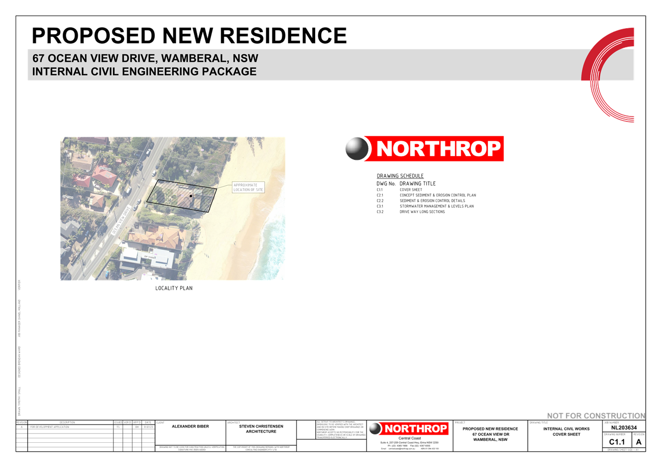
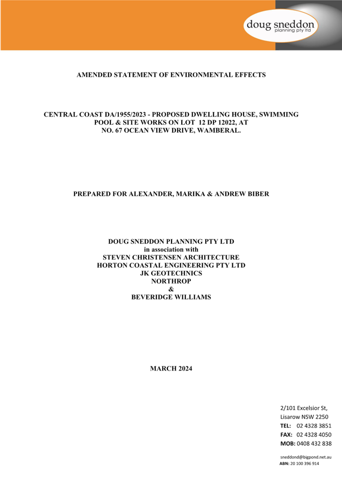
Item No: 3.2 |
|
|
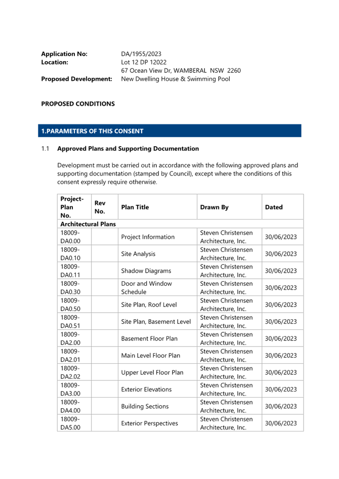
Title: DA/1955/2023 - New Dwelling House & Swimming Pool - 67 Ocean View Drive WAMBERAL NSW 2261 |
|
|
Department: Environment and Planning |
|
|
17 October 2024 Local Planning Panel Meeting |
|
Reference: DA/1955/2023 - D16314508
Author: Karen Hanratty, Senior Development Planner Residential Assessments
Section Manager: Ailsa Prendergast, Section Manager. Residential Assessments
Unit Manager: Andrew Roach, Unit Manager. Development Assessment
|
Summary
An application has been received for New Dwelling House & Swimming Pool. The application has been examined having regard to the matters for consideration detailed in section 4.15 of the Environmental Planning and Assessment Act 1979 and other statutory requirements with the issues requiring attention and consideration being addressed in this report.
This development application is required to be reported to the Local Planning Panel as the application proposes a variation greater than 10% to the Height of Building development standard in clause 4.3(2) of Central Coast Local Environmental Plan 2022. The application proposes a maximum height of 11.287m (on the north-western elevation). This represents a height variation of 2.787m or 32.79%.
The application has been notified and no submissions received.
The application is recommended for approval, subject to conditions.
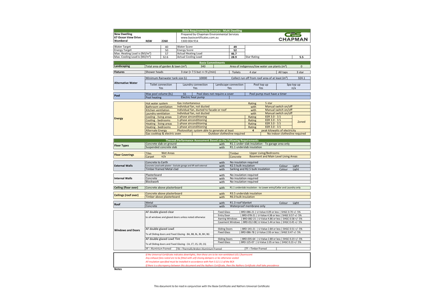
Applicant Doug Sneddon Planning Pty Ltd Owner A O Biber and M Biber and A Biber Application No DA/1955/2023 Description of Land Lot 12 DP 12022, 67 Ocean View Drive Wamberal NSW 2261 Proposed Development New Dwelling House & Swimming Pool Site Area 779.5sqm Zoning R2 Low Density Residential Existing Use Vacant Employment Generation No Estimated Value $2,685,720
|
Recommendation
1 The Panel agrees that the
applicant’s clause 4.6 written request demonstrates that compliance with
clause 4.3(2) Height of Building development standard of Central Coast Local
Environmental Plan 2022 is unnecessary in the circumstances of the case and
that there are sufficient environmental planning grounds to justify
contravening that development standard.
Further, the Panel considers that the proposed development will be in the
public interest because it is consistent with the objectives of the development
standard and the objectives for development within the R2 Low Density zone in
which the development is proposed to be carried out.
2 That the Local Planning Panel grant consent to DA/1955/2023 on Lot 12 DP 12022, 67 Ocean View Drive Wamberal NSW 2261 subject to the conditions detailed in the schedule attached to the report and having regard to the matters for consideration detailed in Section 4.15 of the Environmental Planning and Assessment Act 1979.
Key Issues
· Compliance with Central Coast Local Environmental Plan 2022 (CCLEP 2022).
o Variation greater than 10% to clause 4.3(2) Height of Building development standard.
· Compliance with the Central Coast Development Control Plan 2022
o Chapter 2.1 Dwelling Houses, Secondary Dwellings and Ancillary Structures – building height and side boundary setback.
o Chapter 3.2 Coastal Hazard Management – Southern area - development located within Coastal Hazard Area.
Precis
|
Proposed Development |
New Dwelling House & Swimming Pool |
|
Permissibility and Zoning |
The subject site is zoned R2 Low Density Residential under Central Coast Local Environmental Plan 2022 (CCLEP 2022). The proposed development is defined in the CCLEP 2022 as ‘dwelling house’ and is permissible in the zone with consent. |
|
Current Use |
Vacant land |
|
Integrated Development |
No |
|
Submissions |
Nil |
Variations to Policies - Central Coast Local Environmental Plan 2022
|
Clause |
4.3(2) Height of Building |
|
Standard |
The height of a building on any land is not to exceed the maximum height shown for the land on the Height of Buildings Map of 8.5m. |
|
Departure basis |
Maximum height of 11.287m is proposed on the north-western elevation. This represents a variation of 2.787m or 32.79%. |
Variations to Policies - Central Coast Development Control Plan 2022
Chapter 2.1 Dwelling Houses, Secondary Dwellings and Ancillary Development
|
Clause |
2.1.2.1(a) Building Height |
|
Standard |
Height of building is not to exceed the maximum building height on the Central Coast LEP 2022 Height of Building Map of 8.5m. |
|
Departure basis |
Maximum height of 11.287m is proposed on the north-western elevation. This represents a variation of 2.787m or 32.79%. |
|
Clause |
2.1.2.1(c) Building Height |
|
Standard |
The building height shall not generally exceed two storeys. |
|
Departure basis |
Part two storey, part three storey (western elevation) dwelling house is proposed. This represents a 50% variation for that part of the building containing three storeys. |
|
Clause |
2.1.3.1(c)(i) Side Setbacks |
|
Standard |
Northern Elevation Setback required for the proposed Height of Building (HOB) at Grid 2 on the Architectural Plans is 2.596m. |
|
Departure basis |
The setback for the HOB at Grid 2 is 1.9m. This represents a variation at the first floor of 0.696m or 26.8%. |
Chapter 3.2 Coastal Hazard Management
|
Clause |
Clause 3.2.3.3.2a All Development |
|
Standard |
Council will not permit new buildings or any built structures to be constructed on, over or below the land which has been identified seaward of the coastal building line (except where provided by s.3.2.3.4). |
|
Departure basis |
Part of the dwelling house is located seaward of the Coastal Building Line. |
The Site
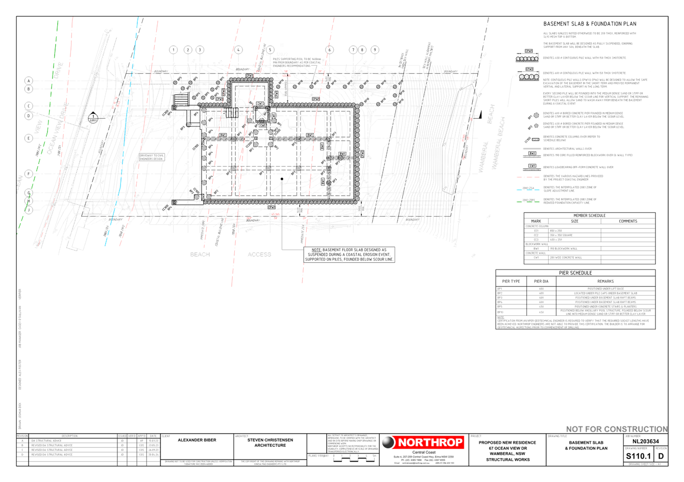
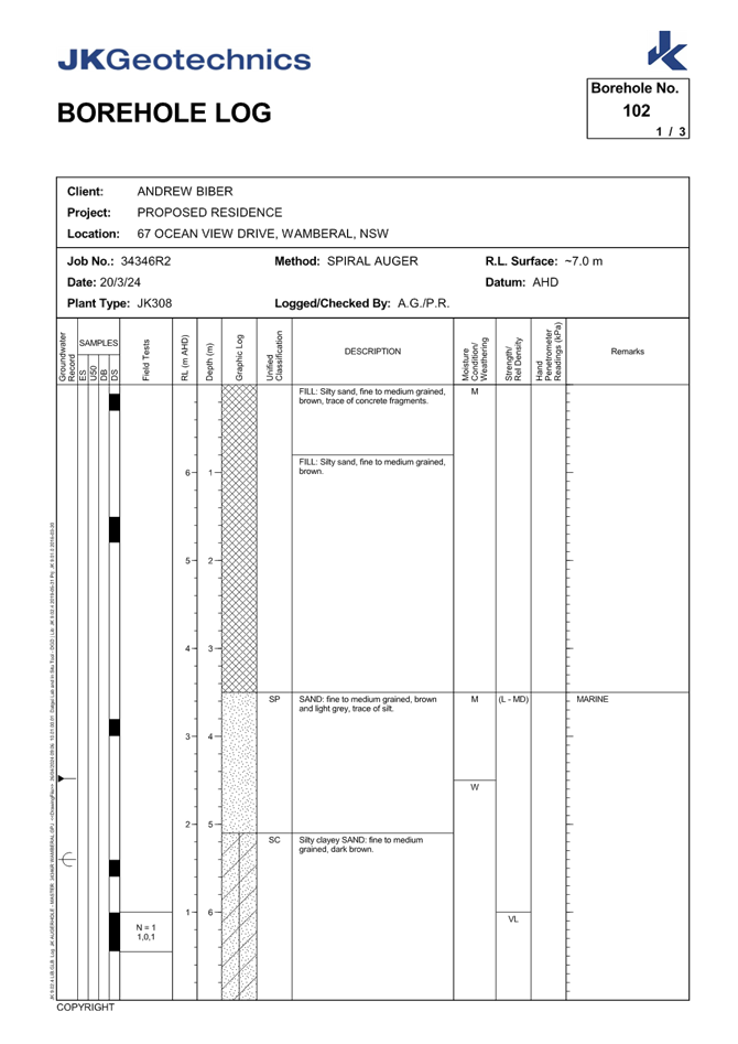
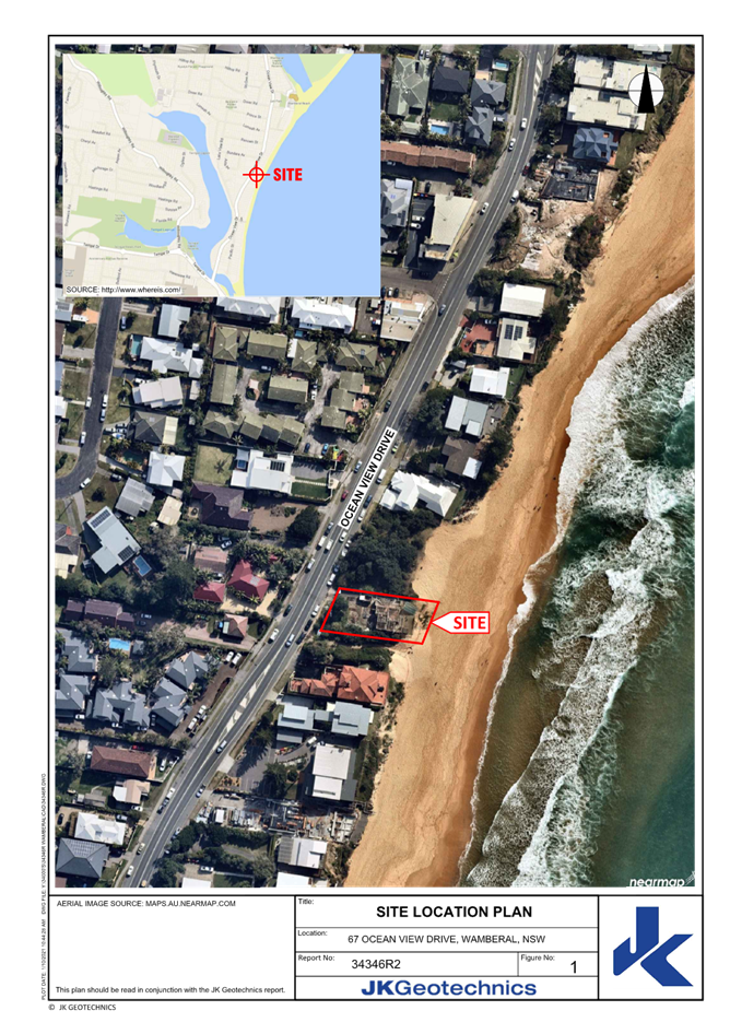
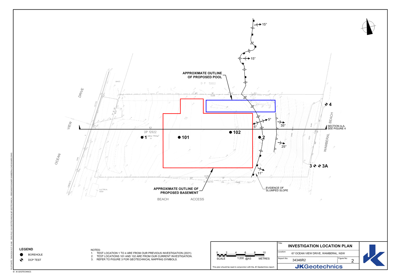
The site is described as Lot 12 DP 12022, 67 Ocean View Drive Wamberal and has an area of 779.5sqm. The site is a trapezoid shaped allotment located on the eastern side of Ocean View Drive and adjoins Wamberal beach to the east and Ocean View Drive to the west.
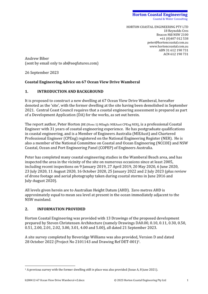
The site is currently vacant with the previous dwelling on the site demolished due to damage sustained during coastal event in July 2020. A history of the site prior to and after the July 2020 storm event is provided within the Coastal Engineering Report submitted with the application and is provided as an Attachment to this report.
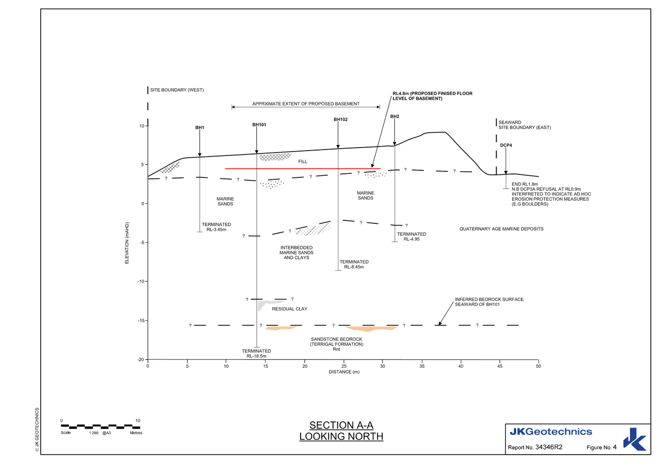
The topography of the site varies from approximately RL8.3m AHD at the dune embankment, around 12m landward of the seaward boundary, at this point the site slopes down to the site frontage to approximately RL 3.6m AHD and 3.0m AHD at Ocean View Drive. Seaward from the dune embankment the land slopes to the beach to approximately RL 3.0m AHD.
The subsurface conditions are described by the Coastal Engineer (Horton 2023) in accordance with the geotechnical investigation (JK Geotechnics 2023) at the site. Boreholes drilled on the landward and seaward side of the site disclosed a generalised profile comprising fill overlying marine sands with residual clay encountered at depth below the marine sands. At the landward borehole, the residual clay had not been reached at a level of -4.2m AHD. At the seaward borehole, the interface between sand and residual clay was found to be at a level of -2.2m AHD.
The site is not identified as bushfire prone land. The site is not affected by the 1 in 100-year flood event however is affected by flooding for the PMF and contains Class 5 Acid Sulfate Soils. The site does not contain any native vegetation or fauna habitat.
The site is located within the coastal hazard area and subject to a Coastal Building Line under Chapter 3.2 Coastal Hazard Management – Southern Area of Central Coast Development Control Plan 2022 (CCDCP 2022).
Figure 1 provides an aerial view of the site prior to the existing dwelling being demolished July 2021 and Figure 2 indicates the vacant site in 2024.
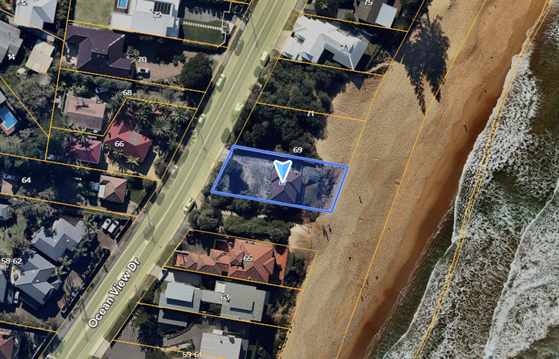
Figure 1 – Site and Locality Plan (subject site blue outline) -
prior to demolition of existing dwelling – Nearmap 4 July 2021
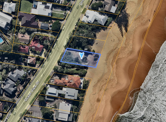
Figure 2 – Site and Locality Plan (subject site blue outline)
Post demolition – Nearmap 22 May 2024
Figures 3 & 4 show the state of the site (photographs taken 22 July 2024) from the street and from the beach, respectively.
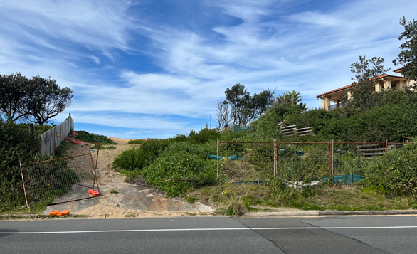
Figure 3 – Subject Site from Ocean View Drive
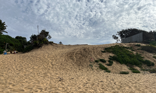
Figure 4 – Subject Site from Wamberal Beach
Wamberal Beach Terminal Protection and Sand Nourishment Project
Council has developed design requirements for a long-term solution for Wamberal Beach erosion. The Gosford Beaches Coastal Zone Management Plan (CZMP) contained an action to progress a long-term solution for Wamberal Beach erosion. The CZMP outlined a preferred protection solution (terminal protection structure) and the technical studies needed to inform further decision making, but it does not provide for the delivery of a seawall and sand nourishment.
· The CZMP lapsed on 31 December 2023.
· Council is currently developing a revised Coastal Management Plan.
The design requirements were developed in conjunction with NSW Government and Manly Hydraulics Laboratory and after the July 2020 storm event the NSW Government Wamberal Seawall Advisory Taskforce was set up to provide technical advice and assistance to Council in progressing a long-term solution for Wamberal. The design requirements/guidelines will enable Wamberal foreshore property owners to undertake approved development to protect their assets whilst the beach public amenity and environment is protected appropriately.
The Engineering Design Requirements Report MHL2872 dated 21 September 2022 was placed on public exhibition from 29 June 2022 to 27 July 2022 and adopted by Council 11 October 2022. Development applications for coastal protection works at Wamberal Beach should demonstrate the use of these requirements in detailed design drawings, technical specifications and construction management.
On 15 July 2024, a separate development application (DA/947/2024) was lodged with Council for Coastal Protection Works along Wamberal Beach, including the subject site.
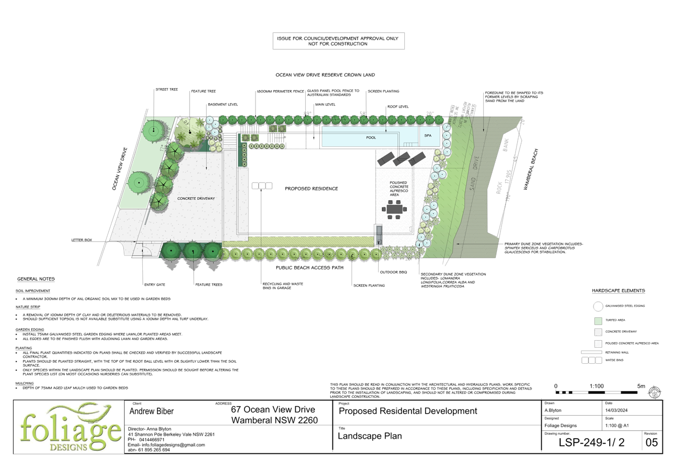
The location of the proposed seawall alignment adopted by the MHL design is indicated on the submitted Architectural Plans for the proposed new dwelling house and swimming pool.
Surrounding Development
Surrounding and nearby land contains detached dwelling houses, with a variety of dwelling types including larger new dwellings and older cottages that are yet to be redeveloped.
Directly to the north of the site are two parcels of vacant land at 69 Ocean View Drive, owned by the Department of Planning and Environment - Sydney, identified on Council’s Land Register as Crown Land and zoned RE1 Public Recreation, refer Figures 5 & 6.
The dwelling house at 73 Ocean View Drive adjoins the vacant land to the north. The front and rear elevations of this residence is visible in Figure 6.
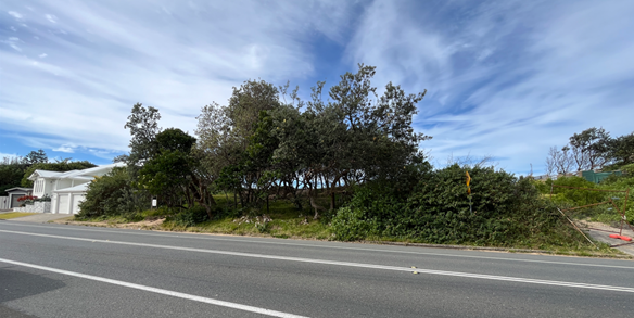
Figure 5 – Properties to the north of Subject Site viewed from Ocean View Drive
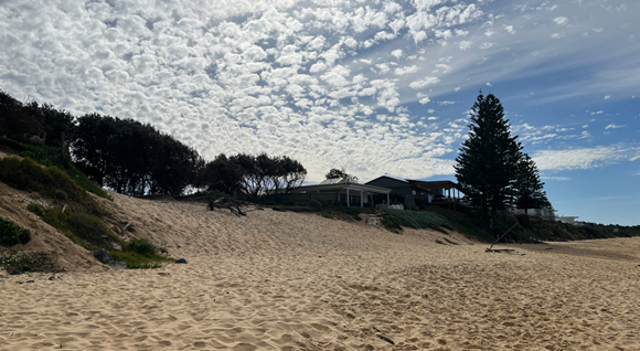
Figure 6 – Properties to the north of Subject Site viewed from Wamberal Beach
To the south of the site is a public walkway beach access reserve (approximately 15m wide) and further south a dwelling house at 65 Ocean View Drive, refer Figures 7 & 8.
Figure 7 – Properties to the south of Subject Site viewed from Wamberal Beach (redacted)
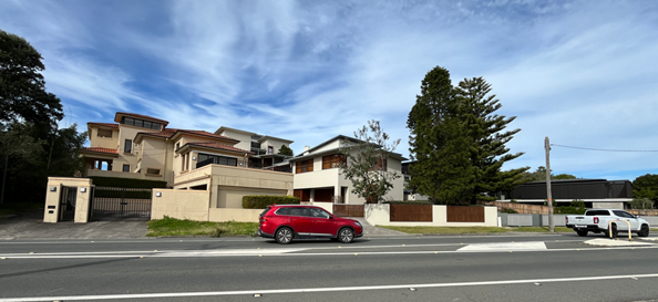
Figure 8 – Properties to the south of Subject Site – 65, 63, 61, 57 Ocean View Drive
In the broader surrounding area along Ocean View Drive there are a number of newer and larger developments with three storey presentations to the street and two storey presentations at the rear towards the beach interspersed with three and four-storey residential flat buildings, new construction and existing dwellings which is evident in Figure 8 above and Figures 9-13 below.
Figure 9 – 29–37 Ocean View Drive
Figure 10 – further to the south – 25, 23, 21 Ocean View Drive
Figure 11 – further to the north - 89 Ocean View Drive in the foreground and
Partially visible 91 and 93 Ocean View Drive
Figure 12 – further to the north - 85-87 Ocean View Drive – approved/not yet constructed
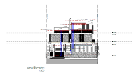
Figure 13 – further to the north - 81 Ocean View Drive – approved/not yet constructed
The Proposed Development
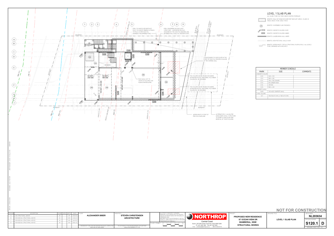
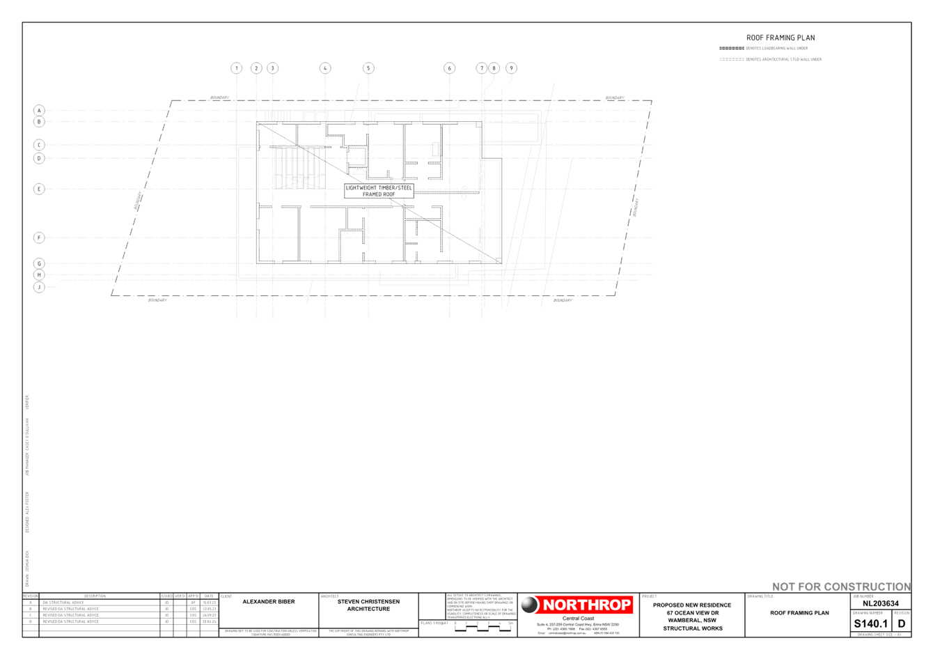
The proposal involves the construction of a two and three storey six (6) bedroom dwelling house comprising:
· Basement Level – RL 4.8m AHD
o Lower entry / 4-car garage / plant rooms / laundry / storage room and wine cellar / lift and stairs.
· Ground Floor - RL 8.9m AHD
o Main entry / kitchen / dining / living rooms / outdoor terrace and swimming pool / lift and stairs.
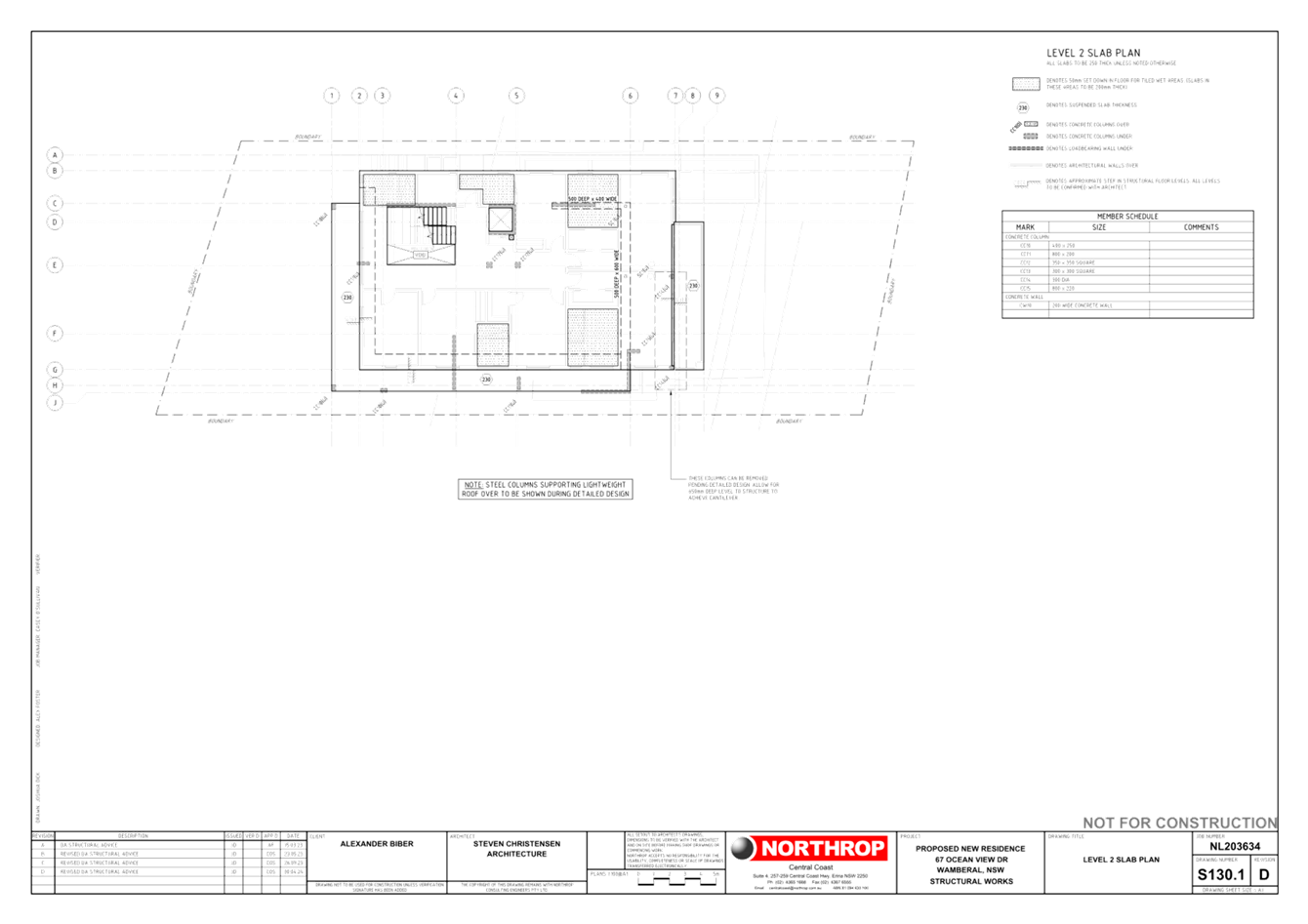
· First Floor - RL 12.5m AHD
o Six (6) bedroom / bathrooms / storage and ocean view balcony / lift and stairs.
The applicant states:
In recent months, the dune at the site has lowered in elevation due to the effects of unauthorised pedestrian access and aeolian processes related to the lack of vegetation on the site. As part of the proposed works, the dune face would be shaped to its former levels by scraping sand up from the adjacent beach (on private property, if sand is available) and/or utilising sand excavated to construct the basement at the site, and revegetated with Spinifex (Spinifex sericeus) and/or other suitable species in accordance with the Coastal Dune Management Manual (Department of Land and Water Conservation, 2001).
The owner also intends to reinstate dune levels after storms in the future by scraping sand up from the adjacent beach (on private property, if sand is available), and to continue revegetating the dune as required, where practical.
A site plan is provided in Figure 14, building elevations in Figures 15 &16 and a landscape Plan in Figure 17.
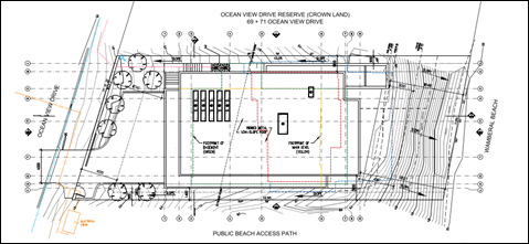
Figure 14 – Site Plan
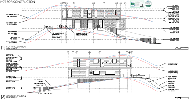
Figure 15 – North and South Elevations
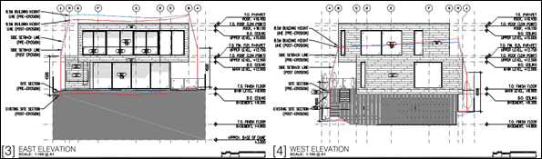
Figure 16 – East and West Elevations
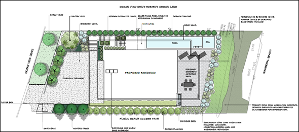
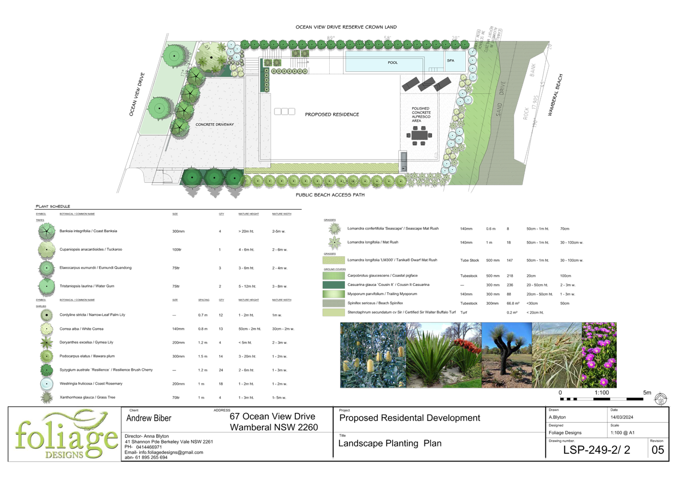
Figure 17 – Landscape Plan
ASSESSMENT
Having regard for the matters for consideration detailed in Section 4.15 of the Environmental Planning and Assessment Act 1979 and other statutory requirements, Council’s policies and Section 10.7 Certificate details, the assessment has identified the following key issues, which are elaborated upon for Council’s information. Any tables relating to plans or policies are provided as an attachment.
Provisions of Relevant Instruments/Plans/Policies
Draft Environmental Planning Instruments
No draft Environmental Planning Instruments apply to this application.
State Environmental Planning Policies
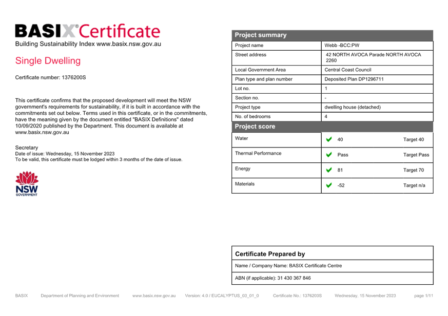
State Environmental Planning Policy (Building Sustainability Index: BASIX) 2004
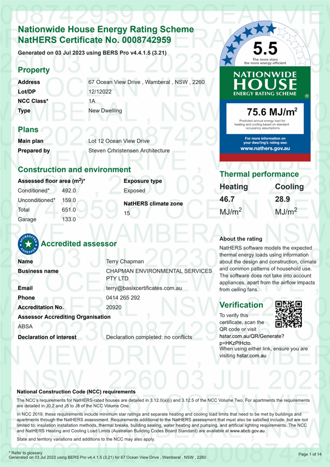
The application is supported by a BASIX certificate which confirms the proposal will meet the NSW government's requirements for sustainability, if built in accordance with the commitments in the certificate.
The proposal is considered to be consistent with the requirements of State Environmental Planning Policy (Building Sustainability Index: BASIX) 2004.
State Environmental Planning Policy (Sustainable Buildings (2022)
The State Environmental Planning Policy (Sustainable Buildings (2022) (Sustainable Buildings SEPP) commenced on 1 October 2023 and provides savings and transitional provisions in clause 4.2(1)(a) which states:
4.2 (1) This policy does not apply to the following—
(a) a development application submitted on the NSW planning portal but not finally determined before 1 October 2023,
The application was submitted to the NSW planning portal on 28 September 2023. The applicant has submitted a valid BASIX Certificate.
State Environmental Planning Policy (Resilience and Hazards) 2021
Chapter 2 Coastal Management
The aims of Chapter 2 are to be considered when determining an application within the Coastal Management Areas. The Coastal Management Areas are defined on maps issued by the NSW Department of Planning and Environment.
The site is located within the Coastal Environment Area and Coastal Use Area as identified on these maps and subject to the provisions of section 2.10 and section 2.11 of the SEPP.
The development is not likely to have an adverse impact on the matters referred to in section 2.10 and section 2.11. The development is not considered likely to cause increased risk of coastal hazards on the site or other land. A summary of considerations is included below.
Section 2.10 - Development on land within the coastal environment area
In accordance with section 2.10(1) development consent must not be granted in the coastal environment area unless the consent authority has considered whether the proposed development is likely to cause an adverse impact on the following:
|
Matters for Consideration |
Compliance |
|
(a) the integrity and resilience of the biophysical, hydrological (surface and groundwater) and ecological environment. |
The proposal is not likely to cause adverse impacts on the biophysical, hydrological, or ecological environment.
The proposal will be connected to reticulated sewer and stormwater will be managed on-site in accordance with the submitted stormwater plans with a 10kL rainwater tank under the driveway. Erosion and sediment controls will be in place during demolition and construction, and the proposal will not impact on the environment. |
|
(b) coastal environmental values and natural coastal processes. |
The proposal is subject to a coastal building line under CCDCP 2022. The Coastal Engineering Report prepared by Horton Coastal Engineering dated 26 September 2023 addresses the impacts of the proposal on coastal processes as follows:
The proposed development would not be expected to adversely affect coastal environmental values or natural coastal processes over its design life, as it would not be damaged by erosion/recession and inundation for an acceptably rare storm and over an acceptably long design life (being piled) and would be suspended above typical coastal processes. The development allows natural erosion/recession and wave runup coastal processes to continue unhindered, while being supported on piles.
The proposal will not impact on the geological and geomorphological coastal processes. |
|
(c) the water quality of the marine estate (within the meaning of the Marine Estate Management Act 2014, in particular, the cumulative impacts of the proposed development on any of the sensitive coastal lakes identified in Schedule 1. |
The proposal will not result in an adverse impact on the water quality of the marine estate and does not drain to a sensitive lake contained in Schedule 1.
The proposal will be connected to reticulated sewer and stormwater will be managed on-site in accordance with the submitted stormwater plans. Erosion and sediment controls will be in place during demolition and construction, to minimise impacts on water quality, and the proposal will not impact on any sensitive coastal lakes. |
|
(d) marine vegetation, native vegetation and fauna and their habitats, undeveloped headlands and rock platforms. |
The proposal will not result in an adverse impact on native vegetation or fauna, undeveloped headlands, and rock platforms. There are no undeveloped headlands or rock platforms in proximity to the proposed development, no marine vegetation in the area to be developed, and no known native vegetation of significance that would be affected at the property.
The proposal will not have significant impacts on marine fauna and flora as the development would not interact with subaqueous areas for an acceptably rare storm and acceptably long life. |
|
(e) existing public open space and safe access to and along the foreshore, beach, headland or rock platform for members of the public, including persons with a disability. |
The proposal will not impact on public access to the foreshore being entirely within the subject site. |
|
(f) Aboriginal cultural heritage, practices and places. |
As stated in the Coastal Engineering Report, an AHIMS search was undertaken on 19 June 2023, and the subject land has not been identified as containing or being within 200m of any Aboriginal sites or places. |
|
(g) the use of the surf zone. |
The proposal is located entirely on the subject site and will not interact with the surf zone or impact on use of the surf zone. |
In accordance with section 2.10(2) development consent must not be granted unless the consent authority is satisfied that:
|
Matters for Consideration |
Compliance |
|
(a) the development is designed, sited and will be managed to avoid an adverse impact referred to in subsection (1), or |
The proposed dwelling house is appropriately designed and sited and will be managed to avoid any adverse impacts referred to in clause 2.10(1) having regard to LEP and DCP requirements, the location and characteristics of the site and existing development on the site and surrounding properties.
The proposal does not involve the removal of any significant vegetation. Historical mapping (Nearmap 5 October 2021) indicates that the site was cleared of structures and vegetation when the previous dwelling was demolished. The current state of the site with minimal vegetation regrowth is shown in Figures 3 and 4.
No additional structures or coastal protection works shall be erected on the dune seaward of the new dwelling house unless separately approved by Council. |
|
(b) if that impact cannot be reasonably avoided—the development is designed, sited and will be managed to minimise that impact, or |
N/A – no adverse impacts
|
|
(c) if that impact cannot be minimised—the development will be managed to mitigate that impact, |
N/A – no adverse impacts
|
Section 2.11 - Development on land within the coastal use area
In accordance with section 2.11(1) development consent must not be granted in the coastal use area unless the consent authority has considered whether the proposed development is likely to cause an adverse impact on the following:
|
Matters for Consideration |
Compliance |
|
(a) whether the proposed development is likely to cause an adverse impact on the following: i. existing, safe access to and along the foreshore, beach, headland or rock platform for members of the public, including persons with a disability, ii. overshadowing, wind funnelling and the loss of views from public places to foreshores, iii. the visual amenity and scenic qualities of the coast, including coastal headlands, iv. Aboriginal cultural heritage, practices and places, v. cultural and built environment heritage. |
The site has a direct frontage to the foreshore of Wamberal Beach.
There will be some impact from overshadowing of the upper dune areas of the beach in the afternoons mid-winter which is similar to the shadows cast by other development along the beachfront. However, the proposal will not cause an adverse impact on overshadowing, access, wind funneling or view loss from public places to any foreshore.
The dwelling house will be visible from the beach and coastal areas and will maintain an appropriate presentation that is consistent with other more recent development along the beachfront. The proposal complies with the required building height on the rear façade facing the beach and is not likely to have any adverse visual amenity from coastal erosion in a significant storm event.
There are no known objects, areas, or items of heritage significance on the land, and no potentially adverse impacts on cultural or environmental heritage have been identified. |
|
(b) is satisfied that i. the development is designed, sited and will be managed to avoid an adverse impact referred to in paragraph (a), or ii. if that impact cannot be reasonably avoided—the development is designed, sited and will be managed to minimise that impact, or iii. if that impact cannot be minimised—the development will be managed to mitigate that impact, |
If designed and constructed in accordance with the recommendations of the coastal engineering report, geotechnical engineering report and structural engineering report prepared for the site, the proposal will not result in adverse impacts referred to in clause 2.11(a) having regard to LEP and DCP requirements, the location and characteristics of the site and existing development on the site and surrounding properties. |
|
(c) has taken into account the surrounding coastal and built environment, and the bulk, scale and size of the proposed development |
The bulk and scale of the proposed development is compatible with the scale and appearance of other development along the Wamberal beachfront and is considered satisfactory for the site and location. |
Section 2.12 - Development in coastal zone generally - development not to increase risk of coastal hazards
In accordance with section 2.12 development consent must not be granted to development on land within the coastal zone unless the consent authority is satisfied that the proposed development is not likely to cause increased risk of coastal hazards on that land or other land.
Comment:
The proposal will be located within the Coastal Hazard Area under CCDCP 2022. Section 8.2 of the Coastal Engineering Report prepared by Horton Coastal Engineering dated 26 September 2023 addresses the impacts of the proposal on coastal processes and risks of coastal hazards on the land and adjoining land in relation to the requirements of Chapter 3.2 Coastal Hazard Management of CCDCP 2022.
The Coastal Engineering Advice states:
· The entire development shall be founded on piles designed to support the loads of the structure and other conventional structural actions, plus should have an allowance for wave impact loading and loading from a collapsing sand dune during or following storm erosion as per Nielsen et al (1992) (Dune Stability Considerations for Building Foundations, Australia civil Engineering Transactions, Institution of Engineers Australia, Volume CE34, No. 2, June, pp. 167-173). The wave impact and sand slumping forces should be provided by a coastal engineer as part of detailed design. A scour level of -1m AHD should be adopted for the design of these piles, i.e. assuming that all soil is eroded above -1m AHD in the design storm.
· The proposed development would not be expected to adversely affect coastal environmental values or natural coastal processes over its design life, as it is at an acceptably low risk of damage from erosion/recession and inundation for an acceptably rare storm and over an acceptably long design life and would be well landward and above typical coastal processes.
· The proposed dwelling is at an acceptably low risk of inundation if natural ground levels are contoured to direct any wave overtopping away from the garage door. The proposed development is to be suspended above most wave action and increased erosion of the beach or adjacent land would not be expected.
The proposed development is being supported on piles whereas the previous dwelling house and deck was not.
The visual amenity and scenic qualities of the coast will also be addressed by revegetation and management of the dune area. The site has been subject to dune erosion following the demolition of the previous dwelling, unauthorised public access and aeolian processes due to the lack of vegetation on the site. The proposed works include the reshaping of the dune face to to its former levels by scraping sand up from the adjacent beach (on private property, if sand is available) and/or utilising sand excavated to construct the basement at the site, and revegetated with Spinifex (Spinifex sericeus) and/or other suitable species in accordance with the Coastal Dune Management Manual (Department of Land and Water Conservation, 2001) refer Conditions 6.12 & 6.13.
Ongoing management of the site will require reinstatement of dune levels after storms to provide adequate cover over all anthropogenic structures and appropriate fill materials over the unbuilt portion of the site to the seaward property boundary refer Conditions 1.4, 1.5 & 1.6.
In summary, if designed and constructed in accordance with the recommendations of the coastal engineering report, geotechnical engineering report and structural engineering report prepared for the site, including the revegetation and management of the dune area, the proposal is not likely to have adverse impact on coastal hazards, coastal environmental values and visual amenity. The proposal is satisfactory in relation to section 2.12 of the SEPP.
Section 2.13 - Development in coastal zone generally - coastal management programs to be considered
In accordance with section 2.13 development consent must not be granted to development on land within the coastal zone unless the consent authority has taken into consideration the relevant provisions of any certified coastal management program that applies to the land.
Comment:
The Gosford Beaches Coastal Zone Management Plan (CZMP), in place at the time of lodgement of the proposal, applies as a certified coastal management program at the subject property, essentially allows for piled beachfront development to manage the risk to public safety and built assests, envisions residential development being maintained and protection works being undertaken at Wamberal Beach in the future.
The Gosford Beaches Coastal Zone Management Plan (CZMP) lapsed on 31 December 2023.
Chapter 4 Remediation of Land
Section 4.6 of Chapter 4 requires that a consent authority must not consent to the carrying out of any development on land unless it has considered whether the land is contaminated. and if the land is contaminated, it is satisfied that the land is suitable in its contaminated state (or will be suitable, after remediation) for the purpose for which the development is proposed to be carried out.
Anecdotal evidence suggests that historically waste material, including asbestos, has been imported as fill material for houses along Wamberal Beach. Council continues to collect asbestos fragments and other wastes from the beach following storm events. Conditions are applied for an asbestos clearance certificate prior to commencement of any works, refer Condition 4.9.
It is proposed to excavate below the natural ground level for the basement. A waste classification condition has been applied for any soils removed from the site. An additional condition has been applied to ensure that waste material present on the land (i.e., the concrete driveway) and any buried waste is not used as fill material to stabilise the beach foredune, refer Conditions 5.10 & 5.13.
The site has been used for residential purposes and subject to conditions and attention to the above, is considered suitable for the proposed use.
The development and the land are not otherwise mentioned in Section 4.6(4) and accordingly the provisions of Section 4.6(2) are not engaged by the proposal and consent may be granted. The proposal is considered consistent with the provisions of Chapter 4 of the SEPP.
Council can be satisfied that the proposed development complies with the provisions of Chapter 2 Coastal Management and Chapter 4 Remediation of Land of State Environmental Planning Policy (Resilience and Hazards) 2021.
Central Coast Local Environmental Plan 2022 (CCLEP 2022)
Zoning and Permissibility
The subject site is zoned R2 Low Density Residential under CCLEP 2022, refer Figure 18. The proposed development is defined as dwelling house which is permissible in the zone with consent of Council.
The CCLEP 2022 defines the following:
dwelling house means a building containing only one dwelling.
dwelling means a room or suite of rooms occupied or used or so constructed or adapted as to be capable of being occupied or used as a separate domicile.
In accordance with clause 2.3(2) the consent authority must have regard to the objectives for development in respect of land within the zone. The objectives of the R2 Low Density Residential zone are:
· To provide for the housing needs of the community within a low density residential environment.
· To enable other land uses that provides facilities or services to meet the day to day needs of residents.
· To encourage best practice in the design of low density residential development.
· To ensure that non-residential land uses do not adversely affect residential amenity or place demands on services.
· To maintain the enhance the residential amenity and character of the surrounding area.
Properties along Wamberal Beach and to the west of Ocean View Drive are zoned R2 Low Density Residential (identified by the pink shaded area in Figure 8). East of the site, part of Wamberal Beach is known as Remembrance Drive and zoned RE1 Public Recreation (identified by the green shaded area in Figure 8).
The proposed development meets the objectives of the zone as follows:
· The proposal will provide a renewal of housing on the site, and the nature of the use is consistent with development in the surrounding area and considered compatible with the desired future character of the area.
· The design of the proposal responds to the beachfront location of the site and is compatible with the scale and nature of more recent development on Wamberal beachfront. Properties along Ocean View Drive on the beachfront comprise a variety of dwelling types including larger new dwellings and older cottages that are yet to be redeveloped. There are a number of newer and larger developments with three storey presentations to the street and two storey presentations at the rear towards the beach interspersed with new construction and existing dwellings.
· The proposal demonstrates architectural quality and uses different setbacks and design features to break up the massing of the dwelling house.
· The proposal does not unreasonably obstruct any significant views from private property or the public domain.
· The proposal maintains appropriate solar access to adjoining properties.
· The proposed development is ecologically, socially and economically sustainable in the sensitive coastal location and will not give rise to any increased coastal hazards on adjacent land.
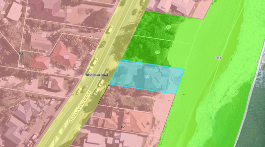
Figure 18 – Zoning Map CCLEP 2022
Clause 4.3 Height of Buildings
Clause 4.3(2) of CCLEP 2022 provides that the height of a building on any land will not exceed the maximum height shown for the land on the Height of Buildings Map. The maximum height shown on the relevant map is 8.5m. The CCLEP 2022 defines this as the height above existing ground level.
The eastern portion of the proposed development complies with the maximum building height except at the western elevation the dwelling has a maximum height from existing ground level of 11.287m at the northwest corner. This represents a variation of 2.787m or 32.79% to the development standard.
The non-compliance with the building height is shown in Figure 19 with the area of exceedance in yellow. The non-compliance does not discernibly impact on bulk and scale, streetscape character or adverse impact on views to surrounding properties.
A written request under clause 4.6 of CCLEP 2022 to vary the development standard has been submitted by the Applicant. The Applicant's submission demonstrates the proposed development is of a satisfactory height, bulk and scale and does not have adverse impact on adjoining development. The Applicant’s objection is considered to be well founded as the proposal is considered to achieve the objectives of the standard and the development is recommended for support.
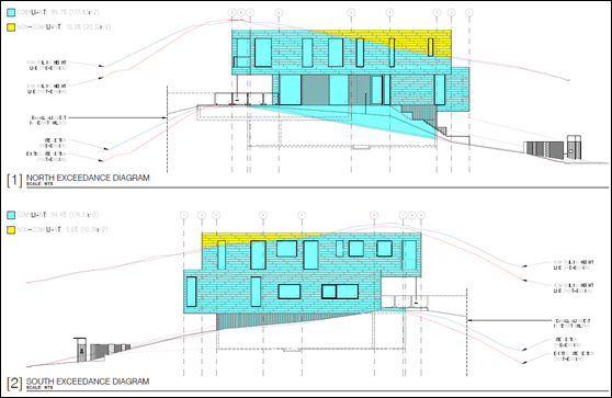
Figure 19 – Building Height Exceedance Diagram
Clause 4.4 Floor Space Ratio
Clause 4.4(2) Floor Space Ratio (FSR) of CCLEP 2022 provides the maximum floor space ratio for a building on any land. There is no floor space ratio applying to the site under the CCLEP 2022.
Notwithstanding this, the proposed development has satisfactory density, bulk and scale which integrates with the streetscape and character of the area and is comparable to contemporary buildings along Ocean View Drive.
Clause 4.6 Exceptions to Development Standards
A clause 4.6 Exceptions to Development Standards variation for the non-compliance associated with floor space ratio development standard in Clause 4.3(2) of CCLEP 2022 was provided by the applicant.
Clause 4.6 of CCLEP 2022 provides the ability to grant consent to a development application where the variation to a development standard can be adequately justified and where the objectives of clause 4.6 are satisfied, being:
(a) to provide an appropriate degree of flexibility in applying certain development standards to particular development,
(b) to achieve better outcomes for and from development by allowing flexibility in particular circumstances.
In accordance with clause 4.6(3) the Applicant has submitted a written request seeking variation the building height development standards of 8.5m in clause 4.3(2) of CCLEP 2022. A copy of the clause 4.6 variation is included in the Statement of Environmental Effects as Appendix H. The Statement of Environmental Effects is provided as Attachment 13 to this report.
The development proposes a maximum building height of 11.287m at the western elevation, northwest corner of the dwelling house. This represents is a variation of 2.787m or 32.79% to the development standard. The non-compliance with the building height is shown in Figure 19. The eastern portion of the proposed development complies with the maximum building.
The applicant’s written request refers to the first of the five tests established in Wehbe v Pittwater Council [2007] NSW LEC 827 to demonstrate that compliance with the numerical standard is unreasonable or unnecessary in the circumstances. The test seeks to demonstrate that the objectives of the standard are achieved notwithstanding non-compliance with the numerical standard, Clause 4.3 Height of Buildings of the CCLEP 2022.
The Applicant’s written request to vary the height of building development standard demonstrates the following (summarised):
· the objectives of the building height development standard and the objectives of the R2 Low Density Residential Zone are achieved by the proposed development, notwithstanding its partial non-compliance with the development standard.
· approval of the proposed development would not raise any matter of significance for State or regional planning.
· there are sufficient environmental planning grounds to justify the proposed development contravening the building height development standard.
· the proposed development is in the public interest as it is intended to facilitate the economically viable redevelopment of the subject land in a manner consistent with strategic planning objectives for the locality.
· there is no public benefit to be derived, or planning purpose to be served, in requiring the proposed development to strictly comply with the 8.5m maximum building height development standard in view of the relatively small area of the proposed structure exceeding the 8.5m maximum building height development standard.
· the proposed dwelling appears presents as a three-storey building from Ocean View Drive and has a compliant two storey presentation to the beach, consistent with other contemporary developments along the Wamberal beachfront.
· Diagram A (North & South Elevation Exceedance Diagrams) presents a proportional analysis of the north & south elevations, showing the area of exceedance in yellow. The elevation proportional analysis of the 8.5m development standard exceedance is:
o North Elevation: Compliant – 89.7% (177.83m2). Non-compliant – 10.3% (20.32m2).
o South Elevation: Compliant – 94.4% (176.51m2). Non-compliant – 5.56% (10.39m2).
· the proposed development has a roof parapet height of RL 16.450m. This is consistent with the roof RL height of approved dwellings in the near vicinity, some examples of which are:
o Nos. 85-89 Ocean View Drive (recently approved) – RL 16.65m
o No. 89 Ocean View Drive – RL 16.80m
o No. 93 Ocean View Drive – RL 17.9m
o No. 95 Ocean View Drive – RL 17.00m.
· the bulk and scale of the proposed development provides for view sharing and does not result in a building which is visually prominent or have any significant adverse scenic/visual impacts or amenity (privacy/overshadowing) impacts on either the public domain or any nearby dwelling, in comparison to a fully complying development.
· as demonstrated in the accompanying Statement of Environmental Effects, the bulk and scale of the proposed development is compatible (and not out of scale) with existing and recently approved multi-storey dwellings in the near vicinity, including the closest neighbour at No. 65 Ocean View Drive.
· the bulk, scale and built form of the proposed development is of high-quality architectural design and is appropriate to its function and urban context. The architectural articulation/stepping of the western elevation of the proposed dwelling provides for a suitable transition of built form through the site.
· the proposed building’s massing does not reduce the opportunity for either the proposed development or public areas to receive satisfactory exposure to sunlight. The accompanying shadow diagrams show that the proposed development does not have adverse shadowing impacts on either the public domain, or any nearby residence; and
· proposed site landscaping (feature trees) at the street frontage mitigates the visual impact of the western building elevation, where exceedance of the 8.5m maximum building height development standard is greatest.
In accordance with clause 4.6(4), development consent must not grant consent for a development that contravenes a development standard unless:
1. The consent authority is satisfied that the Applicant’s written request has adequately addressed the matters required to be demonstrated in clause 4.6(3).
Comment:
The clause 4.6 submitted by the Applicant has addressed how strict compliance with the development standards is unreasonable or unnecessary having regard to various relevant decisions in the NSW Land and Environment Court and New South Wales Court of Appeal and how there are sufficient environmental planning grounds to justify the contravention.
The request for variation has been assessed with consideration of relevant principles set out in various judgements applying to variations to development standards, including:
· Wehbe v Pittwater Council [2007] NSWLEC 827;
· Four2Five Pty Ltd v Ashfield Council [2015] NSWLEC 90;
· Initial Action Pty Ltd v Woollahra Municipal Council [2018] NSWLEC 118;
Council is satisfied that the matters required to be demonstrated in subclause 4.6(3)(a) have been adequately addressed for the variation to the maximum height of building development standard.
2. The consent authority is satisfied that the proposed development will be in the public interest because it is consistent with the objectives of the particular standard and the objectives for development within the zone in which the development is proposed to be carried out.
Comment:
In order to demonstrate if the proposal has merit, consideration of the proposed height of buildings non-compliance regarding the objectives of the control contained within Clause 4.3(1) is as follows:
The objectives of clause 4.3 Height of Buildings:
(a) to establish a maximum height of buildings to enable appropriate development density,
(b) to ensure that the height of buildings is compatible with the character of the locality.
The proposal is consistent with objectives in CCLEP 2022 as follows:
· The variation will not be readily perceptible externally and is considered minor. The proposal will be in keeping with other development in the surrounding area along the beachfront, including other part three storey and elevated two storey dwellings and is compatible with the character of the locality for beachfront developments.
· The extent of the non-compliance does not contribute to the bulk and scale of the building and is not considered to have unreasonable impacts on the amenity of the adjoining residents by overshadowing or overlooking. The height of the building is minimised by the design of the development by the stepping and articulation of the building form and extensive use of glazing and provides natural ventilation, acoustic and visual privacy to neighbours that generally comply with the DCP requirements.
The proposed development is consistent with the objectives for the R2 Low Density Residential zone as follows:
· The proposal will provide a renewal of housing on the site, and the nature of the use is consistent with development in the surrounding area and considered compatible with the desired future character of the area.
· The design of the proposal responds to the beachfront location of the site and is compatible with the scale and nature of more recent development on Wamberal beachfront. Properties along Ocean View Drive on the beachfront comprise a variety of dwelling types including larger new dwellings and older cottages that are yet to be redeveloped. There are a number of newer and larger developments with three storey presentations to the street and two storey presentations at the rear towards the beach interspersed with new construction and existing dwellings.
· The proposal demonstrates architectural quality and uses different setbacks and design features to break up the massing of the dwelling house.
· The proposal does not unreasonably obstruct any significant views from private property or the public domain.
· The proposal maintains appropriate solar access to adjoining properties.
· The proposed development is ecologically, socially and economically sustainable in the sensitive coastal location and will not give rise to any increased coastal hazards on adjacent land.
The assessment of the proposal against the objective of the development standard and the R2 Low Density Residential zone confirms that the proposal complies with these objectives despite the variation.
The Panel can be satisfied that the Applicant has demonstrated compliance with the objectives of the development standard and the zone objectives such that the proposal is in the public interest. The contravention of the building height control does not raise any matter of significance for State or regional environmental planning given the nature of the development proposal. Strict compliance with the prescriptive building height control is unreasonable or unnecessary in the context of the proposal in the circumstances of this case. The proposed development meets the underlying intent of the control and is a compatible form of development that does not result in unreasonable environmental amenity impacts. This assessment concludes that the clause 4.6 variation of CCLEP 2022 having regard to clause 4.3(2) of CCLEP 2022 is well founded and worthy of support.
Clause 5.21 Flood Planning
Council’s records do not indicate that the site is affected by flooding in the 1% AEP flood event. However, the site is identified as marginally impacted at the western end of the site by the Probable Maximum Flood (PMF).
In accordance with clause 5.21(2) development consent must not be granted to development on land the consent authority considers to be within the flood planning area unless the consent authority is satisfied the development:
(a) is compatible with the flood function and behaviour on the land, and
(b) will not adversely affect flood behaviour in a way that results in detrimental increases in the potential flood affectation of other development or properties, and
(c) will not adversely affect the safe occupation and efficient evacuation of people or exceed the capacity of existing evacuation routes for the surrounding area in the event of a flood, and
(d) incorporates appropriate measures to manage risk to life in the event of a flood, and
(e) will not adversely affect the environment or cause avoidable erosion, siltation, destruction of riparian vegetation or a reduction in the stability of river banks or watercourses.
In accordance with clause 5.21(3) in deciding whether to grant development consent on land to which this clause applies, the consent authority must consider the following matters—
(a) the impact of the development on projected changes to flood behaviour as a result of climate change,
(b) the intended design and scale of buildings resulting from the development,
(c) whether the development incorporates measures to minimise the risk to life and ensure the safe evacuation of people in the event of a flood,
(d) the potential to modify, relocate or remove buildings resulting from development if the surrounding area is impacted by flooding or coastal erosion.
The following comments are provided in relation to clause 5.21(2) land 5.21(3) as follows:
· There are no flooding requirements for this development application in respect to the 1% AEP flood event.
· The PMF has minimal impact to the site at the street frontage and the dwelling is not impacted by the PMF.
· Consideration has been given to the requirements of clause 5.21(3)(d) in relation to potential impact to the surrounding area that is impacted by coastal erosion as follows:
o The Coastal Engineering Report has considered the proposed floor levels of the buildings for impact from coastal inundation relative to sea level rise projections. Wave runup levels in 2050 and 2100 can be estimated as up to about RL 8.2m AHD and RL 8.7m AHD respectively for these benchmarks.
o The finished floor level of the ground floor of RL 8.9m AHD is above the 2100 wave runup level of RL 8.7m AHD. The garage and basement floor level of 4.8m AHD is acceptable as long as natural ground levels are contoured to direct any wave overtopping away from the garage door and adjacent dwelling door, which should not be difficult to achieve given the driveway falls from RL 4.8m AHD at the garage to RL 3.5m AHD at the landward property boundary. The garage and basement have no other areas that would allow water overtopping to enter in the design event, comprising solid concrete walls. The proposal will have minimal impact on development and residents from flooding and coastal erosion.
The proposal is consistent with the requirements and objectives of clause 5.21 in that:
· There is no flood affectation in the 1% AEP flood event that would cause risk to life and property associated with the proposed development or the surrounding area.
· The proposed development enables safe occupation and efficient evacuation of people in the event of a PMF flood.
· The proposal would be at an acceptable risk of coastal hazard, provided that the proposed structures are founded on suitable footing system, designed to support all the loads and structural actions and recommended conditions.
The Panel can be satisfied that the proposed development complies with the provisions of clause 5.21 Flood Planning.
Clause 5.22 Special flood considerations
State Environmental Planning Policy Amendment (Flood Planning) 2023 commenced on 10 November 2023 and provides savings provisions in clause 1.8A(.2) which states:
1.8A (2) A development application made, but not finally determined, before the commencement of State Environmental Planning Policy Amendment (Flood Planning) 2023 must be determined as if that policy had not commenced.
The development application was lodged on 10 October 2023 and consideration of clause 5.22 of CCLEP 2022 is not required.
Clause 7.1 Acid sulfate soils
This land has been identified as being affected by the Acid Sulfate Soils Map and the matters contained in clause 7.1 of CCLEP 2022 have been considered. The site contains Class 5 Acid Sulfate Soils (ASS) which are likely to occur where:
· Works within 500 metres of adjacent Class 1, 2, 3 or 4 land that is below 5 metres Australian Height Datum and by which the watertable is likely to be lowered below 1 metre Australian Height Datum on adjacent Class 1, 2, 3 or 4 land.
The land is mapped as Class 5, no known occurrence ASS and is located approximately 200 metres from adjacent Class 2 ASS (Terrigal Lagoon). Works are not likely to lower the water table below 1 metre in the adjacent Class 2 land; therefore, an ASS Management Plan is not required.
The Panel can be satisfied that the proposed development complies with the provisions of clause 7.1 Acid Sulfate Soils.
Clause 7.6 Essential Services
Development consent must not be granted to development unless the consent authority is satisfied that all of the following services that are essential for the development are available or that adequate arrangements have been made to make them available when required—
(a) the supply of water,
(b) the supply of electricity,
(c) the disposal and management of sewage,
(d) stormwater drainage or on-site conservation,
(e) suitable vehicular access,
(f) the collection and management of waste.
The property was previously connected to electricity, reticulated water and sewer and serviced for waste collection and is therefore available to the proposed new dwelling house.
Water and Sewer is available to the land. A Section 307 certificate of compliance under the Water Management Act 2000 is required to be obtained prior to the occupation of the building.
Satisfactory details have been provided in the Waste Management Plan for waste management procedures associated with the construction, and ongoing operation of the proposed development.
Satisfactory stormwater drainage can be obtained in accordance with the Stormwater Plans and there is adequate area for vehicle access.
The Panel can be satisfied that the proposed development complies with the provisions of clause 7.6 and that adequate essential servicing is available to the development having regard for water, sewer, electricity, stormwater drainage, waste collection and vehicular access.
Central Coast Development Control Plan 2022
The relevant controls of Central Coast Development Control Plan (CCDCP 2022) are considered below:
Chapter 2.1 Dwelling Houses, Secondary Dwellings and Ancillary Development
The proposal has been assessed in accordance with the relevant provisions of Chapter 2.1 Dwelling Houses, Secondary Dwellings and Ancillary Development.
|
Development Control |
Required |
Proposed |
Compliance with Control |
Compliance with Objective |
|
2.1.2.1 a & c Building Height |
a) max height – 8.5m c) max 2 storeys, however 3 storeys allowed in some circumstances |
Max 11.287m (32.79% variation) 3 storeys at street / 2 storeys beachfront |
No |
Yes – refer comments below |
|
2.1.2.2 a (ii) Site Coverage |
Max 50% for allotment that has an area of 450sqm to 900sqm |
323.6sqm or 41.5% |
Yes |
Yes |
|
2.1.2.3 Floor Space Ratio (FSR) |
No mapped FSR in CCLEP 2022 |
N/A |
N/A |
N/A |
|
2.1.3.1a Front Setbacks |
Average distance of the front setbacks to the nearest 2 dwelling houses having the same primary road boundary and located within 40m of the lot on which the dwelling house is erected, or if 2 dwelling houses are not located within 40m of the lot – 4.5m. iv. The minimum required setback for garage and carport structures and the like: A minimum 1m behind the front boundary setback. |
There are no 2 dwellings located within 40m of the subject land – required setback is 4.5m.
Provides a front setback of 6.743m.
Garage located >1m behind front boundary setback. |
Yes |
Yes |
|
2.1.3.1b (iii) Rear Setbacks |
Where a property is within the Coastal Hazard Area as per CCDCP 2022, Chapter 3.2 Coastal Hazard Management. |
Seaward of the Coastal Building Line (CBL)
The proposed development is consistent with exemptions to the CBL provided in clause 3.2.3.4.a, as the supporting geotechnical/coastal engineering advice demonstrates reduced recession/future erosion potential on the subject site and the ability to safety construct the proposed dwelling consistent with the provisions of Chapter 3.2 Coastal Hazard Management – Southern Area. |
Yes |
Yes – refer comments under Chapter 3.2 Coastal Hazard Management – Southern Area |
|
2.1.3.1c (i) Side Setbacks |
Any part of a dwelling with a height of up to 4.5m – 0.9m; and - for any part of the dwelling with a height of more than 4.5m – 0.9m + one quarter of the height of the building above 4.5m. |
Northern Elevation Setback required: HOB at Grid 2 – 2.596m HOB at Grid 6 – 1.86m Setback proposed: 1.9m
Southern Elevation Setback required: HOB at Grid 2 – 2.332m HOB at Grid 6 – 1.337m Setback proposed: Lower Roof – 1.4m First floor - 2.9m |
No
Yes
|
Yes – refer comments below |
|
2.1.3.3 Articulation Zones |
Articulation zone variations to front setbacks and garage door articulation facing the street (max 6m or 60% of building width, whichever is greater). |
No articulation zone proposed.
The garage door width is 6m. |
Yes |
Yes |
|
2.1.4.1 Views |
a. Address NSW L&E Court planning principles relating to view sharing. b. Sited and designed to enable view sharing to adjoining / adjacent sites particularly from habitable rooms. c. Development steps down a sloping site. d. Design of the roof form provides for view sharing. |
The site adjoins a public reserve to the north and a public walkway beach access reserve to the south.
There are no impacts on scenic coastal views from adjacent dwelling houses.
|
Yes |
Yes |
|
2.1.4.2 Visual Privacy
|
Orientation of windows and terrace areas to not directly overlook private open space areas of adjoining allotments |
The site adjoins a public reserve to the north and a public walkway beach access reserve to the south.
Extensive glazing is used on all elevations of the building however the siting and design of the development proposal is not considered to impact on visual privacy to the dwelling to the south as it has a separation distance of 17.9m to the first floor to the closest neighbouring dwelling.
No privacy screening to windows or terrace areas is required in this instance. |
Yes |
Yes |
|
2.1.4.3 Private Open Space (POS)
|
24sqm for allotments with a width greater than 10m wide at the building line Min dimension 3m. |
Greater than 24sqm and 3m width achieved by the terrace area on the east elevation directly accessible from living/dining area. |
Yes |
Yes |
|
2.1.4.4 Sunlight Access |
Min 3 hrs/day sunlight mid-winter to 50% of principal private open space POS for new dwellings.
Minimum 3 hours/day sunlight mid-winter to 50% of principal POS on adjoining land |
Shadow diagrams indicate compliance is achieved to the POS of the subject dwelling. The POS is located at the beachfront.
The dwelling house south of the subject site is separated by the public walkway reserve and its east facing POS it not impacted by overshadowing. |
Yes |
Yes |
|
2.1.5 Car Parking and Access |
Provide minimum off street parking facilities – 2 spaces for a dwelling with 4 or more bedrooms. Ensure safe vehicular access to public road. Max driveway width 4m at street crossover. |
4 spaces provided within garage. The garage spaces being behind the primary road setback.
Driveway width 4m at the street crossover is proposed.
The garage/driveway is designed to enable vehicles to provide for safe vehicle entry and pedestrian access and minimise potential for pedestrian and vehicle conflict. |
Yes
|
Yes
|
|
2.1.6.1 Earthworks |
Cut/fill maximum 1m within 1m of boundaries, or 3m if more than 3m from boundary |
Cut within the footprint of the proposed new dwelling and garage is supported by a Geotechnical Report.
Earthworks for the proposal is considered satisfactory for the characteristics of the site, complies with the objectives and generally consistent with the controls.
Erosion and Sedimentation Control Plan provided and deemed satisfactory. |
Yes – subject to conditions for compliance with the Coastal Engineering reports and plans |
Yes |
|
2.1.6.2 Retaining Wall and Structural Support |
More than 600mm above or below existing ground level and within 1m of any boundary, or more than 1m above or below existing ground level in any other location, to be designed by a professional engineer. |
Structural engineering requirements and details provided. |
Yes – subject to compliance with the Coastal Engineering reports and plans |
Yes |
|
2.1.6.3 Drainage |
All stormwater drainage collecting must be conveyed by a gravity fed or charged system to a public drainage system, or an inter-allotment drainage system, or an on-site disposal system |
Stormwater Management Plan provided – no stormwater runoff is directed onto neighbouring properties |
Yes |
Yes |
|
2.1.7.3 Swimming Pools |
i. be located behind the setback area from a primary road or in the rear yard unless it can be justified site constraints exist. ii. Comply with side and rear setbacks for the swimming pool water line and any associated deck. iii. Have associated pump housed in an enclosure that is sound proofed. |
The proposed swimming pool complies with the requirements of clause 2.1.7.3. |
Yes |
Yes |
|
2.1.7.4 Fencing |
Fencing 1.2m – local road or 1.8m to a collector road.
Fences should not be constructed in areas where front fencing is not part of the overall streetscape. |
Fencing is proposed on the front boundary of the site.
Properties with beach frontage along Wamberal Beach where proposed have fencing on the front boundary up to 1.8m in height and therefore this type of fencing forms part of the overall streetscape.
A condition is provided for the design of the proposed fence to be submitted with the Construction Certificate documentation. |
Yes |
Yes |
The areas of non-compliance including other relevant development controls are detailed as follows:
Clause 2.1.2.1 Building Height
Clause 2.1.2.1 provides maximum height requirements for a building in accordance with clause 4.3.(2) of CCLEP 2022. Clause 2.1.2.1 objectives are outlined as follows:
· To ensure that buildings are compatible with the height, bulk and scale of the existing and desired future character of the locality.
· To ensure that the height of buildings protects the amenity of neighbouring properties in terms of visual bulk, access to sunlight, privacy and views.
· To ensure that building height is compatible with the scenic qualities of hillside and ridgetop locations and respects the sites natural topography.
Furthermore, chapter 2.1.2.1(c) building height requirements stipulates that:
“Building Height shall generally not exceed two storeys. Three storey development will generally only be supported on steeply sloping sites, where the three-storey component extends for only a small section of the dwelling or where the lowest storey is contained predominantly in a basement level below natural ground and the maximum building heights are not exceeded”.
The eastern portion of the proposed development complies with the maximum building height. The western elevation the dwelling does not comply with the required 8.5m building height and has a maximum height from existing ground level of 11.287m at the northwest corner resulting in a variation of 32.79% to the development controls. The non-compliance with the building height is shown in Figure 19 with the area of exceedance in yellow.
As stated previously in the report under Clause 4.3 Height of Buildings of CCLEP 2022, the development proposes encroachments and heights above the development standard which are supported by a Clause 4.6 request to vary the development standard. The assessment has considered the variations are satisfactory and supported.
Notwithstanding the numerical non-compliance, the extent of the building height non-compliance is relatively minor:
· The variation will not be readily perceptible externally. The design appears as a three-storey building from the street however has a two-storey presentation to the beach. The bulk and scale of the building is consistent with other contemporary multi-level dwellings along the beachfront and has a basement level generally below existing natural ground line.
· The height of the building is minimised by the design of the development by the stepping and articulation of the building form, extensive use of glazing and provides natural ventilation, acoustic and visual privacy to neighbours that generally comply with the DCP requirements, noting the property to the south at 65 Ocean View Drive has a separation distance of 15m over a vegetated public walkway reserve.
· The proposed dwelling house will not have unreasonable impacts on the amenity of the adjoining residents by privacy, overshadowing or views.
As such, the proposed development is considered to meet the objectives and underlying intent of the height control and is a compatible form of development that does not result in unreasonable environmental amenity impacts on a site within a coastal hazard area.
Clause 2.1.3.1(c) Side Boundary Setbacks
Clause 2.1.3.1(c) provides setbacks for residential zoned land.
It should be noted that clause 2.1.3.1(c)(iv) identifies that if the property is within the Coastal Hazard Planning Areas, Chapter 3.2 Coastal Hazard Management – Southern Area of CCDCP 2022 applies which provides reduced side setbacks if the land is identified as a Severely Impacted Land Parcel. Severely impacted land parcels apply to the area of land behind the Coastal Building Line (CBL) to a maximum of 250sqm. Land area behind the CBL for the site is greater than 250sqm with a developable land area landward of the CBL of 300sqm. The area of the site landward of the Coastal Building Line is greater than that specified in Chapter 3.2 and therefore cannot be applied to the proposal.
Therefore, clause 2.1.3.1(c) is applicable to the proposal and requires:
Any part of a dwelling with a height of up to 4.5m – 0.9m; and - for any part of the dwelling with a height of more than 4.5m – 0.9m + one quarter of the height of the building above 4.5m.
The required setbacks are provided relevant to the section or Grid lines (refer Figure 15 which indicates the Grid lines on the Architectural Plans) as follows:
· Southern Elevation
o Setback required for the Height of Building (HOB) at Grid 2 on the Architectural Plans is 2.332m and for HOB at Grid 6 is 1.337m.
o Setback proposed for the Lower Roof is 1.4m and for the First floor 2.9m.
o The proposal complies with the required setback provision to the southern side boundary.
· North Elevation
o Setback required for the Height of Building (HOB) at Grid 2 on the Architectural Plans is 2.596m and for HOB at Grid 6 is 1.86m.
o Setback proposed is 1.9m.
o The proposal does not comply with the required setback provision to the northern side boundary; a variation of 26.8% at Grid 2.
The applicant requests variation to the setback provisions. The areas of non-compliance over sections at Grid lines of the northern elevation prepared by Steven Christensen Architecture, Inc. are shown in Figure 20.
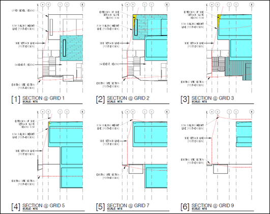
Figure 20 – Serial Section Diagram
The setback objectives in clause 2.1.3 are outlined as follows:
· To ensure that setbacks are compatible with adjacent development and complements the character, streetscape, public reserve, or coastal foreshore.
· To ensure the visual focus of a development is the dwelling, not the garage.
· To protect the views, privacy and solar access of adjacent properties.
· To maintain view corridors to coastal foreshores and other desirable outlooks.
· To maintain the scenic and environmental qualities of natural waterbodies and their foreshores and respond to site attributes such as topography.
· To provide deep soil areas sufficient to conserve existing trees or accommodate new landscaping.
· To provide appropriate articulation of facades and horizontal elements reduce the appearance of bulk and provides visual interest to the building and subsequent streetscape where they face a street frontage/s.
Notwithstanding the numerical non-compliance the variation is considered minor, and the proposal complies with the stated objectives as follows:
· There are no neighbouring dwellings adjacent the northern site boundary and therefore there are no impacts on views, privacy or solar access that otherwise may arise.
· The proposal provides appropriate articulation and does not have adverse visual impacts on the scenic and environmental qualities of the public domain along Wamberal Beach or the streetscape of Ocean View Drive.
· There are no existing trees on the site to be retained. The Landscape Plan prepared by Foliage Designs dated 14 March 2024 indicates sufficient deep soil areas are provided on site for new landscaping.
· The setbacks proposed are compatible with adjacent development and complement the character, streetscape, public reserve and coastal foreshore.
In summary, the proposal generally complies with the relevant provisions for dwelling houses. The non-compliances addressed above are relatively minor and reflect the site characteristics and topographical profile of the coastal dune as it falls toward Ocean View Drive. The proposal has a satisfactory streetscape and beachfront presentation and is compatible with existing development along Wamberal Beach.
Chapter 2.14 Site Waste Management
A Waste Management Plan has been submitted with the proposal. The proposal has demonstrated compliance with this chapter of the CCDCP 2022 and associated Waste Control Guidelines applying at the time the application was lodged. Appropriate conditions are included in the development consent.
Chapter 2.17 Character and Scenic Quality
Character
The site is located within the character area: Wamberal 1: Open Beachfront of CCDCP 2022 Chapter 2.17 Character.
The character statement provides for the desired character as follows:
‘These should remain low-density residential foreshores where future development does not dominate the informal scenic quality of prominent backdrops to Gosford City’s ocean beaches, and new dwellings are surrounded by leafy gardens that provide protection from storm surges and shoreline erosion.
Ensure that new structures do not disrupt development patterns that are evident upon surrounding properties. Avoid disturbing natural slopes plus any existing trees that are visually-prominent foreshore features, and ensure a leafy character for these prominent backdrops to ocean beaches. Plant gardens and street verges with low hedges and salt-tolerant trees that are predominantly indigenous, clustered to maintain existing panoramic views. Facing beachfronts in particular, avoid tall retaining walls or fences, extensive terraces or driveways that would visibly compromise the desired leafy character. Plant low-growing “hedges” of indigenous shrubs and ground covers along boundaries and to stabilise dunes. Also, maintain the informal character of any existing wide street verges that are dotted with shady street trees.
Avoid the appearance of a continuous wall of foreshore development by setting all building works back from exposed fore-dunes, and by surrounding buildings with leafy gardens. Incorporate waterfront and street setbacks that are similar to the surrounding properties, and provide at least one wide side setback or step the shape of front and rear facades.
Minimise the scale and bulk of new buildings or additions to existing dwellings. Use irregular floorplans to create well-articulated forms, such as linked pavilions that are separated by courtyards and capped by individual roofs. All roofs should be gently-pitched to minimise the height of ridges, flanked by wide eaves and verandahs to disguise the scale of exterior walls. Facing the beach, disguise the impact of upper storeys by a combination of extra setbacks from the ground floor plus shady balconies and verandahs.
Reflect elements of traditional coastal architecture and minimise the scale of prominent facades by using extensive windows and lightly-framed verandahs plus a variety of materials and finishes rather than expanses of plain masonry. All dwellings should display a “street address” with verandahs or decks, and living rooms or front doors that are visible from the roadway. Avoid wide garages that would visually-dominate any front façade or block views between the dwelling and the street. Locate and screen all balconies or decks to maintain existing levels of privacy and amenity that are enjoyed by neighbouring dwellings.’
Comment:
The proposal is consistent with the residential use of the site and development on surrounding properties, including larger dwelling houses that are being built on and near to the beachfront.
The existing character of Ocean View Drive and the beachfront area is a mixture of housing types, with an ongoing redevelopment of older housing stock into larger new houses. Surrounding development is primarily detached dwelling houses, with multi dwelling housing and residential flat buildings (subject to existing use rights) within the locality. Carparking on the eastern side of Ocean View Drive is characterised by garages and parking spaces built near or on the street boundary, or forward of the building line.
The proposal has been designed to respond to the slope of the site, and its beach frontage at the rear whilst achieving a compliant street setback. The proposed development complies with the building setbacks to the beachfront and also provides a 3m building setback to the alignment of the proposed coastal protection revetment wall and is similar to the coastal building setback of other dwellings in the locality.
Landscape Plans provide both dune stabilisation and streetscape plantings appropriate for the beachfront location. Coastal hazard assessment and structural engineering provide for protection of the proposed dwelling house and pool from storm surges and shoreline erosion. There are no visually prominent trees on the site and no extensive retaining walls or terraces facing the beach.
The dwelling house has a three-storey presentation to the street and a two-storey presentation to Wamberal Beach at the rear with ground level terrace and first floor balcony. The rear elevation of the dwelling house contains extensive glazed areas, taking advantage of the available views, and provides architectural interest in the beachfront presentation of the development.
The swimming pool is located alongside the northern elevation of the dwelling house and partly protrudes further eastward of the eastern elevation. However, results in a consistent boundary setback to that of the south-eastern corner of the dwelling house. Swimming pools on the foredune are not a feature of the beachfront character along Wamberal Beach, and where proposed are generally located alongside or within the building footprint of the dwelling house and suitably piled. This is a preferred design outcome rather than within the setback area between the seaward boundary of the site and the dwelling house to minimise potential visual amenity and scenic quality impacts from coastal erosion of the seaward portion of the site.
The bulk and scale of the dwelling house is consistent with bulk and scale of contemporary multi-level dwellings along the Wamberal beachfront and will provide an appropriate development for the site.
The dwelling house displays a ‘street address’ with a front door and from regularly occupied rooms (dining/living area) on the first floor visible from the street. The basement garage is setback a minimum of 1 metre from the western façade of the dwelling house and does not visually dominate the street front façade or block views between the dwelling and the street.
The site is separated from other dwelling houses by reserve areas and as a result there is no expected impact on the privacy and amenity to adjoining properties.
Overall, the proposal is compatible with the desired future character of the area, having regard to the zoning of the land, the nature of development in the surrounding area and the nature of the design, which is articulated, with a complying building height along the beach frontage.
Scenic Quality
The site is located within in the Forresters Beach - Wamberal Land Unit within the North Coastal Geographic Unit.
The principle aim of the Scenic Quality chapter is to provide guidelines for the interpretation and management of the scenic quality of the area in accordance with the development objectives of the landscape unit.
The landscape character is described as follows:
‘The Wamberal landscape Unit is more reflective of the Gosford area and consists of a diversity of characteristics. Urban development in Wamberal is not intrusive as it is contained within the forested ridge formed by COSS lands, Environmental/Conservation zoned areas and Wamberal Lagoon. The shopping centre does though detract from this character. Within the Wamberal urban areas the landform is generally open and limited large scale vegetation results in a moderate to high level of visual exposure. Rural-residential areas of Wamberal consist of a small, enclosed valley stretching between Matcham Road and Reads Road. The western portion of the valley is highly visible from The Entrance Road. This rural-residential area from a significant part of the rural buffer between Erina and Wamberal.’
The Wamberal Unit is of regional scenic value where opportunities for increases in densities and scale are available in areas not subject to visibility constraints or other physical constraints. Visually constrained areas include land along the beachfront.
The above statement does not describe the contribution the Wamberal beachfront makes to the scenic landscape character of the unit.
Notwithstanding this, the dwelling house will be visible from the beach and coastal areas and will maintain an appropriate presentation that is consistent with other more recent development along the beachfront and is located as far landward as possible.
Visual amenity of the dune area has been considered in the redevelopment of the site. Landscape Plans provide both dune stabilisation and streetscape plantings appropriate for the beachfront location. As part of the proposed works, the dune face will be shaped to its former levels by scraping sand up from the adjacent beach (on private property, if sand is available) and revegetated. Maintenance and management of the dune area will be required for reinstatement of the dune following a coastal storm event.
The proposal is not likely to have any adverse visual amenity on the scenic quality of the area and/or from coastal erosion in a significant storm event.
Chapter 3.1 Floodplain Management/Water Cycle Management
Chapter 3.1 seeks to minimise the impact of development on the natural pre-development
water cycle. This will lead to more sustainable outcomes that will protect the environment.
The Stormwater Management Plan submitted with the application is considered satisfactory for this type of development.
Chapter 3.2 Coastal Hazard Management
The proposal has been assessed in accordance with the relevant provisions of Part C: Southern Area (Former Gosford LGA) of Chapter 3.2 Coastal Hazard Management of CCDCP 2022.
The Coastal Hazards Mapping is identified in Figure 21 below and indicates the following:
· Coastal Building Line (CBL) - red line.
· Coastal Hazard Area (where piling foundation is required) is hatched in pink.
· Zone of Slope Adjustment (zSA) 2050 – yellow dashed line.
· Zone of Slope Adjustment (zSA) 2100 – orange dashed line.
· Zone of Reduced Foundation Capacity (zRFC) 2050 – yellow line.
· Zone of Reduced Foundation Capacity (zRFC) 2100 – orange line.
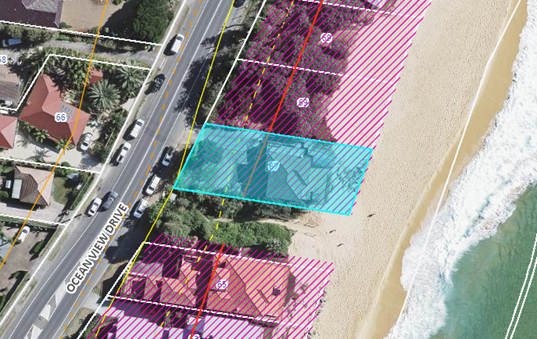
Figure 21 – Coastal Hazards Mapping
There is some discrepancy between the alignment of the aerial photography and the plan in relation to the property boundary. Regardless, when aligned with the property boundary, the proposed development is located within the Coastal Hazard Area.
A Coastal Building Line (CBL) applies to coastal frontage areas and any application is to address coastal hazard impacts, including erosion, inundation and wave runup, on property and development.
The following documentation has been provided with the development application in accordance with clause 3.2.3.5 and are included as Attachments to this report:
· Coastal Engineers Advice prepared by Horton Coastal Engineering dated 26 September 2023 – refer Attachment 5.
· Structural Engineers Advice prepared by Northrop, Ref NL203634.E02(4) dated 30 April 2024 – refer Attachment 7.
· Geotechnical Investigation, prepared by JK Geotechnics, Ref: 34346R2rpt dated 30 April 2024 – refer Attachment 8.
· Architectural plans showing the location of the coastal building line on the site – refer Attachment 2.
Clause 3.2.3.3 Coastal Building Line
Clause 3.2.3.3 states:
a All new development must be constructed landward of the coastal building line;
b Where new development is to be protected by an existing approved seawall or terminal revetment, then standard setbacks will apply for areas landward of that seawall once the seawall has been constructed.
The proposed location of the CBL and the MHL Wamberal seawall alignment is identified on the Architectural Plans in Figure 22. The proposal is located seaward of the CBL as identified in Figure 22 although is approximately 3m landward of the proposed alignment of Wamberal Beach Terminal Protection structure/seawall (identified by the Council adopted Engineering Design Requirements Report MHL2872 dated 21 September 2022 prepared by Manly Hydraulics Laboratory). The location of the seawall is not fixed in that document. A terminal protection structure is not part of the proposal and is not currently in place.
As stated previously, on 15 July 2024, a separate development application (DA/947/2024) was lodged with Council for Coastal Protection Works along Wamberal Beach, including the subject site.
![]()
![]()
![]()
Figure 22 – Site Plan showing location of the Coastal Building Line
and MHL Wamberal Seawall alignment
Figures 23 & 24 aerial photographs (below) show the coastal hazard lines relative to the footprint of the proposed development (proposed basement - brown line, pool – black line, and ground floor - yellow dashed line on the site and in relation to the closest dwelling house to the south. The Coastal Engineering Advice notes ‘the former dwelling deck was located about 1.5m to 4m seaward of the proposed terrace’.
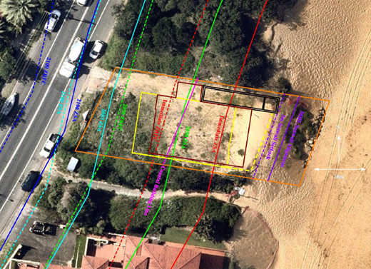
Figure 23 – Coastal Hazard Lines and proposed dwelling house and swimming pool footprint (Source: Coastal Engineers Advice 26/09/2023)
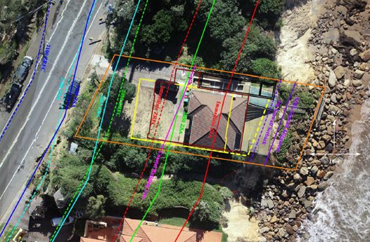
Figure 24 – Coastal Hazard Lines and previous dwelling house and terrace footprint
(Source: Coastal Engineers Advice 26/09/2023)
Clause 3.2.3.3.2 All Development
Clause 3.2.3.3.2 identifies the requirements for all development within the coastal hazard area and these provisions have been considered in the assessment of the proposal.
The key aspects of the development from the Coastal Engineer (Horton 2023) and Structural Engineer (Northrop 20243) taking into consideration the recommendations of the Geotechnical Engineer (JK Geotechnics 2024) are provided as follows:
1. The Coastal Engineers Advice (Horton 2023) concludes the following:
· The proposed dwelling and ancillary structures (terrace, pool and spa) at 67 Ocean View Drive Wamberal extend well seaward of the Coastal Building Line. The entire proposed development is landward of the 3m seawall maintenance setback referred to in MHL (2022).
· The entire development shall be founded on piles designed to support the loads of the structure and other conventional structural actions, plus should have an allowance for wave impact loading and loading from a collapsing sand dune during or following storm erosion as per Nielsen et al (1992). The wave impact and sand slumping forces should be provided by a coastal engineer as part of detailed design. A scour level of -1m AHD should be adopted for the design of these piles, i.e. assuming that all soil is eroded above -1m AHD in the design storm.
· Through analysis as described in Section 6.5 (Horton 2023), any additional erosion associated with the proposed piles, basement and pool would be expected to remain within the site and would thus not impact on adjacent properties. The proposed terrace slab is above wave action in the design storm event at the end of the design life, so there is no possible mechanism whereby it could cause additional erosion for this event.
· The proposed dwelling is at an acceptably low risk of inundation if natural ground levels are contoured to direct any wave overtopping away from the garage door and adjacent dwelling door, which should not be difficult to achieve.
· The proposed development satisfies the requirements of State Environmental Planning Policy (Resilience and Hazards) 2021 for the matters considered herein, including that the development would not be expected to give rise to increased coastal hazards on adjacent land.
· It is proposed to found the dwelling seaward of the Coastal Building Line, and not to comply with Chapter 3.2.3.3.2(e)(i) of Central Coast Development Control Plan 2022 (DCP 2022). This is acceptable as taking a flexible merits-based approach, the development complies with 3.2.3.3.2(e)(ii) and Chapter 3.2.3.3.2(b)(i)(iii)(iv)(v) and (vi) of DCP 2022; the proposed development is permissible based on Central Coast Local Environmental Plan 2022; it is not possible to entirely found the dwelling landward of the Coastal Building Line; a DCP cannot prohibit development that is permissible under SEPP Resilience and that complies with SEPP Resilience; the proposed development would not be expected to increase coastal erosion on adjacent land; and it has been established in Odisho v Central Coast Council [2023] NSWLEC 1017 (approval granted for construction of a new pool to the beach side of the existing dwelling at 44 Ocean Street, North Avoca) that it is acceptable to pile development seaward of the Coastal Building Line if it does not increase coastal erosion on adjacent land.
· The proposed pool, spa and terrace are ancillary based on Chapter 3.2.3.4(d) of DCP (2022), namely “ancillary structures may be permitted forward [seaward] of the coastal building line where the applicant demonstrates that the ancillary structure will not give rise to coastal erosion or increase the risk to property and life”. Any additional erosion caused by the proposed piling and pool would be expected to remain within the site and would thus not impact on adjacent properties. Therefore, the ancillary structures would not be expected to give rise to coastal erosion of any consequence. It is thus permissible for the proposed pool, spa and terrace to be located seaward of the Coastal Building Line. These structures must be piled to be at an acceptably low risk of damage. It has been established in Odisho v Central Coast Council that it is acceptable to pile ancillary development seaward of the Coastal Building Line if it does not increase coastal erosion on adjacent land, as has been demonstrated.
2. The Structural Engineers Advice (Northrop 2024) proposed design solution is as follows:
· The concept structural design adopts the structural recommendations from the Coastal Engineers Advice prepared by Horton Coastal Engineering and the Geotechnical Investigation prepared by JK Geotechnics.
· Northrop has adopted the 2083 design event and corresponding ZRFC and ZSA as the design coastal process event for the development. This is a conservative approach, adopting a design life larger than the design life typically required for residential developments.
· The structure will be designed as fully suspended. Any support from soils located above the design scour level will be ignored during design and is not required for support during a coastal erosion event.
· All foundations for the main dwelling will be founded in the medium dense sands or stiff to very stiff clays below RL -4.6m. This level is much deeper than the required scour level and the structural concept design is based on the most conservative design option provided by the geotechnical engineer.
· All piles, reinforced concrete beams and slabs are designed to resist vertical loads and will be designed for conventional lateral actions such as wind and earthquake as well as the lateral loads arising from coastal hazards such as dune slumping, loss of support and erosion. This is a conservative approach and means that the structure will be able to withstand coastal processes larger than the design event.
It is considered the submitted reports prepared by suitably qualified / expert engineers adequately demonstrate the proposal will not increase coastal hazards and the proposal achieves the objectives for development in the coastal hazard area stated in clause 3.2.3.3.2 which are as follows:
· To manage development in Coastal Vulnerability Areas using precautionary planning tools to reduce coastal hazard risks.
· To protect against or manage coastal hazards on sites where this is feasible, affordable and without adversely impacting the locality or the broader environment.
· To provide for equity in redevelopment of coastal frontage properties by applying consistent setbacks for new developments in Coastal Vulnerability Areas
· To complement and reinforce the objectives and requirements of Clause 2.9 State Environmental Planning Policy (Resilience and Hazards) 2021.
· To protect beach amenity and public safety.
In considering the proposal against these objectives on its merits it considered the proposed development is satisfactory in the sensitive coastal area in that:
· The proposal is considered to address the provisions of the State Environmental Planning Policy (Resilience and Hazards) 2021 as detailed elsewhere this report. There are no Coastal Vulnerability Areas mapped under the SEPP and the provisions of clause 2.9 are not applicable in the assessment of the proposal.
· Adequate information has been provided with the proposal to address clause 3.2.3.3.2(b) (i – vii). The proposal has been designed (foundations) to withstand the effects of coastal processes and is at an acceptably low risk of damage over an acceptably long life if founded in accordance with Section 6.3 of the Coastal Engineers Advice which takes into consideration the coastal forces the structural engineer has to consider in the design of the piles.
· The proposed location of the dwelling house seaward of the of the building line is permissible based on Clause 3.2.3.4(a) Exemptions to the Coastal Building Line of CCDCP 2022:
o Building only landward of the CBL would offer very limited development opportunities at the site. The terrace, swimming pool and spa have been considered as ancillary structures and permitted seaward of the CBL.
o The supporting Coastal Engineers Advice and Structural Engineers Advice has satisfactorily considered the risk to development from coastline hazards as required under clause 3.2.3.3.2 and compliance with the Resilience and Hazards SEPP. The ancillary structures are not expected to give rise to coastal erosion or increase the risk to property and life.
o In accordance with the expert reports as geotechnical engineering advice identifies the land formation and demonstrates significantly reduced erosion/recession potential on the subject site. With appropriate structural engineering input, and the foundation recommendations of the geotechnical engineer, a structure can be constructed at an acceptably low risk of damage at the subject property.
· The development is appropriate for the site having regard to the results of coastal, geotechnical and structural investigations. The proposed development would not be expected to give rise to any increased coastal hazards on the land or other land if founded in accordance with the Coastal Engineers Advice and Structural Engineering Advice as the development is supported on piles above most wave action. Any additional erosion caused by the piles, basement and pool is expected to within the site and not impact on adjacent properties.
· The proposal considers the effects of larger events than the designated hazard. The Coastal Engineer states:
o Larger events than the design event could occur, as could tsunamis. However, the probabilities of these events are so low that the development remains at an acceptably low risk of damage, which is the desired outcome (zero risk is not possible).
o Furthermore, Northrop (2024) noted that the piles would be designed to resist both short-term wind and earthquake actions occurring at the same time as foundation reactions from ultimate wind and seismic actions on the proposed dwelling are the governing load cases and exceed the lateral coastal hazard loads imposed on the piles during a storm event. This means that the structural concept can withstand larger coastal storm events than those specified and designed to. Factors of safety in design also mean that foundations can be expected to withstand larger storm events than the design storm event. However, it is reiterated though that it is acceptable to design for the design event, by definition.
· The proposed development is located seaward of the CBL, however is setback as far landward as practically possible and further landward than the previous dwelling.
o The proposal has a setback of 10m to the seaward boundary with a two- storey presentation to the beachfront and complies with the required front setback for dwelling houses (clause 2.1.3.1 of CCDCP 2022) providing an area for vehicle movements on the site.
o While separated by the walkway reserve to the closest dwelling to the south the proposal generally aligns with the seaward extent of that dwelling (65 Ocean View Drive) and will be consistent with other new and existing development along the beachfront.
o The Coastal Engineer states that it is not practical to found the dwelling landward of the CBL and cantilever it 13m – 15m.
· The building will have an acceptably low risk of damage from runup and inundation (refer Coastal Engineers Advice, Section 7) subject to compliance with the coastal engineering reports and plans. The proposed level of the basement has been considered in the assessment of the application. It should be noted the proposal is consistent in design of basements, parking areas and access to the dwelling house with approvals granted along Ocean View Drive. Section 7 of the Coastal Engineers Advice provides the following:
o In WorleyParsons (2014), present-day design wave runup levels of 6.5m of 9.5m AHD were adopted for Wamberal Beach at the nearest calculations points south and north the subject property. However, this 9.5m value is considered to be particularly conservative, as seemingly recognised by Advisian (2016), who adopted a corresponding wave runup level of 8m AHD at nearby 85 Ocean View Drive.
o Adopting the 8m AHD value and taking projected sea level rise into account (using Council’s adopted sea level rise values of 0.2m at 2050 and 0.74m at 2100), this would simplistically give approximate design wave runup levels of about 8.2m AHD at 2050 and 8.7m AHD at 2100. The approximate design wave runup level at the end of the design life in 2083 is 8.5m AHD.
o The proposed ground finished floor level of 8.9m AHD is above the 2100 wave runup level of 8.7m AHD, such that coastal inundation is not a significant issue for the proposed dwelling. The garage and basement floor level of 4.8m AHD is acceptable as long as natural ground levels are contoured to direct any wave overtopping away from the garage door and adjacent dwelling door and should not be difficult to achieve given the driveway falls from 4.8m ADH at the garage to 3.5m AHD at the landward property boundary. The garage and basement have no areas that would allow water overtopping to enter in the design event.
o Based on Chapter 3.2.3.3.2(f) of DCP 2022, minimum building floor levels shall be 0.5m above the 1% AEP maximum wave inundation level, with no planning period stated and “maximum” assumed to mean “2% exceedance”. This has regularly been noted by Horton Coastal Engineering as a technically flawed requirement, given that it does not consider the likely depth of wave overtopping and given that wave runup calculations assume an infinite height foreshore, but it can be noted that the ground floor of the proposed development meets this requirement, and the lower levels have been considered in the paragraph above.
· Remediation works will be required to re-establish the site and dune with fill/sand/landscaping on the subject site to improve beach amenity, refer discussion under Resilience and Hazard SEPP and relevant conditions are imposed.
Planning Summary
The documentation submitted with the application, including the Coastal Engineers Advice which is prepared by a Land and Environment Court acknowledged expert, Structural Engineering Advice and Geotechnical Investigation demonstrate the proposal is satisfactory in relation to the impacts of coastal hazards on the site.
The proposed development will have an acceptably low risk of damage if founded in accordance with the design parameters in these reports. The proposal is not likely to cause increased risk of coastal hazards on the site or other land.
The proposed location of the dwelling house is not likely to impact on any future seawall/coastal protection works. A condition is imposed for any structures or coastal protection works to require separate approval by Council.
The proposal is of a satisfactory height, bulk and scale and provides equity in redevelopment of the site which allows for view sharing and does not adversely impact on privacy and overshadowing to existing adjoining development.
Revised documentation submitted during the assessment have been reviewed by Council’s Coastal Planning Officer who raises no objection in relation to the provisions of Chapter 3.2 of CCDCP 2022 in that the proposal would be at an acceptable risk of coastal hazard, provided that the proposed structures should be founded on suitable footing system and should be designed to support all the loads and structural actions.
Conditions of consent are imposed for the design and implementation of the requirements of the expert reports including certification from the Geotechnical Engineer that all works have been carried out in accordance with the expert reports, plans and recommendations (as amended), refer Conditions 2.3, 5.4, 6.4.
Conditions of consent are imposed for management of dune erosion and potential visual/amenity impacts of development following coastal storm events on the site, refer Conditions 1.4, 1.5 & 1.6.
Accordingly, in the circumstance it is considered that in applying precautionary principles to the development proposal, strict compliance with Chapter 3.2 provisions is unwarranted in the location, with the proposal therefore supported in relation to the site’s coastal erosion constraint.
Chapter 3.5 Tree and Vegetation Management
The proposal does not propose, impact nor require removal of prominent trees.
Landscape Plans provide both dune stabilisation and streetscape plantings appropriate for the beachfront location.
Chapter 3.7 Geotechnical Requirements for Development
Chapter 3.7 provides a management strategy for development in areas identified as having landslip potential and guidelines on the content of geotechnical reports.
The Geotechnical Investigation prepared by JK Geotechnics dated 30 April 2024 provides recommendations for foundation designs which together with the Coastal Engineers Advice are provided by the Structural Engineering Advice and Plans. Conditions of consent are imposed for the design, implementation and certification of the structural design of the foundations and piling for the proposal, refer Conditions 2.3, 5.4, 6.4.
Likely Impacts of the Development
Section 4.15 (1)(b) of the Environmental Planning and Assessment Act 1979 requires consideration of the likely impacts of the development including environmental impacts on both the natural and built environments, and social and economic impacts in the locality.
In this regard, potential impacts related to the proposal have been considered in response to SEPPs, LEP and DCP controls outlined above and summarised below:
Built Environment, Context and Setting
The subject site is zoned R2 Low Density Residential under CCLEP 2022 and adjoins residential developments comprising single and two-storey dwellings.
A thorough assessment of the impacts of the proposed development on the built environment has been undertaken in terms of CCLEP 2022 and CCDCP 2022 compliance. Despite non-compliance with the building height and northern side setback, the proposal generally complies with the development controls as discussed throughout the report and the proposal will not have any unreasonable impacts on the character or amenity of the area in terms of overshadowing, privacy, noise generating activities and views. The proposed built form is considered acceptable in the context of the site, subject to the recommended conditions of consent.
Access and traffic
The local road network is considered to have adequate capacity to cater for the proposed development and minimal increase in traffic generated by the proposal. More than adequate provision is provided for onsite car parking and vehicle movements within the site to enable entry and exit in a forward manner.
Natural Environment
The proposal is satisfactory in relation to impacts on the natural environment as identified throughout this report for land subject to coastal hazards. There will be no significant impact upon the natural environment as a result of the proposed modifications.
Economic and Social Impacts
The proposal replaces a dwelling that was damaged from a large storm event in July 2020. No unreasonable economic or social impacts will arise from the approval of the dwelling house and swimming pool.
Suitability of the Site for the Development
Section 4.15 (1)(c) of the Environmental Planning and Assessment Act 1979 requires consideration whether the site is suitable for the proposed development.
The site is zoned is zoned R2 Low Density Residential under CCLEP 2022. Dwelling houses are permissible in the zone.
The impact of the proposal within the sensitive coastal location has been considered. The proposed development will have an acceptably low risk of damage if founded in accordance with the design parameters in the supporting Coastal, Structural and Geotechnical reports and plans which demonstrate the proposal is satisfactory in relation to the impacts of coastal hazards on the site. The proposal is not likely to cause increased risk of coastal hazards on the site or other land.
As such the site is considered is suitable for this type of development subject to conditions.
Any Submission made in Accordance with this Act or Regulations
Section 4.15 (1)(d) of the Environmental Planning and Assessment Act 1979 requires consideration of any submissions received during notification of the proposal.
The proposed modification has been notified in accordance with the provisions of Central Coast Development Control Plan 2022. The application was notified for the period 11 October 2023 to 25 October 2023.
No submissions were received.
Submissions from Public Authorities
The application did not require referral to any public authority.
Internal Consultation
|
Environmental Health Officer |
|
Supported subject to conditions. |
|
|
Tree Assessment Officer |
Supported subject to conditions. |
||
|
Coastal Planning Officer |
|
Supported subject to conditions. |
|
Ecologically Sustainable Principles
The development has been assessed having regard to ecologically sustainable development principles and is consistent with the principles.
The development is considered to incorporate satisfactory stormwater, drainage and erosion control and the retention of vegetation where possible and is unlikely to have any significant adverse impacts on the environment and will not decrease environmental quality for future generations. The proposal does not result in the disturbance of any endangered flora or fauna habitats and is unlikely to significantly affect fluvial environments.
Climate Change
The potential impacts of climate change on the development proposed to be modified have been considered by Council as part of the assessment of the application.
This assessment has included consideration of such matters as potential rise in sea level; potential for more intense and/or frequent extreme weather conditions including storm events, bushfires, drought, flood and coastal erosion; as well as how the proposed development may cope, combat, withstand these potential impacts. The proposed development is considered satisfactory in relation to climate change.
The Public Interest
Approval of the development is in the public interest for the following reasons:
· The development has been prepared having regard to the aims and objectives of relevant state and local environmental planning instruments and generally complies.
· The development is deemed to have no negative environmental, social or economic impacts to surrounding residential dwellings or the public domain.
· Subject to various mitigation measures recommended by consultants and Council’s technical officers, the proposal is deemed to have no negative environmental, social or economic impacts to surrounding residential dwellings or the public domain.
· The development is designed and sighted to make a positive contribution to the streetscape and result in a quality residential development.
· The development is sympathetic to the existing character of the surrounding neighbourhood and respects and maintains privacy to and from neighbouring properties.
Political Donations
During assessment of the application there were no political donations were declared by the applicant, applicant’s consultant, owner, objectors and/or residents.
Other Matters for Consideration:
Development Contributions Plan
The land is subject to the Central Coast Section 7.12 Local Infrastructure Contribution Plan 2023 which was adopted by Council on 28 November 2023 and replaces the Central Coast Regional Section 7.12 Development Contribution Plan 2019.
There are no transitional arrangements in place, therefore any subject contributions will be applied to an application based on the contributions plan in force at the date of application determination.
Development that is not subject to a section 7.11 contribution under any other contributions plan adopted by the Council under the Environmental Planning & Assessment Act 1979, may be subject to levy of section 7.12 contributions unless is development that is exempt under Clause 1.5 of this Plan.
Development contributions are only levied where the proposal meets the cost of works thresholds and not subject to any exemption under this plan. The proposed cost of works is $2,685,720 however the development is for a dwelling house and is exempt under clause 1.5 of the plan; no development contributions levy is applicable in this instance.
Water and Sewer
Water and Sewer services are available to the site. A Section 305 application will be required to obtain a Section 307 Certificate of compliance. The resulting Section 306 letter of requirements will contain Water Authority conditions if required.
Air Quality
Standard dust condition is applied during construction works.
Noise
The plant room is depicted on the basement level, therefore noise impacts from mechanical plant and equipment on adjoining residential receivers is not expected. Standard condition for construction times is applied.
Conclusion
This application has been assessed under the heads of consideration of Section 4.15 of the Environmental Planning and Assessment Act 1979 and all relevant instruments and policies. Following a thorough assessment of the relevant planning controls and the key issues identified in this report which have been resolved satisfactorily through amendments to the proposal, it is considered that the application can be supported, noting that:
· The Panel can be satisfied that the provisions of the following State Environmental Planning Policies have been considered and satisfied:
i) State Environmental Planning Policy (Building Sustainability Index: BASIX) 2004
ii) Chapter 2 and Chapter 4, section 4.6(4) of the State Environmental Planning Policy (Resilience and Hazards) 2021
· The Panel can be satisfied that the provisions of clause 7.1 Acid Sulfate Soils and 7.6 Essential Services of Central Coast Local Environmental Plan 2022 have been considered and satisfied.
· The Panel can be satisfied that the relevant provisions of the environmental planning instruments, plans and policies that apply to the development have been considered in the assessment of the application, in particular the impacts of development within the the sensitive coastal location.
· The proposed development is not expected to have any adverse social or economic impact.
Accordingly, the application is recommended for approval pursuant to Section 4.16 of the Environmental Planning and Assessment Act 1979, subject to conditions.
|
1⇩
|
Draft conditions - 67 Ocean View Dr, WAMBERAL NSW 2260 - DA 1955 2023 |
|
|
|
3.2 |
DA/1955/2023 - New Dwelling House & Swimming Pool - 67 Ocean View Drive WAMBERAL NSW 2261 |
|
Attachment 1 |
Draft conditions - 67 Ocean View Dr, WAMBERAL NSW 2260 - DA 1955 2023 |


|
DA/1955/2023 - New Dwelling House & Swimming Pool - 67 Ocean View Drive WAMBERAL NSW 2261 |
|
|
Attachment 3 |
Redacted Architectural Plans - PAN-375846 - 67 Ocean View Dr, WAMBERAL - DA/1955/2023 |
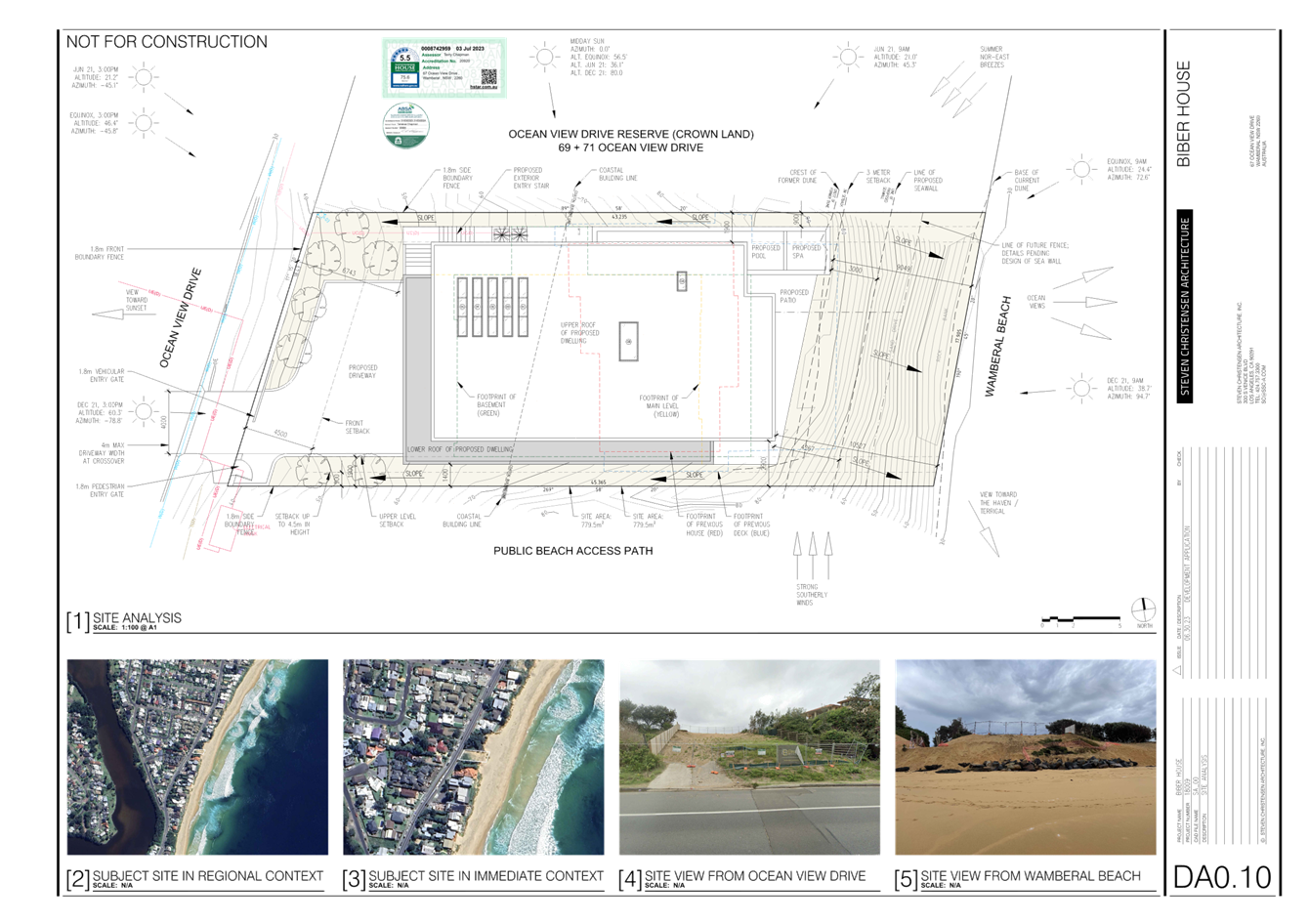
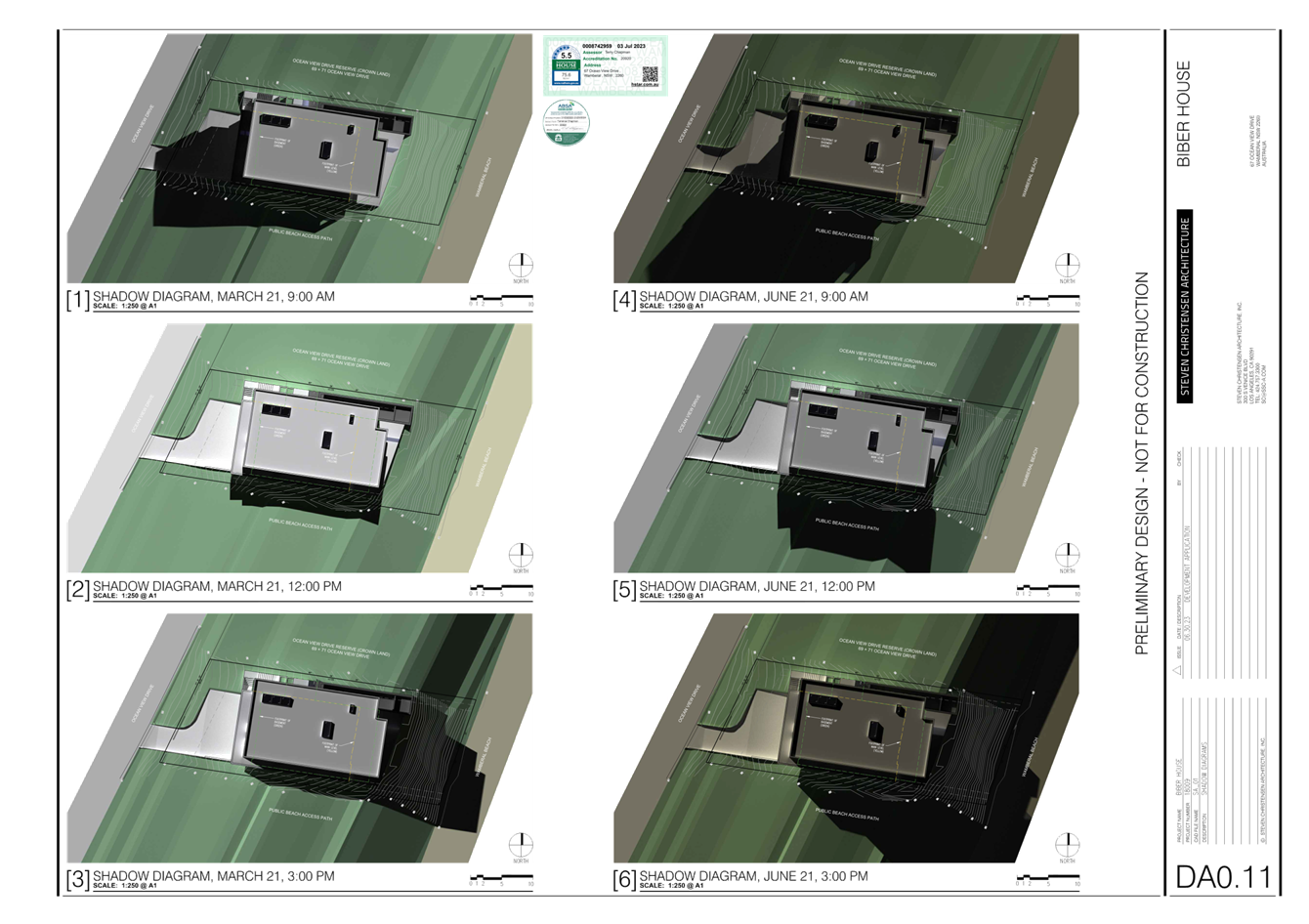
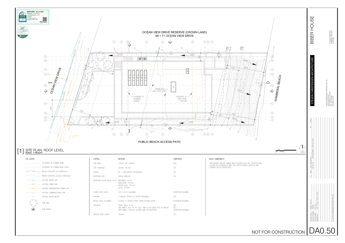

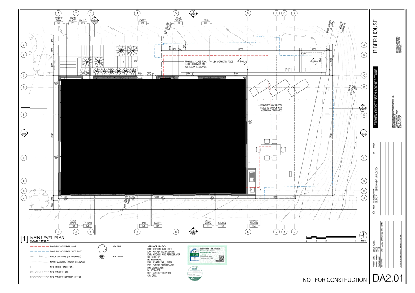
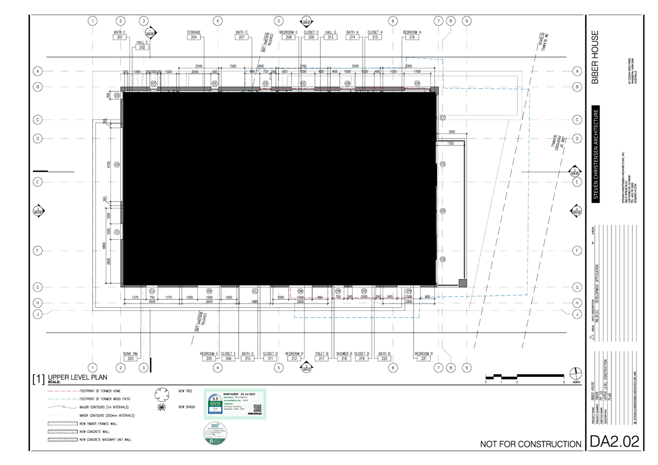
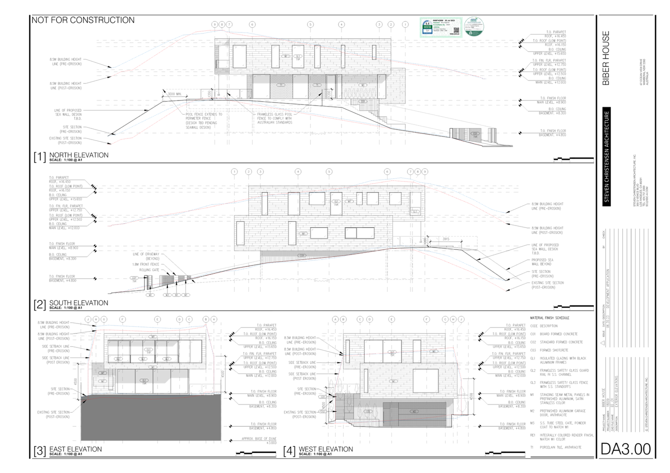
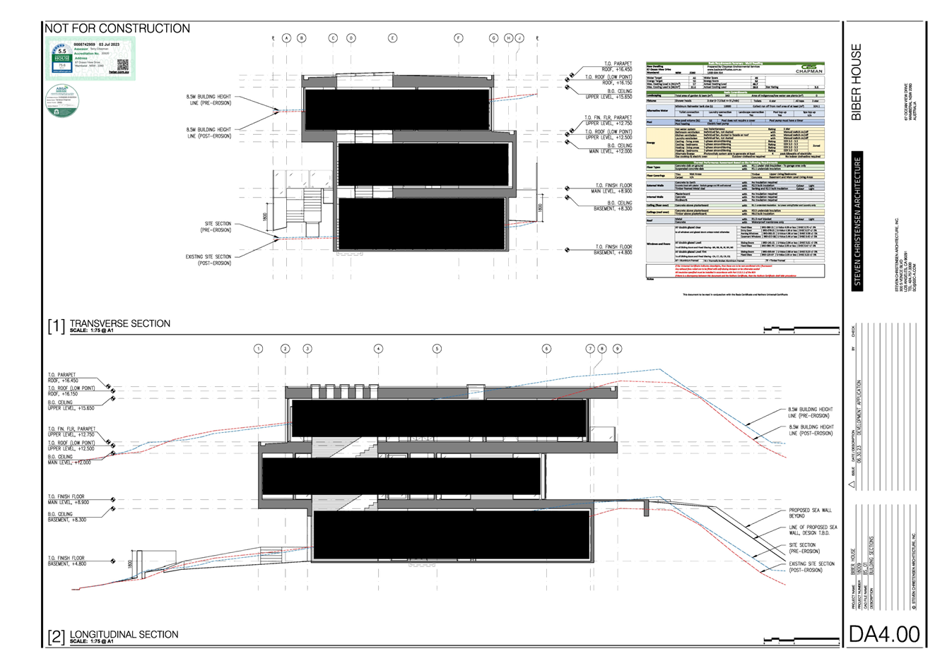
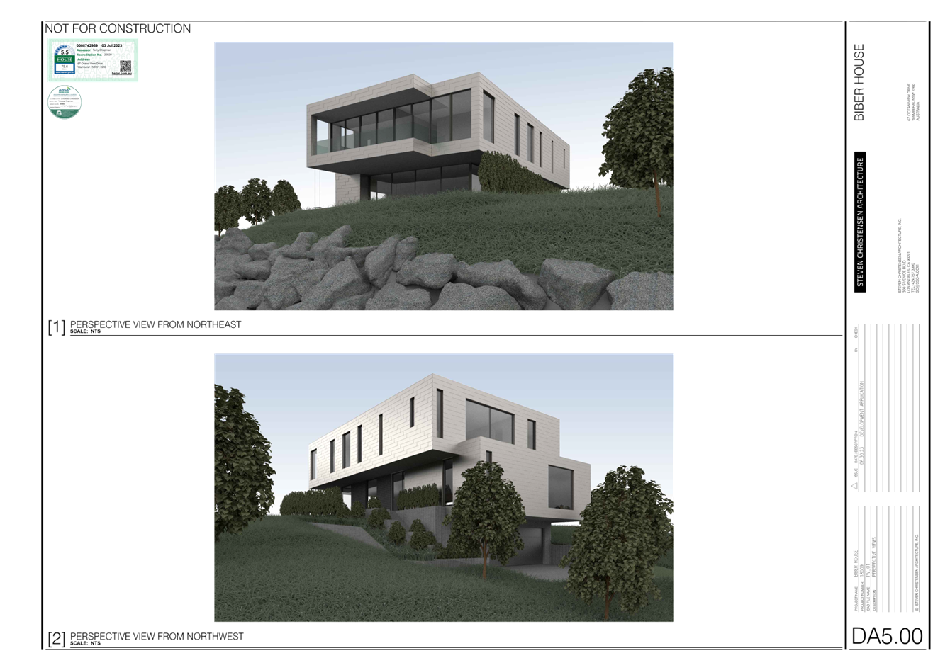
|
DA/1955/2023 - New Dwelling House & Swimming Pool - 67 Ocean View Drive WAMBERAL NSW 2261 |
|
|
Attachment 4 |
Landscape plan REV 5.1 - 67 Ocean View Drive Wamberal - DA/1955/2023 |
|
3.2 |
DA/1955/2023 - New Dwelling House & Swimming Pool - 67 Ocean View Drive WAMBERAL NSW 2261 |
|
Attachment 5 |
Landscape Planting Plan REV 5.1 - 67 Ocean View Drive Wamberal - DA/1955/2023 |
|
3.2 |
DA/1955/2023 - New Dwelling House & Swimming Pool - 67 Ocean View Drive WAMBERAL NSW 2261 |
|
Attachment 6 |
Coastal Engineering Assessment - PAN-375846 - 67 Ocean View Dr, WAMBERAL - DA/1955/2023 |
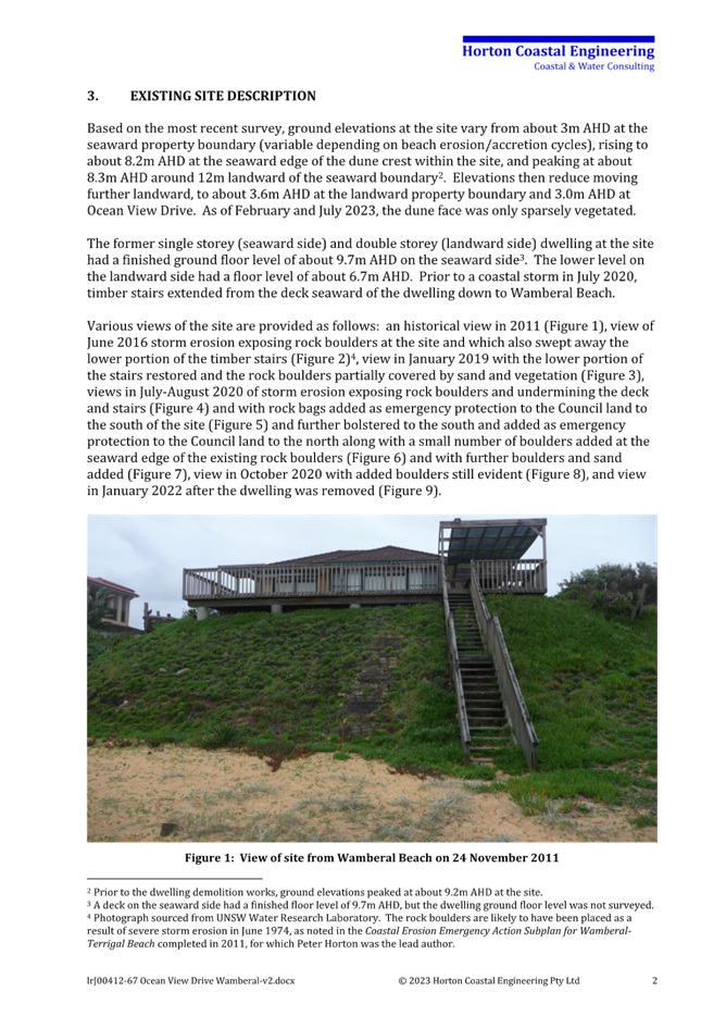
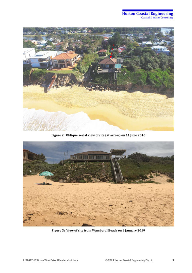
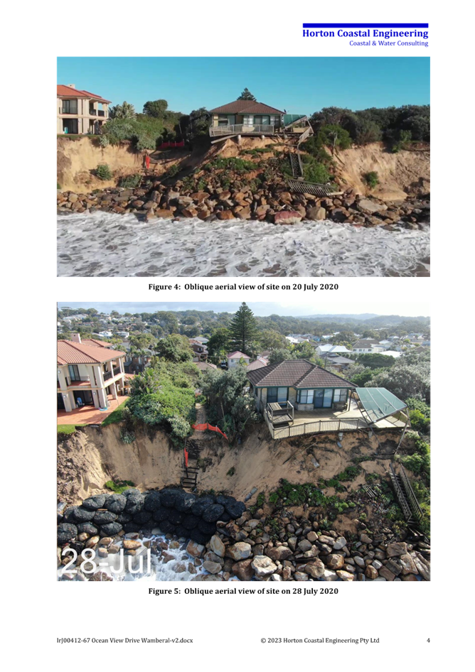
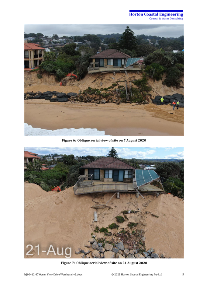
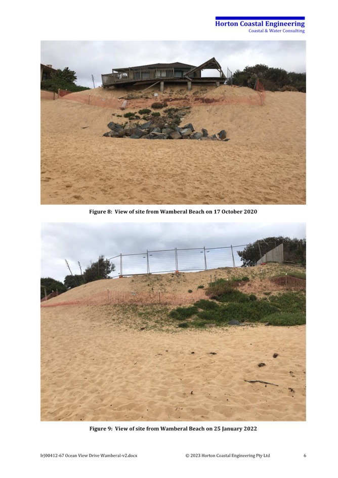
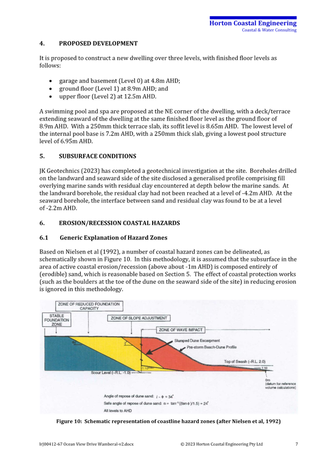
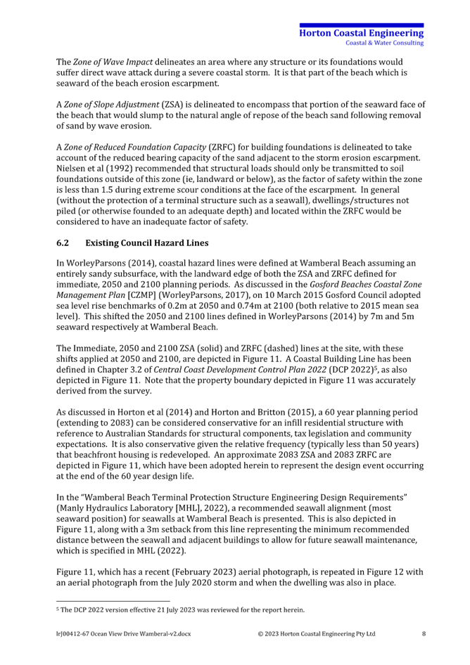
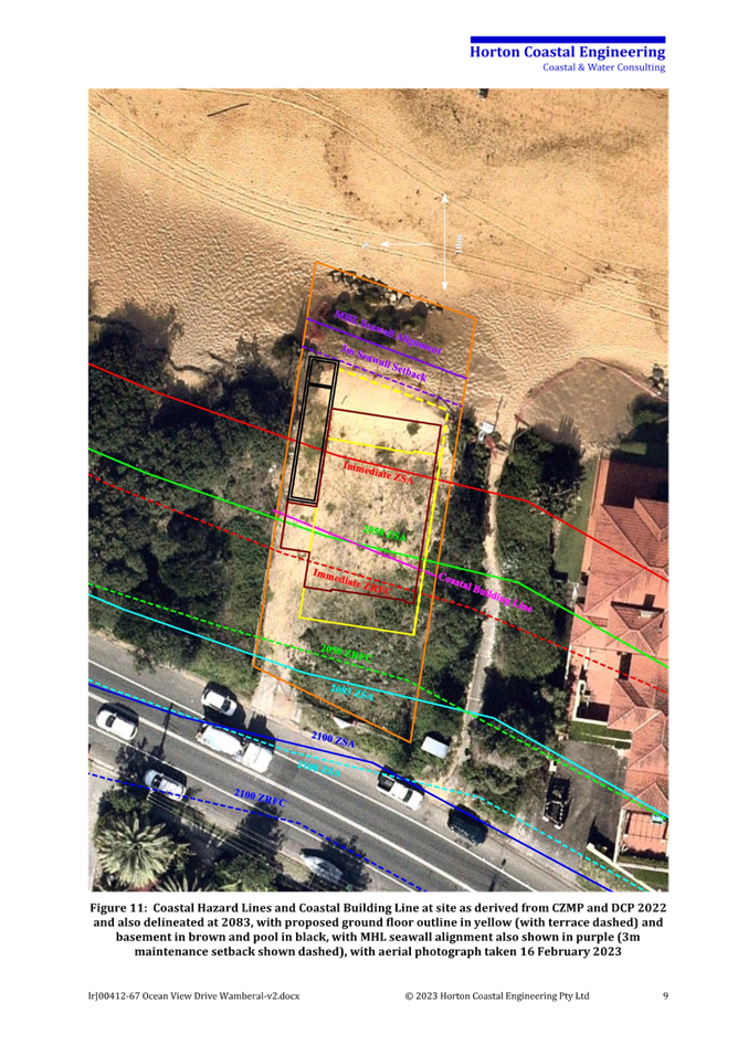
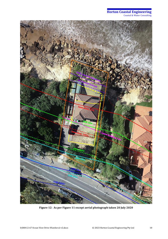
|
DA/1955/2023 - New Dwelling House & Swimming Pool - 67 Ocean View Drive WAMBERAL NSW 2261 |
|
|
Attachment 7 |
Horton Coastal Engineering Advice 30 April 2024 - 67 Ocean View Drive Wamberal - DA/1955/2023 |
|
3.2 |
DA/1955/2023 - New Dwelling House & Swimming Pool - 67 Ocean View Drive WAMBERAL NSW 2261 |
|
Attachment 8 |
Northrop Structural Advice - 30 April 2024 NL203634.E02- 67 Ocean View Drive Wamberal - DA/1955/2023 |

|
DA/1955/2023 - New Dwelling House & Swimming Pool - 67 Ocean View Drive WAMBERAL NSW 2261 |
|
|
Attachment 9 |
Updated geotechnical investigation - JK Geotechnics - 30 April 2024 - 67 Ocean View Drive Wamberal - DA/1955/2023 |
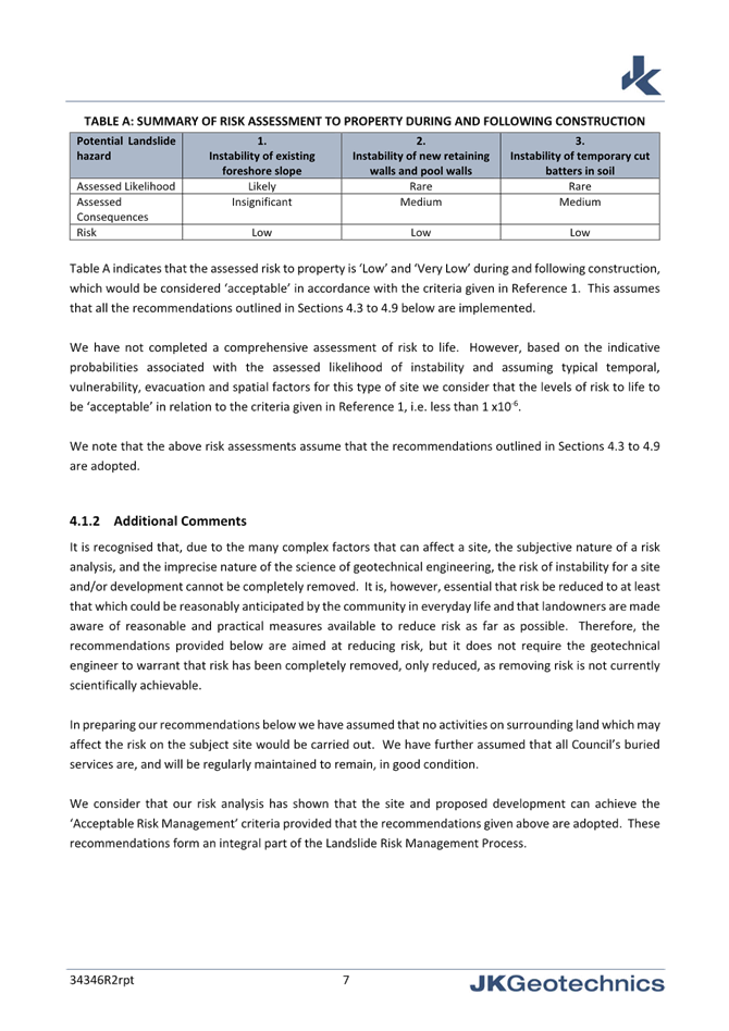


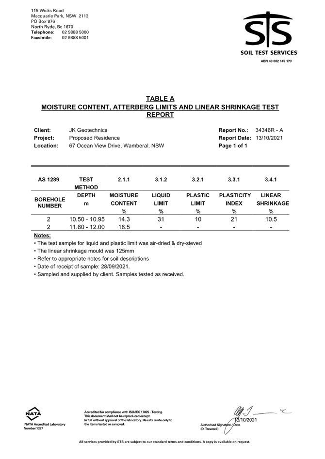
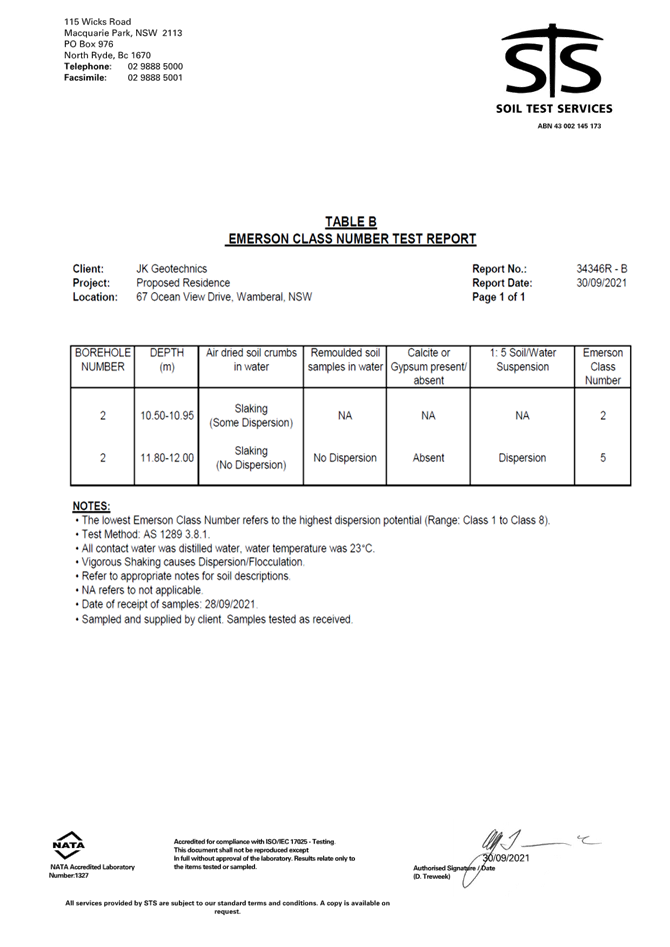
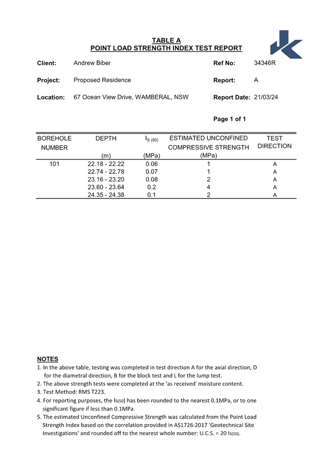
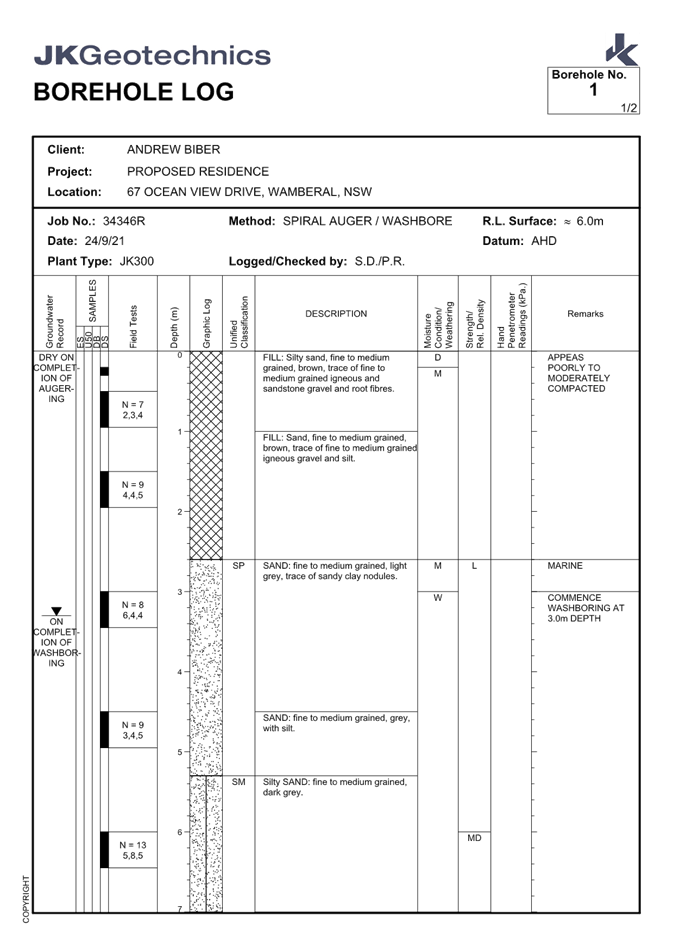
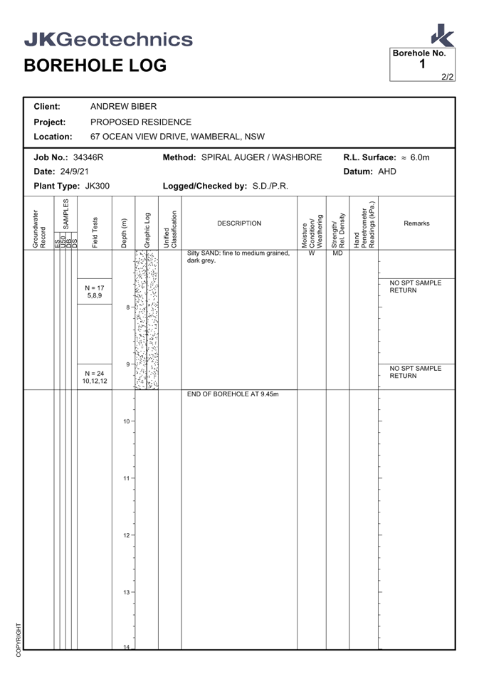
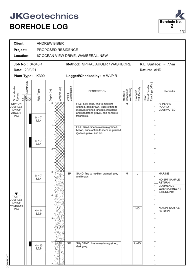
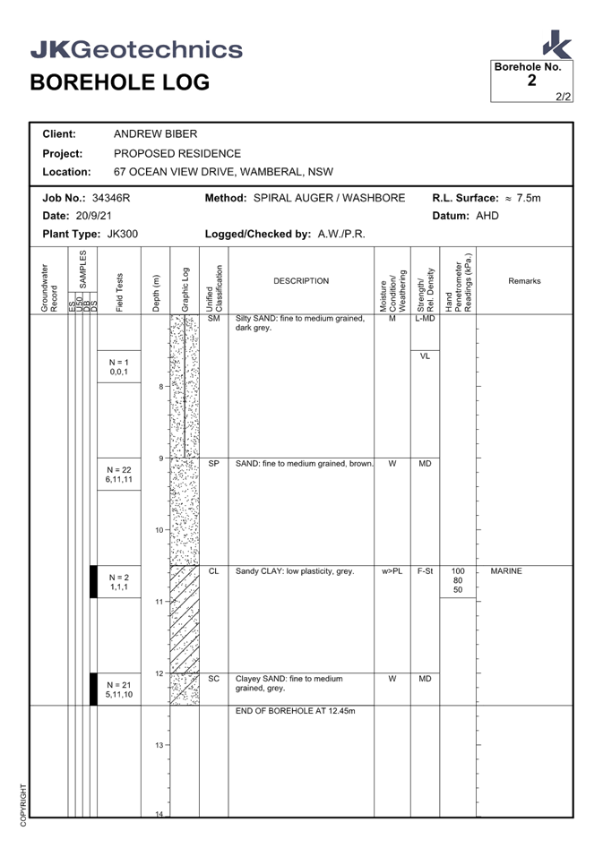
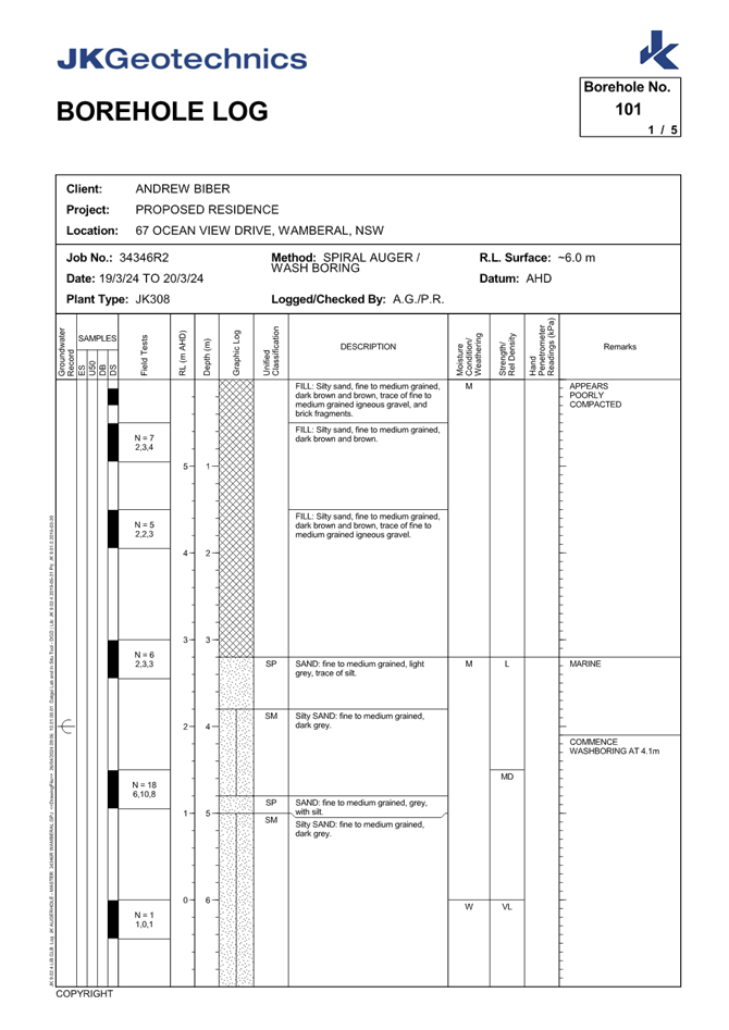
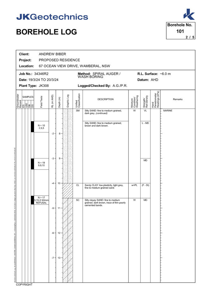
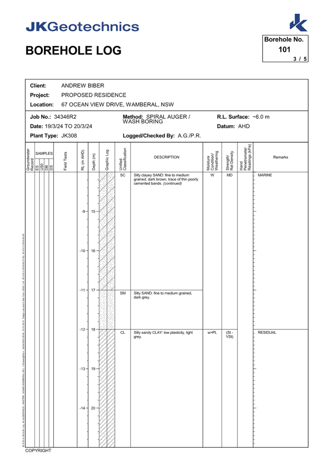
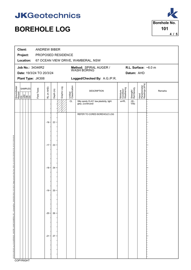
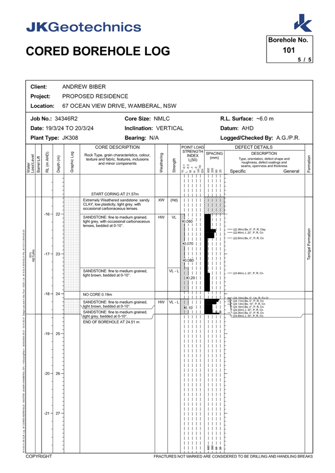
|
DA/1955/2023 - New Dwelling House & Swimming Pool - 67 Ocean View Drive WAMBERAL NSW 2261 |
|
|
Attachment 10 |
CIVIL Combined Plans - 67 Ocean View Drive Wamberal - DA/1955/2023 |
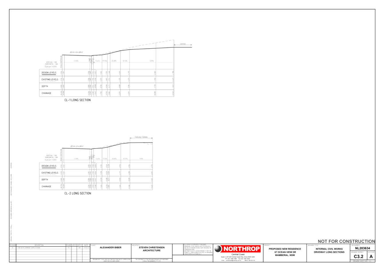
|
DA/1955/2023 - New Dwelling House & Swimming Pool - 67 Ocean View Drive WAMBERAL NSW 2261 |
|
|
Attachment 11 |
BASIX Certificate and Summary - PAN-375846 - 67 Ocean View Dr, WAMBERAL - DA/1955/2023 |
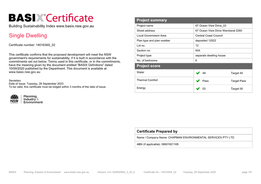
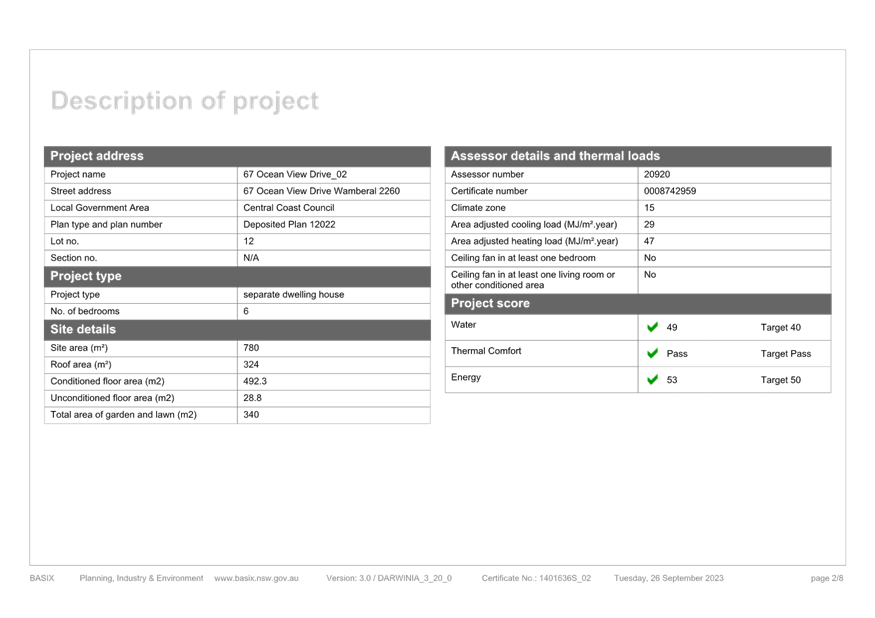
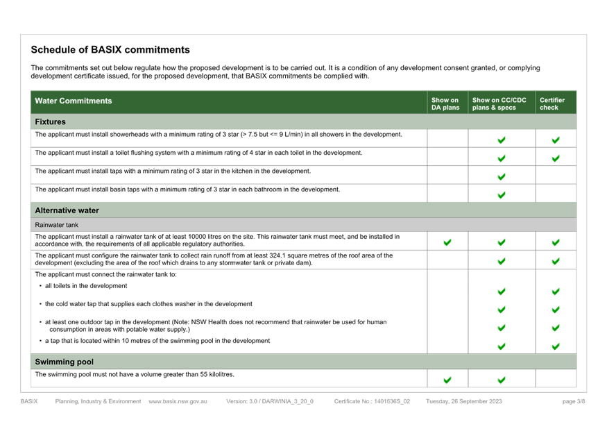
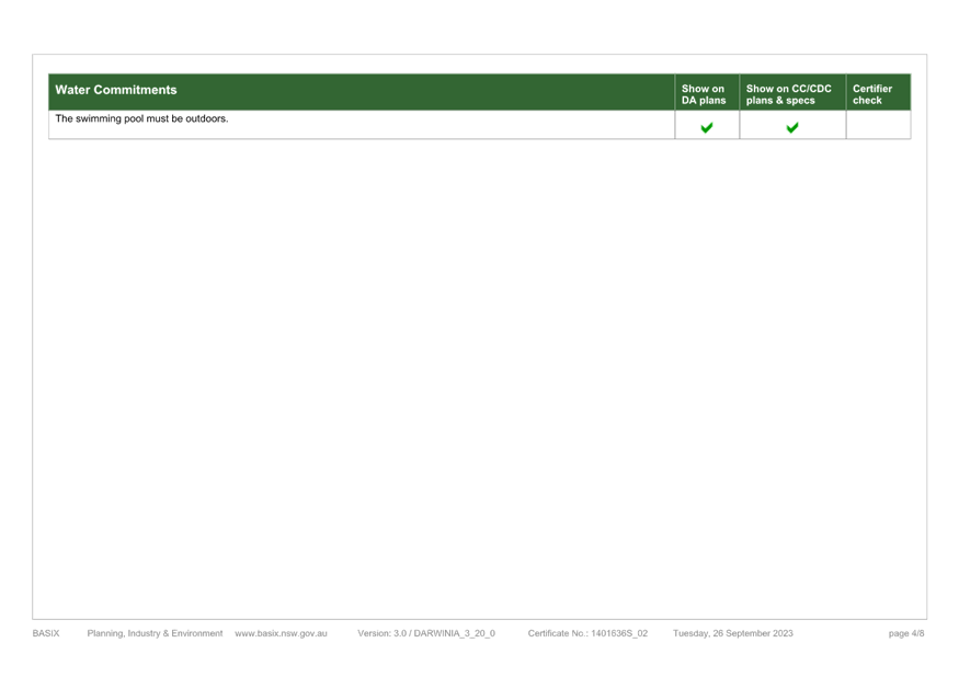
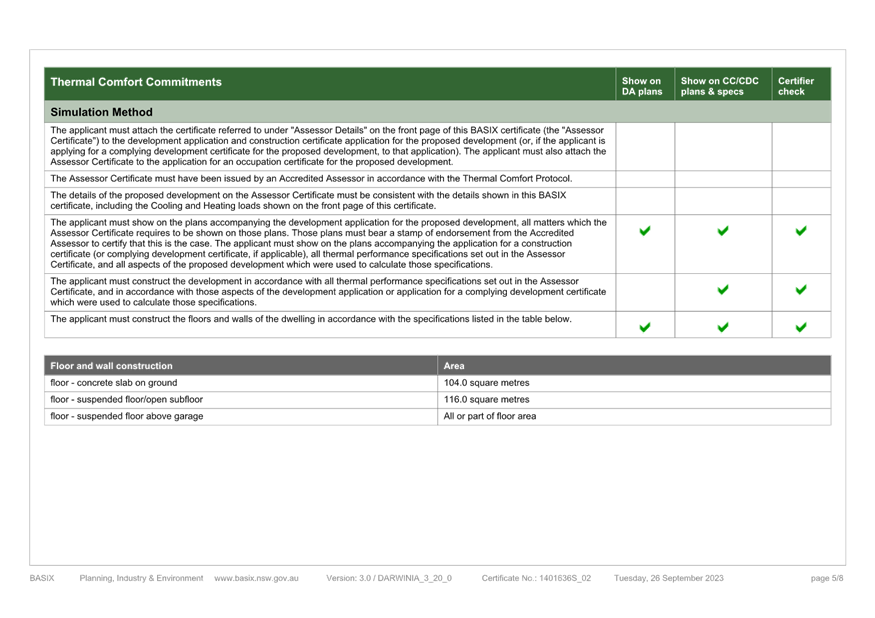
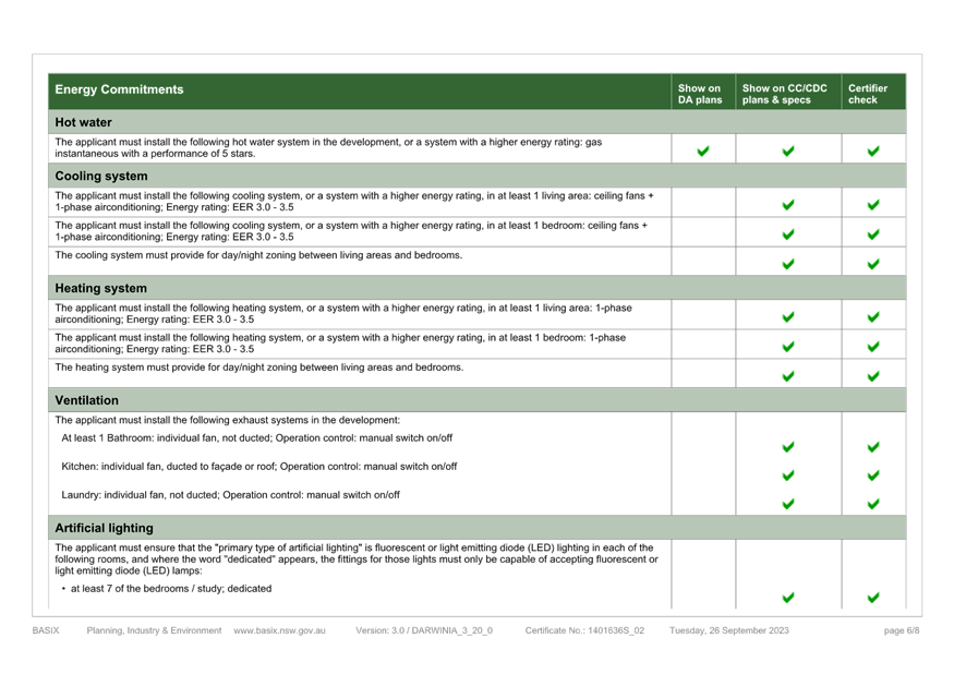
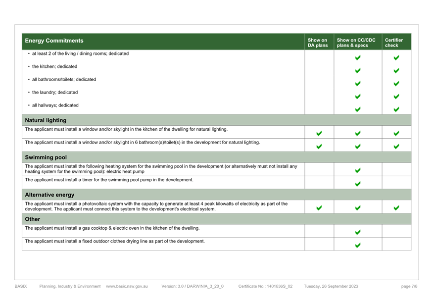
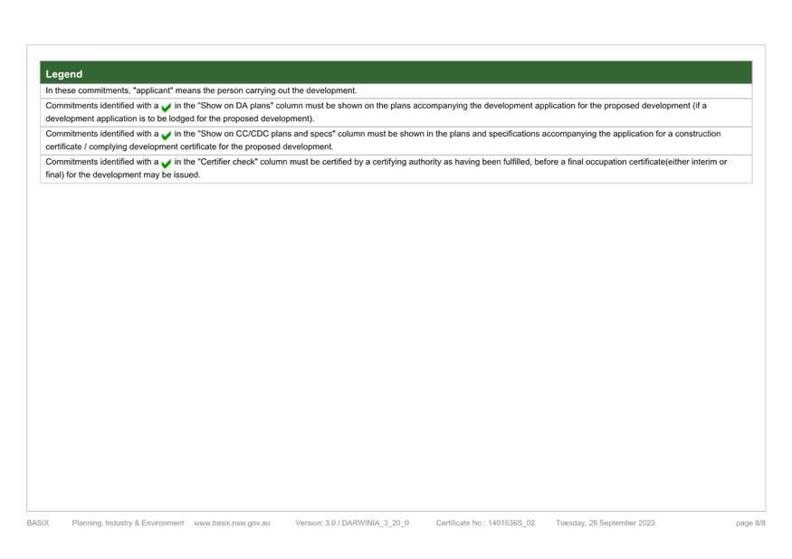
|
DA/1955/2023 - New Dwelling House & Swimming Pool - 67 Ocean View Drive WAMBERAL NSW 2261 |
|
|
Attachment 12 |
NatHERS Certificate - PAN-375846 - 67 Ocean View Dr, WAMBERAL - DA/1955/2023 |
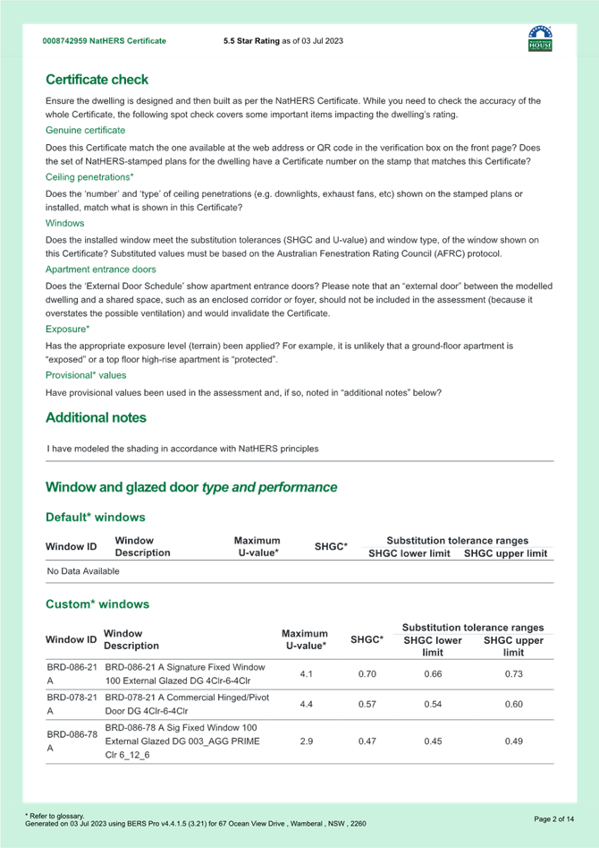

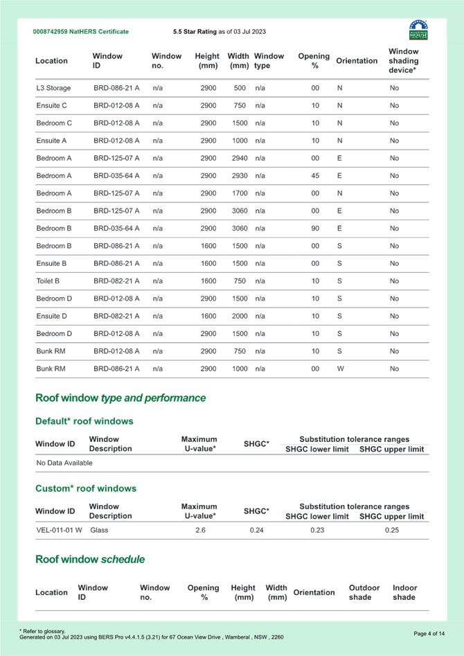
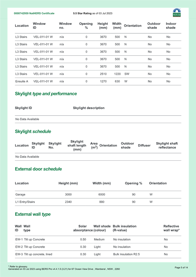
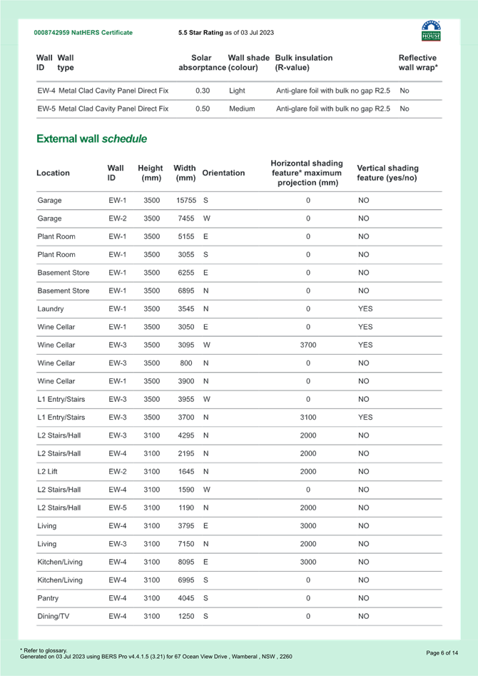
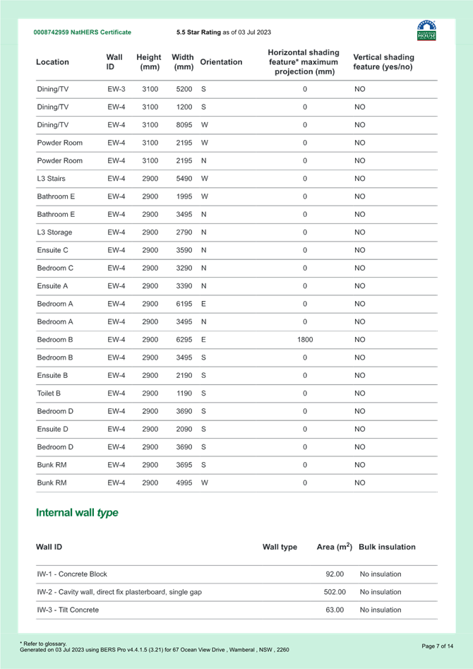
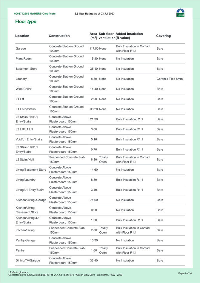
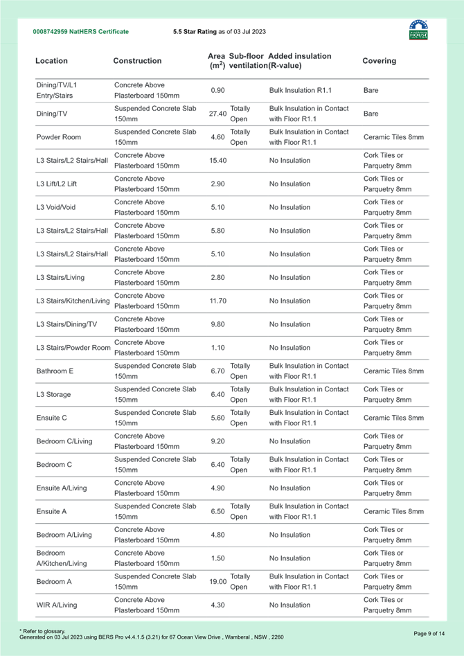
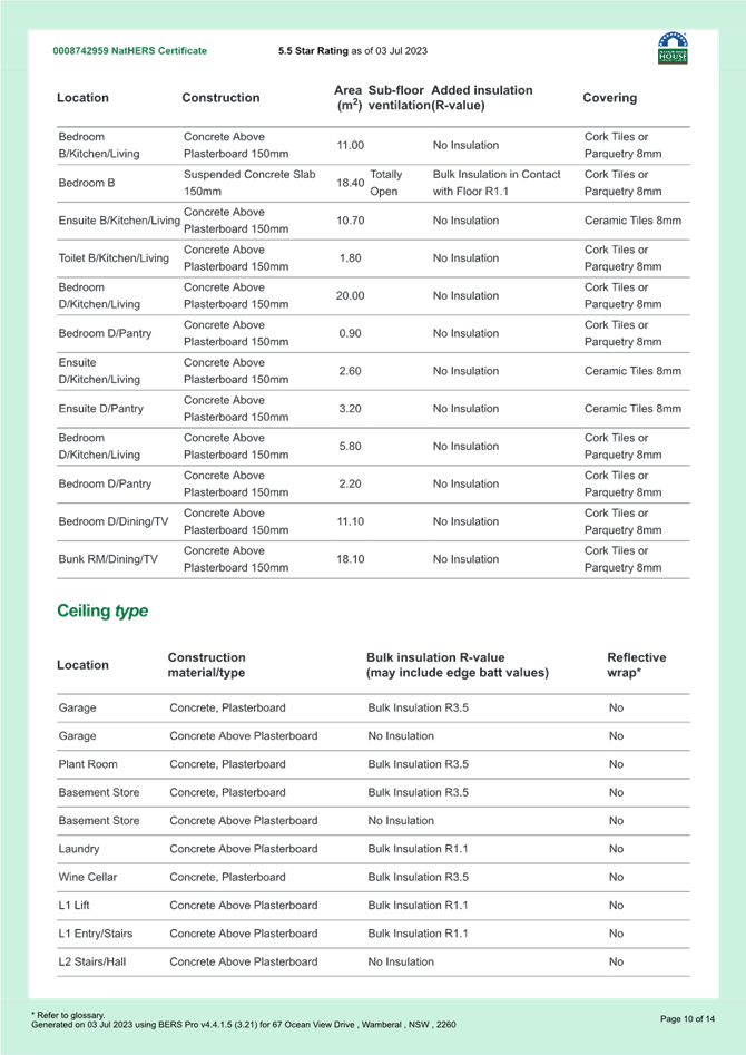
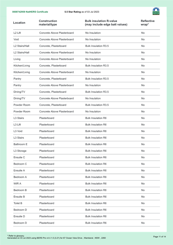
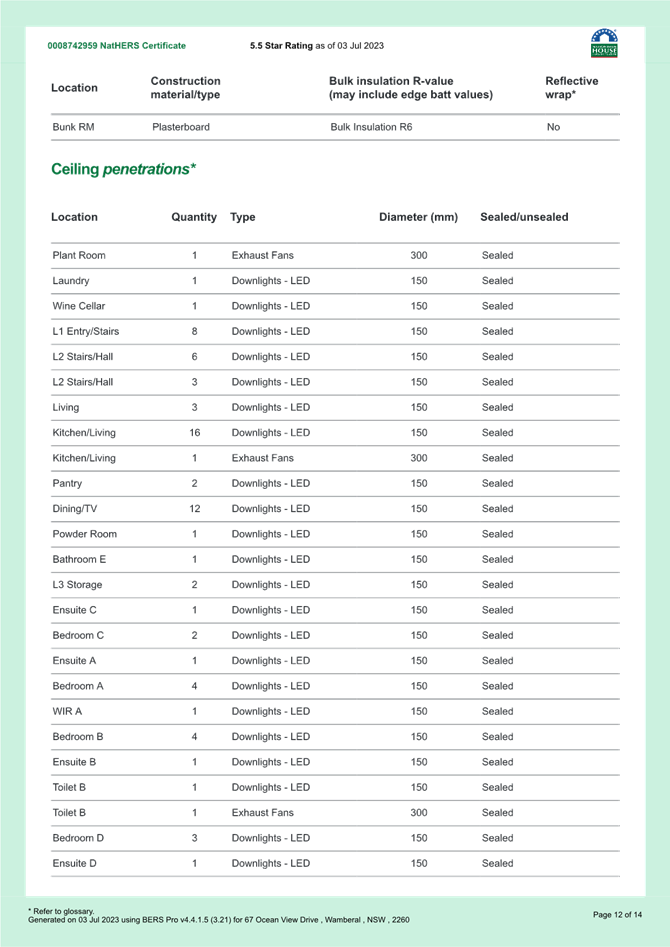
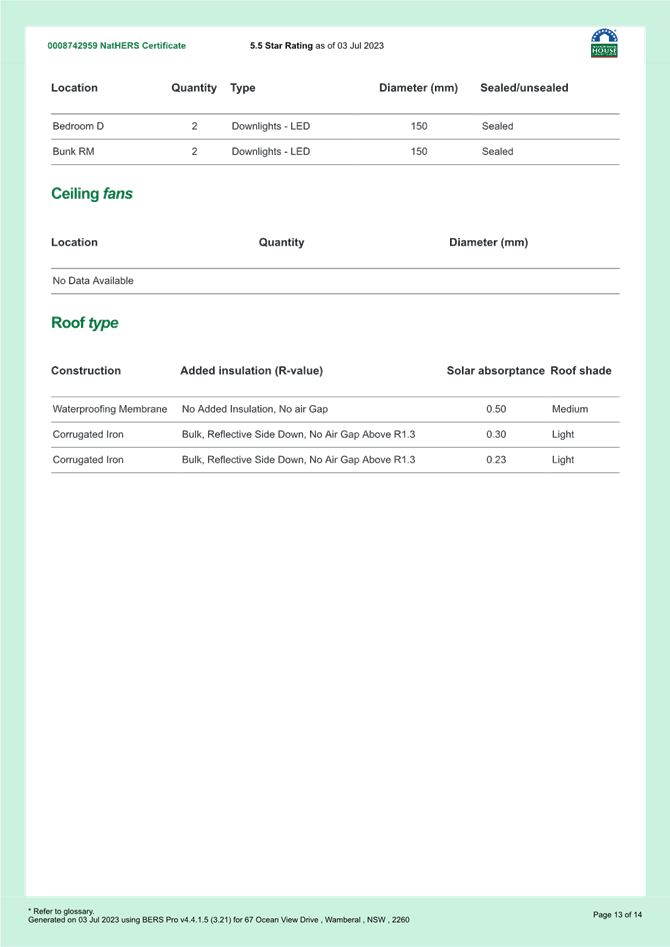
|
DA/1955/2023 - New Dwelling House & Swimming Pool - 67 Ocean View Drive WAMBERAL NSW 2261 |
|
|
Attachment 13 |
PUBLIC - Waste Management Plan - PAN-375846 - 67 Ocean View Dr, WAMBERAL - DA/1955/2023 |
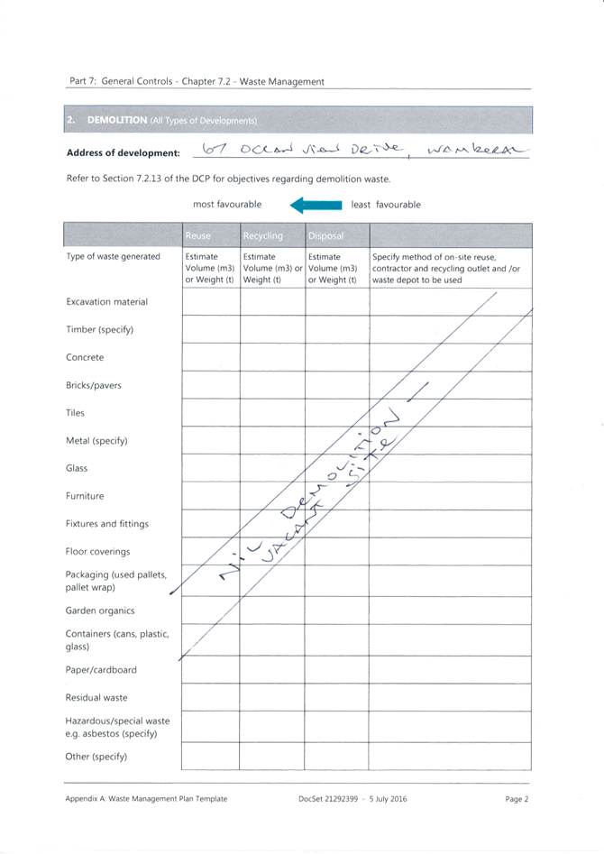
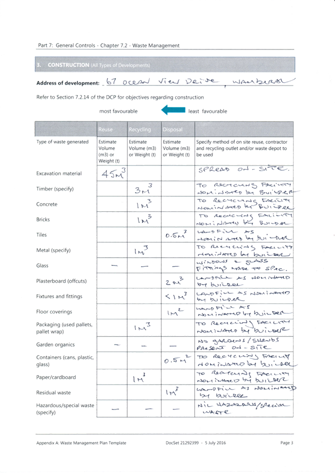
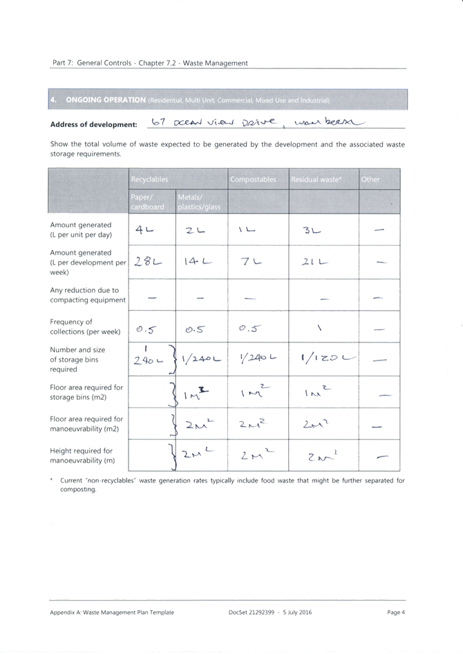
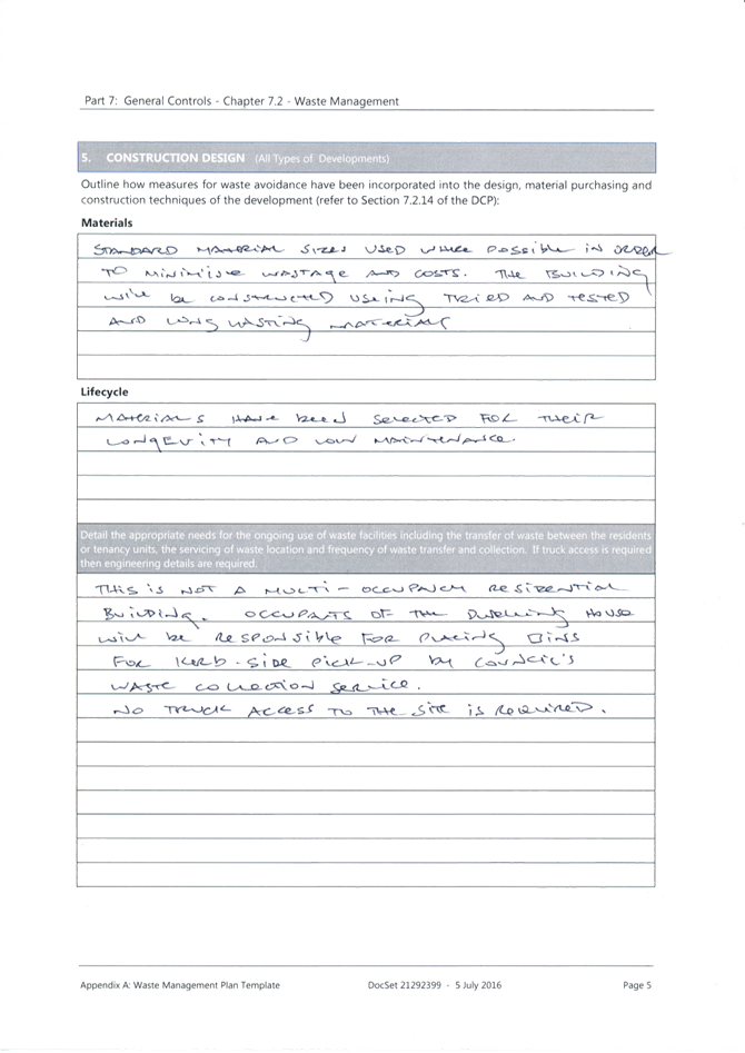
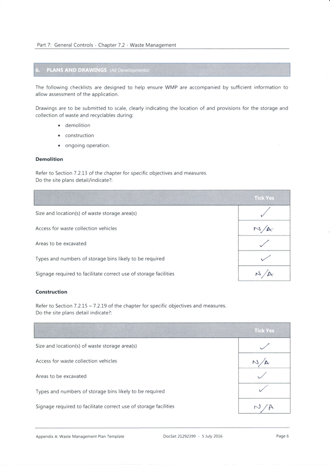

|
DA/1955/2023 - New Dwelling House & Swimming Pool - 67 Ocean View Drive WAMBERAL NSW 2261 |
|
|
Attachment 14 |
Statement of Environmental Effects March 2024 - 67 Ocean View Drive Wamberal - DA/1955/2023 |

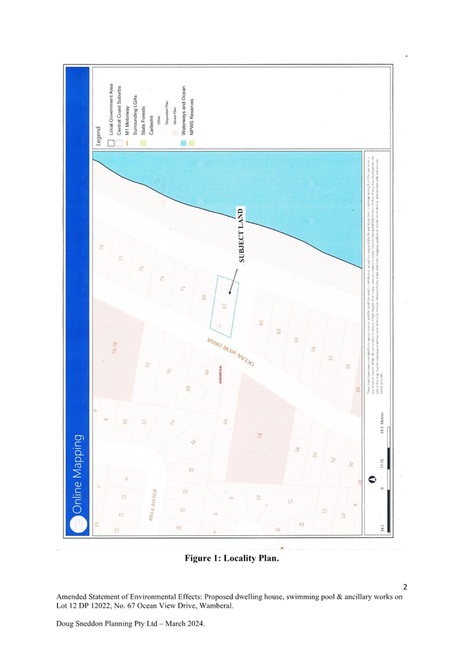
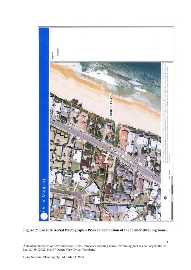
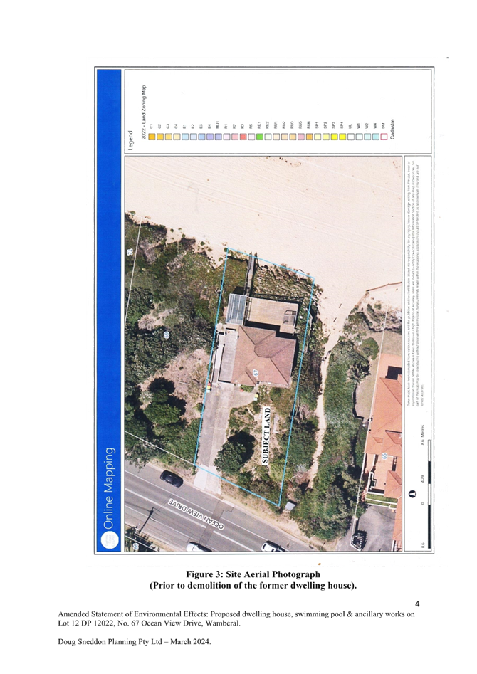
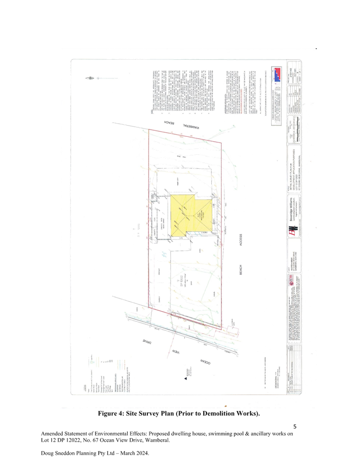

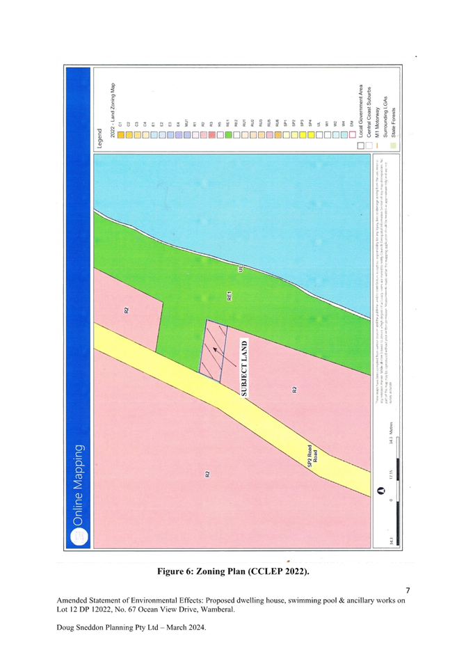
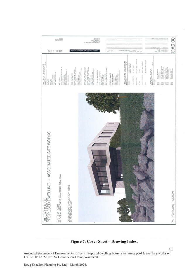
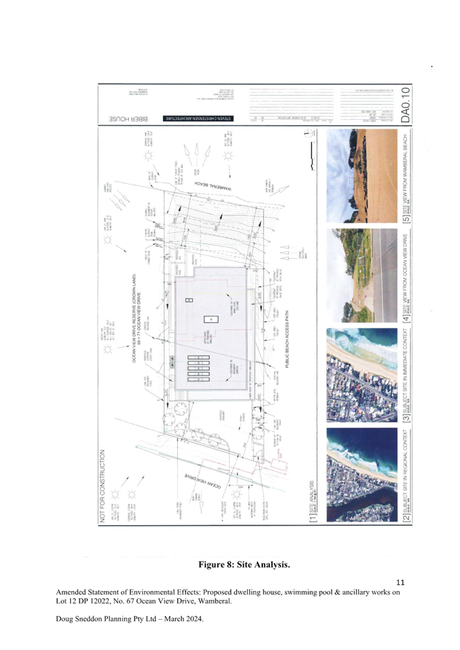
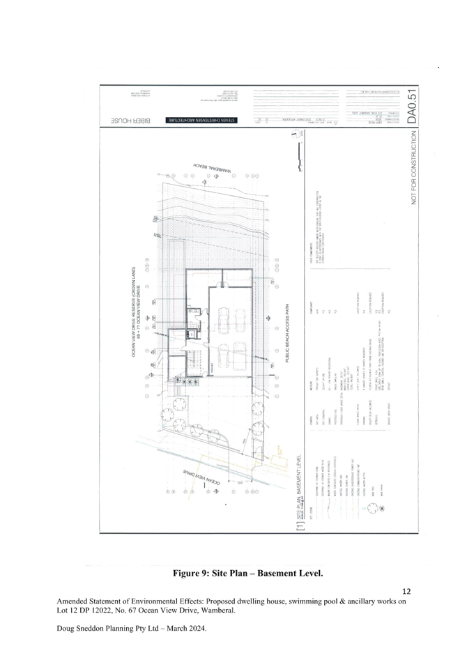
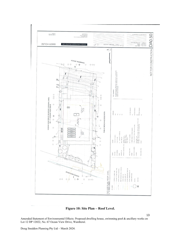
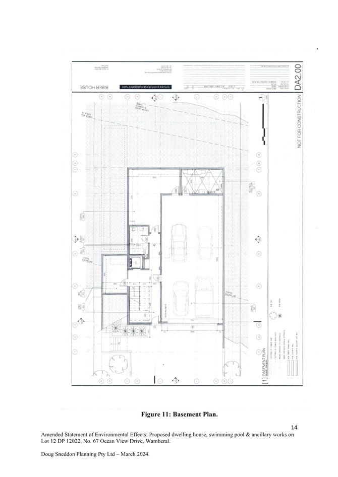
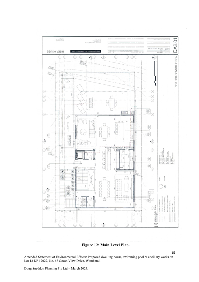
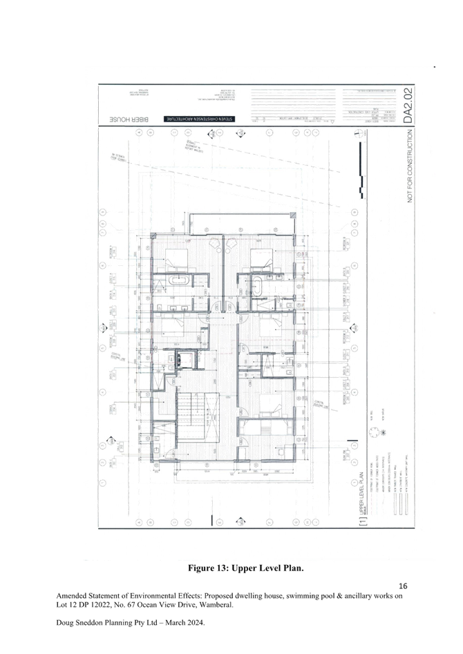
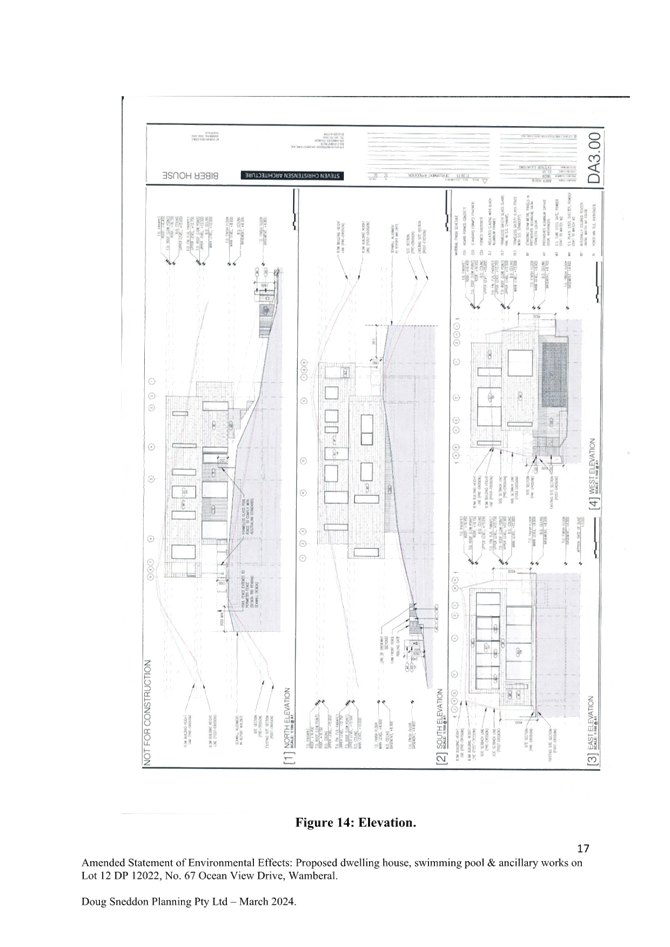
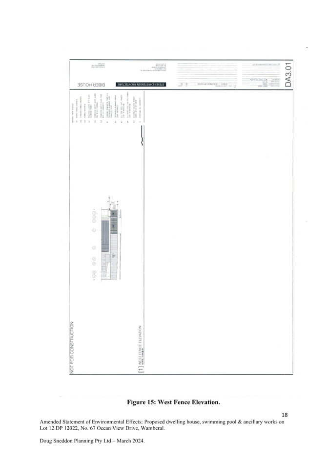
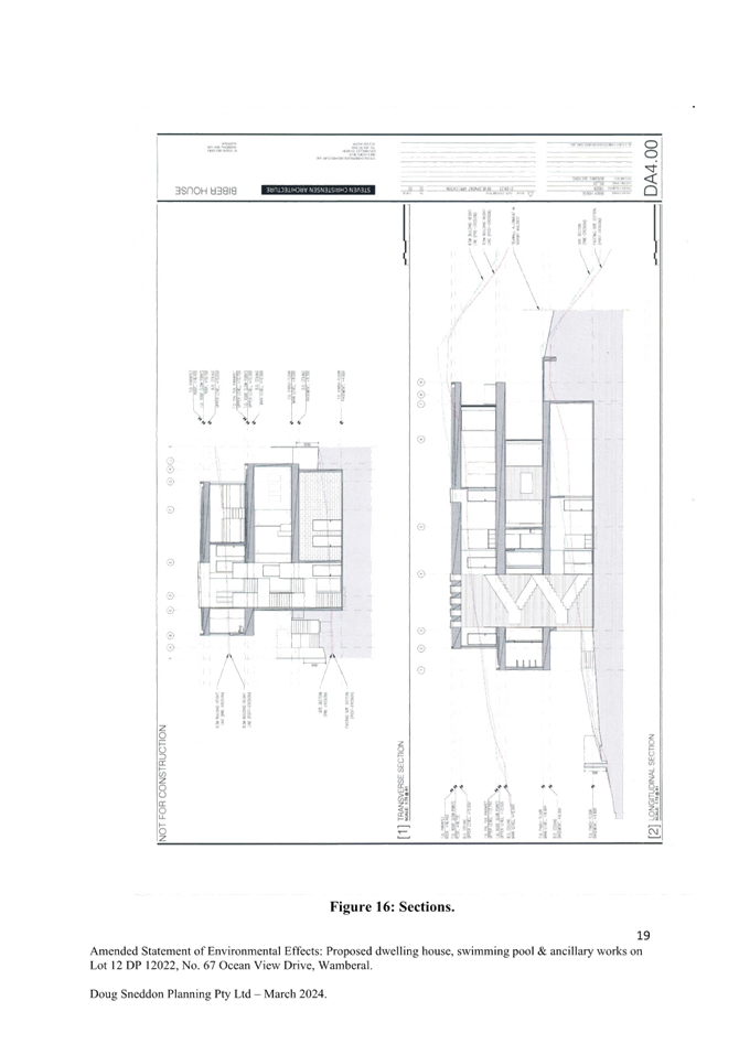
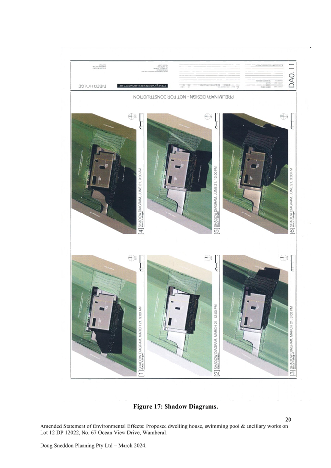
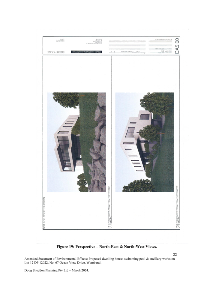
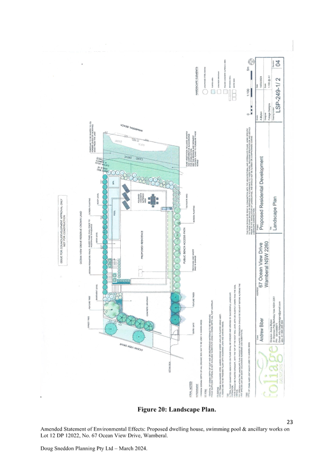
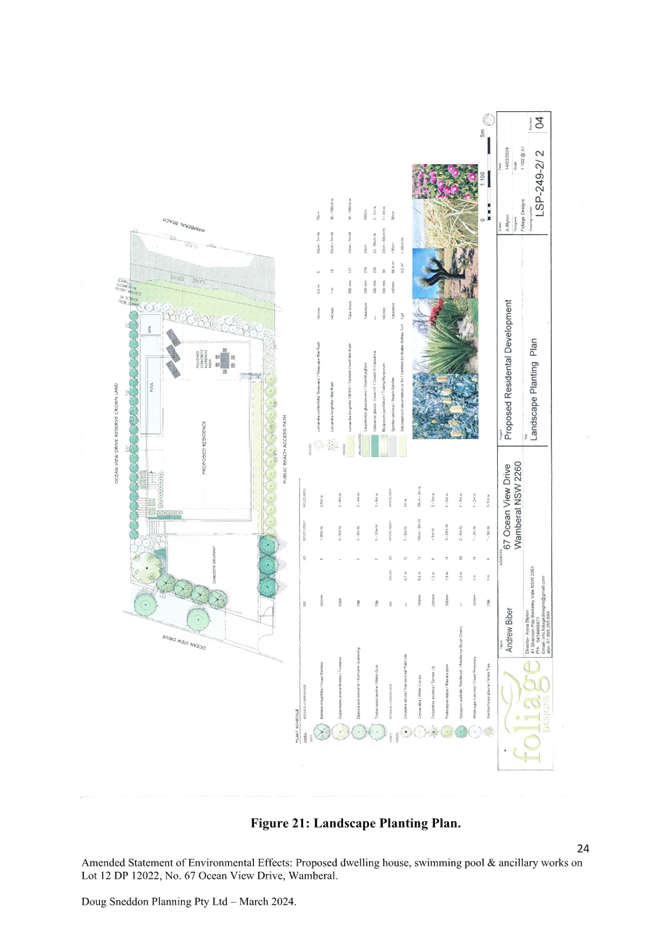
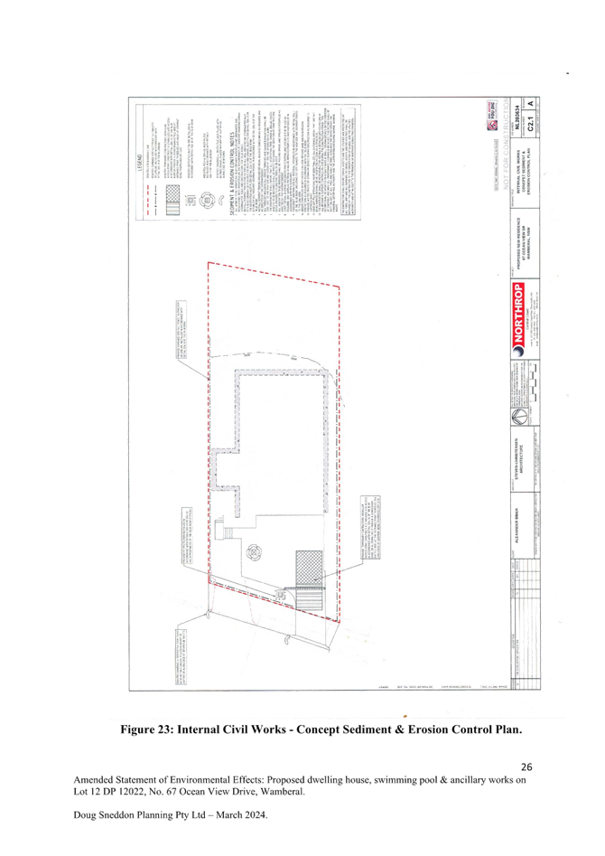
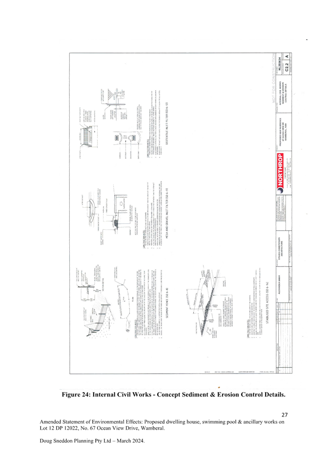
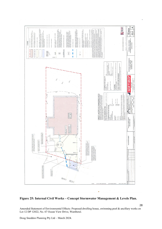

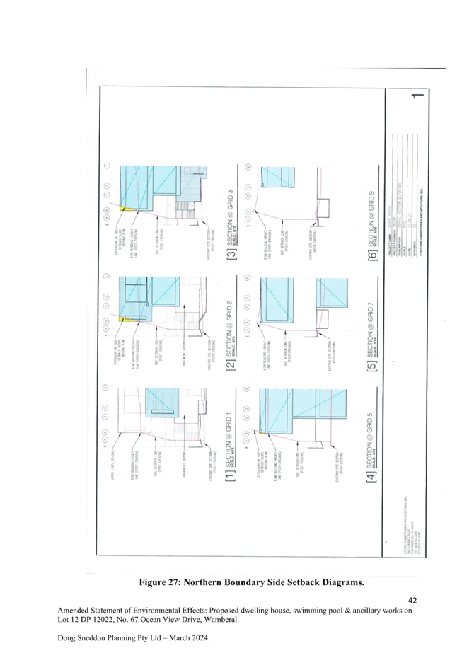

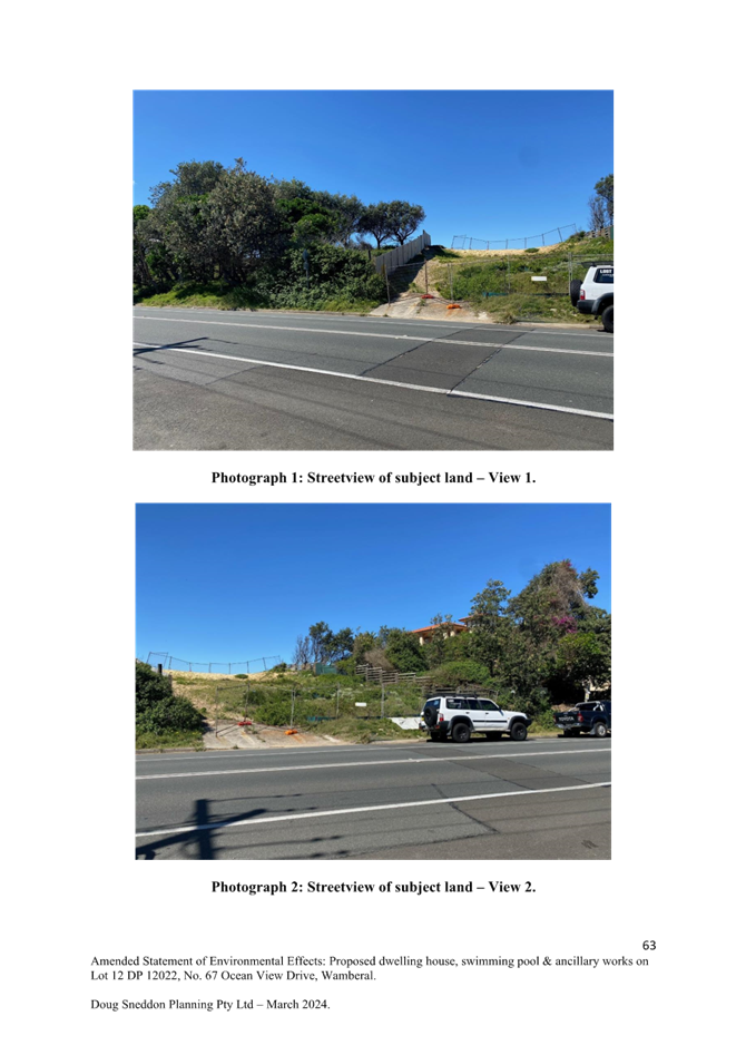
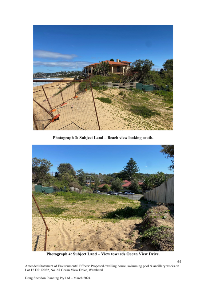


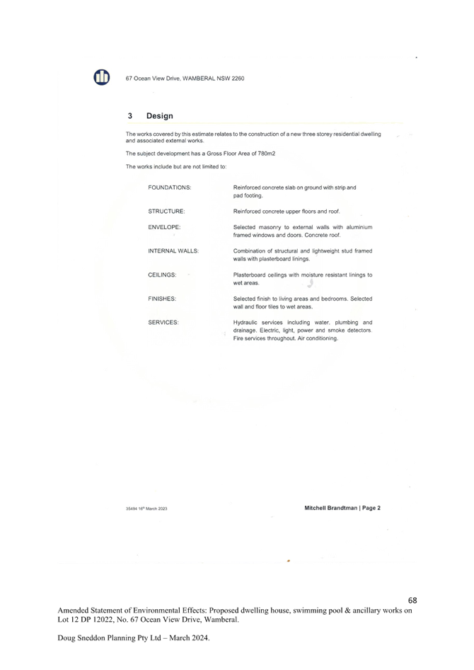
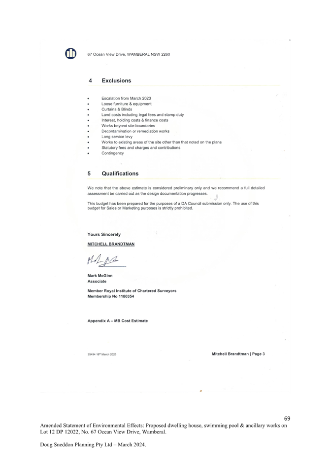
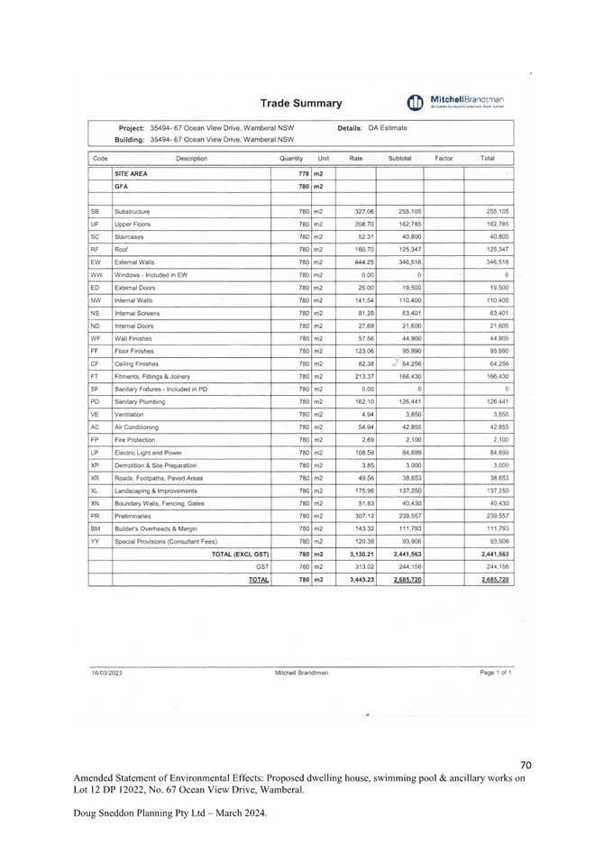


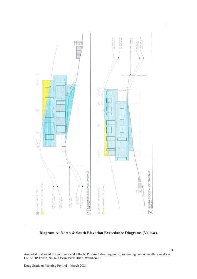
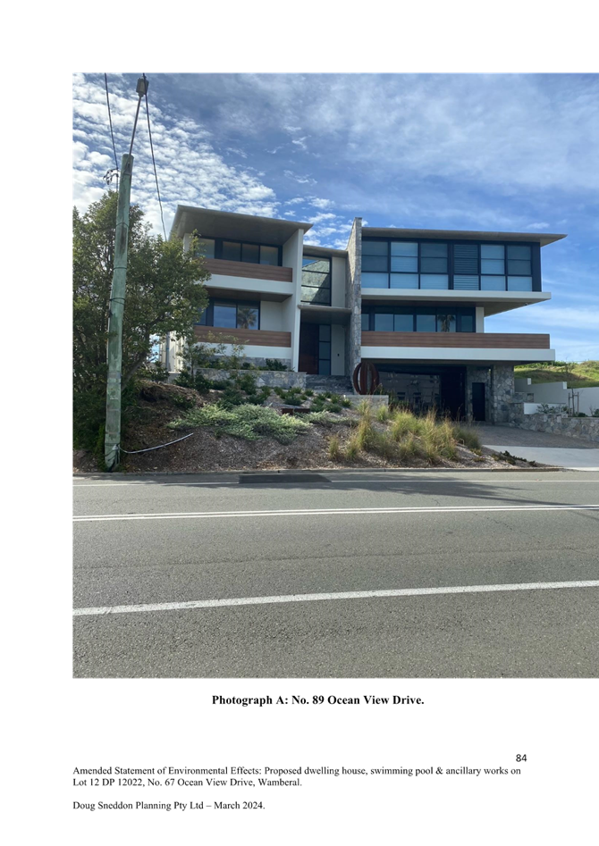
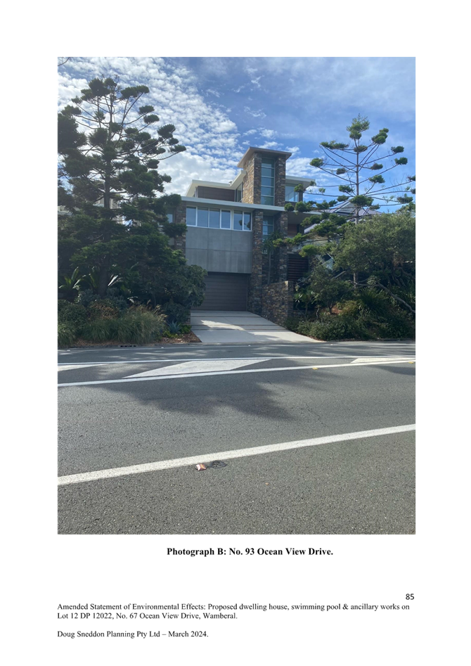
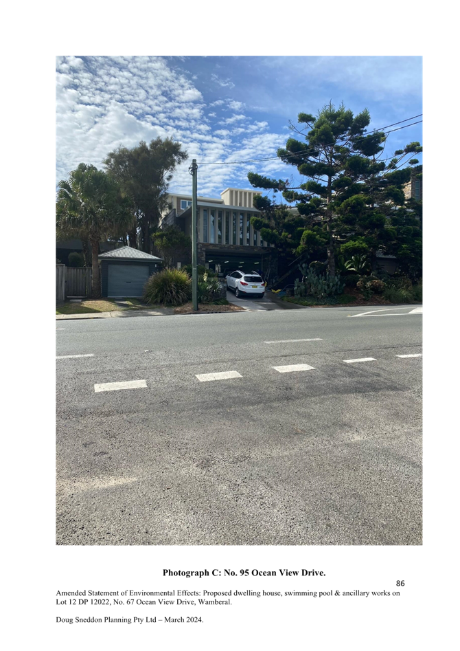
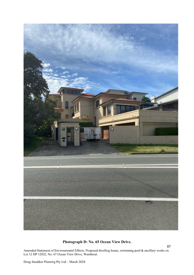

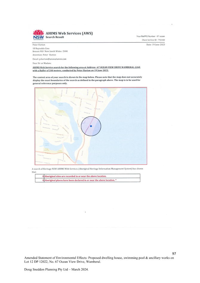

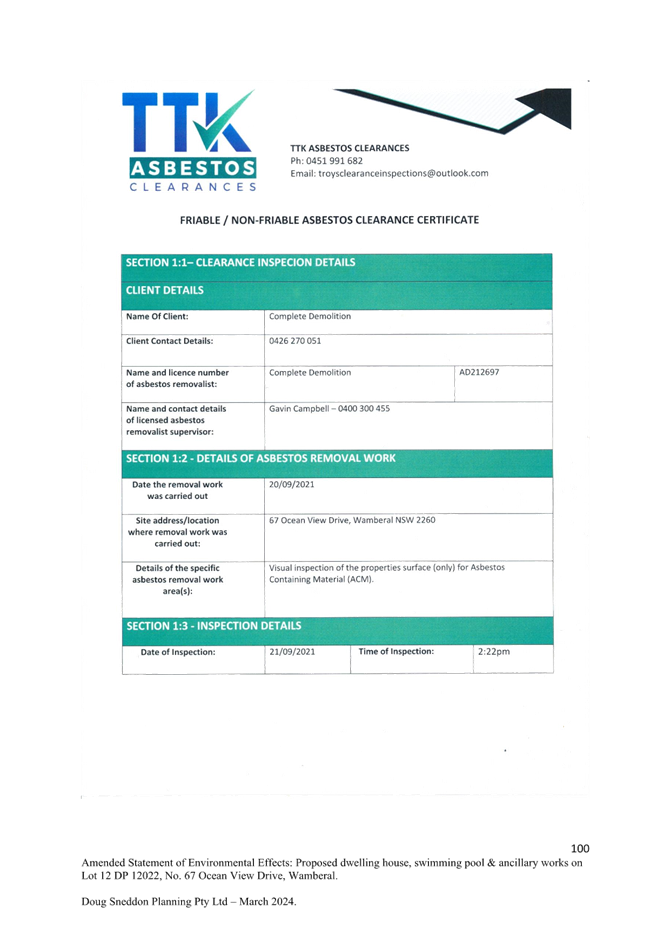

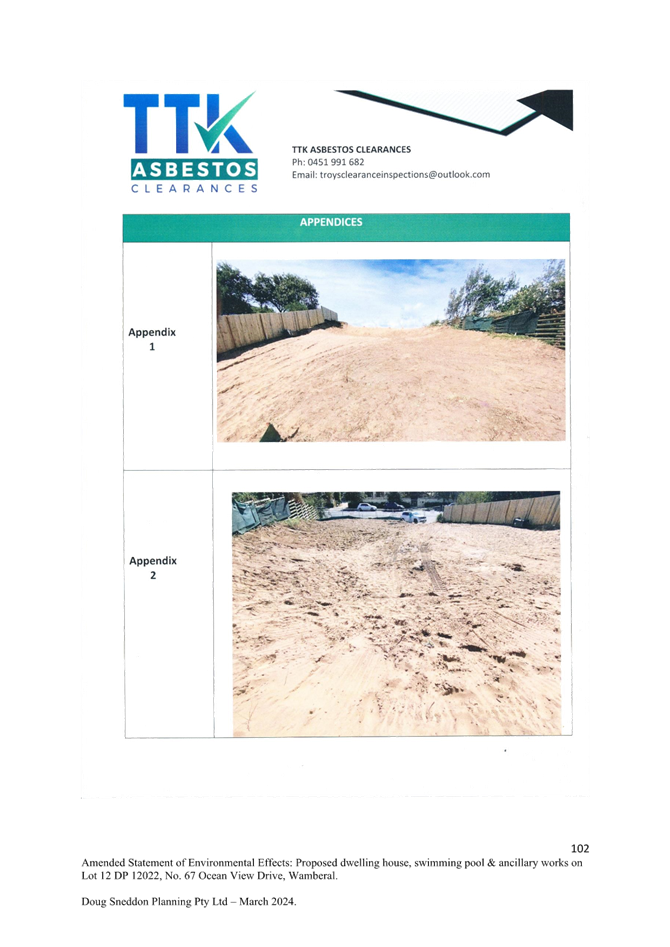


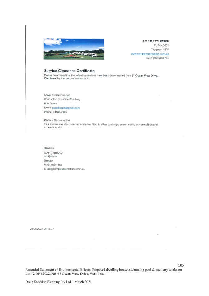
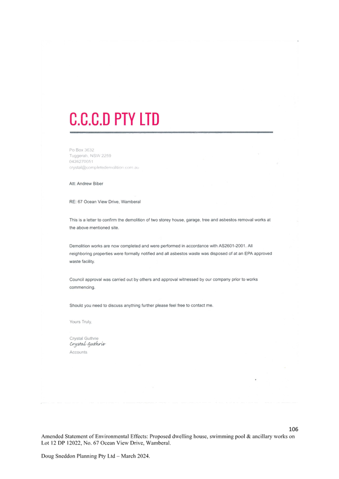
|
Item No: 3.3 |
|
|
Title: DA/2461/2023 - New Dwelling House & Demolition of Existing Structures - 42 North Avoca Parade North Avoca NSW 2250 |
|
|
Department: Environment and Planning |
|
|
17 October 2024 Local Planning Panel Meeting |
|
Reference: DA/2461/2023 - D16434344
Author: Karen Hanratty, Senior Development Planner Residential Assessments
Section Manager: Ailsa Prendergast, Section Manager. Residential Assessments
Unit Manager: Andrew Roach, Unit Manager. Development Assessment
|
Summary
An application has been received for New Dwelling House & Demolition of Existing Structures. The application has been examined having regard to the matters for consideration detailed in section 4.15 of the Environmental Planning and Assessment Act 1979 and other statutory requirements with the issues requiring attention and consideration being addressed in this report.
This development application is required to be reported to the Local Planning Panel as the application proposes a variation greater than 10% to the Height of Building development standard in clause 4.3(2) of Central Coast Local Environmental Plan 2022. The subject land has a maximum building height standard of 8.5 metres. The proposed development has a maximum height of 9.644m which represents a variation of 1.144m (or 13%).
The application was notified with no submissions received.
The application is recommended for approval, subject to conditions.
Applicant Beveridge Williams & Co Pty Ltd Owner S R & C P Webb Application No DA/2461/2023 Description of Land Lot 1 DP 1296711. 42 North Avoca Parade, North Avoca Proposed Development New Dwelling House & Demolition of Existing Structures Site Area 631.9sqm Zoning R2 Low Density Residential Existing Use Dwelling House Employment Generation No Estimated Value $2,380,260 |
1 The Panel agrees that the applicant’s clause 4.6 written request demonstrates that compliance with clause 4.3(2) Height of Building development standard of Central Coast Local Environmental Plan 2022 is unnecessary in the circumstances of the case and that there are sufficient environmental planning grounds to justify contravening that development standard.
Further, the Panel considers that the proposed development will be in the public interest because it is consistent with the objectives of the development standard and the objectives for development within the R2 Low Density zone in which the development is proposed to be carried out.
2 That the Local Planning Panel grant consent to DA/2461/2023 on Lot 1 DP 1296711, 42 North Avoca Parade North Avoca NSW 2250 subject to the conditions detailed in the schedule attached to the report and having regard to the matters for consideration detailed in Section 4.15 of the Environmental Planning and Assessment Act 1979.
Key Issues
· Compliance with Central Coast Local Environmental Plan 2022 (CCLEP 2022).
o Variation greater than 10% to clause 4.3(2) Height of Building development standard.
· Compliance with the Central Coast Development Control Plan 2022
o Chapter 2.1 Dwelling Houses, Secondary Dwellings and Ancillary Structures – building height and side boundary setback.
o Chapter 3.2 Coastal Hazard Management – Southern area - development located within Coastal Hazard Area.
Precis:
|
Proposed Development |
New Dwelling House & Demolition of Existing Structures |
|
Permissibility and Zoning |
The subject site is zoned R2 Low Density Residential under Central Coast Local Environmental Plan 2022 (CCLEP 2022). The proposed development is defined in the CCLEP 2022 as ‘dwelling house’ and is permissible in the zone with consent. |
|
Current Use |
Dwelling House |
|
Integrated Development |
No |
|
Submissions |
Nil |
Variations to Policies - Central Coast Local Environmental Plan 2022
|
Clause |
4.3(2) Height of Building |
|
Standard |
The height of a building on any land is not to exceed the maximum height shown for the land on the Height of Buildings Map of 8.5m. |
|
Departure basis |
Maximum height of 9.644m is proposed to the eastern pavilion of the development. This represents a variation of 1.144m or 13%. |
Variations to Policies - Central Coast Development Control Plan 2022
Chapter 2.1 Dwelling Houses, Secondary Dwellings and Ancillary Development
|
Clause |
2.1.2.1(a) Building Height |
|
Standard |
Height of building is not to exceed the maximum building height on the Central Coast LEP 2022 Height of Building Map of 8.5m. |
|
Departure basis |
Maximum height of 9.644m is proposed to the eastern pavilion of the development. This represents a variation of 1.144m or 13%. |
|
Clause |
2.1.3.1(a)(i) Front Setback |
|
Standard |
The average distance of the setbacks of the nearest 2 dwelling houses having the same primary road boundary and located within 40m of the lot on which the dwelling house is erected. |
|
Departure basis |
The front setback required is 8.3m. A setback of 2.88m to 5.84m is proposed from the front boundary to the western elevations of the development. This represents a variation of 66% and 30% respectively. |
|
Clause |
2.1.3.1(a)(iv) Garage Setback |
|
Standard |
A minimum of 1m behind the front boundary setback |
|
Departure basis |
The front setback required is 9.3m. A setback of 2.88m to 3.75m is proposed. This represents a variation of 69% and 60% respectively. |
|
Clause |
2.1.3.1(c)(i) Side Setbacks |
|
Standard |
900mm setback for any part of the building with a height of up to 4.5m – the dwelling house pavilion structures comply, and, for any part of the building with a height of more than 4.5m—0.9m plus one quarter of the height of the building above 4.5m. |
|
Departure basis |
Proposed side setbacks vary along the site boundaries and respective building elevations due to changes in building height over the three linked pavilions and described in detail under the stated clause and summarised below.
Northern side boundary: · Western Pavilion (garage and rumpus room) – Section B1 West 22%, Section B1 East – 20% · Eastern Pavilion – Section B3 West 43%, Section B3 East 39% Southern side boundary: · Western Pavilion (bedrooms 2, 3 and 4) – Section B2 West 3%, Section B2 East 2.5%. · Eastern Pavilion – Section B3 East 8%. |
The Site
The site is described as Lot 1 DP 1296711. 42 North Avoca Parade, North Avoca and has an area of 631.9sqm. The site is irregular in shape and is located on the eastern side of the street, with a rear, eastern boundary to the beach reserve of North Avoca Beach, refer Figure 1.
The site contains an existing elevated one and two storey weatherboard dwelling with a floor level of RL 8.2m AHD (approved 29 June 1993, only stage 1 was constructed) toward the eastern boundary and detached clad building at the street frontage (the original dwelling house pre-1985), several trees, private gardens and grassed covered areas, refer Figures 2, 3 and 4.
The topography of the site is predominantly flat. From the street boundary the ground surface is approximately RL 6.34m AHD and rises to a dune crest situated within the eastern portion of the site at approximately RL 7.00m AHD. Seaward from the eastern site boundary, the ground surface falls at about 5 degrees for approximately 30-40m over densely vegetated dunes. The beach area is approximately 70m to the waterline of North Avoca Beach.
The site is not identified as bushfire prone land. The site is affected by flooding and contains Class 4 Acid Sulfate Soils. The site does not contain any native vegetation or fauna habitat.
The site is located within the coastal hazard area and subject to a Coastal Building Line under Chapter 3.2 Coastal Hazard Management – Southern Area of Central Coast Development Control Plan 2022 (CCDCP 2022).
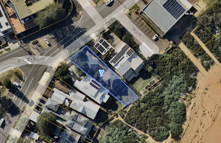
Figure 1 – Site and Locality Plan (subject site blue outline)
Source: Nearmap 21 August 2024
![]()
![]()
![]()
Figure 2 – Subject Site from North Avoca Parade
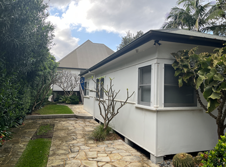
Figure 3 – Subject Site – Internal view of existing structures
![]()
![]()
![]()
Figure 4 – Subject Site from North Avoca Beach
Surrounding Development
The site is surrounded by existing residential accommodation, mostly single detached dwellings. To the northwest opposite the site beyond North Avoca Parade, is an existing mixed-use development featuring a three-storey building with a combination of commercial, retail and residential tenancies. The site shares its eastern boundary with North Avoca Beach and enjoys exceptional panoramic ocean and coastal views to the northeast, east, and southeast. A short distance north is the North Avoca Beach Surf Life Saving Club.
The Proposed Development
The development application seeks approval for the demolition of existing dwelling and outbuilding and the construction of a two storey four (4) bedroom dwelling house.
The dwelling design incorporates three linked pavilions (eastern pavilion/east wing and two western pavilions/west wings) featuring a central sun court and courtyard terrace that facilitate dwelling connectivity and comprises:
· Lower Ground Floor (western pavilion/west wing)
o Front entry stairs / attached double garage / laundry / bedroom 2 with ensuite / internal stairs and undercroft (sub-floor).
o Finished floor level (FFL):
§ Garage and laundry – RL 6.65m AHD
§ Bedroom 2 – RL 7.10m AHD
· Ground Floor (western pavilion/west wing)
o Rumpus room with covered terrace / bedroom 3 with ensuite / bedroom 4 with ensuite / hall and internal stairs.
o Finished floor level:
§ Rumpus room with covered terrace – RL 9.40m AHD
§ Bedroom 3 and hallway – RL 8.50m AHD
§ Bedroom 4 – RL 9.90m AHD
· Ground Floor (outdoor)
o Central sun court with spa
o Constructed planter box to facilitate deep soil planting for a proposed feature tree.
o Finished floor level – RL 8.50m AHD
· Ground Floor (eastern pavilion/east wing)
o Main front entry / kitchen-living-dining areas / courtyard terrace (west) / ocean terrace (east) / WC / internal stairs / outdoor shower / timber decking along southern side of the east wing.
o Finished floor level – RL 8.50m AHD.
· First Floor (eastern pavilion/east wing)
o Master bedroom with ensuite, walk in wardrobe / small east facing viewing deck / study / storeroom/ internal stairs.
o Finished floor level – RL 11.80m AHD.
Associated works include, front fencing, earthworks, tree removal and landscaping replenishment, stormwater infrastructure.
A site plan is provided in Figure 5, building elevations in Figures 6, 7 8 and 9, and Landscape Plan in Figure 10.
![]()
![]()
Figure 5 – Site Plan
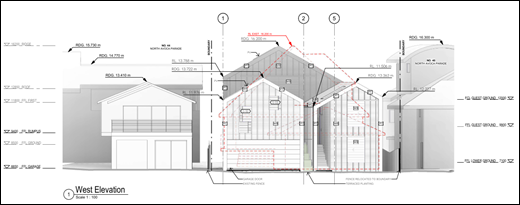
Figure 6 – West Elevation – street frontage
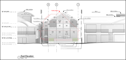
Figure 7 – East Elevation – beach frontage
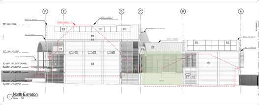
Figure 8 – North Elevation
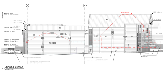
Figure 9 – South Elevation
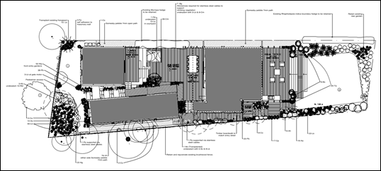
Figure 10 – Landscape Plan
ASSESSMENT:
Having regard for the matters for consideration detailed in Section 4.15 of the Environmental Planning and Assessment Act 1979 and other statutory requirements. The assessment has identified the following key issues, which are elaborated upon for Council’s information. Any tables relating to plans or policies are provided as an attachment.
Provisions of Relevant Instruments/Plans/Policies:
Draft Environmental Planning Instruments
No draft Environmental Planning Instruments apply to this application.
State Environmental Planning Policies
State Environmental Planning Policy (Sustainable Buildings (2022)
The application is supported by a BASIX certificate which confirms the proposal will meet the NSW government's requirements for sustainability, if built in accordance with the commitments in the certificate.
The proposal is considered to be consistent with the requirements of State Environmental Planning Policy (Sustainable Buildings) 2022.
State Environmental Planning Policy (Resilience and Hazards) 2021
Chapter 2 Coastal Management
The aims of Chapter 2 are to be considered when determining an application within the Coastal Management Areas. The Coastal Management Areas are defined on maps issued by the NSW Department of Planning and Environment.
The site is located within the Coastal Environment Area (section 2.10) and Coastal Use Area (section 2.11) as identified on these maps. Development consent must not be granted to development on land that is within these areas unless the consent authority has considered whether the proposed development is likely to cause an adverse impact; and is satisfied the proponent has taken all reasonable measures to avoid, minimise and/or mitigate that impact.
The development is not likely to have an adverse impact on the matters referred to in section 2.10 and section 2.11. The development is not considered likely to cause increased risk of coastal hazards on the site or other land. A summary of considerations is included below.
Section 2.10 - Development on land within the coastal environment area
In accordance with section 2.10(1) development consent must not be granted in the coastal environment area unless the consent authority has considered whether the proposed development is likely to cause an adverse impact on the following:
|
Matters for Consideration |
Compliance |
|
(a) the integrity and resilience of the biophysical, hydrological (surface and groundwater) and ecological environment. |
The proposal is not likely to cause adverse impacts on the biophysical, hydrological, or ecological environment.
The proposal will be connected to reticulated sewer and stormwater will be managed on-site in accordance with the submitted stormwater plans. Erosion and sediment controls will be in place during demolition and construction, and the proposal will not impact on the environment. No significant vegetation is recorded on site. |
|
(b) coastal environmental values and natural coastal processes. |
The site shares its eastern boundary with North Avoca Beach. However, the proposed works are to occur wholly within an already disturbed area of the site and acceptably landward of natural coastal processes. The site is largely protected by an existing vegetated sand dune seaward of the eastern boundary.
The proposal will not impact on the geological and geomorphological coastal processes. |
|
(c) the water quality of the marine estate (within the meaning of the Marine Estate Management Act 2014, in particular, the cumulative impacts of the proposed development on any of the sensitive coastal lakes identified in Schedule 1. |
The proposal will not result in an adverse impact on the water quality of the marine estate and does not drain to a sensitive lake contained in Schedule 1.
The proposal will be connected to reticulated sewer and stormwater will be managed on-site in accordance with the submitted stormwater plans. Furthermore, stormwater and overland flow is directed west being toward the landward (street) boundary. Erosion and sediment controls will be in place during demolition and construction, to minimise impacts on water quality, and the proposal will not impact on any sensitive coastal lakes. |
|
(d) marine vegetation, native vegetation and fauna and their habitats, undeveloped headlands and rock platforms. |
The proposal will not result in an adverse impact on native vegetation or fauna, undeveloped headlands, and rock platforms.
The proposed works will occur within an already disturbed area the site. The development will not interact with subaqueous areas and therefore, is unlikely to impact marine vegetation or flora and fauna for an acceptably rare storm and acceptably long life. |
|
(e) existing public open space and safe access to and along the foreshore, beach, headland or rock platform for members of the public, including persons with a disability. |
The proposal will not impact on public access to the foreshore being entirely within the subject site. |
|
(f) Aboriginal cultural heritage, practices and places. |
An AHIMS search was undertaken, and the subject land has not been identified as containing or being within 200m of any Aboriginal sites or places. |
|
(g) the use of the surf zone. |
The proposal is located entirely on the subject site and will not interact with the surf zone or impact on use of the surf zone. |
In accordance with section 2.10(2) development consent must not be granted unless the consent authority is satisfied that:
|
Matters for Consideration |
Compliance |
|
(a) the development is designed, sited and will be managed to avoid an adverse impact referred to in subsection (1), or |
The proposed dwelling house is appropriately designed and sited and will be managed to avoid any adverse impacts referred to in clause 2.10(1) having regard to LEP and DCP requirements, the location and characteristics of the site and existing development on the site and surrounding properties.
The proposal does not involve the removal of any significant vegetation. No additional structures or coastal protection works shall be erected on the dune seaward of the new dwelling house unless separately approved by Council. |
|
(b) if that impact cannot be reasonably avoided—the development is designed, sited and will be managed to minimise that impact, or |
N/A – no adverse impacts
|
|
(c) if that impact cannot be minimised—the development will be managed to mitigate that impact, |
N/A – no adverse impacts
|
Section 2.11 - Development on land within the coastal use area
In accordance with section 2.11(1) development consent must not be granted in the coastal use area unless the consent authority has considered whether the proposed development is likely to cause an adverse impact on the following:
|
Matters for Consideration |
Compliance |
|
(a) whether the proposed development is likely to cause an adverse impact on the following: i. existing, safe access to and along the foreshore, beach, headland or rock platform for members of the public, including persons with a disability, ii. overshadowing, wind funnelling and the loss of views from public places to foreshores, iii. the visual amenity and scenic qualities of the coast, including coastal headlands, iv. Aboriginal cultural heritage, practices and places, v. cultural and built environment heritage. |
The site has a direct frontage to the foreshore of North Avoca Beach.
There will be some impact from overshadowing of the upper dune areas of the beach in the afternoons mid-winter which is similar to the shadows cast by other development along the beachfront. However, the proposal will not cause an adverse impact on overshadowing, access, wind funneling or view loss from public places to any foreshore.
The dwelling house will be visible from the beach and coastal areas and will maintain an appropriate presentation that is consistent with other more recent development along the beachfront. The proposal has minor exceedance of the required building height however is not considered to have unacceptable bulk and scale and is not likely to have any adverse visual impact on the scenic qualities of the coast including coastal headlands.
There are no known objects, areas, or items of heritage significance on the land, and no potentially adverse impacts on cultural or environmental heritage have been identified. |
|
(b) is satisfied that i. the development is designed, sited and will be managed to avoid an adverse impact referred to in paragraph (a), or ii. if that impact cannot be reasonably avoided—the development is designed, sited and will be managed to minimise that impact, or iii. if that impact cannot be minimised—the development will be managed to mitigate that impact, |
If designed and constructed in accordance with the recommendations of the coastal engineering report and geotechnical engineering report prepared for the site, the proposal will not result in adverse impacts referred to in section 2.11(a) having regard to LEP and DCP requirements, the location and characteristics of the site and existing development on the site and surrounding properties. |
|
(c) has taken into account the surrounding coastal and built environment, and the bulk, scale and size of the proposed development |
The bulk and scale of the proposed development is compatible with the scale and appearance of other development along the beachfront and is considered satisfactory for the site and location. |
Section 2.12 - Development in coastal zone generally - development not to increase risk of coastal hazards
In accordance with section 2.12 development consent must not be granted to development on land within the coastal zone unless the consent authority is satisfied that the proposed development is not likely to cause increased risk of coastal hazards on that land or other land.
Comment:
The proposal will be located within the Coastal Hazard Area under CCDCP 2022 although landward of the Coastal Building Line. The Coastal Engineering Advice Ref PA3313, prepared by Royal HaskoningDHV dated 14 November 2023 states:
· Chapter 3.2 of DCP 2022 requires piling into the 2100 Stable Foundation Zone, which occurs below RL -1 across most of the subject property; only 11 m of the most landward portion of the property is characterised by stable foundation conditions above this level. While this may permit a slight rationalisation of the detailed foundation design for any structure located within this 11 m zone, the use of different foundation types is generally not recommended. To avoid differential movement and structural cracking it would be preferred that the proposed development be founded on piles across the entirety of the property. This should be verified by a geotechnical and structural engineer at detailed design.
· Given that the proposed development would be elevated on piles above most wave action, wave reflections due to the development would be avoided and it would not be expected that there would be significant impacts on neighbouring developments.
· In practice, any overtopping flows would “fold over” the crest of the dune and travel as an intermittent sheet flow at shallow depth, spreading out and infiltrating over landward areas. A significant reduction in the velocity and depth of the runup would be expected within the order of 10 m landward from the foreshore crest.
· If the foundations for the proposed development are designed in accordance with Section 6.2 of the Coastal Engineering Advice the proposed development would not be expected to adversely affect coastal environmental values or natural coastal processes over its design life, as it is at an acceptably low risk of damage from erosion/recession and inundation for an acceptably rare storm and over an acceptably long design life and would be well landward and above typical coastal processes.
In summary, if the proposal is designed and constructed in accordance with the recommendations of the Coastal Engineering Advice and Geotechnical Assessment prepared for the site the proposal is not likely to have adverse impact on coastal hazards, coastal environmental values and visual amenity. The proposal is satisfactory in relation to clause 2.12 of the SEPP.
Section 2.13 - Development in coastal zone generally - coastal management programs to be considered
In accordance with section 2.13 development consent must not be granted to development on land within the coastal zone unless the consent authority has taken into consideration the relevant provisions of any certified coastal management program that applies to the land.
Comment:
The Gosford Beaches Coastal Zone Management Plan (CZMP) lapsed on 31 December 2023.
Chapter 4 Remediation of Land
Section 4.6 of Chapter 4 requires that a consent authority must not consent to the carrying out of any development on land unless it has considered whether the land is contaminated. and if the land is contaminated, it is satisfied that the land is suitable in its contaminated state (or will be suitable, after remediation) for the purpose for which the development is proposed to be carried out.
The site has been used for residential purposes and subject to conditions, is considered suitable for the proposed use.
The development and the land are not otherwise mentioned in Section 4.6(4) and accordingly the provisions of Section 4.6(2) are not engaged by the proposal and consent may be granted. The proposal is considered consistent with the provisions of Chapter 4 of the SEPP.
The Panel can be satisfied that the proposed development complies with the provisions of Chapter 2 Coastal Management and Chapter 4 Remediation of Land of State Environmental Planning Policy (Resilience and Hazards) 2021.
Central Coast Local Environmental Plan 2022 (CCLEP 2022)
Zoning and Permissibility
The subject site is zoned R2 Low Density Residential under CCLEP 2022, identified in Figure 9. The proposed development is defined as dwelling house which is permissible in the zone with consent of Council.
The CCLEP 2022 defines the following:
dwelling house means a building containing only one dwelling.
dwelling means a room or suite of rooms occupied or used or so constructed or adapted as to be capable of being occupied or used as a separate domicile.
In accordance with clause 2.3(2) the consent authority must have regard to the objectives for development in respect of land within the zone. The objectives of the R2 Low Density Residential zone are:
· To provide for the housing needs of the community within a low density residential environment.
· To enable other land uses that provides facilities or services to meet the day to day needs of residents.
· To encourage best practice in the design of low density residential development.
· To ensure that non-residential land uses do not adversely affect residential amenity or place demands on services.
· To maintain the enhance the residential amenity and character of the surrounding area.
Properties along North Avoca Beach are zoned R2 Low Density Residential (identified by the pink shaded area in Figure 11). East of the site, the Beach and the North Avoca Surf Life Saving Club is zoned RE1 Public Recreation (identified by the green shaded area in Figure 11). Opposite the site is a multi storey mixed use development on land zoned E1 Local Centre.
The proposed development meets the objectives of the zone as follows:
· The proposal will provide a renewal of housing on the site, and the nature of the use is consistent with development in the surrounding area and considered compatible with the desired future character of the area.
o Low density urban morphology is achieved through a combination of development controls including, minimum lot size, setbacks, floor space ratio (FSR), site coverage and building height. The CCLEP 2022 does not prescribe an FSR control for the site.
o The proposed development incorporates three linked pavilions (east wing and two west wings) featuring a central sun court and courtyard terrace that facilitate dwelling connectivity. The proposed development has a general linear form that follows the shape and topography of the site. The proposed development is consistent in size and scale to existing neighbouring development in the low-density residential zone.
· The design of the proposal responds to the beachfront location of the site and the site constraints including flooding, coastal inundation and geotechnical requirements.
· The proposal demonstrates architectural quality with a general linear form that follows the shape and topography of the site. The pitch and scale of the proposed roof has been designed to maximise solar access to the occupants of the dwelling and adjoining properties. The materials are commensurate with the natural and built environment and will complement surrounding development in the locality.
· The design of the proposal responds to the beachfront location of the site and is compatible with the scale and nature of more recent development on the beachfront and maintains a two storey presentation to the beach front and designed to achieve views yet does not unreasonably obstruct any significant views from private property or the public domain.
· The amenity of the residential streetscape will be improved by retention and replenishment of trees along the property boundary. Additional vegetation will improve the outlook from upper-floor levels of dwellings to the west.
· The proposed development is ecologically, socially and economically sustainable in the sensitive coastal location and will not give rise to any increased coastal hazards on adjacent land.
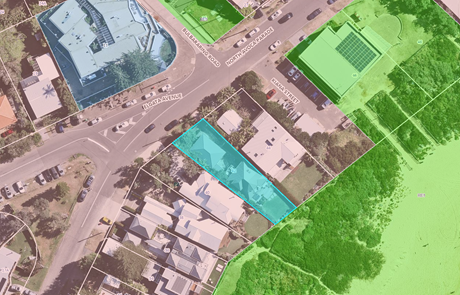
Figure 11 – Zoning Map CCLEP 2022
Clause 4.3 Height of Buildings
Clause 4.3(2) of CCLEP 2022 provides that the height of a building on any land will not exceed the maximum height shown for the land on the Height of Buildings Map. The maximum height shown on the relevant map is 8.5m. The CCLEP 2022 defines this as the height above existing ground level.
The eastern pavilion/east wing will have a maximum height of 9.644m. This represents a variation of 1.144m or 13% to the development standard. The area of the proposed development that exceeds the development standard is the apex of the roof over the eastern pavilion at RL 16.20m AHD. The area of non-compliance with the building height is shown in Figures 12, 13 and 14.
The western pavilions/west wing of the proposed development located at the front of the site complies with the maximum building height of 7.379m. These buildings are consistent in height to the secondary dwelling located at the site frontage of the adjoining northern property, 44 North Avoca Drive.
A written request under clause 4.6 of CCLEP 2022 to vary the development standard has been submitted by the Applicant. The Applicant's submission demonstrates the proposed development is of a satisfactory height, bulk and scale and does not have adverse impact on adjoining development. The Applicant’s objection is considered to be well founded as the proposal is considered to achieve the objectives of the standard and the development is recommended for support.
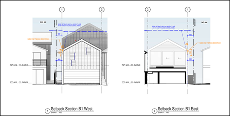
Figure 12 – Building Height Exceedance Diagram
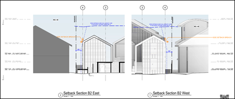
Figure 13 – Building Height Exceedance Diagram
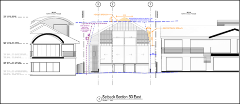
Figure 14 – Building Height Exceedance Diagram
Clause 4.4 Floor Space Ratio
Clause 4.4(2) Floor Space Ratio (FSR) of CCLEP 2022 provides the maximum floor space ratio for a building on any land. There is no floor space ratio applying to the site under the CCLEP 2022.
Notwithstanding this, the proposed development has satisfactory density, bulk and scale which integrates with the streetscape and character of the area and is comparable to contemporary buildings along North Avoca Parade.
Clause 4.6 Exceptions to Development Standards
A clause 4.6 Exceptions to Development Standards variation for the non-compliance associated with floor space ratio development standard in Clause 4.3(2) of CCLEP 2022 was provided by the applicant.
Clause 4.6 of CCLEP 2022 provides the ability to grant consent to a development application where the variation to a development standard can be adequately justified and where the objectives of clause 4.6 are satisfied, being:
(a) to provide an appropriate degree of flexibility in applying certain development standards to particular development,
(b) to achieve better outcomes for and from development by allowing flexibility in particular circumstances.
In accordance with clause 4.6(3) the Applicant has submitted a written request seeking variation the building height development standards of 8.5m in clause 4.3(2) of CCLEP 2022. A copy of the clause 4.6 variation is included in the Statement of Environmental Effects as Appendix H. The Statement of Environmental Effects is provided as Attachment 15 to this report.
The development proposes a maximum building height of 9.644m for the east wing. This represents is a variation of 1.144m or 13% to the development standard. The non-compliance with the building height is shown above in Figures 12, 13, and 14.
The majority of the development is contained, and well within the maximum building height standard. The only area of the proposed development that exceeds the development standard is the apex of the roof over the eastern pavilion at RL 16.20m AHD. The western pavilions, located at the front of the property are well within the prescribed maximum building height.
From the east elevation of the eastern pavilion, natural ground level is identified at RL 7.018m AHD. The resultant breach at the east elevation is 0.681m representing a departure of 8.5% from the development standard. From the west elevation of the eastern pavilion, natural ground level is identified at RL 6.555m AHD. The resultant breach at the west elevation is 1.144m representing a departure of 13% from the development standard.
The applicant’s written request refers to the first of the five tests established in Wehbe v Pittwater Council [2007] NSW LEC 827 to demonstrate that compliance with the numerical standard is unreasonable or unnecessary in the circumstances. The test seeks to demonstrate that the objectives of the standard are achieved notwithstanding non-compliance with the numerical standard, Clause 4.3 Height of Buildings of the CCLEP 2022.
The Applicant’s written request to vary the height of building development standard demonstrates the following (summarised):
· The height of building development standard is also concerned with establishing appropriate development density and ensuring that height of buildings are compatible with the character of the locality. The exceedance of the development standard will ensure the proposed development has a positive relationship with established surrounding development and the scale of existing dwellings (and those recently approved) on beach front properties along North Avoca Parade.
· To address the impact of coastal inundation and coastal hazards, a minimum habitable floor level applies to the site. This presents additional challenges in achieving full compliance due to augmented building heights. The impact of coastal hazards restricts development to the western and central parts of the site, leading to a reduced development footprint. Consequently, building heights are increased to achieve additional floor space commensurate with the grandeur building forms proposed along the beach front at North Avoca.
· The proposed development will provide high quality housing in close proximity to facilities and public open spaces including North Avoca Beach.
· The height of the building is without impact, in terms of increased overshadowing, permitting overlooking or disrupting views.
· The variation facilitates good design. The proposed floor plates allow habitable windows to face the public domain from the ground and first floor levels. The floor plate provides for significant modulation and articulation in the built form.
· The linked pavilion design, separated by a central courtyard, contributes to a well-articulated building form. The use of architectural features and a diverse range of external materials and finishes further enhances the design, collectively diminishing perceived bulk and scale while increasing visual interest and presentation.
· First floor levels are extremely modest containing only bedrooms, bathrooms and a study. By minimising the amount of floor area within these levels (which are under the building height plane), the development is able to provide a highly modulated and articulated development when viewed from all elevations.
· The pitched roof design will allow for internal areas of the west wing pavilion to receive sunlight and be successfully cross ventilated, thus reducing the reliance on artificial air conditioning systems.
· The variation in height facilitates the provision of a dwelling that is commensurate to the standard and size of other recently constructed dwellings in the North Avoca Beach locality, whilst still allowing a highly articulated and attractive development to be provided.
· As demonstrated in the SEE Report and supporting documentation/plans attached as Appendices to the DA Submission, the increase in building height which is limited to the apex of the pitch roof design does not result in any adverse impact to the built or natural environment.
· Development density is compatible with the existing urban context and built form. The proposed dwelling is consistent with the desired future character of the area and there is no impact to adjoining properties.
· The objectives of the building height development standard and the objectives of the R2 Low Density Residential Zone are achieved by the proposed development, notwithstanding its partial non-compliance with the development standard.
· The proposed departure from the maximum building height development standard will achieve a positive outcome for and from the proposed development, will not raise any matter of significance for State or Regional environmental planning and there would be no public benefit served by maintaining the standard.
· Development density is compatible with the existing urban context and built form. The proposed dwelling is consistent with the desired future character of the area and there is no impact to adjoining properties. The proposed dwelling respectfully responds to the natural hazards on the site and the scale of built form in the locality.
In accordance with clause 4.6(4), development consent must not grant consent for a development that contravenes a development standard unless:
1. The consent authority is satisfied that the Applicant’s written request has adequately addressed the matters required to be demonstrated in clause 4.6(3).
Comment:
The clause 4.6 submitted by the Applicant has addressed how strict compliance with the development standards is unreasonable or unnecessary having regard to various relevant decisions in the NSW Land and Environment Court and New South Wales Court of Appeal and how there are sufficient environmental planning grounds to justify the contravention.
The request for variation has been assessed with consideration of relevant principles set out in various judgements applying to variations to development standards, including:
· Wehbe v Pittwater Council [2007] NSWLEC 827;
· Four2Five Pty Ltd v Ashfield Council [2015] NSWLEC 90;
· Initial Action Pty Ltd v Woollahra Municipal Council [2018] NSWLEC 118;
Council is satisfied that the matters required to be demonstrated in subclause 4.6(3)(a) have been adequately addressed for the variation to the maximum height of building development standard.
2. The consent authority is satisfied that the proposed development will be in the public interest because it is consistent with the objectives of the particular standard and the objectives for development within the zone in which the development is proposed to be carried out.
Comment:
In order to demonstrate if the proposal has merit, consideration has been given to the proposed height of buildings non-compliance and achieving the objectives of the control contained within Clause 4.3(1) as follows:
The objectives of clause 4.3 Height of Buildings:
(a) to establish a maximum height of buildings to enable appropriate development density,
(b) to ensure that the height of buildings is compatible with the character of the locality.
· 44 North Avoca Parade is located to the north of the site, the dwelling has a ridge height of RL15.73m AHD and building height of approx. 8.5m, the secondary dwelling located to the street frontage is below the 8.5m maximum building height.
· 40 North Avoca Parade is located to the south of the site. Described as a second-floor addition approved in 2017, the dwelling has a building height of 9.72m and a ridge height at RL 16.3m AHD.
The proposal is consistent with objectives in CCLEP 2022 as follows:
· The variation will not be readily perceptible externally and is considered minor. The proposed variation to the maximum building height applies only to a small section of the ridgeline of the east pavilion, with the majority of the roof contained within the building envelope. The design of the east pavilion roof provides greater environmental benefits, including increased effectiveness of the solar panels and maximising solar access to the main dwelling. The design preserves the essential character of the locality while providing for contemporary housing needs in keeping with the community expectations. The size and design of new residential housing within this beachside setting is commensurate to the location, aspect and land value. Combining a mixture of external materials and finishes will ensure the proposed development integrates and blends with both the natural and built environment,
· The extent of the non-compliance does not contribute to the bulk and scale of the building and is not considered to have unreasonable impacts on the amenity of the adjoining residents by overshadowing or overlooking. The height of the building is minimised by the design of the development and the linked pavilions providing articulation of the building form, extensive use of glazing (east and west elevation) and provides natural ventilation, acoustic and visual privacy to neighbours that generally consistent with the DCP requirements.
· The proposed dwelling design provides for a better outcome and responds to the coastal hazard affectation, topography of the site and scale of built form in the locality.
The proposed development is consistent with the objectives for the R2 Low Density Residential zone as follows:
· The proposal will provide a renewal of housing on the site, and the nature of the use is consistent with development in the surrounding area and considered compatible with the desired future character of the area.
o Low density urban morphology is achieved through a combination of development controls including, minimum lot size, setbacks, floor space ratio (FSR), site coverage and building height. The CCLEP 2022 does not prescribe an FSR control for the site.
o The proposed development incorporates three linked pavilions (east wing and two west wings) featuring a central sun court and courtyard terrace that facilitate dwelling connectivity. The proposed development has a general linear form that follows the shape and topography of the site. The proposed development is consistent in size and scale to existing neighbouring development in the low-density residential zone.
· The design of the proposal responds to the beachfront location of the site and the site constraints including flooding, coastal inundation and geotechnical requirements.
· The proposal demonstrates architectural quality with a general linear form that follows the shape and topography of the site. The pitch and scale of the proposed roof has been designed to maximise solar access to the occupants of the dwelling and adjoining properties. The materials are commensurate with the natural and built environment and will complement surrounding development in the locality.
· The design of the proposal responds to the beachfront location of the site and is compatible with the scale and nature of more recent development on the beachfront and maintains a two storey presentation to the beach front and designed to achieve views yet does not unreasonably obstruct any significant views from private property or the public domain.
· The amenity of the residential streetscape will be improved by retention and replenishment of trees along the property boundary. Additional vegetation will improve the outlook from upper-floor levels of dwellings to the west.
· The proposed development is ecologically, socially and economically sustainable in the sensitive coastal location and will not give rise to any increased coastal hazards on adjacent land.
The assessment of the proposal against the objective of the development standard and the R2 Low Density Residential zone confirms that the proposal complies with these objectives despite the variation and the proposed building height is commensurate with residential development on North Avoca beachfront properties.
The Panel can be satisfied that the Applicant has demonstrated compliance with the objectives of the development standard and the zone objectives such that the proposal is in the public interest. The contravention of the building height control does not raise any matter of significance for State or regional environmental planning given the nature of the development proposal. Strict compliance with the prescriptive building height control is unreasonable or unnecessary in the context of the proposal in the circumstances of this case. The proposed development meets the underlying intent of the control and is a compatible form of development that does not result in unreasonable environmental amenity impacts. This assessment concludes that the clause 4.6 variation of CCLEP 2022 having regard to clause 4.3(2) of CCLEP 2022 is well founded and worthy of support.
Clause 5.21 Flood Planning
This land has been identified as being affected by flooding and the matters contained in clause 5.21 of CCLEP 2022 have been considered.
In accordance with clause 5.21(2) development consent must not be granted to development on land the consent authority considers to be within the flood planning area unless the consent authority is satisfied the development—
(a) is compatible with the flood function and behaviour on the land, and
(b) will not adversely affect flood behaviour in a way that results in detrimental increases in the potential flood affectation of other development or properties, and
(c) will not adversely affect the safe occupation and efficient evacuation of people or exceed the capacity of existing evacuation routes for the surrounding area in the event of a flood, and
(d) incorporates appropriate measures to manage risk to life in the event of a flood, and
(e) will not adversely affect the environment or cause avoidable erosion, siltation, destruction of riparian vegetation or a reduction in the stability of river banks or watercourses.
In accordance with clause 5.21(3) in deciding whether to grant development consent on land to which this clause applies, the consent authority must consider the following matters—
(a) the impact of the development on projected changes to flood behaviour as a result of climate change,
(b) the intended design and scale of buildings resulting from the development,
(c) whether the development incorporates measures to minimise the risk to life and ensure the safe evacuation of people in the event of a flood,
(d) the potential to modify, relocate or remove buildings resulting from development if the surrounding area is impacted by flooding or coastal erosion.
The proposal addresses clause 5.21(2) land 5.21(3) as follows:
· The site is located within the Avoca Lagoon Catchment and falls within the Flood Planning Area (FPA) and is affected by flooding. The 1% AEP flood level RL 6.44m AHD. The Probable Maximum Flood (PMF) RL 6.96m AHD.
· The respective minimum habitable floor level is RL 6.94m AHD (Flood Planning Level, i.e., 1% AEP flood level RL 6.44m AHD plus 0.5m freeboard. The development has a habitable floor level of RL 7.10m AHD for the lower ground level and RL 8.5m AHD for the ground floor level. Both floors are above the minimum floor level and the PMF.
· Consideration has been given to the requirements of clause 5.21(3)(d) and potential to modify, relocate or remove buildings resulting from development if the surrounding area that is impacted by flooding or coastal erosion and has been addressed as follows:
o The Coastal Engineering Report has considered the proposed floor levels of the buildings as required of the flooding affection for impact from coastal inundation relative to sea level rise projections. Wave runup levels in 2050 and 2100 can be estimated as up to about RL 5.4m AHD and RL 5.9m AHD respectively for these benchmarks, noting ground levels over the site are generally at or above RL 6.4m AHD, 0.5m which is above wave runup levels up to 2100.
o The proposed floor levels, comply with the flood levels for both non habitable development (garage) and habitable development indicated by the Architectural Plans and are above maximum wave runup levels. The Coastal Engineering Advice indicates that any overtopping flows would travel as sheet flow at shallow depth spreading out and infiltrating over landward areas and the velocity would be significantly reduced within 10m landward from the foreshore crest and the proposal will have minimal impact on development and residents from flooding.
The proposal has been considered by Council’s Development Engineer and the Applicants Coastal Engineer; no objections are raised to the proposal.
The proposal is considered consistent with the requirements and objectives of clause 5.21 in that:
· The flood affectation has no risk to life and property associated with the proposed development.
· The proposed development is compatible with the flood function and behaviour on the land.
· The proposed development does not have adverse cumulative impacts on flood behaviour and the environment.
· The proposed development enables safe occupation and efficient evacuation of people in the event of a flood.
The Panel can be satisfied that the matters contained in clause 5.21 Flood Planning in respect to the flood affection for the site have been adequately considered and the proposed development complies with the provisions and objectives of clause 5.21 of CCLEP 2022.
Clause 5.22 Special flood considerations
A Flood Information Certificate for the site was issued by Council on 22 November 2022. As identified in clause 5.21 Flood Planning and comments above, the proposed floor levels are at and above the PMF. The proposal does not intensify the use of the land. The proposed development complies with the provisions of clause 5.21 and no additional considerations are required in relation to Clause 5.22.
Clause 7.1 Acid sulfate soils
This land has been identified as being affected by the Acid Sulfate Soils Map and the matters contained in clause 7.1 of CCLEP 2022 have been considered. The site contains Class 4 Acid Sulfate Soils (ASS) which are likely to occur where:
· Works more than 2 metres below the natural ground surface
· Works by which the watertable is likely to be lowered more than 2m below the natural ground surface.
A Geotechnical Assessment prepared by CK Geotech Pty Ltd, Ref: CKG 1034-1R, dated 7 March 2024 was provided with the application. The purpose of the investigation was to provide an assessment of site classification, risk of overall instability and related geotechnical advice, consideration of relevant Council controls and acid sulfate soil assessment. An addendum to the report was provided by CK Geotech Pty Ltd, Ref: CKG 1034-2 dated 7 March 2024 which states:
Our Report CKG 1034-1 included assessment that Silty SAND topsoil fill and marine SAND’s encountered to the 5.0m depth of testing (approximately 1.35m AHD) are not acid sulfate soils in accordance with the National Acid Sulfate Soils Guidance.
The Coastal engineering advice contains foundation design recommendations including that piles would need embedment within the 2100 Stable Foundation Zone (SFZ) that occurs below RL -1m AHD across most of the property.
It is anticipated that Continuous Flight Auger (CFA) piling continued into the SFZ would
extend through similar marine SAND and possibly within residual soil and weathered rock of the Narrabeen Group Terrigal Formation which are considered unlikely to be acid sulfate soils.
In view of the above we confirm that an Acid Sulfate Soils Management Plan is not required during earthworks associated with the proposed new dwelling at this site.
Comment:
Following site assessment and soil sampling, it was found that acid sulfate soils are not present at the site. CK Geotech Pty Ltd concluded that an Acid Sulfate Soil Management Plan is not required.
Notwithstanding this, a condition is included in the consent should Acid Sulfate Soils be found, suitable mitigation measure can be undertaken, refer Condition 5.12.
The Panel can be satisfied that the proposed development complies with the provisions of clause 7.1 Acid Sulfate Soils.
Clause 7.6 Essential Services
Development consent must not be granted to development unless the consent authority is satisfied that all of the following services that are essential for the development are available or that adequate arrangements have been made to make them available when required—
(a) the supply of water,
(b) the supply of electricity,
(c) the disposal and management of sewage,
(d) stormwater drainage or on-site conservation,
(e) suitable vehicular access,
(f) the collection and management of waste.
The property is currently connected to electricity, reticulated water and sewer and serviced for waste collection and is therefore available to the proposed new dwelling house.
Water and Sewer is available to the land. A Section 307 certificate of compliance under the Water Management Act 2000 is required to be obtained prior to the occupation of the building.
Satisfactory details have been provided in the Waste Management Plan for waste management procedures associated with the construction, and ongoing operation of the proposed development.
Satisfactory stormwater drainage can be obtained in accordance with the Stormwater Plans and there is adequate area for vehicle access from North Avoca Parade.
The Panel can be satisfied that the proposed development complies with the provisions of clause 7.6 and that adequate essential servicing is available to the development having regard for water, sewer, electricity, stormwater drainage, waste collection and vehicular access.
Central Coast Development Control Plan 2022
The relevant controls of Central Coast Development Control Plan (CCDCP 2022) are considered below:
Chapter 2.1 Dwelling Houses, Secondary Dwellings and Ancillary Development
The proposal has been assessed in accordance with the relevant provisions of Chapter 2.1 Dwelling Houses, Secondary Dwellings and Ancillary Development.
|
Development Control |
Required |
Proposed |
Compliance with Control |
Compliance with Objective |
|
2.1.2.1 a & c Building Height |
a) max height – 8.5m c) max 2 storeys, however 3 storeys allowed in some circumstances |
Max 9.644m (13% variation) 2 storeys |
No
Yes |
Yes – refer comments below and Clause 4.6 written request |
|
2.1.2.2 a (ii) Site Coverage |
Max 50% for allotment that has an area of 450sqm to 900sqm |
290.4sqm or 46% |
Yes |
Yes |
|
2.1.2.3 Floor Space Ratio (FSR) |
No mapped FSR in CCLEP 2022 |
N/A |
N/A |
N/A |
|
2.1.3.1a Front Setbacks |
Average distance of the front setbacks to the nearest 2 dwelling houses having the same primary road boundary and located within 40m of the lot on which the dwelling house is erected, or if 2 dwelling houses are not located within 40m of the lot – 4.5m. iv. The minimum required setback for garage and carport structures and the like: A minimum 1m behind the front boundary setback. |
Average distance of 2 dwellings located within 40m of the subject land is 8.3m.
Dwelling (west wing and rumpus room above garage – 2.88m to 5.84m (variation 66% and 30% respectively).
Garage – 2.88m to 3.75m (variation 66% and 55% respectively). |
No |
Yes – refer comments below |
|
2.1.3.1b (iii) Rear Setbacks |
Where a property is within the Coastal Hazard Area as per CCDCP 2022, Chapter 3.2 Coastal Hazard Management. |
Landward of the coastal building line identified in Chapter 3.2 Coastal Hazard Management – Southern Area. |
Yes |
Yes – refer comments under Chapter 3.2 Coastal Hazard Management – Southern Area |
|
2.1.3.1c (i) Side Setbacks |
Any part of a dwelling with a height of up to 4.5m – 0.9m; and - for any part of the dwelling with a height of more than 4.5m – 0.9m + one quarter of the height of the building above 4.5m. |
The proposal does not comply with the setback provisions which are detailed in the comments below. |
No
|
Yes – refer comments below |
|
2.1.3.3 Articulation Zones |
Articulation zone variations to front setbacks and garage door articulation facing the street (max 6m or 60% of building width, whichever is greater). |
No articulation zone proposed.
The garage door width is 6m. |
Yes |
Yes |
|
2.1.4.1 Views |
a. Address NSW L&E Court planning principles relating to view sharing. b. Sited and designed to enable view sharing to adjoining / adjacent sites particularly from habitable rooms. c. Development steps down a sloping site. d. Design of the roof form provides for view sharing. |
Surrounding properties will continue to achieve reasonable viewing sharing, and accordingly, views for these properties will be retained. |
Yes |
Yes – refer comments below |
|
2.1.4.2 Visual Privacy
|
Orientation of windows and terrace areas to not directly overlook private open space areas of adjoining allotments. |
Extensive glazing is on the east and west elevations, orientated toward public spaces and do not directly overlook adjoining properties.
There are no windows proposed that would directly face onto windows, balconies, or the principal private open space areas of adjoining dwellings.
Fixed timber batten (angled) privacy screens are proposed to: - Ground floor terrace areas at the eastern elevation and first floor deck (setback >3m to side boundaries). - rumpus terrace (northern side) within the western pavilion plus and an existing 3m high murraya hedge will continue to offer a suitable level of screening from the north to the central sun court. |
Yes |
Yes |
|
2.1.4.3 Private Open Space (POS)
|
24sqm for allotments with a width greater than 10m wide at the building line Min dimension 3m. |
Greater than 24sqm and 3m width achieved by the terrace area on the east elevation directly accessible from living/dining area.
Private open space is also provided via the courtyard terrace, rumpus terrace and sun court with a combined area greater than 24sqm and 3m dimension. |
Yes |
Yes |
|
2.1.4.4 Sunlight Access |
Min 3 hrs/day sunlight mid-winter to 50% of principal private open space POS for new dwellings.
Minimum 3 hours/day sunlight mid-winter to 50% of principal POS on adjoining land |
Shadow diagrams indicate compliance is achieved to the POS of the subject dwelling. The POS is located at the beachfront.
The proposal will result in some additional overshadowing of the neighbouring property during mid-winter to the south during the winter solstice. However, is considered reasonable and within acceptable limits in the residential setting and orientation of the site. |
Yes |
Yes – refer comments below |
|
2.1.5 Car Parking and Access |
Provide minimum off street parking facilities – 2 spaces for a dwelling with 4 or more bedrooms. Ensure safe vehicular access to public road. Max driveway width 4m at street crossover. |
2 spaces provided within double garage. The proposed garage is to be located within the front building setback.
Driveway width 5.5m at the street crossover is proposed.
The garage/driveway is designed to enable vehicles to provide for safe vehicle entry and pedestrian access. |
No
|
Yes – refer comments below clauses 2.1.3.1.a(iv) and 2.1.5
|
|
2.1.6.1 Earthworks |
Cut/fill maximum 1m within 1m of boundaries, or 3m if more than 3m from boundary |
Cut within the footprint of the proposed new dwelling and garage is supported by a Geotechnical Report.
Piled footings are required up to depths of 12-14m from existing surface levels in accordance with the Geotechnical Report. And Coastal Engineering Report.
Minor disturbance to areas beyond the dwelling footprint will also be required to provide for appropriate surface transitions between finished floor levels and outdoor connecting spaces, the proposed driveway and landscape replenishment and treatment activities etc.
Site disturbance will primarily occur within the proposed dwelling footprint. There is no excavation or filling within 1m.
Earthworks for the proposal is considered satisfactory for the characteristics of the site, complies with the objectives and generally consistent with the controls.
Erosion and Sedimentation Control Plan provided and deemed satisfactory. |
Yes – subject to conditions for compliance with the Coastal Engineering reports and plans |
Yes |
|
2.1.6.2 Retaining Wall and Structural Support |
More than 600mm above or below existing ground level and within 1m of any boundary, or more than 1m above or below existing ground level in any other location, to be designed by a professional engineer. |
No retaining walls proposed. However, if determined as required, design by a Structural Engineer will be necessary with further details to be provided at CC stage.
Structural engineering requirements and details provided. |
Yes – subject to compliance with the Coastal Engineering reports and plans |
Yes |
|
2.1.6.3 Drainage |
All stormwater drainage collecting must be conveyed by a gravity fed or charged system to a public drainage system, or an inter-allotment drainage system, or an on-site disposal system |
Stormwater Management Plan provided – no stormwater runoff is directed onto neighbouring properties. |
Yes |
Yes |
|
2.1.7.3 Swimming Pools |
i. be located behind the setback area from a primary road or in the rear yard unless it can be justified site constraints exist. ii. Comply with side and rear setbacks for the swimming pool water line and any associated deck. iii. Have associated pump housed in an enclosure that is sound proofed. |
The proposal includes the placement of a spa within the central sun court space. Side and rear setbacks are compliant. All spa plant is to be located within the undercroft area below the central sun court. Although not shown on the plans a balustrade will be required on the northern edge of the terrace and subject to compliance with BCA. The visual impact of which is not considered to have adverse impact on amenity of the adjoining residence and the existing Murraya hedge at the site boundary in this location is to be retained. The proposed spa shall comply with all relevant requirements of the Swimming Pools Act 1992, Swimming Pools Regulations 2018 and AS1926.1-2012. |
Yes |
Yes |
|
2.1.7.4 Fencing |
Fencing 1.2m – local road or 1.8m to a collector road.
Fences should not be constructed in areas where front fencing is not part of the overall streetscape. |
Fencing is proposed on the front boundary of the site comprising a maximum height of 1.35m and includes automated steel framed security gate across the driveway together with a pedestrian access gate, will integrate with the remainder of front fencing which is transparent in design. Satisfactory level of landscaping is proposed between the building and the front boundary will soften the built form.
Properties with beach frontage along North Avoca Drive where proposed have fencing on the front boundary up to 1.8m in height and therefore this type of fencing forms part of the overall streetscape. |
Yes |
Yes |
The areas of non-compliance including other relevant development controls are detailed as follows:
Clause 2.1.2.1 Building Height
Clause 2.1.2.1 provides maximum height requirements for a building in accordance with clause 4.3.(2) of CCLEP 2022. Clause 2.1.2.1 objectives are outlined as follows:
· To ensure that buildings are compatible with the height, bulk and scale of the existing and desired future character of the locality.
· To ensure that the height of buildings protects the amenity of neighbouring properties in terms of visual bulk, access to sunlight, privacy and views.
· To ensure that building height is compatible with the scenic qualities of hillside and ridgetop locations and respects the sites natural topography.
Furthermore, chapter 2.1.2.1(c) building height requirements stipulates that:
“Building Height shall generally not exceed two storeys. Three storey development will generally only be supported on steeply sloping sites, where the three-storey component extends for only a small section of the dwelling or where the lowest storey is contained predominantly in a basement level below natural ground and the maximum building heights are not exceeded”.
The development proposes a maximum building height of 9.644m for the eastern pavilion. This represents is a variation of 1.144m or 13% to the development standard. The non-compliance with the building height is shown in Figures 10, 11, and 12 and pertains to the apex of the roof over the eastern pavilion. The west pavilions located at the front of the property are well within the prescribed maximum building height.
As stated previously in the report under Clause 4.3 Height of Buildings of CCLEP 2022, the development proposes encroachments and heights above the development standard which are supported by a Clause 4.6 request to vary the development standard. The assessment has considered the variations are satisfactory and supported.
The development is generally two-storeys although elevated above ground level at the eastern elevation 1.5m (the current dwelling is elevated 1.2m above ground level). The proposed development has a general linear form that follows the shape and topography of the site and facilitates best practice in the design of low-density residential development by providing an appropriate response to the constraints of the subject site, including flooding, coastal inundation and geotechnical requirements. Council’s records indicate a raised floor level was a consistent design feature for dwelling houses on the eastern side of the street approved after the previous Gosford LEP 2014 came into force, to comply with the updated flood affection.
The bulk and scale of the proposal is increased to that of the current dwelling and buildings on the site with building mass located closer to the street frontage. However, as shown in Figure 15 which provides a street elevation, the variation will not be readily perceptible externally and the proposal is compatible with the height, bulk and scale of adjoining dwellings and is consistent with other contemporary multi-level dwellings along the beachfront.
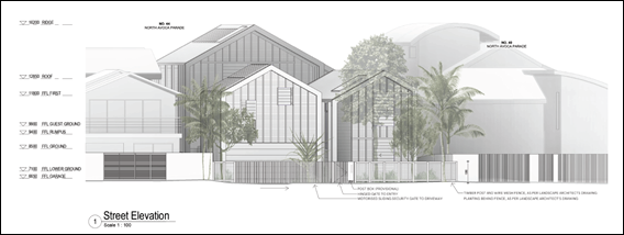
Figure 15 – Street Elevation
The height non-compliance will not have unreasonable impacts on the amenity of the adjoining residents by privacy, overshadowing or views as detailed in the compliance table and additional commentary below.
The proposed variation to the maximum building height applies only to a small section of the ridgeline of the east pavilion, with the majority of the roof contained within the building envelope. The design of the eastern pavilion roof provides greater environmental benefits, including increased effectiveness of the solar panels and maximising solar access to the main dwelling. The design preserves the essential character of the locality while providing for contemporary housing needs in keeping with the community expectations. The size and design of new residential housing within this beachside setting is commensurate to the location, aspect and land value. Combining a mixture of external materials and finishes will ensure the proposed development integrates and blends with both the natural and built environment.
The variation to the building height is supported and notwithstanding the numerical non-compliance the proposed development is considered to meet the objectives and underlying intent of the height control and is a compatible form of development that does not result in unreasonable environmental amenity impacts on a site within a coastal hazard area.
2.1.3 Setbacks
The development proposes front and side boundary setbacks that do not comply with the numerical provisions of the development controls. The Applicant has submitted a request to vary the front and side boundary setbacks, to demonstrate if the proposal has merit, consideration of the numerical non-compliance regarding the objectives of the control contained within clause 2.1.3 is discussed below.
The objectives of clause 2.1.3:
· To ensure that setbacks are compatible with adjacent development and complements the character, streetscape, public reserve, or coastal foreshore.
· To ensure the visual focus of a development is the dwelling, not the garage.
· To protect the views, privacy and solar access of adjacent properties.
· To maintain view corridors to coastal foreshores and other desirable outlooks.
· To maintain the scenic and environmental qualities of natural waterbodies and their foreshores and respond to site attributes such as topography.
· To provide deep soil areas sufficient to conserve existing trees or accommodate new landscaping.
· To provide appropriate articulation of facades and horizontal elements reduce the appearance of bulk and provides visual interest to the building and subsequent streetscape where they face a street frontage/s.
2.1.3.1(a) Front Setback
· Clause 2.1.3.1(a)(i) – The controls require the dwelling house to have 8.3m setback to the front boundary based on the average setback of the nearest 2 dwelling houses. The dwelling house has a front setback of 2.88m to 5.84m to the western elevations of the western pavilions. This represents a variation of 66% and 30% respectively and does not comply with the control.
· Clause 2.1.3.1(a)(iv) – The controls require a garage to have a minimum 1m setback behind the front boundary setback which has been established as 8.3m. Therefore, the proposed garage requires a 9.3m setback. A setback of 2.88m to 3.75m is proposed. This represents a variation of 69% and 60% respectively and does not comply with the control.
The proposed development seeks a variation to the front building setback and provides the following reasons in support of the proposal (summarised):
· The proposed garage/rumpus wing (west pavilion) aligns with the two-storey building on the on the adjoining property to the north of the subject site and has a setback of 1.7m. The proposed guest wing (west pavilion) extends no closer to the street boundary than the existing outbuilding on site.
· The proposed dwelling maintains the existing alignment, in terms of front setbacks, of existing buildings and garages along the eastern side of North Avoca Pde. The proposed front setback is representative of the established setback pattern for beachfront properties along the eastern side of North Avoca Pde and within proximity to the site.
· The position of the proposed garage is consistent with the location of other garages and carports in the street which are located either on or close to the front property boundary. Car parking structures within the front building setback area contribute to the established local streetscape character.
· The reduced setback will not result in any additional impacts to view sharing, privacy, or solar amenity to adjoining dwellings.
· The unbuilt upon portion of the front setback area will remain unencumbered and is to incorporate landscape plantings and grassed areas and including the front fencing will provide significant screening of new built form.
· The proposed dwelling maintains a rear setback in line with neighbouring residences to the north and south positioning the proposed development footprint within the central and western portions of the site. This approach will reduce potential impacts on privacy and support the ongoing and uninterrupted sharing of views across the site. In the context of the coastal location, where view sharing is particularly sensitive, a considered response to the siting of new built form is critical. Therefore, the proposed departure to the front building setback is considered justified, as the overall benefits of siting the proposed dwelling further westward considerably outweigh any potential negative impacts, which are deemed to be minimal, if any.
· The existing flood and coastal hazard considerations advocate for the bulk of development to occur within the central and western portions of the site. The proposed dwelling is positioned in an area of the site deemed most suitable for development and which will result in the least environmental impact.
· The west wing pavilion offers a well-articulated street presentation, compliant building height, combination of external materials and finishes and landscape replenishment. The proposed dwelling offers visual interest and minimises the appearance of bulk and scale. Encroaching elements would not be out of character or intrusive on the streetscape. The front setback variation is satisfactorily justified and within acceptable limits.
2.1.3.1(c) Side Setback
Clause 2.1.3.1(c) provides side setbacks for residential zoned land. It should be noted that clause 2.1.3.1(c)(iv) identifies that if the property is within the Coastal Hazard Planning Areas, Chapter 3.2 Coastal Hazard Management – Southern Area of CCDCP 2022 applies which provides reduced side setbacks if the land is identified as a Severely Impacted Land Parcel. Severely impacted land parcels apply to the area of land behind the Coastal Building Line (CBL) to a maximum of 250sqm. The area of the site landward of the Coastal Building Line, is greater than that specified in Chapter 3.2 and therefore cannot be applied to the proposal.
Clause 2.1.3.1c (i) applies to the proposal and requires:
· a 900mm setback for any part of the building with a height of up to 4.5m – the dwelling house pavilion structures comply, and,
· for any part of the building with a height of more than 4.5m—0.9m plus one quarter of the height of the building above 4.5m. The proposal encroaches into the side setback controls as stated below:
The required setbacks are provided relevant to the sections shown on the Architectural Plans as follows:
· Western Pavilion (garage and rumpus room) – Northern Side Boundary
o Section B1 West for Height of Building (HOB) of 5.501m is 1.150m. Setback proposed is 0.9m, a variation of 250mm or 22%.
o Section B1 East for HOB of 5.426m is 1.132m. Setback proposed is 0.9m, a variation of 232mm or 20%.
· West Pavilion (bedrooms 2, 3 and 4) – Southern Side Boundary
o Section B2 West for HOB of 5.857m is 1.234m. Setback proposed is 1.2m, a variation of 34mm or 3%.
o Section B2 East for HOB of 5.849m is 1.232m. Setback proposed is 1.2m, a variation of 32mm or 2.5%.
· Eastern Pavilion – Northern Side Boundary
o Section B3 West for HOB of 7.178m is 1.569m. Setback proposed is 0.9m, a variation of 669mm or 43%.
o Section B3 East for HOB of 6.838m is 1.484m. Setback proposed is 0.9m, a variation of 584mm or 39%.
· Eastern Pavilion – Southern Side Boundary
o Section B3 East for HOB of 5.984m is 1.340m. Setback proposed is 1.233m, a variation of 107mm or 8%.
The Applicant requests variation to the side setback as follows:
· The northern and southern common boundaries are shared with neighbouring dwellings and directly adjoin respective side setback areas that are landscaped and not used as living or principal private open space areas. Noting the urban context and relationship of buildings to each other, it is unlikely the resultant side setback departures would lead to any adverse impacts.
· It is noted that existing beach front dwellings on the eastern side of North Avoca Parade typically span the width of allotments and are positioned closer to both front and side boundaries. This pattern is likely in response to the coastal building line setback and coastal hazard considerations impacting the eastern portion of beach front properties.
· Windows for the proposed dwelling are also minimised to side facing building elevations to further protect neighbour amenity. Where proposed, windows are small and serve only upper-level bedrooms and bathrooms. Similar to neighbouring properties, the bulk of glazing is oriented to the east (beach front) and west (street front). There are no active use balcony areas directly facing neighbouring dwellings that may otherwise give rise to additional amenity impacts to the proposed departure.
· The northern and southern building elevations of the proposed dwelling are well articulated with suitable vertical and horizontal treatments incorporating a linked pavilion arrangement with unroofed central sun court. A mixture of external materials and finishes will reduce visual dominance and soften the appearance of new built form.
· The proposed dwelling is strategically positioned closer to the northern side boundary with the purpose of reducing the impact of overshadowing on the neighbouring dwelling to the south. Consequently, a lesser setback to the north is proposed.
· To address the impact of coastal inundation and coastal hazard risks, a minimum floor level applies to the site. Calculation of required side setbacks is determined by the building height which presents additional challenges in achieving strict compliance due to augmented building heights.
· The ground floor ocean terrace and first floor viewing deck are unenclosed but do include timber batten privacy screens to facilitate privacy, sunlight and breezes. The first floor viewing deck extends from the master bedroom, is intended for passive use only and setback from side boundaries greater than three metres.
· Non-compliant areas create no additional shadowing, amenity concerns or view impacts to that of a compliant design.
· It is to note proposed building heights at the boundary are compliant and well below the minimum 8.5 metres permitted. Combined with a combination of external materials and finishes including the retention of existing vegetation and landscape replenishment, the proposed departures are satisfactorily justified and acceptable.
Comment:
The cumulative impact of the proposed non-compliances of the building height, front and side boundary setbacks has been considered.
The locality of the area is undergoing a transition whereby existing cottages are progressively being replaced with larger contemporary dwellings designed to capture views of the coastline and respond appropriately to the coastal hazard affectation.
The proposal will result in a building of an increased bulk and scale to that currently exists on the site however is of a bulk and scale that is generally in keeping with the replacement of dwellings on the beachfront properties and compatible with the streetscape character and scenic quality of the beach frontage. There are sufficient landscaping opportunities proposed within the front setback to provide visual relief to the built form.
The proposal has considered potential privacy and amenity impacts from the reduced setbacks on adjoining development in terms of views, overshadowing and overlooking from reduced setbacks:
· Given the orientation of the site, any reasonable development within the subject site will have some impact on solar access to the southern neighbour however on balance, it is considered that the proposal has appropriately considered the principal areas of the neighbouring property and the shadow analysis provided with the application confirms that the development has maintained reasonable solar access in accordance with Council’s requirements.
· Overlooking is addressed by the number, size and placement of windows on side boundaries which has been kept to minimum. Windows facing neighbouring properties to the north and south are minimal in number and size where proposed, extensive glazed areas being proposed on the eastern (beachfront) and western (street front) elevations of the buildings. Existing and proposed landscape plantings will offer added screening and protection to maintain suitable levels of privacy and prevent overlooking.
· The proposal complies with the rear (beachfront) setback in line with neighbouring residences to the north and south, positioning the proposed development footprint within the central and western portions of the site which will reduce potential privacy impacts and maintain existing panoramic views.
The proposal has considered the provisions of development within the coastal hazard area. In this regard development on the beachfront is required to comply with the coastal building line (Chapter 3.2 Coastal Hazard Management of CCDCP 2022) and which requires the building to be setback as far landward as possible to withstand the effects of coastal processes, not give rise to increased coastal hazards on the site or adjacent land and have a floor level to avoid flooding, wave run up and storm inundation. The proposed dwelling is positioned in an area of the site deemed most suitable for development and which will result in the least environmental impact.
Taking into consideration the environmental impacts and characteristics of the site, variation to the front and side setbacks is considered a reasonable design response in this instance. The proposal has an acceptable bulk and scale and streetscape appearance and is not considered to have adverse privacy and amenity impacts on adjoining residential development as a result of the non-compliances. The proposal is consistent with the setback objectives in clause 2.1.3 and is supported.
2.1.4 Residential Amenity
2.1.4.1 Views
The proposal is not considered to impact on views of adjoining dwellings. Apart from the ground floor deck stairs, the proposed dwelling generally aligns with neighbouring dwellings to the north and south. Screening is provided to ground floor terrace and first floor deck to provide privacy however will not impact on scenic coastal views from adjacent dwelling houses.
The pitched roof design (although non-compliant with the building height control) with ridge running front to back permits view corridors to continue along side boundaries and not considered to impact on adjoining dwellings.
There are no existing views through the site from development on the opposite side of North Avoca Parade. Views from residential units at Levels 1 and 2 would largely be unaffected as currently exists, there would be little to no change to existing view corridors.
2.1.4.4 Sunlight Access
Shadow diagrams for the existing dwelling and proposed development are provided in the Architectural Plan set as Drawings 301, 302 and 303. The shadow diagrams indicate compliance is achieved to the POS of the subject dwelling located at the beachfront and the central courtyard although there is some additional overshadowing impact to the property to the south and identified as follows:
· The proposed dwelling would result in some additional overshadowing of the neighbouring property to the south during the winter solstice. However, this is considered reasonable and within acceptable limits for a residential setting. The shadow diagrams also demonstrate that the extent of shadows cast significantly decrease during the warmer months.
· The proposed breach of the 8.5m height control is not in itself considered to cause any increase in overshadowing to areas of private open space, or principal living areas for adjoining residential dwellings.
· The shadow diagrams indicate the proposed development will create some additional shadowing between 9am and 12pm to the northern and eastern elevations of the neighbouring dwelling to the south. However, the principal private open space area, considered to be the grassed beach front garden, will receive 50% unobstructed sunlight between 9am and 12pm as is presently the case.
· The shadow diagrams also indicate that a narrow north-facing highlight window of the neighbouring dwelling to the south will be in shadow from 9am to 12pm during the Winter solstice. However, will receive more than 50% sunlight between 12pm and 3pm.
· It is noted this is a small window that presently allows limited sunlight access due to shadowing cast by the existing dwelling on the subject site up until 12pm and its own shadowing at 3pm.
· The proposed development will slightly increase the extent of shadowing to the upper-level balcony of the neighbouring property to the south at 9am during Winter, whereas at 12noon and 3pm, shadowing remains unchanged from existing and would have a negligible impact.
The proposal generally complies with the objectives and facilitates solar access to the living areas and private open space areas of the proposed dwelling and neighbouring dwellings.
2.1.5 Car Parking and Access
· Clause 2.1.5b – 2 car spaces are provided as the dwelling has 4 or more bedrooms and complies with the controls.
· Clause 2.1.5c – car parking should be located behind the primary road setback. The proposal is designed with a double garage located forward of the primary road setback and therefore does not comply with the controls.
· Clause 2.1.5f – the maximum driveway width should be 4m at the street crossover. The proposal will have a driveway width of 5.5m to cater for access to the double garage.
The design of the proposal, setback of the garage and driveway width is supported despite the non-compliance with the controls for the reasons discussed above under clause 2.1.3.1(a) (iv). The proposal is consistent with the majority of properties within North Avoca Parade in the location of the garage at the site frontage.
Council’s Development Engineer has reviewed the proposal and raises no objections to the access arrangements. The proposed garage dimensions and internal driveway grades comply with AS2890.1:2004 – Off-street car parking.
The siting of the proposal complies with the objectives for dwelling houses and ancillary development and is supported on merit.
In summary, assessment of the application concludes that the proposal is satisfactory from a street and beachfront presentation and is also satisfactory in terms of amenity impacts, internal and external to the subject site.
Chapter 2.14 Site Waste Management
A Waste Management Plan has been submitted with the proposal. The proposal has demonstrated compliance with this chapter of the CCDCP 2022 and associated Waste Control Guidelines. Appropriate conditions are included in the development consent.
Chapter 2.17 Character and Scenic Quality
Character
The site is located within the character area: North Avoca 1: Ocean Beachfront GDCP 2013.
The character statement provides for the desired character as follows:
These should remain low-density residential foreshores where future development does not dominate the informal scenic quality of prominent backdrops to Gosford City’s ocean beaches, and new dwellings are surrounded by leafy gardens that provide protection from storm surges and shoreline erosion.
Ensure that new structures and alterations to existing buildings do not disrupt development patterns that are evident upon surrounding properties. Avoid disturbing natural slopes plus any existing trees that are visually-prominent foreshore features, and ensure a leafy character for these prominent backdrops to ocean beaches. Plant gardens and street verges with low hedges and salt-tolerant trees that are predominantly indigenous, clustered to maintain existing panoramic views. Facing beachfronts in particular, avoid tall retaining walls or fences, extensive terraces or driveways that would visibly compromise the desired leafy character. Plant low-growing “hedges” of indigenous shrubs and ground covers along boundaries and to stabilise dunes. Also, maintain the informal character of any existing wide street verges that are dotted with shady street trees.
Avoid the appearance of a continuous wall of foreshore development by setting all building works back from exposed fore-dunes, and by surrounding buildings with leafy gardens. Incorporate waterfront and street setbacks that are similar to the surrounding properties, and provide at least one wide side setback or step the shape of front and rear facades.
Minimise the scale and bulk of new buildings or additions to existing dwellings. Use irregular floorplans to create well-articulated forms, such as linked pavilions that are separated by courtyards and capped by individual roofs. All roofs should be gently-pitched to minimise the height of ridges, flanked by wide eaves and verandahs to disguise the scale of exterior walls. Facing the beach, disguise the impact of upper storeys by a combination of extra setbacks from the ground floor plus shady balconies and verandahs.
Reflect elements of traditional coastal architecture and minimise the scale of prominent facades by using extensive windows and lightly-framed verandahs plus a variety of materials and finishes rather than expanses of plain masonry. All dwellings should display a “street address” with verandahs or decks, and living rooms or front doors that are visible from the roadway. Avoid wide garages that would visually-dominate any front façade or block views between the dwelling and the street. Locate and screen all balconies or decks to maintain existing levels of privacy and amenity that are enjoyed by neighbouring dwellings.
Comment:
Over recent decades, the majority of original, traditional seaside cottages have been redeveloped for large, individually designed two storey houses that accommodate residents and holidaying visitors. The proposal is consistent with this trend and will replace the existing buildings on the site with a larger dwelling house and double garage.
The proposal reflects the existing character for development on North Avoca Beach which maintains the beachfront alignment of adjoining development setback behind a coastal building line. While this will result in an almost continuous wall of buildings along the beachfront the building footprint is concentrated within the central part of the site and toward the street frontage in response to coastal hazard risks and to allow for view sharing across side boundaries.
The proposal has a two-storey presentation to the beach with living areas located at the beachfront to obtain views with small open gardens also located at the beachfront, consistent with development along the beach. No change is proposed to the external ground level at the beachfront although the proposed dwelling will have a ground floor above existing ground level which is consistent with recently approved and constructed development in the street to address site constraints of flooding, coastal inundation and geotechnical requirements.
The street frontage setbacks are variable and changing when a site is redeveloped with larger building footprints and greater building mass including enclosed garages located at the site frontage and visible from the street. Tall front fencing is located on the front boundary for security purposes as regularly occupied rooms and living areas are orientated to the beach front. Notwithstanding this, the leafy character of the area is preserved by retaining significant trees and providing landscaping at the site frontage to reduce the visible impact of new development. The design of the proposal and location of car parking and landscaping is consistent with other existing developments and new construction in the street.
The form of the dwelling house is well-articulated, the linked pavilion design breaks up the building mass and provides private open space away from onshore winds with a central courtyard located toward the northern side boundary. The use of architectural features and a variety of external materials and finishes further enhances the design, to reduce perceived bulk and scale while increasing visual interest and presentation. Windows are minimised on side elevations. The rear elevation of the dwelling house contains extensive glazed areas, taking advantage of the available views, and provides changes in the rear alignment together with a centrally located upper-level balcony/deck to create architectural interest in the beachfront presentation of the development. Privacy screening is proposed to side elevations of outdoor living areas to minimise overlooking and provide privacy to adjoining neighbours.
The proposal is compatible with the desired and likely future character of the of the area. The scale of the dwelling house will be consistent with more recent developments along the beachfront and will provide an appropriate development for the site.
Scenic Quality
The site is located within the South Coastal geographic unit and the Avoca landscape unit which is of regional significance.
Detracting elements within the landscape unit for urban areas include overscale and prominently sited residential buildings, dense developments and excessive site coverage, especially on visible slopes and on beach front areas.
The proposed dwelling is consistent with the objectives of this Chapter in that the design retains the low-density characteristics of the area and is compatible in scale and bulk with existing development. The dwelling design appropriately responds to visible and physical constraints of the site.
The dwelling house will be visible from the beach and coastal areas however will maintain an appropriate presentation that is consistent with other more recent development along the beachfront and is not likely to have any adverse visual amenity on the scenic quality of the area and/or from coastal erosion in a significant storm event.
Chapter 3.1 Floodplain Management/Water Cycle Management
Chapter 3.1 seeks to minimise the impact of development on the natural pre-development
water cycle. This will lead to more sustainable outcomes that will protect the environment.
The Stormwater Management Plan submitted with the application prepared by ITM Design Pty Ltd, Rev A dated 27 June 2023 has been reviewed by Council’s Development Engineer.
Whilst no objections are raised, the connect straight into Councils Drainage Pit (DPIT-31518) is not supported. Revised plans will be required with outlet similar to existing kerb outlet to south (as seen on survey plan) and can be addressed at construction certificate stage. Conditions have been applied to address the above comments.
The Erosion and Sediment Control Plan is considered satisfactory.
Chapter 3.2 Coastal Hazard Management
The proposal has been assessed in accordance with the relevant provisions of Part C: Southern Area (Former Gosford LGA) of Chapter 3.2 Coastal Hazard Management of CCDCP 2022.
The Coastal Hazards Mapping is identified in Figure 16 below and indicates the following:
· Coastal Building Line (CBL) – thick red lines.
· Coastal Hazard Area (where piling foundation is required) is hatched in pink.
· Zone of Slope Adjustment (zSA) 2014 Immediate hazard line – red dashed line.
· Zone of Slope Adjustment (zSA) 2050 – yellow dashed line.
· Zone of Slope Adjustment (zSA) 2100 – orange dashed line.
· Zone of Reduced Foundation Capacity (zRFC) 2014 – red line.
· Zone of Reduced Foundation Capacity (zRFC) 2050 – yellow line.
· Zone of Reduced Foundation Capacity (zRFC) 2100 – orange line.
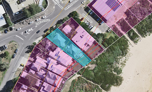
Figure 16 – Coastal Hazards Mapping
There is some discrepancy between the alignment of the aerial photography and the plan in relation to the property boundary. Regardless, when aligned with the property boundary, the proposed development is located within the Coastal Hazard Area. A Coastal Building Line (CBL) applies to coastal frontage areas and any application is to address coastal hazard impacts, including erosion, inundation and wave runup, on property and development.
The following documentation has been provided with the development application in accordance with clause 3.2.3.5 and included as Attachments to this report:
· Coastal Engineering Advice prepared by Royal HaskoningDHV dated 14 November 2023 – refer Attachment 5.
· Geotechnical Assessment, prepared by CK Geotech Pty Ltd, Ref: CKG 1034-1R dated 7 March 2024 – refer Attachment 6.
· Architectural plans showing the location of the 6m and 10m foreshore building line – refer Attachment 2.
Clause 3.2.3.3 Coastal Building Line
Clause 3.2.3.3 states:
a All new development must be constructed landward of the coastal building line;
b Where new development is to be protected by an existing approved seawall or terminal revetment, then standard setbacks will apply for areas landward of that seawall once the seawall has been constructed.
In accordance with clause 3.2.3.3 of CDCP 2022, a coastal building line (CBL) applies to coastal frontage areas. All new development must be constructed landward of this line. The CBL has been defined as the general allowable setback from the seaward cadastral boundary for beachfront property, being:
· 6m for single storey dwellings; and
· 10m for multi storey structures.
The location of the CBL is identified by the foreshore setback dimensions on the Architectural Plans, as shown on the Site Plan excerpt below at Figure 17. In this regard the 10m setback line applies to the two-storey dwelling and as shown in Figure 16 above, the immediate hazard line and the CBL are seaward of the proposed main structure inclusive of the eastern deck other than a minor encroachment of this deck of approximately 0.7m. Clause 3.2.3.4(d) permits ancillary structures forward of the CBL where this will not give rise to coastal erosion or increase the risk to property and life.
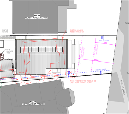
Figure 17 – Excerpt from Site Plan
showing location of the Coastal Building Line / Foreshore Setback
In relation to the encroachment of the eastern deck, the Coastal Engineering Advice states:
The following is noted in relation to the proposed seaward deck, which would be an ancillary structure at the subject property:
· Given the minor scale of this structure and its location above the region of wave action and runup, it would not give rise to coastal erosion.
· Also, given the lightweight construction of the timber deck structure, it would not be expected to significantly increase the risk to property and life.
· Furthermore, and to fully mitigate any residual risk, the deck would be designed to cantilever seaward of the coastal building line by structurally attaching the seaward portion to building components founded landward of the building line.
On this basis the proposal complies with clause 3.2.3.3(a).
Clause 3.2.3.3.2 All Development
a. Council will not permit new buildings or any built structures to be constructed on, over or below the land which has been identified seaward of the coastal building line (except where provided by s.3.2.3.4).
Comment:
It has been established above in clause 3.2.3.3(a) the proposed location of the dwelling house is landward of the of the CBL other than the eastern portion of the eastern deck which encroaches into the 10m setback by 0.7m. This encroachment is permissible based on clause 3.2.3.4(a) of CCDCP 2022, in accordance with the Coastal Engineering Advice as geotechnical engineering advice demonstrates significantly reduced erosion/recession potential on the subject site. With appropriate structural engineering input, and the foundation recommendations of the geotechnical engineer, a structure can be constructed at an acceptably low risk of damage at the subject property.
b. All structures constructed within a designated Coastal Hazard Area shall:
i. be compatible with the coastal hazards identified;
ii. be founded landward of the coastal building line;
iii. not give rise to any increased coastal hazard;
iv. be designed to not be damaged by the designated hazard;
v. give consideration to the effects of larger events than the designated hazard;
vi. be constructed in a manner which overcomes any problem from the coastal hazards of runup and inundation; and
vii. be set back as far landward as practicable.
The Coastal Engineering Advice states:
If the foundations for the proposed development are designed in accordance with Section 6.2, the development is considered to be consistent with Items (i), (ii), (iv) and (v) above.
Based on existing ground surface levels and the minimum required floor levels as noted in Section 7, the proposed development is considered to be consistent with the requirements of Item (vi).
Given that the proposed development would be elevated on piles above most wave action, wave reflections due to the development would be avoided and it would not be expected that there would be significant impacts on neighbouring developments. Therefore, the proposed development is consistent with Item (iii).
Although Item (vii) is not strictly a coastal engineering matter, it is noted that the proposed development would be located landward of both the existing development and the coastal building line. Therefore, in addition to satisfying Item (ii), it is considered that the proposed development would meet the intent of Item (vii).
The site is located within the coastal hazard area where piling is required into the 2100 Stable Foundation Zone.
The Geotechnical Assessment indicates that a standard footing system for the site is not suitable and shall be designed by a suitably qualified Structural Engineer. The geotechnical report notes that dense / hard residual soils and weathered rock of the Narrabeen Group Terrigal Formation could be present between depths of about 11 to 14 m at this site.
The Geotechnical Engineer has recommended that piled footings within the Zone of Slope Adjustment (ZSA) up to depths of approx. 12 to 14 metres from existing surface levels are required on the basis that dense / hard residual soils and weathered rock of the Narrabeen Group Terrigal Formation could be present between depths of about 11 to 14 m at this site.
The Coastal Engineer states that while very dense marine sands are present within the area of active coastal erosion/recession (i.e., at a level above about RL -1) and may reduce the erosion potential and future recession at the site, the effect of this material on the realisation of coastal erosion/recession hazards would likely be negligible and the assessment has been conservatively assumed that the entire subsurface in the area of active coastal erosion/recession is erodible
Section 6.2 of the Coastal Engineering Advice provides foundation design recommendations which states:
The 2100 Stable Foundation Zone occurs below RL -1 across most of the subject property; only 11 m of the most landward portion of the property is characterised by stable foundation conditions occurring above this level. Therefore, piles would need to be embedded below RL -1 to a sufficient depth for any part of a structure located more than 11 m seaward of the landward property boundary to develop the capacity to support the structure loads applied. The required depth of piling reduces moving landward from this location.
Detailed foundation design, including provision of specific recommended pile depths, is beyond the scope of the investigation reported herein. However, the following recommendations are provided:
· The piles should be designed to support the loads from the structure and other conventional structural actions, plus wave impact loading and loading from a collapsing sand dune during or following storm erosion as per Nielsen et al (1992), with an allowance for a scour level of RL -1 over the entire development. The wave impact and sand slumping forces should be provided by a coastal engineer as part of detailed design.
· Service pipes and the like at the subject property should be supported on the structure such that they would not be undermined or damaged in coastal storms.
Comment:
The proposed development is located landward of the CBL and is considered to withstand the effects of coastal processes and would not be expected to give rise to any increased coastal hazards on the site or adjacent land if founded in accordance with Section 6.2 of the Coastal Engineering Advice over the design life which is established by the Coastal Engineer of between 40 and 60 years for beachfront development.
The proposal has given consideration to the effects of larger events than the designated hazard. The design modelling of the Coastal Engineer indicates that:
Furthermore, designing the proposed development with piles extending into the 2100 Stable Foundation Zone as described in Section 6.2 would be expected to maintain structural integrity of the development to well beyond a typical 40- to 60-year design life and for more severe events than the 100-year ARI event (say up to 1,000-year ARI) for at least several decades.
The proposal will be constructed in a manner which overcomes any problem from the coastal hazards of runup and inundation. The proposed development is located landward of the CBL and is setback as far landward as practical. The building will have an acceptably low risk of damage from runup and inundation subject to compliance with the coastal engineering reports and plans.
c. Council will not permit the redevelopment of existing buildings within the Coastal Hazard Area unless the foundation design is demonstrated to have been constructed to withstand designated coastal processes and is certified by a coastal and structural engineer.
Comment:
If recommendations outlined in the Coastal Engineering Report, the proposal would be designed to withstand the designated coastal processes.
d. Council may permit renovations to existing buildings seaward of the coastal building line if it is demonstrated that works will not increase the level of coastal hazard to the existing and neighbouring properties, and the work can be fully located within the pre-existing footprint. If the proposed works include major works, e.g., continuous footings, slab, and masonry construction, a supporting Coastal Assessment Statement suitable to the scale of the proposal will be required.
Comment:
A new dwelling house is proposed to be constructed.
e. Council will permit cantilevering and engineered design seaward of the coastal building line provided the following is satisfied:
i. Building footings must be entirely founded landward of the coastal building line.
ii. The structure must not project seaward of a line drawn from the closest corner of the closest neighbouring dwellings either side of the subject lot; the aim being to align with existing buildings’ setbacks to provide equity and consistency.
Comment:
The proposed rear setback is generally aligning with adjoining dwellings as shown on the part site plan in Figure 5 and generally located landward of the CBL.
The rear presentation to the beach will maintain a similar setback to the beach as currently exists. The impacts of the proposed dwelling house in terms of consideration of views, overshadowing and overlooking has been undertaken. The proposal is supported and not considered to have adverse impacts on the privacy and amenity of adjoining residences.
f. In areas subject to coastal inundation within a Coastal Hazard Area, minimum building floor levels shall be designed to overcome flooding and storm inundation by including an additional freeboard of 0.5m above the 1% AEP maximum wave inundation level.
Comment:
The building is designed to overcome flooding and storm inundation as stated in Section 7 of the Coastal Engineering Advice which states:
After waves break in the surf zone, they can run up the beach and foredune and have the potential to inundate beachfront development. Present-day maximum wave runup levels (assuming an infinite foreshore height) of around RL 5 in the vicinity of the subject property were determined as part of the 2014 Open Coast and Broken Bay Beaches Coastal Processes and Hazard Definition Study.
Council has adopted sea level rise (SLR) planning benchmarks of 0.4m in 2050 and 0.9m in 2100 (relative to 1990), as described in WorleyParsons (2014). Therefore, runup levels in 2050 and 2100 can be estimated as up to about RL 5.4 and RL 5.9 respectively for these benchmarks.
Seaward of the subject property, the dune crest has an elevation of about RL 7. As such, wave overtopping of the dune crest would not be expected at the subject property. However, if erosion/recession led to loss of the dune (as per the 2050 or 2100 Zone of Slope Adjustment positions), inundation may propagate into the subject property. Nevertheless, as noted in Section 3, ground levels over the subject property are generally at or around RL 6.4 which indicates that maximum wave runup levels would be at least 0.5 m below the existing ground surface up to 2100.
A minimum habitable floor level of RL 7.08 is noted on the Flood Information Certificate issued by Council for the subject property. This is required to ensure that the proposed house and guest residences are at a low risk of damage due to coastal inundation. The proposed finished floor level for the lower ground residence is RL 7.1, while the ground floor residence has a proposed finished floor level of RL 8.5. As such, the proposed floor levels comply with the requirements of the Flood Information Certificate.
From a coastal inundation perspective, it is recommended that the garage floor level is elevated above RL 6.4, such that it is located above the adjacent ground surface levels7 while also essentially providing a freeboard of at least 0.5 m above the 2100 maximum wave runup level.
However, it is understood that the subject property will be subject to the requirements of Chapter 3.1 of DCP 2022 (Floodplain Management), which requires non-habitable floor levels (e.g., garages) at least 300 mm above the surrounding finished ground level, which indicates that a minimum non-habitable floor level of around RL 6.65 will be required. The proposed finished floor level of the garage is RL 6.65, which complies with the above recommendations.
In practice, any overtopping flows would “fold over” the crest of the dune and travel as an intermittent sheet flow at shallow depth, spreading out and infiltrating over landward areas. A significant reduction in the velocity and depth of the runup would be expected within the order of 10 m landward from the foreshore crest.
As previously stated, it is considered the recommendation of the external consultants can be relied upon for the assessment of the proposed dwelling house, subject to conditions for the foundation design and implementation of the requirements of the expert reports.
g. Maintenance of existing buildings is permitted, provided that the maintenance work does not change the size, scale, or the building footprint of the structure.
Comment:
New dwelling house proposed to be constructed.
h. Structural design of buildings and foundations shall take into account storms greater than the design storm event, and that erosion/ runup/ inundation may exceed the design storm event.
Comment:
Section 8 of the Coastal Engineering Report has considered larger events than the 100-year ARI Event. As the design event and planning period becomes more severe, the required depth of piling essentially increases. The severity of the erosion and inundation for an event exceeding the 100-year ARI event wave inundation may exceed the levels predicted although inundation is unlikely to be an issue at the subject property with floor levels being above the natural ground surface.
Furthermore, the coastal engineer states that designing the proposed development with piles extending into the 2100 Stable Foundation Zone as described in Section 6.2 would be expected to maintain structural integrity of the development to well beyond a typical 40- to 60-year design life and for more severe events than the 100-year ARI event (say up to 1,000-year ARI) for at least several decades.
i. Building footings including strip-footings and/or isolated pier construction are to be designed to ensure safe bearing below or beyond the calculated zone of reduced foundation capacity.
Comment:
See response under clause 3.2.3.3.2.a.
j. Where structural consideration of coastal forces is required the engineer shall take into account the forces generated by coastal processes, possible dune slumping, loss of support, slope readjustment, changing water table as well as the normal structural and foundation considerations. Foundation design shall extend beyond the reduced foundation capacity zone of influence.
Comment:
See response under clause 3.2.3.3.2.a.
k. In areas of high or moderate cliff instability risk within a Coastal Hazard Area, a geotechnical engineer site assessment will need to demonstrate that the position of the building on the site and its design has taken into account any expected foundation impediments (Refer Cliffline Hazard Definition Study for Tudibaring Headland).
Comment:
Not applicable to the proposal.
l. Any sand excavated during building works should, where possible, remain within the same embayment, and requires approval by Council to be reused in other beach locations. It should be demonstrated to Council that the sand is clean and free of deleterious matter.
Comment:
The owner does not propose to place excavated sand on the beach.
Planning Summary
The documentation submitted with the application, including the Coastal Engineering Advice and Geotechnical Assessment demonstrate the proposal is satisfactory in relation to the impacts of coastal hazards on the site.
The proposed development will have an acceptably low risk of damage if founded in accordance with the design parameters in these reports. The proposal is not likely to cause increased risk of coastal hazards on the site or other land.
The proposal is of a satisfactory height, bulk and scale and provides equity in redevelopment of the site which allows for view sharing and does not adversely impact on privacy and overshadowing to existing adjoining development.
The proposal is supported by Council’s Coastal Planning Officer; the proposal would not increase coastal hazard at the site and that the proposal at an acceptable risk, provided that the proposed structure should be founded on suitable footing system and should be designed to support all the loads and structural actions.
Conditions of consent are imposed for the foundation design and implementation of the requirements of the expert reports including certification from the Geotechnical Engineer that all works have been carried out in accordance with the expert reports, plans and recommendations, refer Conditions 2.3, 5.3, 6.4.
Chapter 3.5 Tree and Vegetation Management
The proposal is supported by an Arboricultural Impact Assessment that provides general tree protection advice. The Architectural Plans indicate detail of trees to be removed and retained.
The proposal has been reviewed by Council’s Tree Assessment Officer. No objection is raised to the proposal and the following comments are provided:
A mature Norfolk Island Hibiscus is proposed to be removed from the front yard with a smaller Dragon tree. Norfolk Island Hibiscus are generally an undesirable species known for their seed pods that cause skin irritation. The rear yard could not be accessed at the time of inspection but noted from the arborist report that Banksia and Norfolk Island Hibiscus are to be removed from between the side boundary and new dwelling.
Trees to be retained on the adjoining property (Banksia and Palm) are not expected to be adversely impacted but noted that the Arborist recommends some pruning of overhanging branches.
Landscape Plans indicate planting of new trees. Plantings are appropriate for the beachfront location. A standard tree replacement condition has been provided.
Chapter 3.7 Geotechnical Requirements for Development
Chapter 3.7 provides a management strategy for development in areas identified as having landslip potential and guidelines on the content of geotechnical reports.
The Geotechnical Assessment prepared by CK Geotech Pty Ltd, Ref: CKG 1034-1R dated 7 March 2024 provides recommendations for foundation designs which together with the Coastal Engineering Advice are to be designed by a Structural Engineer. Conditions of consent are imposed for the design, implementation and certification of the structural design of the foundations and piling for the proposal, refer Conditions 2.3, 5.3, 6.4.
Likely Impacts of the Development
Section 4.15 (1)(b) of the Environmental Planning and Assessment Act 1979 requires consideration of the likely impacts of the development including environmental impacts on both the natural and built environments, and social and economic impacts in the locality.
In this regard, potential impacts related to the proposal have been considered in response to SEPPs, LEP and DCP controls outlined above and summarised below:
Built Environment, Context and Setting
The subject site is zoned R2 Low Density Residential under CCLEP 2022 and adjoins residential developments comprising two-storey dwellings.
A thorough assessment of the impacts of the proposed development on the built environment has been undertaken in terms of CCLEP 2022 and CCDCP 2022 compliance. Despite non-compliance with the building height and side setbacks, the proposal generally complies with the development controls as discussed throughout the report and the proposal will not have any unreasonable impacts on the character or amenity of the area in terms of overshadowing, privacy, noise generating activities and views. The proposed built form is considered acceptable in the context of the site, subject to the recommended conditions of consent.
Access and traffic
The local road network is considered to have adequate capacity to cater for the proposed development and minimal increase in traffic generated by the proposal. Adequate provision is provided for onsite car parking.
Natural Environment
The proposal is satisfactory in relation to impacts on the natural environment as identified throughout this report for land subject to coastal hazard risks. There will be no significant impact upon the natural environment as a result of the proposed modifications.
Economic and Social Impacts
The site’s main value lies in its location and aspect. The proposal provides renewed housing stock in the local area and would allow the site to achieve its maximum value with limited environmental impact. The design preserves the essential character of the locality while providing for contemporary housing needs in keeping with the community expectations. The size and design of new residential housing within this beachside setting is commensurate to the location, aspect and land value. No unreasonable economic or social impacts will arise from the approval of the dwelling house.
Suitability of the Site for the Development
Section 4.15 (1)(c) of the Environmental Planning and Assessment Act 1979 requires consideration whether the site is suitable for the proposed development.
The site is zoned is zoned R2 Low Density Residential under CCLEP 2022. Dwelling houses are permissible in the zone.
The site is located within a coastal hazard area. The impact of the proposal within the sensitive coastal location has been considered. The proposed development will have an acceptably low risk of damage if founded in accordance with the design parameters in the supporting Coastal and Geotechnical reports and plans which demonstrate the proposal is satisfactory in relation to the impacts of coastal hazards on the site. The proposal is not likely to cause increased risk of coastal hazards on the site or other land.
As such the site is considered is suitable for this type of development subject to conditions.
Any Submission made in Accordance with the EP&A Act or Regulations
Section 4.15 (1)(d) of the Environmental Planning and Assessment Act 1979 requires consideration of any submissions received during notification of the proposal.
The proposed modification has been notified in accordance with the provisions of Central Coast Development Control Plan 2022. The application was notified for the period 29 January 2024 to 12 February 2024.
No public submissions were received.
Submissions from Public Authorities
The application did not require referral to any public authority.
Internal Consultation
|
Development Engineer |
|
Supported subject to conditions. |
|
|
Tree Assessment Officer |
Supported subject to conditions. |
||
|
Coastal Planning Officer |
|
Supported subject to conditions. |
|
Ecologically Sustainable Principles
The development has been assessed having regard to ecologically sustainable development principles and is consistent with the principles.
The development is considered to incorporate satisfactory stormwater, drainage and erosion control and the retention of vegetation where possible and is unlikely to have any significant adverse impacts on the environment and will not decrease environmental quality for future generations. The proposal does not result in the disturbance of any endangered flora or fauna habitats and is unlikely to significantly affect fluvial environments.
Climate Change
The potential impacts of climate change on the development proposed to be modified have been considered by Council as part of the assessment of the application.
This assessment has included consideration of such matters as potential rise in sea level; potential for more intense and/or frequent extreme weather conditions including storm events, bushfires, drought, flood and coastal erosion; as well as how the proposed development may cope, combat, withstand these potential impacts. The proposed development is considered satisfactory in relation to climate change.
The Public Interest
Approval of the development is in the public interest for the following reasons:
· The development has been prepared having regard to the aims and objectives of relevant state and local environmental planning instruments and generally complies.
· The development is deemed to have no negative environmental, social or economic impacts to surrounding residential dwellings or the public domain.
· Subject to various mitigation measures recommended by consultants and Council’s technical officers, the proposal is deemed to have no negative environmental, social or economic impacts to surrounding residential dwellings or the public domain.
· The development is designed and sighted to make a positive contribution to the streetscape and result in a quality residential development.
· The development is sympathetic to the existing character of the surrounding neighbourhood and respects and maintains privacy to and from neighbouring properties.
Political Donations
During assessment of the application there no political donations were declared by the applicant, applicant’s consultant, owner, and/or residents.
Other Matters for Consideration
Development Contributions Plan
The land is subject to the Central Coast Section 7.12 Local Infrastructure Contribution Plan 2023 which was adopted by Council on 28 November 2023.
Development that is not subject to a section 7.11 contribution under any other contributions plan adopted by the Council under the Environmental Planning and Assessment Act 1979, may be subject to levy of section 7.12 contributions unless is development that is exempt under Clause 1.5 of this Plan.
Development contributions are only levied where the proposal meets the cost of works thresholds and not subject to any exemption under this plan. The proposed cost of works is $2,380,260 however the development is for a dwelling house and is exempt under clause 1.5 of the plan; no development contributions levy is applicable in this instance.
Water and Sewer
Water and Sewer services are available to the site. The existing CICL water main is adjacent to the front boundary. Any driveway construction over the main or structures adjacent to must comply the building adjacent to water main guideline. A Section 305 application will be required to obtain a Section 307 Certificate of compliance. The resulting Section 306 letter of requirements will contain Water Authority conditions if required.
Air Quality
Standard dust condition is applied during construction works.
Noise
The plant room is depicted within the undercroft subfloor with decking over on the Lower Ground Floor level, therefore noise impacts from mechanical plant and equipment on adjoining residential receivers is not expected. Standard condition for construction times is applied.
Conclusion
This application has been assessed under the heads of consideration of Section 4.15 of the Environmental Planning and Assessment Act 1979 and all relevant instruments and policies. Following a thorough assessment of the relevant planning controls and the key issues identified in this report which have been resolved satisfactorily through amendments to the proposal, it is considered that the application can be supported, noting that:
· The Panel can be satisfied that the provisions of the following State Environmental Planning Policies have been considered and satisfied:
i) State Environmental Planning Policy (Sustainable Buildings) 2022
ii) Chapter 2 and Chapter 4, section 4.6(4) of the State Environmental Planning Policy (Resilience and Hazards) 2021
· The Panel can be satisfied that the provisions of clause 5.21 Flood Planning, clause 7.1 Acid Sulfate Soils and 7.6 Essential Services of Central Coast Local Environmental Plan 2022 have been considered and satisfied.
· The Panel can be satisfied that the relevant provisions of the environmental planning instruments, plans and policies that apply to the development have been considered in the assessment of the application, in particular the impacts of development within the the sensitive coastal location.
· The proposed development is not expected to have any adverse social or economic impact.
Accordingly, the application is recommended for approval pursuant to Section 4.16 of the Environmental Planning and Assessment Act 1979, subject to conditions.
|
3.3 |
DA/2461/2023 - New Dwelling House & Demolition of Existing Structures - 42 North Avoca Parade North Avoca NSW 2250 |
|
Attachment 1 |
Draft Conditions - DA/2461/2023 - 42 North Avoca Parade North Avoca |
|
DA/2461/2023 - New Dwelling House & Demolition of Existing Structures - 42 North Avoca Parade North Avoca NSW 2250 |
|
|
Attachment 3 |
Redacted - Architectural Plans - PAN-401899 - 42 North Avoca Pde, NORTH AVOCA - DA/2461/2023 |
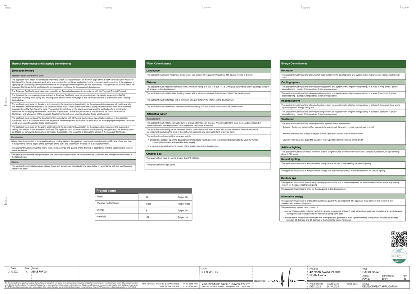
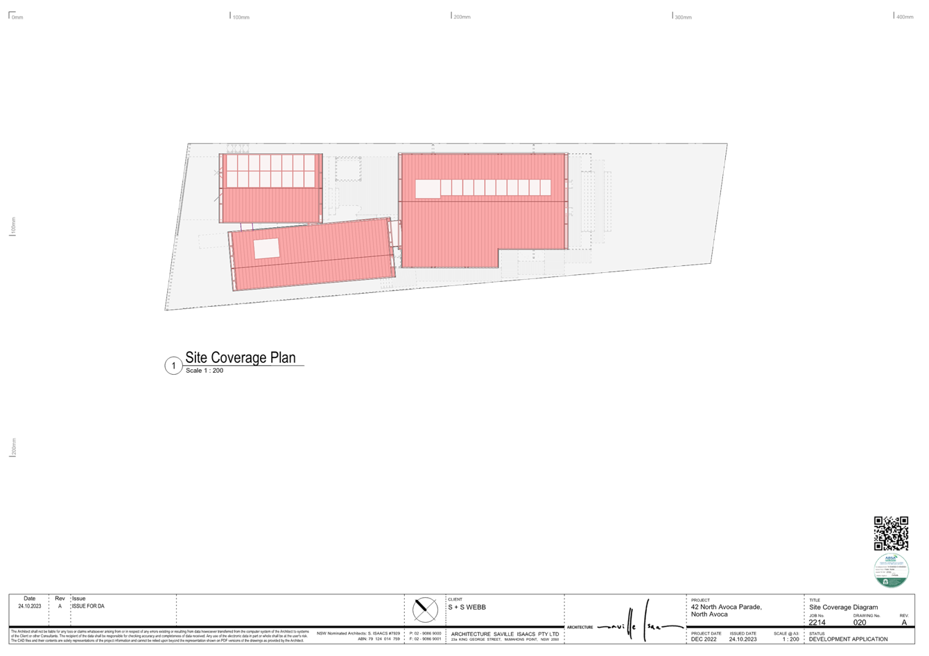
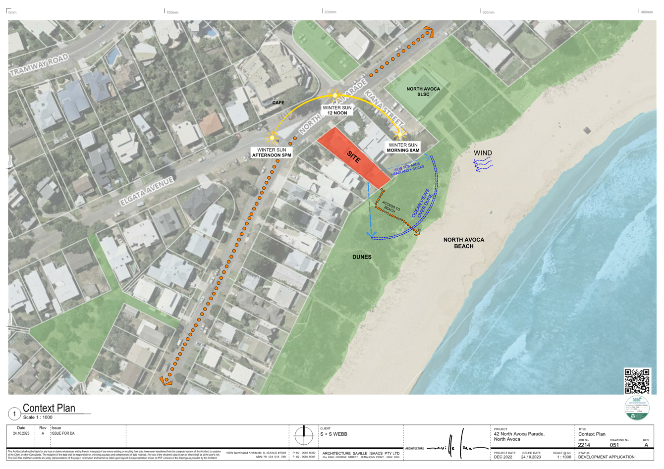
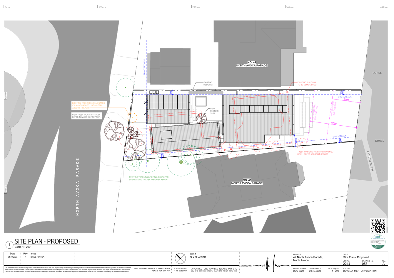
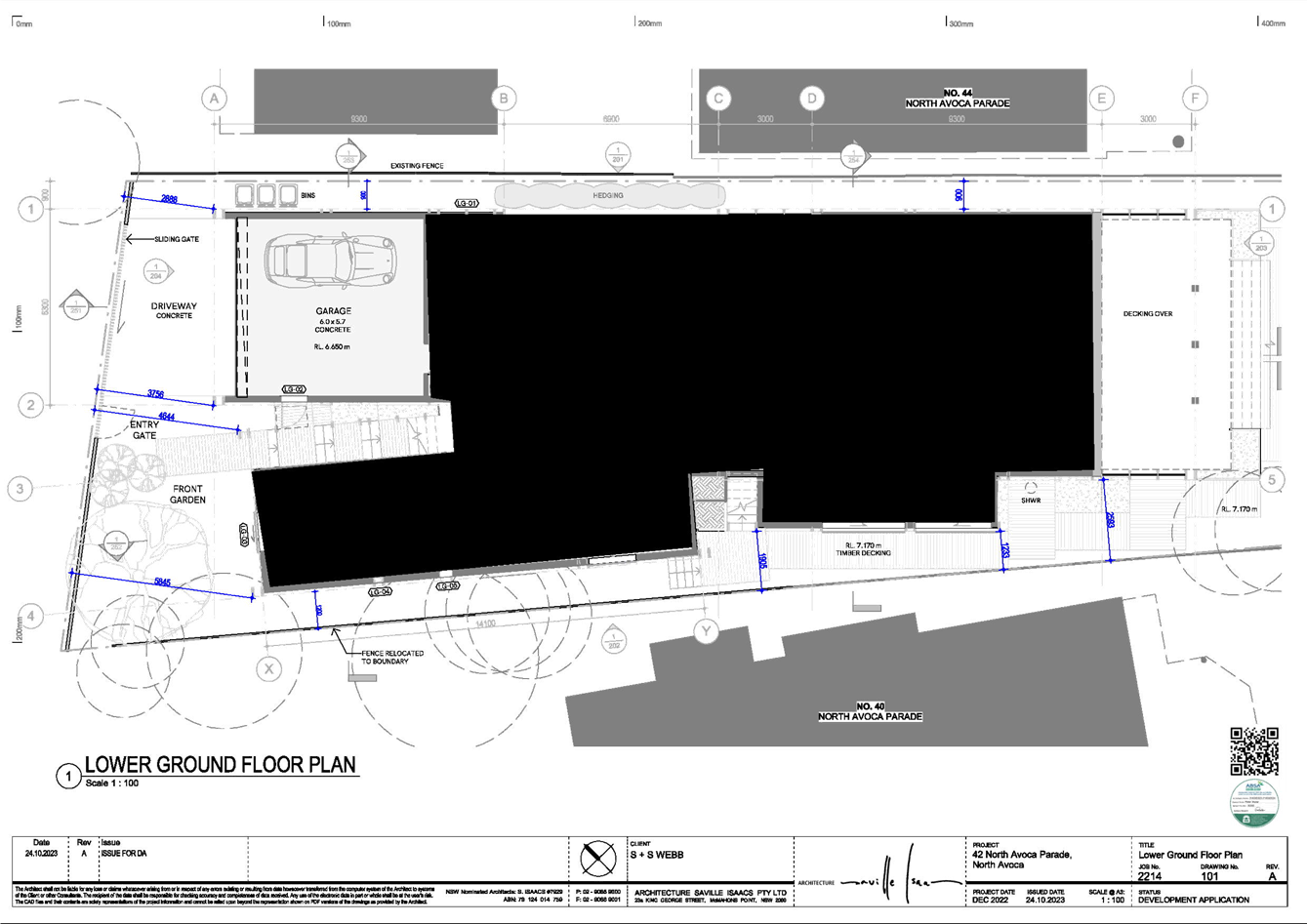
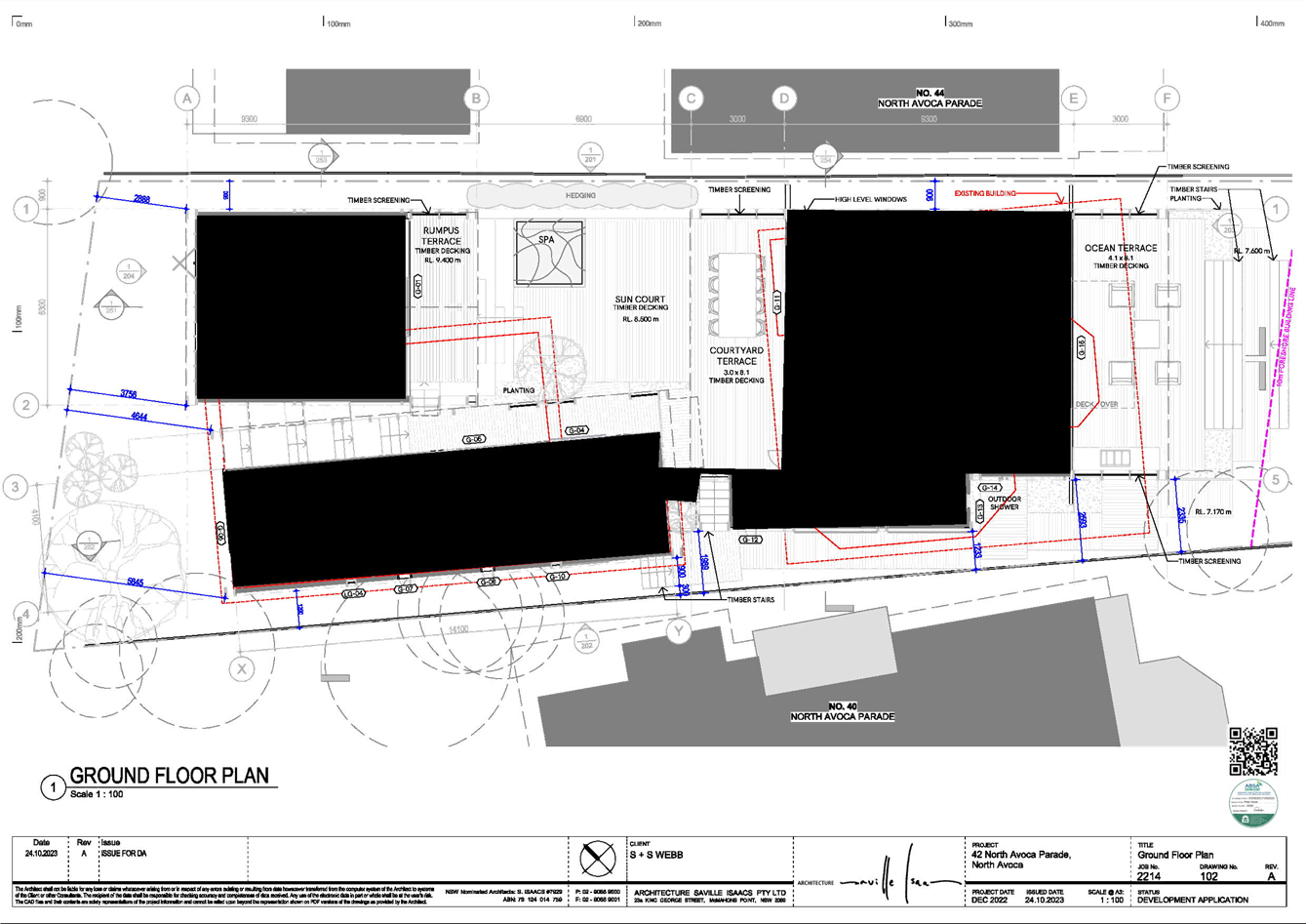
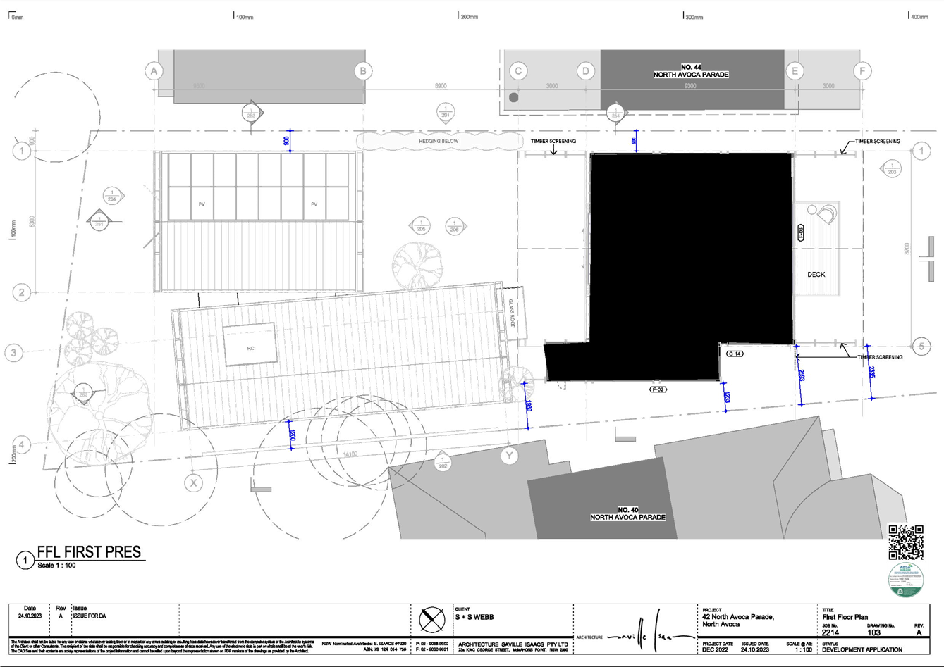
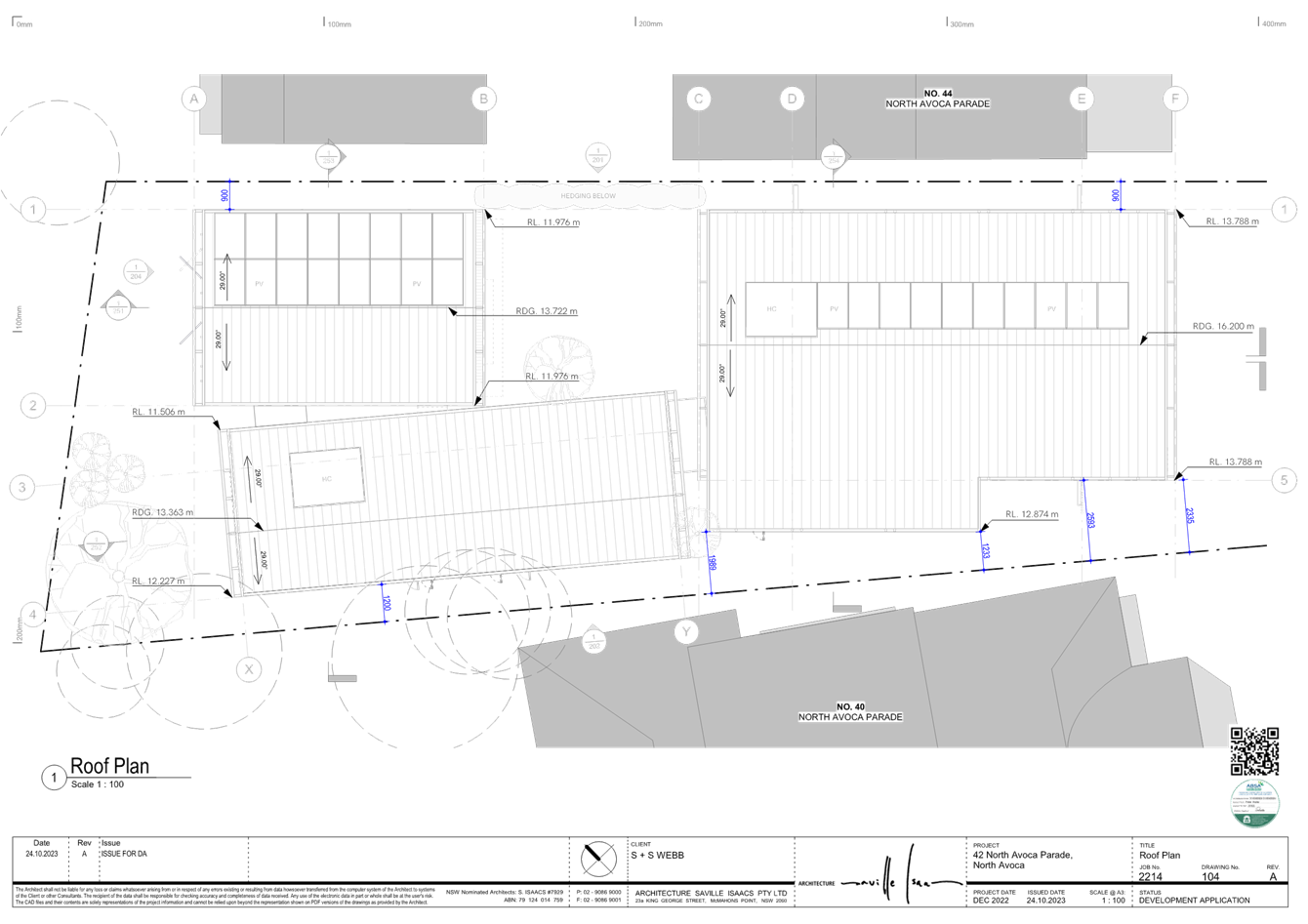
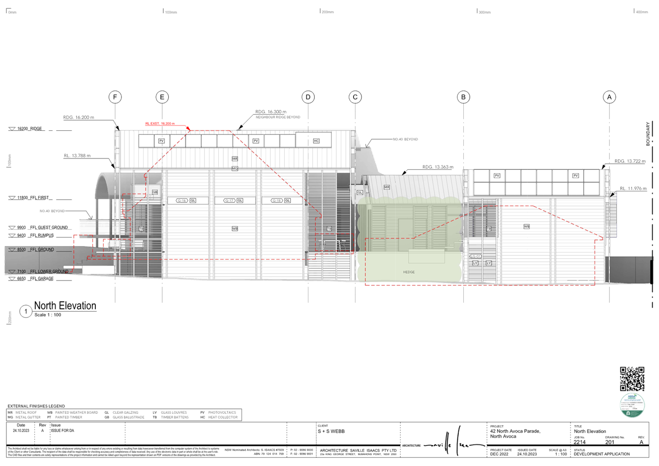
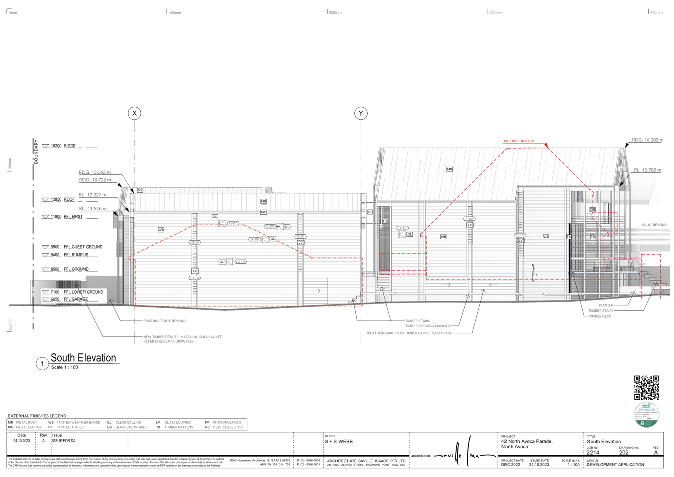
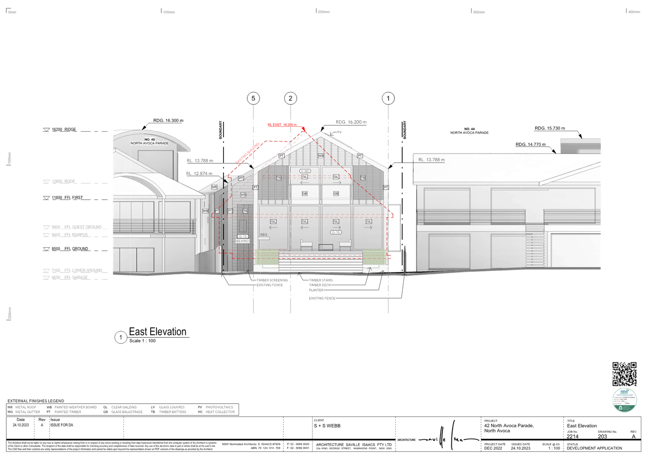
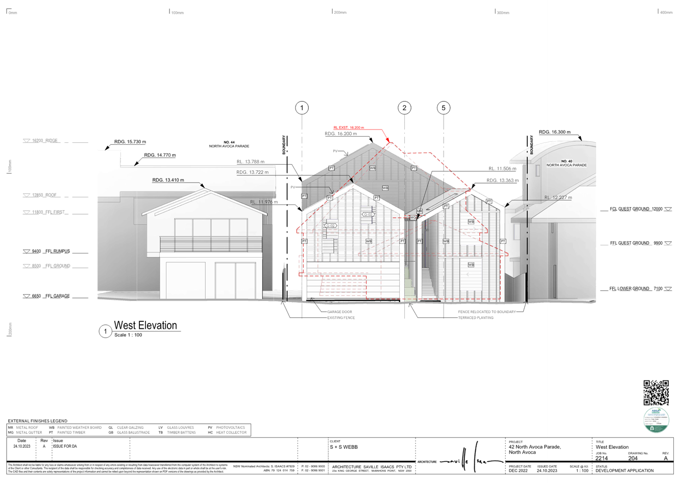
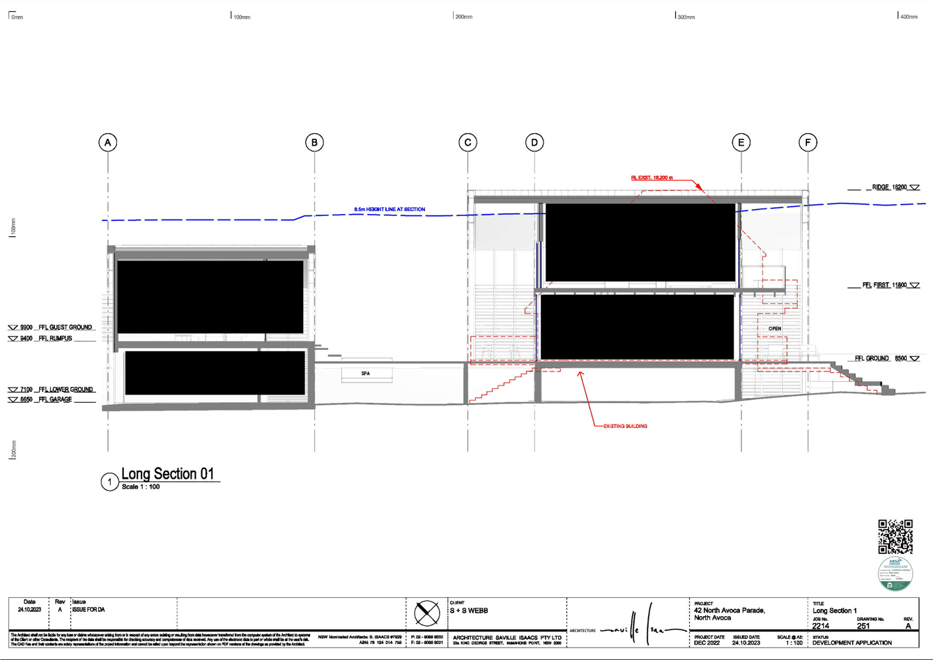
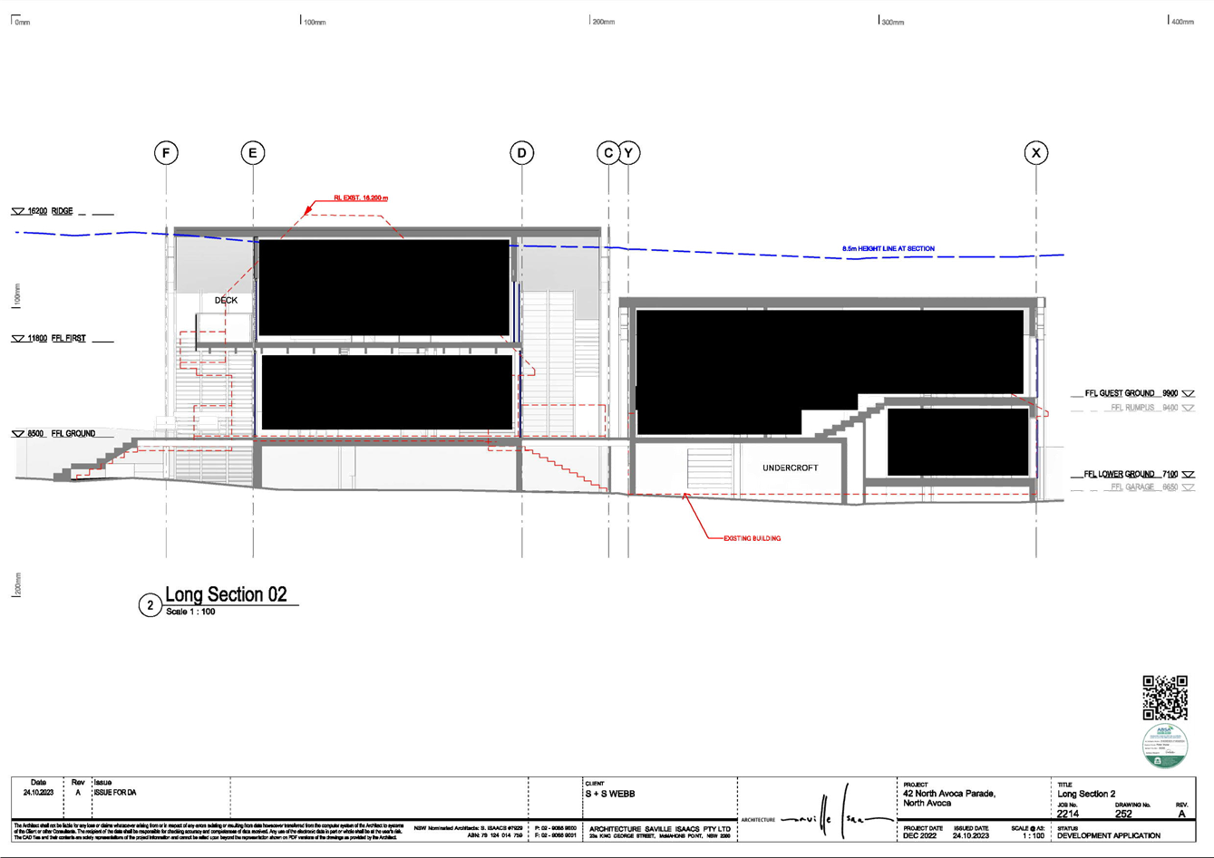
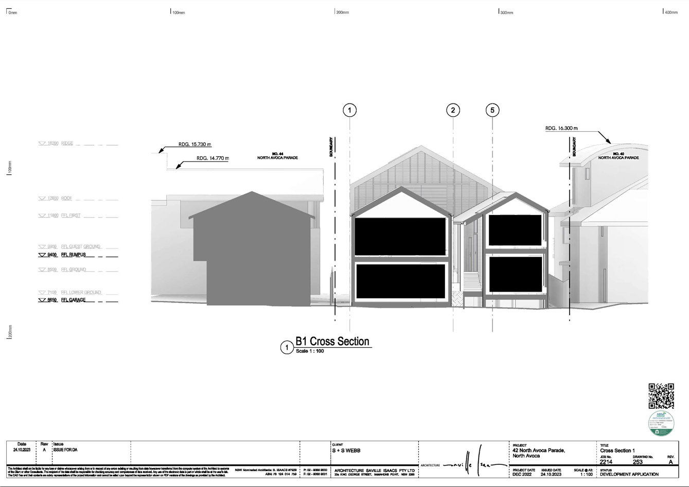
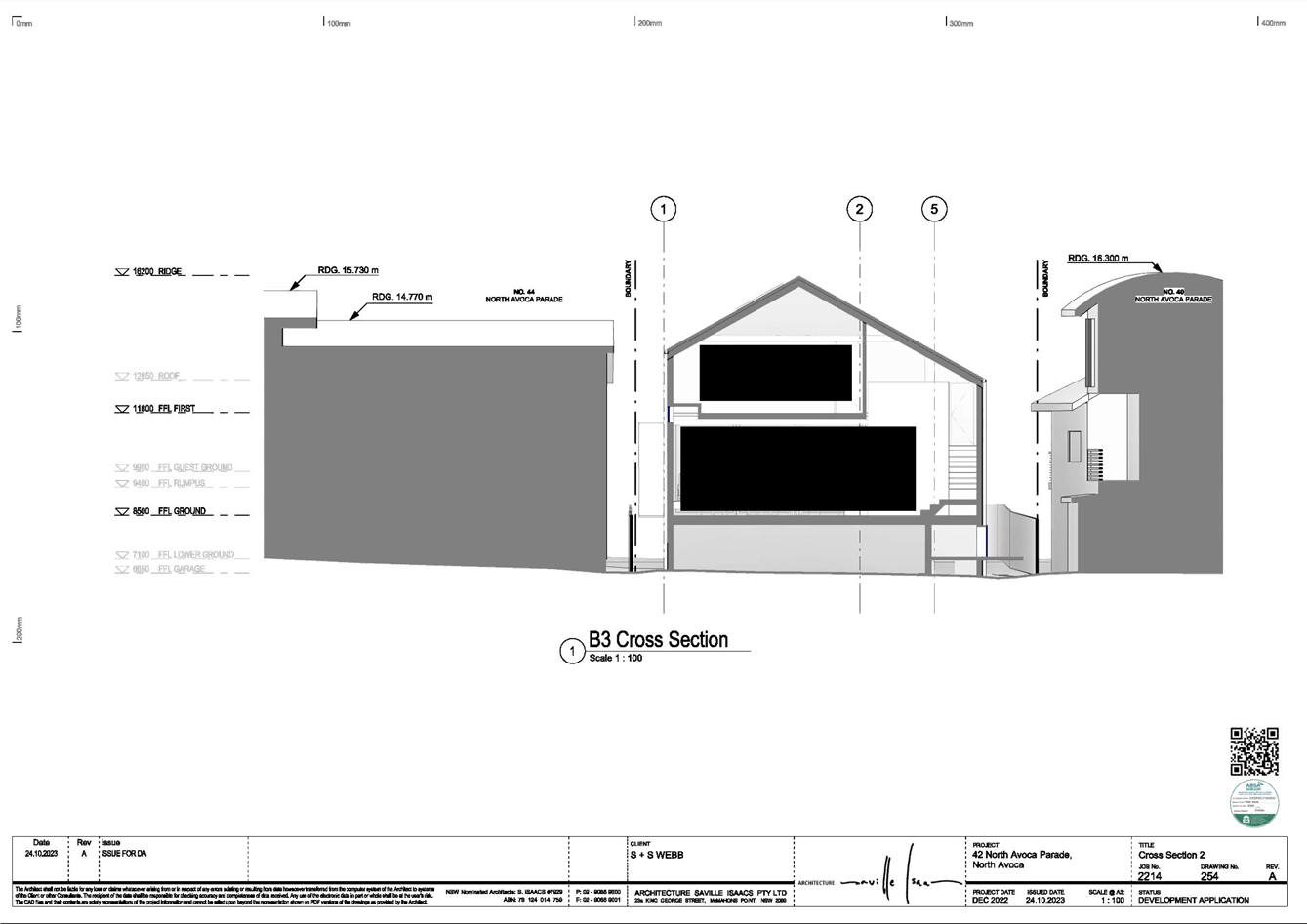
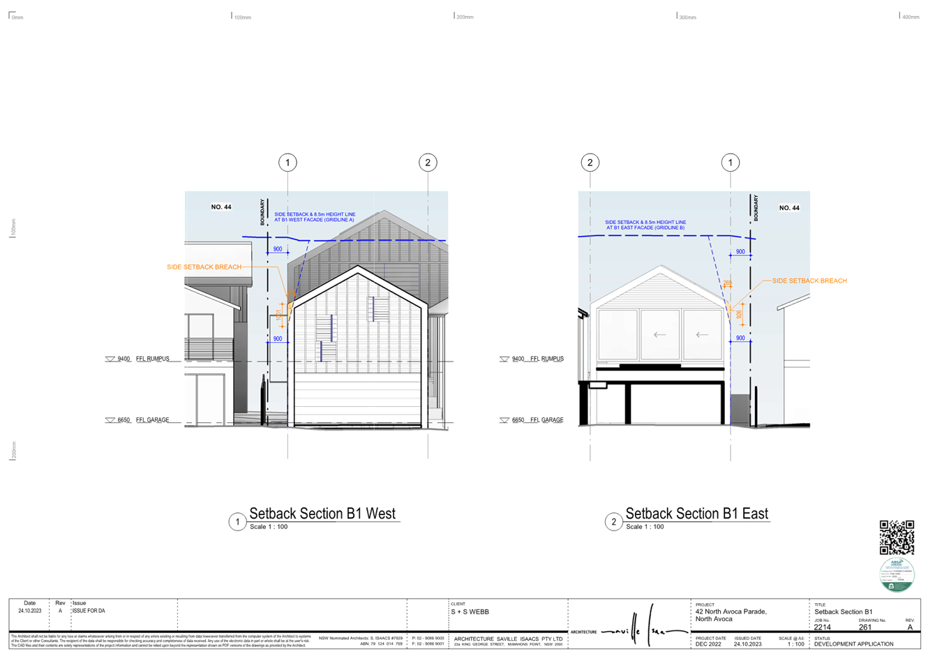
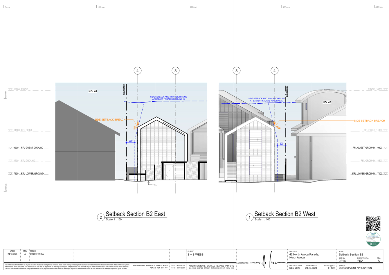
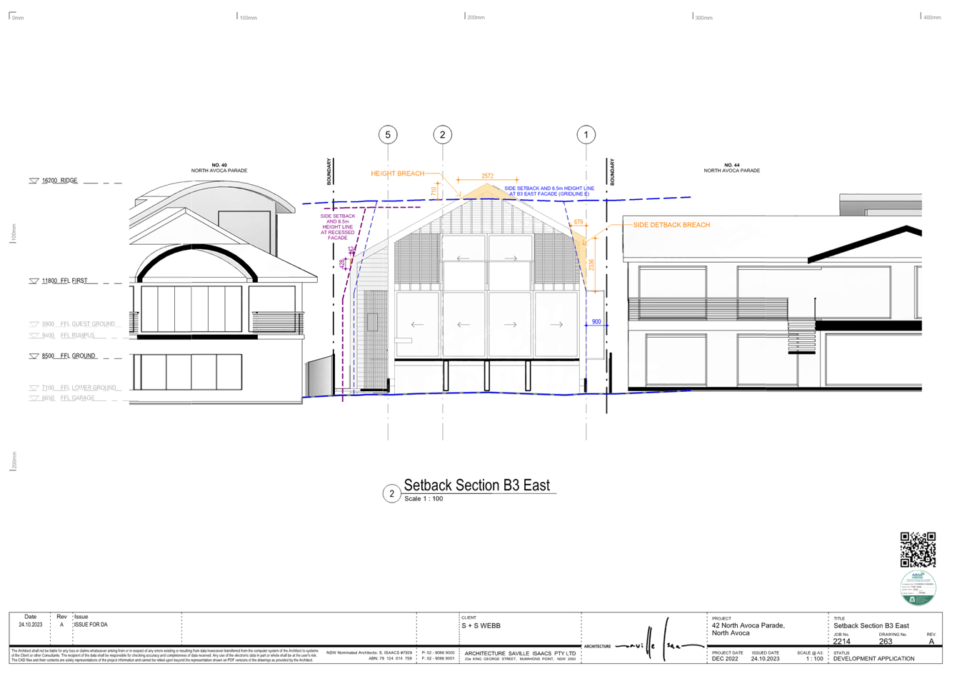
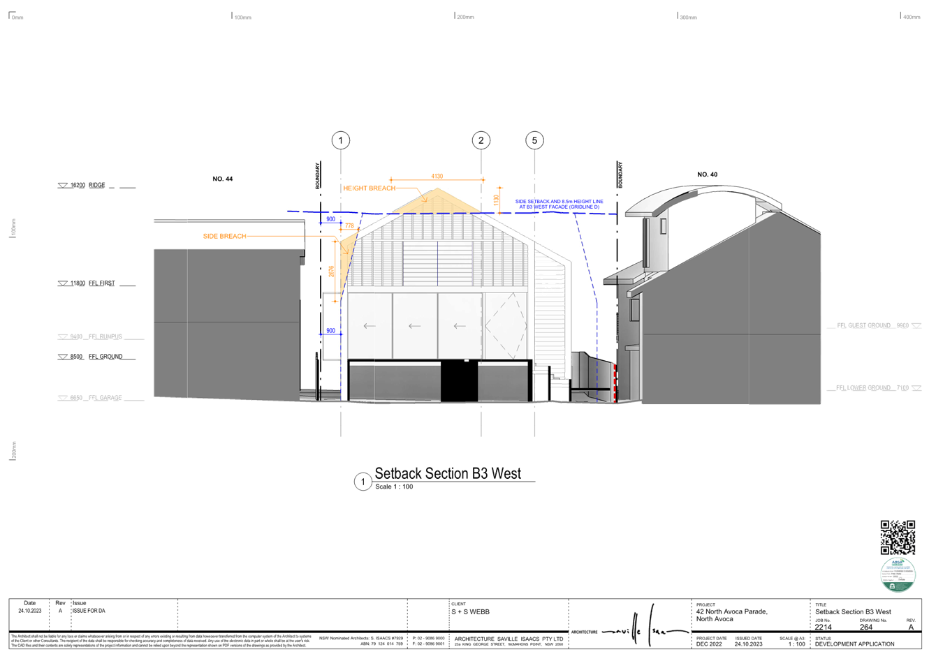
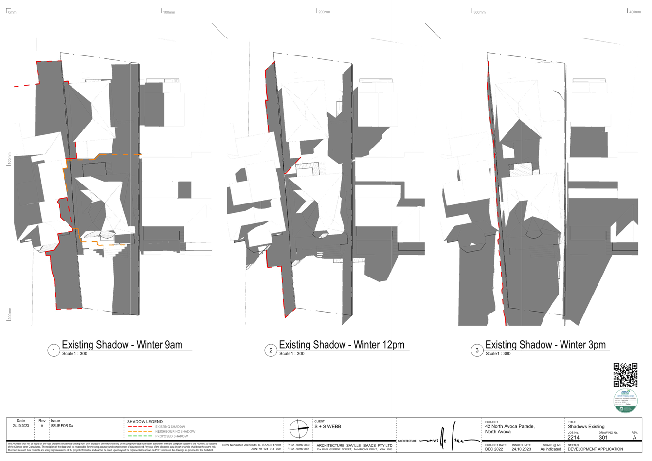

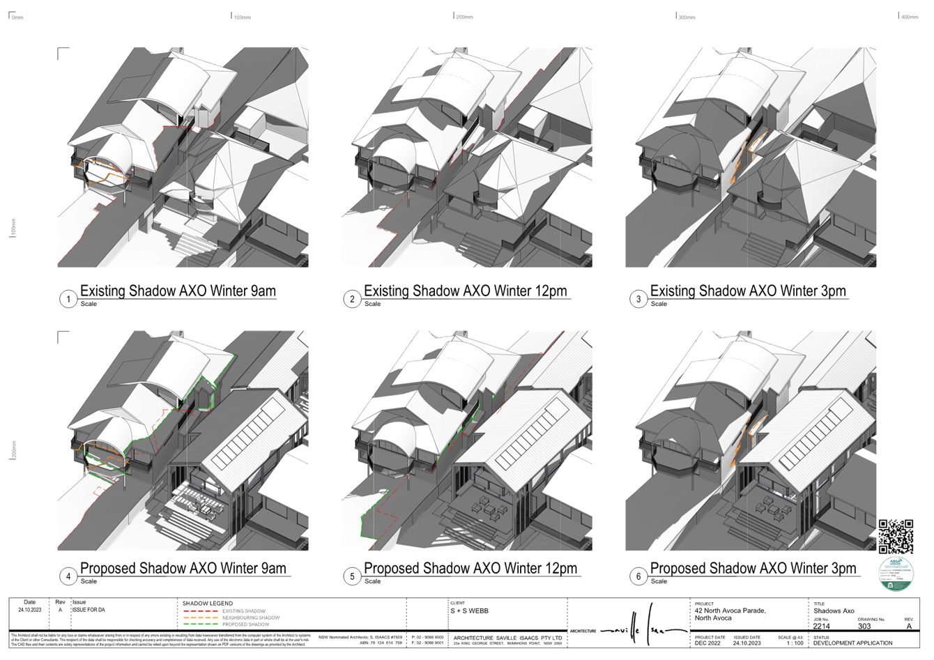
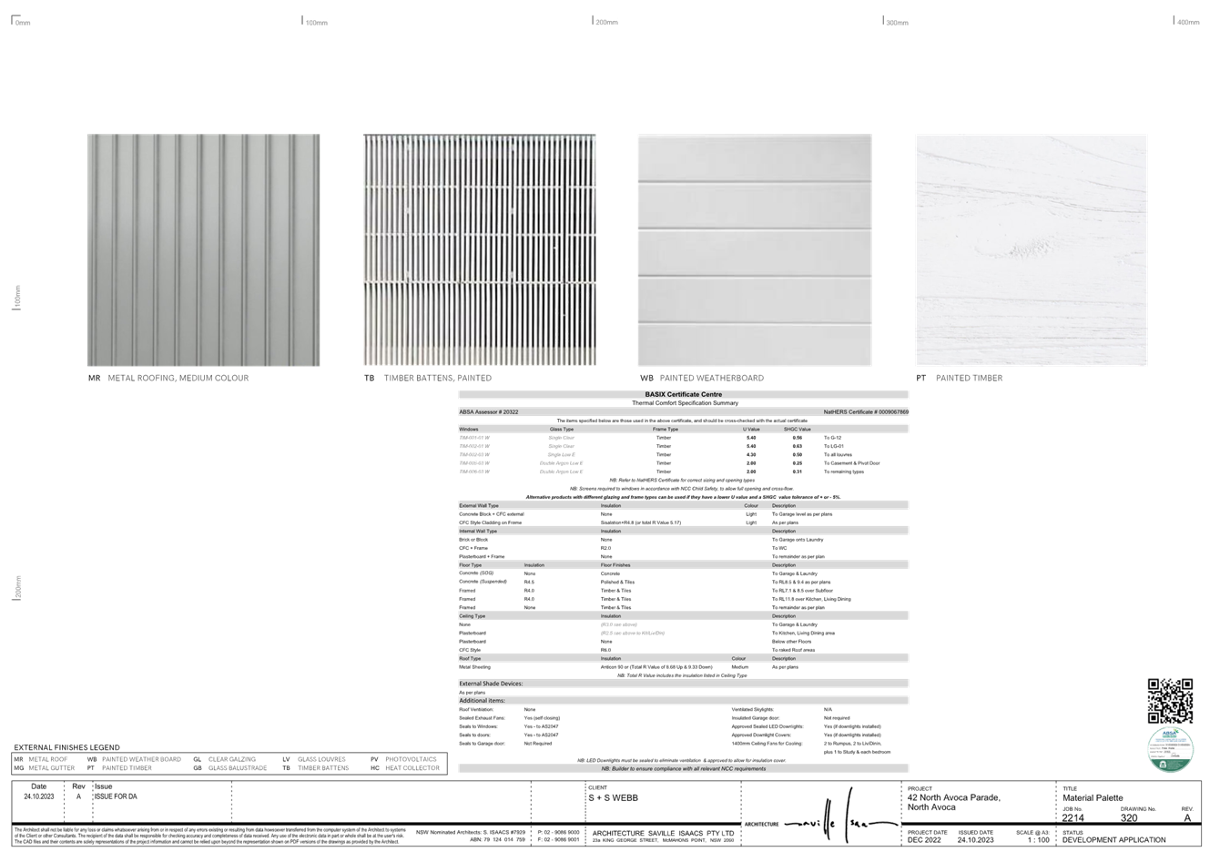
|
DA/2461/2023 - New Dwelling House & Demolition of Existing Structures - 42 North Avoca Parade North Avoca NSW 2250 |
|
|
Attachment 4 |
PUBLIC - Front Fence Elevation Plan - PAN-401899 - 42 North Avoca Pde, NORTH AVOCA - DA/2461/2023 |
|
3.3 |
DA/2461/2023 - New Dwelling House & Demolition of Existing Structures - 42 North Avoca Parade North Avoca NSW 2250 |
|
Attachment 6 |
Redacted - Landscape Plan - PAN-401899 - 42 North Avoca Pde, NORTH AVOCA - DA/2461/2023 |
|
3.3 |
DA/2461/2023 - New Dwelling House & Demolition of Existing Structures - 42 North Avoca Parade North Avoca NSW 2250 |
|
Attachment 7 |
Engineering Plans - PAN-401899 - 42 North Avoca Pde, NORTH AVOCA - DA/2461/2023 |

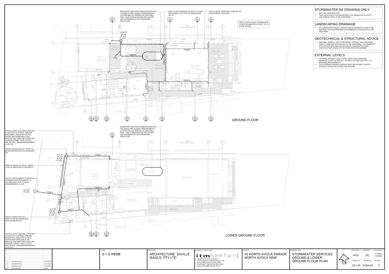
|
DA/2461/2023 - New Dwelling House & Demolition of Existing Structures - 42 North Avoca Parade North Avoca NSW 2250 |
|
|
Attachment 8 |
PUBLIC - Coastal Engineering Advice - PAN-401899 - 42 North Avoca Pde, NORTH AVOCA - DA/2461/2023 |
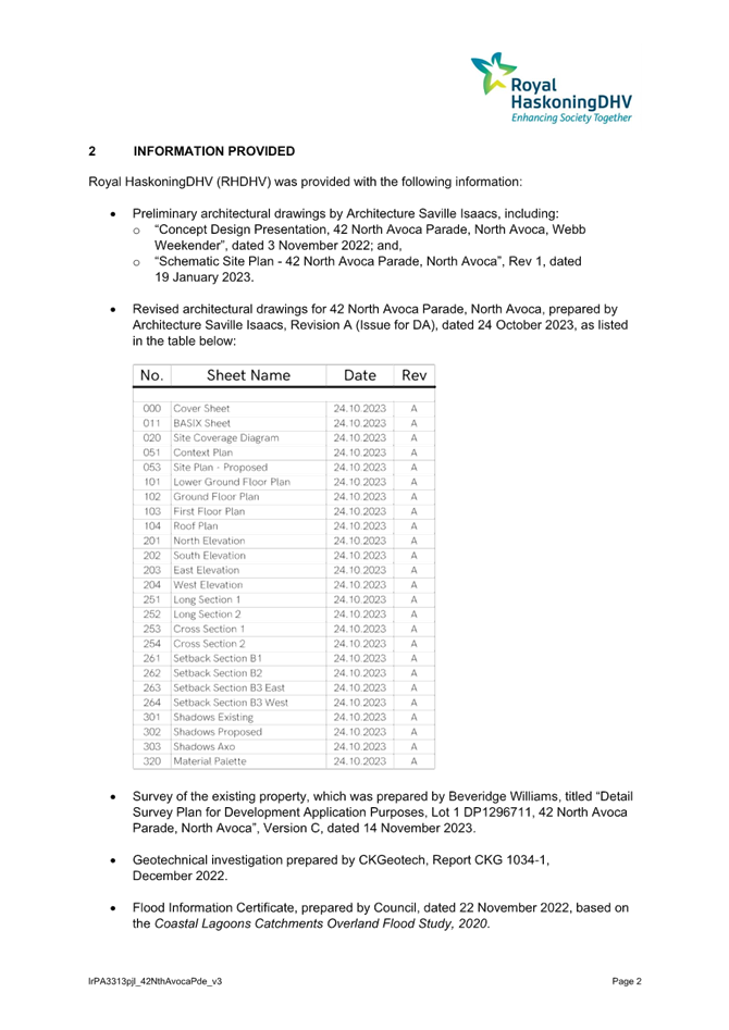
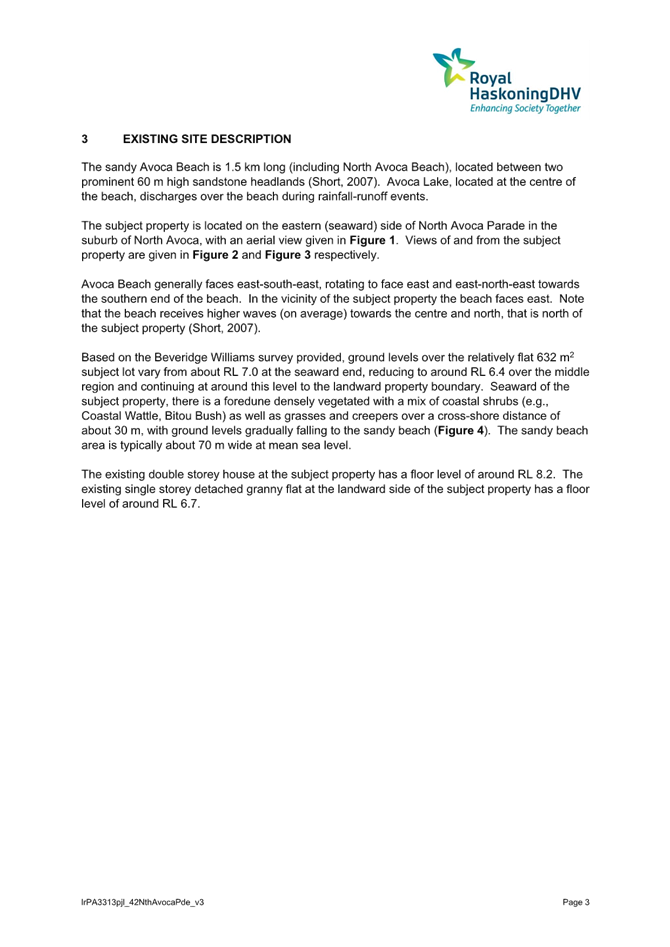
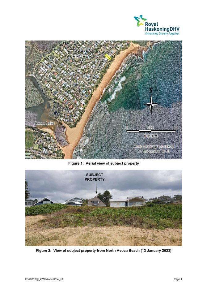

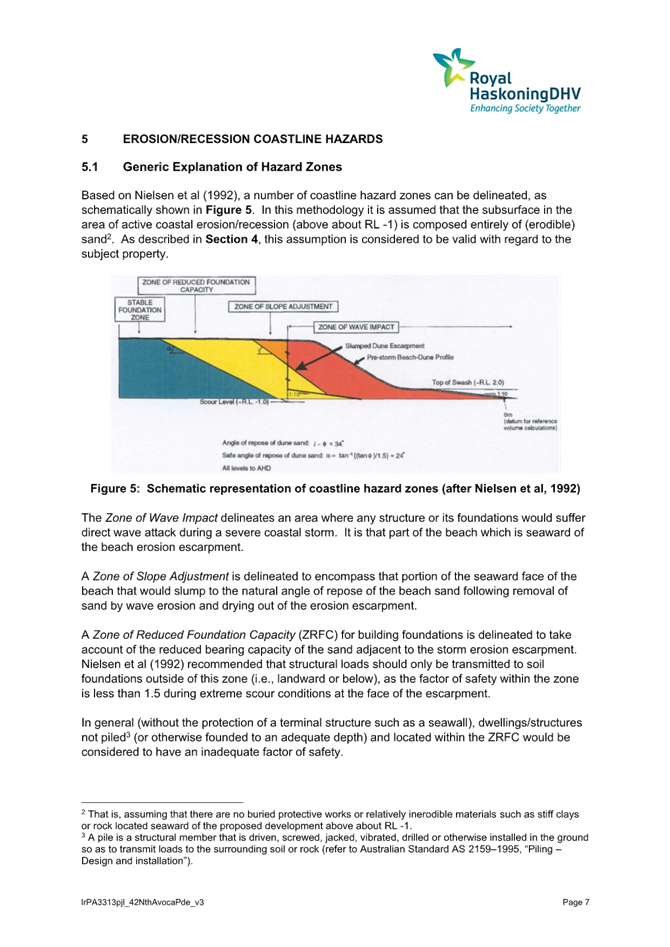


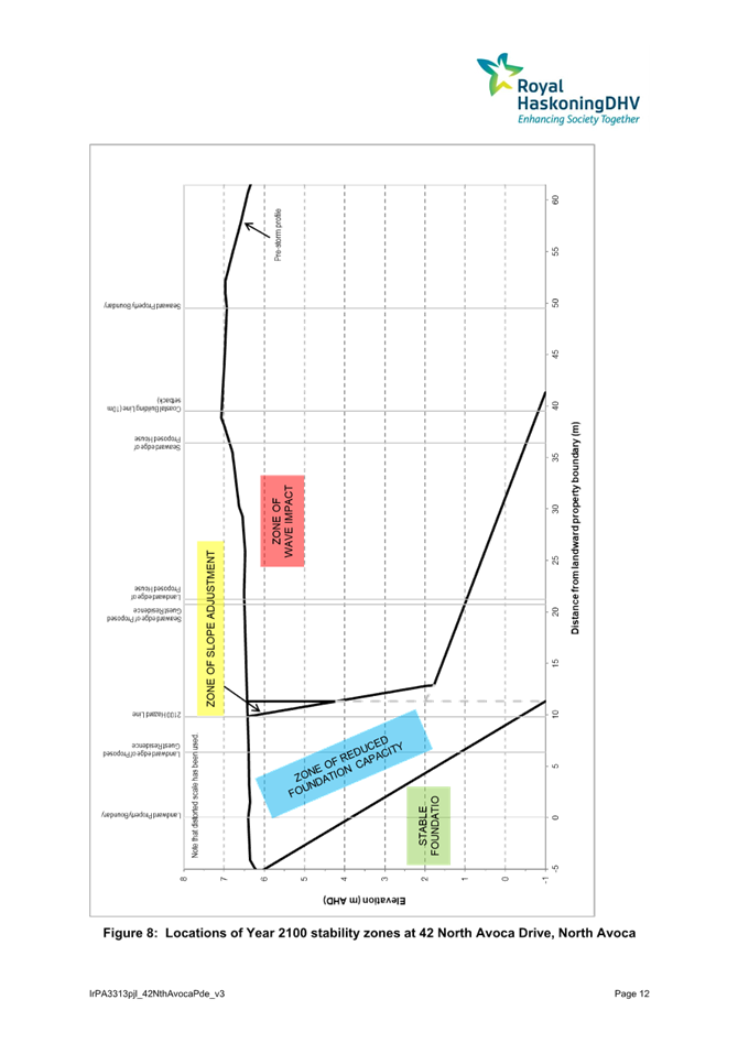

|
DA/2461/2023 - New Dwelling House & Demolition of Existing Structures - 42 North Avoca Parade North Avoca NSW 2250 |
|
|
Attachment 9 |
Geotechnical Assessment - 42 North Avoca Parade NORTH AVOCA - DA/2461/2023 |
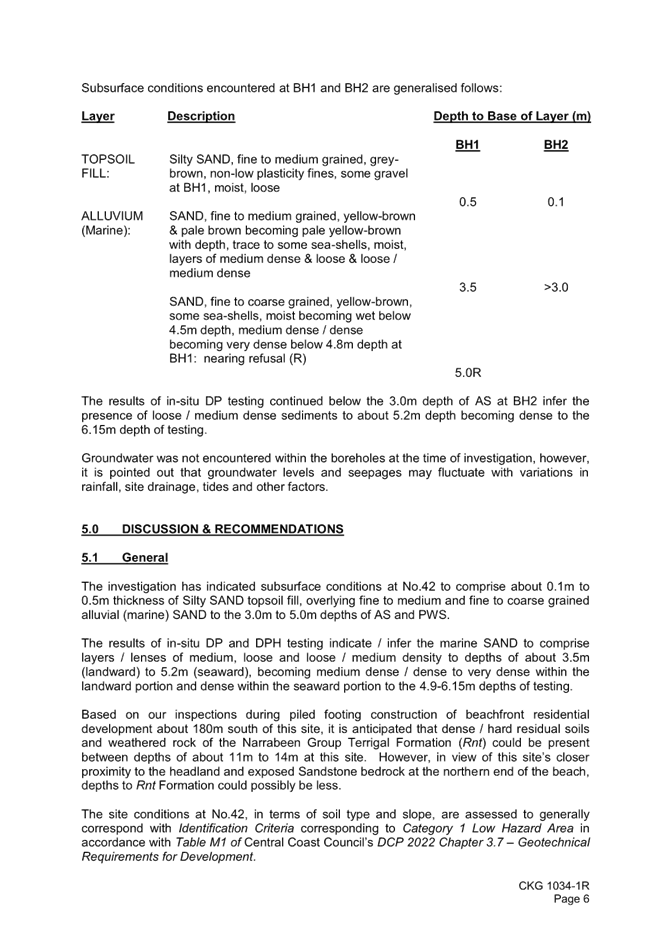

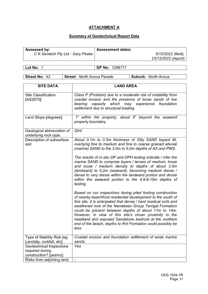
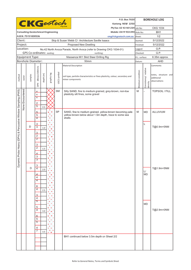
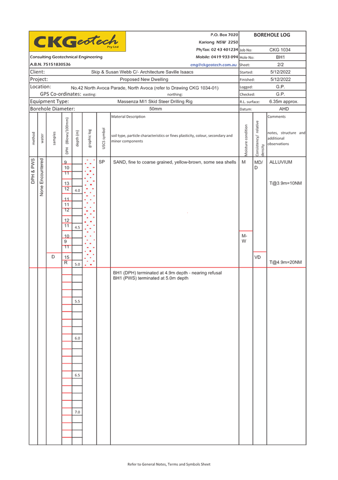
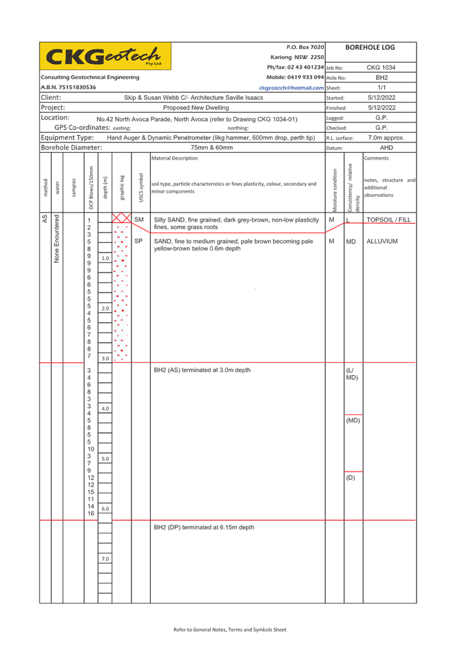
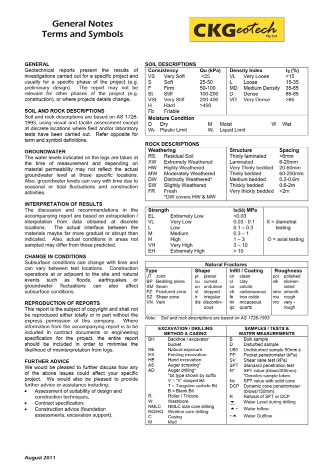
|
DA/2461/2023 - New Dwelling House & Demolition of Existing Structures - 42 North Avoca Parade North Avoca NSW 2250 |
|
|
Attachment 10 |
Acid Sulfate Soils Assessment Addendum - 42 North Avoca Parade NORTH AVOCA - DA/2461/2023 |
|
3.3 |
DA/2461/2023 - New Dwelling House & Demolition of Existing Structures - 42 North Avoca Parade North Avoca NSW 2250 |
|
Attachment 11 |
PUBLIC - Arborist Report - PAN-401899 - 42 North Avoca Pde, NORTH AVOCA - DA/2461/2023 |

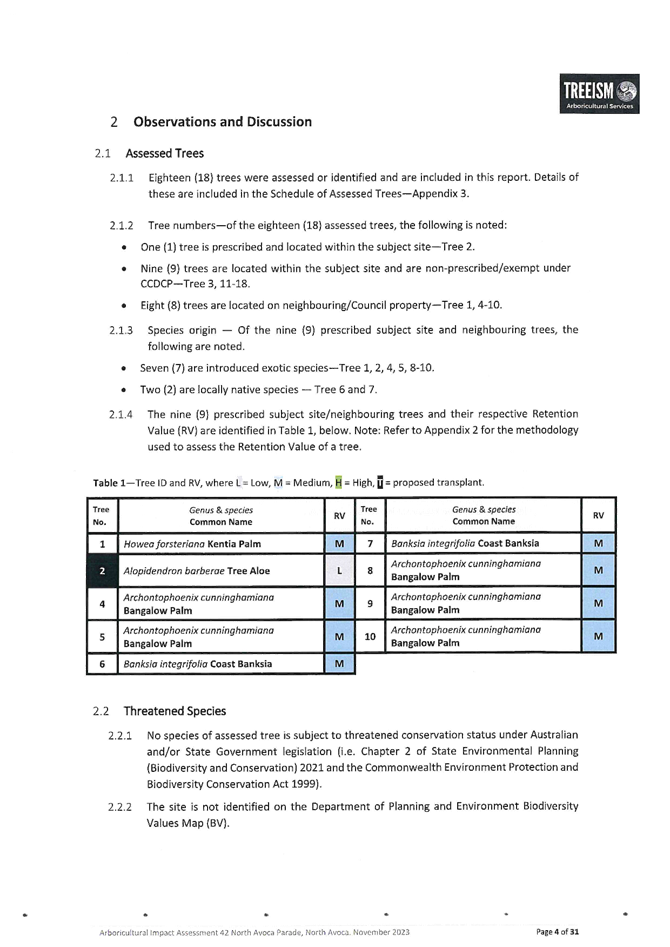
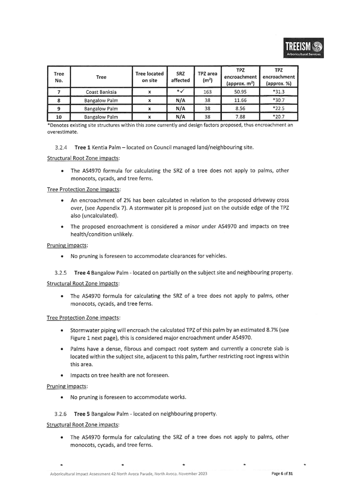


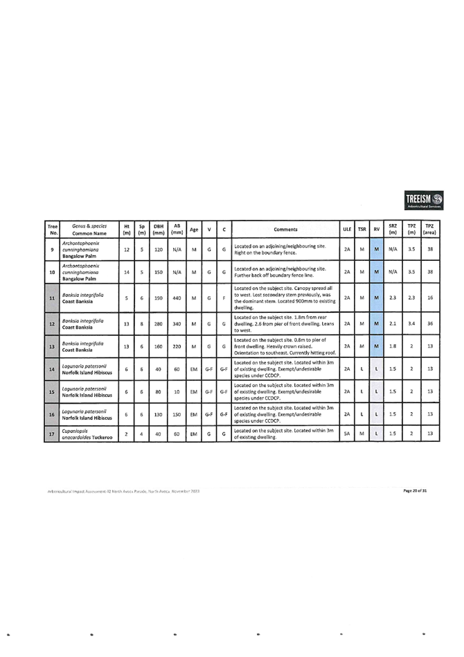

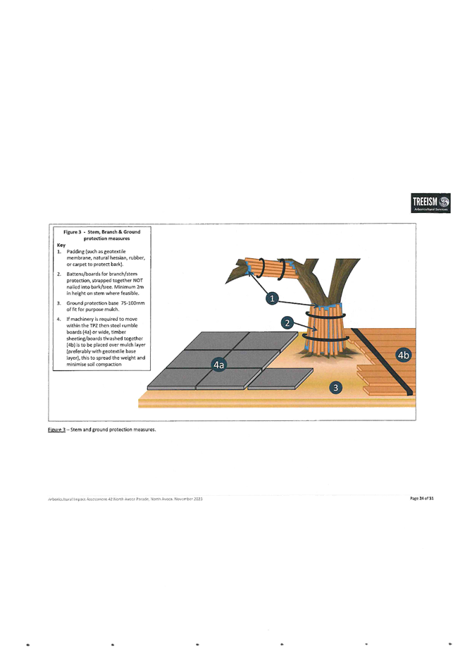
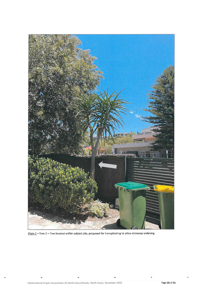
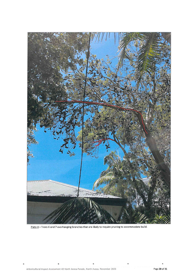

|
DA/2461/2023 - New Dwelling House & Demolition of Existing Structures - 42 North Avoca Parade North Avoca NSW 2250 |
|
|
Attachment 12 |
PUBLIC - BASIX Certificate - PAN-401899 - 42 North Avoca Pde, NORTH AVOCA - DA/2461/2023 |
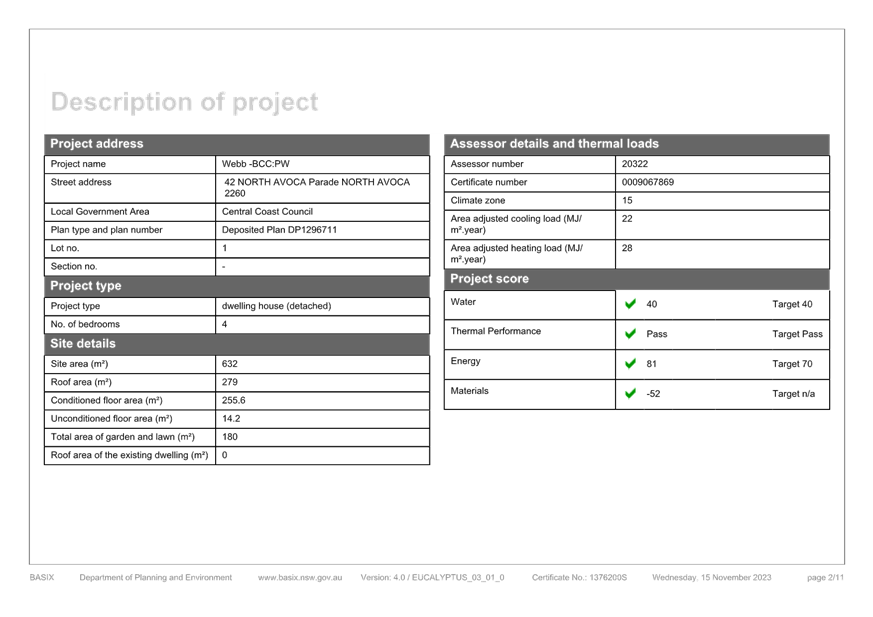
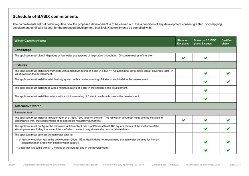
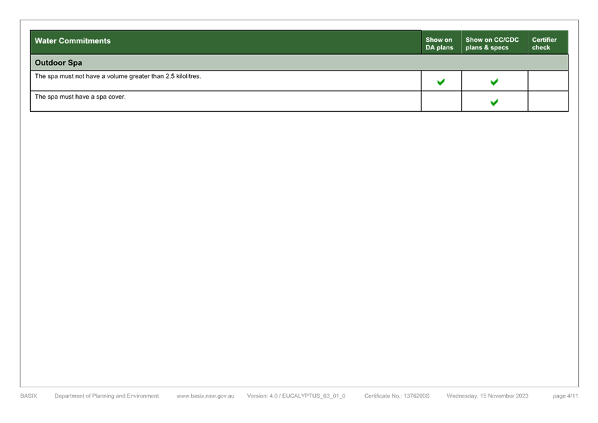
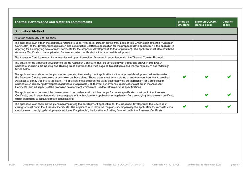
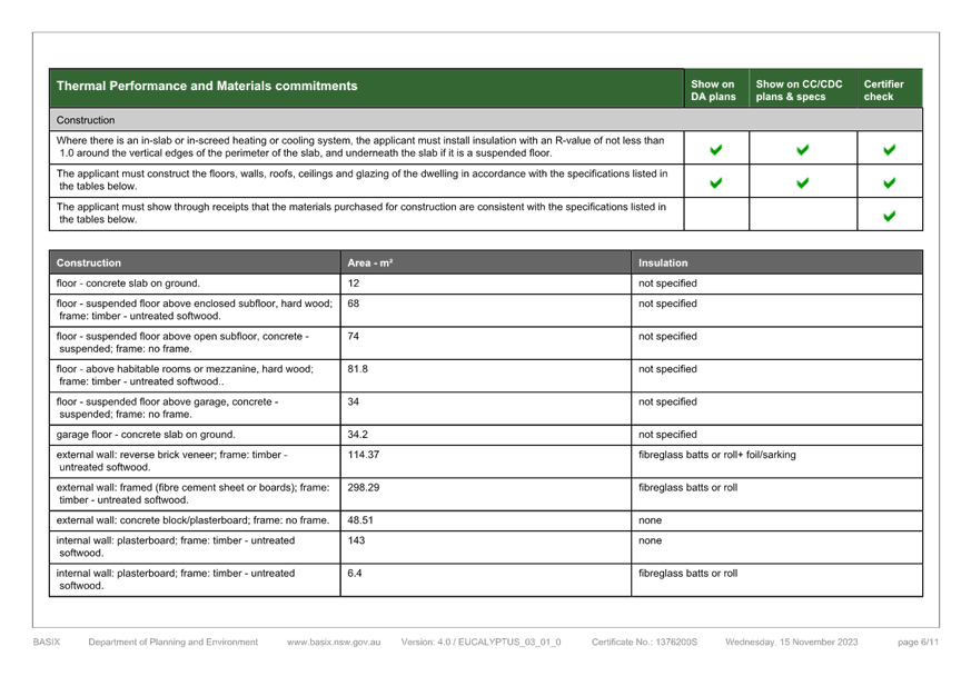
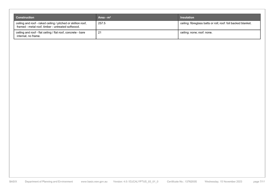
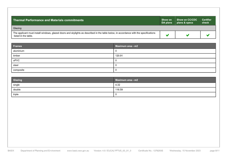
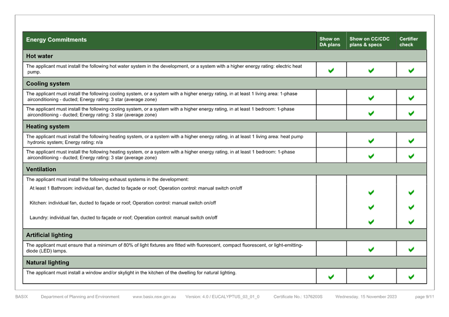
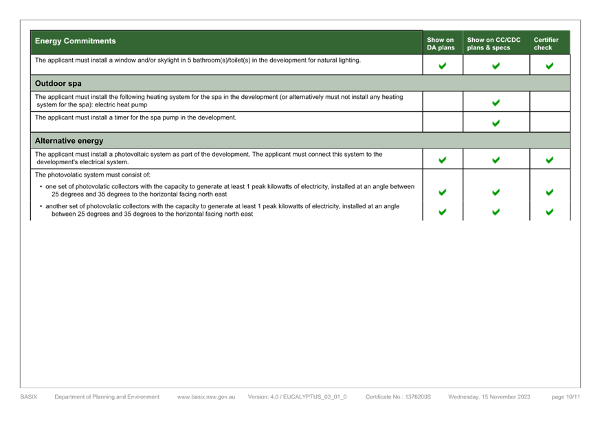
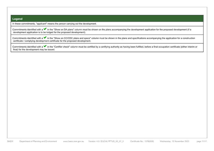
|
DA/2461/2023 - New Dwelling House & Demolition of Existing Structures - 42 North Avoca Parade North Avoca NSW 2250 |
|
|
Attachment 13 |
PUBLIC - NatHERS Certificate - PAN-401899 - 42 North Avoca Pde, NORTH AVOCA - DA/2461/2023 |
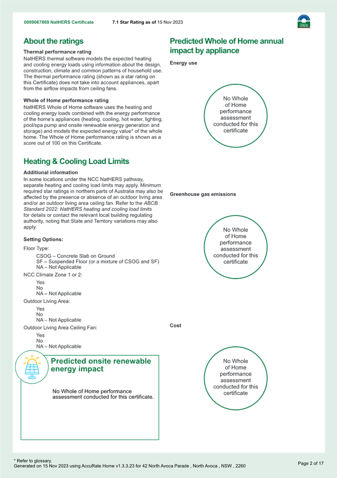

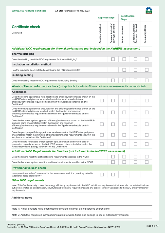
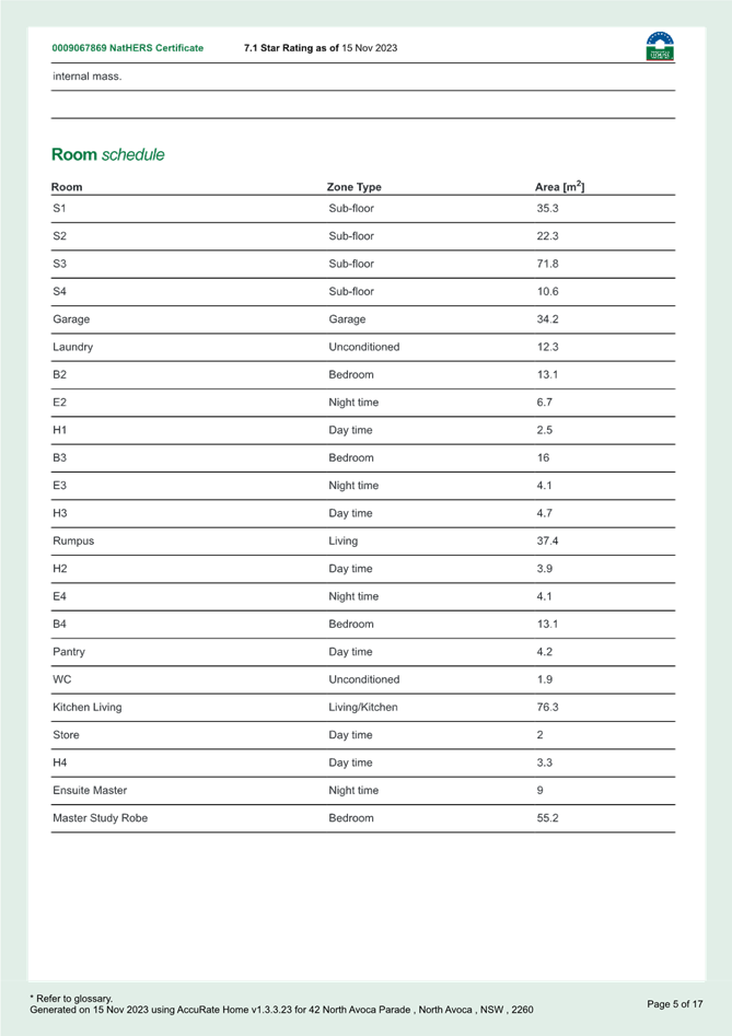
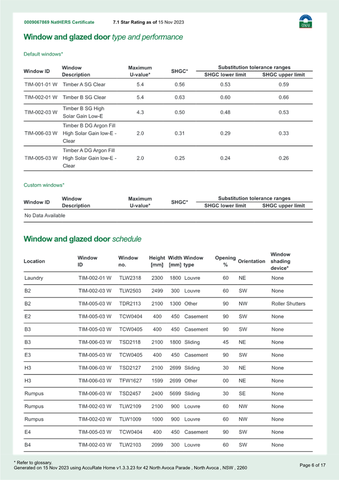
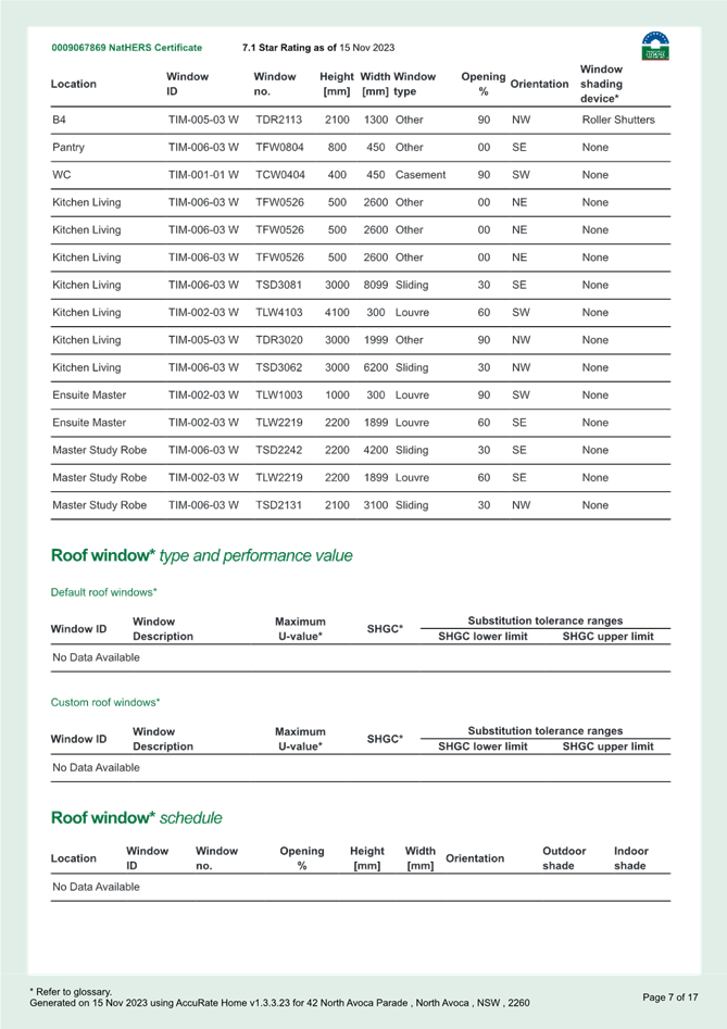
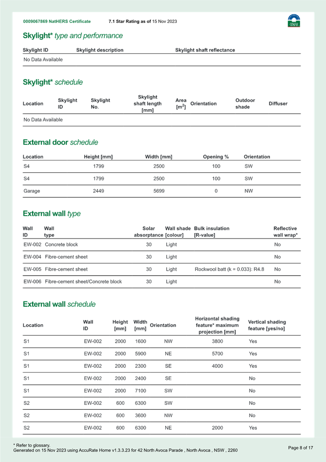

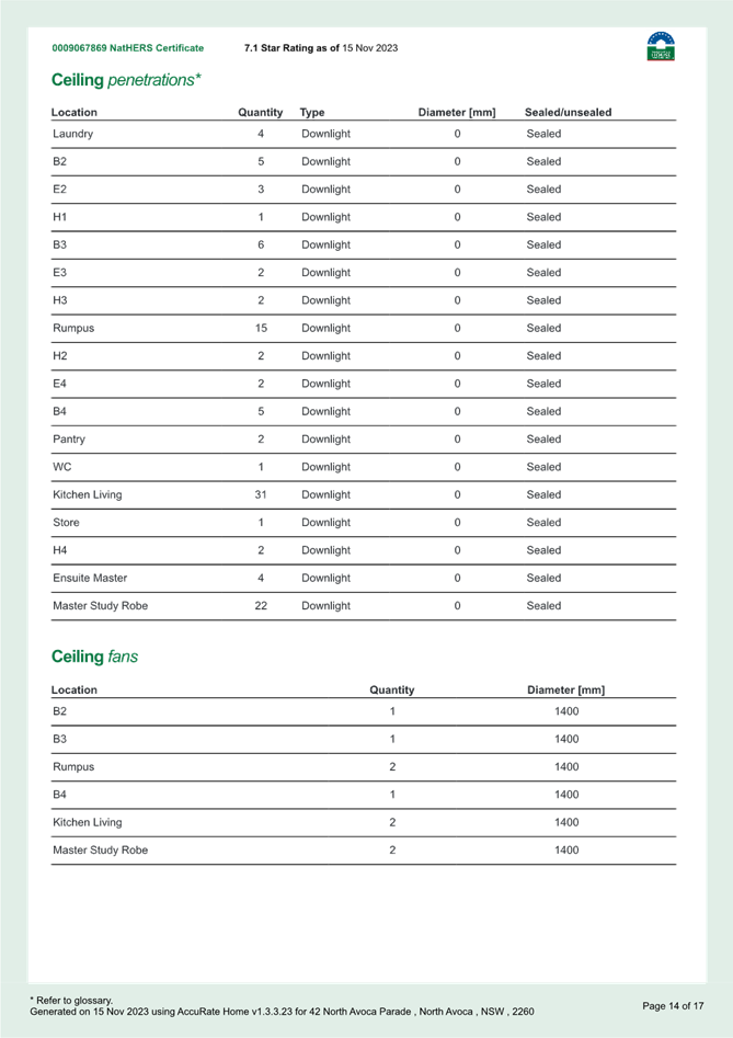
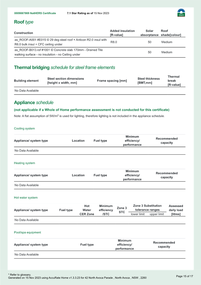
|
DA/2461/2023 - New Dwelling House & Demolition of Existing Structures - 42 North Avoca Parade North Avoca NSW 2250 |
|
|
Attachment 14 |
PUBLIC - Waste Management Plan - PAN-401899 - 42 North Avoca Pde, NORTH AVOCA - DA/2461/2023 |
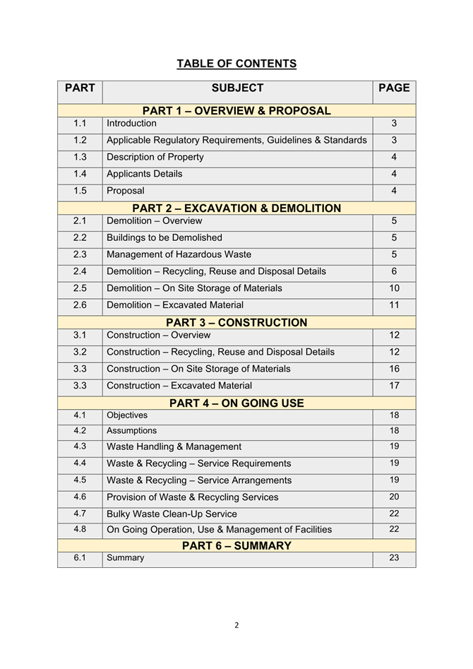


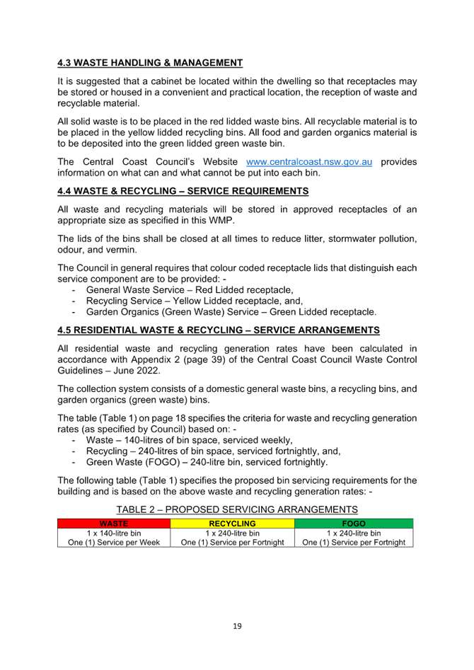
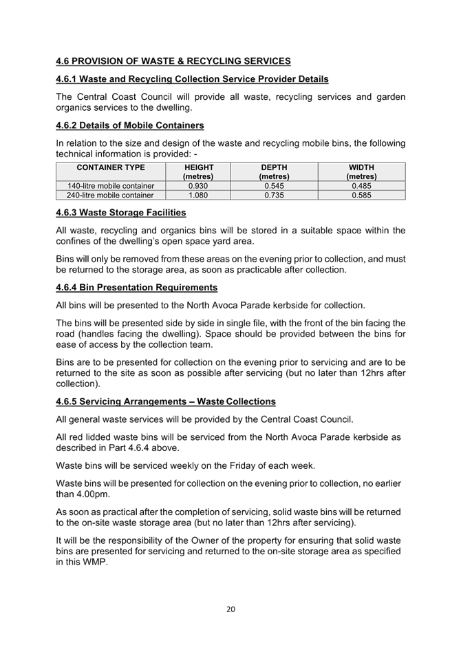
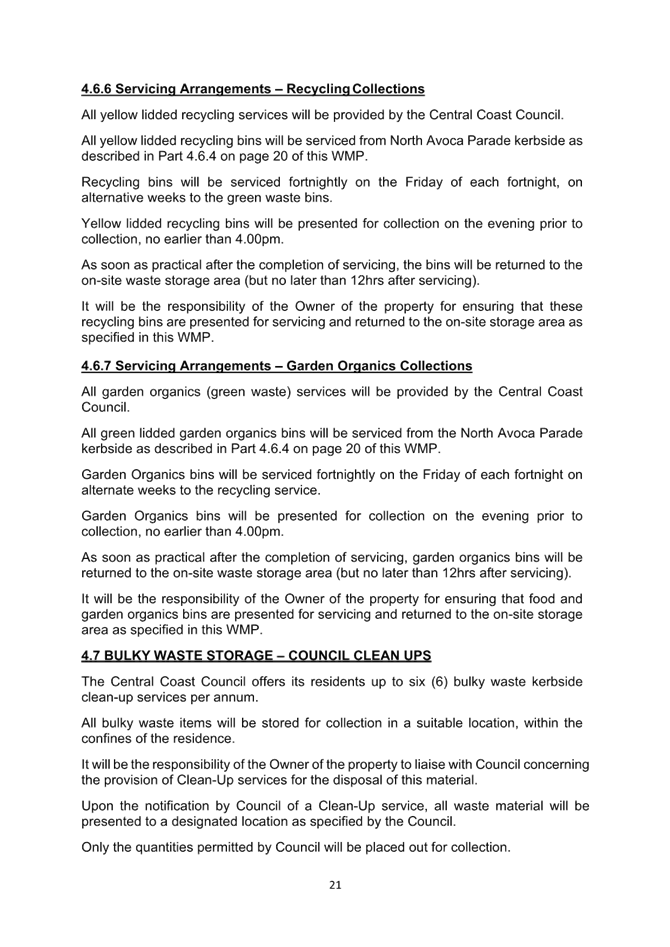
|
DA/2461/2023 - New Dwelling House & Demolition of Existing Structures - 42 North Avoca Parade North Avoca NSW 2250 |
|
|
Attachment 15 |
PUBLIC - Survey - PAN-401899 - 42 North Avoca Pde, NORTH AVOCA - DA/2461/2023 |
|
3.3 |
DA/2461/2023 - New Dwelling House & Demolition of Existing Structures - 42 North Avoca Parade North Avoca NSW 2250 |
|
Attachment 16 |
Clause 4.6 Variation Request - PAN-401899 - 42 North Avoca Pde, NORTH AVOCA - DA/2461/2023 |
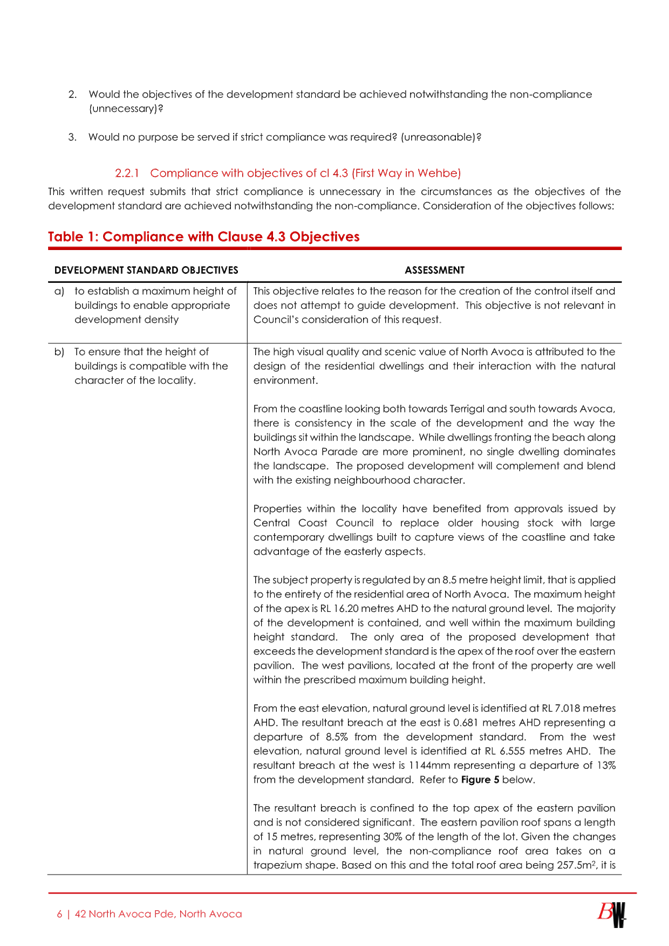
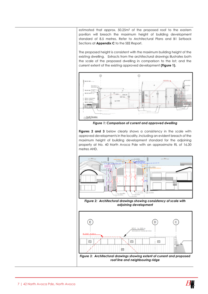
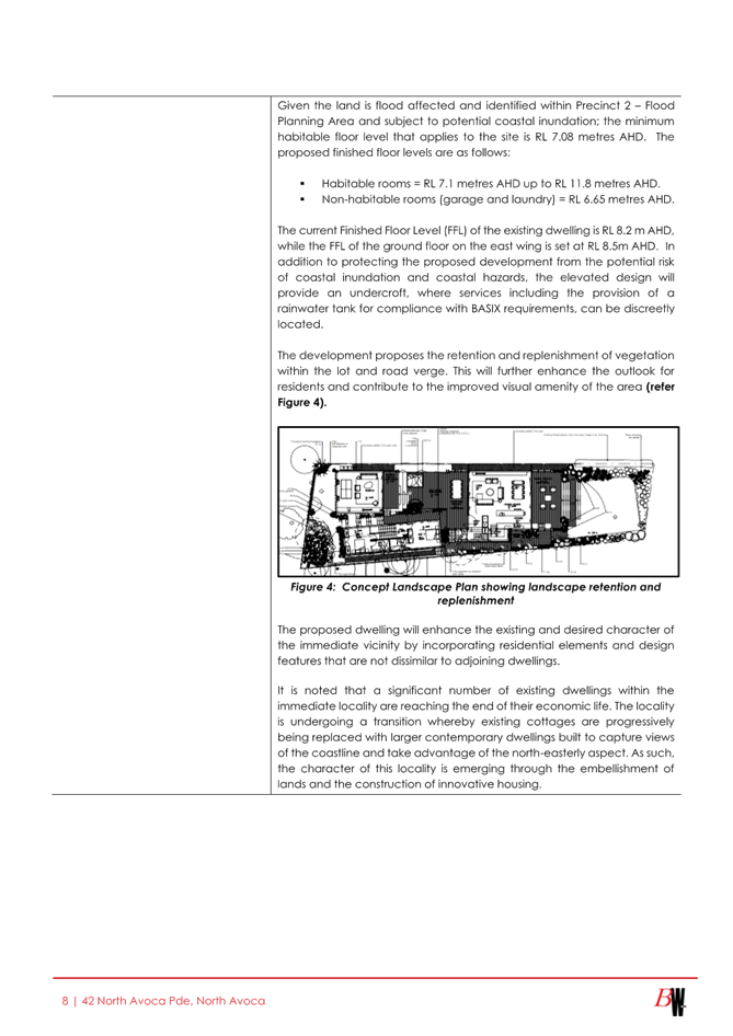
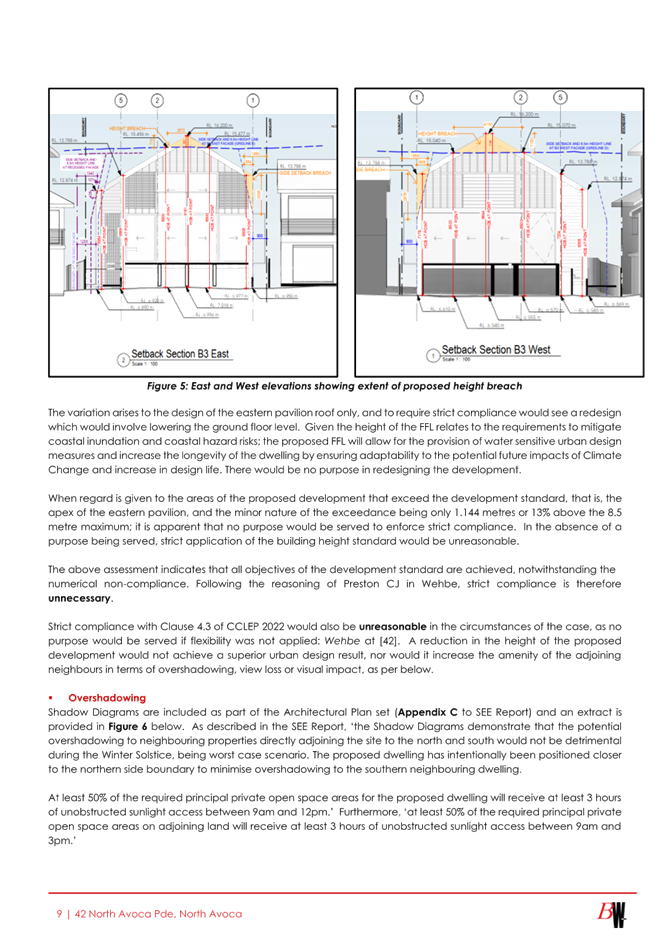
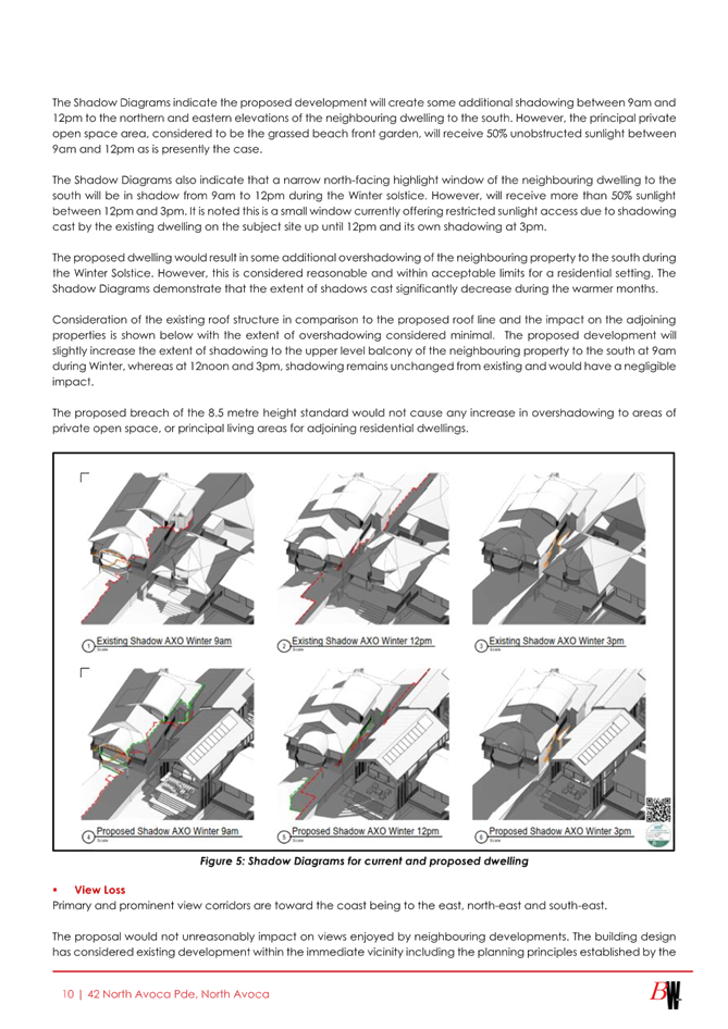

|
DA/2461/2023 - New Dwelling House & Demolition of Existing Structures - 42 North Avoca Parade North Avoca NSW 2250 |
|
|
Attachment 17 |
Statement Environmental Effects - PAN-401899 - 42 North Avoca Pde, NORTH AVOCA - DA/2461/2023 |
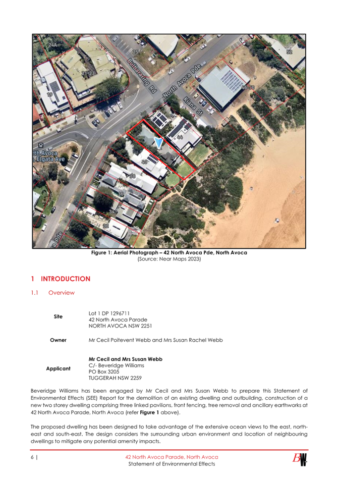
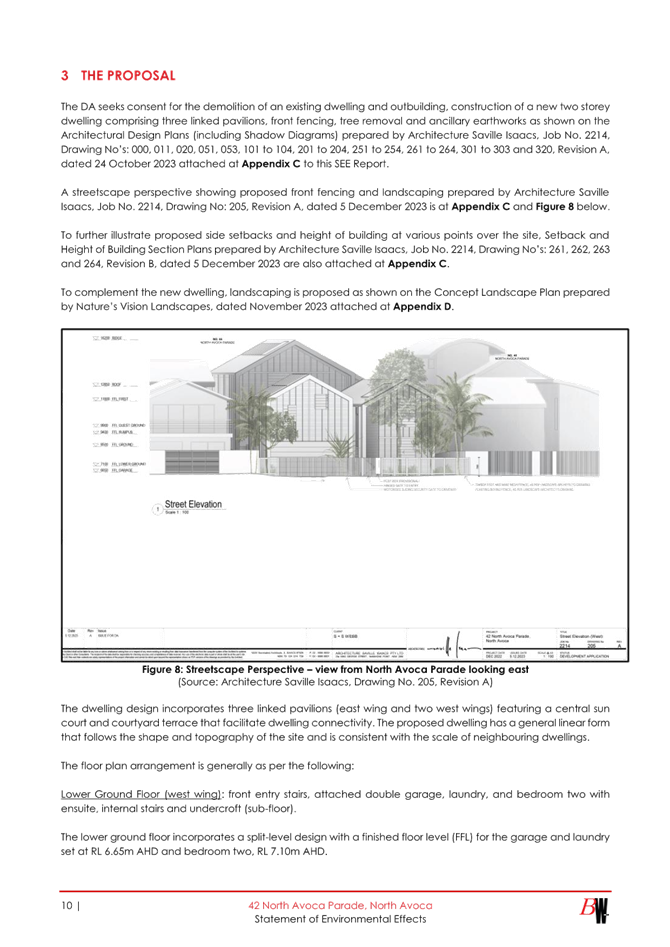
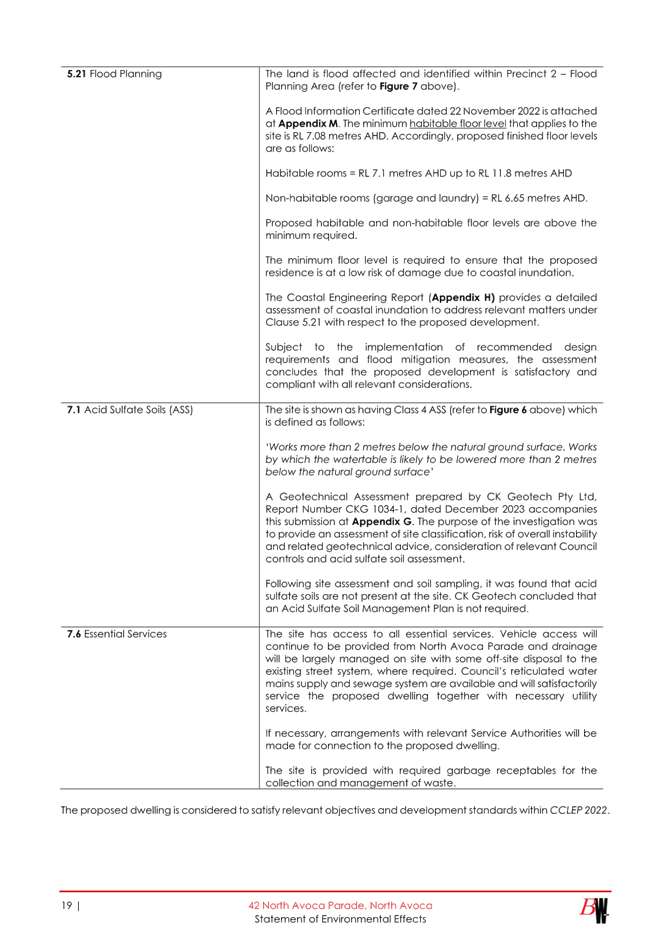
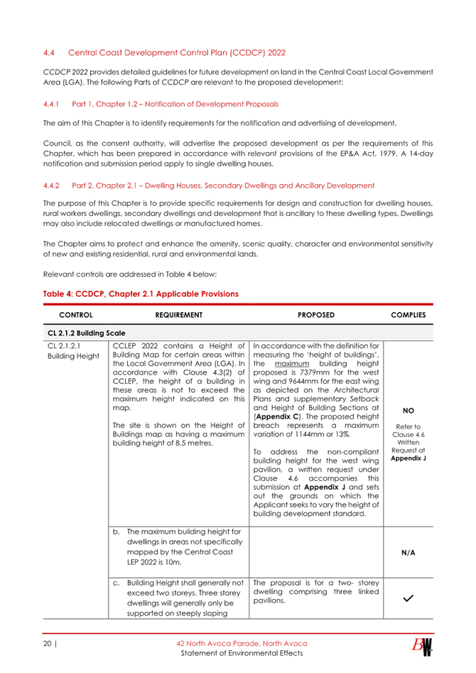
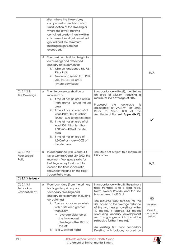

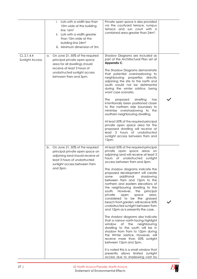
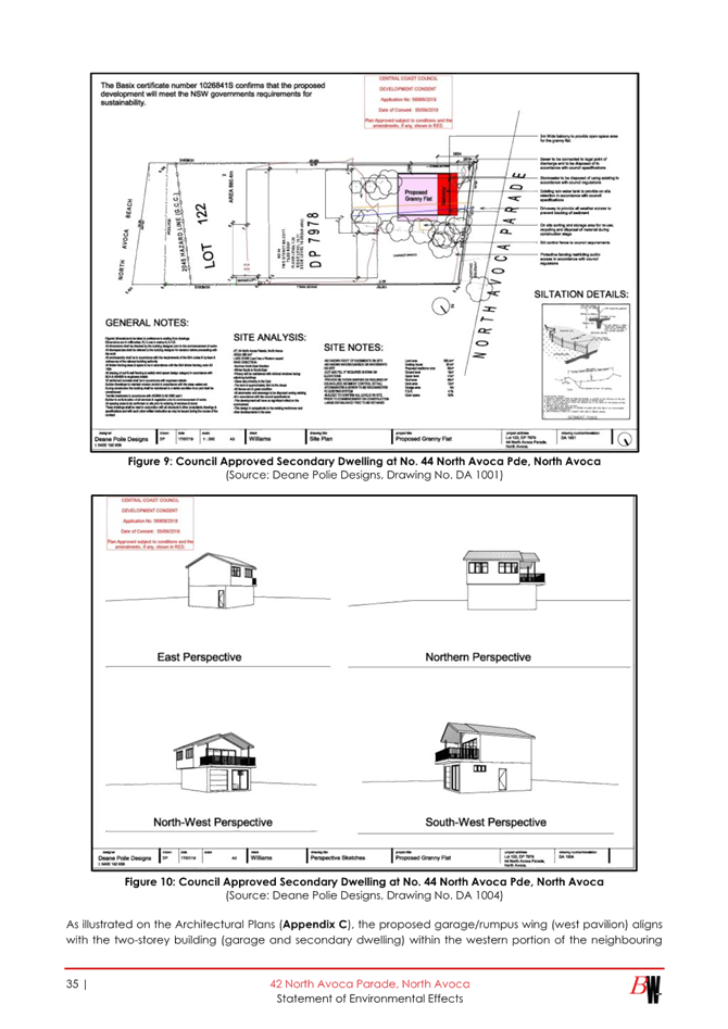
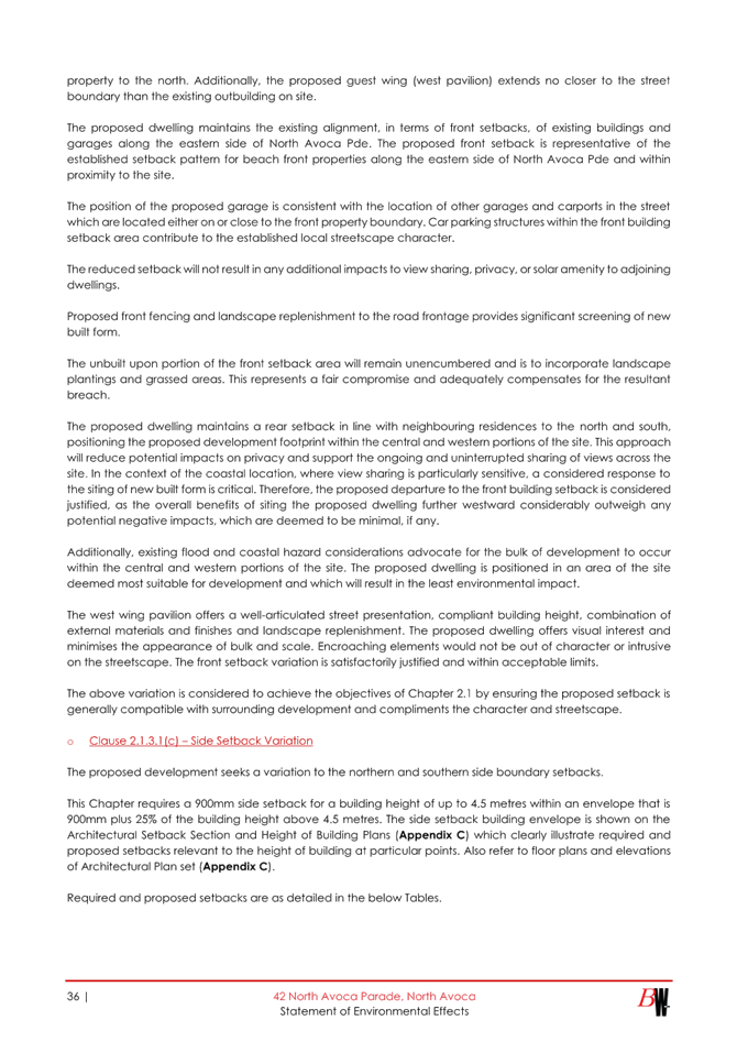
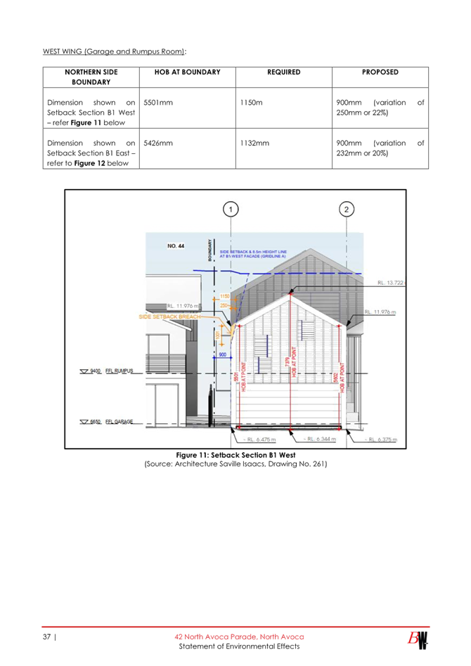
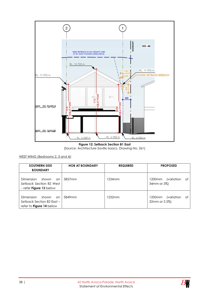
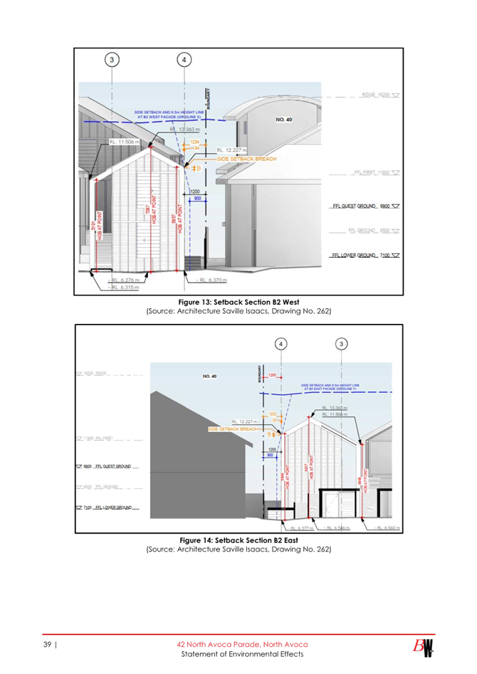
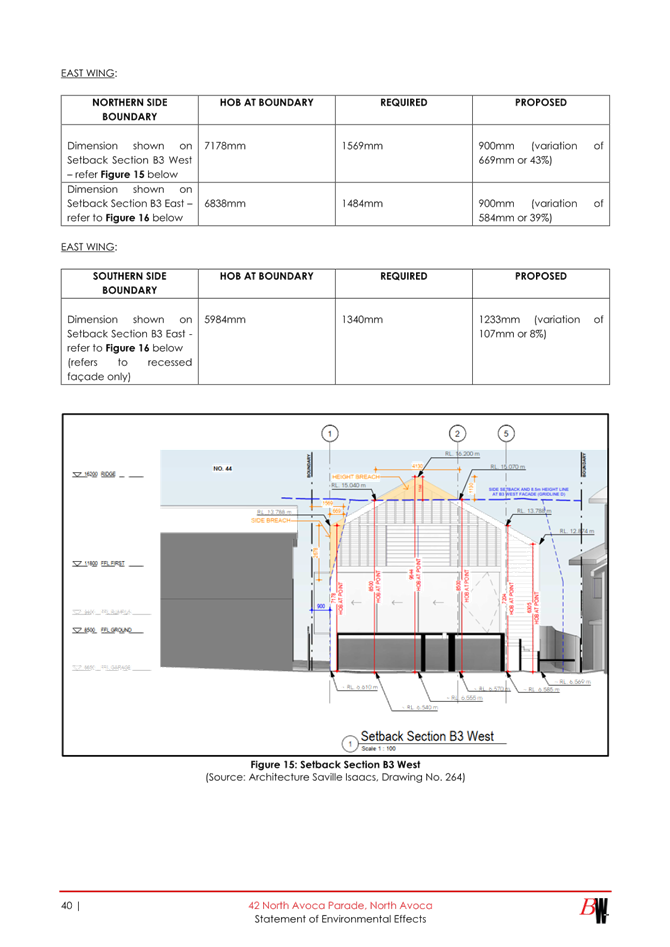
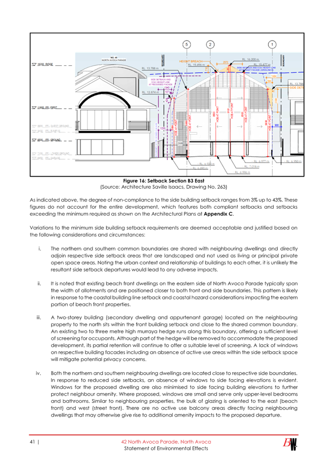

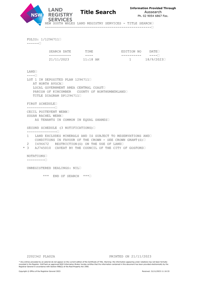
|
Item No: 3.4 |
|
|
Title: DA/862/2023 - 1 Agate Avenue PEARL BEACH - New Dwelling and Demolition of Existing Dwelling |
|
|
Department: Environment and Planning |
|
|
17 October 2024 Local Planning Panel Meeting |
|
Reference: DA/862/2023 - D16258339
Author: Susana Machuca, Senior Development Planner
Section Manager: Ailsa Prendergast, Section Manager. Development Assessments
Unit Manager: Andrew Roach, Unit Manager. Development Assessment
|
Summary
An application has been received for a new dwelling house. The application has been examined having regard to the matters for consideration detailed in section 4.15 of the Environmental Planning and Assessment Act 1979 and other statutory requirements with the issues requiring attention and consideration being addressed in the report.
The development application has been referred to the Local Planning Panel (LPP) as a result of the number of submissions objecting to the proposal. A total of 18 submissions were received by Council during notification.
The application is recommended for approval, subject to conditions.
Applicant Louise Lu Owner Hunter Steele Application No DA/862/2023 Description of Land Lot: 192 DP: 14817 No. 1 Agate Avenue PEARL BEACH Proposed Development New Dwelling House and Demolition of Existing Dwelling Site Area 701.8m2 Zoning R2 Low Density Residential Existing Use Dwelling House Employment Generation No Estimated Value $996,000.00 |
Recommendation
1 That the Local Planning Panel grant consent to DA/862/2023 for New Dwelling House and Demolition of Existing Dwelling on Lot: 192 DP:14817 No. 1 Agate Avenue PEARL BEACH subject to the conditions detailed in the schedule attached to the report and having regard to the matters for consideration detailed in Section 4.15 of the Environmental Planning and Assessment Act 1979.
2 That Council advises those who made written submissions of the Panel’s decision.
Key Issues
· Removal of vegetation (including mature trees); and
· Matters raised in public submissions, including amenity impacts.
Precis:
|
Proposed Development |
Dwelling House and demolition of existing house |
|
Permissibility and Zoning |
The subject site is zoned R2 Low Density Residential under Central Coast Local Environmental Plan 2022 (CCLEP 2022).
The proposed development is defined in the CCLEP 2014 as ‘dwelling house’ and is permissible in the zone with the consent of Council.
dwelling house means a building containing only one dwelling. |
|
Current Use |
Dwelling House |
|
Integrated Development |
No |
|
Submissions |
18 Submissions
|
The Site
The subject site is legally referred to as Lot 192 DP 14817 No. 1 Agate Avenue, PEARL BEACH NSW 2256, has a site area of 701.08m2 and located on the southern side of Agate Avenue between Diamond Road and Coral Crescent. The site is regular in shape with an approximately 15.46m wide frontage to Agate Avenue (north) and length and a site depth of 46.37m. The topography of the site has predominantly a north to south axis, is relatively flat and grades from the south-west corner (RL: 4.7AHD) to the north-east corner (RL: 4.0AHD). Refer to figure 1.
The land is zoned R2 Low Density Residential pursuant to Central Coast Local Environmental
Plan (CCLEP) 2022 and is approximately 87.0m to Pearl Beach zoned RE1 Public Recreation and is nestled in amongst fragmented remnant native vegetation. Refer to figure 2.
The subject site presently contains a detached single level weatherboard and fibrocement roof dwelling and a single detached carport located on the western side of the dwelling, accessed via an informal driveway. The site is grassed and has been identified to contain ecological constraints, whereby the subject site is surrounded by pockets of significant Plant Community Types (PCTS). To the east and west of the subject site exists the Endangered Ecological Community Umina Sands Coastal Woodlands (PCT1645), characterised by representative species Angophora floribunda, Eucalyptus botryoides, Corymbia gummifera and Angophora costata. To the north of the subject site exists Broad-leaved Paperbark - Swamp Oak - Saw Sedge swamp forest on coastal lowlands of the Central Coast and Lower North Coast (PCT1724), represented by the presence of Melaleuca quinquenervia and Eucalyptus robusta. The subject site is connected to reticulated water, sewer and electricity services. Refer to figure 3 and 4.
The site is not identified as being "bushfire prone land" on Council's bushfire maps.
The site is identified as including “flood prone land”. The property is affected by flooding according to Brisbane Water Foreshore Flood Study 2015. The 1% AEP is RL 4.04m AHD and the Flood Planning Level (minimum floor level) is RL 4.54m AHD. The proposed ground floor level is RL 4.67m AHD. Council’s Development Engineer is supportive of the application subject to conditions.
![]()
Surrounding Development
The subject site is situated in the village of Pearl Beach, in land zoned Low Density Residential (R2), on the southern side of Agate Avenue, south of Pearl Beach Lagoon. The existing lot is representative of the existing land use of the area, being single and two-storey dwellings nestled in amongst fragmented remnant native vegetation.
Adjoining development to the east No. 1A Agate Avenue comprises an older style 2-storey detached brick and tiled roof dwelling with double garage contained within the dwelling roof line, refer to figure 5. To the west No. 3 Agate Avenue comprises a single storey detached weatherboard and metal roof dwelling with a detached single storey fibrocement clad and metal roof garage, refer to figure 6. It is noted that No. 3 Agate Street benefits from DA/2216/2022, approved on 8 February 2023 for the demolition of the existing dwelling, tree removal and the construction of a single level dwelling house. The approved application has a 4.5m front setback and is detailed as it relates to the subject site, refer to figure 7.
Surrounding development to the north, east and west consists of a combination of
detached single and two-storey detached original older dwellings and some two-storey
newer developments. In the immediate vicinity there is a mix of dwelling types, sizes and
architectural designs with smaller and older dwelling houses giving way to larger new and/or
renovated residential homes, refer figures 6 - 10.
![]()
![]()
![]()
The Proposed Development
The proposed development involves the demolition of the existing detached single storey dwelling and associated structures, removal of 13 trees to enable the construction of a five (5) bedroom dwelling house over two levels with associated in-ground swimming pool and landscaping. With an overall building height of approximately RL 12.48 AHD (HOB 8.0m), and a Floor Space Ratio (FSR) of 0.4:1 (276.30m2). Refer to figures 11 - 14.
The proposal comprises:
a. Demolition of existing:
· Detached dwelling and ancillary structures;
· Removal of 15 trees as follows:
o Six (6) trees meeting Councils exempt removal criteria;
o Two (2) trees on adjoining property No. 3 Agate Avenue under DA/2216/2021;
o Seven (7) prescribed trees from the subject site; and
· Retention of seventeen (17) trees to implement protection measures.
b. The construction of new dwelling (276.00m2):
· Ground Floor (RL 4.67AHD): Includes a double garage within the dwelling roof line, a covered entry porch to main entry foyer and hallway, a guest double bedroom with WD, ensuite and access to porch /landscaped area. A secondary living /media room area, stair well with a double height void area, a powder room, laundry area with storage area and side exit to a small outdoor area with clothesline. Main open plan lounge /dinning /kitchen and pantry area, fireplace and exit to alfresco and integrated BBQ area and POS with pool and landscaping.
· First Floor: (RL 7.87AHD): Includes the stair well with a double height void area, and a double void area to the main lounge and fireplace. Hallway leads to two (2) balcony areas (north and south), has four (4) double bedrooms, two (2) with WD, ensuites and exit to north balcony and two (2) bedrooms with WD and exit to south balcony, a full bathroom and linen areas.
· Roof Design caters for future solar panels and open slit area to northern balcony.
c. Ancillary development – Access /Landscaping / Swimming Pool:
· Construction of paved driveway, entry steppers and pony walls.
· Landscaping in line with arborist report and landscaping plan.
· Construction of 7.7m(length) x 3.0m(wide) x max 1.8m(depth) inground pool.
![]()
![]()
History / Background
The proposed development was amended once during the assessment process on 21 December 2023 in response to issues raised through initial assessment by Council Officers and matters raised in submissions including but not limited to:
· Environmental Considerations: The environmental assessment of the application identified that the subject site is located in a central location between two stands of “good” native vegetation that is providing important connectivity to core habitat in the National Park to the west of the subject site. The high density of mature, remnant native flowering vegetation is also providing important food and shelter opportunities for threatened blossom feeding species, with recorded sightings of Pteropus poliocephalus (Grey-headed Flying Fox), Lathmus discolor (Swift Parrot), and Glossopsitta pusilla (Little Lorikeet) in the vicinity of the development proposal.
Melaleuca quinquenervia are known to provide food foraging sources for Pteropus poliocephalus (Grey-headed Flying Fox) when flowering. The impacts of the removal of these trees should be assessed in an ecological assessment. Further information is required to better understand the indirect and direct impacts on threatened species that will result from the removal of the nominated Melaleuca quinquenervia.
As such, an Ecological Assessment, Flora and Fauna Report was required to be completed in accordance with Council’s Flora and Fauna Guidelines 2019. The report will require the relevant tests of Significance to be prepared in accordance with Section s.7.3 of the Biodiversity Conservation Act 1999 and the NSW Threatened Species Test of Significance Guidelines. The removal of the nominated vegetation should be assessed in accordance with impacts to any local EECs in the area.
· Planning Considerations: The planning assessment of the application identified overall variations to:
o FSR: A review of the floor area calculations indicates the proposal exceeds the required floor space ratio (FSR) of 0.4:1 by approximately 33.1m2 (or a variation of 11.76%) resulting in an FSR of 0:45:1;
o Site Coverage is not to exceed 40% of the total site area. The maximum allowable site coverage for the subject site is 280.72m2. A review of the site coverage calculations indicate that the proposal exceeds the required building area by approximately 6.0m2 (or a variation of 2.2%).
o Chapter 5.10 Pearl Beach Residential Development was not addressed as part of the Statement of Environmental Effects (SoEE).
o Pearl Beach Character Statement and Land Unit area of Scenic Quality of the CCDCP 2022 was not addressed as part of the Statement of Environmental Effects (SoEE).
o Notification concern items:
- Overscale and bulk of building – FSR and Height
- Loss of Amenity – sunlight, breezes, overlooking, noise, privacy
- Loss of Amenity – sunlight, breezes, overlooking, noise, privacy
- Overdevelopment of the site, excessive building footprint
- Flooding issues of the area
- Justification to Pool installation
- Building setbacks / roof overhangs too close
- Use of materials and articulation
- View loss, Visual Privacy, intrusion into and diminished privacy of adjacent properties
- Non-compliance of character and appeal of the locality
- Landscaping and trees – inclusion of canopy trees Deep soil
- ASS, Earthworks and retaining walls etc.
In response to the above-mentioned items the applicant submitted the following documentation:
· Amended Architectural Plan Set – Revision B
· Amended Statement of Environmental Effects Revision A
· Amended Landscape Plan – Revision B
· Amended Arborist Report – Revision B
· Flora and Fauna Assessment Report
· Amended BASIX and NatHERS Certificates
Once this information was received, the application was considered substantially the same Development (in scope and nature) and in accordance with the provisions of Central Coast
Development Control Plan 2022 the proposal, it was not required to be notified.
Previous Applications on the Subject Land
· DA/58527/2020 for New Two Storey Dwelling & Below Ground Pool at Rear
Lodged: 11/06/2020 (Withdrawn: 27/07/2020
· DA/43641/1987 for Dwelling House
Lodged: 04/08/1987 (Withdrawn: 02/09/1987
ASSESSMENT:
Having regard for the matters for consideration detailed in Section 4.15 of the Environmental Planning and Assessment Act 1979 and other statutory requirements, the assessment has identified the following key issues, which are elaborated upon for the information of the Local Planning Panel.
Provisions of Relevant Instruments/Plans/Policies:
State Environmental Planning Policies (SEPP)
State Environmental Planning Policy (Sustainable Buildings) 2022
The application is supported by BASIX certificate Number 1379910S_02 prepared by Green Star Energy Solutions ABN: 22501249847, dated 11 December 2023 by which confirms the proposal will meet the NSW government's requirements for sustainability, if built in accordance with the commitments in the certificate.
The proposal is considered to be consistent with the requirements of State Environmental Planning Policy (Sustainable Buildings) 2022.
It is also noted that, the application is also accompanied by NatHERS Thermal Assessors Certificate Number 0006180158, dated 4 December 2023 and prepared by Tutis Consulting Assessor No. 10194 which if built in accordance with the commitments in the certificate.
State Environmental Planning Policy (Resilience and Hazards) 2021
The relevant provisions of the SEPP are addressed as follows:
Chapter 2 Coastal Management
The aims of Chapter 2 are to be considered when determining an application within the Coastal Management Areas. The Coastal Management Areas are areas defined on maps issued by the NSW Department of Planning & Environment and the subject property falls within the mapped coastal management areas.
The relevant matters have been considered in the assessment of this application. The application is considered consistent with the stated aims and objectives.
Chapter 4 Remediation of Land
Clause 4.6 of Chapter 4 requires that a consent authority must not consent to the carrying out of any development on land unless it has considered whether the land is contaminated.
The current use of the site is for domestic residential purposes, and there are no known previous uses that would lead to the site being contaminated or unsuitable for the proposed use.
Biodiversity Conservation Act 2016
In accordance with Section 7.2(1) of the Biodiversity Conservation Act 2016 a development or activity “is likely to significantly affect threatened species” if:
a) it is likely to significantly affect threatened species or ecological communities, or their habitats, according to the test in section 7.3, or
(b) the development exceeds the biodiversity offsets scheme threshold if the biodiversity offsets scheme applies to the impacts of the development on biodiversity values, or
(c) it is carried out in a declared area of outstanding biodiversity value.
Assessment: In accordance with Section 7.3 of the Biodiversity Conservation Act 2016 (BC Act) and Section 5.7 of the Environmental Planning and Assessment Act 1979 (EP&A Act) a ('5-part test') was prepared and undertaken by Fraser Ecological Consulting and concluded that the proposed development is unlikely to significantly affect threatened species or ecological communities or their habitats or trigger the requirement to prepare a Species Impact Statement.
The proposed development impact area is below the 0.25ha Biodiversity Offsets Scheme (BOS) and the subject site is not mapped on the NSW DPIE ‘Sensitive Biodiversity Values Map’.
The relevant matters have been considered in the assessment of this application. The application is considered consistent with the objectives of the relevant policies, zoning objectives and potential environmental impacts associated with the proposal.
Environment Protection and Biodiversity Conservation Act 1999
The Environment Protection and Biodiversity Conservation Act requires that actions judged to significantly impact upon matters of National Environmental Significance are to be assessed via a formal referral process. This assessment report determines whether a referral to be made to the Department of the Environment, Water, Heritage and the Arts for further assessment is required.
As previously mentioned, on behalf of the application Fraser Ecological Consulting completed an Assessments of significance ('5-part test') was undertaken in accordance with Section 7.3 of the Biodiversity Conservation Act 2016 (BC Act) and Section 5.7 of the Environmental Planning and Assessment Act 1979 (EP&A Act). The test concluded that the proposal is unlikely to have a significant impact on species, populations and communities listed under the New South Wales Biodiversity Conservation Act 2016 and Commonwealth Environment Protection Biodiversity Conservation Act 1999.
As such and in accordance with the EPA Act (1979) and BC Act (2016), a Biodiversity Assessment Report is not required.
Central Coast Local Environmental Plan 2022 – Permissibility
The subject site is zoned R2 Low-density Residential under Gosford Local Environmental Plan
2014 (GLEP 2014).
The proposed development is defined as dwelling house which is permissible in the zone with consent of Council.
dwelling house means a building containing only one dwelling.
Central Coast Local Environmental Plan 2022
Principal Development Standards
The proposal has been assessed in accordance with the relevant development standards of CCLEP 2022.
|
Required |
Proposed |
Compliance with Controls |
Variation % |
Compliance with Objectives |
|
|
2.7 Demolition requires development consent |
The demolition of a building or work may be carried out only with development consent. |
The proposal involves demolition of the existing dwelling and associated structures including the carport, a shed and a detached toilet. |
Yes |
Nil |
Yes |
|
4.3(2) Height of Buildings (HOB) |
8.5m |
8.0m |
Yes |
Nil |
Yes |
|
4.4(2) Floor Space Ratio (FSR) |
Not Mapped 0.4:1 (276.3m2) |
276.3m2 (0.4:1) |
n/a |
n/a |
Yes |
The proposal is consistent with the relevant development standards of the CCLEP 2022.
Zone Objectives and Land Use Table
Subclause 2.3(2) of the GLEP 2014 requires the consent authority to have regard to the
objectives for development in a zone when determining a development application.
The objectives of the R2 Low-density Residential zone are:
· To provide for the housing needs of the community within a low-density residential environment.
· To enable other land uses that provides facilities or services to meet the day-to-day needs of residents.
· To ensure that development is compatible with the desired future character of the zone.
· To encourage best practice in the design of low-density residential development.
· To promote ecologically, socially and economically sustainable development and the need for, and value of, biodiversity in Gosford. To ensure that non-residential land uses do not adversely affect residential amenity or place demands on services beyond the level reasonably required for low-density housing.
The proposal will not impact on the consistency of the approved development with the
objectives of the R2 Low-density Residential zone. The proposal demonstrates high architectural quality design and use of materials whilst continuing to provide for the housing needs of the community and will not impact on the character of the area or the character of the approved development.
The design of the proposal responds to the coastal location of the site and is compatible with the scale and nature of more recent development in Pearl Beach village and maintains a two-storey presentation to Agate Avenue and designed to maintain protection measures for the Natural Vegetation and Fauna contained within the rear of the subject site and surrounding area. The proposal does not obstruct any significant views from private property or the public domain.
The amenity of the streetscape will be greatly improved by the retention of existing trees, minimalistic hard and soft landscaping design features to accentuate an easily identifiable access and main entry into the dwelling. The upper floor balcony provides for an integrated building set back with typical modern coastal architectural design elements that reinforce primary road articulation, provides for surveillance opportunities and encourages positive social interaction with neighbours.
In this instance, it is considered that the proposal is consistent with the stated objectives of the zone and consistent with the principles of Ecologically Sustainable Development as
specified within the Local Government Act 1993.
5.21 Flood Planning
The site is located within the Pearl Beach Lagoon Catchment and Council’s records indicate that the site is affected by flooding and minimum floor level requirements.
The area is subjected to flood planning controls Pearl Beach Lagoon Flood Drainage Investigation 1992. The 1% AEP is RL 4.04m AHD and the Flood Planning Level (minimum floor level) is RL 4.54m AHD. All building materials used or located below RL 4.54m AHD must be of a type that is able to withstand the effects of immersion. The location of all electrical and gas fixtures and outlets are to be at a minimum height of RL 4.54m AHD. It is noted that proposed ground level for the dwelling is RL 4.67m AHD for habitable areas and RL 4.57m AHD for the garage.
Council’s Development and Floodplain Engineering have assessed the application and are supportive subject to conditions.
The development is considered satisfactory in respect to clause 5.21 of Central Coast Local Environmental Plan 2022.
7.1 Acid sulfate soils
This land has been identified as being affected by the Acid Sulfate Soils (ASS) Map and the matters contained in clause 7.1 of have been considered. The site contains Class 3 Acid Sulfate Soils on northern portion and Class 5 on the southern portion of the site respectively.
It is noted that no excavation will take place below 1m at the site area classified as Class 3 ASS and that the proposed inground pool will require some excavation within the rear section of the site identified as Class 5 ASS. The pool excavation will extend to an RL 2.97AHD and is not expected to lower the water table below 1.0mAHD as such, a management plan is not required. Notwithstanding this, general ASS conditions will form part of Schedule 1 of the Draft Notice of Determination.
7.6 Essential Services
Development consent must not be granted to development unless the consent
authority is satisfied that all the following services that are essential for the
development are available or that adequate arrangements have been made to make
them available when required—
(a) the supply of water,
(b) the supply of electricity,
(c) the disposal and management of sewage,
(d) stormwater drainage or on-site conservation,
(e) suitable vehicular access,
(f) the collection and management of waste.
The proposed multi dwelling housing development is located within an area that is serviced.
Reticulated water, sewer, telecommunications, and electricity services are available to be provided to the subject site for the new development which complies with the provision of clause 7.6 Essential Services of the CCLEP 2022.
Central Coast Development Control Plan 2022
It is noted that Central Coast Development Control Plan 2013 (CCDP 2022) provides objectives, design criteria and design guidance on how development proposals can achieve good design and planning practice.
An assessment of the proposed development against the relevant chapters of CCDCP 2022 is provided in a Compliance Table below. The application is compliant with all the requirements of Chapter 5.10 Pearl Beach Residential Development of CCDCP 2022, it is concluded the development is appropriate in the locale.
Additional detail is provided on the following relevant Chapters of Central Coast Development Control Plan 2022 are considered below:
Chapter 5.10 - Pearl Beach Residential Development
The proposal has been assessed in accordance with the relevant provisions of CCDCP 2022
Chapter 5.10 Pearl Beach Residential Development at detailed in the table below:
|
Required |
Proposed |
Compliance |
|
|
5.10.5 |
An Erosion and Sediment Control Plan is required. The wildlife habitat of the Koala is protected. |
· The proposal is accompanied by an Erosion & Sediment Control Plan prepared by Luxitecture and as indicated on DWG DA014 of architectural plan set.; · Tree Protection Measures and Ecological Mitigation Actions have been applied to ensure long lasting impacts are minimised; and · No impact on Koala habitat. |
Yes |
|
5.10.6 Tree Cover |
Retain, or replace existing tree cover to ensure the predominant landscape quality of the locality is maintained. |
The amended design has considered Councils ecologist and concerns raised in submissions regarding the removal of some mature and established Melaleuca quinquenervia, as such will: · Retain seventeen (17) Trees; · Six (6) trees meeting Councils exempt removal criteria; and · The removal of seven (7) prescribed trees from the subject site. Councils Ecologist assessed and is supportive the amended application subject to conditions. |
Yes |
|
5.10.7 Site Development
|
a. Site Coverage max 40% of total site area (280.7m2) |
Proposed Site Coverage of 276.3m2, refer to DWG DA011 of architectural plan set. |
Yes
|
|
b. Minimum open space 50% total site area |
Open Space – ground level 480m2 or 68% |
||
|
c. Maximum FSR 0.4:1 |
Maximum FSR - 0.4:1 (276.3m2) |
||
|
d. Maximum 10% site area to be hard surfaces |
The proposal provides balance between hard surfaces and soft landscaping to maintain bushland setting and character. |
||
|
e. Maximum site coverage 300m2 on any site |
The maximum site coverage is 278m2, refer to DWG DA011 of architectural plan set. |
||
|
Minimise Site Disturbance |
Overall, the proposal: · Retains a large portion of the existing trees and does not impact on root zones of existing trees; · There is no significant change to natural ground levels of sensitive site features; · No excavation required beyond 1.0m other than the swimming pool; and · The amended proposals driveway and pathways encourage minimised disturbance. |
||
|
Erosion Control |
Provided as indicated on DWG DA014 of architectural plan set. |
||
|
5.10.8 Streetscape |
The size and shape of development, the extent of cut and fill, the type and colour of building materials, the design of roofs (in terms of materials, colour, pitch, etc) and the amount and type of landscaping: · are to be compatible with the character and scale of surrounding residential development; and · do not intrude or otherwise impact upon the natural landscape, particularly on the beachfront, hillsides, headlands and on ridgetop locations and adjoining public reserves. · Textured face brick is to be avoided. |
· The proposal is generally consistent with a modern coastal aesthetics building design and found to be compatible in style, form, materials and colour with the surrounding residential homes, the character and scenic quality of the area. · The proposal is located in a low-density residential street and provides an intermediate bulk and scale to both adjoining neighbouring properties on Nos. 1A (east) and 3 (west) Agate Avenue respectively. No.1A comprises a two-storey longitudinal open gable roof older style detached dwelling house and No.3 a single storey sectional open gable roof older style detached dwelling whereby the proposal presents a two-storey combination roof detached dwelling that is lower that No.1(east) dwelling and slightly higher than No.3 (west) dwelling. · The proposed front façade by sightly stepping back and the roofline design stepping back and aligning on the east and west neighbouring properties provide a good transitional building form for the streetscape complements the visual impact on the streetscape. · The built form has approximately 6.00m on the ground level and 8.60m on the first-floor level front setbacks and 17.30m to the rear setback to allow for good residential amenity features (front streetscape landscaping, good open private space including pool, alfresco, balconies and landscaping) whilst retaining the more prominent existing native vegetation and trees. · No textured face brick is proposed; the main exterior building material proposed is white weatherboard sheathing and a basalt (mid grey) colorbond seam roof and natural stone tiles and paving. |
Yes |
|
5.10.9 Building Setbacks and Building Lines |
Front setback 6.0m |
Proposed front setbacks – 6.00m and 8.60m. · Ground level of existing dwelling garage footprint is similarly retained with existing adjoining neighbouring properties building lines. · Front entry, landscaping, porch, garage and balcony building elements provide an adequate transitional public to semiprivate effect from streetscape to front access. · Garage set back 1.00m from front porch building elements. |
Yes |
|
Rear setback 6.0m |
Proposed rear setbacks – 17.30m · Extended ground and first floor level setbacks allow to retain the more prominent existing native vegetation and trees. |
||
|
Side setback for building height up to 3.8m – 1m, if the lot has an area of at least 450sqm – 900sqm. |
Proposed side setbacks – 1.00m and 1.50m |
||
|
Side setback for building height over 3.8m – 1m plus ¼ of building height over 3.8m – 1.75m |
Proposed side setbacks above 3.80m – 2.20m and 2.16m
|
||
|
5.10.10 Building Styles |
Building form should be compatible with the scale and character of development in Pearl Beach.
Buildings should be articulated by breaking up the building mass to reduce their apparent size.
Sympathetic development |
· The proposal is generally consistent with the scale and desired character of the area. · Provides building articulation by incorporating good fenestration, use of porches, balconies and decks (screened) along with the use of combined roof design and use of high-quality materials. · Terraces, balconies and Porch areas enable passive surveillance of public spaces from upper floor decks to the street and rear native vegetative Coastal Sand Swamp Forest. · Development does not interrupt the streetscape of Agate Avenue – provides consistency in HOB and building setbacks to adjoining neighbouring properties, No. 1A and 3 Agate Avenue. · Overall, building mass aligns with the adjoining 2-storey neighbouring dwelling building lines and articulates stepped side elevations that facilitate the overall articulation and provide some backdrop view corridors to the native vegetation and sunlight to neighbouring properties. |
Yes |
|
5.10.11 External Materials, Colours & Finishes |
External materials and finishes complement the natural environment and streetscape character.
Avoid undue glare. |
· A clear and concise materials schedule provided to the assemblage of colours, textures, materials, and other design features of the proposal. The external materials and finishes included on the schedule clearly indicates a modern coastal high level aesthetics concept for the building design, that complements the natural environment, streetscape and coastal architecture style homes. · The use of porches, terraces and balconies provides an articulation and combination of solid mass and transparencies proper of pavilion style. · Avoids expanses of reflective/brightly coloured materials, landscaping and paved areas concentrated in entry and pool area. · Garage, driveway and carparking areas shall not dominate streetscape, good use of layered landscaping planting and trees. |
Yes |
|
5.10.12 Privacy |
|
· Overall, the amended proposal integrates into the building design sympathetic elements to existing site constraints and orientation. Including but not limited to extended setbacks, roof slits and skylights, placement of main living areas on the ground floor, well distanced windows, double height spaces (voids), and screening devices that avoid direct sight lines in a way to minimise overlooking into neighbouring properties and future users’ internal privacy and recreational areas. · The double height space used over the ground floor lounge area serves to capture morning easterly good solar and daylight access as well as providing an additional 5.3m setback distance to the neighbouring property to the east and an articulation element to the east façade. · Similarly, the stairwell next to the living areas of the ground floor plan also serves as a good solar and daylight capturing feature for the vertical connection of the home with good privacy height to the windows with the objective to avoid direct sight lines with the neighbouring property to the east. · It is noted that all upper floor elevational windows to the east and west boundary properties are high sill (minimum of 1.5m) windows. · Similarly, all the upper floor proposed balconies are recessed within the external façade by incorporating 2.4m fixed horizontal privacy screens, balustrades and planter box elements. |
Yes |
|
5.10.13 Views |
Development to maintain, within reason, the views and outlook of existing buildings. |
The siting of the proposed upper storey has an L-shaped floor plan and is set back from the ground floor building footprint whereby the stepping back along with the roofline design and minimization of windows to the northern and southern longitudinal elevations provides a good transitional building form that allows articulation and transparencies. Additionally, the use of recessed balconies and fixed privacy screens to the balconies ensure that visual corridors from any possible future developments to the east and west will maintain a desirable outlook. |
Yes |
|
5.10.14 Solar Access |
Development should not unreasonably reduce solar access to living and recreational areas on adjacent properties. |
· Shadow diagrams have been submitted with the application which shows the development maintains a reasonable level of sunlight to neighbours living and recreational space between 9.00am and 3.00pm during the winter solstice, 22 June. · Site design and building orientation of living and recreational areas achieves the objectives of the controls. · The proposed development will not have any adverse overshadowing effects on adjoining residential development. o No. 1A Agate Avenue maintains unchanged and compliant sunlight in the morning during the winter solstice between 9:00am to 12:00pm. o No. 3 Agate Avenue maintains unchanged and compliant sunlight in the afternoon during the winter solstice between 12:00pm to 3:00pm. · Solar access to ground floor living areas is maintained by the provision of a double height void area with high windows to the east allowing solar access in the mornings. |
Yes |
|
5.10.15 Noise |
· Noise level, measured at any point of the boundary of a site, shall not exceed 5dBA above background noise level. · Use may be made of screen barriers or noise mitigation techniques, to Council’s approval. |
· The dwelling has been designed to retain and minimise noise by concentrating the living areas and private open spaces on the ground floor to the rear of the site (south) in accordance with the prevailing pattern of the surrounding dwellings. · Floor plans indicate that services and pump equipment have been located away from neighbouring properties notwithstanding this, appropriate conditions of consent have been included on draft conditions of consent. |
Yes |
|
5.10.16 Construction Controls |
Minimise disturbance to neighbours and the environment during construction. |
· Construction hours conditioned. · Appropriate method for removal of any asbestos if encountered, conditioned. · Tree protection measures, conditioned. |
Yes |
|
5.10.17 Landscaping & Stormwater |
· Maintain and enhance landscape quality of the village. · Decrease stormwater run-off by the inclusion of soft landscaped areas. · Ensure the natural environment is not threatened by development. · Avoid curb and guttering. |
· Landscape concept plan, tree impact plan, Arborist Report and Flora and Fauna Report have been submitted with the amended application which indicate the Tree Protection Measures and Ecological Mitigation actions are applied to ensure long lasting impacts are minimised. · Existing trees onsite and on road reserve are clearly identified to be either removed, retained and tree protection measure and replacement are conditioned appropriately. · Stormwater Management Plan provided – designed by Hyten Engineering. |
Yes |
|
5.10.19 Car Parking |
Off streetcar parking shall not take priority over other provisions of this chapter.
|
The proposal provides 2 parking spaces within a double garage and is consistent with the provisions in clause 2.13.3.2a(ii) Car Parking and Access. |
Yes |
|
5.10.20.5 Flood Prone Land |
Council will give regard to requirements set out in the Green Point Creek Floodplain Management Plan 1991 and the Middle Creek Floodplain Management Plan 2008. |
The area is subjected to flood planning controls set out in Pearl Beach Lagoon Flood Drainage Investigation 1992 and has minimum floor level requirements.
The Flood Planning Level (minimum floor level) is RL 4.54m AHD. It is noted that proposed ground level for the dwelling is RL 4.67m AHD for habitable areas and RL 4.57m AHD for the garage.
Council’s Development and Floodplain Engineering have assessed the application and are supportive subject to conditions. |
Yes |
Chapter 2.13 Transport and Parking
Chapter 2.13 provides car parking requirements for Dwelling House developments in accordance with clause 2.13.3.2 Car Parking Requirements as follows:
|
Development Type |
Required |
Proposed |
Compliance with Control |
Compliance with Objective |
|
2.13.3.2a(ii) Car Parking Requirements |
2 Space for 4 or more Bedrooms |
2 spaces provided |
Yes |
Yes |
Chapter 2.14 Site Waste Management
The application is accompanied by a Waste Management Plan has been prepared by Anthony Maiolo of Luxitecture, dated 20 April 2023. Appropriate conditions will be imposed on Schedule 1 of the Draft Notice of Determination requiring the development to comply with Council’s Technical Specification Waste minimisation and Management regarding demolition and construction waste.
Chapter 2.17 Character and Scenic Quality
Character
The proposal is subject to the provisions of Central Coast Development Control Plan (CCDCP) 2013 Chapter 2.17 – Character and clause 2.17.1 provides for the following objectives:
· Provide guidance in the assessment of development applications with regard to character and scenic value considerations; and
· Maintaining the character and scenic quality of an area while considering the desired and likely future character of the area.
The site is located within the character area: Pearl Beach 7: Woodland Bungalows of Central Coast Development Control Plan 2013 (CCDCP 2022) Chapter 2.17 Character.
The desired character (summarised) is:
These areas should remain low-density residential hillsides where scenic quality of the existing bushland canopy is conserved, and where new buildings complement the distinctive pattern of mid-Twentieth Century bungalows that are distinctive features of Gosford City’s older hillside suburbs.
For new dwellings and additions to existing dwellings, reflect the modest scale and simple articulation of traditional early-to-mid Twentieth Century cottages and bungalows. Roofs should be simple hips, gables or skillions without elaborate articulation, gently-pitched to minimise the height of ridges, and flanked by wide eaves to disguise the scale and bulk of exterior walls. Use stepped floorplans or divide floorspace into linked pavilion structures that are capped by individual roofs and separated by landscaped courtyards. Any facades that are taller or longer than those of neighbouring dwellings should be screened by an extra setback or by balconies and verandahs. Preferably, provide parking in open carports or detached garages that are screened by shady trees, or on steeper sites in part-basement levels.
In order to complement the scale and design character of traditional bungalows, a “light-weight appearance” is preferable for facades that are visible from the street or down-hill locations. For example, incorporate large windows plus timber-framed balconies or verandahs, plus painted finishes and some sheet or board cladding rather than extensive plain masonry. Also, provide a traditional “street address” with verandahs and living rooms or front doors that are visible from the road, and ensure that wide garages do not visually-dominate any facade.
Facing the street, maintain the informal qualities of existing sloping street verges and plant new shady street trees. Plant the boundaries facing streets with hedges or shrubs to allow a filtered view from each dwelling, rather than using fences that are tall and opaque. Screen terraces and balconies to protect the privacy and amenity that are enjoyed by neighbouring dwellings.
The proposed development does not change the use and complies with the development controls. The proposal is consistent with the desired future character and densities of the area and is considered to comply with the objectives of Chapter 2.1 Character which are to protect and enhance environmental character of the development site and surrounding area for the
following reasons:
· The proposal is for a new dwelling house which is consistent with the current use and will remain low-density residential and will maintain significant Plant Community Types (PCTS) that will support important connectivity to core habitat in the National Park to the west of the subject site.
· The overall building footprint and site positioning (in line and staggered from adjoining neighbouring building lines both at the front and rear facades) design is consistent in height, bulk and scale with adjoining properties and with other recent development in the immediate surrounding locality.
· The architectural design of the dwelling reflects extended setbacks, simple roof design and building articulation reflective of modern yet traditional coastal architecture with extensive windows (where appropriate) and lightly framed porches, balconies and terraces.
· This dwelling design (including the pool position) provides the use of various building elements and materials that permit a light-weight appearance with a variety of transparencies, planter boxes and shutters as part of their integrated articulation features.
· The proposal provides the desired “street address” by incorporating large windows, weatherboard cladding plus timber-framed balconies, planter boxes and painted finishes characteristic of modern coastal architecture. The street access is well designed with minimal solid material elements and landscaping that delineate and compliment with the informal qualities of Agate Avenue.
As such, it is considered the proposal will not adversely impact on the character of the streetscape or the character of the surrounding area.
Scenic Quality
The proposal is located within the Broken Bay geographic unit and the Pearl Beach landscape and described as follows:
The Pearl Beach Landscape Unit is an isolated beach-side residential and recreational settlement contained within a natural heavily vegetated backdrop and surrounded by National Park landscapes of steep wooded hills on the foreshore of Broken Bay. Urban form is largely of traditional beachcomber, bungalows and more recent residential development, mostly of similar scale, with an almost tropical setting.
For the Pearl Beach Landscape Unit area, the need to conserve the consistency of small-scale residential development, informal street alignments and paths, low speed traffic environment, vernacular form and compact scale of village.
Visual sensitive for Pearl Beach is high on waterfront areas and moderate elsewhere.
Development Objectives as follows (summarized):
· Retain and enforce existing provisions contained within instruments and policies relating to the low density nature of development.
· Encourage the maintenance of distinctive vernacular character of development in the Pearl Beach and Patonga landscape units.
· Encourage new buildings in all landscape units to blend into existing unique fabric and environment.
· Retain in Pearl Beach informal street alignment and paths plus vegetated nature reserves which help to create the scenic character of the area.
Overall, the proposal is considered to have appropriate context and compatibility within the
surrounding neighbourhood character and immediate streetscape of the area and is considered to appropriately respond to desired characteristics, topography and natural features of the site.
The proposal will not impact on the scenic value or quality of the area, overpower the natural
elements of the native vegetation and surrounding natural backdrop.
The proposal will present a building, landscaping and native vegetation protection to the existing pockets of significant Plant Community Types (PCTS) respectively and is consistent with adjoining neighbouring properties. As such, the proposal is consistent with the stated objectives of Broken Bay – Pearl Beach Scenic Quality.
![]()
Chapter 3.1 Water Cycle Management
Chapter 3.1 seeks to minimise the impact of development on the natural predevelopment
water cycle. This will lead to more sustainable outcomes that will protect the environment.
The application is accompanied by Water Cycle Management concept drainage design prepared by Hyten Engineering Revision A dated 16 March 2023 in support of the application.
The Water Cycle Management Plan has been reviewed by Councils Development Engineer and addresses the requirements of the Chapter 3.1 Part C: Southern Area Water Cycle Management (Former Gosford LGA) of CCDCP 2022. The proposal’s response to flooding and drainage requirements is discussed under Clause 5.21 Flood Planning of CCLEP 2022.
Council’s Development Engineer is supportive of the application subject to conditions.
Chapter 3.5 Tree and Vegetation Management
The proposal is supported by amended Arboricultural Impact Assessment that provides an arboricultural impact assessment for trees located on and adjoining the property at 1 Agate Ave Pearl Beach where it is proposed to demolish the existing structures and construct a new dwelling. The Architectural Plan set and amended Landscape Plan indicate detail of trees to be removed and retained in line with the Arboricultural Impact Assessment.
The proposal has been reviewed by Council’s Tree Assessment Officer. No objection is raised to the proposal and the following comments are provided:
The proposal is supported by an Arborist Report that nominates removal of fifteen (15) trees, of which six (6) of those trees to be removed meet Council criteria for exempt removal due to their species and location to existing buildings.
More prominent trees to be removed consist of five (5) Melaleuca quinquenervia located within the development footprint and a planted Liquidambar at the rear of the yard.
Fifteen (15) existing trees are shown to be retained and Tree Protection methods have been recommended in the Arborist Report and linked to conditions of consent.
Two (2) trees are nominated for removal from the adjoining property which have recently been approved for removal for the redevelopment of that property DA/2216/2022. Nevertheless, the tree removal condition requires agreement from the adjoining property owner prior to removal.
Although many trees are to be retained and landscaping to occur, a standard tree replacement condition has been provided to ensure at least two (2) of the replacement trees can achieve a height of 10m.
Council’s Tree Officer has assessed the application and is supportive subject to conditions.
Other Matters for Consideration
Ecology – Vegetation and Fauna
Council's Ecologist has assessed the ecological impact of the proposed development in accordance with section 4.15 of the Environmental Planning and Assessment Act 1979 (EP&A Act) and the Environment Protection and Biodiversity Conservation Act 1999 (EPBC Act). Impacts to biodiversity values have been assessed in accordance with the Biodiversity Conservation Act 2016 (BC Act).
Council's Ecologist has assessed the ecological impact of the proposed development in accordance with section 4.15 of the Environmental Planning and Assessment Act 1979 (EP&A Act) and the Environment Protection and Biodiversity Conservation Act 1999 (EPBC Act). Impacts to biodiversity values have been assessed in accordance with the Biodiversity Conservation Act 2016 (BC Act).
The subject site is situated in the village of Pearl Beach, in land zoned Low Density Residential (R2), on the southern aspect of Agate Avenue, south of Pearl Beach Lagoon. In its current standing, the existing lot is representative of the existing land use of the area, being single and multi-storey dwellings nestled in amongst fragmented remnant native vegetation.
Council’s Ecologist has completed a desktop analysis of the ecological constraints of the site and has identified that the subject site is surrounded by pockets of significant Plant Community Types (PCTS). To the east and west of the subject site exists the Endangered Ecological Community Umina Sands Coastal Woodlands (PCT1645), characterised by representative species Angophora floribunda, Eucalyptus botryoides, Corymbia gummifera and Angophora costata. To the north of the subject site exists Broad-leaved Paperbark - Swamp Oak - Saw Sedge swamp forest on coastal lowlands of the Central Coast and Lower North Coast (PCT1724), represented by the presence of Melaleuca quinquenervia and Eucalyptus robusta.
Council’s vegetation mapping software has indicated that the vegetation condition where the proposed dwelling is situated is classified as being in “low” condition, which can be understood to be typical of the existing low density Pearl Beach residential development situated amongst fragmented corridors of native vegetation.
Due to the subject site being located in a central location between two stands of “good” native vegetation, with an EEC to the east, and the continuous canopy, albeit fragmented, is providing important connectivity to core habitat in the National Park to the west of the subject site. The high density of mature, remnant native flowering vegetation is also providing important food and shelter opportunities for threatened blossom feeding species, with recorded sightings of Pteropus poliocephalus (Grey-headed Flying Fox), Lathmus discolor (Swift Parrot), and Glossopsitta pusilla (Little Lorikeet) in the vicinity of the development proposal.
The proposed development nominates to demolish an existing dwelling and construct a new dwelling with associated landscaping, and to install an inground swimming pool. Initially, to complete the development, the removal of fifteen (15) trees, of which six (6) of those trees to be removed meet Council criteria for exempt removal due to their species and location to existing buildings.
More significant trees initially nominated for removal included five (5) Melaleuca quinquenervia (Broad-leaved Paperbark), identified in the submitted Arborist Report as having a high retention value, located within the development footprint. It is likely that the removal of these large, native, canopy feed trees will impact connectivity for arboreal mammals and birds traversing the area, and result in a loss of foraging and habitat opportunity for these species.
Council’s Ecologist attended site on the 24/07/2023 and observed a vegetation community that may be representative of the Umina Sands Coastal Woodlands EEC and Swamp Sclerophyll EEC. The removal of the nominated vegetation may result in impacts to surrounding EECs in the area.
While onsite, several species of birdlife were observed foraging in the canopy of the subject site, including Glossopsitta pusilla (Little Lorikeet), Trichoglossus moluccanus (Rainbow Lorikeet), Manorina melanocephala (Noisy Miner), Grallina cyanoleuca (Magpie-lark) and Strepera graculina (Pied Currawong). Council’s Ecologist also observed a male Aletura lathami (Australian Brush turkey) constructing a nest in the in the adjacent lot, near the most southwestern boundary of the subject site, where a tree hollow, potentially still in use, in an Angophora floribunda was also sighted.
Melaleuca quinquenervia are known to provide food foraging sources for Pteropus poliocephalus (Grey-headed Flying Fox) when flowering. The impacts of the removal of these trees should be assessed in an ecological assessment. Further information is required to better understand the indirect and direct impacts on threatened species that will result from the removal of the nominated Melaleuca quinquenervia (Broad-leaved Paperbark).
Council’s Ecologist requested further information in an earlier referral due to the previous design resulting in excessive tree removal, particularly involving Tree 19, a mature and very large Melaleuca quinquenervia (Broad-leaved Paperbark). An amended design, Arborist Report and Flora and Fauna Assessment was provided to Council, which revised the proposed design resulting in the retention of two ecologically significant trees T19 and T20, a very large Melaleuca quinquenervia (Broad-leaved Paperbark) and Pittosporum undulatum (Sweet Pittosporum).
In the submitted Flora and Fauna Assessment by Fraser Ecological Consulting, the proponent understands the significance of the tree removal and will install a large pot size Melaleuca quinquenervia (Broad-leaved Paperbark) as an offset.
Fraser Ecological Consulting completed an Assessments of significance ('5 part test') were undertaken in accordance with Section 7.3 of the Biodiversity Conservation Act 2016 (BC Act) and Section 5.7 of the Environmental Planning and Assessment Act 1979 (EP&A Act). The test concluded that the proposal is unlikely to have a significant impact on species, populations and communities listed under the New South Wales Biodiversity Conservation Act 2016 and Commonwealth Environment Protection Biodiversity Conservation Act 1999.
After reviewing the amended submitted supporting documentation:
· Updated Arborist Report (Accurate Tree Assessment, November 2023)
· Updated Landscape Plan (Studio Botanica, December 2023)
· Updated Flora and Fauna Assessment (Fraser Ecological Consulting, December 2023)
The issues raised, and further retention of ecological significant trees have now since been addressed and the Arborist Report and Tree Retention/Removal Plan have both be amended to accurately reflect this change. The consultant ecologist also advises that offset planting to install a large pot size Melaleuca quinquenervia (Broad-leaved Paperbark) will also be completed to offset the tree removal on site.
It is expected that all the Tree Protection Measures and Ecological Mitigation Actions are applied to ensure long lasting impacts are minimised.
The objectives of the relevant policies, zoning objectives and potential environmental impacts associated with the proposal have been considered. Council’s Ecologist is supportive of the application subject to conditions.
Water and Sewer
Water and Sewer services are available to the site. The existing CICL water main is showing adjacent to the front east boundary. Any driveway construction over the main or structures adjacent to must comply the building adjacent to water main guideline. A Section 305 application will be required to obtain a Section 307 Certificate of compliance. The resulting Section 306 letter of requirements will contain Water Authority conditions if required.
Air Quality
Standard dust condition is applied during construction works.
Noise
Standard condition for construction times is applied.
Development Contributions
Contributions may be applicable to development which is subject to Central Coast Regional
Section 7.12 Contributions Plan. Development contributions are only levied where the
proposal meets the cost of works thresholds and not subject to any exemption under this plan.
In this instance, the proposed development is for the construction of a new a dwelling house and is exempt under Clause 1.5. Therefore, no contributions are applicable.
Likely Impacts of the Development:
Section 4.15 (1)(b) of the EP&A Act requires consideration of the likely impacts of the
development including environmental impacts on both the natural and built environments, and social and economic impacts in the locality.
Built Environment
The subject site is zoned R2 Low Density Residential under CCLEP 2022 and adjoins residential developments comprising single and 2-storey dwellings. A thorough assessment of the impacts of the proposed development on the built environment has been undertaken in terms of CCLEP 2022 and CCDCP 2022 compliance. There will be minimal amenity impacts as a result of the proposal being compliant under Chapter 5.10 Pearl Beach Residential Development. The proposed built form is considered acceptable in the context of the site and will not detract from the size, scale and bulk present in the immediate vicinity and neighbourhood.
Natural Environment
The proposed development seeks to redevelop the site for low density residential purposes in accordance with the zone objectives and is not considered to have an adverse impact on the natural environment, the scenic quality of Pearl Beach or the streetscape of Agate Avenue.
As previously mentioned, the subject site is nestled in and surrounded by pockets of significant Plant Community Types (PCTS). The proposal identifies a range of thirty (30) trees on site of which seventeen (17) trees are be retained and thirteen (13) trees and two (2) trees on the adjoining property that need removal. The application is accompanied by an Arborist and Flora and Fauna Reports that provide an accurate impact assessment that specifically addresses the proposed development in line with the existing pockets of significant Plant Community Types (PCTS) found on and around the subject site. Notwithstanding this, at least two (2) replacement trees capable of achieving a height of 10m as general tree mitigation measures conditions will form part of Schedule 1 of the Draft Notice of Determination.
As such and in accordance with Section 7.3 of the Biodiversity Conservation Act 2016 (BC Act) and Section 5.7 of the Environmental Planning and Assessment Act 1979 (EP&A Act), the proposal was found to unlikely to have a significant impact on species, populations and communities listed under the New South Wales Biodiversity Conservation Act 2016 and Environment Protection Biodiversity Conservation Act 1999.
In these circumstances, the proposal is considered satisfactory in relation to impacts on the natural environment and as identified throughout this report. There will be no significant impact upon the natural environment as a result of the proposal.
Economic Impacts
The proposed development will contribute to the supply of an upgraded housing need and
contribute to the amenity of the immediate the locality and scenic value of Pearl Beach and is satisfactory from an economic perspective.
Social Impact
No social impacts will arise from the approval of this residential development.
Suitability of the Site for the Development
The site is zoned is zoned R2 Low Density Residential under GCCLEP 2022. The proposed
development is permitted in the zone with development consent. The proposal complies with the provisions of CCLEP 2022 and with the provisions of Chapter 5.10 Pearl Beach Residential Development of CCDCP 2022 and raises no adverse impacts or consequences in regard to the principles of Ecologically Sustainable Development.
There are no environmental hazards which would prevent development of the site, existing utilities are available to the site and is located near public transport facilities as well as Pearl Beach village and beach, public recreation / community facilities.
As such the site is considered suitable for this type of development subject to conditions.
Any Submission made in Accordance with the Act or Regulations
Section 4.15 (1)(d) of the Environmental Planning and Assessment Act 1979 requires consideration of any submissions received during notification of the proposal.
The development application was notified between 8 May 2023 to 24 May 2023 in accordance with CCDCP 2013 – Chapter 1.2 Notification of Development Proposals with 18 submissions received.
Those issues associated with key issues have been addressed in the above report. The
remaining issues pertaining to various concerns were addressed in the assessment of the
application pursuant to the heads of consideration contained within section 4.15 of the
Environmental Planning and Assessment Act 1979.
A summary of the submissions objecting to the proposal is detailed below.
· Concerns about the overscale and bulk of building – FSR and Height
Comment: The amended application has been considered under the provisions of CCLEP 2022 and Chapter 5.10 of CCLEP 2022 which contains site specific controls for R2 land zoning and residential development in Pearl Beach that are applied to new buildings.
A comprehensive assessment of Chapter 5.10 of the CCLEP 2022 was carried out and detailed within in this report. It is noted the amended proposal is for low density residential housing, consistent with the R2 zoning objectives and is compliant for building height floor, space ratio and building setbacks development controls. Additionally, the amended proposal is in line with the desired character of the area, the bulk and scale of adjoining properties and surrounding development in Pearl Beach village area and is not considered to have adverse impact on the natural or built environment or the privacy and amenity of surrounding and adjoining properties.
· Concerns about the Loss of Amenity – sunlight, breezes, overlooking, noise, privacy
Comment: The proposal was modified during the assessment process as result of the concerns raised by neighbours to address excessive clearing and loss of trees which in turn raised further privacy and amenity concerns. The amended architectural plans demonstrate that the HOB and FSR have been reduced and now compliant with the CCLEP 2022 and DCP 2022 development controls.
The building footprint of the ground floor is in line with the front setbacks of adjoining properties and has an extended setback to rear of the site in order to keep, protect and maintain the current conditions of the native vegetation. The upper floor footprint has extended setbacks and fenestration to allow for good building articulation and residential amenity that will allow some filtered views to the existing rear vegetation.
· Concerns about the excessive clearing, loss of trees; visual amenity, wildlife /birdlife environment etc
Comment: As previously mentioned the proposal was modified during the assessment process as result of the concerns raised by neighbours to address excessive clearing and loss of trees, wildlife /birdlife environment etc. As part of Councils ecologist assessment process the applicant was required to complete an Ecological Assessment in accordance with Council’s Flora and Fauna Guidelines 2019. The report required to provide the relevant tests of Significance to be prepared in accordance with Section s.7.3 of the Biodiversity Conservation Act 1999 and the NSW Threatened Species Test of Significance Guidelines. The removal of the nominated vegetation had to be assessed in accordance with impacts to any local EECs in the area. Additionally, the applicant was requested to investigate other design or tree protection measures to retain the high value Melaleuca quinquenervia, in accordance with Chapter 5.10 of Central Coast Council’s DCP 2022: Pearl Beach Residential Development.
The issues raised, and further retention of ecological significant trees have now since been addressed and the Arborist Report and Tree Retention/Removal Plan have both be amended to accurately reflect this change. The consultant ecologist also advises that offset planting to install a large pot size Melaleuca quinquenervia (Broad-leaved Paperbark) will also be completed to offset the tree removal on site. It is expected that all the Tree Protection Measures and Ecological Mitigation Actions are applied to ensure long lasting impacts are minimised.
· Concerns about the overdevelopment of the site, excessive building footprint
Comment: The proposal complies with the allowable building height stipulated in CCLEP 2022 of 8.5m (the proposal has a maximum roof height of 8.0m) and the maximum floor space ratio (FSR) is not mapped for the site stipulated in CCDCP 2022.The subject site has a total area of 701.80m2 and gross floor area of 276.3m2 which results in FSR of 0.40:1 and complies with the development standards.
The development control plan Chapter 5.10 Pearl Beach Residential Development of CCDCP
2013 provides further guidance for development within the Pearl Beach area which requires consideration to the bulk of buildings to address visual amenity of the street, reserves, neighbours, the balance between vegetation cover and built form. The DCP further reduces the FSR on a site to 0.4:1 (cl 5.10.7b). As such it is noted that, the subject site has a total area of 701.80m2 and gross floor area of 276.3m2 which results in FSR of 0.40:1 and complies with the development standards.
As previously stated, noted the amended proposal is for low density residential housing, consistent with the R2 zoning objectives and is compliant for building height, floor space ratio and building setbacks development controls. Additionally, the proposal is consistent with the desired character of the area and in line with size, bulk and scale of adjoining properties and surrounding development and is not considered to have adverse impact on the natural or built environment or the privacy and amenity of surrounding and adjoining properties.
· Concerns about the flooding issues of the area
Comments: Noted. Refer to section 5.21 Flood Planning of this report.
· Concerns about the pool installation
Comment: Swimming pools are permissible ancillary development that is to be appropriately sited, sized and compatible with the local context and should minimise the impact on the scenic quality of the natural environment and amenity of adjoining properties.
The proposed swimming pool is designed inground and is located within the main rear POS of the residential dwelling and away from the Tree protection fencing area. The pool is of suitable size and simple design with high quality materials and finishes and protection measures. As such, the proposed swimming pool is considered compatible with the local context and does not compromise the privacy, views and solar access to the adjoining property No.3 Agate Avenue. Notwithstanding this, general swimming conditions will form part of Schedule 1 of the Draft Notice of Determination to ensure compliance with the Swimming Pools Act 1992 and Australian Standard AS 1926.1.
· Concerns about the building setbacks / roof overhangs too close
Comment: Noted. As a result of the amended proposal has overall reduced the building footprint and has extended east and west side boundary distances. Additionally, it is noted that the proposed roof overhangs form an important element of the building articulation and overall, for the purpose of setbacks on residential lots, the CCDCP 2022 requirements states that reference to any point of a building with regard to side and rear setbacks excludes an eave up to 450mm wide and other permissible associated structures in accordance with the BCA. As such, the amended proposal complies with the development standard.
· Concerns about the use of materials and articulation
Comment: Noted. The proposal overall is considered to achieve a high level of amenity and aesthetic quality through the use of good building design elements and use of high-quality materials. The materials board prepared by Lexitecture Designs demonstrates the use of a modern coastal building design reminiscent of typical traditional coastal design with modern aesthetics, incorporating the use natural material elements and textures like wood, stone, weatherboards, and large windows along with a sea inspired exterior colour scheme.
The proposal has a simple architectural building floor plan and elevational design approach but is well-articulated with the application of good functional building elements such as the use of weatherboard cladding for the exterior walls, an integrated roof design and awnings using Colorbond steel seam roofing material that has a high level of ridge, hips and gutter terminations, balconies with integrated planter boxes and screening privacy shutters and stone cladding for front porch and terraced areas. The fenestration of the building provides visual interest, good use of timber trimming and detailing, transparency and lightweighted façades typical of modern coastal architecture. As such, the amended proposal is considered consistent with the objectives of built form and articulation design standards.
· Concerns about the non-compliance of character and appeal of the locality
Comment: Noted. The amended SoEE has addressed the relevant controls that apply to Chapter 5.10 Pearl Beach Residential Development of the CCDCP 2022. The development control plan Chapter 5.10 Pearl Beach Residential Development of GDCP 2013 provides further guidance for development within the Pearl Beach area which requires consideration to the bulk of buildings to address visual amenity of the street, reserves, neighbours, the balance between vegetation cover and built form.
The amended proposal is consistent with the objectives of the R2 zone and desired character
of the area, in line with size, bulk and scale of adjoining properties and surrounding development and is not considered to have adverse impact on the natural or built environment.
· Concerns about the ASS, Earthworks and retaining walls etc.
Comment: Noted. Please refer to section 7.1 Acid sulfate soils of this report.
Submissions from Public Authorities
The application did not require referral to any public authority.
Internal Consultation
|
Development Engineer |
Supported subject to conditions. |
||
|
Environmental Officer |
|
Supported subject to conditions. |
|
|
Tree Assessment Officer |
Supported subject to conditions. |
||
|
VAC Assessing Officer |
Supported subject to conditions. |
||
|
Water and Sewer |
Supported subject to conditions. |
The Public Interest
The approval of the application is considered to be in the public interest. The proposal will It
will not have any adverse impact on the natural environment and will not unreasonably impact the amenity of neighbouring properties.
Ecologically Sustainable Principles
The proposal has been assessed having regard to ecologically sustainable development principles and is considered to be consistent with the principles.
The proposed development is considered to incorporate satisfactory stormwater, drainage and erosion control and the retention of vegetation where possible and is unlikely to have any significant adverse impacts on the environment and will not decrease environmental quality for future generations. The proposal does not result in the disturbance of any endangered flora or fauna habitats and is unlikely to significantly affect fluvial environments.
Climate Change
The potential impacts of climate change on the proposed development have been considered by Council as part of the assessment of the application.
This assessment has included consideration of such matters as potential rise in sea level;
potential for more intense and/or frequent extreme weather conditions including storm events, bushfires, drought, flood and coastal erosion; as well as how the proposed development may cope, combat, withstand these potential impacts.
The proposed development is considered satisfactory in relation to climate change.
Conclusion
This application has been assessed under the heads of consideration of section 4.15 of the
Environmental Planning and Assessment Act 1979 and all relevant instruments and policies.
Following a comprehensive assessment of the relevant planning controls and the key issues identified in this report which have been resolved satisfactorily through amendments to the proposal, it is considered that the application can be supported subject to the imposition of appropriate conditions.
In summary:
1. The proposal is satisfactory having regard for the relevant environmental planning instruments, plans and policies.
2. There are no significant issues or impacts identified with the proposal under s.4.15 of the Environmental Planning and Assessment Act 1979.
3. The proposed development is not expected to have any adverse social or economic impact.
Accordingly, the application is recommended for approval pursuant to section 4.16 of the
Environmental Planning and Assessment Act 1979, subject to the conditions set out in Attachment 1.
|
1⇩ |
1. DA Draft Conditions, 1 Agate Avenue PEARL BEACH NSW 2256 - DA 862 2023 |
|
D16445187 |
|
2⇩ |
2. Amended Architectural Plans, 1 Agate Avenue PEARL BEACH DA/862/2023 |
|
D16006220 |
|
3⇩ |
3. SWMP Concept Design, 1 Agate Avenue PEARL BEACH DA/862/2023 |
|
D15640579 |
|
4⇩ |
4. 1 Amended Arborist Report, 1 Agate Avenue PEARL BEACH DA/862/2023 |
|
D16006237 |
|
5⇩ |
5. Flora and Fauna Report, 1 Agate Avenue PEARL BEACH DA/862/2023 |
|
D16006224 |
|
6⇩ |
6. Amended Statement of Environmental Effects, 1 Agate Avenue PEARL BEACH DA/862/2023 |
|
D16006233 |
|
7⇩ |
7. Amended Landscape Plan, 1 Agate Avenue PEARL BEACH DA/862/2023 |
|
D16006249 |
|
8⇩ |
8. Amended Basix Certificate, 1 Agate Avenue PEARL BEACH DA/862/2023 |
|
D16006262 |
|
9⇩ |
9. Amended NatHERS Certificate, 1 Agate Avenue PEARL BEACH DA/862/2023 |
|
D16006256 |
|
10⇩ |
10. Waste Management Plan, 1 Agate Avenue PEARL BEACH DA/862/2023 |
|
D15640603 |
|
11⇩ |
11. Survey Plan, 1 Agate Avenue PEARL BEACH DA/862/2023 |
|
D15640576 |
|
3.4 |
DA/862/2023 - 1 Agate Avenue PEARL BEACH - New Dwelling and Demolition of Existing Dwelling |
|
Attachment 1 |
1. DA Draft Conditions, 1 Agate Avenue PEARL BEACH NSW 2256 - DA 862 2023 |

|
DA/862/2023 - 1 Agate Avenue PEARL BEACH - New Dwelling and Demolition of Existing Dwelling |
|
|
Attachment 2 |
2. Amended Architectural Plans, 1 Agate Avenue PEARL BEACH DA/862/2023 |
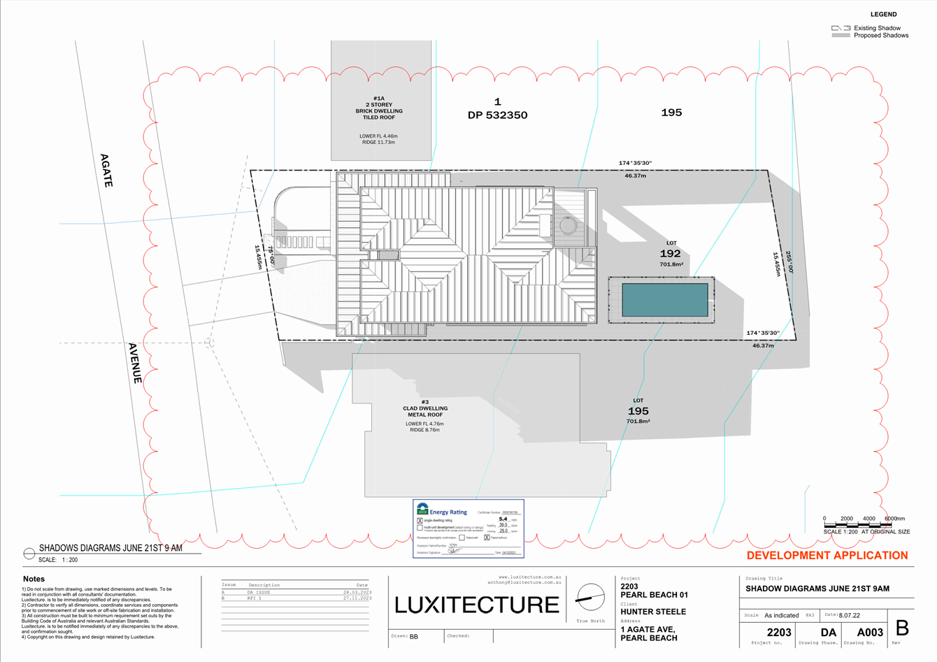
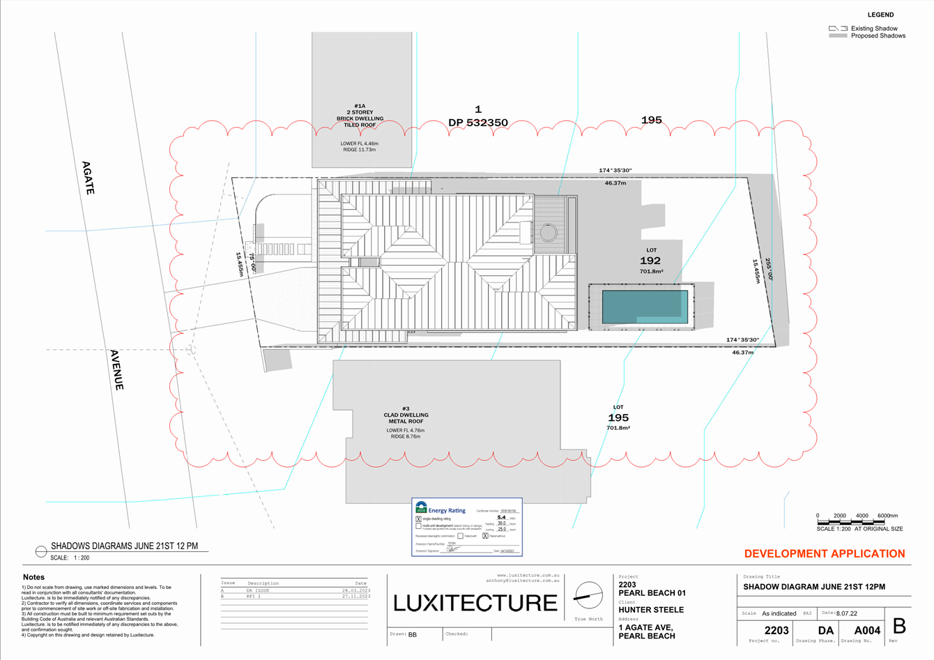
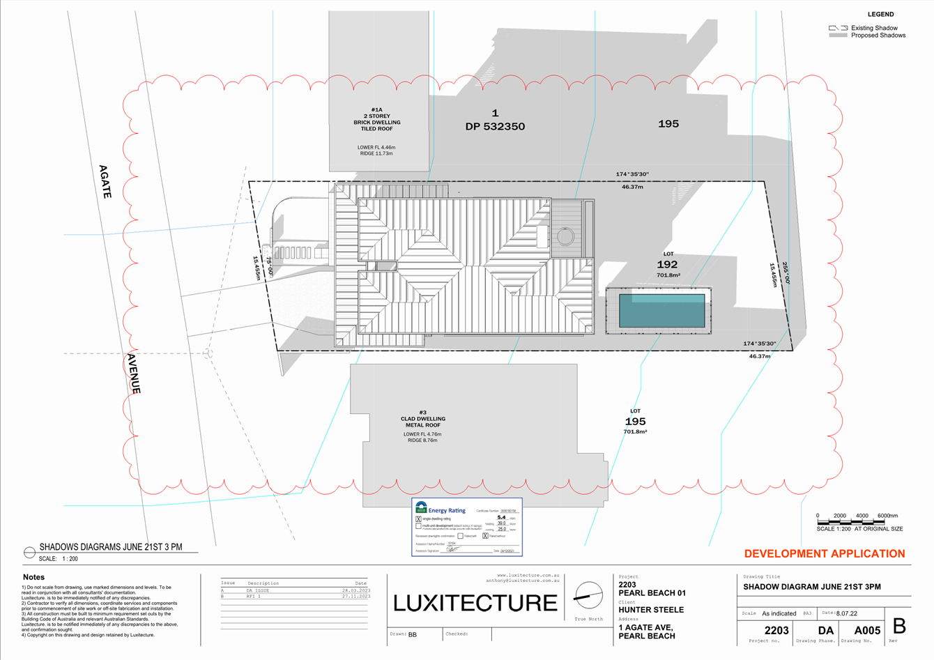
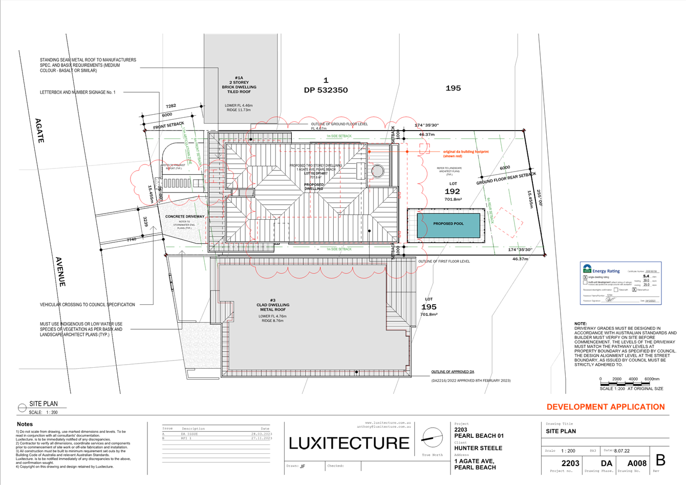
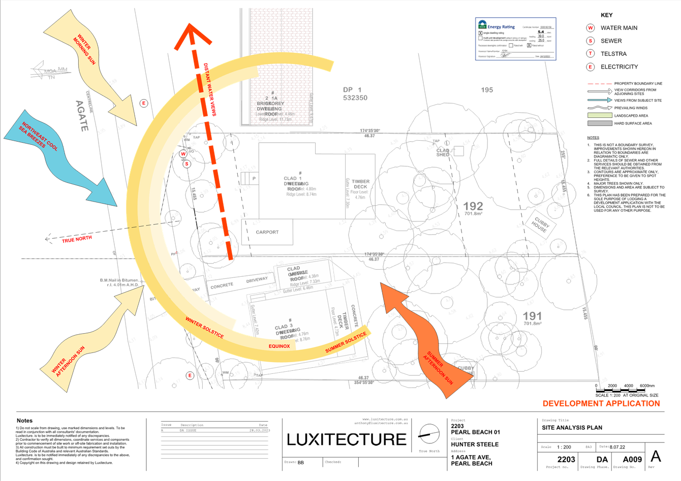
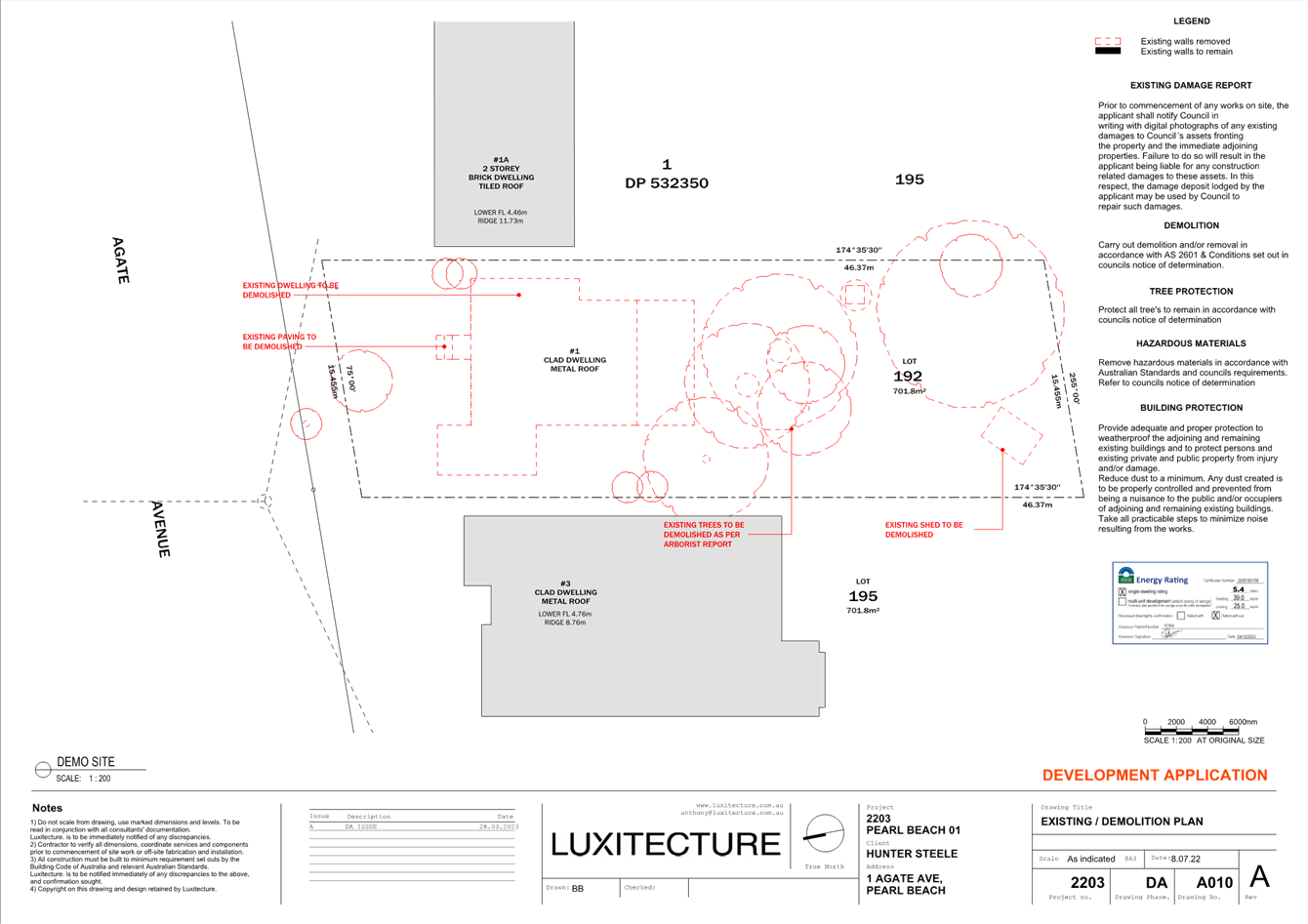
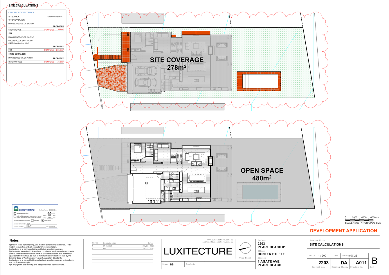
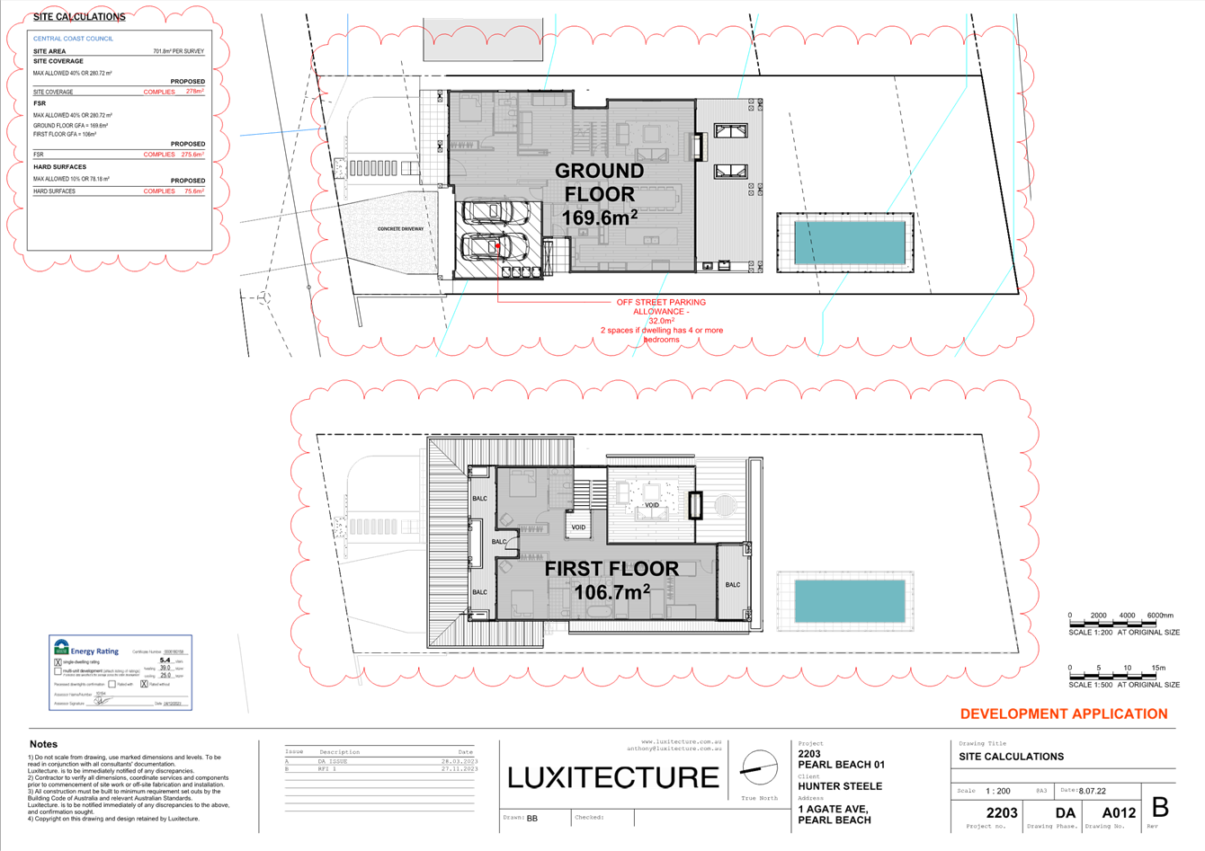
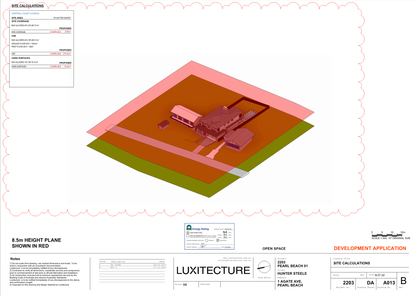
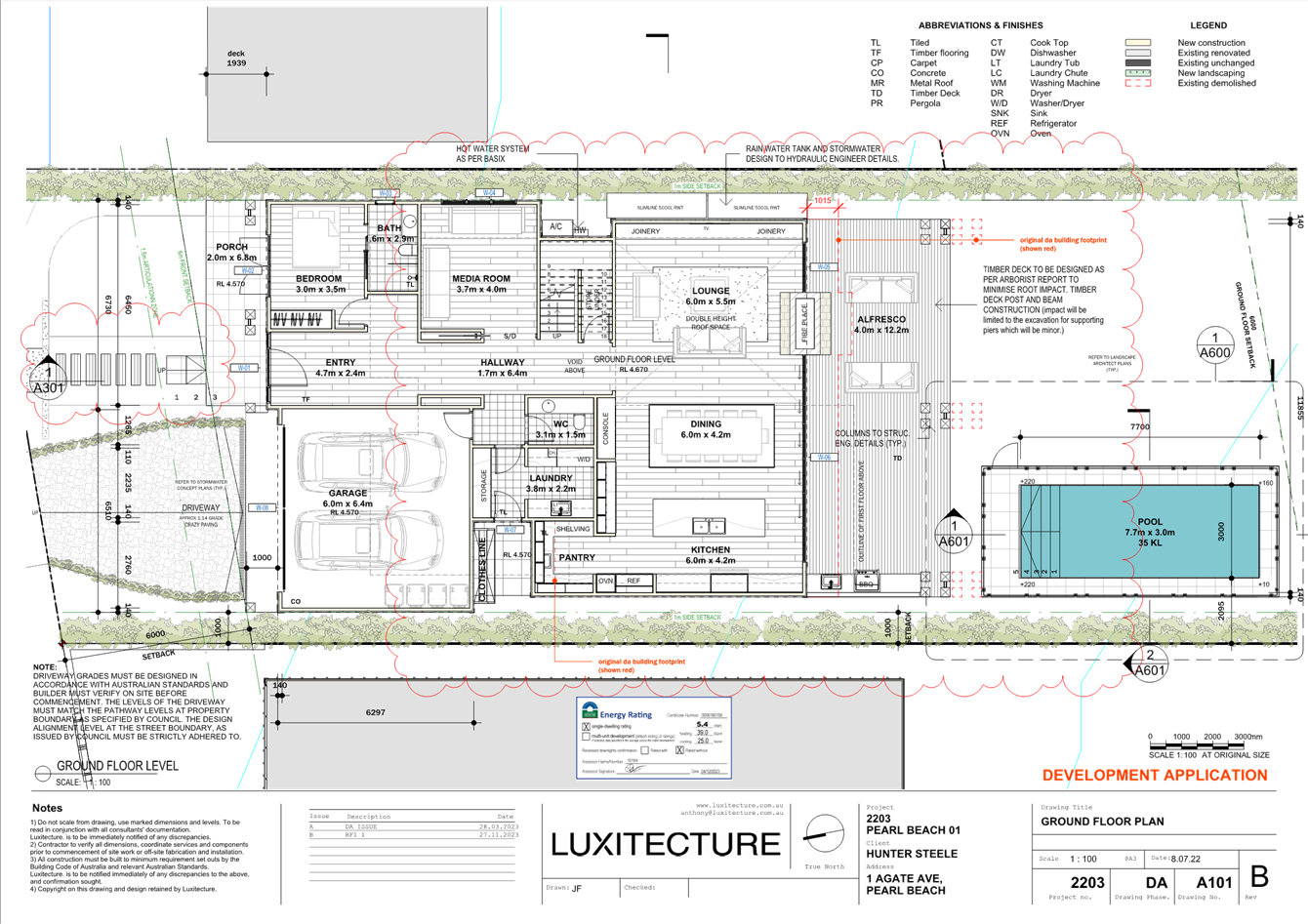
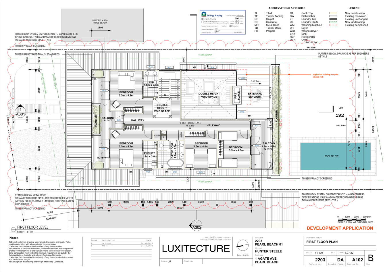
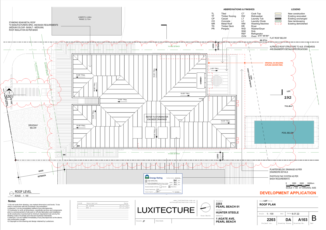
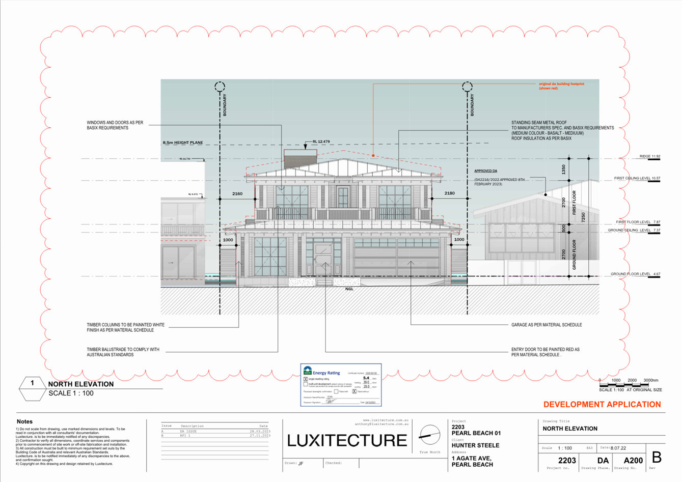
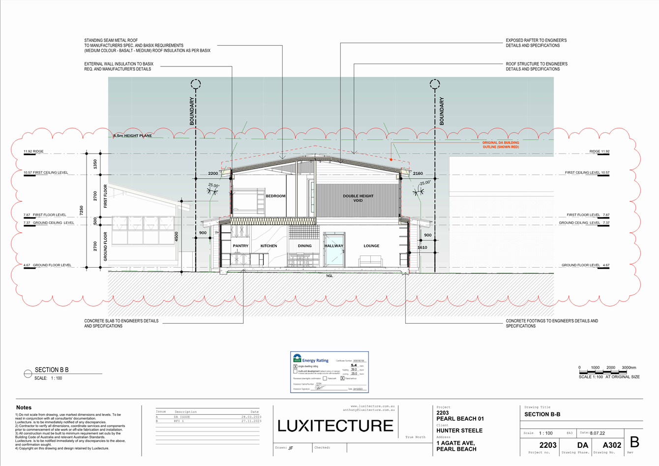
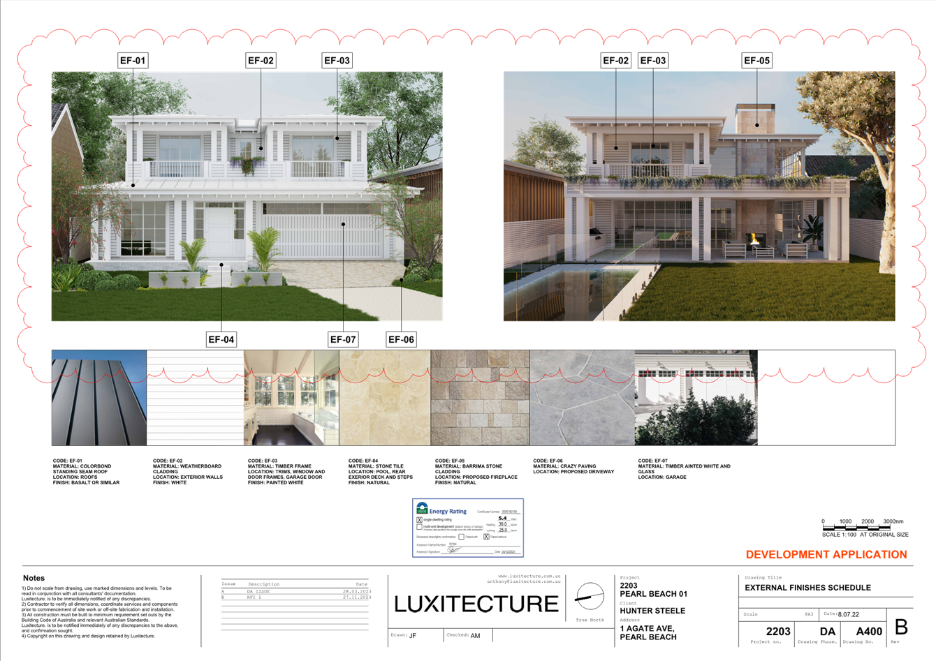
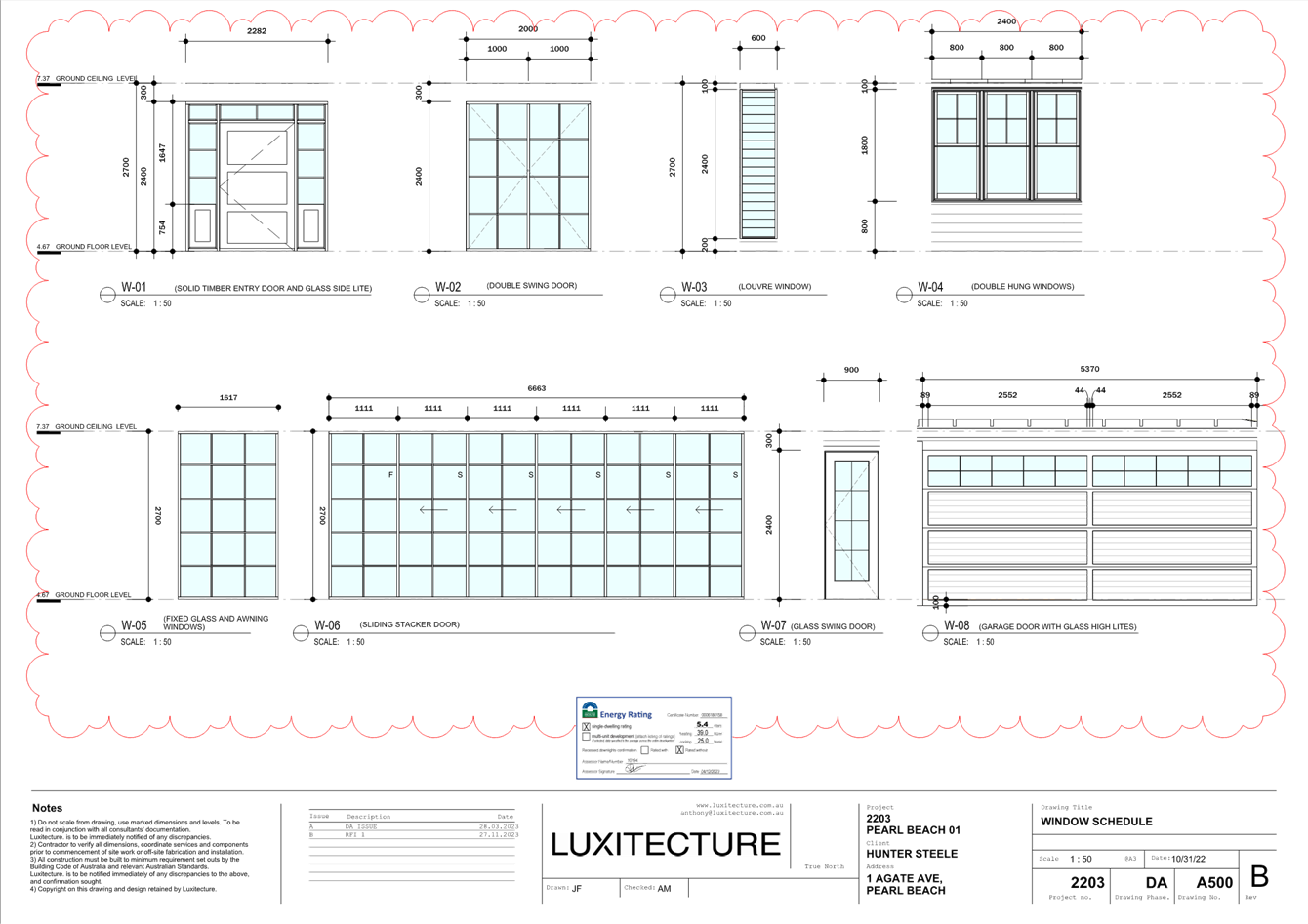
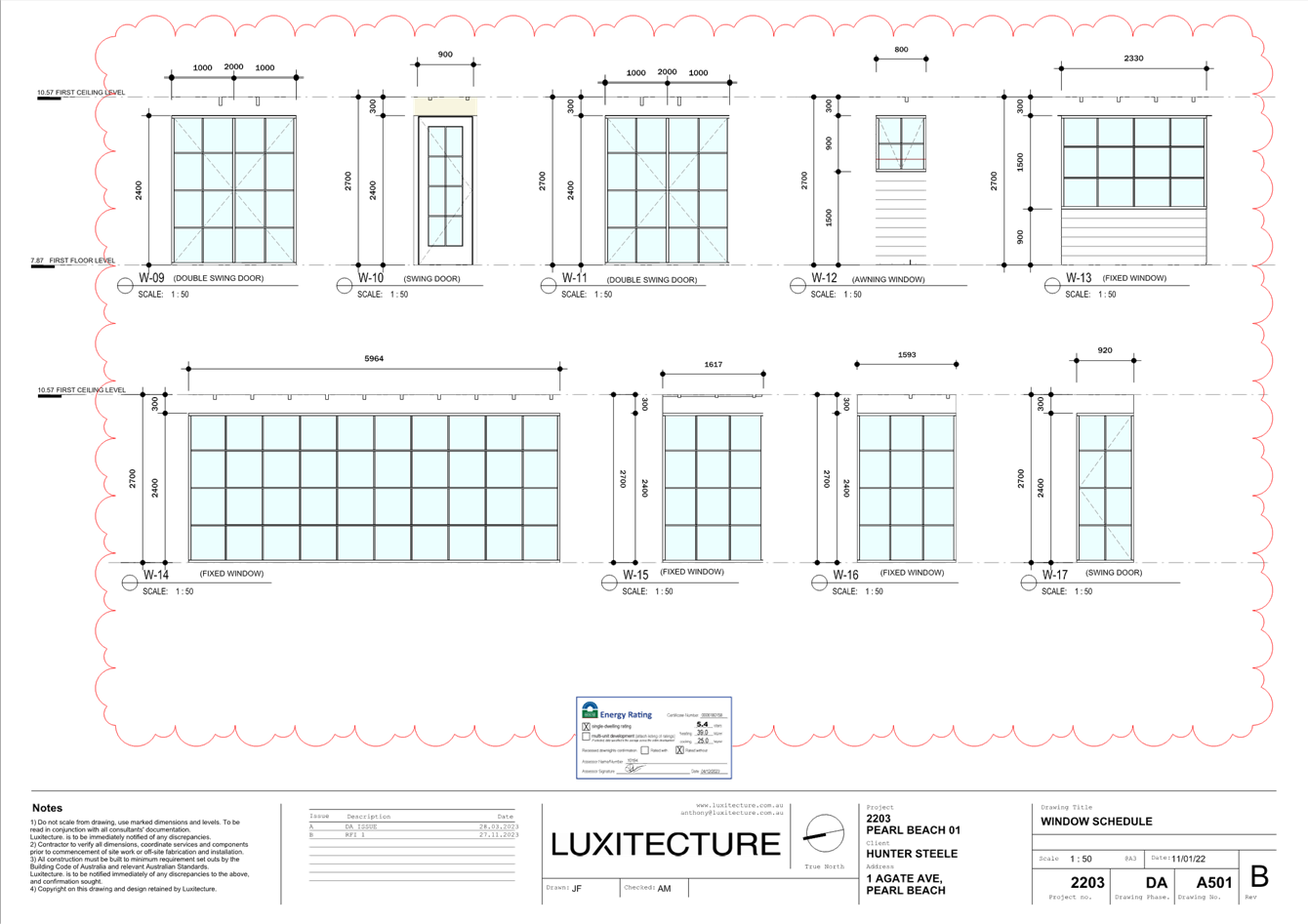
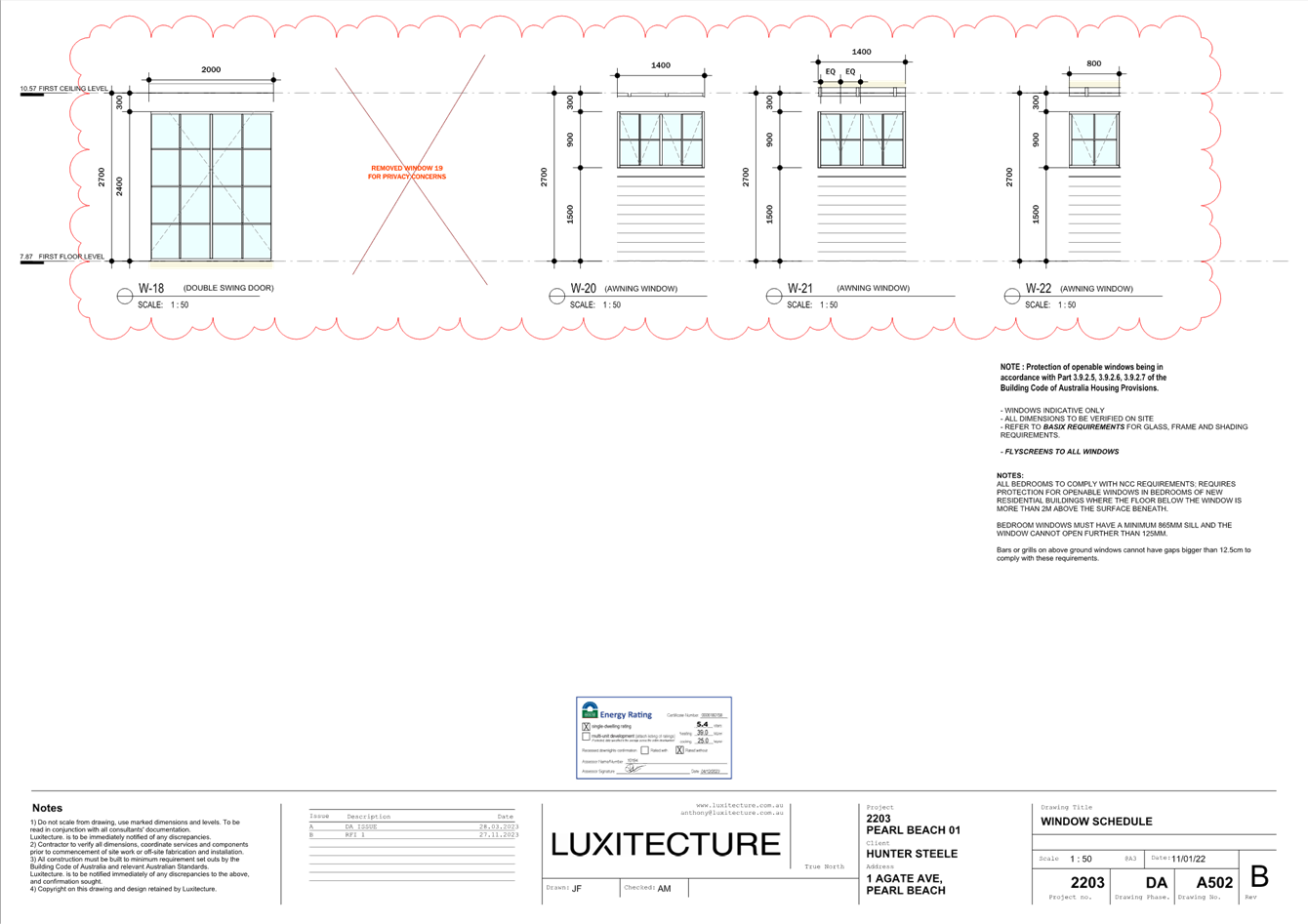
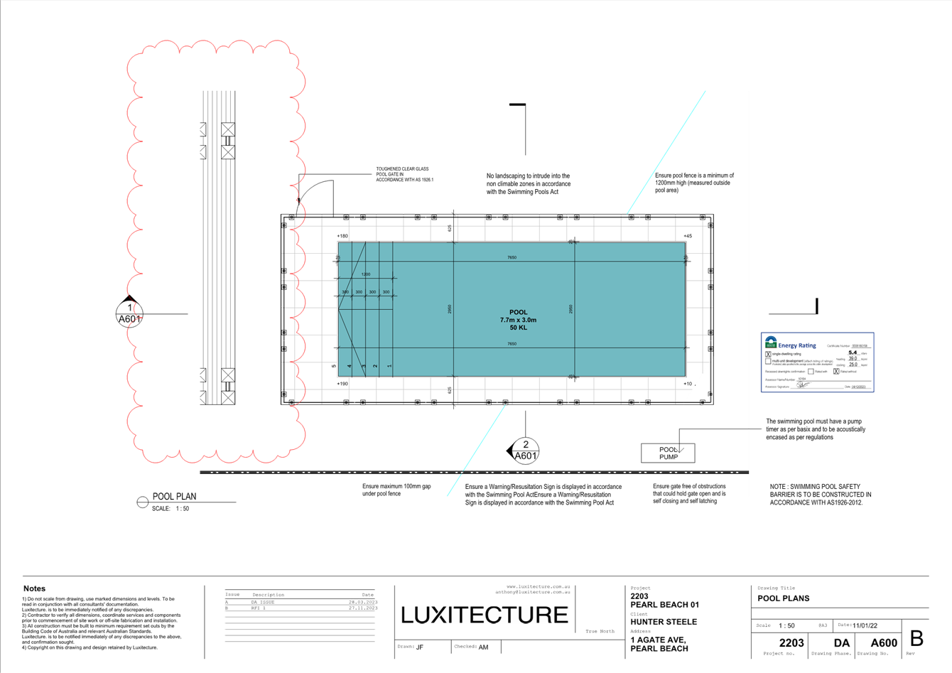
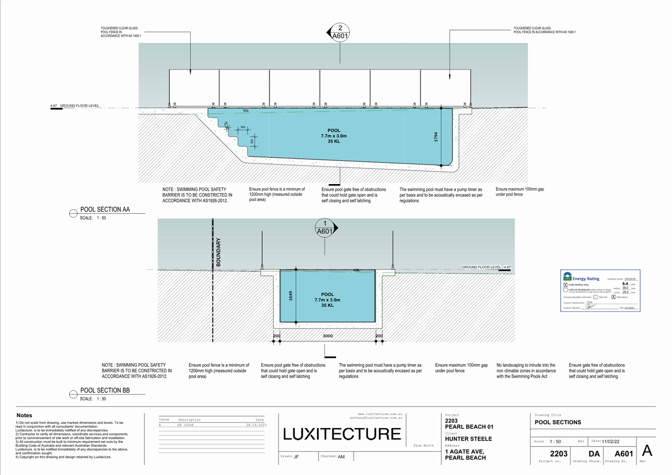
|
DA/862/2023 - 1 Agate Avenue PEARL BEACH - New Dwelling and Demolition of Existing Dwelling |
|
|
Attachment 3 |
3. SWMP Concept Design, 1 Agate Avenue PEARL BEACH DA/862/2023 |
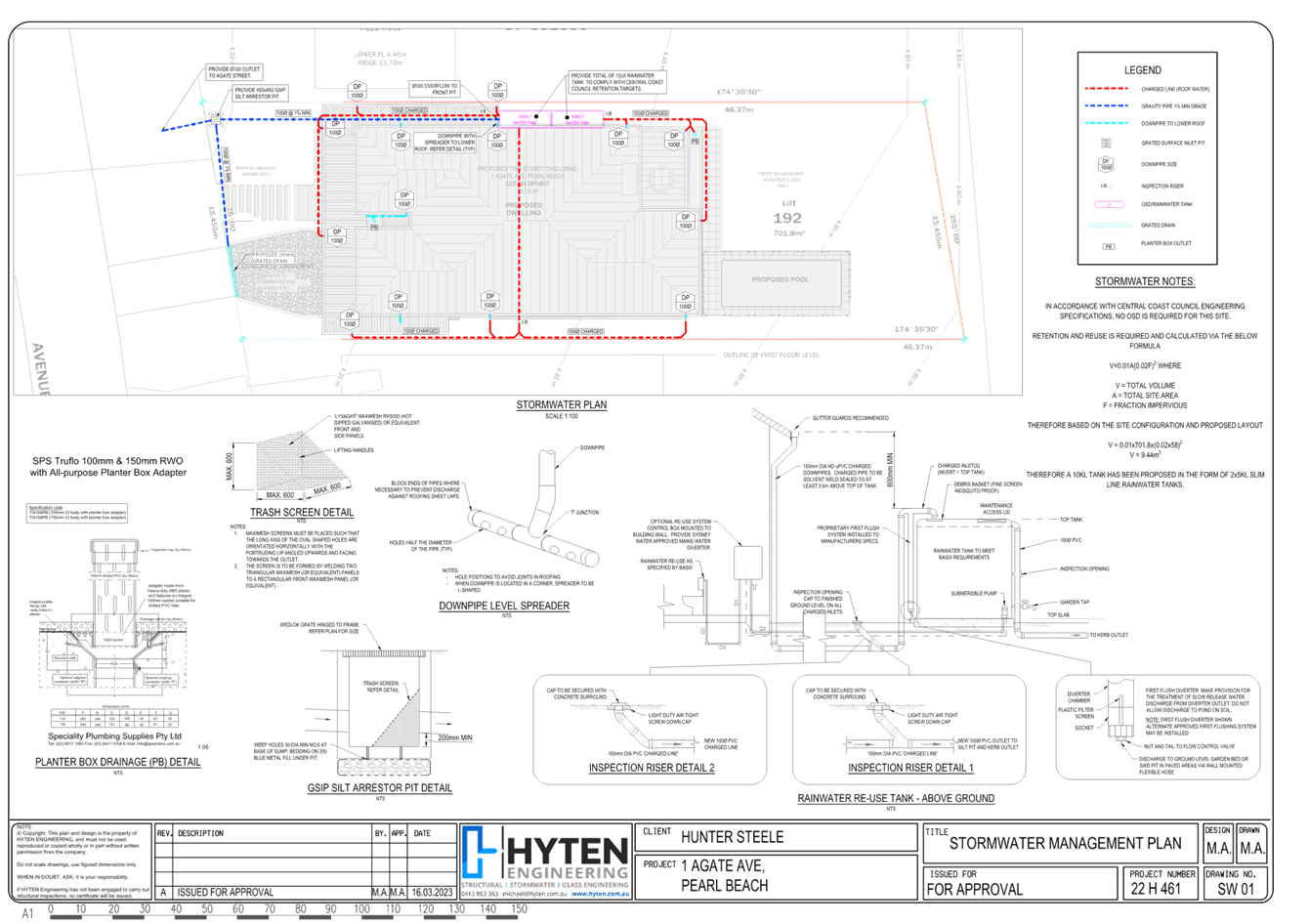
|
DA/862/2023 - 1 Agate Avenue PEARL BEACH - New Dwelling and Demolition of Existing Dwelling |
|
|
Attachment 4 |
4. 1 Amended Arborist Report, 1 Agate Avenue PEARL BEACH DA/862/2023 |
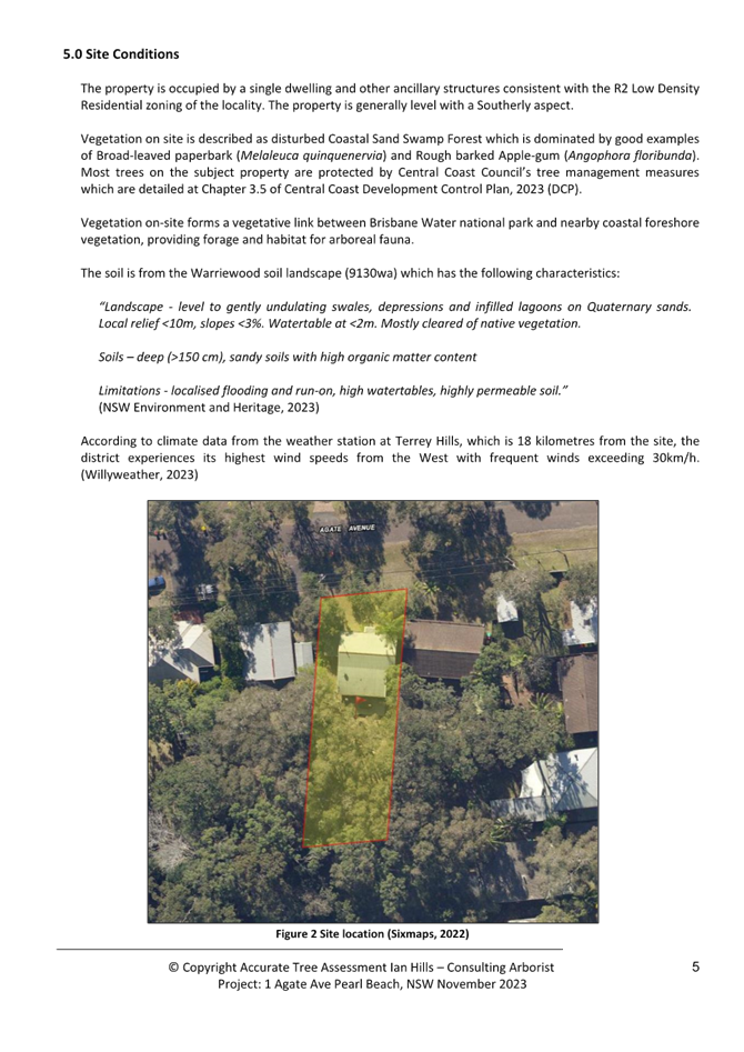
|
DA/862/2023 - 1 Agate Avenue PEARL BEACH - New Dwelling and Demolition of Existing Dwelling |
|
|
Attachment 5 |
5. Flora and Fauna Report, 1 Agate Avenue PEARL BEACH DA/862/2023 |

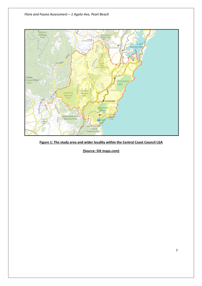
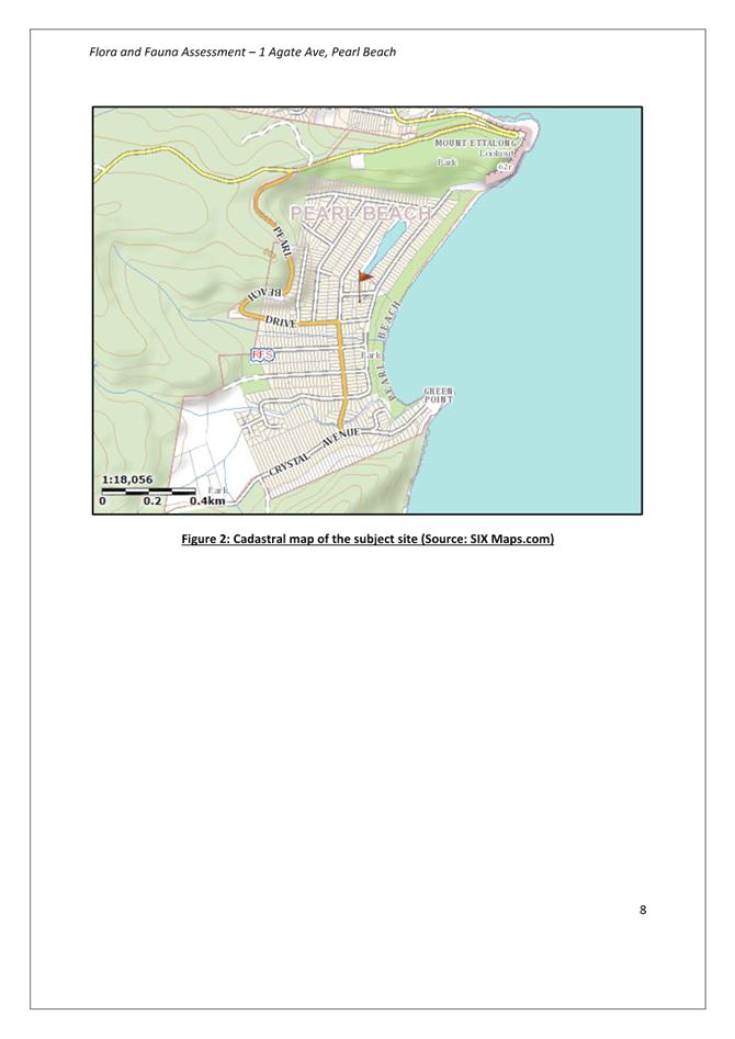
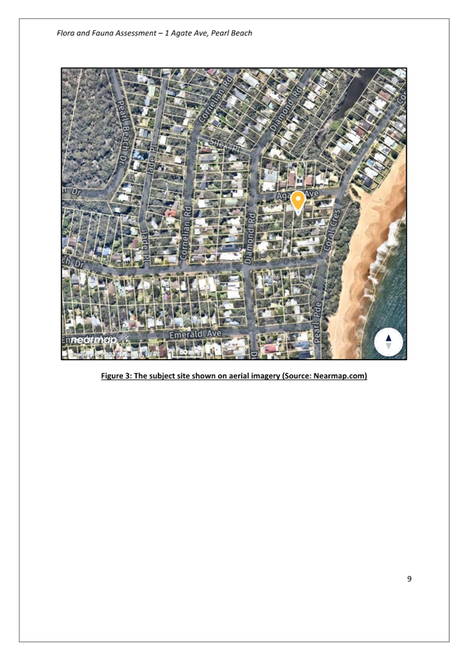
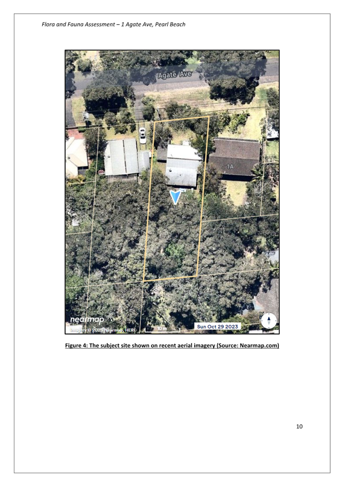
|
3.4 |
DA/862/2023 - 1 Agate Avenue PEARL BEACH - New Dwelling and Demolition of Existing Dwelling |
|
Attachment 6 |
6. Amended Statement of Environmental Effects, 1 Agate Avenue PEARL BEACH DA/862/2023 |
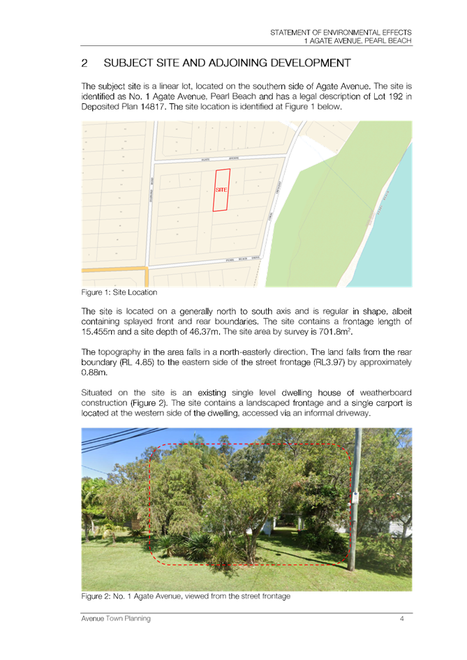
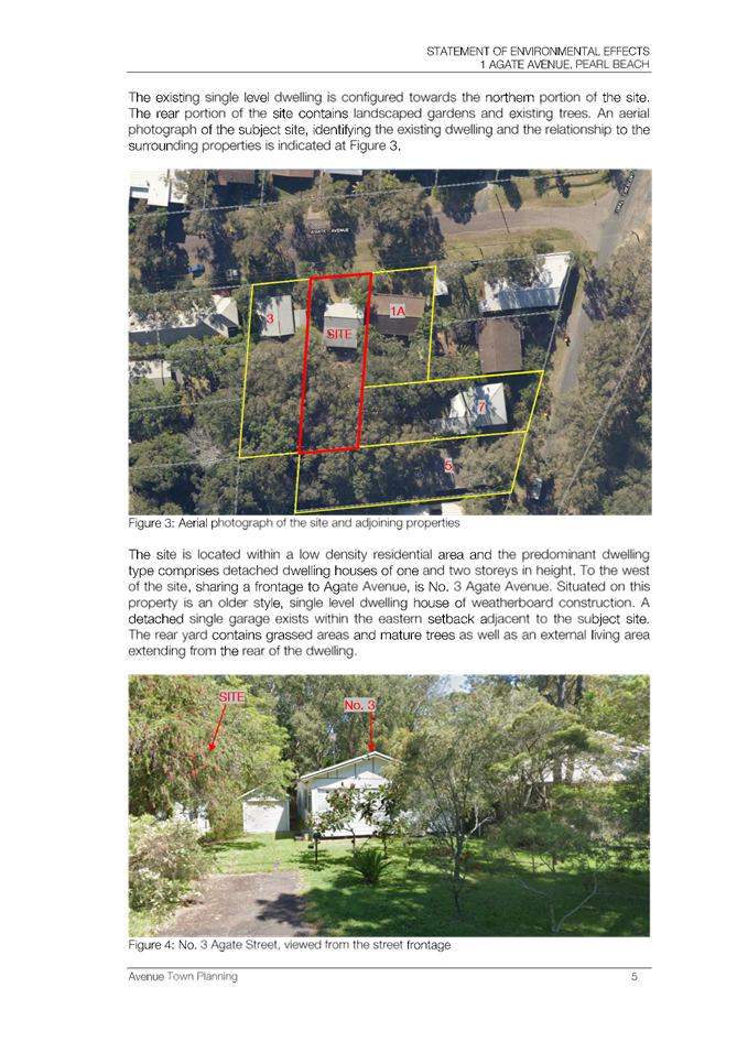
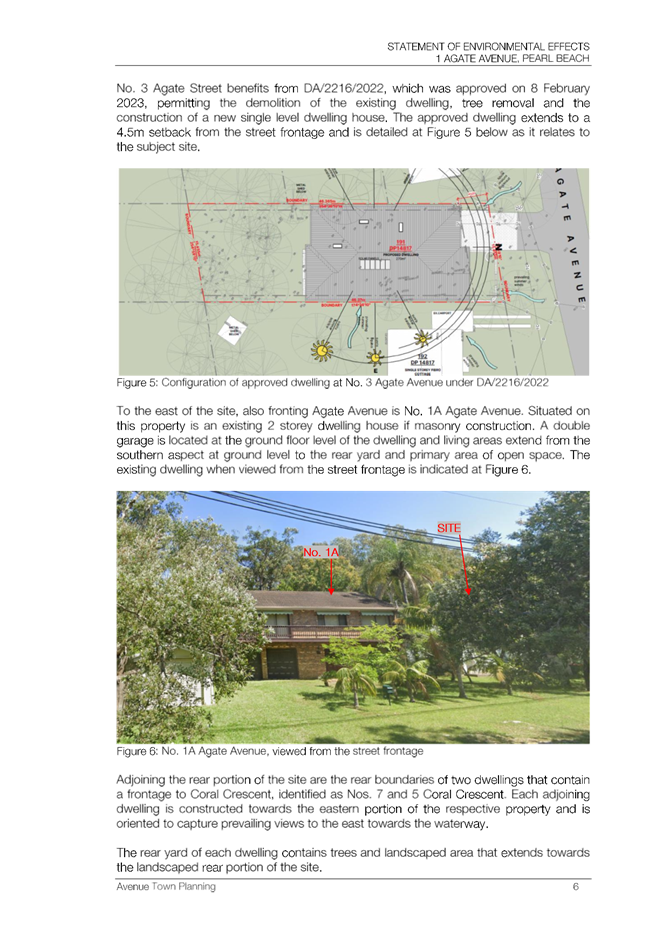
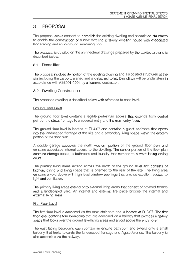
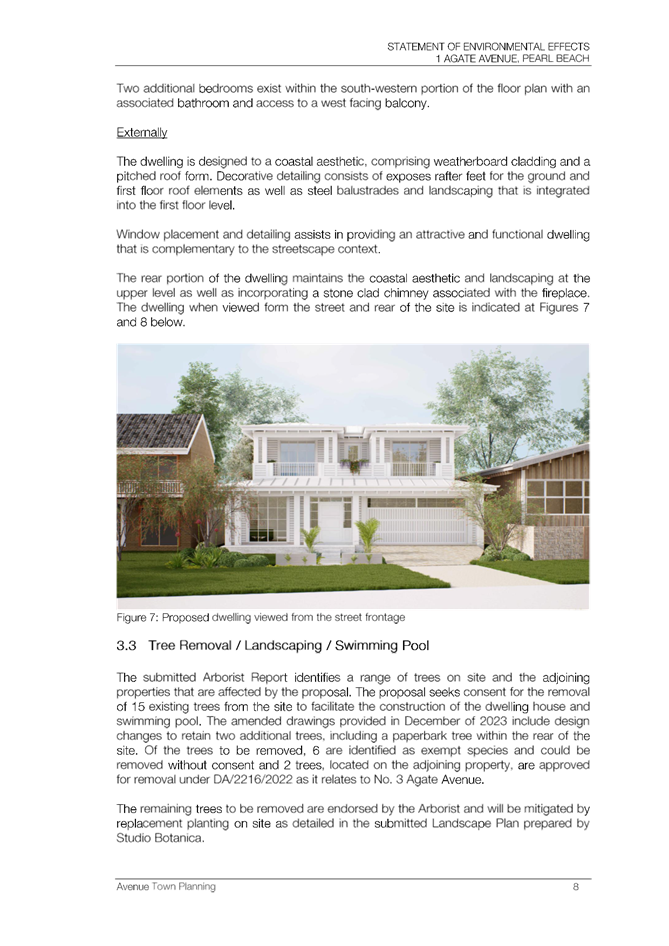
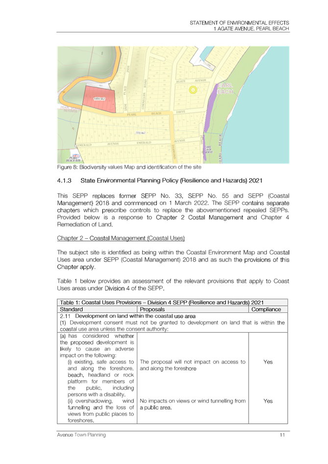
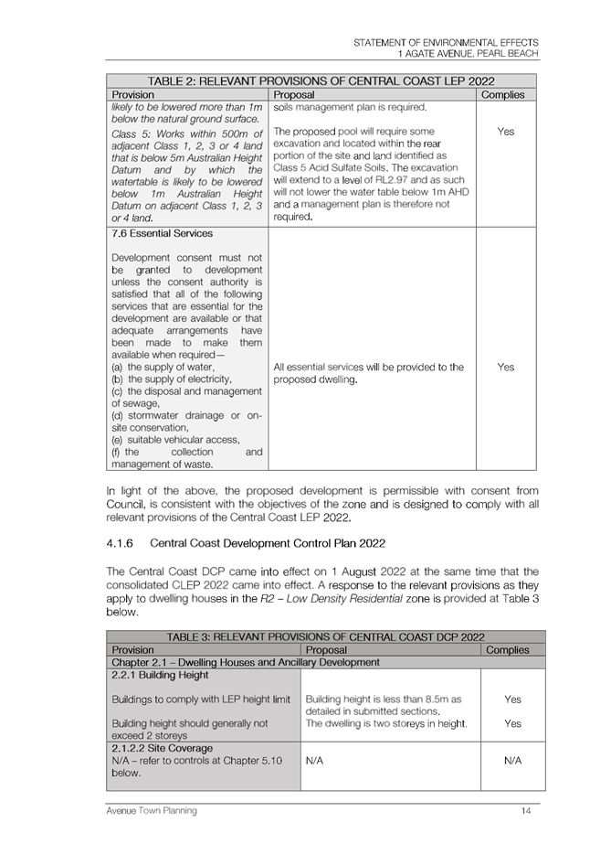
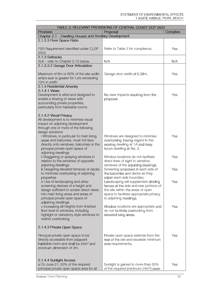
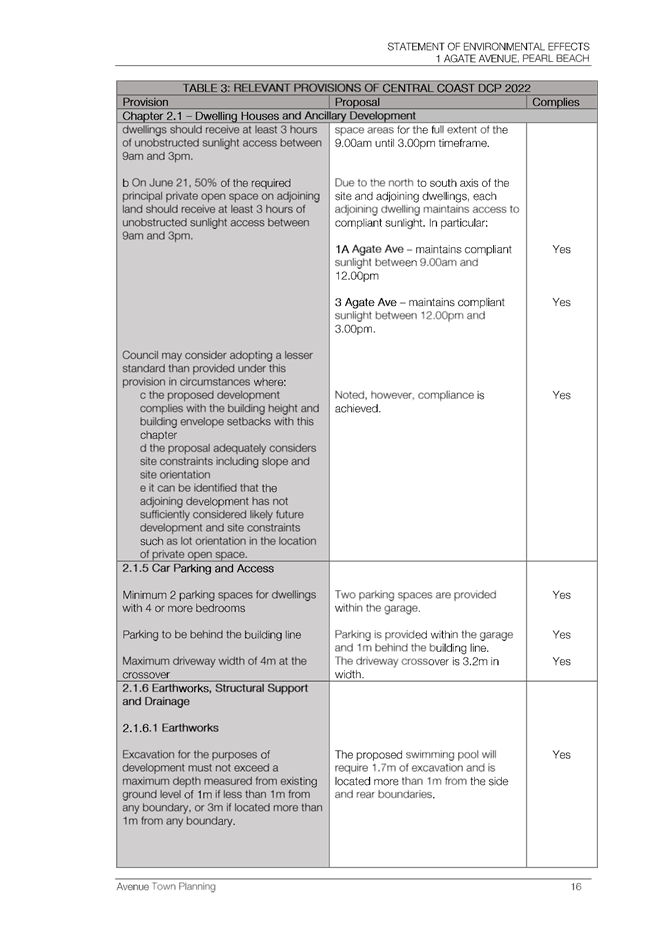
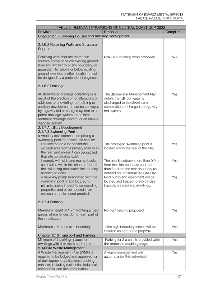
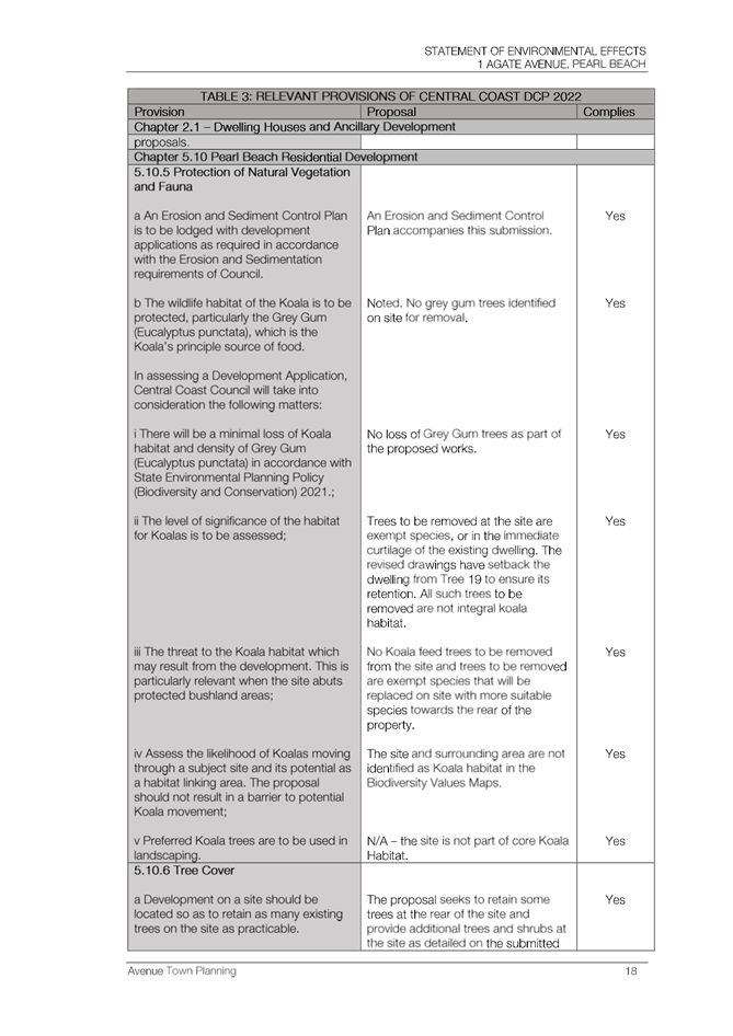
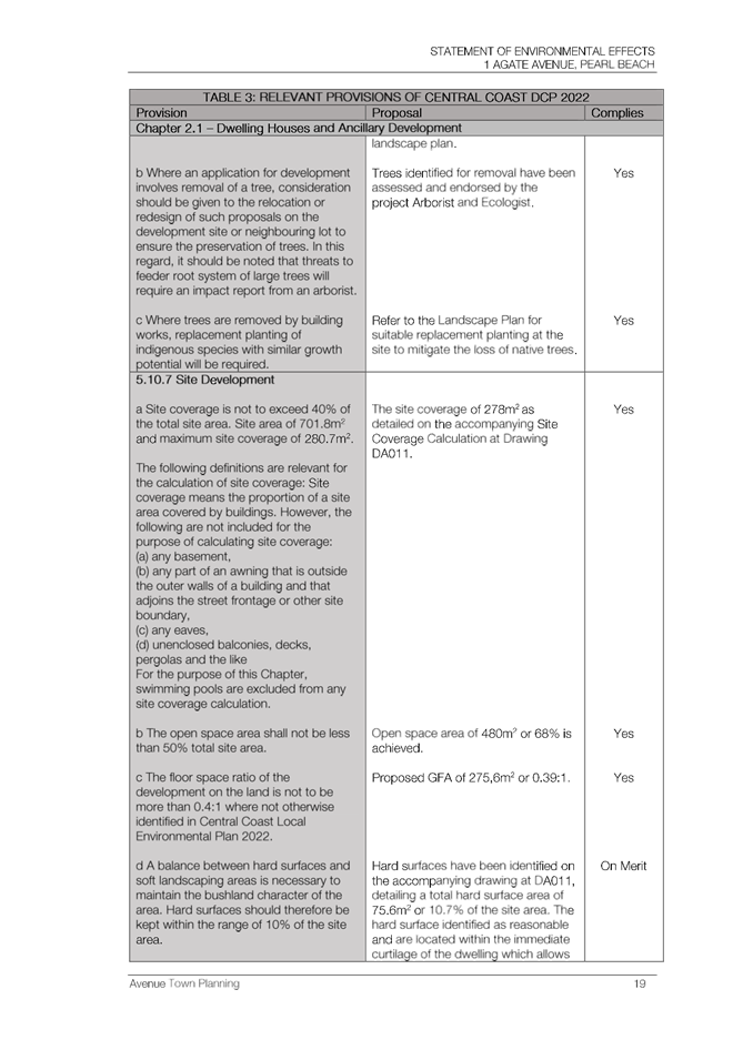
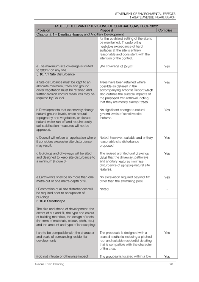

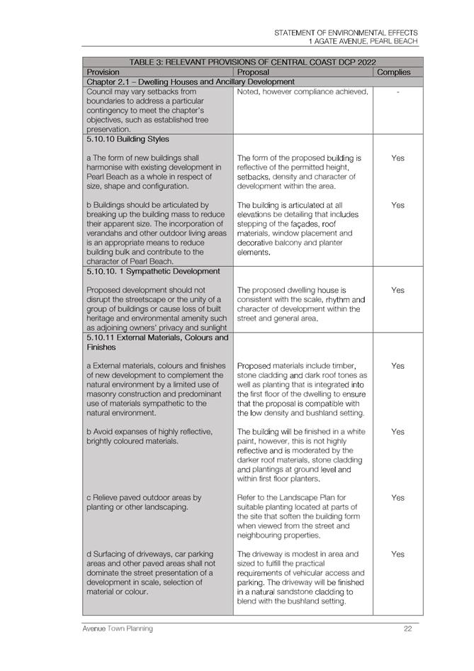
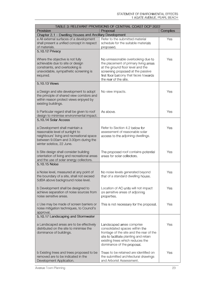
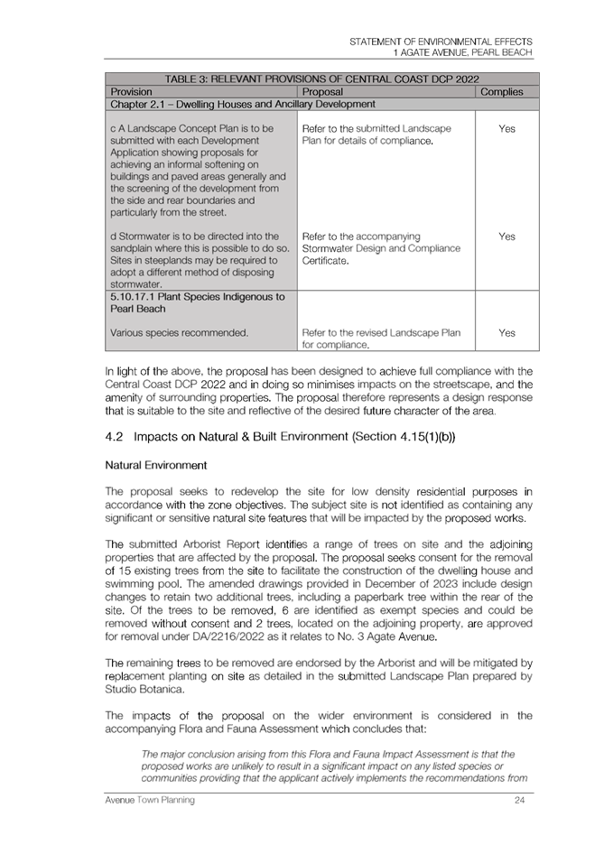
|
DA/862/2023 - 1 Agate Avenue PEARL BEACH - New Dwelling and Demolition of Existing Dwelling |
|
|
Attachment 7 |
7. Amended Landscape Plan, 1 Agate Avenue PEARL BEACH DA/862/2023 |
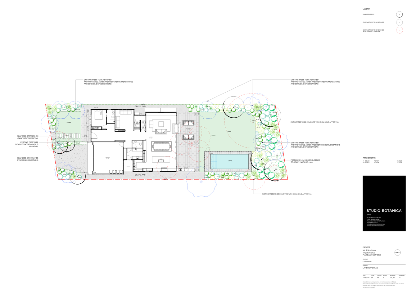
|
DA/862/2023 - 1 Agate Avenue PEARL BEACH - New Dwelling and Demolition of Existing Dwelling |
|
|
Attachment 8 |
8. Amended Basix Certificate, 1 Agate Avenue PEARL BEACH DA/862/2023 |
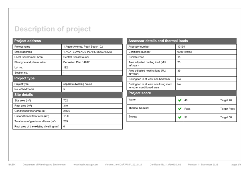
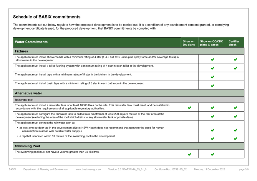
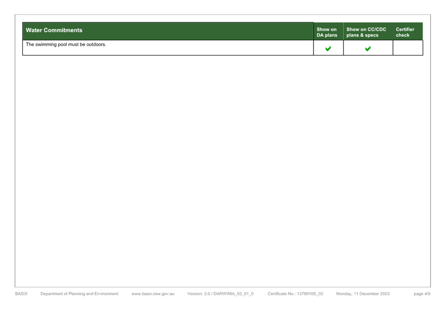
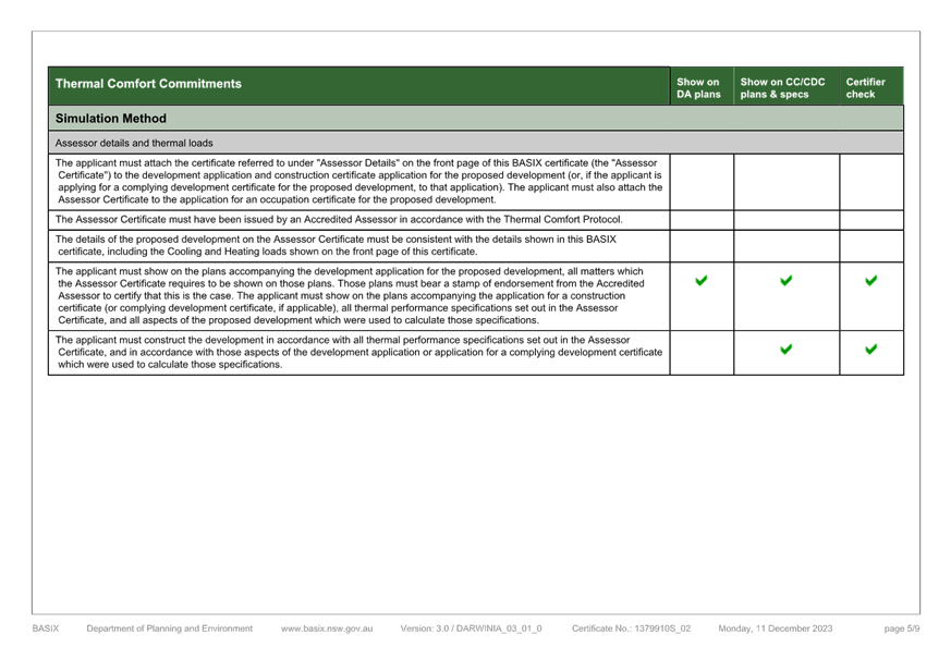
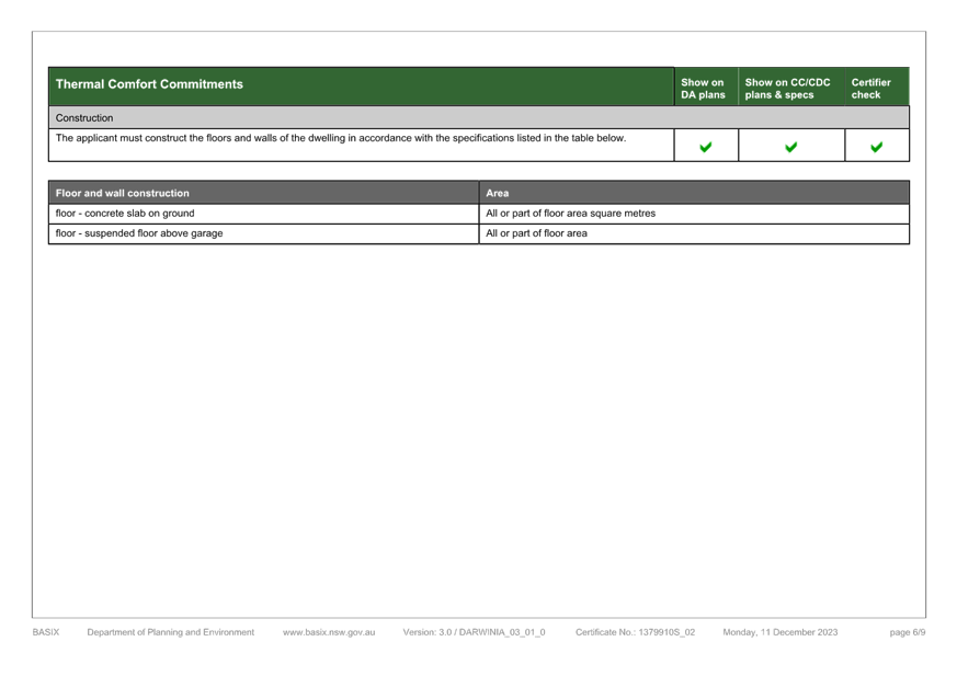
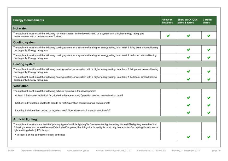
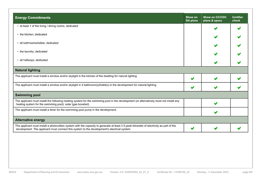
|
DA/862/2023 - 1 Agate Avenue PEARL BEACH - New Dwelling and Demolition of Existing Dwelling |
|
|
Attachment 9 |
9. Amended NatHERS Certificate, 1 Agate Avenue PEARL BEACH DA/862/2023 |
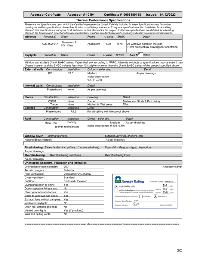
|
DA/862/2023 - 1 Agate Avenue PEARL BEACH - New Dwelling and Demolition of Existing Dwelling |
|
|
Attachment 10 |
10. Waste Management Plan, 1 Agate Avenue PEARL BEACH DA/862/2023 |